Archive - Date
Archive - Activity
-
Bike trip (111)
- Bike trip - mixed (25)
- Bike trip - road (86)
-
Drive (9)
- Car drive (9)
-
Other trip (3)
- Kayaking (3)
-
Ski trip (116)
- Backcountry skiing (69)
- Cross-country skiing (47)
- Trip by foot (1897)
Collected lists
-
Utvalgte topper og turmål i Bergen
(349/351)
 99%
99% -
Alle topper i Bergen
(393/400)
98%
-
Voss ≥ 100m pf.
(96/98)
97%
-
Opptur Hordaland
(144/159)
90%
-
Stasjoner på Bergensbanen
(33/40)
82%
-
Ulvik ≥ 100m pf.
(30/38)
78%
-
Hordaland ≥ 100m pf.
(624/863)
72%
-
Mjølfjell PF > 100m
(21/31)
67%
-
Jondal ≥ 100m pf.
(15/23)
65%
-
Dagsturhyttene i Vestland
(36/61)
59%
-
Sunnhordland PF >= 100m
(105/186)
56%
-
Hordaland: Hardanger PF>=100m
(196/359)
54%
-
DNT-hytter i Hordaland
(23/45)
51%
-
Kvinnherad ≥ 100m pf.
(40/79)
50%
-
Eidfjord ≥ 100m pf.
(13/42)
30%
-
Sogndal ≥ 100m pf.
(23/81)
28%
-
Gulen ≥ 100m pf.
(15/54)
27%
-
Vik i Sogn ≥ 100m pf.
(10/46)
21%
-
Sogn - Sør for Sognefjorden PF>=100m
(31/159)
19%
-
DNT-hytter i Sogn og Fjordane
(8/47)
17%

Totlandsfjellet, Livarden and Slettegga
- Date:
- 13.05.2017
- Characteristic:
- Hillwalk
- Duration:
- 4:58h
- Distance:
- 17.3km
 Started by taking the bus to Øvre Totland. Or so I thought. Turned out I had left the bus one stop too early. But after only a couple of hundred meters walking up along Totlandsvegen I reached my planned starting point for the hike.
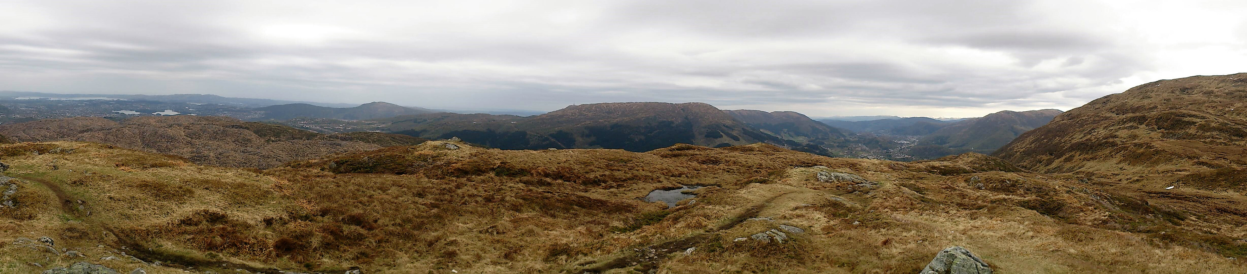
I continued to the parking lot at Øvre Totland and from there followed an unmarked, but easy to follow trail, along the ridge of Totlandsfjellet , that took me all the way to the summit. Nice views from the summit, but the light rain and the low-hanging clouds did not help of course.
From the summit of Totlandsfjellet I continued towards Livarden , but while the trail was still easy to follow it got significantly wetter and a lot muddier. However, I quickly reached the summit of Livarden and after a short break for some pictures (the rain had started to increase in intensity), I followed >>>
Started by taking the bus to Øvre Totland. Or so I thought. Turned out I had left the bus one stop too early. But after only a couple of hundred meters walking up along Totlandsvegen I reached my planned starting point for the hike.
I continued to the parking lot at Øvre Totland and from there followed an unmarked, but easy to follow trail, along the ridge of Totlandsfjellet , that took me all the way to the summit. Nice views from the summit, but the light rain and the low-hanging clouds did not help of course.
From the summit of Totlandsfjellet I continued towards Livarden , but while the trail was still easy to follow it got significantly wetter and a lot muddier. However, I quickly reached the summit of Livarden and after a short break for some pictures (the rain had started to increase in intensity), I followed >>>
Stendafjellet and Skeisåsen from Lagunen
- Date:
- 07.05.2017
- Characteristic:
- Hillwalk
- Duration:
- 2:47h
- Distance:
- 9.8km
 Started by taking Bybanen to Lagunen and walking southeast to Øvre Krohnåsen, following the road and later gravel road towards the summit of Stendafjellet . When getting close to the summit I started looking for trails to the west and found one that took me to a trig marker north of the summit (see picture). I then followed the same trail south, assuming it would take me to the summit. However, I thought I would pass by both summits of Stendafjellet, and therefore left the trail to hunt for the northern summit. This turned out to be in the middle of a quite dense forest with no views and, in my opinion, not really worth a visit. I therefore quickly moved on to the southern summit, which was a lot nicer and had much better views, particularly southwest across Fanafjorden.
From the summit of Stendafjellet >>>
Started by taking Bybanen to Lagunen and walking southeast to Øvre Krohnåsen, following the road and later gravel road towards the summit of Stendafjellet . When getting close to the summit I started looking for trails to the west and found one that took me to a trig marker north of the summit (see picture). I then followed the same trail south, assuming it would take me to the summit. However, I thought I would pass by both summits of Stendafjellet, and therefore left the trail to hunt for the northern summit. This turned out to be in the middle of a quite dense forest with no views and, in my opinion, not really worth a visit. I therefore quickly moved on to the southern summit, which was a lot nicer and had much better views, particularly southwest across Fanafjorden.
From the summit of Stendafjellet >>>
Raudlifjellet from Tømmernes
- Date:
- 06.05.2017
- Characteristic:
- Hillwalk
- Duration:
- 2:53h
- Distance:
- 8.0km
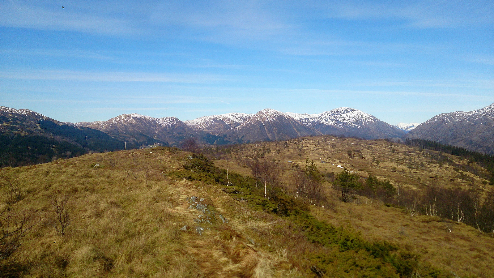
 Started by taking the bus to Tømmernes, crossing the main road and then the Tømmernes bridge. Next, I located the start of the trail indicated on the map and followed what turned out to be a tractor road that quickly turned into an unmarked trail taking me to Sælafjellet . Here there were very nice views towards the south.
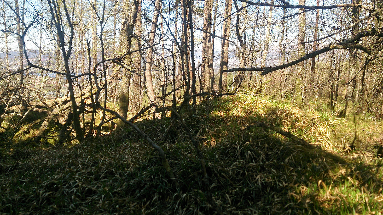
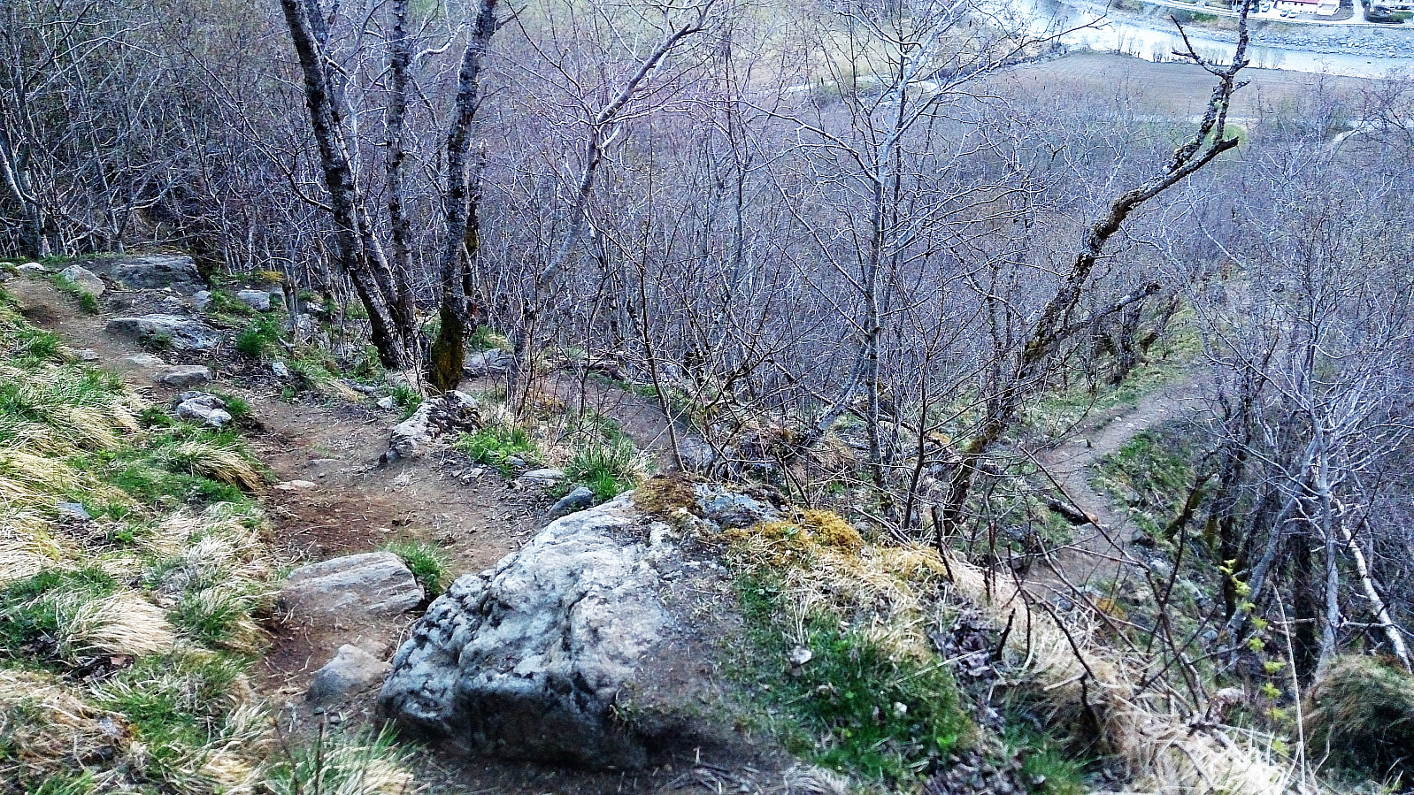
I continued north along the trail to Nordhordlandskulten and then onwards to Raudlifjellet , along the ridge of the mountain through a nice pine forest. The trail had some wet sections, even after a week of no rain, which resulted in the trail disappearing at times. Nordhordlandskulten had limited views, while Raudlifjellet had nice views, mainly in the westerly direction.
From the top of Raudlifjellet I turned south and followed more or less the same route back to the main road. Twenty minutes to the next bus, so I >>>
Started by taking the bus to Tømmernes, crossing the main road and then the Tømmernes bridge. Next, I located the start of the trail indicated on the map and followed what turned out to be a tractor road that quickly turned into an unmarked trail taking me to Sælafjellet . Here there were very nice views towards the south.
I continued north along the trail to Nordhordlandskulten and then onwards to Raudlifjellet , along the ridge of the mountain through a nice pine forest. The trail had some wet sections, even after a week of no rain, which resulted in the trail disappearing at times. Nordhordlandskulten had limited views, while Raudlifjellet had nice views, mainly in the westerly direction.
From the top of Raudlifjellet I turned south and followed more or less the same route back to the main road. Twenty minutes to the next bus, so I >>>
Brekkefossen
- Date:
- 03.05.2017
- Characteristic:
- Hike
- Duration:
- 1:37h
- Distance:
- 7.1km
 Short evening hike starting from Fretheim Hotel in Flåm, walking up Brekkevegen and then following the marked trail up to Brekkefossen.
Then back down to Brekkevegen, before continuing further up the valley to Flåm Skole where I crossed the river and turned back towards Fretheim Hotel, now walking along Flåmsdalsvegen.
Short evening hike starting from Fretheim Hotel in Flåm, walking up Brekkevegen and then following the marked trail up to Brekkefossen.
Then back down to Brekkevegen, before continuing further up the valley to Flåm Skole where I crossed the river and turned back towards Fretheim Hotel, now walking along Flåmsdalsvegen.
Solbakkefjellet from Kalandseidet
- Date:
- 01.05.2017
- Characteristic:
- Hillwalk
- Duration:
- 5:04h
- Distance:
- 16.5km
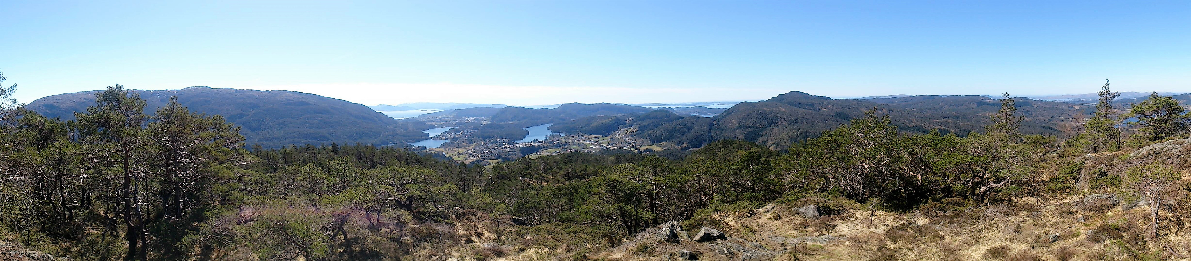
 Started by taking the bus to Kalandseidet and walking up Hausdalsvegen, but quickly took a shortcut north that was indicated on the map. The shortcut started ok, but quickly turned worse and is probably not recommended in wet conditions. It soon connected with a gravel road though, and perhaps it would have been simpler to rather follow the gravel road until the start of the trail towards Solbakkefjellet .
The start of the marked trail was easy to locate and I followed this trail all the way to the summit. In the beginning I felt a bit stupid though, as the trail and gravel road followed each other pretty closely at times (see picture). However, the two thankfully parted ways after not too long, and from there on the trail continued along the ridge of the mountain in a beautiful pine forest. The trail itself >>>
Started by taking the bus to Kalandseidet and walking up Hausdalsvegen, but quickly took a shortcut north that was indicated on the map. The shortcut started ok, but quickly turned worse and is probably not recommended in wet conditions. It soon connected with a gravel road though, and perhaps it would have been simpler to rather follow the gravel road until the start of the trail towards Solbakkefjellet .
The start of the marked trail was easy to locate and I followed this trail all the way to the summit. In the beginning I felt a bit stupid though, as the trail and gravel road followed each other pretty closely at times (see picture). However, the two thankfully parted ways after not too long, and from there on the trail continued along the ridge of the mountain in a beautiful pine forest. The trail itself >>>
