Archiv - Nach Datum
Archiv - Nach Aktivität
-
Andere Tour (3)
- Kayaking (3)
-
Fahrradtour (111)
- Fahrradtour Straße (86)
- Fahrradtour gemischt (25)
-
Fahrzeugtour (9)
- Autotour (9)
-
Fußtour (1897)
- Bergtour (1120)
- Jogging (1)
- Spaziergang (60)
- Wanderung (716)
-
Skitour (116)
- Langlauf (47)
- Tourenskilauf (69)
Gesammelte Listen
-
Utvalgte topper og turmål i Bergen
(349/351)
 99%
99% -
Alle topper i Bergen
(393/400)
98%
-
Voss ≥ 100m pf.
(96/98)
97%
-
Opptur Hordaland
(144/159)
90%
-
Stasjoner på Bergensbanen
(33/40)
82%
-
Ulvik ≥ 100m pf.
(30/38)
78%
-
Hordaland ≥ 100m pf.
(624/863)
72%
-
Mjølfjell PF > 100m
(21/31)
67%
-
Jondal ≥ 100m pf.
(15/23)
65%
-
Dagsturhyttene i Vestland
(36/61)
59%
-
Sunnhordland PF >= 100m
(105/186)
56%
-
Hordaland: Hardanger PF>=100m
(196/359)
54%
-
DNT-hytter i Hordaland
(23/45)
51%
-
Kvinnherad ≥ 100m pf.
(40/79)
50%
-
Eidfjord ≥ 100m pf.
(13/42)
30%
-
Sogndal ≥ 100m pf.
(23/81)
28%
-
Gulen ≥ 100m pf.
(15/54)
27%
-
Vik i Sogn ≥ 100m pf.
(10/46)
21%
-
Sogn - Sør for Sognefjorden PF>=100m
(31/159)
19%
-
DNT-hytter i Sogn og Fjordane
(8/47)
17%

Ustetind from Kikut
- Datum:
- 28.03.2017
- Tourcharakter:
- Tourenskilauf
- Tourlänge:
- 7:23h
- Entfernung:
- 28,4km
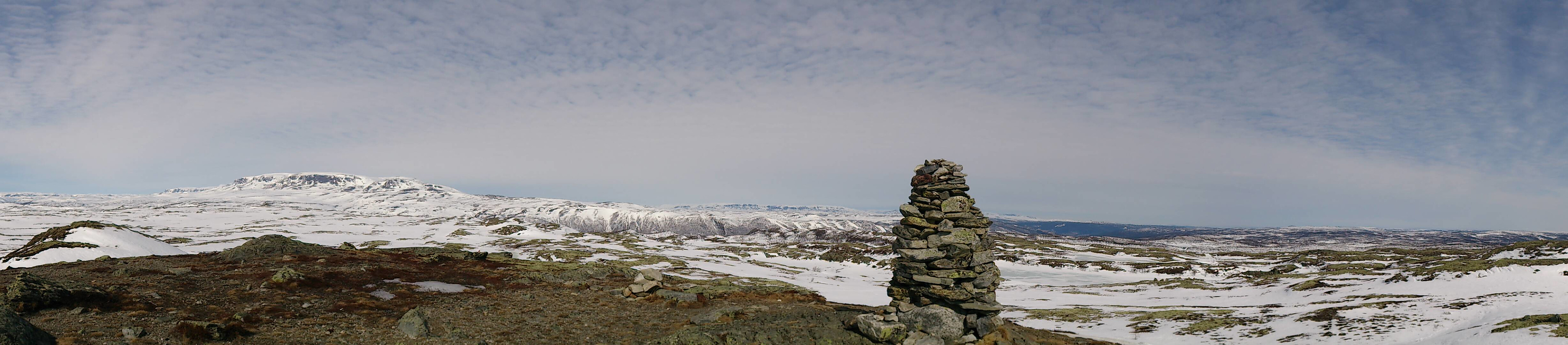 Eight degrees, sunny, almost no clouds, and close to no wind. Only the snow conditions could have been better, as for many sections of the trail we could see the ground through the snow, while for other parts the snow melting during the previous day had turned into ice overnight. Yet at other places we had to leave the trail completely for smaller detours to avoid larger wet areas. Luckily this greatly improved as the trip progressed.
The first summit visited was Birgithovda , an easy to reach summit that is very close to the main winter trail. I had to remove my skis to reach the summit though, as all the snow had melted towards the summit. Even though this summit is relatively low compared to its surroundings, it still provided nice views as can be seen from the pictures.
The trip quickly continued to >>>
Eight degrees, sunny, almost no clouds, and close to no wind. Only the snow conditions could have been better, as for many sections of the trail we could see the ground through the snow, while for other parts the snow melting during the previous day had turned into ice overnight. Yet at other places we had to leave the trail completely for smaller detours to avoid larger wet areas. Luckily this greatly improved as the trip progressed.
The first summit visited was Birgithovda , an easy to reach summit that is very close to the main winter trail. I had to remove my skis to reach the summit though, as all the snow had melted towards the summit. Even though this summit is relatively low compared to its surroundings, it still provided nice views as can be seen from the pictures.
The trip quickly continued to >>>
Ruperanden from Kikut
- Datum:
- 27.03.2017
- Tourcharakter:
- Langlauf
- Tourlänge:
- 1:38h
- Entfernung:
- 7,5km
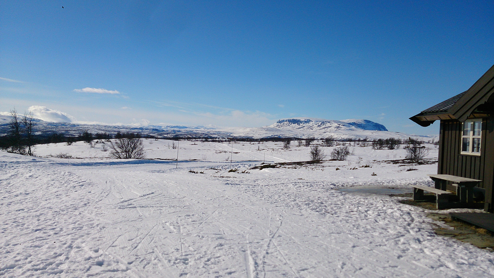 Short skiing trip from Kikut to Ruperanden . The skiing conditions were poor at the start of the trip, where we had to look out for rocks sticking out of the snow in order to not damage our skis. But as soon as we hit the main skiing trail the conditions improved significantly. The wind started to pick up during the trip though. Tailwind on the way there and an even stronger head-wind on the way back towards Kikut.
Hellen Festning
- Datum:
- 26.03.2017
- Tourcharakter:
- Wanderung
- Tourlänge:
- 0:37h
- Entfernung:
- 3,3km
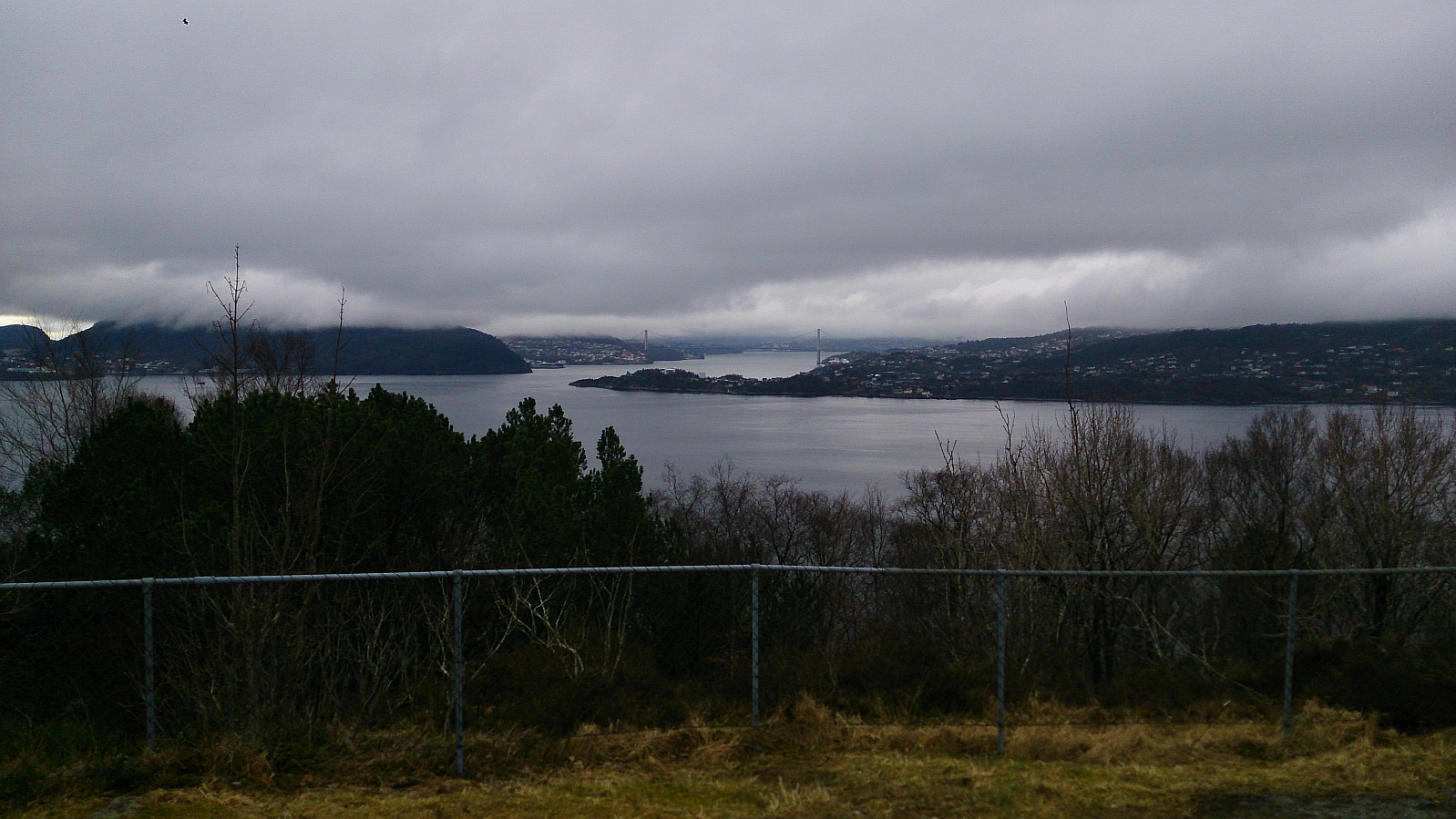 Short hike across Hellen Festning.
Lyshornet and Vetla Lyshornet
- Datum:
- 18.03.2017
- Tourcharakter:
- Bergtour
- Tourlänge:
- 2:23h
- Entfernung:
- 6,1km
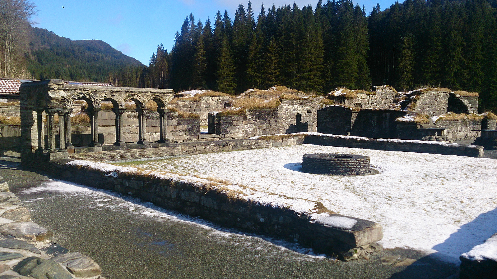 We started from the parking lot next to the Lysekloster Ruins . (Note that the number of parking spots is limited (less than 10?), so keep this in mind if doing this hike on a weekend with nice weather.) From there we followed the standard trail through the woods to the summit of Lyshornet . Snow started appearing at around 300 meters and from there on the trail was covered by snow and ice all the way to the summit.
For return we decided to follow the advice of some fellow hikers and follow in their footsteps by taking a longer U-turn across Vetla Lyshornet (see map for details). This was a nice addition to an otherwise short hike. The trail was not always easy to locate though, so it was a good thing we had footprints in the snow to follow.
In the end our U-turn ended up connecting with the end of the gravel road that we briefly crossed >>>
We started from the parking lot next to the Lysekloster Ruins . (Note that the number of parking spots is limited (less than 10?), so keep this in mind if doing this hike on a weekend with nice weather.) From there we followed the standard trail through the woods to the summit of Lyshornet . Snow started appearing at around 300 meters and from there on the trail was covered by snow and ice all the way to the summit.
For return we decided to follow the advice of some fellow hikers and follow in their footsteps by taking a longer U-turn across Vetla Lyshornet (see map for details). This was a nice addition to an otherwise short hike. The trail was not always easy to locate though, so it was a good thing we had footprints in the snow to follow.
In the end our U-turn ended up connecting with the end of the gravel road that we briefly crossed >>>
