Arkiv - dato
Arkiv - aktivitet
-
Annen tur (3)
- Kajakkpadling (3)
- Fottur (1897)
-
Kjøretur (9)
- Biltur (9)
-
Skitur (116)
- Fjellskitur (69)
- Langrennstur (47)
-
Sykkeltur (111)
- Blandet sykling (25)
- Gatesykling (86)
Lister jeg samler etter
-
Utvalgte topper og turmål i Bergen
(349/351)
 99%
99% -
Alle topper i Bergen
(393/400)
98%
-
Voss ≥ 100m pf.
(96/98)
97%
-
Opptur Hordaland
(144/159)
90%
-
Stasjoner på Bergensbanen
(33/40)
82%
-
Ulvik ≥ 100m pf.
(30/38)
78%
-
Hordaland ≥ 100m pf.
(624/863)
72%
-
Mjølfjell PF > 100m
(21/31)
67%
-
Jondal ≥ 100m pf.
(15/23)
65%
-
Dagsturhyttene i Vestland
(36/61)
59%
-
Sunnhordland PF >= 100m
(105/186)
56%
-
Hordaland: Hardanger PF>=100m
(196/359)
54%
-
DNT-hytter i Hordaland
(23/45)
51%
-
Kvinnherad ≥ 100m pf.
(40/79)
50%
-
Eidfjord ≥ 100m pf.
(13/42)
30%
-
Sogndal ≥ 100m pf.
(23/81)
28%
-
Gulen ≥ 100m pf.
(15/54)
27%
-
Vik i Sogn ≥ 100m pf.
(10/46)
21%
-
Sogn - Sør for Sognefjorden PF>=100m
(31/159)
19%
-
DNT-hytter i Sogn og Fjordane
(8/47)
17%

Sveåsen and Lauvåsen from Kalandseidet
- Dato:
- 05.06.2017
- Turtype:
- Fjelltur
- Turlengde:
- 3:37t
- Distanse:
- 12,0km
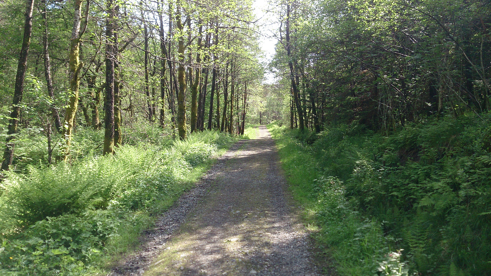 Started by taking the bus to Kalandseidet and walking west along Kismulvegen until Kismulstølen. Here I followed the road south until a crossroads where I took a right and then left, entering a very nice gravel road. At both of these crossroads there were hiking signs towards Tereleitet . I continued south towards Svartavatnet, where the road turned west and then north, and started looking for trails to Sveåsen .
A sign with "Merket sti til Sveåsen" (i.e. "Marked trail to Sveåsen") soon appeared on my left-hand side, and I decided to follow this one. The trail started south on the east side of Sveåsen, before finally turning north and approaching Sveåsen from the south. Note that even though the trail was marked, it was of pretty low quality and very muddy at times, especially the section >>>
Started by taking the bus to Kalandseidet and walking west along Kismulvegen until Kismulstølen. Here I followed the road south until a crossroads where I took a right and then left, entering a very nice gravel road. At both of these crossroads there were hiking signs towards Tereleitet . I continued south towards Svartavatnet, where the road turned west and then north, and started looking for trails to Sveåsen .
A sign with "Merket sti til Sveåsen" (i.e. "Marked trail to Sveåsen") soon appeared on my left-hand side, and I decided to follow this one. The trail started south on the east side of Sveåsen, before finally turning north and approaching Sveåsen from the south. Note that even though the trail was marked, it was of pretty low quality and very muddy at times, especially the section >>>
Herlandsfjellet and Bjørndalshovden to Storoksla
- Dato:
- 03.06.2017
- Turtype:
- Fjelltur
- Turlengde:
- 5:42t
- Distanse:
- 17,8km
 From Espeland to Osavatnet
Started by taking the bus to Espelandshallen and walking up Moldamyrane and later Gullfjellsvegen to Osavatnet. The distance was about 5 km and took around one hour, and even though this was merely a requirement to get to the start of the actual hike, it was nicer than expected and can be recommended as an alternative way of getting to Osavatnet if you do not have a car.
Herdalsfjellet
Next, I located the trail towards Herlandsfjellet . It starts close to the northern end of Osavatnet, right behind the red cabin on the left-hand side before arriving at the parking lot. The start of the trail was not marked, and a bit weak at the beginning, but due to the red cabin it is still very easy to locate. According to the map, the trail would only take me up to around 500 meters, but as expected >>>
From Espeland to Osavatnet
Started by taking the bus to Espelandshallen and walking up Moldamyrane and later Gullfjellsvegen to Osavatnet. The distance was about 5 km and took around one hour, and even though this was merely a requirement to get to the start of the actual hike, it was nicer than expected and can be recommended as an alternative way of getting to Osavatnet if you do not have a car.
Herdalsfjellet
Next, I located the trail towards Herlandsfjellet . It starts close to the northern end of Osavatnet, right behind the red cabin on the left-hand side before arriving at the parking lot. The start of the trail was not marked, and a bit weak at the beginning, but due to the red cabin it is still very easy to locate. According to the map, the trail would only take me up to around 500 meters, but as expected >>>
Gullsteinen, Løvstakken and Strandafjellet
- Dato:
- 31.05.2017
- Turtype:
- Fjelltur
- Turlengde:
- 3:39t
- Distanse:
- 9,7km
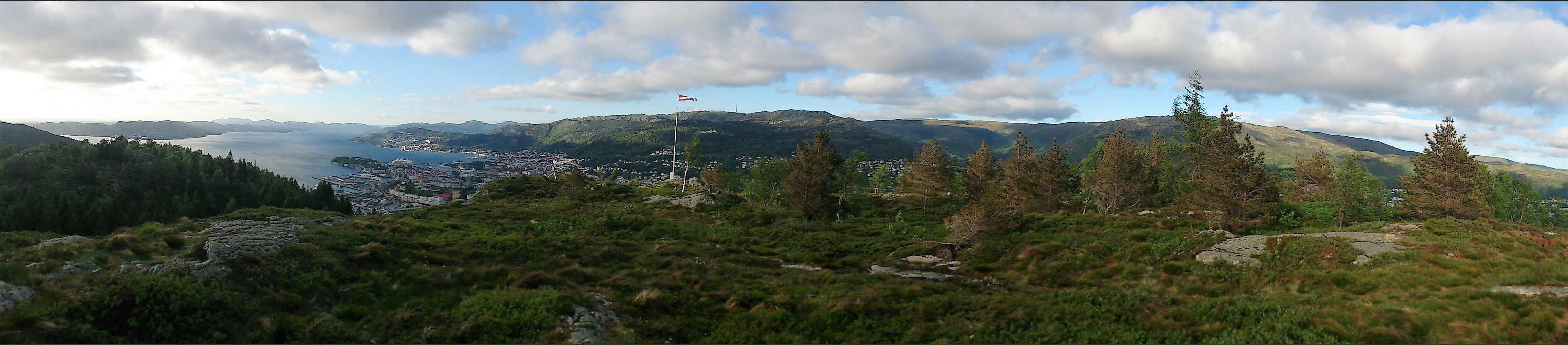 Started by taking the bus to Bønestoppen and from there following the trail over Gullsteinen to Løvstakken . From Løvstakken we continued to Strandafjellet , and finally followed the trail/gravel road down to Løvstien before ending the hike in the city center. Overall, a very nice hike that can be highly recommended.
Skinarfjellet from Barsnesfjorden
- Dato:
- 27.05.2017
- Turtype:
- Fjelltur
- Turlengde:
- 6:14t
- Distanse:
- 12,6km
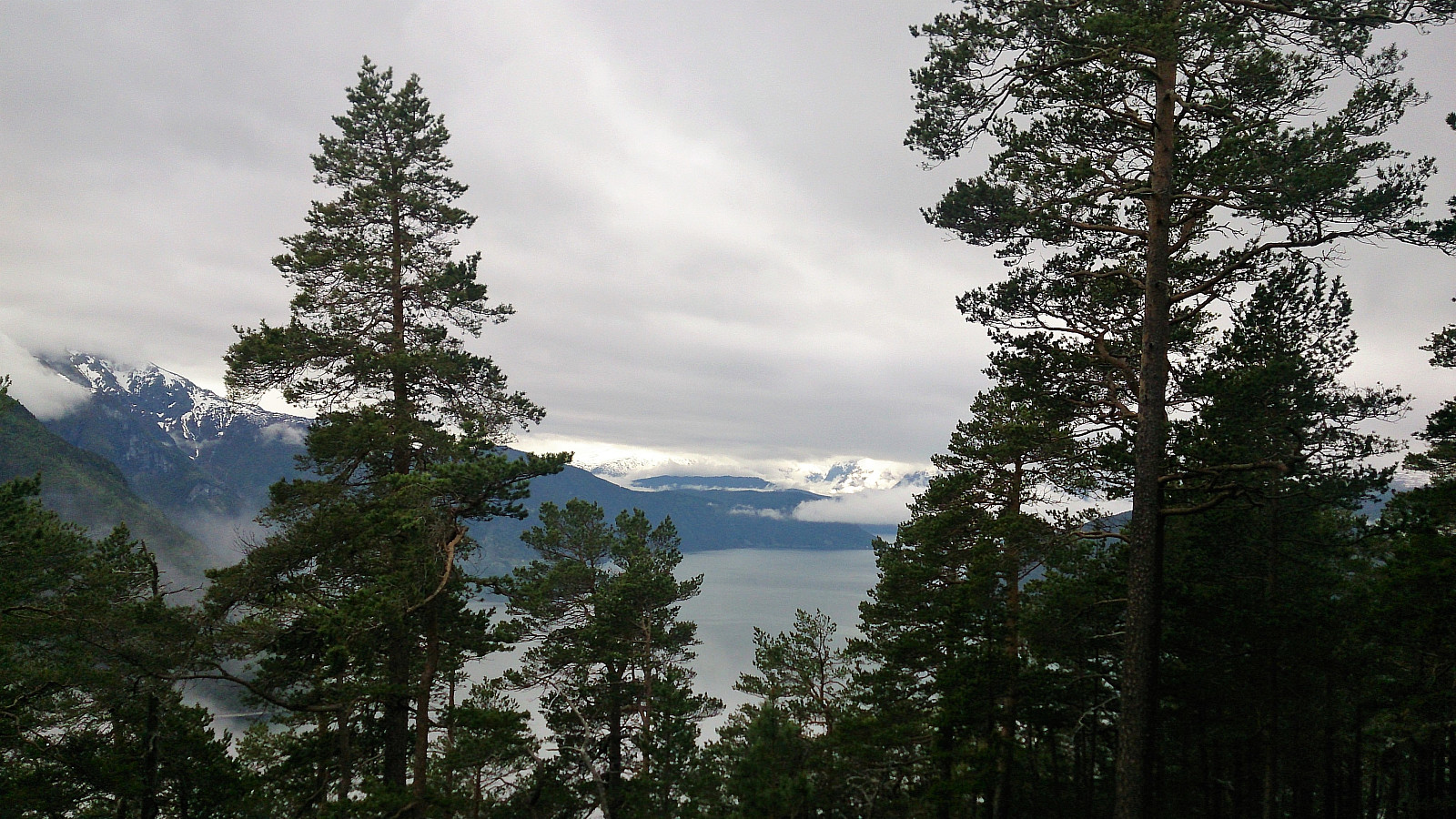
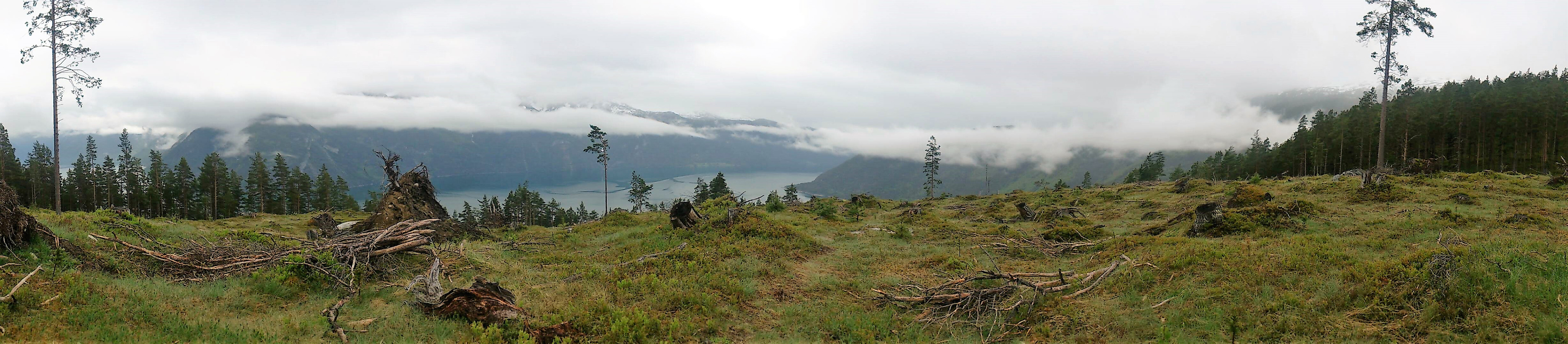
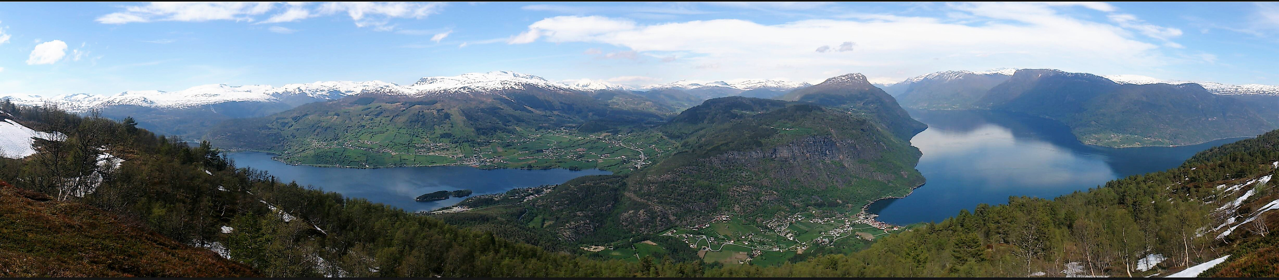 Started from the private parking lot at the end of the gravel road on the south side of Barsnesfjorden. We then followed the marked trail via Dal to Helgasete .
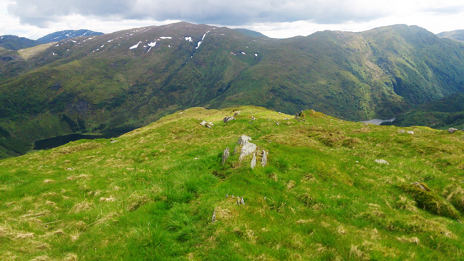
After a long break at Helgasete we continued northeast, first along the marked trail towards Solvornnipa and later along the marked trail towards Solvorn. When getting to the end of Hestadalen and the start of Skaret, we turned northwest and made our own way across the smaller peaks there, while enjoying all around spectacular views towards the north!
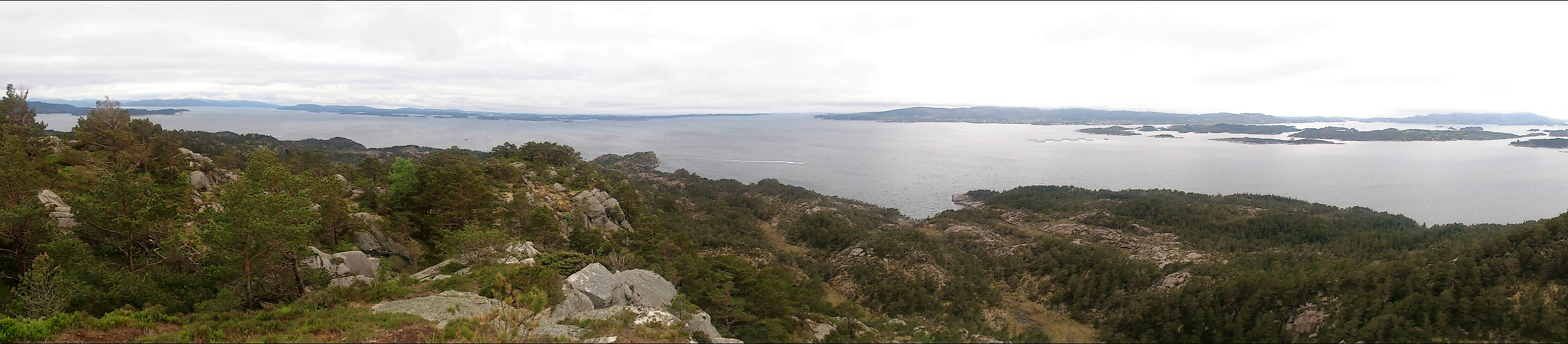
We then turned southwest and headed for the summit of Skinarfjellet , which is called Nonhaug on the sign at the summit (and Skinarfjellet/Nonshaug on the map). Here there were excellent views in all directions, as can be seen from the pictures. No clear trails to/from the summit, but some weak trails/animal tracks that could >>>
Started from the private parking lot at the end of the gravel road on the south side of Barsnesfjorden. We then followed the marked trail via Dal to Helgasete .
After a long break at Helgasete we continued northeast, first along the marked trail towards Solvornnipa and later along the marked trail towards Solvorn. When getting to the end of Hestadalen and the start of Skaret, we turned northwest and made our own way across the smaller peaks there, while enjoying all around spectacular views towards the north!
We then turned southwest and headed for the summit of Skinarfjellet , which is called Nonhaug on the sign at the summit (and Skinarfjellet/Nonshaug on the map). Here there were excellent views in all directions, as can be seen from the pictures. No clear trails to/from the summit, but some weak trails/animal tracks that could >>>
Amlaholten
- Dato:
- 25.05.2017
- Turtype:
- Fjelltur
- Turlengde:
- 1:40t
- Distanse:
- 5,2km
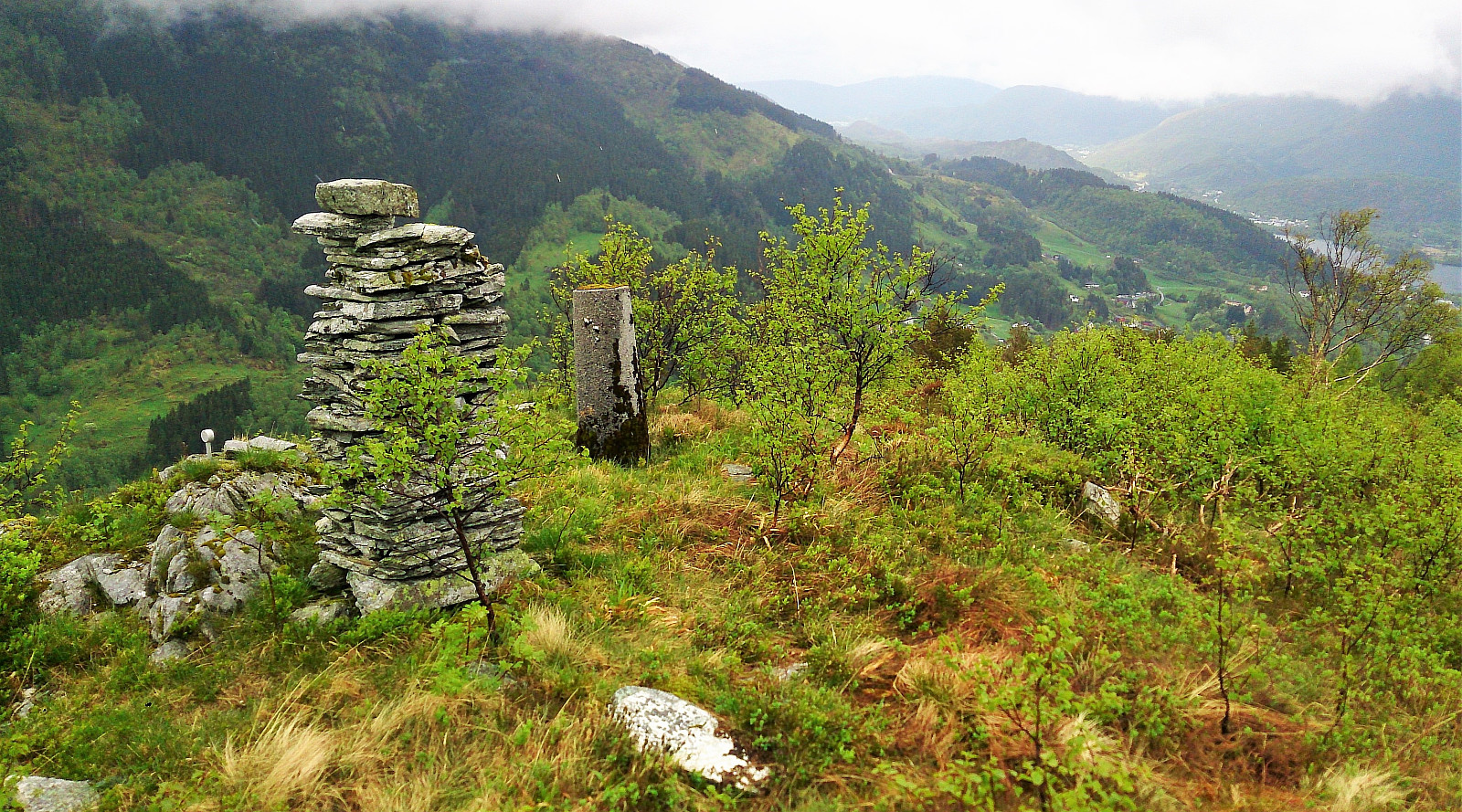
 From Kaupanger we drove towards Mannheller (where the ferry goes to Fodnes), but before heading into the tunnel going down to the ferry, we left the highway and followed the road towards Festingdalen. A bit more than halfway to Festingdalen we located a small parking lot with signs indicating the trail to Amlaholten . We followed this trail/forest road west until it turned south and then east. Here we shortly left the main trail and located a nice viewpoint to the southwest.
Next, we relocated the trail, which now got a lot steeper, and quickly arrived at the summit of Amlaholten. The views from the summit were nice, but rather limited due to all the trees. We continued east across the summit and followed the trail in the direction of Festingdalen, and finally arrived back at the road for a short 200 >>>
From Kaupanger we drove towards Mannheller (where the ferry goes to Fodnes), but before heading into the tunnel going down to the ferry, we left the highway and followed the road towards Festingdalen. A bit more than halfway to Festingdalen we located a small parking lot with signs indicating the trail to Amlaholten . We followed this trail/forest road west until it turned south and then east. Here we shortly left the main trail and located a nice viewpoint to the southwest.
Next, we relocated the trail, which now got a lot steeper, and quickly arrived at the summit of Amlaholten. The views from the summit were nice, but rather limited due to all the trees. We continued east across the summit and followed the trail in the direction of Festingdalen, and finally arrived back at the road for a short 200 >>>
Kaupangsholtane
- Dato:
- 25.05.2017
- Turtype:
- Fjelltur
- Turlengde:
- 1:58t
- Distanse:
- 6,1km
 The marked trail started from Haukåsvegen soon after leaving Kaupanger, and we first followed this trail/forest road to Kaupangsholten . Note that this is not the highest point of Kaupangsholtane, but it did provide a very nice view towards the south and seems to be where most people visit. We then followed the trail west to another viewpoint towards the south, before taking the mandatory visit to the highest point. From the summit, we followed trails and forest roads back to where we started the hike. All in all, a nice and easy hike, along easy to follow trails and forest roads.
Helldalssåta
- Dato:
- 23.05.2017
- Turtype:
- Fjelltur
- Turlengde:
- 0:37t
- Distanse:
- 2,0km
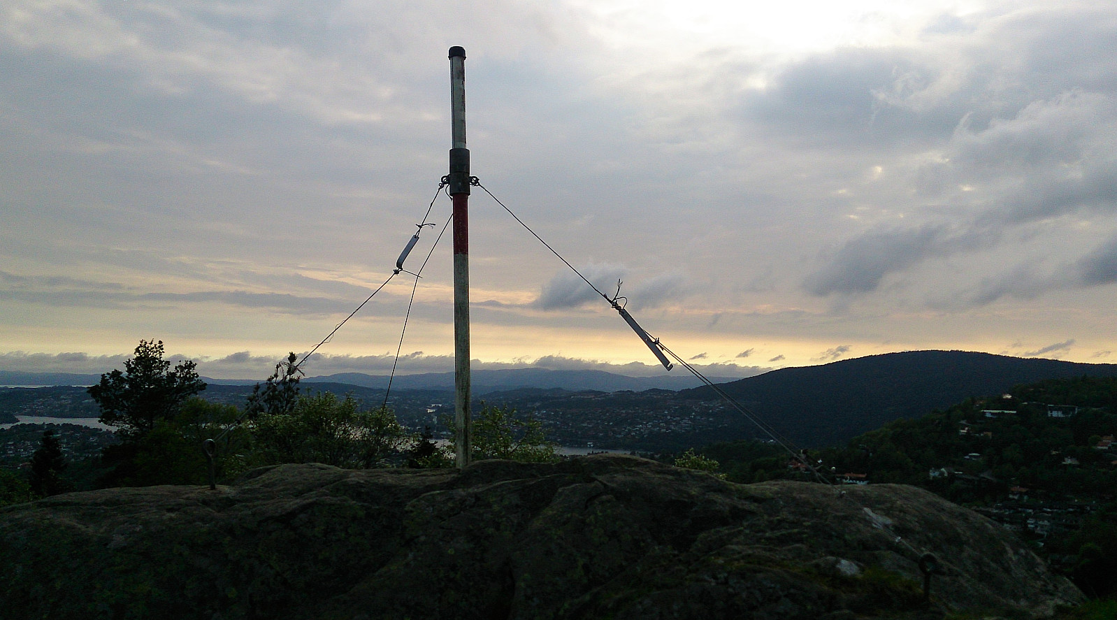 Started by taking the bus to Helldalssåta (the street has the same name as the peak, indicating how short the hike would be). The start of the trail was easy to locate and after just a few minutes I arrived at the summit. For being such an easily accessible summit, and only 250 meters above sea level, the views were surprisingly good in all directions. Well worth a visit.
From the summit I followed the trail southwest along the ridge to quickly arrive at the trig marker next to Storesåta , which also provided excellent views towards the west. The distance from Helldalssåta to Storesåta was less than one kilometer, so I'd definitely recommend including a visit if at Helldalssåta. Instead of going all the way back to Helldalssåta I rather located a shortcut down to Sanddalsringen, where a trail was indicated on >>>
Started by taking the bus to Helldalssåta (the street has the same name as the peak, indicating how short the hike would be). The start of the trail was easy to locate and after just a few minutes I arrived at the summit. For being such an easily accessible summit, and only 250 meters above sea level, the views were surprisingly good in all directions. Well worth a visit.
From the summit I followed the trail southwest along the ridge to quickly arrive at the trig marker next to Storesåta , which also provided excellent views towards the west. The distance from Helldalssåta to Storesåta was less than one kilometer, so I'd definitely recommend including a visit if at Helldalssåta. Instead of going all the way back to Helldalssåta I rather located a shortcut down to Sanddalsringen, where a trail was indicated on >>>
Myrdalsvatnet to Søylevatnet
- Dato:
- 21.05.2017
- Turtype:
- Fjelltur
- Turlengde:
- 4:14t
- Distanse:
- 12,0km
 Started by taking the bus to Ulsmåg skole and walking up to Myrdalsvatnet. From there I followed the gravel road north before locating the start of the trail towards Stordalsfjellet . The trail was easy to follow and I quickly arrived at the summit for some nice views, even though the rain and the low-hanging clouds did not help.
I continued along the trail towards Flåfjellet , with the only difficult part being the short, but quite steep, decent by Fjellklovevatnet, where light climbing was required to cross the valley. When ascending on the north side I lost the trail, but had no problems finding my way without it. The summit of Flåfjellet provided even better views than Stordalsfjellet, though again the views would clearly benefit from better weather.
Next, I continued towards Skardalsfjellet . Here the trail reappeared, but that >>>
Started by taking the bus to Ulsmåg skole and walking up to Myrdalsvatnet. From there I followed the gravel road north before locating the start of the trail towards Stordalsfjellet . The trail was easy to follow and I quickly arrived at the summit for some nice views, even though the rain and the low-hanging clouds did not help.
I continued along the trail towards Flåfjellet , with the only difficult part being the short, but quite steep, decent by Fjellklovevatnet, where light climbing was required to cross the valley. When ascending on the north side I lost the trail, but had no problems finding my way without it. The summit of Flåfjellet provided even better views than Stordalsfjellet, though again the views would clearly benefit from better weather.
Next, I continued towards Skardalsfjellet . Here the trail reappeared, but that >>>
Veten, Leirvågfjellet and Storafjellet
- Dato:
- 20.05.2017
- Turtype:
- Fjelltur
- Turlengde:
- 2:48t
- Distanse:
- 8,7km
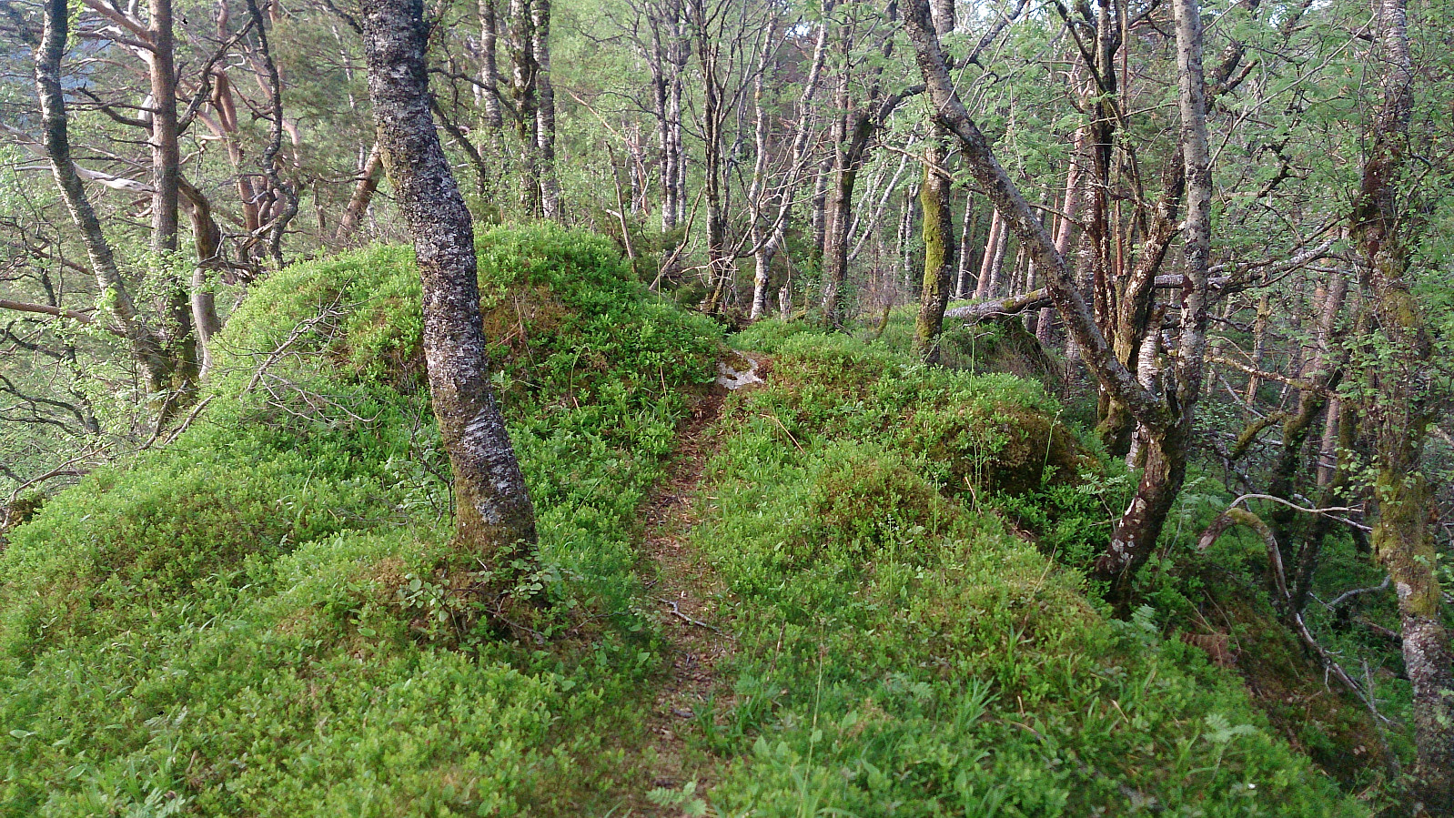
 Started by taking the bus to Krokeide Videregående Skole and walking up Korsnesvegen to where the map indicated a trail in the direction of Moldstigahaugen. The start of the tail was not marked, but the trail itself was marked with small colored wooden tags (see picture). However three colors were used and I had no information about which color corresponded to which goal...
The trail started out as a tractor road that later turned into a trail. As I would later figure out, the trail continues over the hill and reconnects with Korsnesvegen as it comes up from the parking lot. But my plan was to first go via Leirvågfjellet , and I therefore instead followed a weak trail north. This trail quickly disappeared (if it was ever more than an animal track to begin with), and thus getting to the top of Leirvågfjellet >>>
Started by taking the bus to Krokeide Videregående Skole and walking up Korsnesvegen to where the map indicated a trail in the direction of Moldstigahaugen. The start of the tail was not marked, but the trail itself was marked with small colored wooden tags (see picture). However three colors were used and I had no information about which color corresponded to which goal...
The trail started out as a tractor road that later turned into a trail. As I would later figure out, the trail continues over the hill and reconnects with Korsnesvegen as it comes up from the parking lot. But my plan was to first go via Leirvågfjellet , and I therefore instead followed a weak trail north. This trail quickly disappeared (if it was ever more than an animal track to begin with), and thus getting to the top of Leirvågfjellet >>>
Floråsen and Furekampane
- Dato:
- 19.05.2017
- Turtype:
- Fjelltur
- Turlengde:
- 2:52t
- Distanse:
- 8,1km
 Started by taking the bus to Ulsmåg Skole and walking up Dyngelandsvegen until reaching Dyngelandseidet, which I then followed for ~200 meters while searching for a trail towards Floråsen . I could not find any, and in the end simply started off in what I assumed was the direction of the summit. Getting to the summit was not too difficult, but far from a pleasant experience as it mainly involved fighting with low bushes and trees. Plus lots of cobwebs. There was a trail of sorts when getting through the initial larger trees, but I'm pretty sure this trail is predominantly used by animals. The summit provided no views, and I quickly returned to Dyngelandseidet.
My next goal was Furekampane , and I therefore continued east along the gravel road to Myrdalsvatnet, before following the same road north. I had located >>>
Started by taking the bus to Ulsmåg Skole and walking up Dyngelandsvegen until reaching Dyngelandseidet, which I then followed for ~200 meters while searching for a trail towards Floråsen . I could not find any, and in the end simply started off in what I assumed was the direction of the summit. Getting to the summit was not too difficult, but far from a pleasant experience as it mainly involved fighting with low bushes and trees. Plus lots of cobwebs. There was a trail of sorts when getting through the initial larger trees, but I'm pretty sure this trail is predominantly used by animals. The summit provided no views, and I quickly returned to Dyngelandseidet.
My next goal was Furekampane , and I therefore continued east along the gravel road to Myrdalsvatnet, before following the same road north. I had located >>>
