Archive - Date
Archive - Activity
-
Bike trip (111)
- Bike trip - mixed (25)
- Bike trip - road (86)
-
Drive (9)
- Car drive (9)
-
Other trip (3)
- Kayaking (3)
-
Ski trip (116)
- Backcountry skiing (69)
- Cross-country skiing (47)
- Trip by foot (1897)
Collected lists
-
Utvalgte topper og turmål i Bergen
(349/351)
 99%
99% -
Alle topper i Bergen
(393/400)
98%
-
Voss ≥ 100m pf.
(96/98)
97%
-
Opptur Hordaland
(144/159)
90%
-
Stasjoner på Bergensbanen
(33/40)
82%
-
Ulvik ≥ 100m pf.
(30/38)
78%
-
Hordaland ≥ 100m pf.
(624/863)
72%
-
Mjølfjell PF > 100m
(21/31)
67%
-
Jondal ≥ 100m pf.
(15/23)
65%
-
Dagsturhyttene i Vestland
(36/61)
59%
-
Sunnhordland PF >= 100m
(105/186)
56%
-
Hordaland: Hardanger PF>=100m
(196/359)
54%
-
DNT-hytter i Hordaland
(23/45)
51%
-
Kvinnherad ≥ 100m pf.
(40/79)
50%
-
Eidfjord ≥ 100m pf.
(13/42)
30%
-
Sogndal ≥ 100m pf.
(23/81)
28%
-
Gulen ≥ 100m pf.
(15/54)
27%
-
Vik i Sogn ≥ 100m pf.
(10/46)
21%
-
Sogn - Sør for Sognefjorden PF>=100m
(31/159)
19%
-
DNT-hytter i Sogn og Fjordane
(8/47)
17%

Nattlandsfjellet to Haukeland Sykehus
- Date:
- 18.12.2016
- Characteristic:
- Hillwalk
- Duration:
- 2:10h
- Distance:
- 7.4km
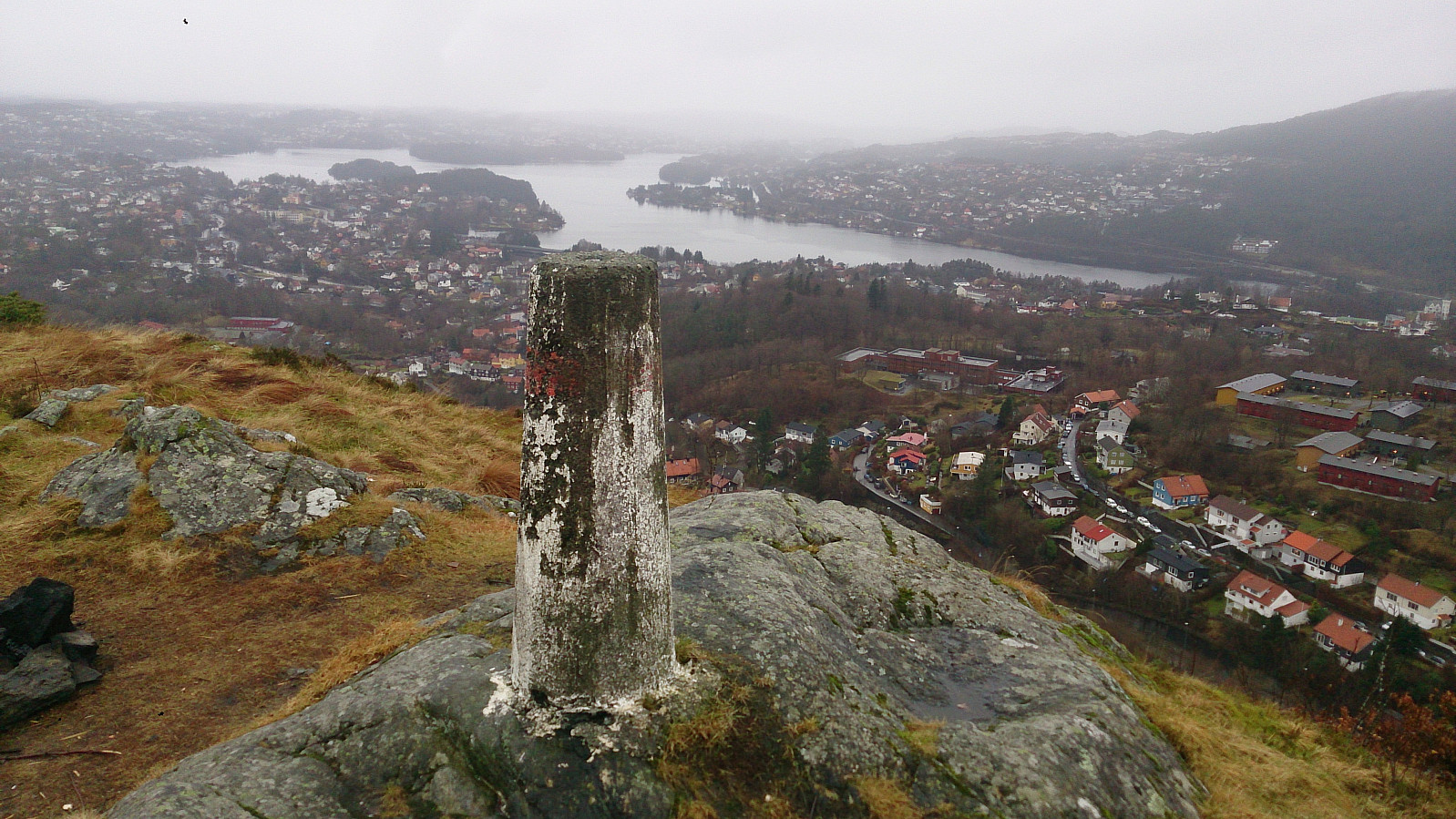 Took the bus to Kolstibotn and walked along the road up to Nattlandsfjellet for a quick trip to the trig marker indicated on the map for a better view than from the summit itself. I then continued along the road to Nordre Nattlandsfjellet for the start of the hike towards Ulriken, along the ridge passing by Orrehaugane before ending up at Haukeland Sykehus for the bus back to the city center. Overall, a nice hike, but in poor weather conditions with lots of rain and dense fog. Perhaps something to repeat in better weather.
Burdalsfjellet and Botlenipa
- Date:
- 11.12.2016
- Characteristic:
- Hillwalk
- Duration:
- 2:16h
- Distance:
- 6.8km
 Started by taking the bus to Knarrevik and trying to locate the trail on the north side of Rv. 555 for the start of the hike. However, this turned out to be more difficult than expected, as I quickly found myself on the wrong side of a busy road with no zebra crossings to be found. I therefore ended up walking along the road towards Sotra, but in the end I gave up looking for a crossing and managed to find a short break in the traffic and finally managed to safely reach the other side of the road.
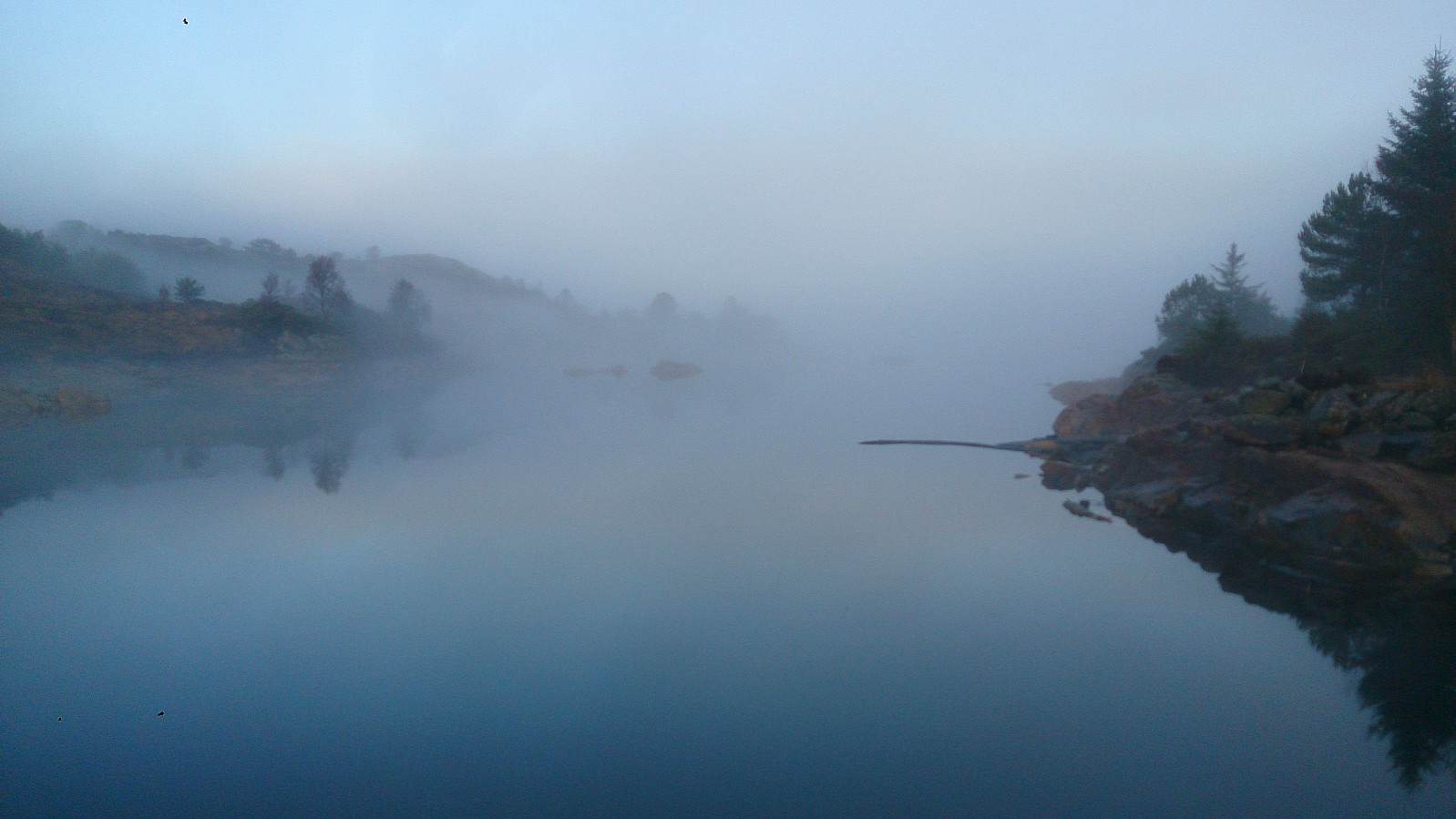
Next, I located a trail taking me to Storavatnet and then onwards to Burdalsfjellet . Even in quite dense fog, the trail was easy to follow and I quickly arrived at the summit for some nice atmospheric pictures. I continued along the trail towards the small piece of land connecting the two lakes of Storavatnet and >>>
Started by taking the bus to Knarrevik and trying to locate the trail on the north side of Rv. 555 for the start of the hike. However, this turned out to be more difficult than expected, as I quickly found myself on the wrong side of a busy road with no zebra crossings to be found. I therefore ended up walking along the road towards Sotra, but in the end I gave up looking for a crossing and managed to find a short break in the traffic and finally managed to safely reach the other side of the road.
Next, I located a trail taking me to Storavatnet and then onwards to Burdalsfjellet . Even in quite dense fog, the trail was easy to follow and I quickly arrived at the summit for some nice atmospheric pictures. I continued along the trail towards the small piece of land connecting the two lakes of Storavatnet and >>>
Håøytoppen
- Date:
- 10.12.2016
- Characteristic:
- Hillwalk
- Duration:
- 3:07h
- Distance:
- 11.3km
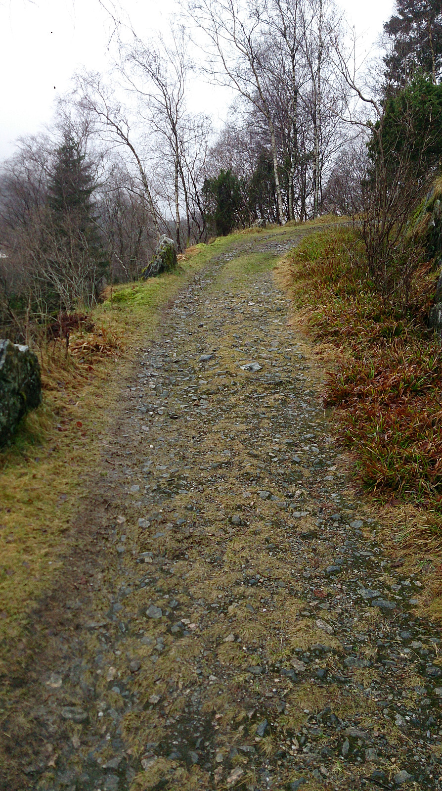 Started by talking the bus to Flatøy and walking along the main road (on a nice wide sidewalk) to a parking lot next to E39 where I found the hiking signs to Håøytoppen . I then followed a varied and easy to follow trail to the southern end of Håøyna, where the trail turned into a gravel road that lead me all the way to the summit of Håøytoppen.
I spent some time at the top exploring the different views before taking (more or less) the same route back to the starting point of the hike. There I figured out that I had to wait quite a while for the bus, so I decided to rather extend the hike by also crossing Nordhordlandsbroen and take the bus from there.
Started by talking the bus to Flatøy and walking along the main road (on a nice wide sidewalk) to a parking lot next to E39 where I found the hiking signs to Håøytoppen . I then followed a varied and easy to follow trail to the southern end of Håøyna, where the trail turned into a gravel road that lead me all the way to the summit of Håøytoppen.
I spent some time at the top exploring the different views before taking (more or less) the same route back to the starting point of the hike. There I figured out that I had to wait quite a while for the bus, so I decided to rather extend the hike by also crossing Nordhordlandsbroen and take the bus from there.
Håmanen and Sandviksfjellet
- Date:
- 03.12.2016
- Characteristic:
- Hillwalk
- Duration:
- 3:32h
- Distance:
- 12.8km
 Started from Lønborg and used the new gravel road (Hellemyrstien) on the eastern side of Eidsvågsfjellet to get to Langevatnet and then Munkebotsvatnet. Here we took a short detour to Håmanen . No views from the summit itself, but there are nice views to the southwest if moving west of the the summit.
After descending from Håmanen we continued up the gravel road to Storevatnet, where we took another short detour, this time to reach the top of Sandviksfjellet , where the views were very limited due to fog. Same route back to Lønborg.
Started from Lønborg and used the new gravel road (Hellemyrstien) on the eastern side of Eidsvågsfjellet to get to Langevatnet and then Munkebotsvatnet. Here we took a short detour to Håmanen . No views from the summit itself, but there are nice views to the southwest if moving west of the the summit.
After descending from Håmanen we continued up the gravel road to Storevatnet, where we took another short detour, this time to reach the top of Sandviksfjellet , where the views were very limited due to fog. Same route back to Lønborg.
