Arkiv - dato
Arkiv - aktivitet
-
Annen tur (3)
- Kajakkpadling (3)
- Fottur (1908)
-
Kjøretur (9)
- Biltur (9)
-
Skitur (116)
- Fjellskitur (69)
- Langrennstur (47)
-
Sykkeltur (115)
- Blandet sykling (28)
- Gatesykling (87)
Lister jeg samler etter
-
Utvalgte topper og turmål i Bergen
(351/352)
 99%
99% -
Alle topper i Bergen
(395/400)
98%
-
Voss ≥ 100m pf.
(96/98)
97%
-
Opptur Hordaland
(144/159)
90%
-
Stasjoner på Bergensbanen
(33/40)
82%
-
Ulvik ≥ 100m pf.
(30/38)
78%
-
Hordaland ≥ 100m pf.
(625/863)
72%
-
Mjølfjell PF > 100m
(21/31)
67%
-
Jondal ≥ 100m pf.
(15/23)
65%
-
Dagsturhyttene i Vestland
(37/62)
59%
-
Sunnhordland PF >= 100m
(106/186)
56%
-
Hordaland: Hardanger PF>=100m
(196/359)
54%
-
Kvinnherad ≥ 100m pf.
(41/79)
51%
-
DNT-hytter i Hordaland
(23/46)
50%
-
Eidfjord ≥ 100m pf.
(13/42)
30%
-
Sogndal ≥ 100m pf.
(23/81)
28%
-
Gulen ≥ 100m pf.
(15/54)
27%
-
Vik i Sogn ≥ 100m pf.
(10/46)
21%
-
Sogn - Sør for Sognefjorden PF>=100m
(31/159)
19%
-
DNT-hytter i Sogn og Fjordane
(8/47)
17%

Hetlebakksåta, Breisteinsåta and Erviknipa
- Dato:
- 28.08.2016
- Turtype:
- Fjelltur
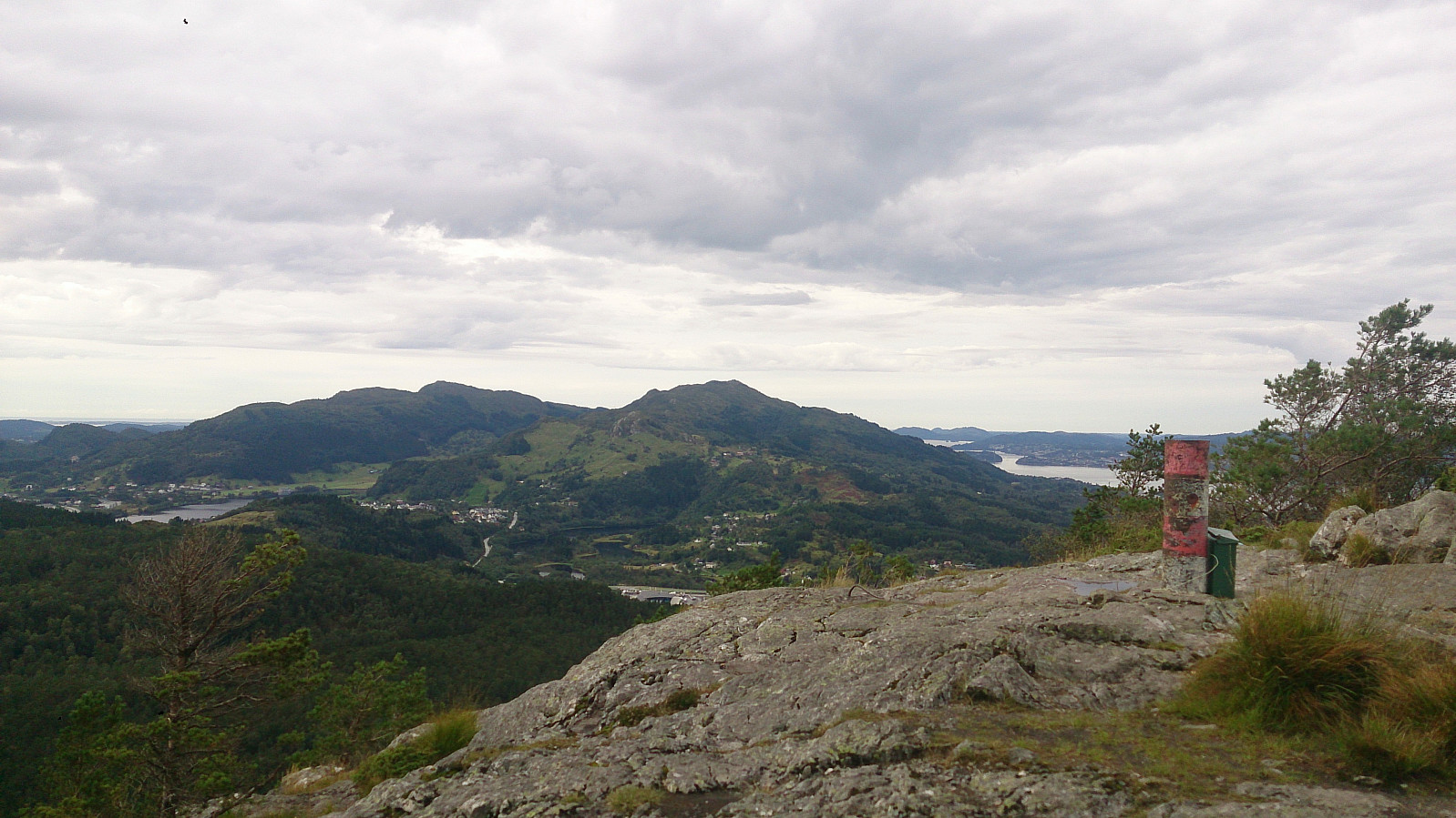 Started by taking the bus to Breisteinvegen and from there walking to Haukåsrinden for the start of the hike. I then followed the marked trail to Hetlebakksåta and Breisteinsåta, before heading down to Erviknipa. From Erviknipa I followed the trail towards Tuftadalen and Gaupåsvegen. Overall a very nice hike that can be highly recommended.
See Hetlebakksåta, Breisteinsåta and Erviknipa for the same hike with GPS tracking.
Started by taking the bus to Breisteinvegen and from there walking to Haukåsrinden for the start of the hike. I then followed the marked trail to Hetlebakksåta and Breisteinsåta, before heading down to Erviknipa. From Erviknipa I followed the trail towards Tuftadalen and Gaupåsvegen. Overall a very nice hike that can be highly recommended.
See Hetlebakksåta, Breisteinsåta and Erviknipa for the same hike with GPS tracking.
Hauggjeldsvarden from Gløvrehaugen
- Dato:
- 23.08.2016
- Turtype:
- Fjelltur
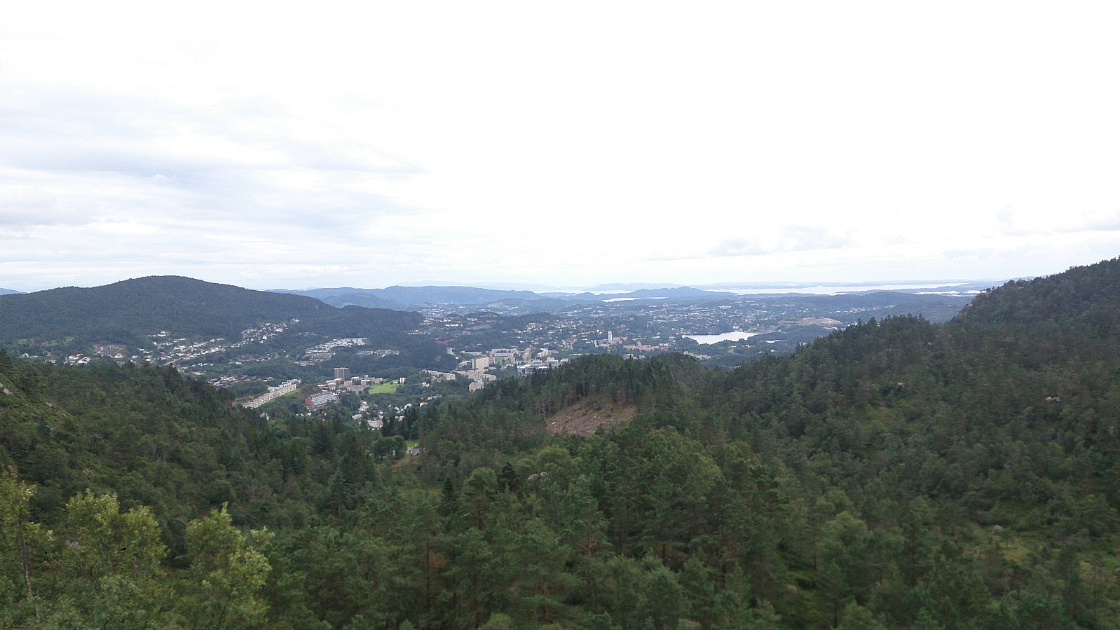
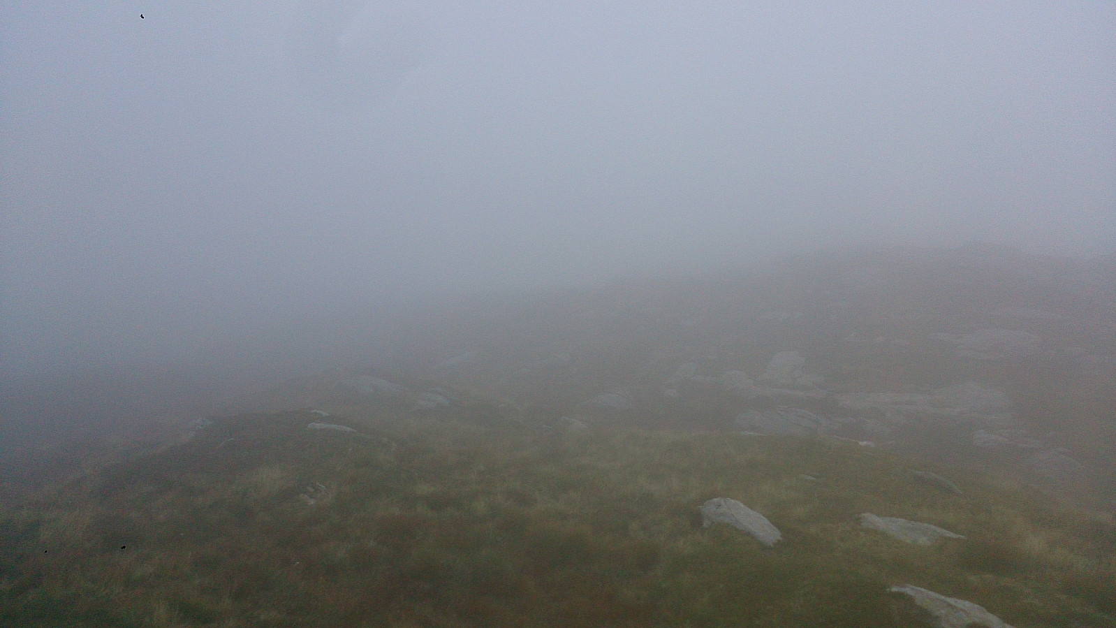 Started from Haukeland Sykehus and walked to Baunehytten. From there we continued to Gløvrevatnet and up the ridge to Haukelandsstikkene and finally reaching Hauggjeldsvarden. The fog started to gather soon after leaving Gløvrevatnet though, and at the summit we had to rely on the GPS to locate the cairn. From the summit we followed the trail back to Ulriken and down to Haukeland Sykehus.
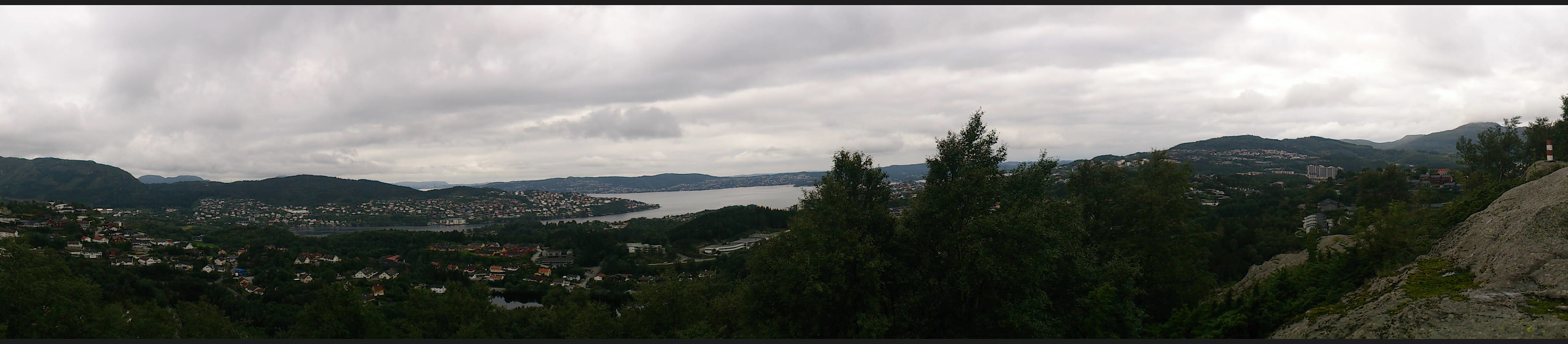
Gullsteinen, Løvstakken and Strandafjellet
- Dato:
- 21.08.2016
- Turtype:
- Fjelltur
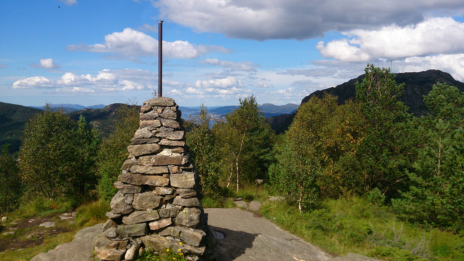 The trip started by taking the bus to Bønestoppen and from there following the trail over Gullsteinen to Løvstakken. From Løvstakken I continued to Strandafjellet where I followed a very steep trail down to Solheimslien.
See Gullsteinen, Løvstakken and Strandafjellet for a similar hike with GPS tracking but with an easier descent from Strandafjellet.
The trip started by taking the bus to Bønestoppen and from there following the trail over Gullsteinen to Løvstakken. From Løvstakken I continued to Strandafjellet where I followed a very steep trail down to Solheimslien.
See Gullsteinen, Løvstakken and Strandafjellet for a similar hike with GPS tracking but with an easier descent from Strandafjellet.
Geitanuken, Ulsetvarden and Rollandsoksen
- Dato:
- 14.08.2016
- Turtype:
- Fjelltur
 Started by taking the bus to Saudalen and from there following the marked trail to Geitanuken . I then doubled back to try to locate the trail towards Ulsetvarden . The trail was not easy to find (and unmarked). However, in the end I found what I assumed was the correct trail and followed a very wet path to Ulsetvarden. From there I found the trail towards Myrdal and along "Den Trondhjemske Postvei" with a short detour to Rollandsoksen .
Lyngbønipa, Gravdalsfjellet and Olsokfjellet
- Dato:
- 05.08.2016
- Turtype:
- Fjelltur
 Started by taking the bus to Lyngbø and walking up Nipedalen. Right behind the final bus stop in Nipedalen there is a steep trail that took me almost all the way to Lyngbønipa . The summit was reached by continuing north after getting to the top of the trail up from the bus stop. I completed the trip by crossing over Gravdalsfjellet , Holefjellet S , Damsgårdsfjellet and Olsokfjellet before ending up at Melkeplassen.
