Arkiv - dato
Arkiv - aktivitet
-
Annen tur (3)
- Kajakkpadling (3)
- Fottur (1897)
-
Kjøretur (9)
- Biltur (9)
-
Skitur (116)
- Fjellskitur (69)
- Langrennstur (47)
-
Sykkeltur (111)
- Blandet sykling (25)
- Gatesykling (86)
Lister jeg samler etter
-
Utvalgte topper og turmål i Bergen
(349/351)
 99%
99% -
Alle topper i Bergen
(393/400)
98%
-
Voss ≥ 100m pf.
(96/98)
97%
-
Opptur Hordaland
(144/159)
90%
-
Stasjoner på Bergensbanen
(33/40)
82%
-
Ulvik ≥ 100m pf.
(30/38)
78%
-
Hordaland ≥ 100m pf.
(624/863)
72%
-
Mjølfjell PF > 100m
(21/31)
67%
-
Jondal ≥ 100m pf.
(15/23)
65%
-
Dagsturhyttene i Vestland
(36/61)
59%
-
Sunnhordland PF >= 100m
(105/186)
56%
-
Hordaland: Hardanger PF>=100m
(196/359)
54%
-
DNT-hytter i Hordaland
(23/45)
51%
-
Kvinnherad ≥ 100m pf.
(40/79)
50%
-
Eidfjord ≥ 100m pf.
(13/42)
30%
-
Sogndal ≥ 100m pf.
(23/81)
28%
-
Gulen ≥ 100m pf.
(15/54)
27%
-
Vik i Sogn ≥ 100m pf.
(10/46)
21%
-
Sogn - Sør for Sognefjorden PF>=100m
(31/159)
19%
-
DNT-hytter i Sogn og Fjordane
(8/47)
17%

Nattlandsfjellet to Haukeland Sykehus
- Dato:
- 18.12.2016
- Turtype:
- Fjelltur
- Turlengde:
- 2:10t
- Distanse:
- 7,4km
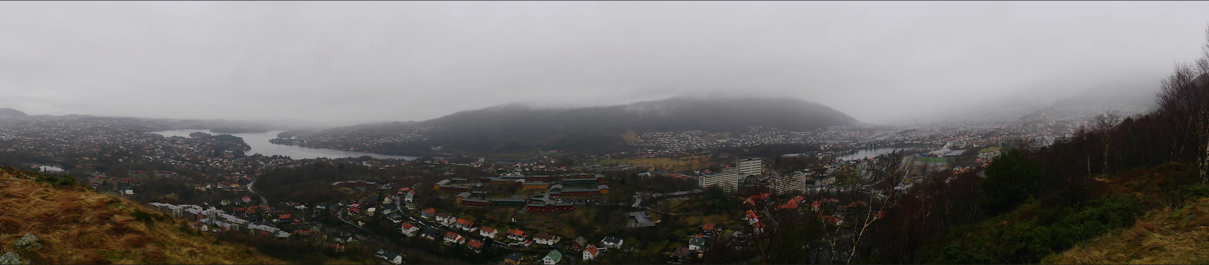 Took the bus to Kolstibotn and walked along the road up to Nattlandsfjellet for a quick trip to the trig marker indicated on the map for a better view than from the summit itself. I then continued along the road to Nordre Nattlandsfjellet for the start of the hike towards Ulriken, along the ridge passing by Orrehaugane before ending up at Haukeland Sykehus for the bus back to the city center. Overall, a nice hike, but in poor weather conditions with lots of rain and dense fog. Perhaps something to repeat in better weather.
Burdalsfjellet and Botlenipa
- Dato:
- 11.12.2016
- Turtype:
- Fjelltur
- Turlengde:
- 2:16t
- Distanse:
- 6,8km
 Started by taking the bus to Knarrevik and trying to locate the trail on the north side of Rv. 555 for the start of the hike. However, this turned out to be more difficult than expected, as I quickly found myself on the wrong side of a busy road with no zebra crossings to be found. I therefore ended up walking along the road towards Sotra, but in the end I gave up looking for a crossing and managed to find a short break in the traffic and finally managed to safely reach the other side of the road.
Next, I located a trail taking me to Storavatnet and then onwards to Burdalsfjellet . Even in quite dense fog, the trail was easy to follow and I quickly arrived at the summit for some nice atmospheric pictures. I continued along the trail towards the small piece of land connecting the two lakes of Storavatnet and >>>
Started by taking the bus to Knarrevik and trying to locate the trail on the north side of Rv. 555 for the start of the hike. However, this turned out to be more difficult than expected, as I quickly found myself on the wrong side of a busy road with no zebra crossings to be found. I therefore ended up walking along the road towards Sotra, but in the end I gave up looking for a crossing and managed to find a short break in the traffic and finally managed to safely reach the other side of the road.
Next, I located a trail taking me to Storavatnet and then onwards to Burdalsfjellet . Even in quite dense fog, the trail was easy to follow and I quickly arrived at the summit for some nice atmospheric pictures. I continued along the trail towards the small piece of land connecting the two lakes of Storavatnet and >>>
Håøytoppen
- Dato:
- 10.12.2016
- Turtype:
- Fjelltur
- Turlengde:
- 3:07t
- Distanse:
- 11,3km
 Started by talking the bus to Flatøy and walking along the main road (on a nice wide sidewalk) to a parking lot next to E39 where I found the hiking signs to Håøytoppen . I then followed a varied and easy to follow trail to the southern end of Håøyna, where the trail turned into a gravel road that lead me all the way to the summit of Håøytoppen.
I spent some time at the top exploring the different views before taking (more or less) the same route back to the starting point of the hike. There I figured out that I had to wait quite a while for the bus, so I decided to rather extend the hike by also crossing Nordhordlandsbroen and take the bus from there.
Started by talking the bus to Flatøy and walking along the main road (on a nice wide sidewalk) to a parking lot next to E39 where I found the hiking signs to Håøytoppen . I then followed a varied and easy to follow trail to the southern end of Håøyna, where the trail turned into a gravel road that lead me all the way to the summit of Håøytoppen.
I spent some time at the top exploring the different views before taking (more or less) the same route back to the starting point of the hike. There I figured out that I had to wait quite a while for the bus, so I decided to rather extend the hike by also crossing Nordhordlandsbroen and take the bus from there.
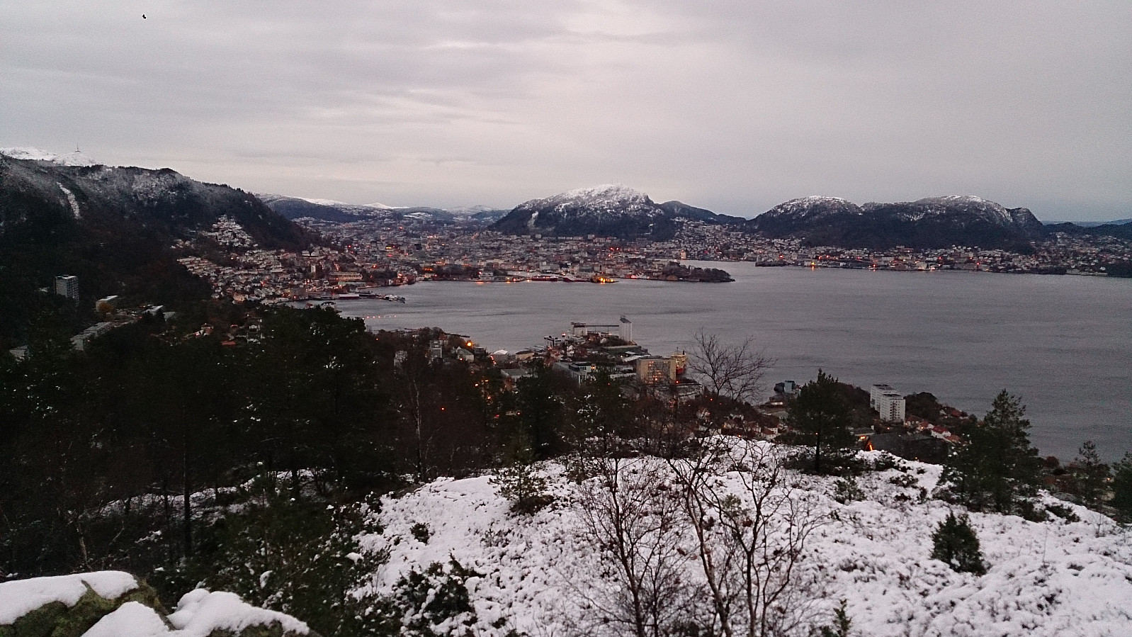
Håmanen and Sandviksfjellet
- Dato:
- 03.12.2016
- Turtype:
- Fjelltur
- Turlengde:
- 3:32t
- Distanse:
- 12,8km
 Started from Lønborg and used the new gravel road (Hellemyrstien) on the eastern side of Eidsvågsfjellet to get to Langevatnet and then Munkebotsvatnet. Here we took a short detour to Håmanen . No views from the summit itself, but there are nice views to the southwest if moving west of the the summit.
After descending from Håmanen we continued up the gravel road to Storevatnet, where we took another short detour, this time to reach the top of Sandviksfjellet , where the views were very limited due to fog. Same route back to Lønborg.
Started from Lønborg and used the new gravel road (Hellemyrstien) on the eastern side of Eidsvågsfjellet to get to Langevatnet and then Munkebotsvatnet. Here we took a short detour to Håmanen . No views from the summit itself, but there are nice views to the southwest if moving west of the the summit.
After descending from Håmanen we continued up the gravel road to Storevatnet, where we took another short detour, this time to reach the top of Sandviksfjellet , where the views were very limited due to fog. Same route back to Lønborg.
Sjurstonipa and Lydarnipa
- Dato:
- 27.11.2016
- Turtype:
- Fjelltur
- Turlengde:
- 3:40t
- Distanse:
- 11,4km
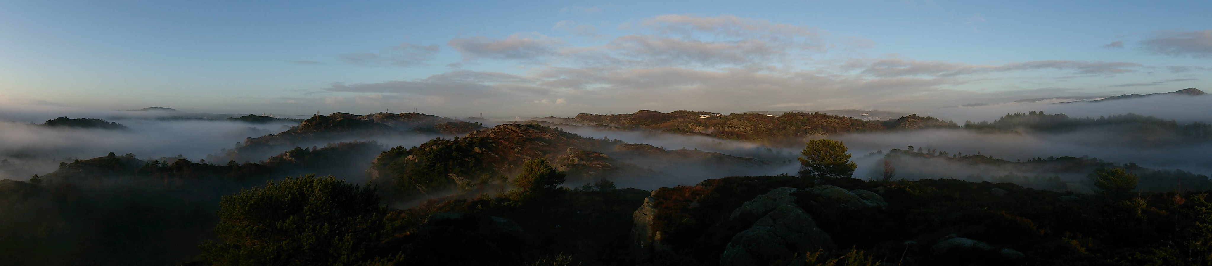
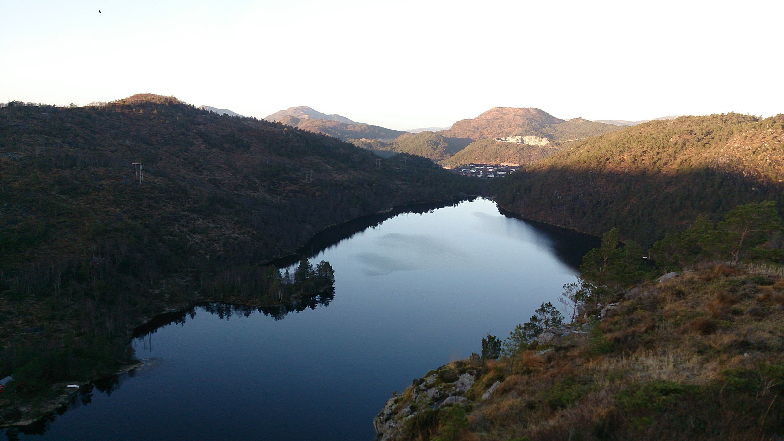 Another hike in Ytre Arna. This time the main goal being Ulvaberget . I started by taking the bus to Gamsevegen and following the gravel road that leads towards Sjurstonipa . After getting to the summit of Sjurstonipa I continued south to the old discontinued shooting range at the southern end of Stemmevatnet, and from there followed the trail towards Ulvaberget. The views from the summit were very nice, with steep cliffs down to Spåkevatnet, which was a bit surprising as the climb to the top was not particularly long or steep.
From the summit of Ulvaberget I decided to try walking along the western side of Spåkevatnet to get back to the road to the north of Gaupåsvatnet. I was therefore encouraged when seeing signs indicating that this was indeed an option. However, after following the trail along the lake for >>>
Another hike in Ytre Arna. This time the main goal being Ulvaberget . I started by taking the bus to Gamsevegen and following the gravel road that leads towards Sjurstonipa . After getting to the summit of Sjurstonipa I continued south to the old discontinued shooting range at the southern end of Stemmevatnet, and from there followed the trail towards Ulvaberget. The views from the summit were very nice, with steep cliffs down to Spåkevatnet, which was a bit surprising as the climb to the top was not particularly long or steep.
From the summit of Ulvaberget I decided to try walking along the western side of Spåkevatnet to get back to the road to the north of Gaupåsvatnet. I was therefore encouraged when seeing signs indicating that this was indeed an option. However, after following the trail along the lake for >>>
Storrinden
- Dato:
- 26.11.2016
- Turtype:
- Fjelltur
- Turlengde:
- 1:08t
- Distanse:
- 4,8km
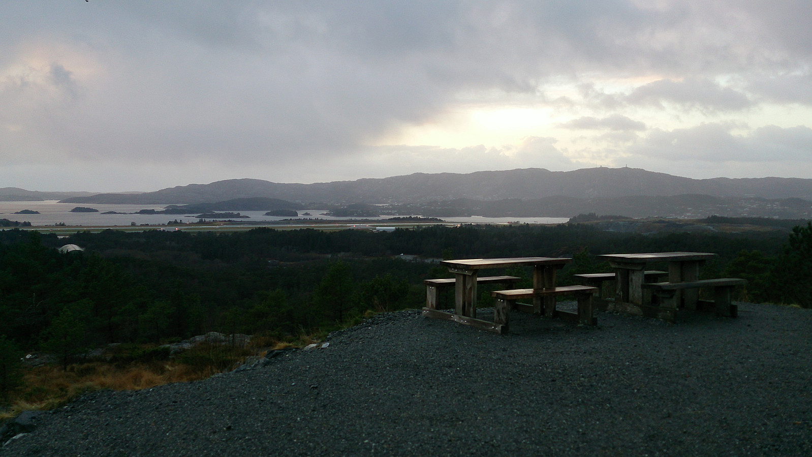 Started by taking the bus to Kokstadvegen and following the gravel road all the way to the summit of Storrinden . The best views were obtained southwest of the summit , which included excellent views towards Liatårnet and the airport at Flesland. I used the same route back to the starting point, but with a minor detour to Hammarslandsfjellet, which provided very limited views.
Grøntua and Festeråsen
- Dato:
- 19.11.2016
- Turtype:
- Fjelltur
- Turlengde:
- 1:39t
- Distanse:
- 7,5km
 Took the bus to Loddefjord Terminal and walked up towards Kjøkkelvikveien and onto Olsvikskjenet before locating a trail I assumed was heading to the top of Grøntua . After only a couple of minutes I was at the summit. I then continued towards Festeråsen , passing by Olsvik Kirke and crossing Olsvikskjenet, before following the road to Festeråsen.
From the summit of Festeråsen I made a U-turn and followed Olsvikskjenet until I reconnected with the trail to Grøntua. Note that a major part of this section consisted of walking along the main road with no sidewalk. (Pretty sure there are better alternatives though, such as the smaller roads in between the apartment buildings, but these options were not very clear to someone unfamiliar with the area.) I then followed the same route back to Loddefjord Terminal for >>>
Took the bus to Loddefjord Terminal and walked up towards Kjøkkelvikveien and onto Olsvikskjenet before locating a trail I assumed was heading to the top of Grøntua . After only a couple of minutes I was at the summit. I then continued towards Festeråsen , passing by Olsvik Kirke and crossing Olsvikskjenet, before following the road to Festeråsen.
From the summit of Festeråsen I made a U-turn and followed Olsvikskjenet until I reconnected with the trail to Grøntua. Note that a major part of this section consisted of walking along the main road with no sidewalk. (Pretty sure there are better alternatives though, such as the smaller roads in between the apartment buildings, but these options were not very clear to someone unfamiliar with the area.) I then followed the same route back to Loddefjord Terminal for >>>
Svartaberget
- Dato:
- 16.11.2016
- Turtype:
- Fjelltur
- Turlengde:
- 1:37t
- Distanse:
- 6,1km
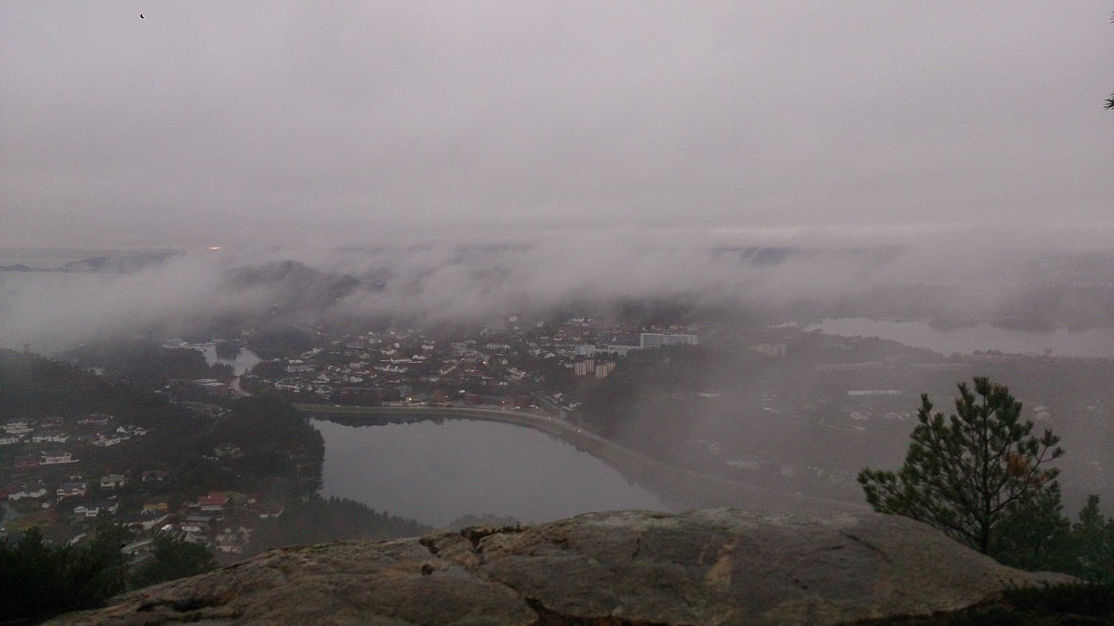 Started by taking the bus to Lyngbø and walking up Nipedalen to Tennebekktjørna, and onwards to Svartatjørna where I tried to locate a trail to Svartaberget . The trick was to follow a trail heading upwards in the northwesterly direction from Svartatjørna and when this flattened out follow a trail heading south.
I followed this trail towards the summit, but at one point the trail started descending. I then took a hard right (i.e. west) until reconnecting with what was likely a missed exit of the previous trail, which I could then easily follow all the way to the summit of Svartaberget.
Given the bad weather and the low-hanging clouds, the views from the summit were limited, but are probably much better with nicer conditions. From the summit I followed a steep, and on this day very slippery, trail down >>>
Started by taking the bus to Lyngbø and walking up Nipedalen to Tennebekktjørna, and onwards to Svartatjørna where I tried to locate a trail to Svartaberget . The trick was to follow a trail heading upwards in the northwesterly direction from Svartatjørna and when this flattened out follow a trail heading south.
I followed this trail towards the summit, but at one point the trail started descending. I then took a hard right (i.e. west) until reconnecting with what was likely a missed exit of the previous trail, which I could then easily follow all the way to the summit of Svartaberget.
Given the bad weather and the low-hanging clouds, the views from the summit were limited, but are probably much better with nicer conditions. From the summit I followed a steep, and on this day very slippery, trail down >>>
Storhaugen, Repparåsen and Skåldalsfjellet
- Dato:
- 06.11.2016
- Turtype:
- Fjelltur
- Turlengde:
- 6:10t
- Distanse:
- 14,7km
 We started from the parking lot in Stølsvegen in Arna and from there followed the marked trail to Reppadalen. Here we turned north and started our accent to Repparåsen . The snow started getting deeper, at times up to half a meter to a meter deep, making the progress significantly slower than expected. We therefore rejected our original plan of going via Herlandsfjellet and instead headed directly towards the summit of Skåldalsfjellet .
From Skåldalsfjellet the plan was to head to Skåldalsnipa before descending to Raudtjørn. But as it was now getting fairly dark, we instead decided to go to the unnamed 685m hill northeast of Skåldalsnipa (later named Sælinga ) and from there follow the ridge back down to Reppadalen. This turned out to be a good decision, given that we had to rely on flashlights to properly see the road for the last kilometers back to the car.
All in all in excellent >>>
We started from the parking lot in Stølsvegen in Arna and from there followed the marked trail to Reppadalen. Here we turned north and started our accent to Repparåsen . The snow started getting deeper, at times up to half a meter to a meter deep, making the progress significantly slower than expected. We therefore rejected our original plan of going via Herlandsfjellet and instead headed directly towards the summit of Skåldalsfjellet .
From Skåldalsfjellet the plan was to head to Skåldalsnipa before descending to Raudtjørn. But as it was now getting fairly dark, we instead decided to go to the unnamed 685m hill northeast of Skåldalsnipa (later named Sælinga ) and from there follow the ridge back down to Reppadalen. This turned out to be a good decision, given that we had to rely on flashlights to properly see the road for the last kilometers back to the car.
All in all in excellent >>>
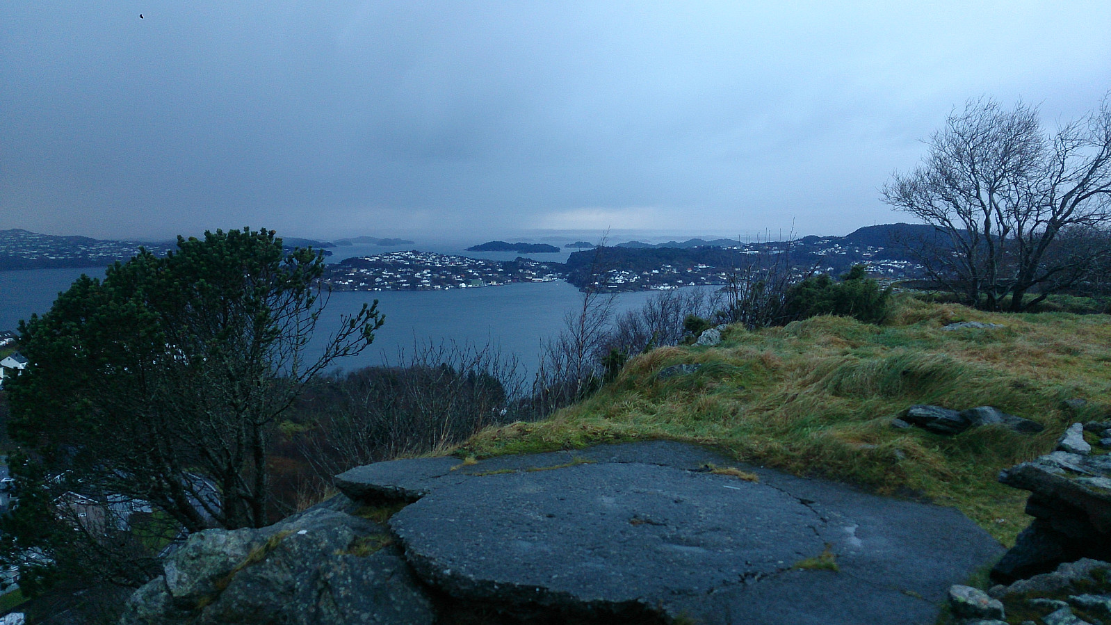
Ørneberget
- Dato:
- 05.11.2016
- Turtype:
- Fjelltur
 Short Saturday hike across Øyjordsfjellet, aka Ørneberget.
