Archiv - Nach Datum
Archiv - Nach Aktivität
-
Andere Tour (3)
- Kayaking (3)
-
Fahrradtour (108)
- Fahrradtour Straße (83)
- Fahrradtour gemischt (25)
-
Fahrzeugtour (9)
- Autotour (9)
-
Fußtour (1844)
- Bergtour (1093)
- Jogging (1)
- Spaziergang (55)
- Wanderung (695)
-
Skitour (113)
- Langlauf (46)
- Tourenskilauf (67)
Gesammelte Listen
-
Utvalgte topper og turmål i Bergen
(343/344)
 99%
99% -
Alle topper i Bergen
(390/397)
98%
-
Voss ≥ 100m pf.
(96/98)
97%
-
Opptur Hordaland
(144/159)
90%
-
Stasjoner på Bergensbanen
(31/40)
77%
-
Ulvik ≥ 100m pf.
(28/38)
73%
-
Hordaland ≥ 100m pf.
(617/863)
71%
-
Mjølfjell PF > 100m
(21/31)
67%
-
Jondal ≥ 100m pf.
(15/23)
65%
-
Sunnhordland PF >= 100m
(105/186)
56%
-
Dagsturhyttene i Vestland
(33/61)
54%
-
Hordaland: Hardanger PF>=100m
(189/359)
52%
-
DNT-hytter i Hordaland
(23/45)
51%
-
Kvinnherad ≥ 100m pf.
(40/79)
50%
-
Sogndal ≥ 100m pf.
(23/81)
28%
-
Eidfjord ≥ 100m pf.
(10/42)
23%
-
Vik i Sogn ≥ 100m pf.
(10/46)
21%
-
Gulen ≥ 100m pf.
(10/54)
18%
-
DNT-hytter i Sogn og Fjordane
(8/47)
17%
-
Sogn - Sør for Sognefjorden PF>=100m
(26/159)
16%

Loneggi from Ekse
- Datum:
- 21.06.2025
- Tourcharakter:
- Bergtour
- Tourlänge:
- 2:28h
- Entfernung:
- 6,0km
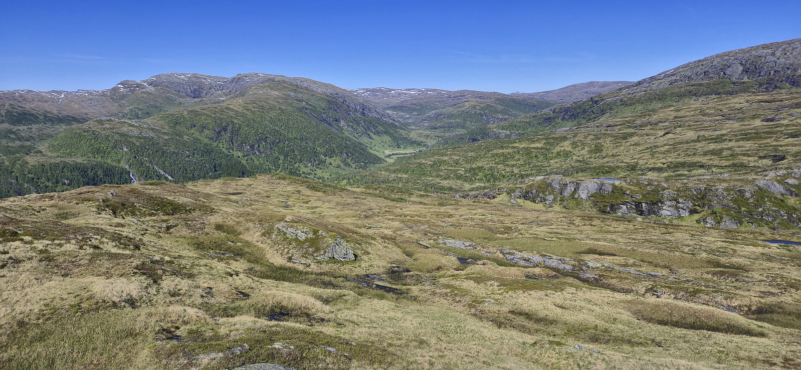 After my solo ascent of Blyfjell , I was picked up by Endre at Gullbrå and we drove the short distance west to Ekse where we found parking next to the suspension bridge across Ekso . The bridge made for easy access to the trail starting on the other side of the river, which we proceeded to follow up Tjørnadalen before later heading off-trail to the summit.
The summit was reached without any issues and provided great panoramic views. Before descending along the same route we had a short break celebrating that I had now completed both Vaksdal ≥ 100m pf. and Nordhordland PF >= 100m !
Towards the end of the hike the trail passed by a picturesque small pond and Endre of course could not resist going for a swim. This was apparently not enough however and he also later decided not to use the bridge to get back to the car but rather walk across the river, which he managed with only minor concerns along >>>
After my solo ascent of Blyfjell , I was picked up by Endre at Gullbrå and we drove the short distance west to Ekse where we found parking next to the suspension bridge across Ekso . The bridge made for easy access to the trail starting on the other side of the river, which we proceeded to follow up Tjørnadalen before later heading off-trail to the summit.
The summit was reached without any issues and provided great panoramic views. Before descending along the same route we had a short break celebrating that I had now completed both Vaksdal ≥ 100m pf. and Nordhordland PF >= 100m !
Towards the end of the hike the trail passed by a picturesque small pond and Endre of course could not resist going for a swim. This was apparently not enough however and he also later decided not to use the bridge to get back to the car but rather walk across the river, which he managed with only minor concerns along >>>
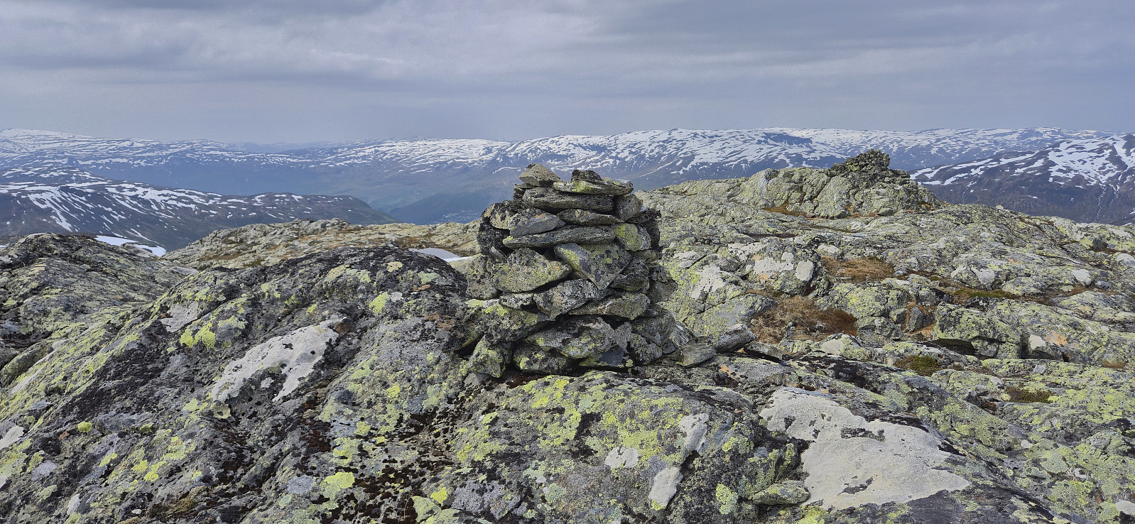
Blyfjell and Torvedalshytta from Grøndalsvatnet
- Datum:
- 21.06.2025
- Tourcharakter:
- Bergtour
- Tourlänge:
- 5:31h
- Entfernung:
- 14,8km
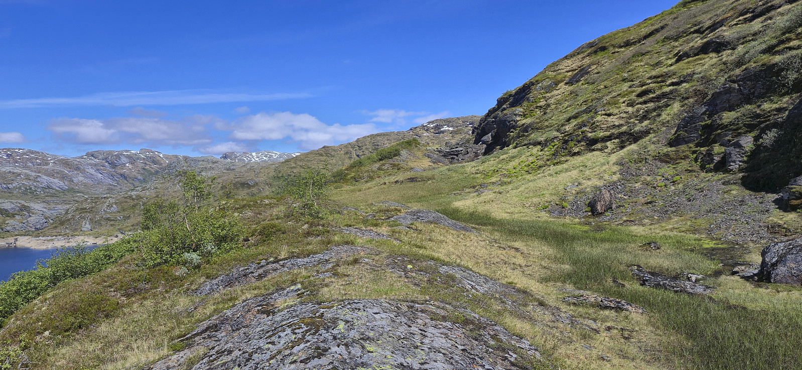 For a while I had been looking into how to get to the northeastern end of Eksingedalen via public transportations to ascend the final two peaks I had left in this area, and while doable, it seemed to require a long walk to either Evanger or Myrkdalen/Vinje at the end of the hike. When Endre suggested a joint trip to Eksingedalen I was therefore quick to say yes, and we came up with a plan covering all of the peaks we had left between us.
After the roughly two-hour drive from Bergen, Endre dropped me off at the parking lot south of Grøndalsvatnet before returning west for this ascents of Eggane , Blåvasshorgi , Sørvest for Hundeggi and Storhaug , while I continued northeast towards Blyfjell . The off-trail ascent was relatively easy, however my chosen route was not the best and included more ups and downs than necessary. There were also lots of sections of exposed mountainside that would >>>
For a while I had been looking into how to get to the northeastern end of Eksingedalen via public transportations to ascend the final two peaks I had left in this area, and while doable, it seemed to require a long walk to either Evanger or Myrkdalen/Vinje at the end of the hike. When Endre suggested a joint trip to Eksingedalen I was therefore quick to say yes, and we came up with a plan covering all of the peaks we had left between us.
After the roughly two-hour drive from Bergen, Endre dropped me off at the parking lot south of Grøndalsvatnet before returning west for this ascents of Eggane , Blåvasshorgi , Sørvest for Hundeggi and Storhaug , while I continued northeast towards Blyfjell . The off-trail ascent was relatively easy, however my chosen route was not the best and included more ups and downs than necessary. There were also lots of sections of exposed mountainside that would >>>
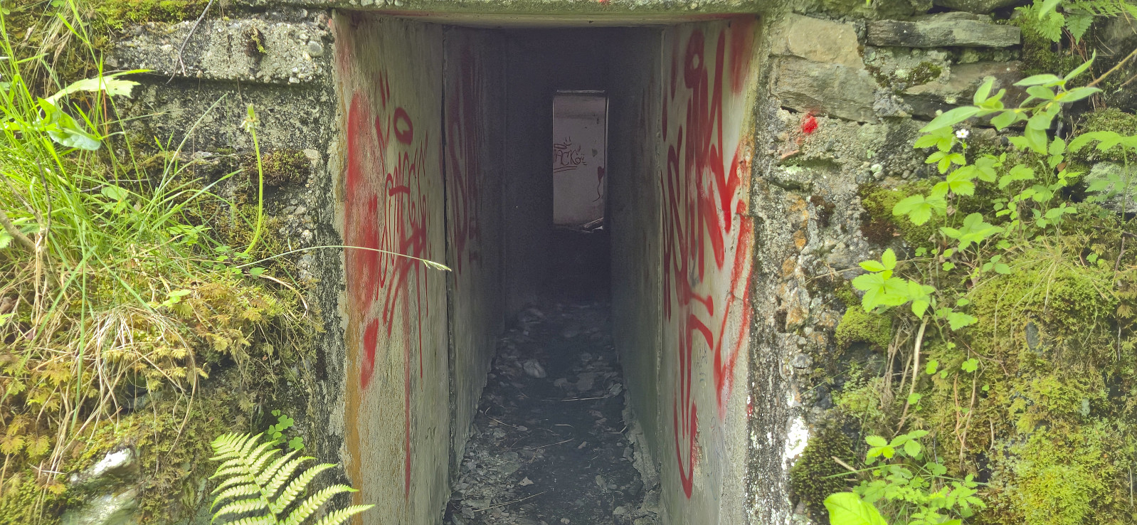
Across Hellen festning
- Datum:
- 17.06.2025
- Tourcharakter:
- Wanderung
- Tourlänge:
- 0:38h
- Entfernung:
- 3,2km
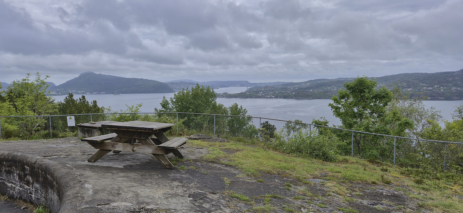 Short local evening hike.
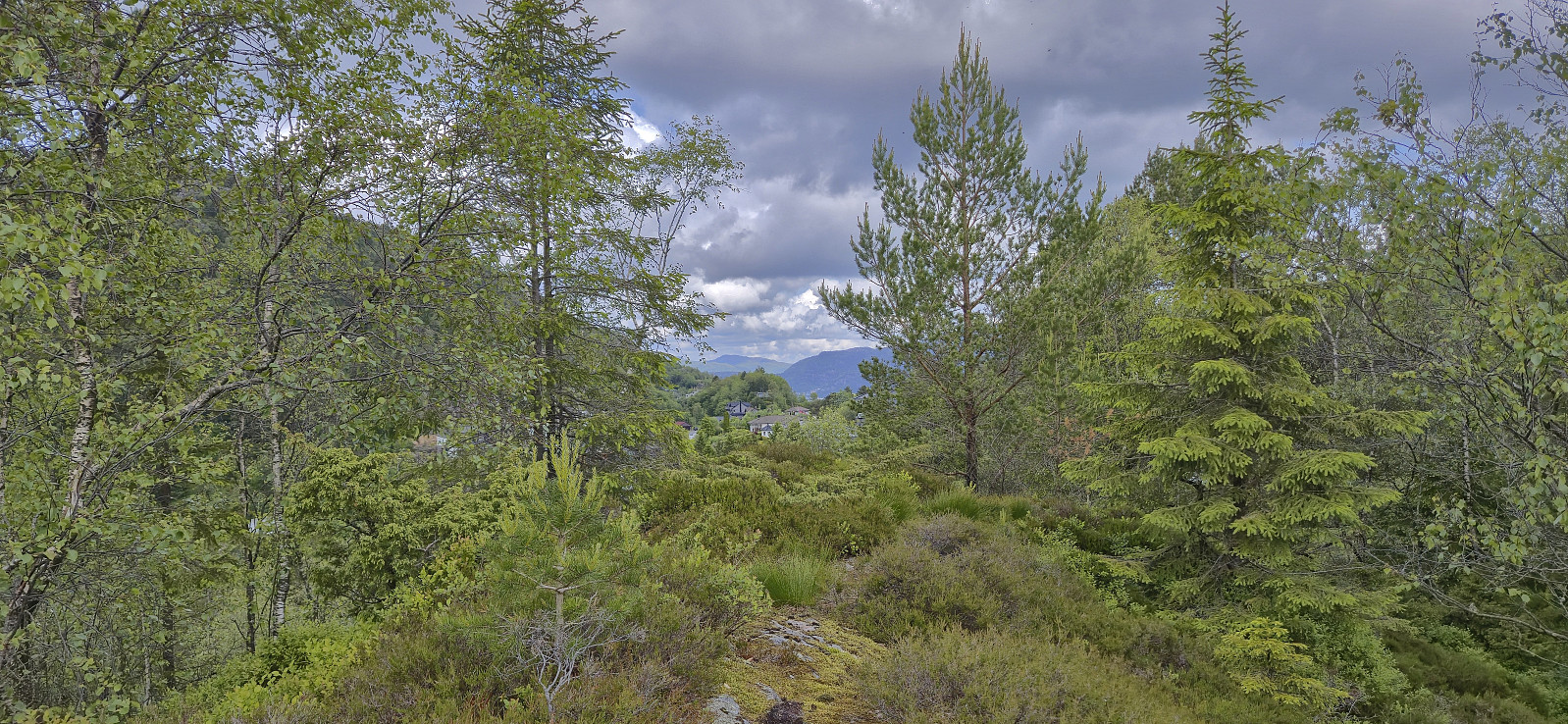
Fjellveien and Furukammen
- Datum:
- 15.06.2025
- Tourcharakter:
- Wanderung
- Tourlänge:
- 3:32h
- Entfernung:
- 10,9km
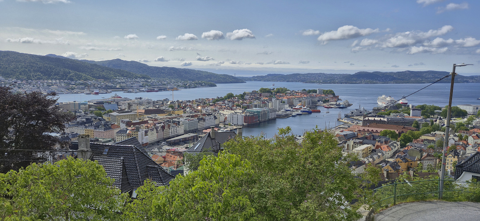 Local Sunday hike in warm sunshine and cold wind.
Larsfonnberget from Oppheim
- Datum:
- 14.06.2025
- Tourcharakter:
- Bergtour
- Tourlänge:
- 7:02h
- Entfernung:
- 21,8km
 Started by taking the train to Voss and continued by bus to Oppheim. I then followed Oppheimsdalsvegen all the way to Kvanndalen. Walking along the gravel road was a bit boring at the start but soon the views opened up and it was actually quite enjoyable. I had expected there to be snow for the final off-trail ascent to Larsfonnberget but there were only a couple of patches that could not be avoided. The summit itself was completely free of snow and provided excellent views.
After a short stop, I returned to the gravel road via a slightly different route including detours to Geitaberget and Høgafjellet before passing by Turtene . The map indicated trails however I did not see much of these and largely found my own way. From Turtene I followed the gravel road back to Oppheim, where I had a look at the discontinued ski lift before getting on the bus to Voss and finally the >>>
Started by taking the train to Voss and continued by bus to Oppheim. I then followed Oppheimsdalsvegen all the way to Kvanndalen. Walking along the gravel road was a bit boring at the start but soon the views opened up and it was actually quite enjoyable. I had expected there to be snow for the final off-trail ascent to Larsfonnberget but there were only a couple of patches that could not be avoided. The summit itself was completely free of snow and provided excellent views.
After a short stop, I returned to the gravel road via a slightly different route including detours to Geitaberget and Høgafjellet before passing by Turtene . The map indicated trails however I did not see much of these and largely found my own way. From Turtene I followed the gravel road back to Oppheim, where I had a look at the discontinued ski lift before getting on the bus to Voss and finally the >>>
Skogsøytua
- Datum:
- 12.06.2025
- Tourcharakter:
- Bergtour
- Tourlänge:
- 2:48h
- Entfernung:
- 5,2km
 A revisit of Skogsøytua with with an old colleague visiting from Sweden.
Nordre Gamletjørnhaugen and Eidahaugane
- Datum:
- 09.06.2025
- Tourcharakter:
- Bergtour
- Tourlänge:
- 1:37h
- Entfernung:
- 4,4km
 Another return to Kalandseidet to visit a recent addition to the Alle topper i Bergen list , namely Nordre Gamletjørnhaugen , which could be easily reached via a marked trail from the north/northeast. After returning the same way I spent some time exploring Eidahaugane before heading to the bus stop.
Lyskasterhaugen and Nordåsen
- Datum:
- 08.06.2025
- Tourcharakter:
- Bergtour
- Tourlänge:
- 1:23h
- Entfernung:
- 4,7km
 Short Sunday hike with the main objective of visiting Nordåsen , yet another minor addition to the Alle topper i Bergen list . When in the area I also took the opportunity to visit Lyskasterhaugen and Egget . Nordåsen was easily reached via a weak trail/track from the north/northeast and provided better views than expected.
Øvrehusknotten
- Datum:
- 07.06.2025
- Tourcharakter:
- Bergtour
- Tourlänge:
- 1:55h
- Entfernung:
- 3,6km
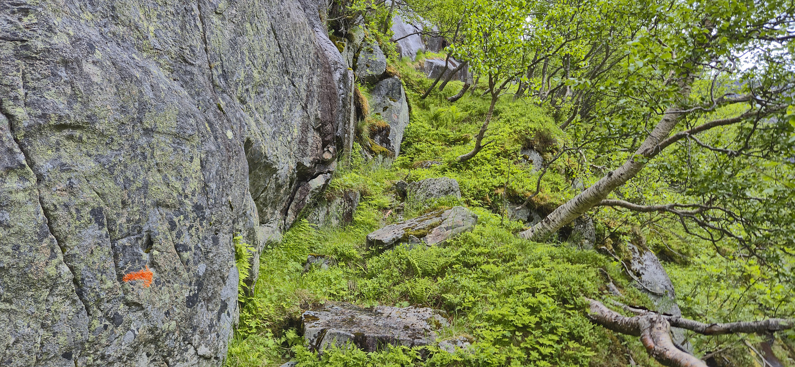 After our ascent of Nordlifjellet , Petter and I drove the short distance northeast to Austrepollen. We then left the main road and continued on a winding gravel road that took us up to just above 600 meters above sea level. Here we found parking next the road and started searching for the marked trail to Øvrehusknotten that Rune had described in his trip report from 2014 .
The start of the trail, or rather the start of the route as the trail itself was hardly visible, was not obvious, but after locating the first orange marker it was relatively easy to follow these up the initial steep ascent. Some easy scrambling was required but thankfully the terrain soon turned slightly less steep.
A field of boulders then had to be crossed before turning east and ascending towards Mysevatnet. So far we had been following a combination of old worn red markers and newer orange ones, >>>
After our ascent of Nordlifjellet , Petter and I drove the short distance northeast to Austrepollen. We then left the main road and continued on a winding gravel road that took us up to just above 600 meters above sea level. Here we found parking next the road and started searching for the marked trail to Øvrehusknotten that Rune had described in his trip report from 2014 .
The start of the trail, or rather the start of the route as the trail itself was hardly visible, was not obvious, but after locating the first orange marker it was relatively easy to follow these up the initial steep ascent. Some easy scrambling was required but thankfully the terrain soon turned slightly less steep.
A field of boulders then had to be crossed before turning east and ascending towards Mysevatnet. So far we had been following a combination of old worn red markers and newer orange ones, >>>
Nordlifjellet from Geitebu
- Datum:
- 07.06.2025
- Tourcharakter:
- Bergtour
- Tourlänge:
- 4:42h
- Entfernung:
- 15,3km
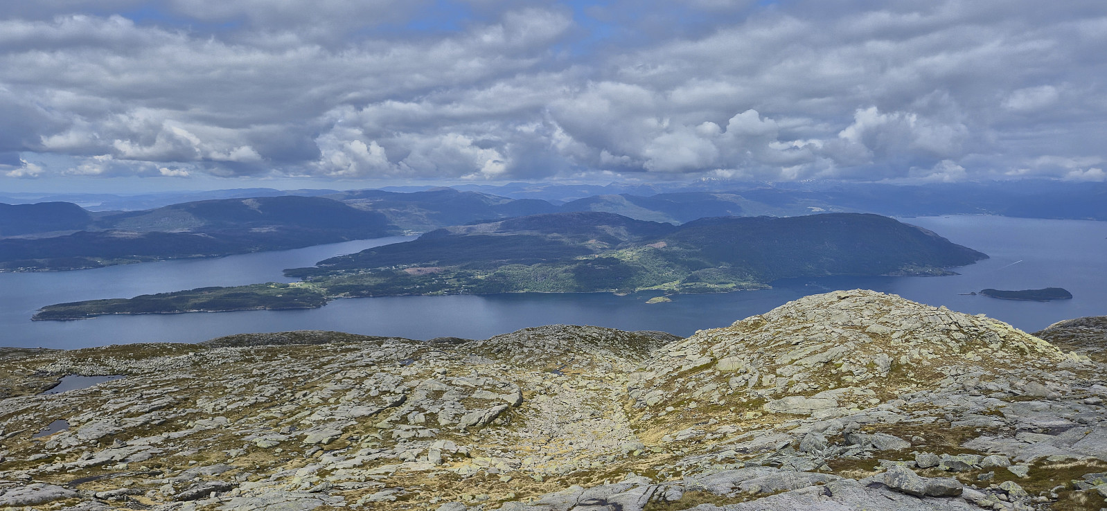 A return to Kvinnherad with Petter . This time the goal was to ascend Nordlifjellet . After the drive from Bergen, and the ferry ride from Gjermundshamn to Årsnes, we drove the short distance south to Geitebu. Here we parked at a small parking lot at the start of the gravel road to Strandasætret . The gravel road was of good quality and we could easily have driven almost all the way to Strandasætret, however there was a locked gate just above the parking lot .
When the gravel road came to an end just southwest of Strandasætret, we continued on what looked like a relatively new marked route east in order to connect with the trail marked with red T's that follows the ridge from Rosendal to Nordlifjellet. From there on it was simply a matter of following the marked trail all the way to the summit. On the way there I also made a short detour to the highest point at Gråurdstinden .
The summit, and most of the ascent, provided excellent >>>
A return to Kvinnherad with Petter . This time the goal was to ascend Nordlifjellet . After the drive from Bergen, and the ferry ride from Gjermundshamn to Årsnes, we drove the short distance south to Geitebu. Here we parked at a small parking lot at the start of the gravel road to Strandasætret . The gravel road was of good quality and we could easily have driven almost all the way to Strandasætret, however there was a locked gate just above the parking lot .
When the gravel road came to an end just southwest of Strandasætret, we continued on what looked like a relatively new marked route east in order to connect with the trail marked with red T's that follows the ridge from Rosendal to Nordlifjellet. From there on it was simply a matter of following the marked trail all the way to the summit. On the way there I also made a short detour to the highest point at Gråurdstinden .
The summit, and most of the ascent, provided excellent >>>
