Arkiv - dato
Arkiv - aktivitet
-
Annen tur (3)
- Kajakkpadling (3)
- Fottur (1844)
-
Kjøretur (9)
- Biltur (9)
-
Skitur (113)
- Fjellskitur (67)
- Langrennstur (46)
-
Sykkeltur (108)
- Blandet sykling (25)
- Gatesykling (83)
Lister jeg samler etter
-
Utvalgte topper og turmål i Bergen
(343/344)
 99%
99% -
Alle topper i Bergen
(390/397)
98%
-
Voss ≥ 100m pf.
(96/98)
97%
-
Opptur Hordaland
(144/159)
90%
-
Stasjoner på Bergensbanen
(31/40)
77%
-
Ulvik ≥ 100m pf.
(28/38)
73%
-
Hordaland ≥ 100m pf.
(617/863)
71%
-
Mjølfjell PF > 100m
(21/31)
67%
-
Jondal ≥ 100m pf.
(15/23)
65%
-
Sunnhordland PF >= 100m
(105/186)
56%
-
Dagsturhyttene i Vestland
(33/61)
54%
-
Hordaland: Hardanger PF>=100m
(189/359)
52%
-
DNT-hytter i Hordaland
(23/45)
51%
-
Kvinnherad ≥ 100m pf.
(40/79)
50%
-
Sogndal ≥ 100m pf.
(23/81)
28%
-
Eidfjord ≥ 100m pf.
(10/42)
23%
-
Vik i Sogn ≥ 100m pf.
(10/46)
21%
-
Gulen ≥ 100m pf.
(10/54)
18%
-
DNT-hytter i Sogn og Fjordane
(8/47)
17%
-
Sogn - Sør for Sognefjorden PF>=100m
(26/159)
16%

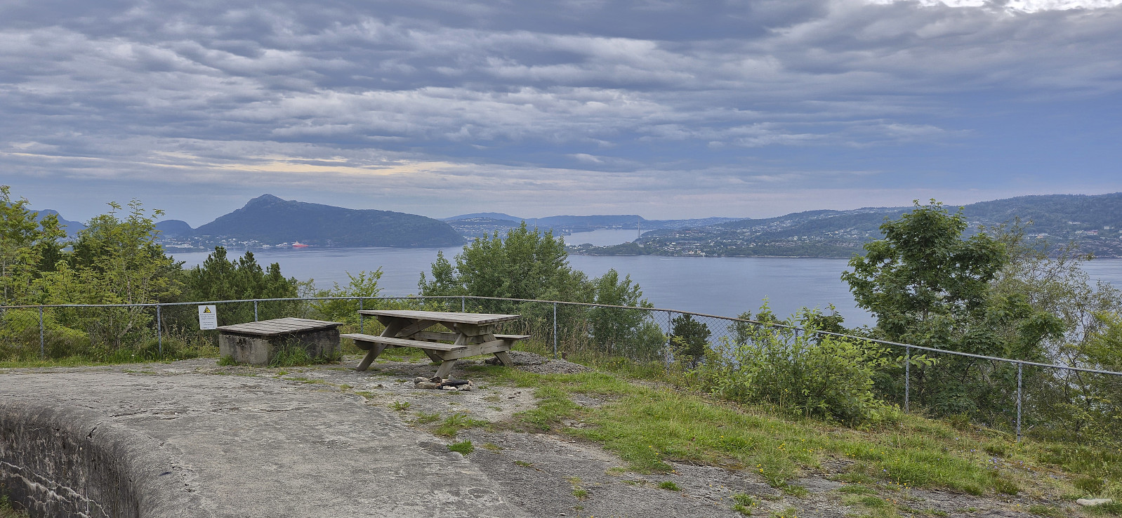
Across Hellen festning
- Dato:
- 26.07.2025
- Turtype:
- Fottur
- Turlengde:
- 0:39t
- Distanse:
- 3,2km
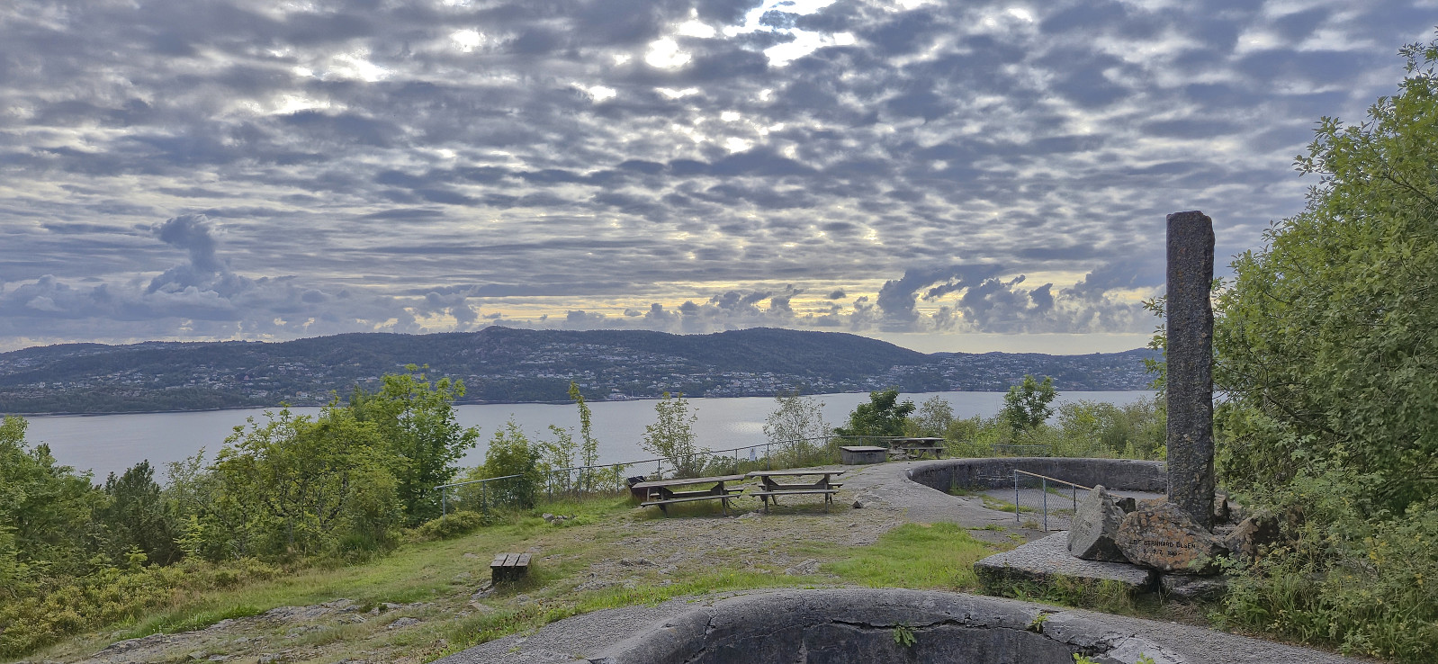 Short local Saturday hike after spending all of Friday hiking at Hallingskeid .
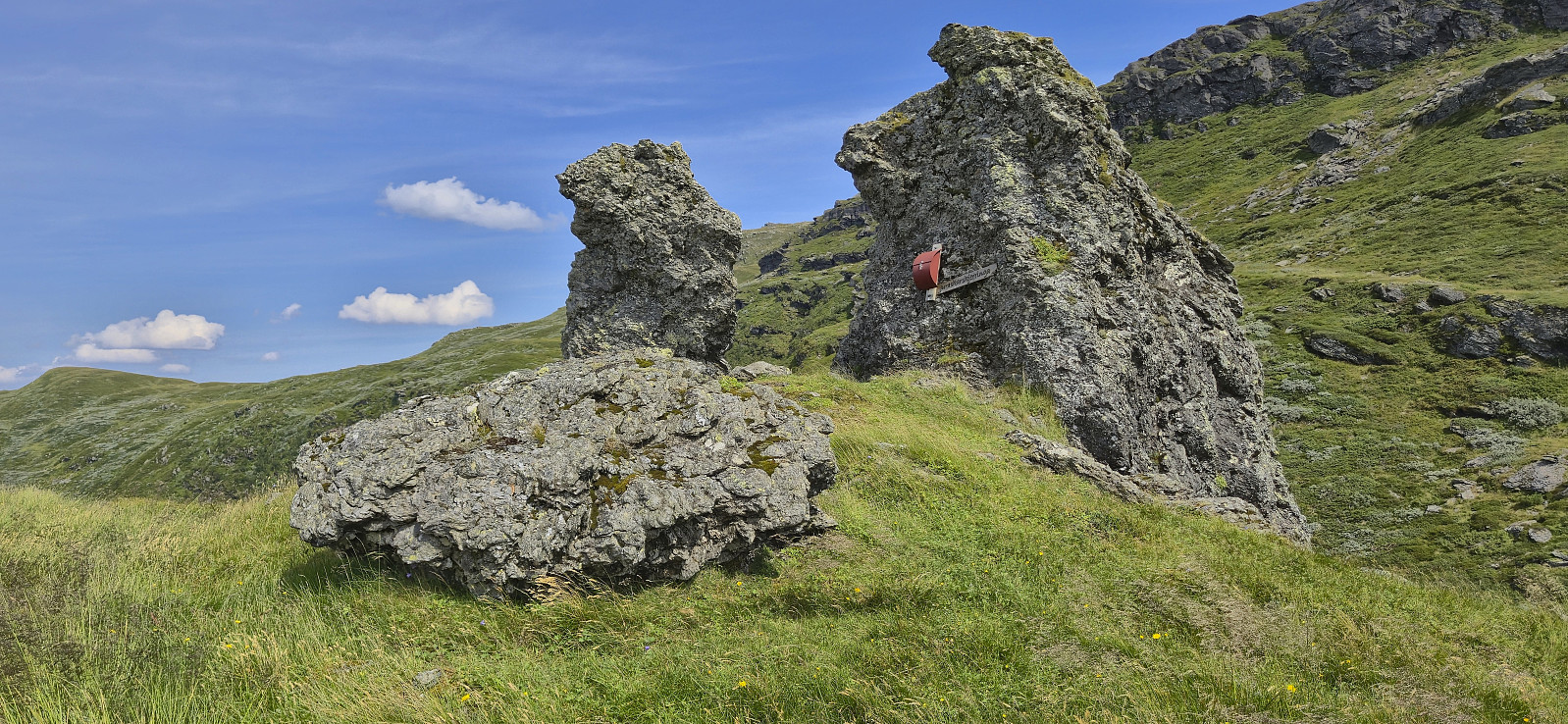
Vestre Låghellerhøgdene, Storhaugane and Søre Grøndalsnuten
- Dato:
- 25.07.2025
- Turtype:
- Fjelltur
- Turlengde:
- 7:08t
- Distanse:
- 23,0km
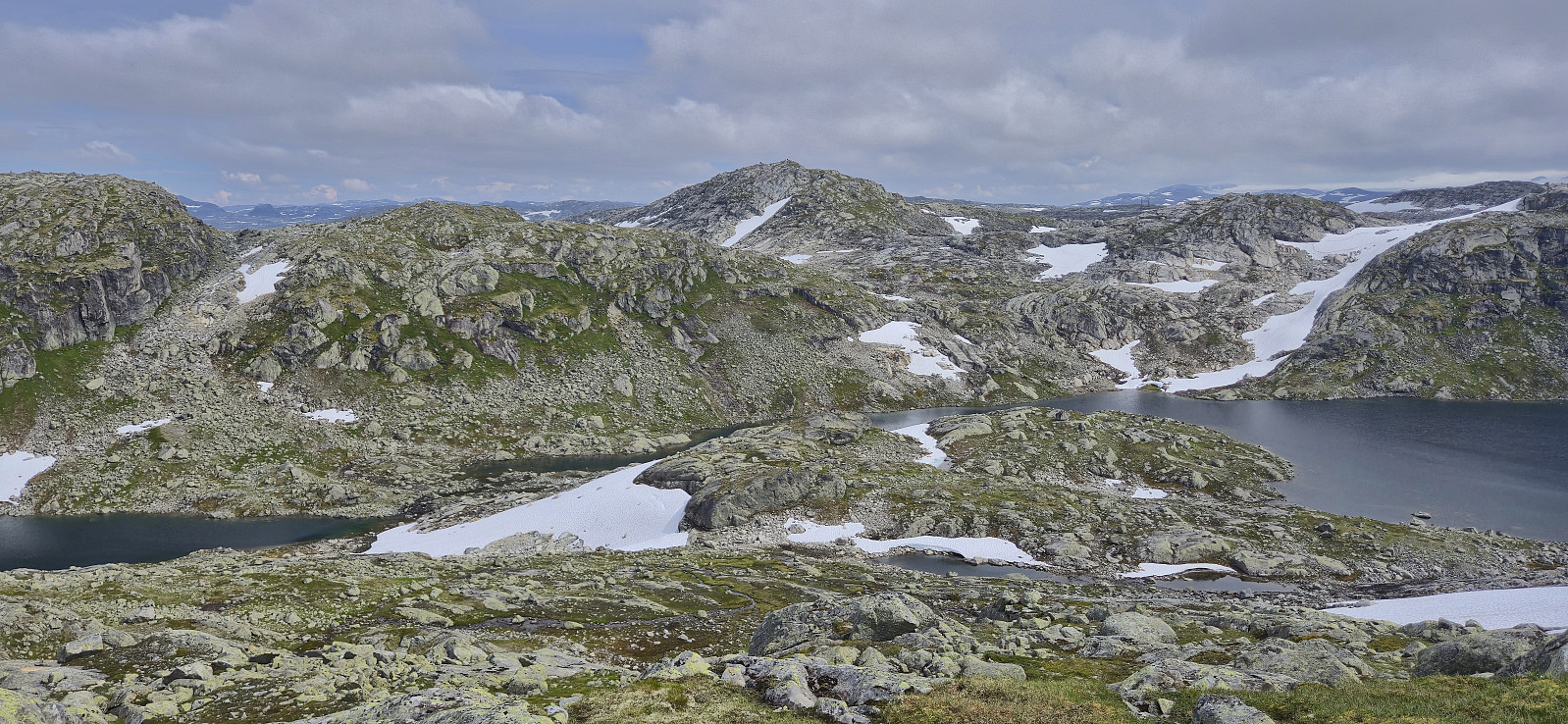 After getting off the train at Hallingskeid , I continued southeast along Rallarvegen with the goal to cross the river via a bridge between Låghellervatnet and Høghellervatnet that I had spotted on the map. However, upon arriving it became clear that this crossing was not going to happen. All that was left of the bridge were the two supporting wires. There was nothing to do but continue east to find another place to cross.
North of Låghellerbotnen I left the gravel road and after fording a small stream I could finally start my ascent to Vestre Låghellerhøgdene . The off-trail ascent to the summit was straightforward. I made sure to visit both competing highest points, with the eastern one being ever so slightly higher (maybe only 1 cm?) while the western one contained the remains of a fallen down trig marker.
I turned my attention >>>
After getting off the train at Hallingskeid , I continued southeast along Rallarvegen with the goal to cross the river via a bridge between Låghellervatnet and Høghellervatnet that I had spotted on the map. However, upon arriving it became clear that this crossing was not going to happen. All that was left of the bridge were the two supporting wires. There was nothing to do but continue east to find another place to cross.
North of Låghellerbotnen I left the gravel road and after fording a small stream I could finally start my ascent to Vestre Låghellerhøgdene . The off-trail ascent to the summit was straightforward. I made sure to visit both competing highest points, with the eastern one being ever so slightly higher (maybe only 1 cm?) while the western one contained the remains of a fallen down trig marker.
I turned my attention >>>
Storsåta from Hjortlandsvegen
- Dato:
- 24.07.2025
- Turtype:
- Fjelltur
- Turlengde:
- 2:00t
- Distanse:
- 6,5km
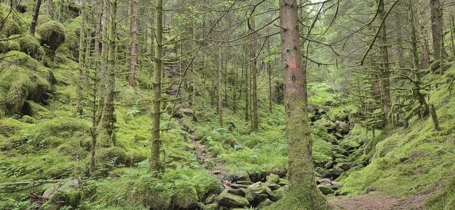 Tried two alternative routes to/from Storsåta . The ascent route was ok but the trail was quite weak at times, while the descent route, except for the upper part, followed a much nicer trail. Maybe next time I'll instead go for the righthand option where the trail from Hjortlandsvegen forks early on.
Skora, Rustene and Straumsrinden
- Dato:
- 23.07.2025
- Turtype:
- Fjelltur
- Turlengde:
- 1:25t
- Distanse:
- 4,9km
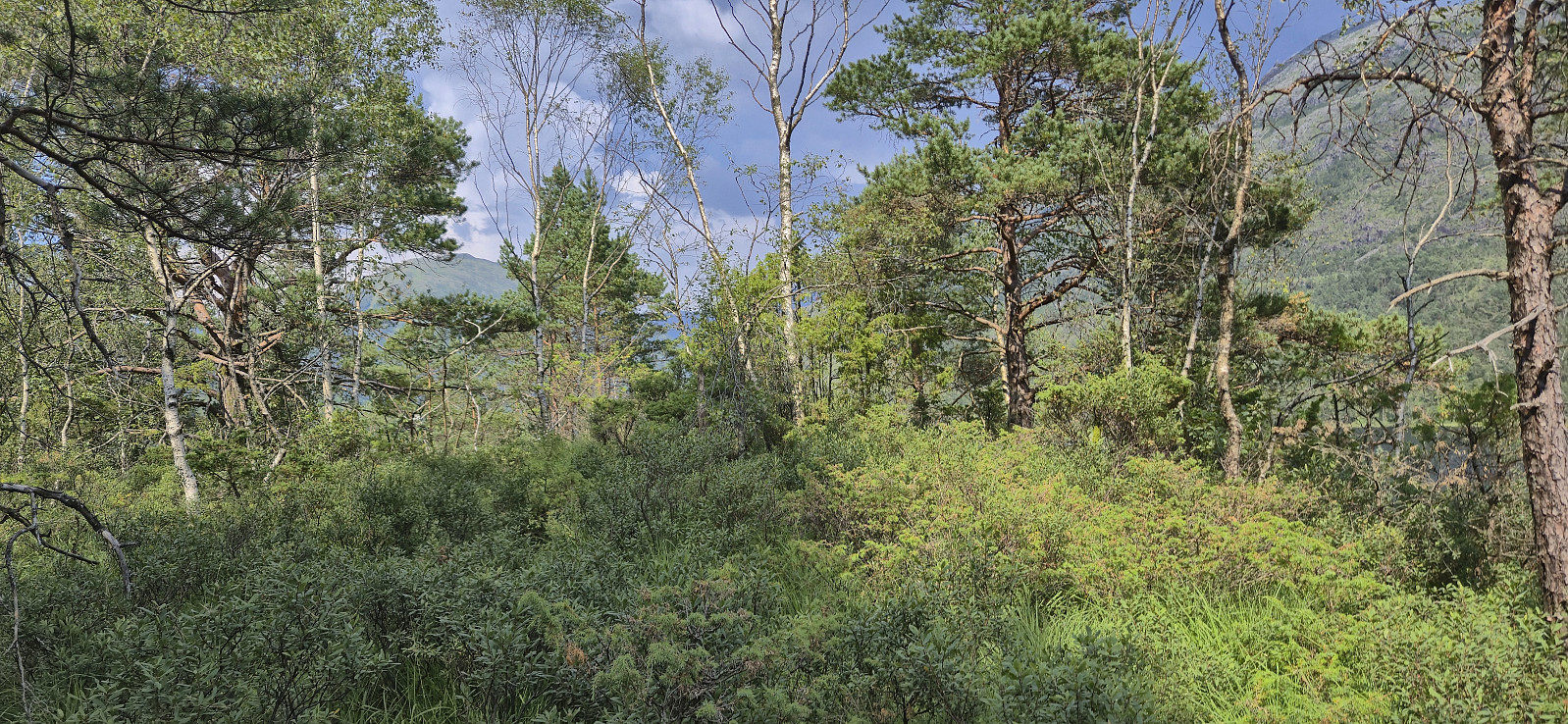 With a weather forecast including potential afternoon thunderstorms, I decided to stay relatively local and at low altitude. The result was a return to Hausdalen for a visit of yet another minor peak on the Alle topper i Bergen list . After getting off the bus at "Samdal sag" I shortly continued north along the main road before following the tractor road to south towards Ulvvatnet.
Just before the bridge at the northwestern end of Ulvvatnet, I left the tractor road and followed a deer track across the stream to connect with an older tractor road took me very close to Skora . All that remained was a short off-trail ascent to the highest point.
I descended via various deer tracks until reconnecting with the old tractor road and then followed the same route back to the main road. With rolling thunder in the distance, >>>
With a weather forecast including potential afternoon thunderstorms, I decided to stay relatively local and at low altitude. The result was a return to Hausdalen for a visit of yet another minor peak on the Alle topper i Bergen list . After getting off the bus at "Samdal sag" I shortly continued north along the main road before following the tractor road to south towards Ulvvatnet.
Just before the bridge at the northwestern end of Ulvvatnet, I left the tractor road and followed a deer track across the stream to connect with an older tractor road took me very close to Skora . All that remained was a short off-trail ascent to the highest point.
I descended via various deer tracks until reconnecting with the old tractor road and then followed the same route back to the main road. With rolling thunder in the distance, >>>
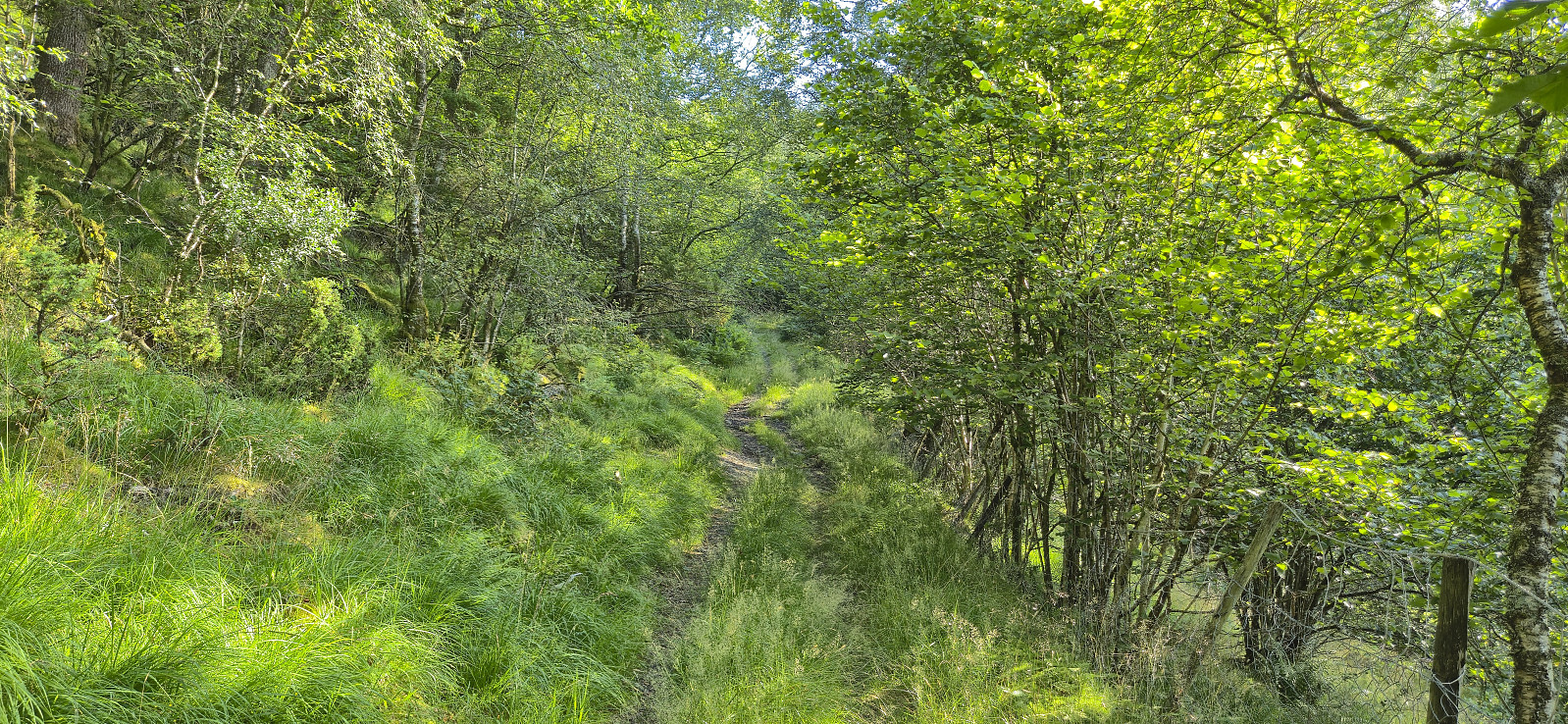
Cycling: Fjellveien and Skansemyren
- Dato:
- 22.07.2025
- Turtype:
- Gatesykling
- Turlengde:
- 1:19t
- Distanse:
- 16,7km
 Short evening cycling trip after finally replacing the very old brake pads on my equally old bike.
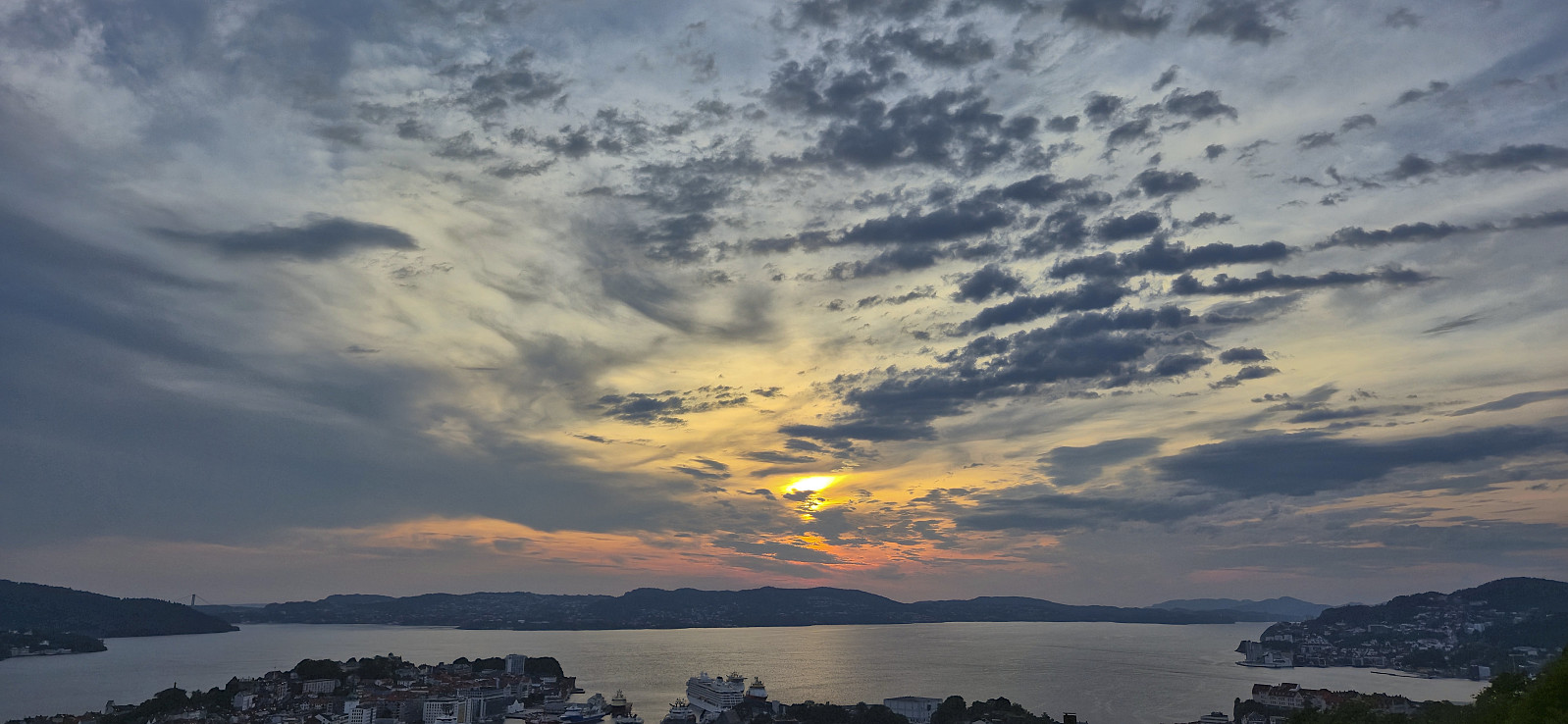
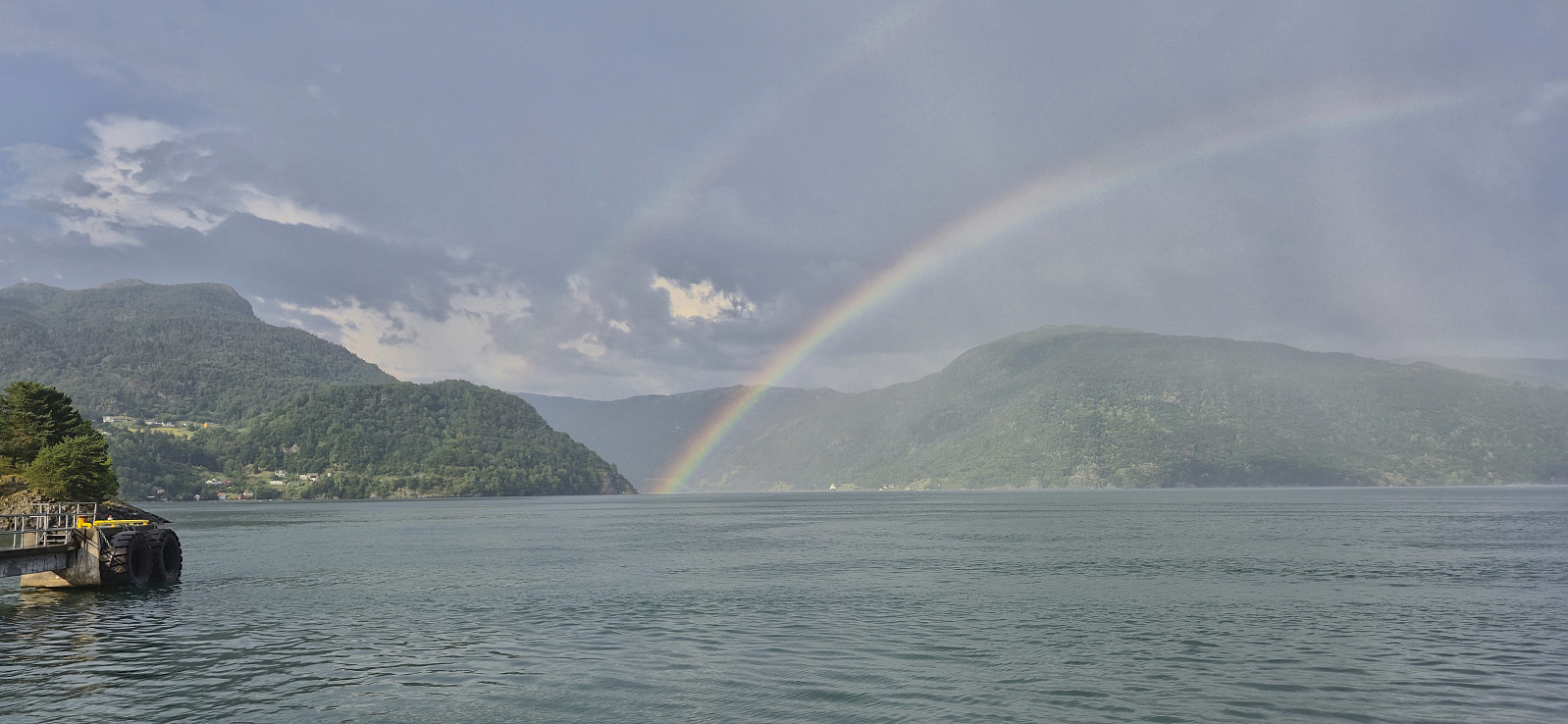
Hellen festning and Furukammen
- Dato:
- 21.07.2025
- Turtype:
- Fottur
- Turlengde:
- 1:07t
- Distanse:
- 4,5km
 Short local evening hike.
Hovlandsskuten and Håfjellet from Skånevik
- Dato:
- 20.07.2025
- Turtype:
- Fjelltur
- Turlengde:
- 7:28t
- Distanse:
- 19,2km
 After another early breakfast, I checked out of Skånevik Fjordhotel and left behind most of my luggage to be picked up at the end of the hike. I started following the road east before turning southeast and ascending Åsheimsvegen. When the gravel road forked west of Valdra I crossed Valdraelva via a bridge and continued on a tractor road until it came to an end near a couple of cabins close to Måsahaugen.
Just as I was about to start on the route taking me up to the uppermost cabin called Takhaug, I spotted the one thing that I'd rather not see just before setting out on a longer off-trail part of a hike: a viper slithering away to my left. Hoping that more were not hiding in the tall gras, I continued across a wet area before following the weak traces of a tractor road that seemed to be more used by ATVs.
When >>>
After another early breakfast, I checked out of Skånevik Fjordhotel and left behind most of my luggage to be picked up at the end of the hike. I started following the road east before turning southeast and ascending Åsheimsvegen. When the gravel road forked west of Valdra I crossed Valdraelva via a bridge and continued on a tractor road until it came to an end near a couple of cabins close to Måsahaugen.
Just as I was about to start on the route taking me up to the uppermost cabin called Takhaug, I spotted the one thing that I'd rather not see just before setting out on a longer off-trail part of a hike: a viper slithering away to my left. Hoping that more were not hiding in the tall gras, I continued across a wet area before following the weak traces of a tractor road that seemed to be more used by ATVs.
When >>>
Aksdalsneset to Skånevik
- Dato:
- 19.07.2025
- Turtype:
- Fjelltur
- Turlengde:
- 7:47t
- Distanse:
- 19,5km
 After arriving late in Skånevik the day before and spending the night at Skånevik Fjordhotel , I got up early to catch the 08:30 bus from Skånevik to Aksdalsneset. Note that the bus had to be ordered by calling Skyss at least one day in advance. Also, it was not actually a bus, but a rather a taxi. In other words, if you have not called in advance, you may risk being left behind at the bus stop, or that there is no taxi showing up in the first place.
I got dropped off at Aksdalsneset from where I had come across a hiking suggestion at ut.no indicating what looked like a nice route to the summit of Børkjenesnuten . First I followed a gravel road that quickly turned into a tractor road taking me up to the unmarked trailhead.
The start of the trail was easy to miss but after crossing a wet area early on it was overall straightforward to follow until getting near Vasstølsvatnet. Here the trail turned >>>
After arriving late in Skånevik the day before and spending the night at Skånevik Fjordhotel , I got up early to catch the 08:30 bus from Skånevik to Aksdalsneset. Note that the bus had to be ordered by calling Skyss at least one day in advance. Also, it was not actually a bus, but a rather a taxi. In other words, if you have not called in advance, you may risk being left behind at the bus stop, or that there is no taxi showing up in the first place.
I got dropped off at Aksdalsneset from where I had come across a hiking suggestion at ut.no indicating what looked like a nice route to the summit of Børkjenesnuten . First I followed a gravel road that quickly turned into a tractor road taking me up to the unmarked trailhead.
The start of the trail was easy to miss but after crossing a wet area early on it was overall straightforward to follow until getting near Vasstølsvatnet. Here the trail turned >>>
Skånevik: Skålnestangen and Peparen
- Dato:
- 18.07.2025
- Turtype:
- Spasertur
- Distanse:
- 1,7km
 Short late evening stroll after travelling from Bergen to spend the weekend hiking in Skånevik. A journey that turned out much longer than expected given that the boat I was supposed to transfer to at Leirvik had technical issues. Those of us travelling to Skånevik therefore instead had to stay on the boat from Bergen one more stop to Sunde. There we were promised that a taxi would be waiting for to drive us to Utåker such that we could catch the next ferry to Skånevik. The ferry had even agreed to delay its departure by five minutes, which would have been just enough, if the taxi had been there when we got off the boat. It was not, and when it finally arrived the ferry had already left Utåker. As a result, we ended up with almost two hours waiting for the next ferry at Utåker. On the >>>
Storetunga and Vetle Hansbunuten from Finse
- Dato:
- 17.07.2025
- Turtype:
- Fjelltur
- Turlengde:
- 5:49t
- Distanse:
- 20,0km
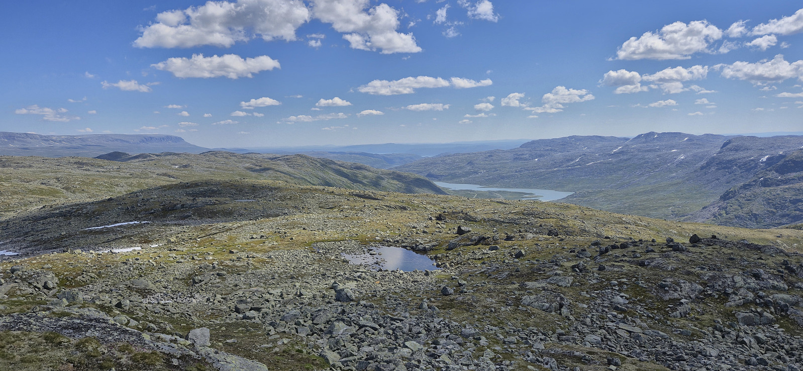 On yet another very warm day, I decided to escape some of the heat by heading up to Finse to visit two relatively recent additions to the Hordaland ≥ 100m pf. list , both of which had been upgraded due to more accurate LiDAR data . First up was Storetunga . After getting off the train at Finse, I headed southeast along Rallarvegen before later leaving the gravel road and heading off-trail towards the summit. Besides some annoying undergrowth early on, the terrain was generally easy to travers and the summit was reached without any difficulties.
After a break next to the summit cairn to take in the excellent views, I returned along the same route to Rallarvegen before crossing the river along a small bridge underneath the larger railroad bridge and started my ascent of Vetle Hansbunuten . There were a couple of small cairns in the area around the bridge but I quickly lost >>>
On yet another very warm day, I decided to escape some of the heat by heading up to Finse to visit two relatively recent additions to the Hordaland ≥ 100m pf. list , both of which had been upgraded due to more accurate LiDAR data . First up was Storetunga . After getting off the train at Finse, I headed southeast along Rallarvegen before later leaving the gravel road and heading off-trail towards the summit. Besides some annoying undergrowth early on, the terrain was generally easy to travers and the summit was reached without any difficulties.
After a break next to the summit cairn to take in the excellent views, I returned along the same route to Rallarvegen before crossing the river along a small bridge underneath the larger railroad bridge and started my ascent of Vetle Hansbunuten . There were a couple of small cairns in the area around the bridge but I quickly lost >>>
