Øvrehusknotten (07.06.2025)

| Startsted | Øvrehusknotten p-lomme (608moh) |
|---|---|
| Sluttsted | Øvrehusknotten p-lomme (608moh) |
| Turtype | Fjelltur |
| Turlengde | 1t 55min |
| Distanse | 3,6km |
| Høydemeter | 446m |
| GPS |
|
| Bestigninger | Øvrehusknotten (1020moh) | 07.06.2025 |
|---|---|---|
| Andre besøkte PBE'er | Øvrehusknotten p-lomme (608moh) | 07.06.2025 |
Øvrehusknotten
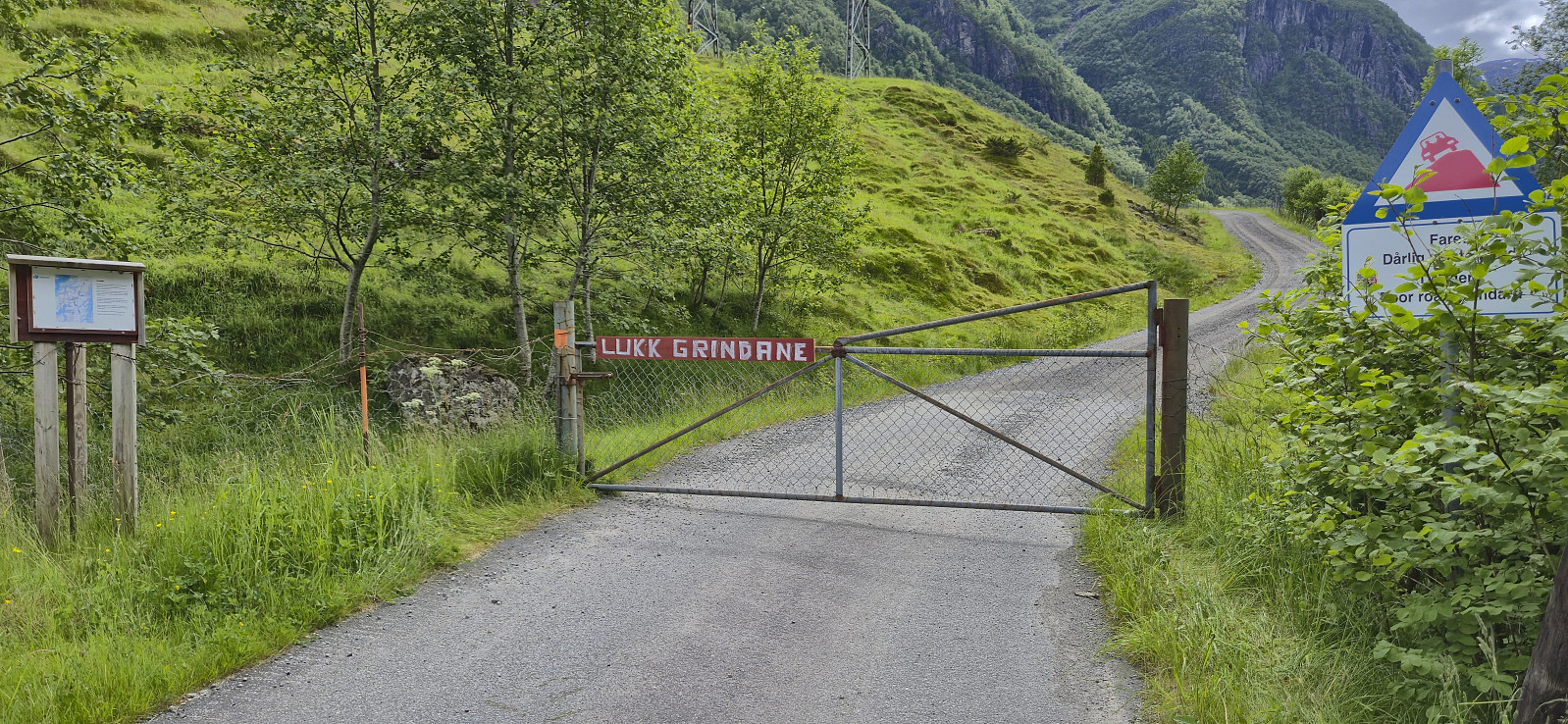
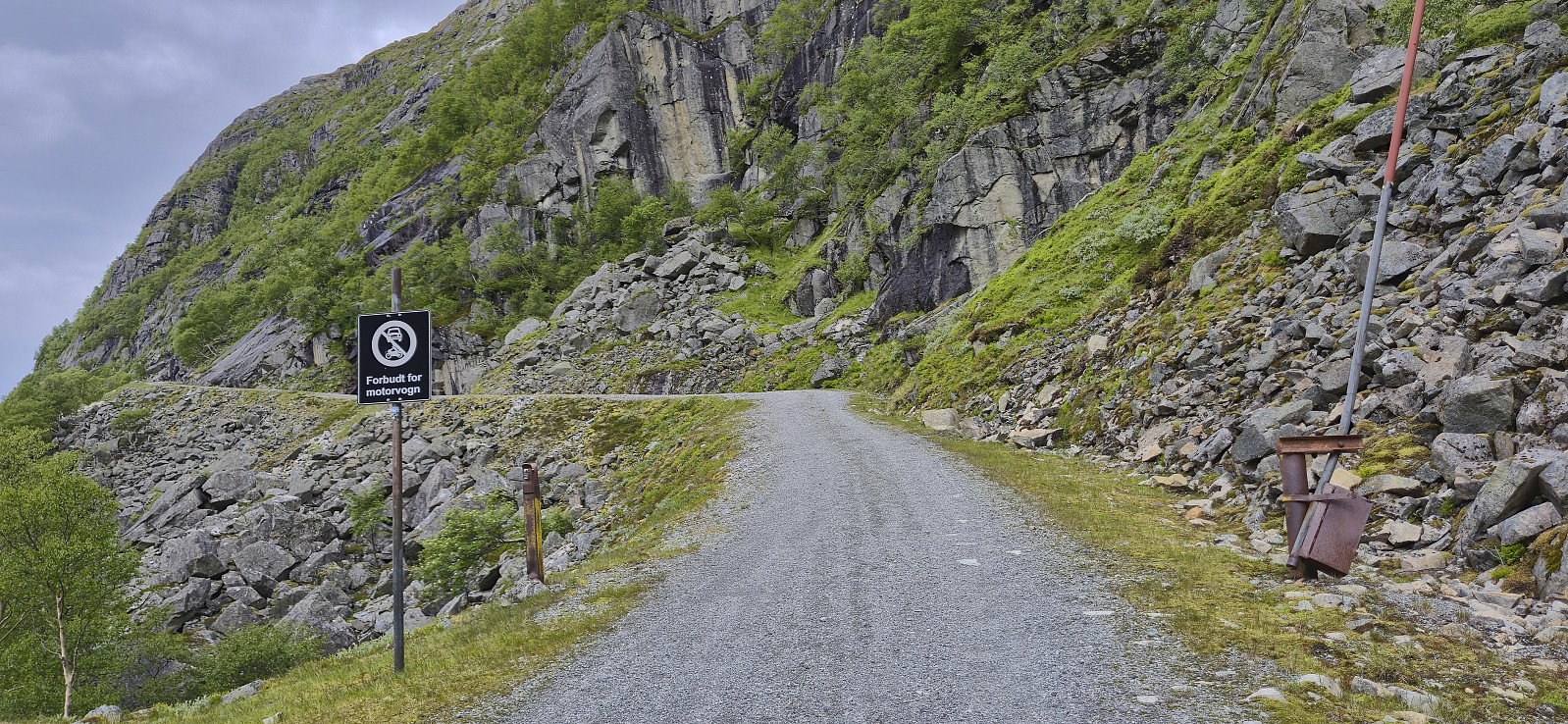
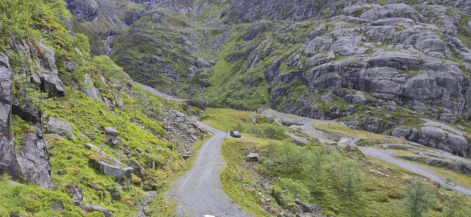
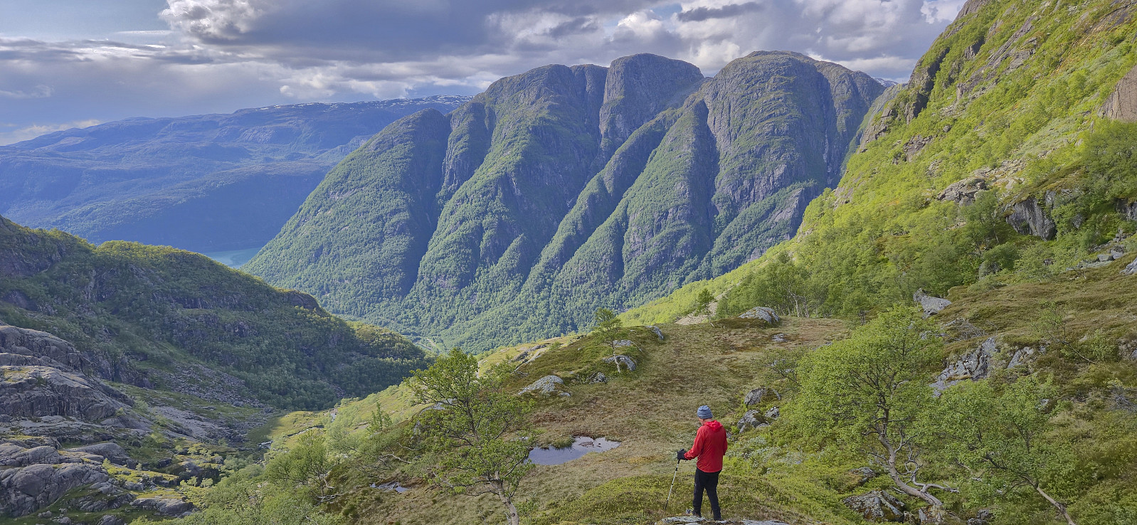
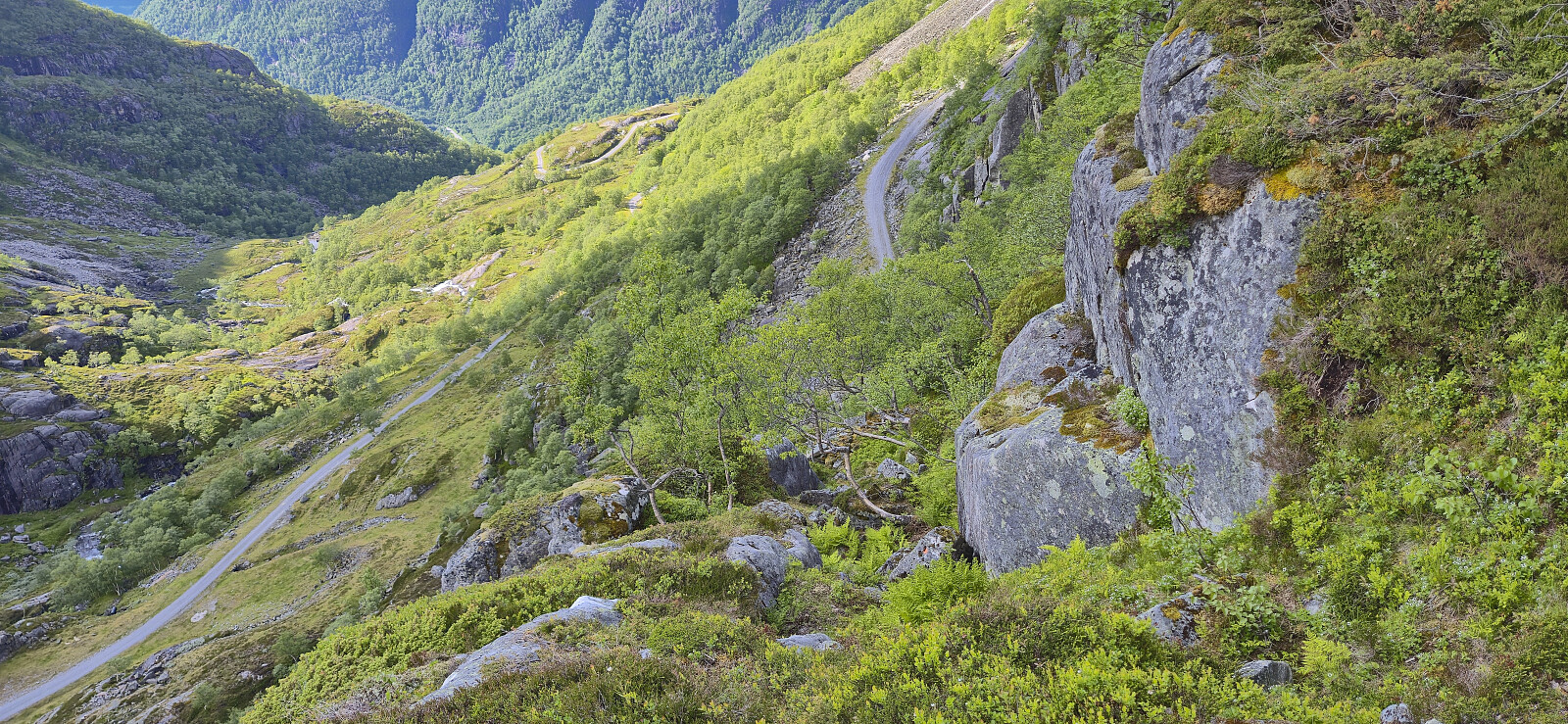
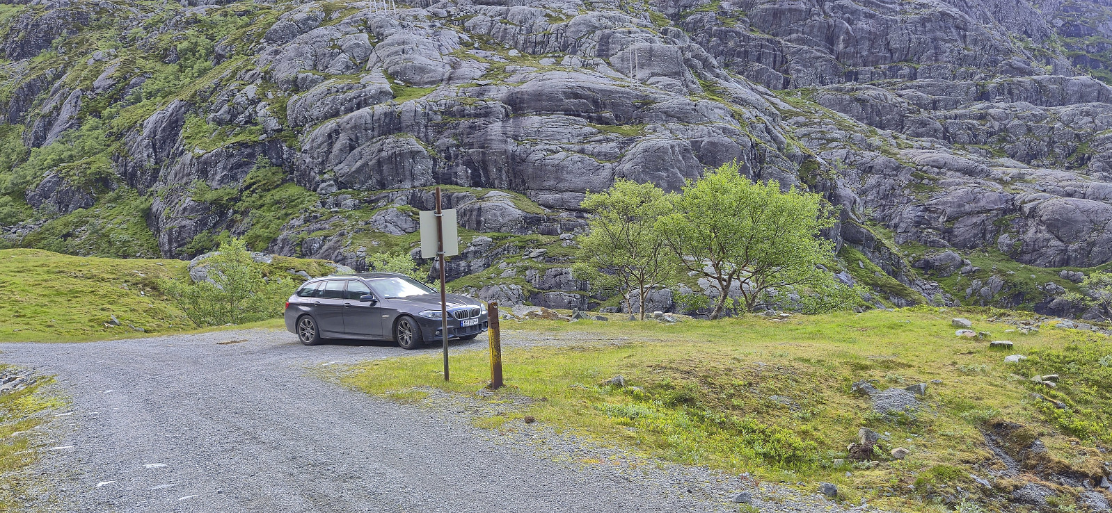
After our ascent of Nordlifjellet, Petter and I drove the short distance northeast to Austrepollen. We then left the main road and continued on a winding gravel road that took us up to just above 600 meters above sea level. Here we found parking next the road and started searching for the marked trail to Øvrehusknotten that Rune had described in his trip report from 2014.
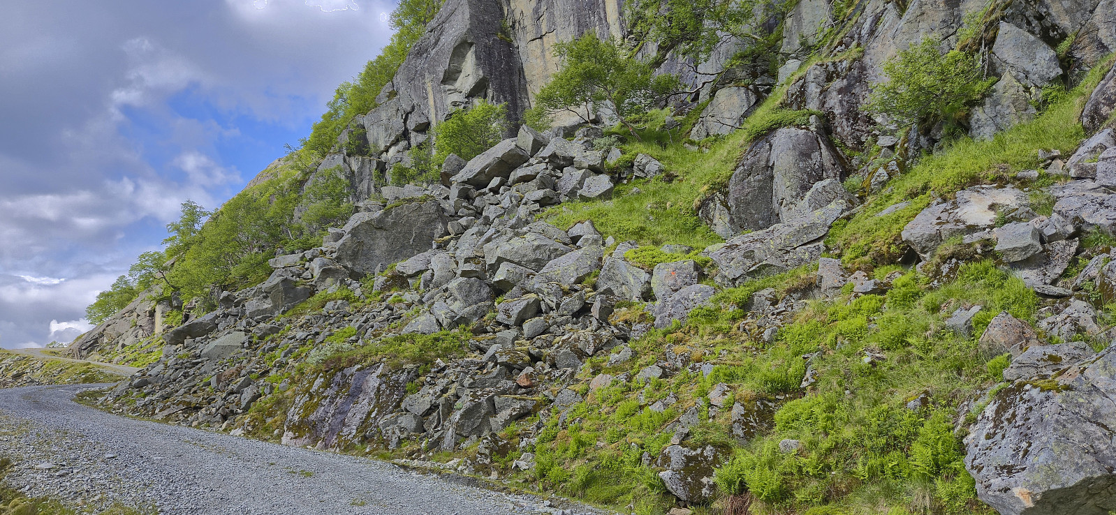
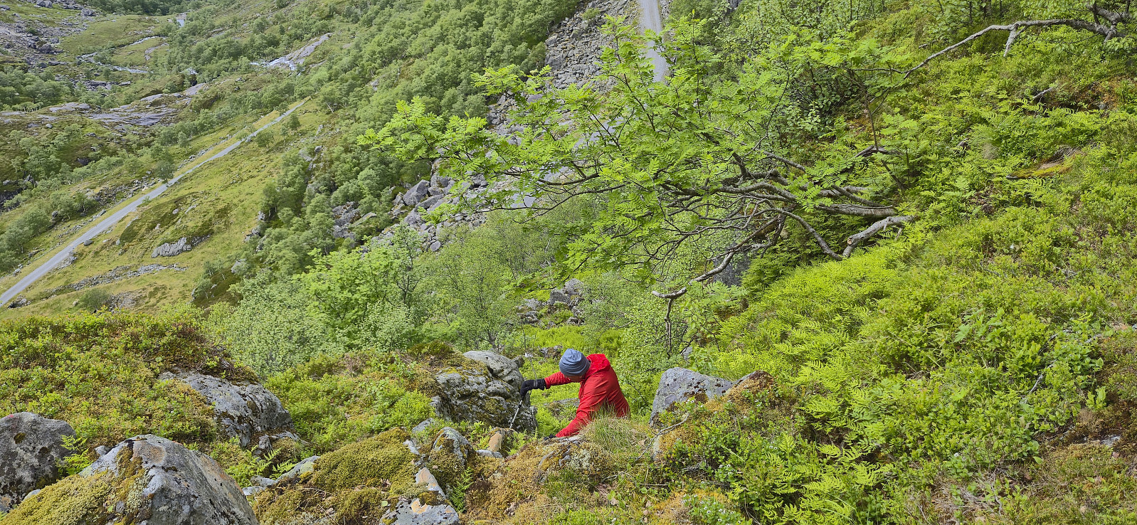
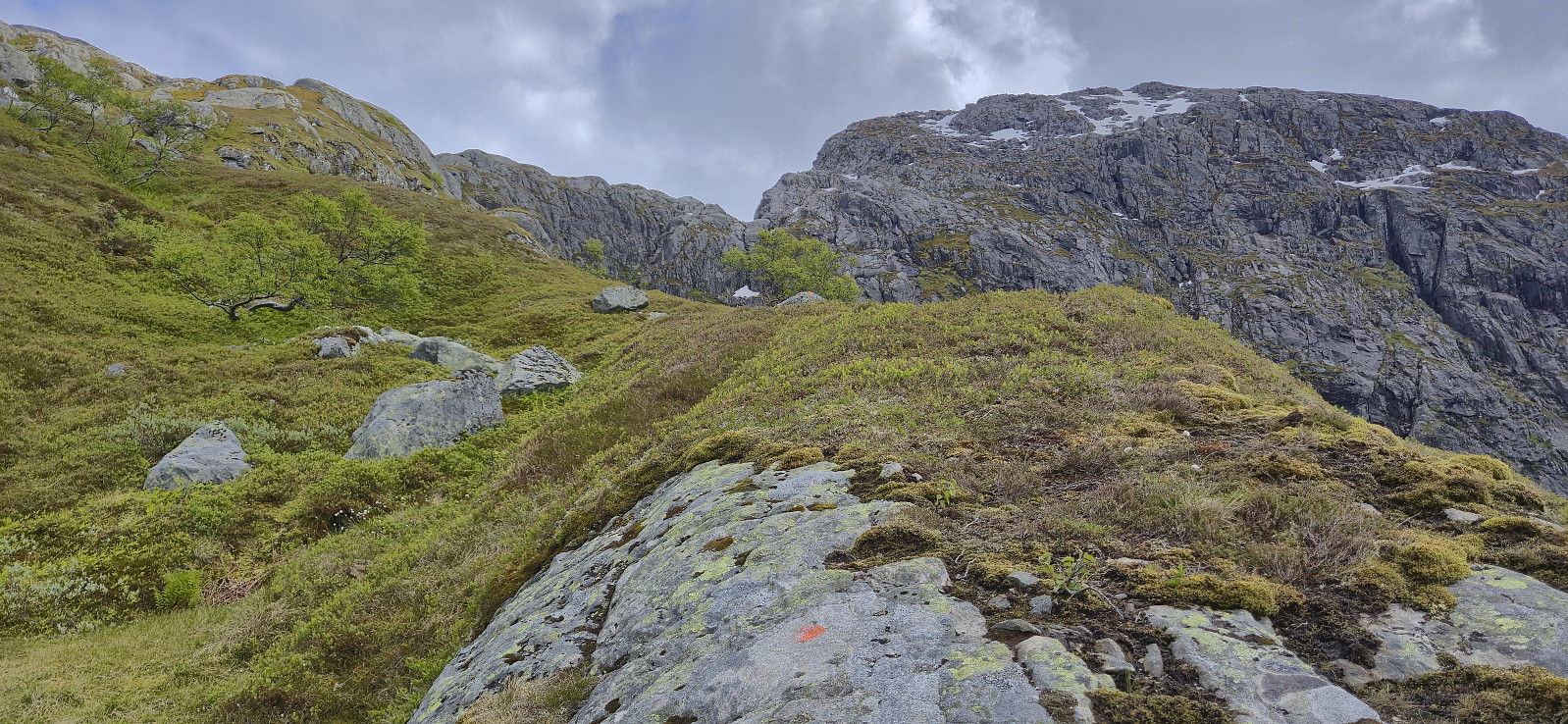
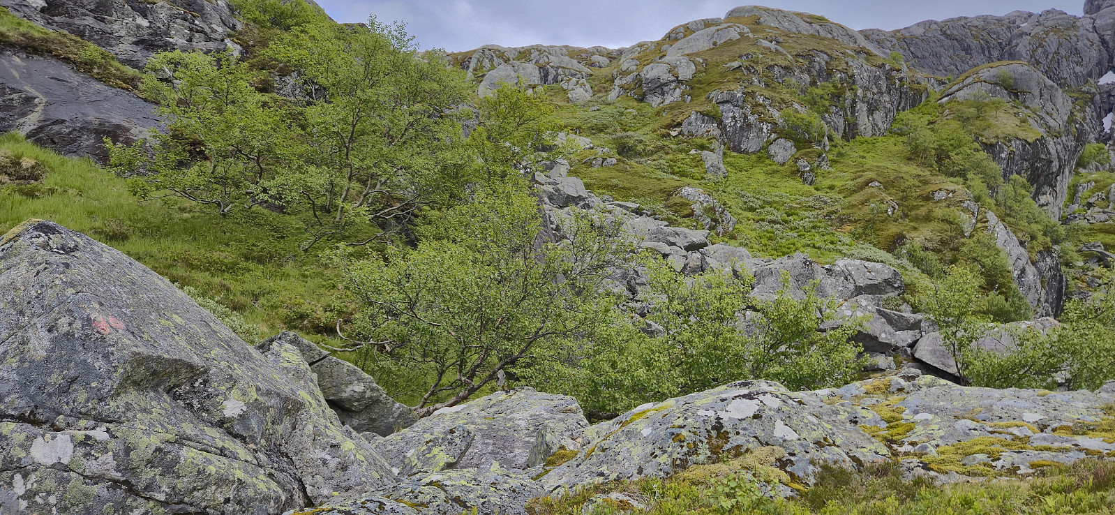
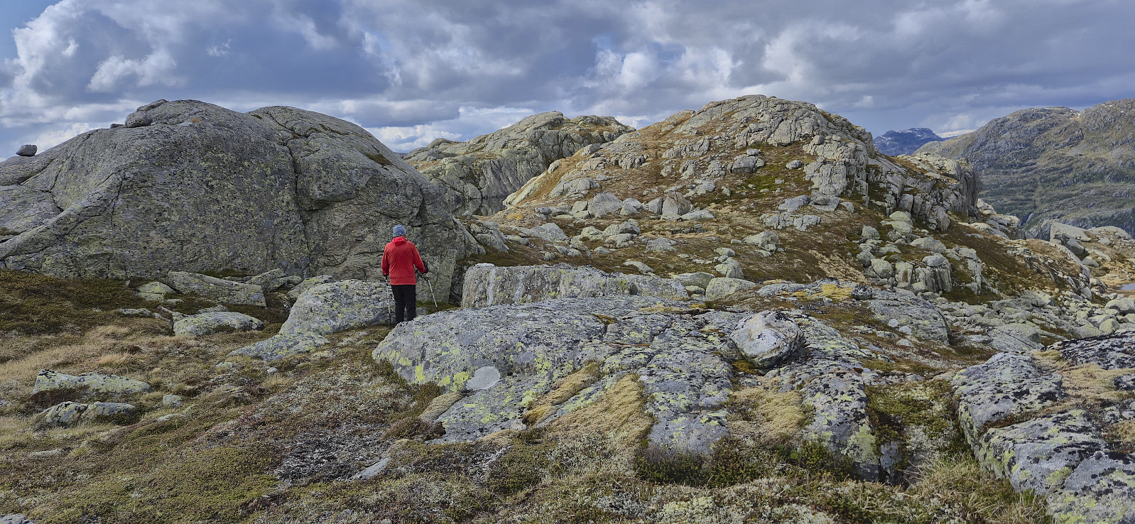
The start of the trail, or rather the start of the route as the trail itself was hardly visible, was not obvious, but after locating the first orange marker it was relatively easy to follow these up the initial steep ascent. Some easy scrambling was required but thankfully the terrain soon turned slightly less steep.
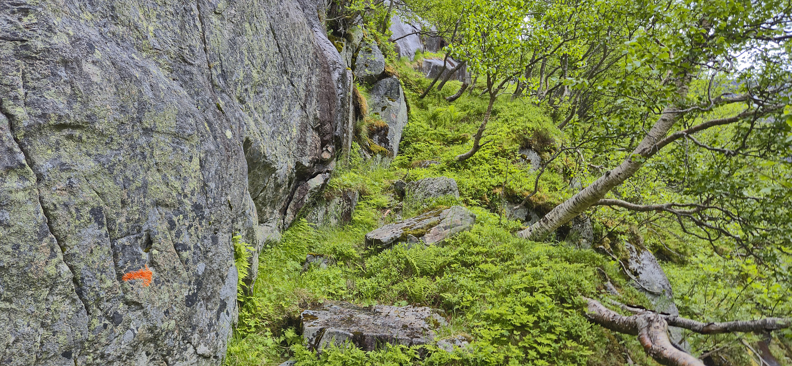
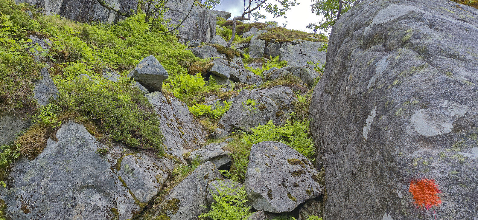
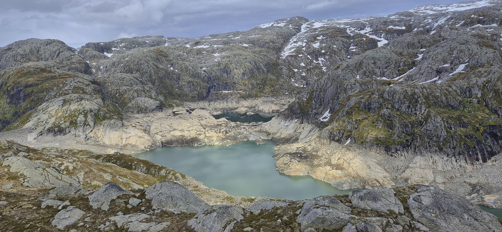
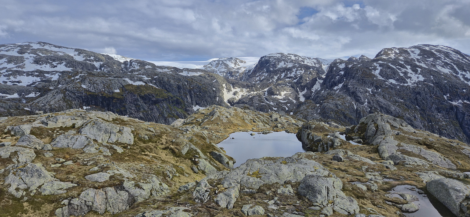
A field of boulders then had to be crossed before turning east and ascending towards Mysevatnet. So far we had been following a combination of old worn red markers and newer orange ones, but neither were always easy to spot and the GPS track from Rune was therefore also used to make sure that we were heading in the right direction.
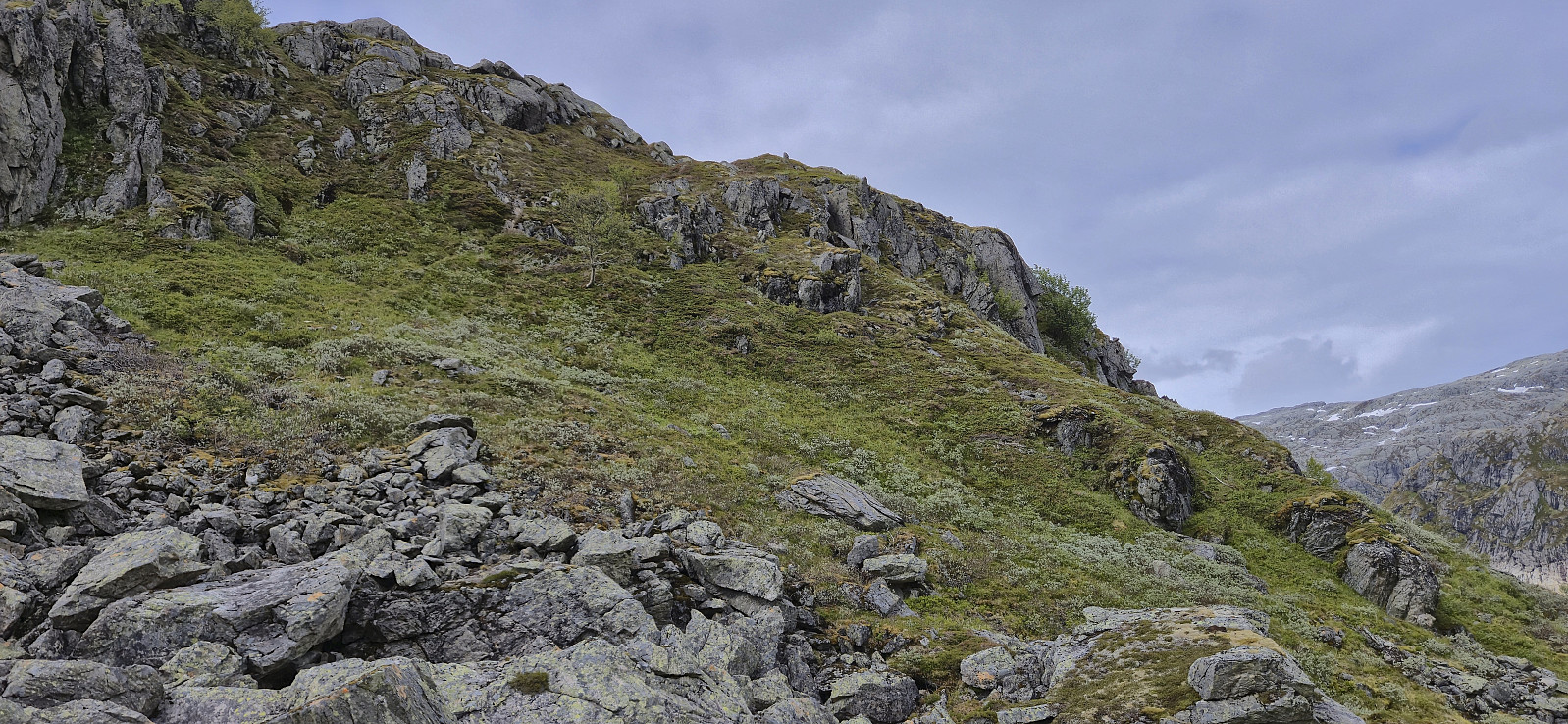
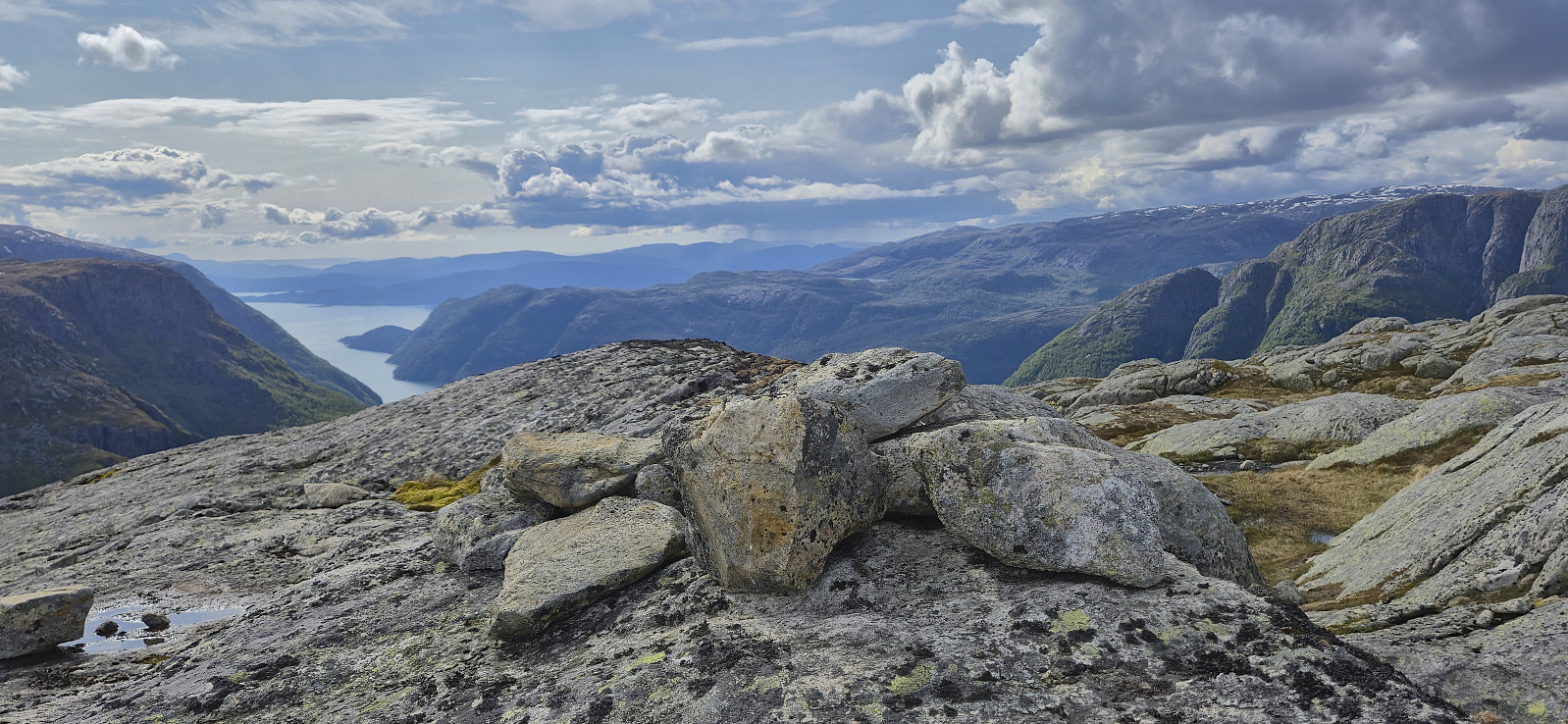
We now finally turned north towards the summit and followed a weak track up the final steepish ascent. From there on it was relatively straightforward to complete the remaining distance to the summit. We did spot one or two additional orange markers before arriving at the summit but whether the markers can actually be followed all the way is unclear.
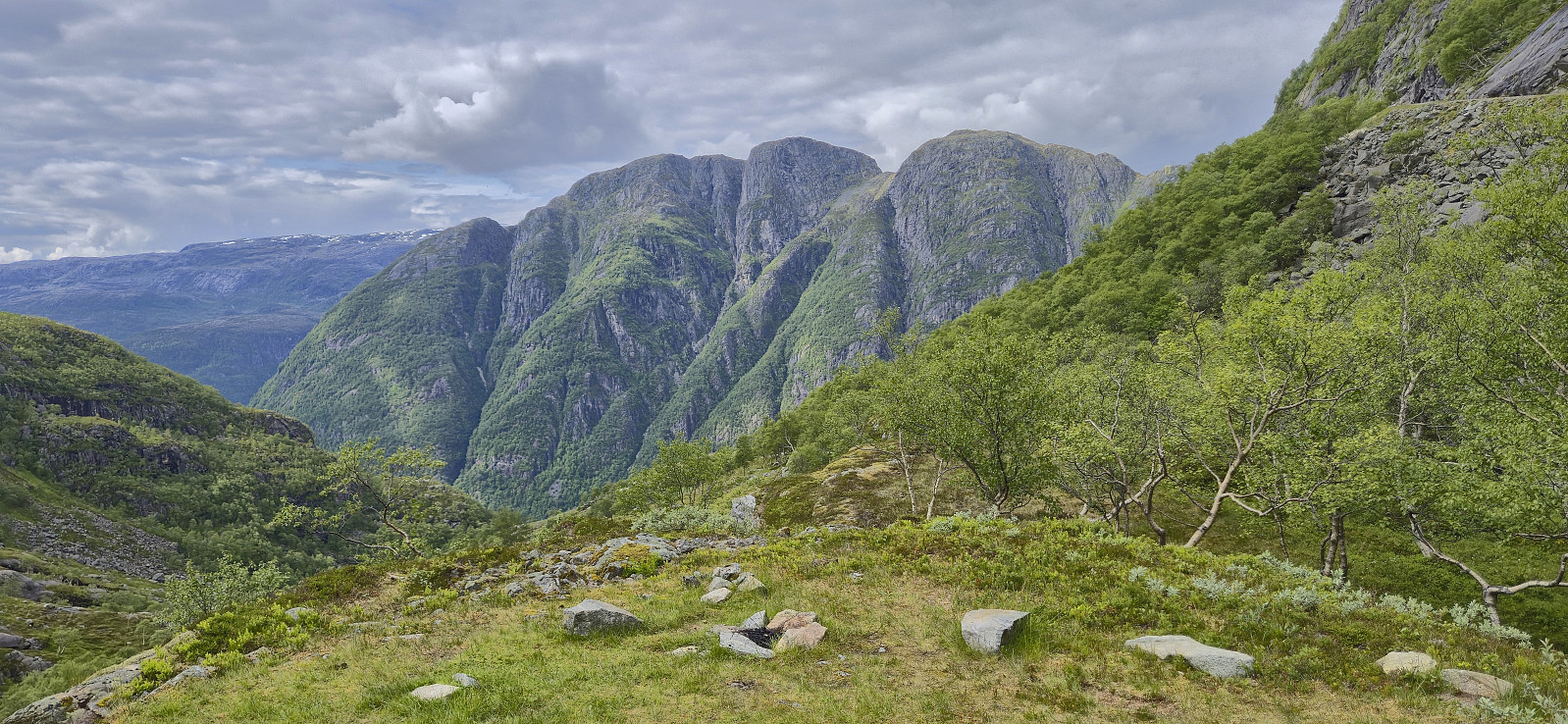
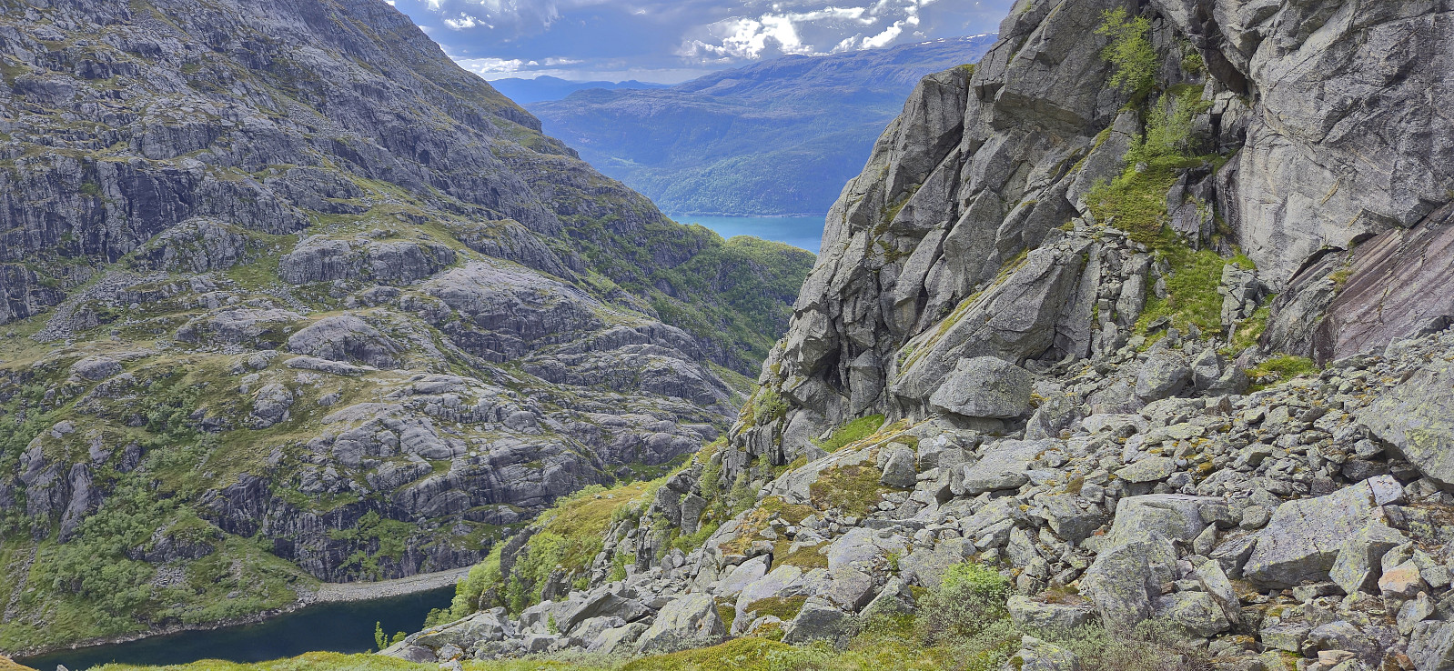
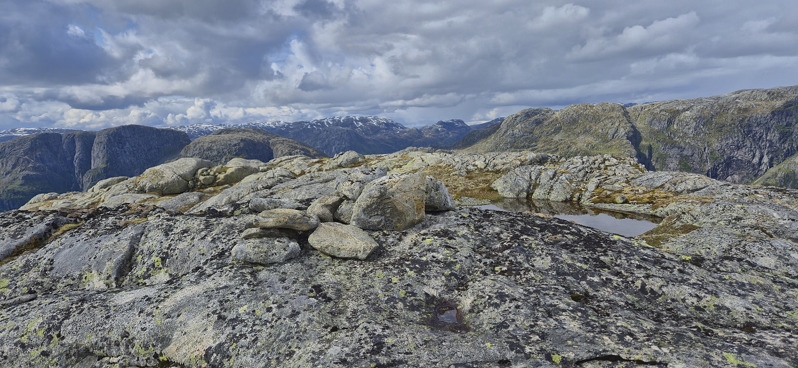
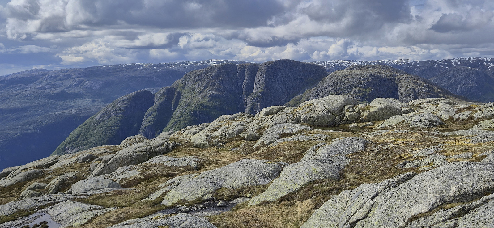
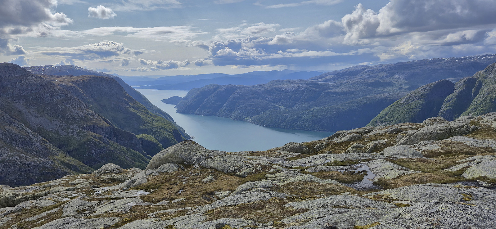
The summit provided excellent views, especially into Austrepollen/Maurangerfjorden and across to Ripelssåta and Bukkaknotten. After a couple of pictures we descended along the same route, with some minor improvements for the first half.
Back in the car, we had to decide whether we returned to the ferry at Årsnes or continued northwest to Jondal. The choice was however made for us when we learned that one of the ferries at Jondal was out of order. In the end, we made it to Årsnes with less than five minutes to spare and could take a break on the ferry before completing the 1.5 hour drive back to Bergen.
To conclude, visiting Øvrehusknotten is relatively easy if following the marked route from the gravel road. However, the route does have a couple of steep sections and may not be to everyone's liking, and it is probably best to avoid this hike if there is snow and ice.
Takk for turen, Petter!
| Starttidspunkt | 07.06.2025 15:54 (UTC+01:00 ST) |
| Sluttidspunkt | 07.06.2025 17:50 (UTC+01:00 ST) |
| Totaltid | 1t 55min |
| Bevegelsestid | 1t 48min |
| Pausetid | 0t 7min |
| Snittfart totalt | 1,8km/t |
| Snittfart bevegelsestid | 2,0km/t |
| Distanse | 3,6km |
| Høydemeter | 446m |

Kommentarer
Nyttige spor og bilder
Skrevet av Kjell51 08.06.2025 21:34Takker for god turbeskrivelse med spor. Ser at Mysevatnet er godt nedtappet. Bidet viser nå plassen den første turisthytten til Bergen Turlag lå ved Folgefonna. Rett plassering vises på eldre kart. Ved zooming av bilde vises grunnmuren?
Bilde av hytten: https://www.facebook.com/groups/638833152854586/posts/8574211565983332/
Re: Nyttige spor og bilder
Skrevet av hbar 08.06.2025 23:37Takk for interessant informasjon! Mulig spor hytten kan sees, men jeg vet ikke helt hvor? Har du link til eldre kart som viser posisjonen av hytten?
Re: Nyttige spor og bilder
Skrevet av hbar 08.06.2025 23:46I denne FB-tråden vises det til at "Den fyrste turisthytta ved Folgefonna låg i Urdabotnen, på søraustsida av (noverande) Mysevatnet, langt frå den nye demningen/muren."
https://www.facebook.com/groups/638833152854586/posts/26436954902615724/?_rdr
Dermed er det nok neppe mulig å se noe spor fra de bildene jeg tok i går.
Sv: Re: Nyttige spor og bilder
Skrevet av Kjell51 09.06.2025 00:02Her er kart der hytten er inntegnet. Skal være nesten midt i bildet (litt til venstre)
https://histkart.kartverket.no/#id=3273