Slettefjellet via Eikemostølen (15.10.2022)

| Startpunkt | Eidslandsvegen ved Eikemo (93m) |
|---|---|
| Endpunkt | Eide (45m) |
| Tourcharakter | Bergtour |
| Tourlänge | 4h 53min |
| Entfernung | 12,0km |
| Höhenmeter | 953m |
| GPS |
|
| Besteigungen | Slettefjellet (958m) | 15.10.2022 |
|---|---|---|
| Besuche anderer PBE | Eide utsiktspunkt (55m) | 15.10.2022 |
| Eikemostølen (344m) | 15.10.2022 |
Slettefjellet via Eikemostølen
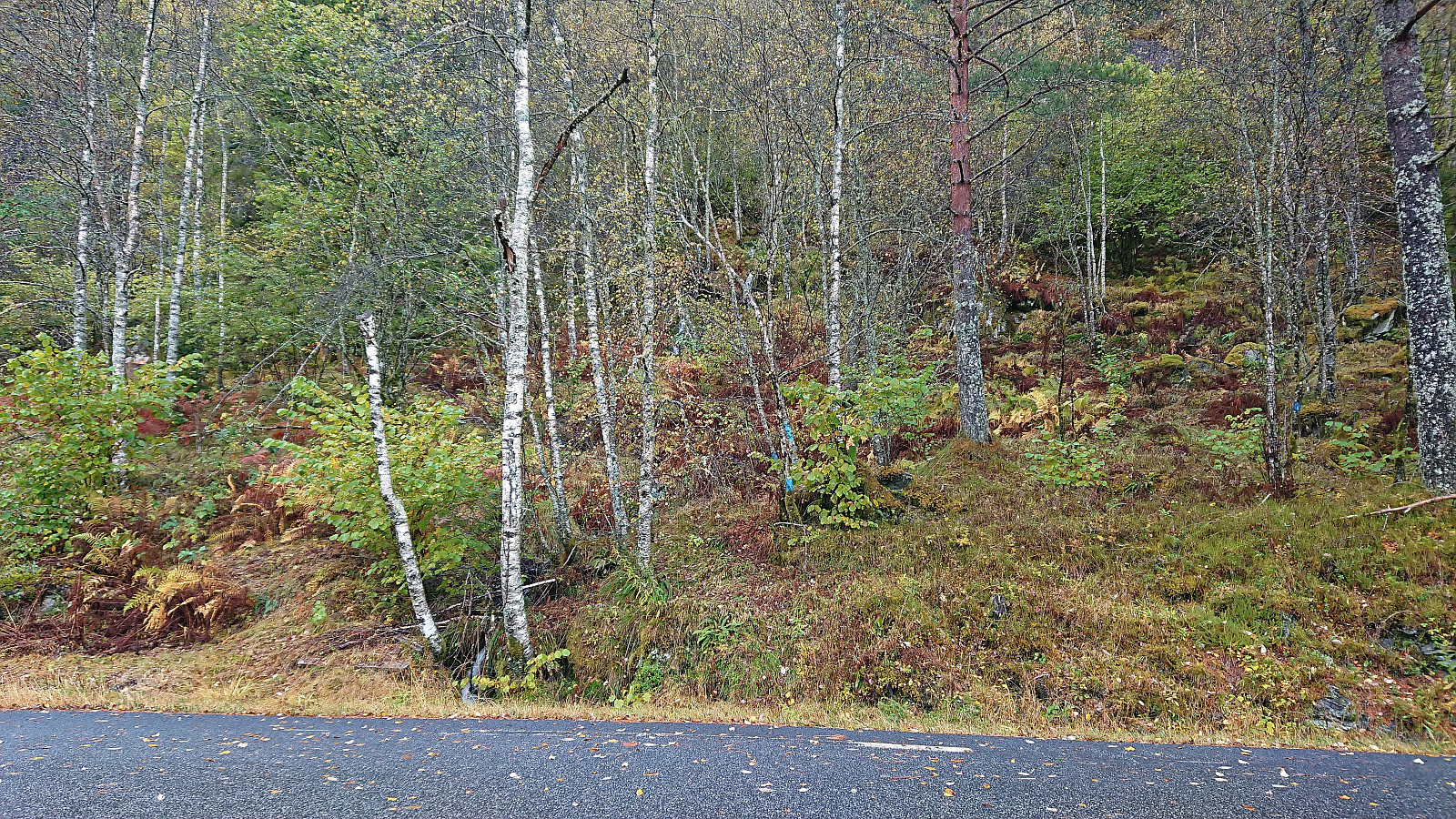
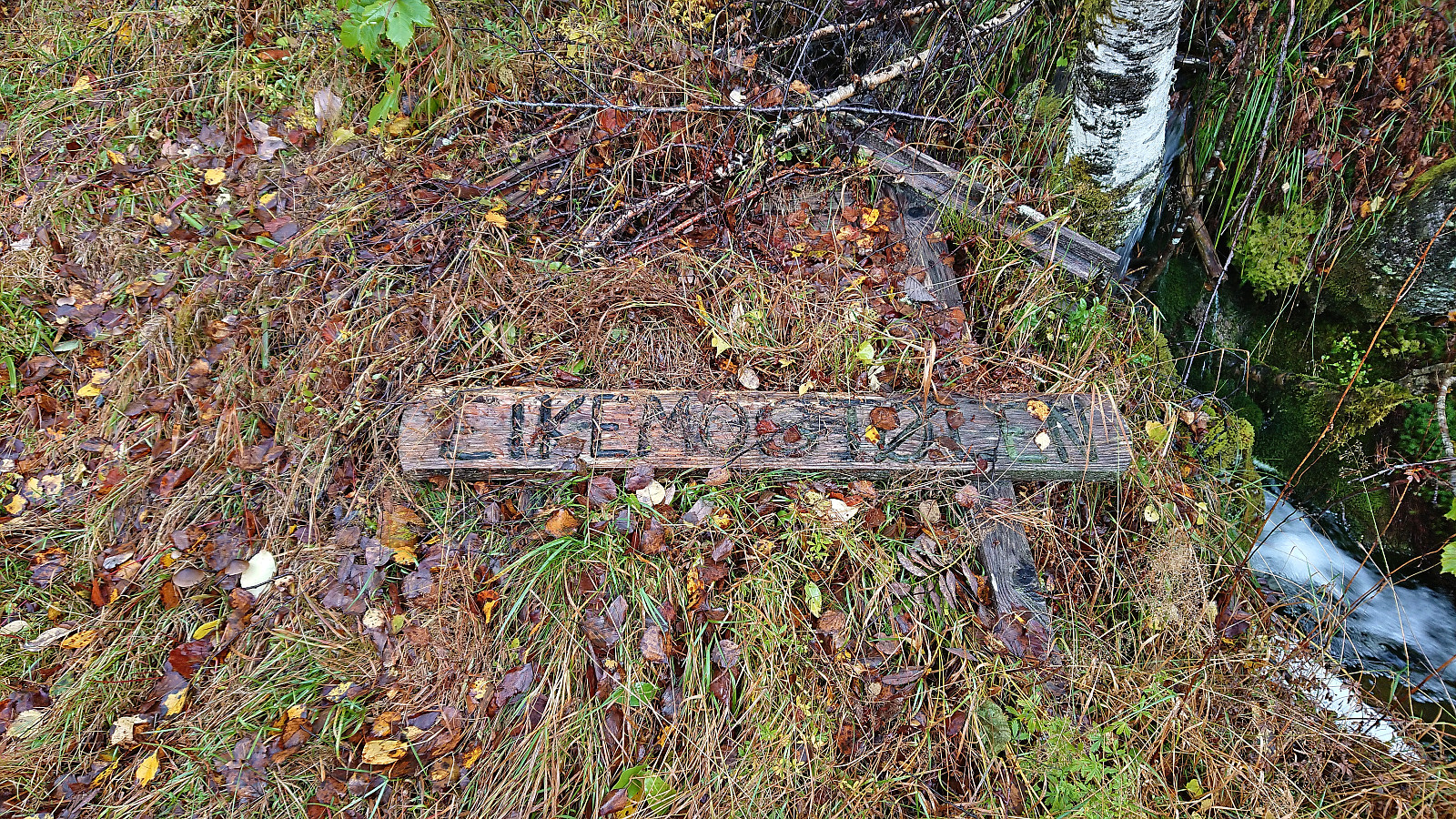
I started by taking the train to Dale and from there the bus to Eikemo. As I was the only passenger on the bus (and would be so for the return as well), I got a bit of extra service and was dropped off right at the trailhead (the official stop is just 150 meters earlier though). The start of the trail was clearly visible from the road due the many tree trunks marked with blue paint, although the sign for Eikemostølen shown in arntfla (Arnt Flatmo)'s external trip report from 2005 was now on the ground and hardly visible.
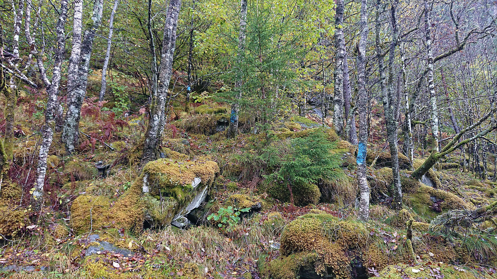
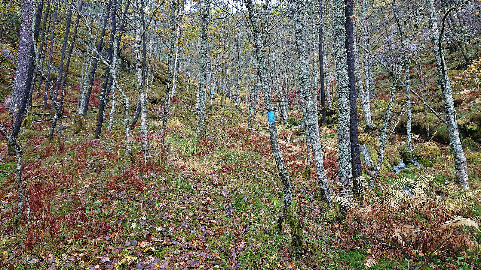
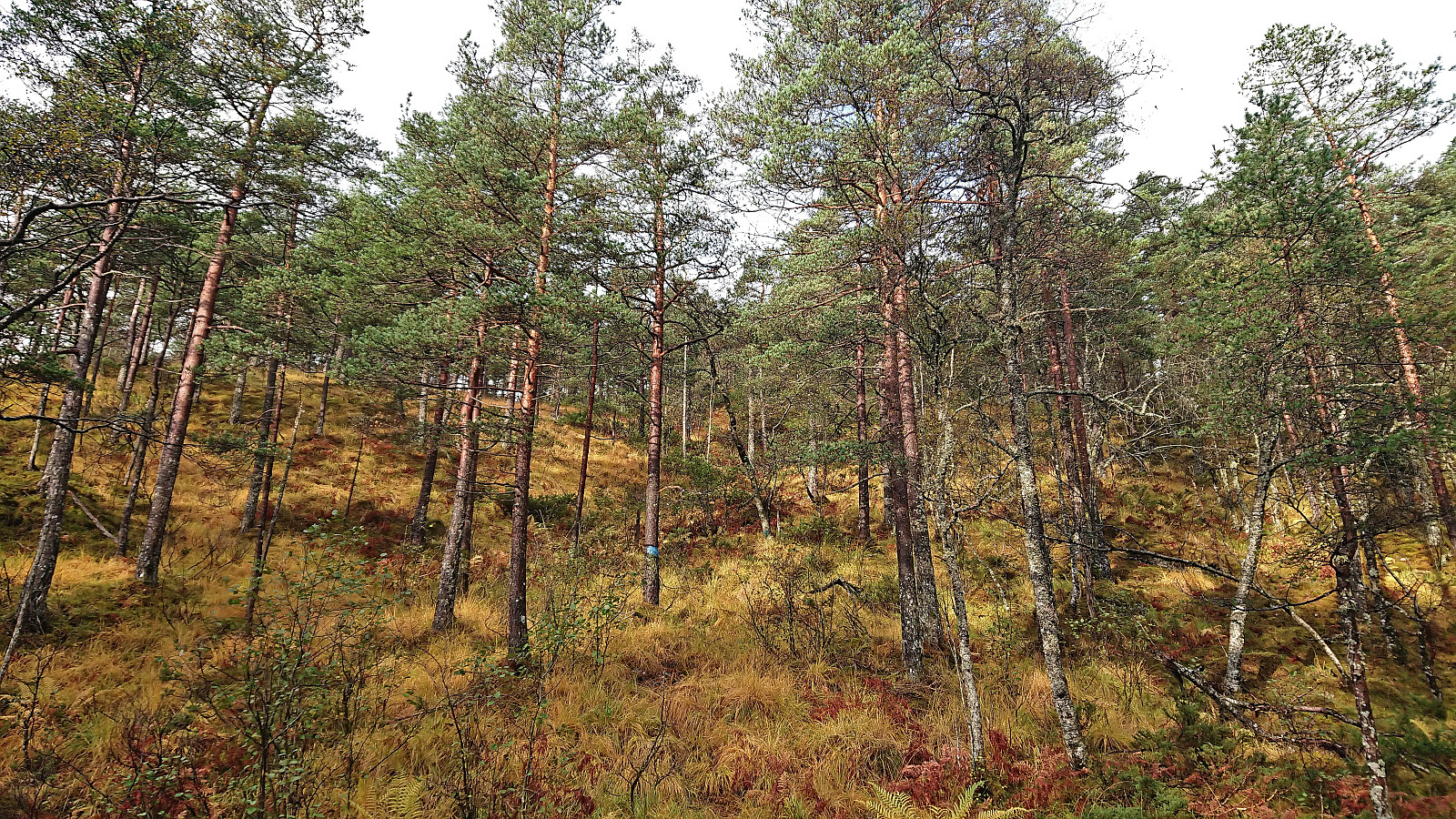
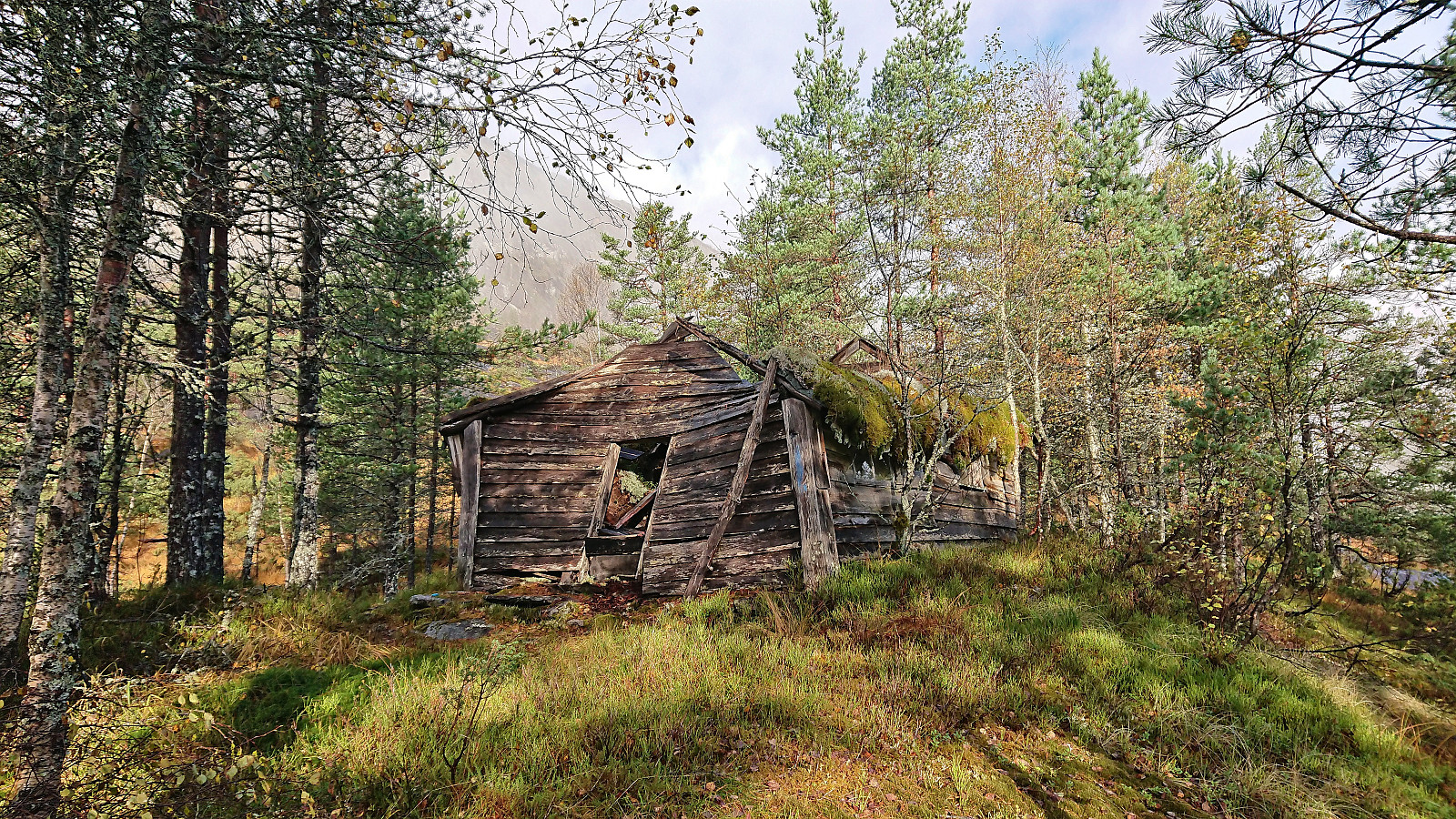
Following the marked trail made it relatively straightforward to ascend to Eikemostølen, however the trail was clearly not very frequently used and a bit weak at times before pretty much disappearing altogether just before reaching Eikemostølen. While the cabin was still standing when Arnt visited it back in 2005, the roof had now caved in and it was thus in sync with the fallen down sign at the trailhead.
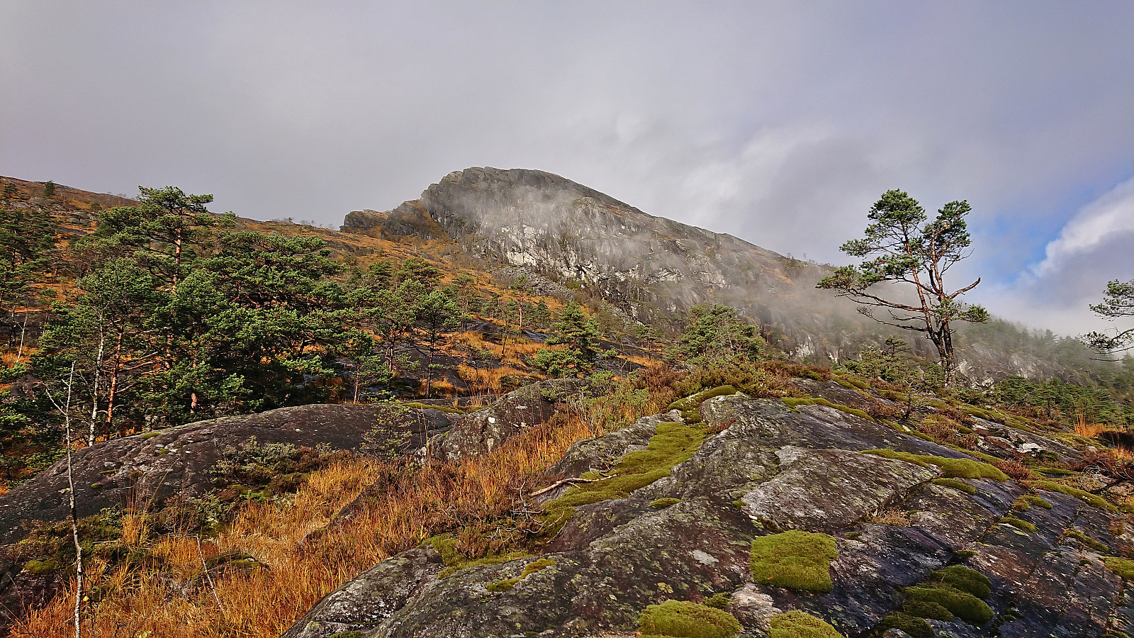
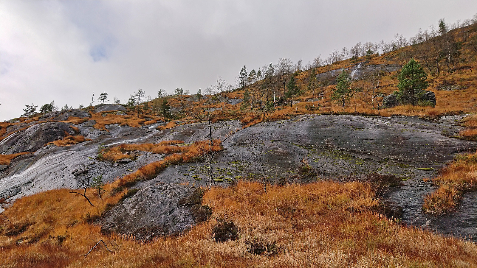
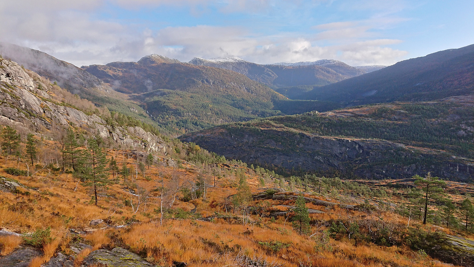
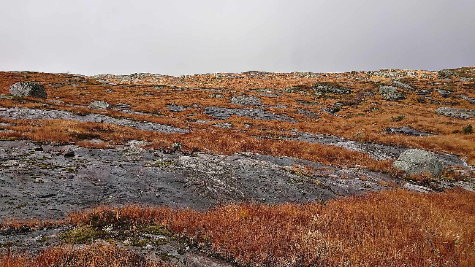
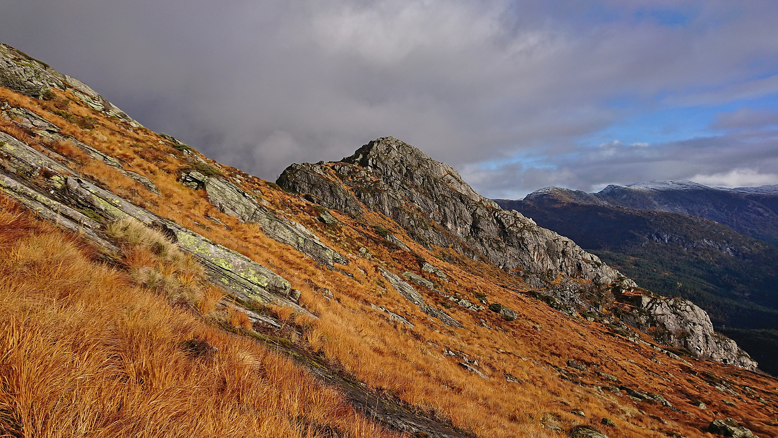
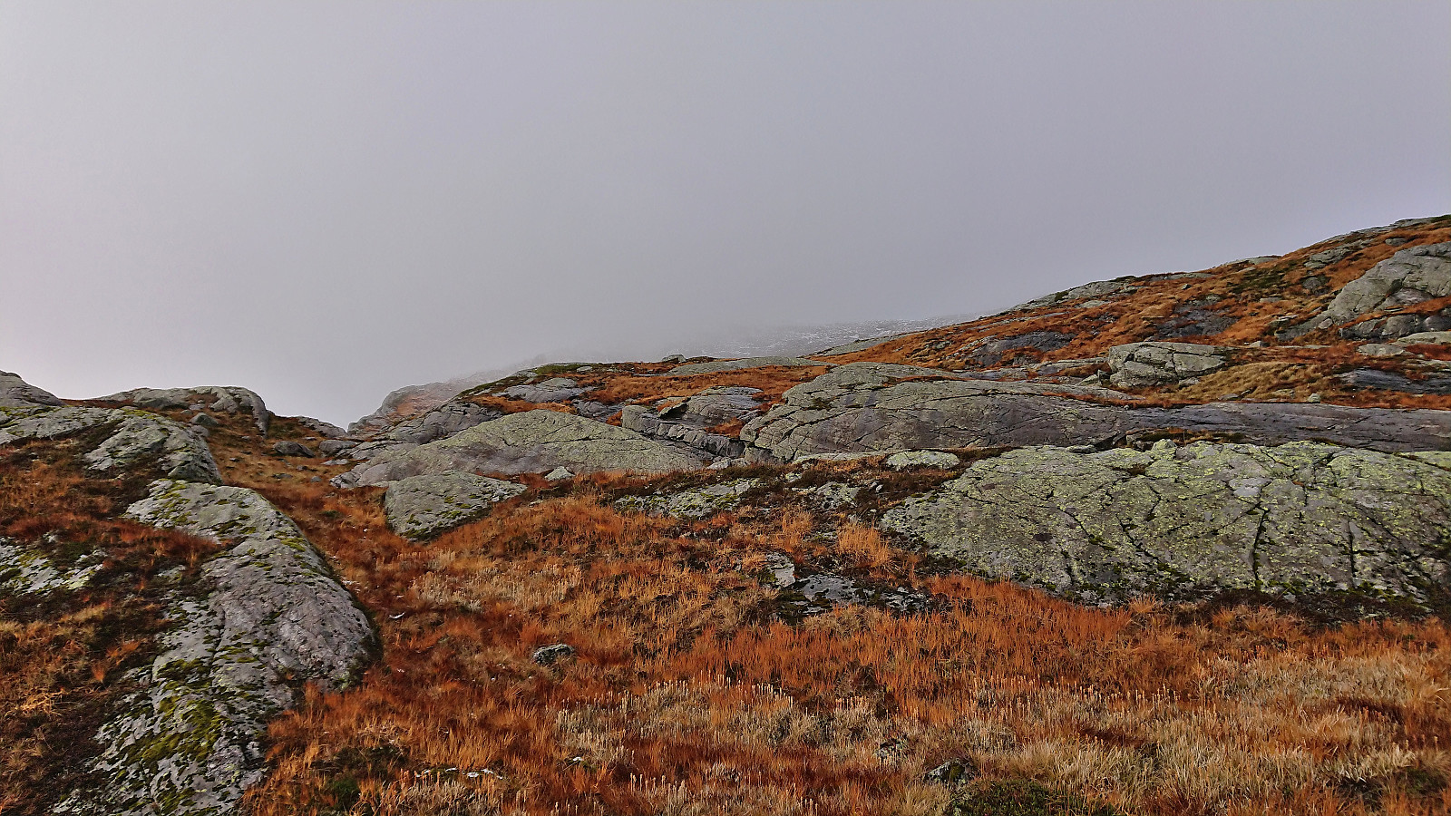
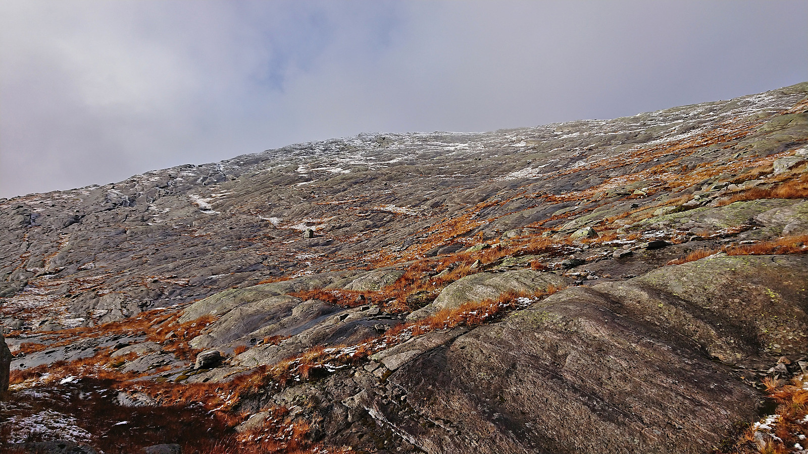
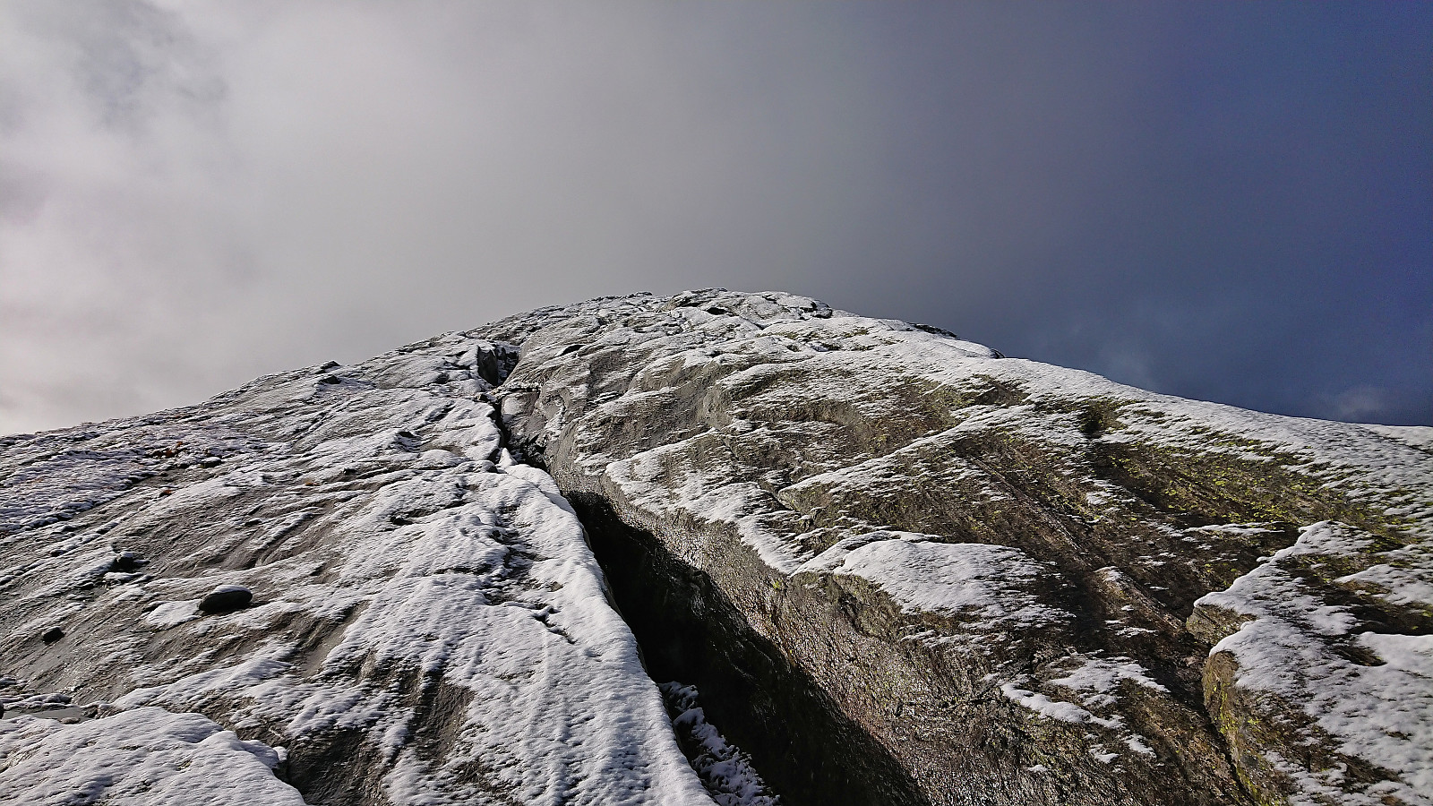
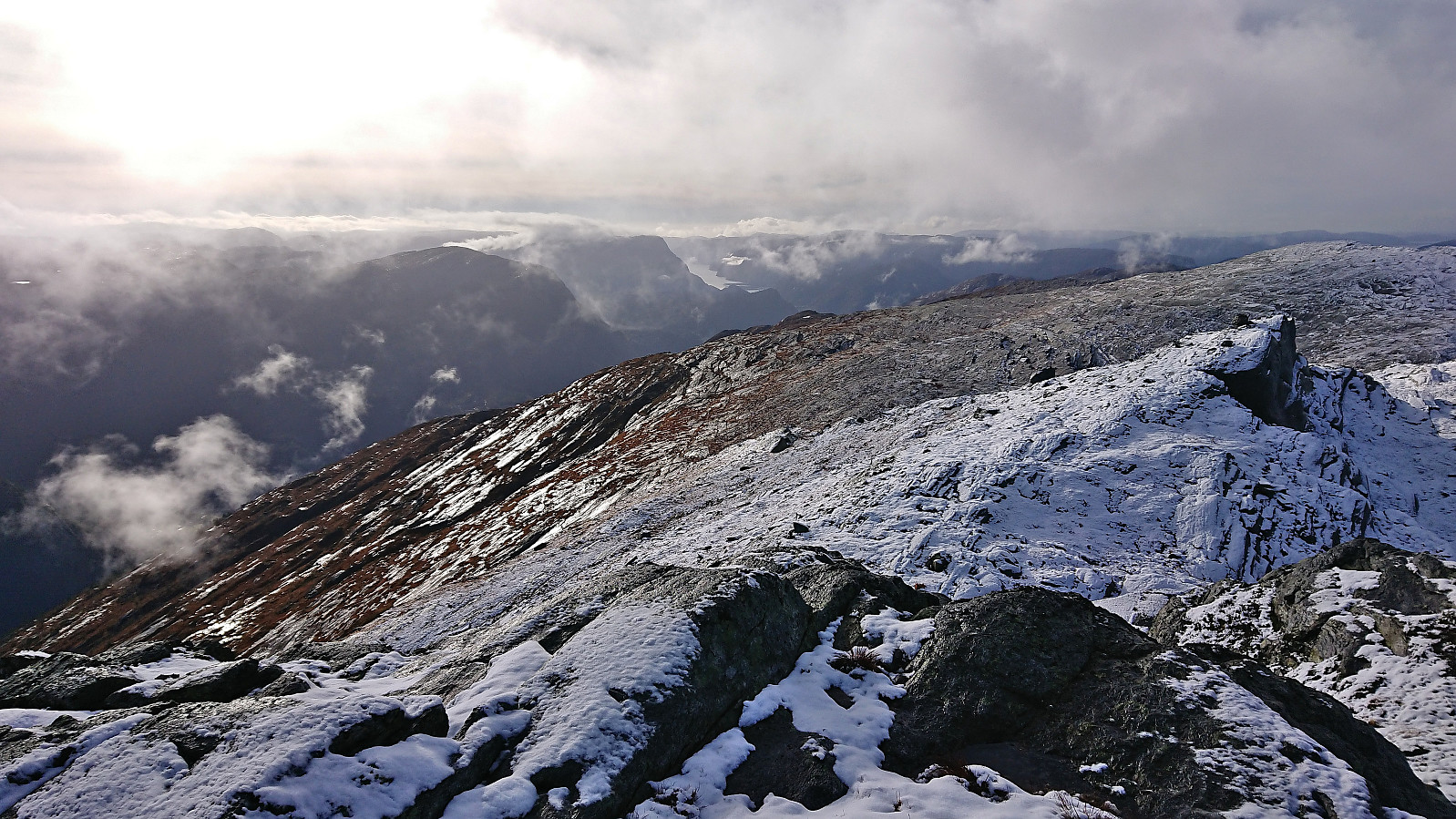
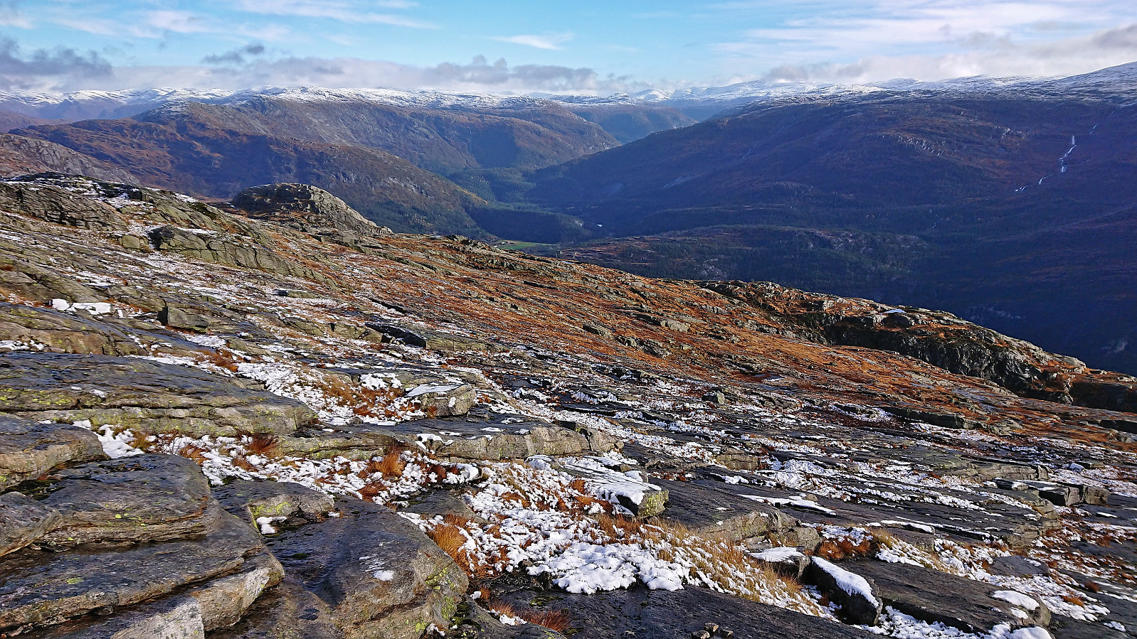
From Eikemostølen I continued off-trail in the direction of the summit of Slettefjellet more or less following a straight line west and only making minor detours when the terrain demanded it. Overall, the terrain was easy to traverse and did not present any difficulties besides lots of wet rocky surfaces that had to be avoided. This would however turn much more tricky as I got closer to the summit, as now there were only wet rocky surfaces, and with the added bonus of a thin layer of wet snow on top.
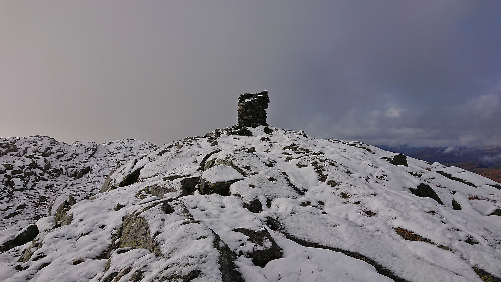
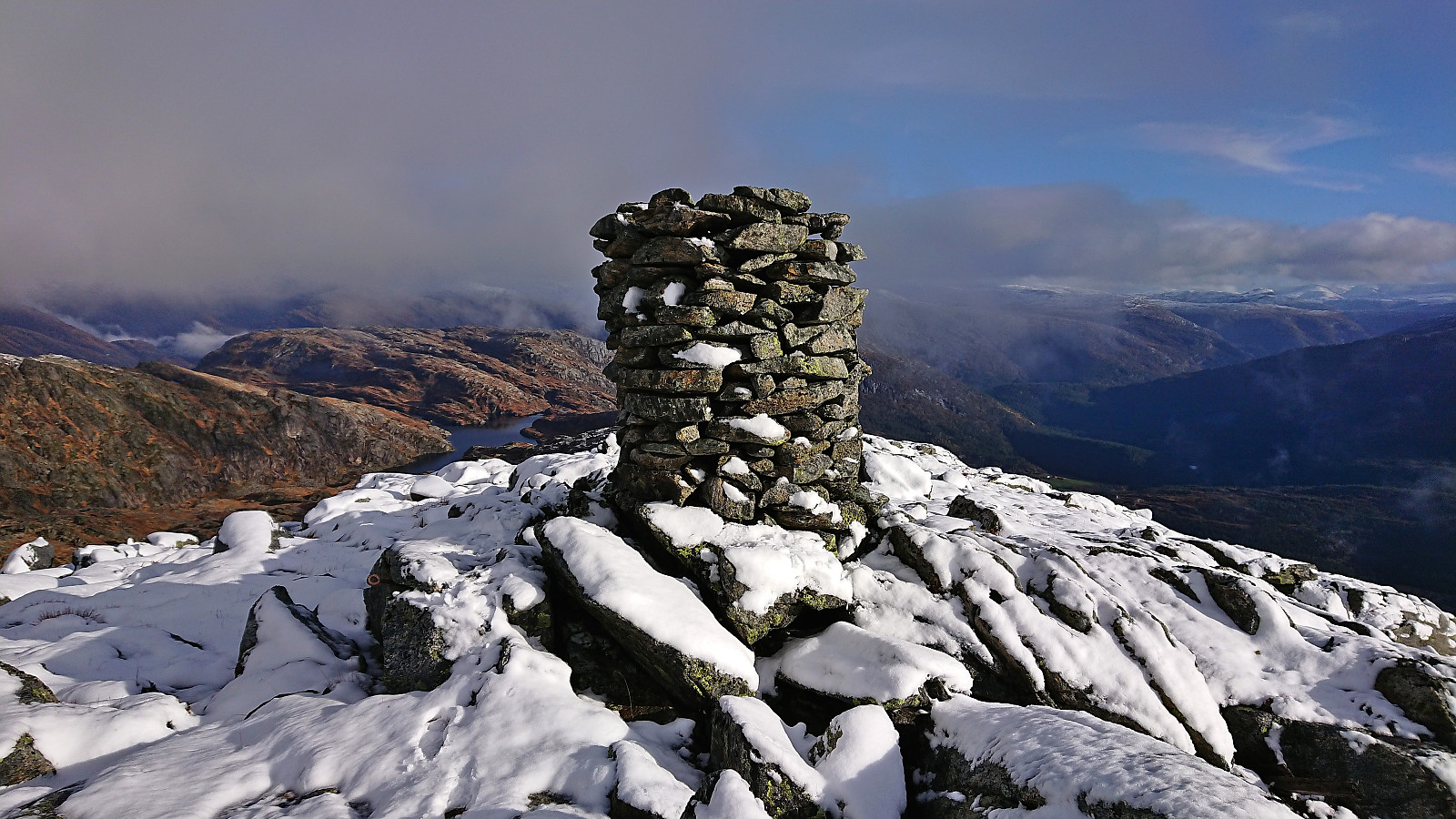
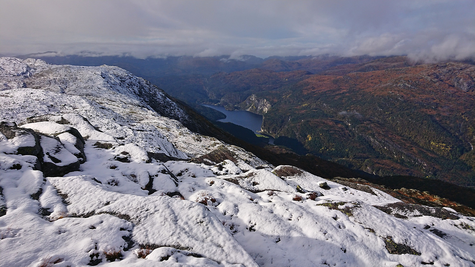
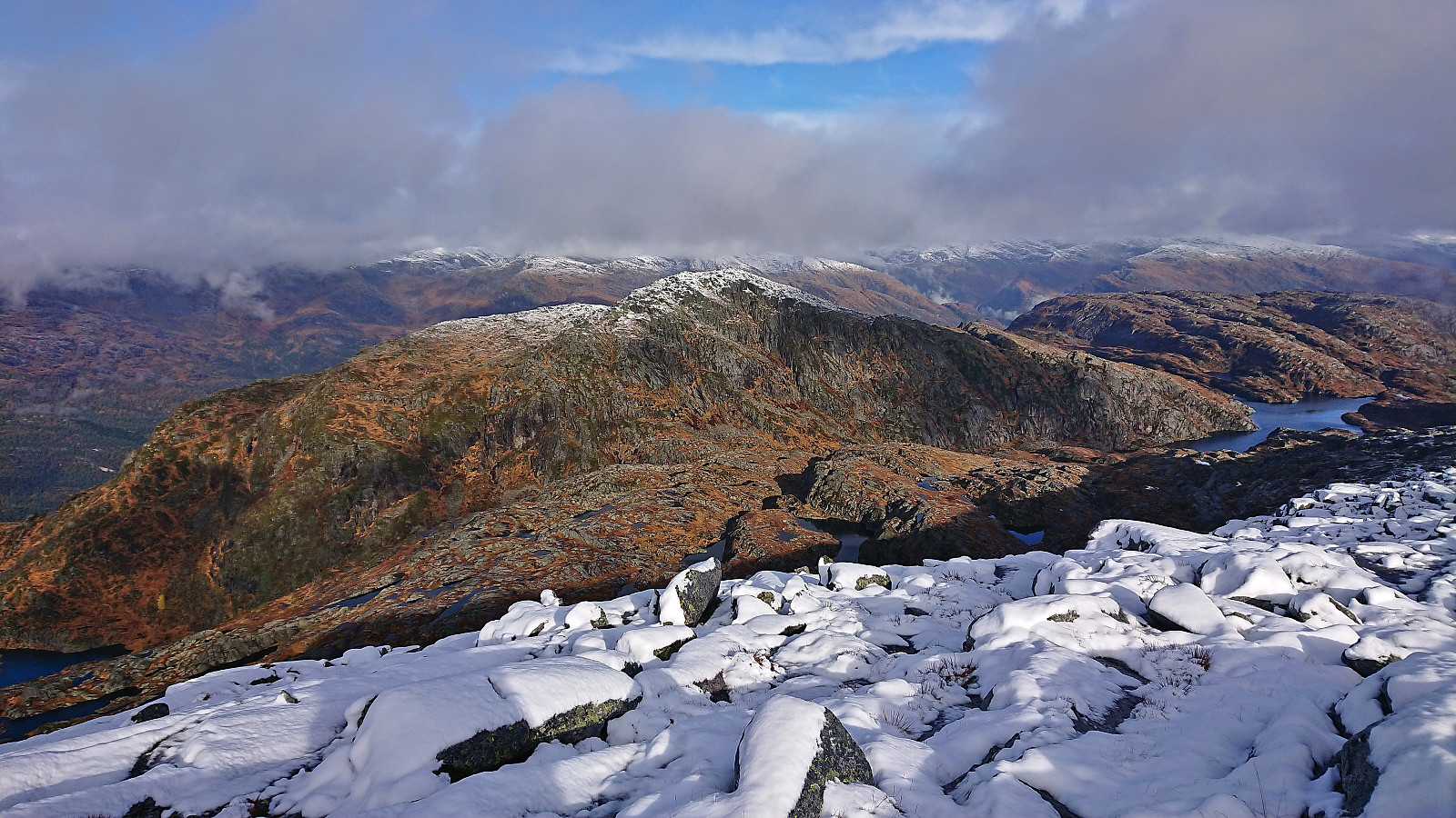
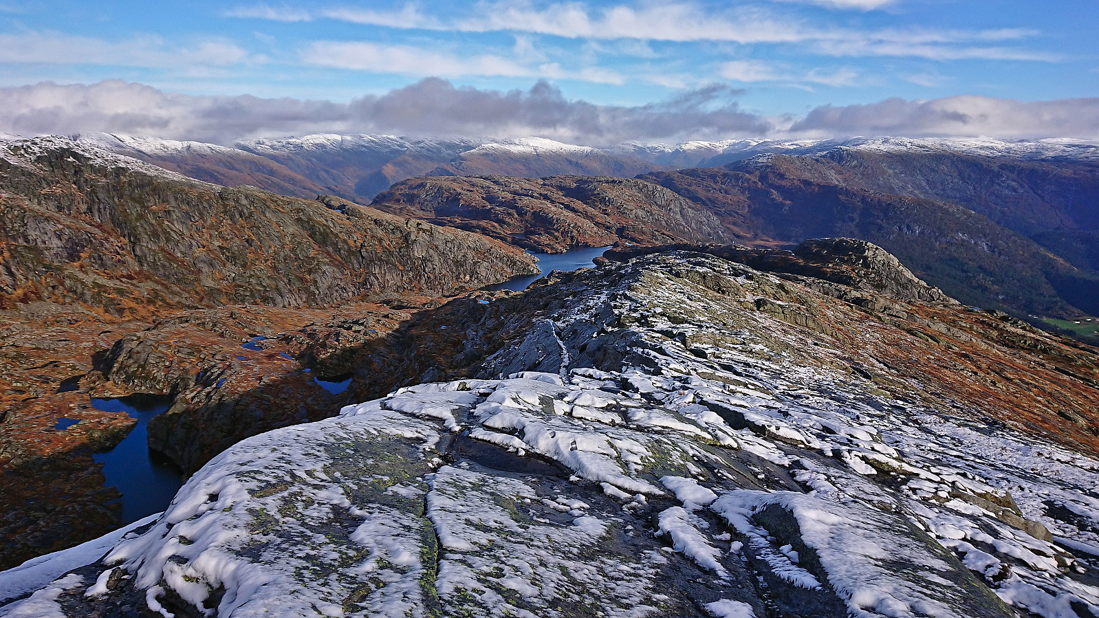
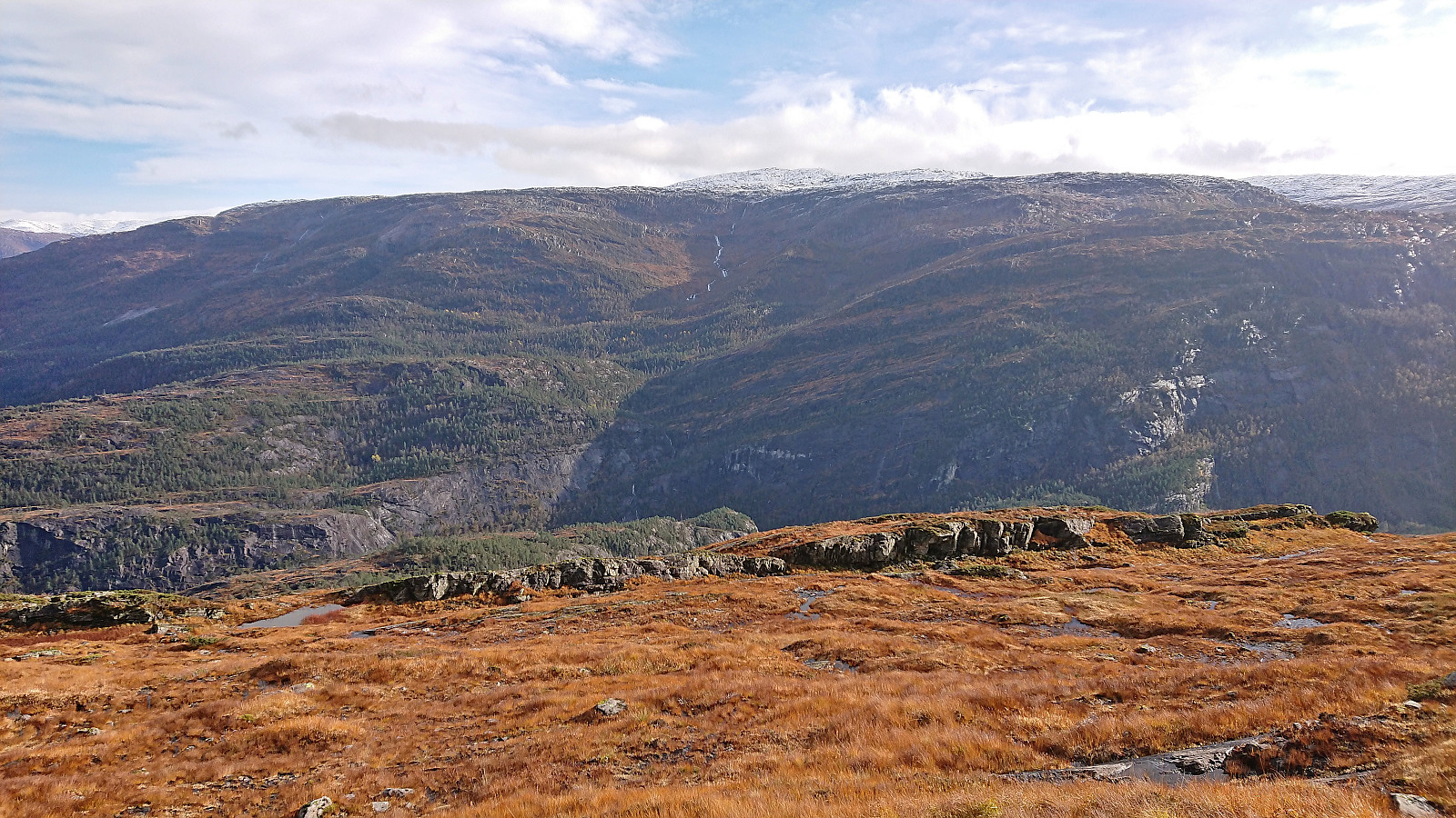
By taking it slow I managed to navigate the slippery surfaces without falling (I saved that until walking around at the summit…) and finally made it to the large cairn marking the highest point. The low-hanging clouds that had been threatening to ruin the views had thankfully more or less disappeared just as I arrived at the summit, and I could now enjoy the excellent views.
After lots of pictures, I started my descent along the same route, taking it very slow until I was done with the snow-covered section, and taking a short lunch break when I found a bit of shelter from the cold wind.
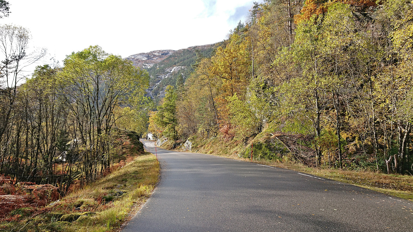
Upon returning to the main road, I still had almost 45 minutes until the bus would take me back the Dale, so I headed south along the road, making it to Eide before finally getting on the bus. At Dale I had to wait another 45 minutes for the train to arrive - the first 25 were according to the schedule, but the extra 20 were due to the train being late. Thankfully the waiting room at the station at Dale was now open again after having recently been closed due to updates at the station, so at least I did not have to wait outside in the cold.
In summary, a very nice hike with excellent views from the summit. Due to the marked trail to Eikemostølen the first part of the ascent was straightforward and the final off-trail ascent from there did not present any real difficulties either. Probably recommended to do this hike in dry weather though in order to avoid the many slippery rocky surfaces. Note also that skipping the final walk along the road reduces the hike by around 5.5 km.
| Startzeitpunkt | 15.10.2022 10:21 (UTC+01:00 SZ) |
| Endzeitpunkt | 15.10.2022 15:15 (UTC+01:00 SZ) |
| Gesamtzeit | 4h 53min |
| Zeit in Bewegung | 4h 19min |
| Pausenzeit | 0h 33min |
| Gesamtschnitt | 2,4km/h |
| Bewegungsschnitt | 2,8km/h |
| Entfernung | 12,0km |
| Höhenmeter | 953m |

Benutzerkommentare