Skarpefjellet and Torhaugen from Kjetland/Storemyr (07.11.2021)

| Startsted | Kjetland/Storemyr (50moh) |
|---|---|
| Sluttsted | Kjetland/Storemyr (50moh) |
| Turtype | Fjelltur |
| Turlengde | 6t 04min |
| Distanse | 12,4km |
| Høydemeter | 1157m |
| GPS |
|
| Bestigninger | Skarpefjellet (744moh) | 07.11.2021 |
|---|---|---|
| Torhaugen (833moh) | 07.11.2021 | |
| Andre besøkte PBE'er | Fjellfossen (455moh) | 07.11.2021 |
| Storemyr p-lomme (50moh) | 07.11.2021 |
Skarpefjellet and Torhaugen from Kjetland/Storemyr
My first joint hike with long-time colleague and very experienced hiker Petter (see his external web page for an overview of his extensive hiking and climbing experience and lots of external hiking reports). Initially we had decided on a hike to Skarpefjellet and Blåfjellet, but upon closer inspection we both concluded that Blåfjellet only has a primary factor of maximum 99. The plans were therefore changed to first ascend Skarpefjellet and from there see whether we would also have the time to include Torhaugen instead.
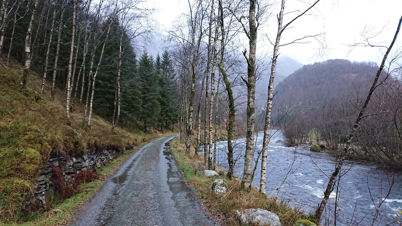
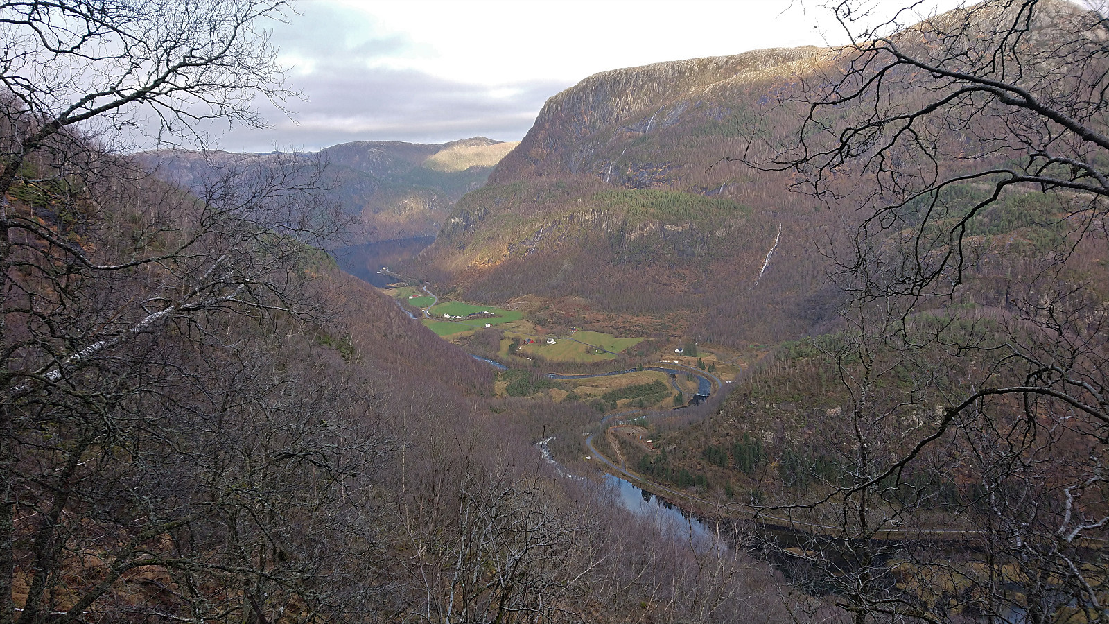
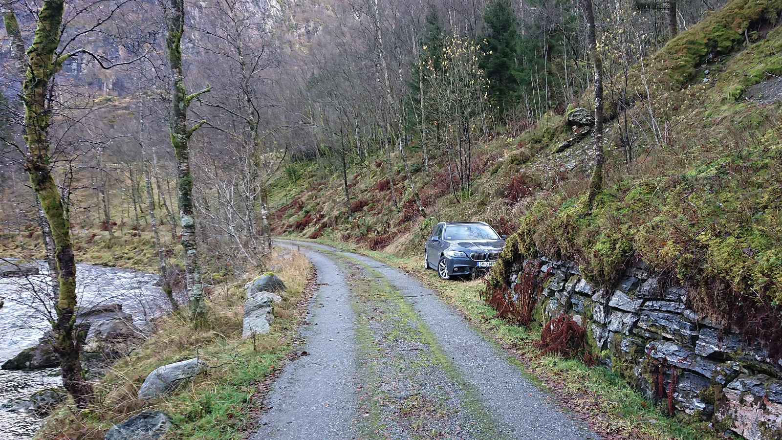
During the drive from Bergen it had rained quite heavily, but thankfully the rain more or less stopped as we arrived at Kjetland where we easily located a spot next to the road where we could park the car without hindering other vehicles (same as the one used by previous hikers). The fact that the rain had now almost ended would however not mean that we would stay dry for long...
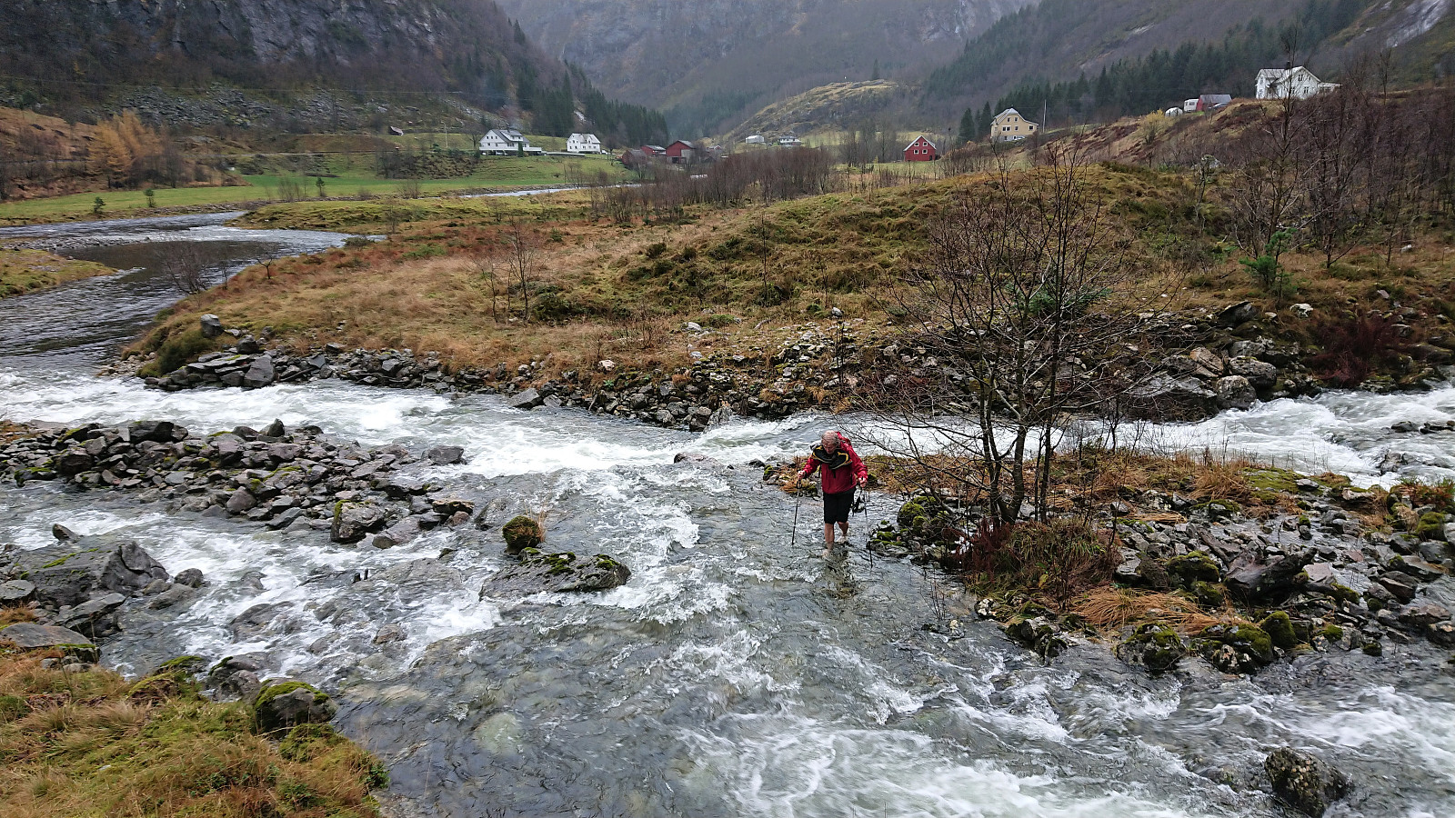
After passing the houses at Storemyr we headed off-trail towards Kvernhuslelva and quickly realized that this river crossing would not be straightforward. Due to the massive amounts of rain over the last month (with a new record for October in Bergen), the river was both wider and more powerful than we had hoped. The initial crossing therefore had to be abandoned and we instead descended along the river looking for a safe location to cross.
In the end we concluded that there was no place to cross that did not involve getting wet. Petter therefore decided to remove his boots before crossing, while I did not, assuming that I would get wet at some point during this hike anyway. I shortly got even wetter than expected though, as I managed to slip halfway across the river. Thankfully I still kept most of my body above water and given that we had chosen a safe place to cross I was in no real danger.
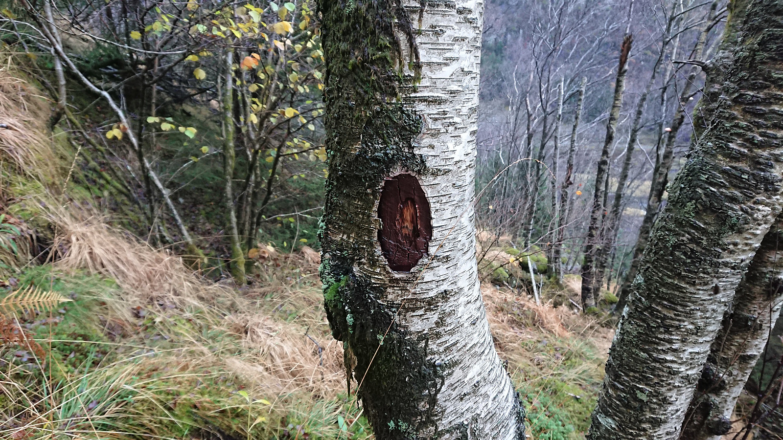
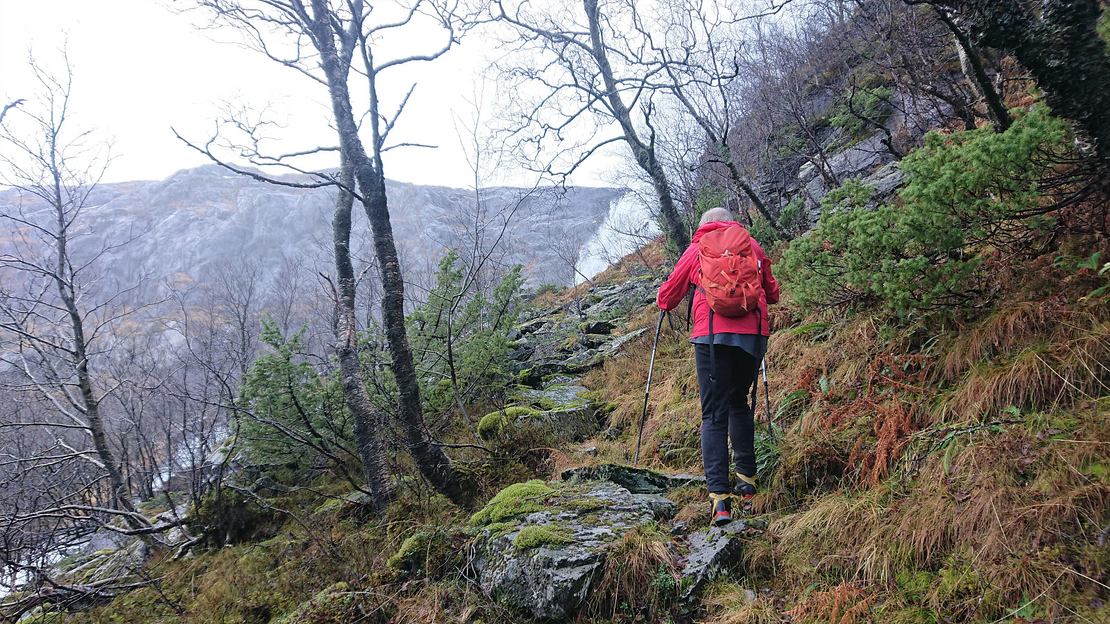
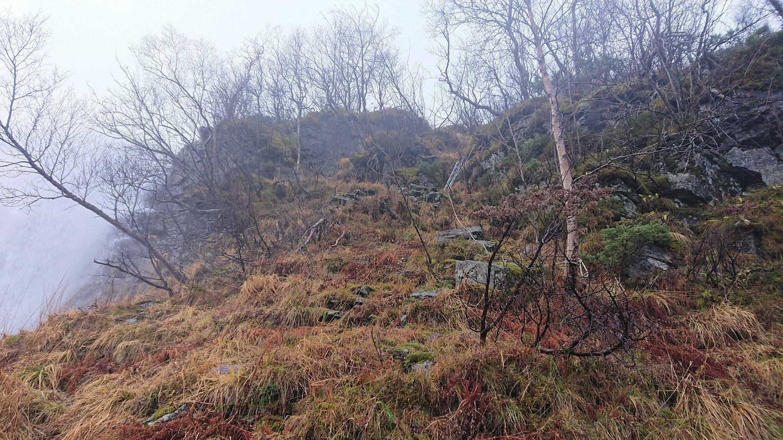
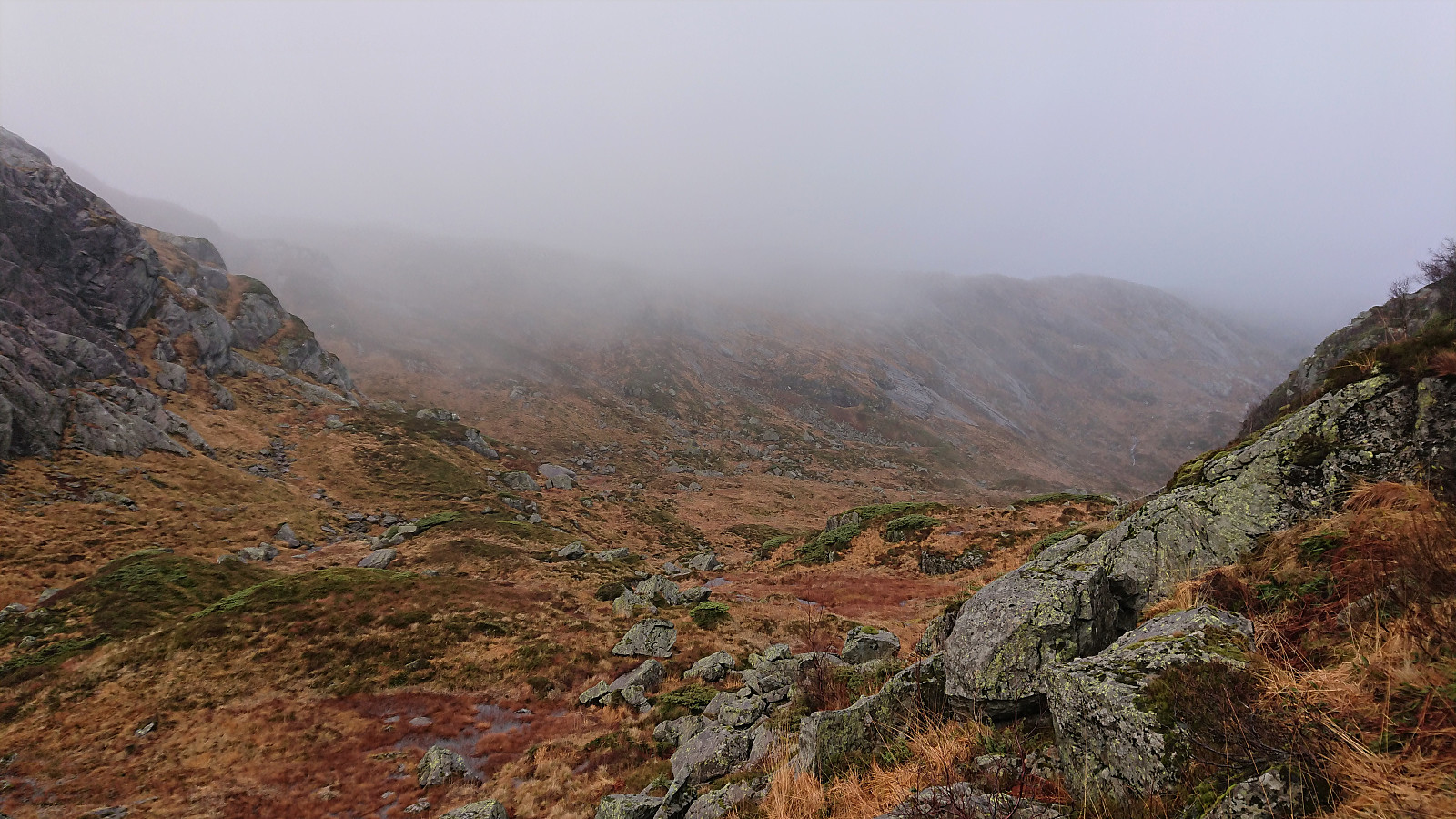
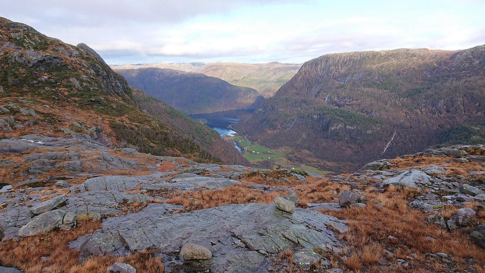
As soon as Petter also made it safely across, and significantly drier than me, we started our off-trail ascent towards Haugsdalsvatnet. Within not too long we located a weak marked trail indicated by minor marks in some of the tree trunks next to the trail (see picture). However, neither the marks nor the trail itself were always easy to spot. But there were also short sections of man-made stone steps, and the trail overall greatly simplify the ascent.
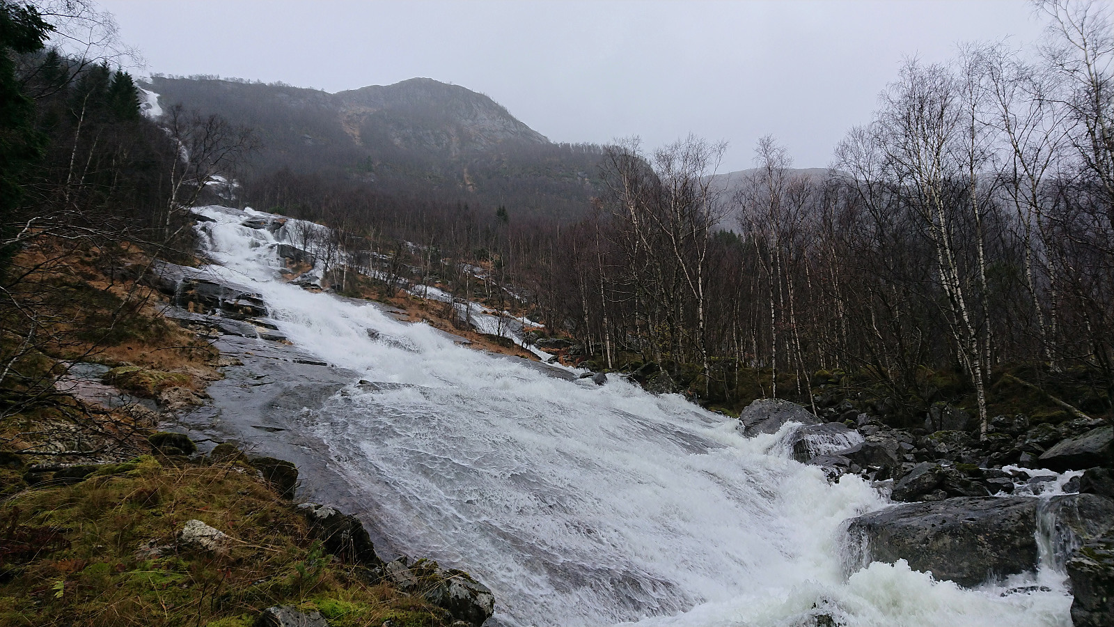
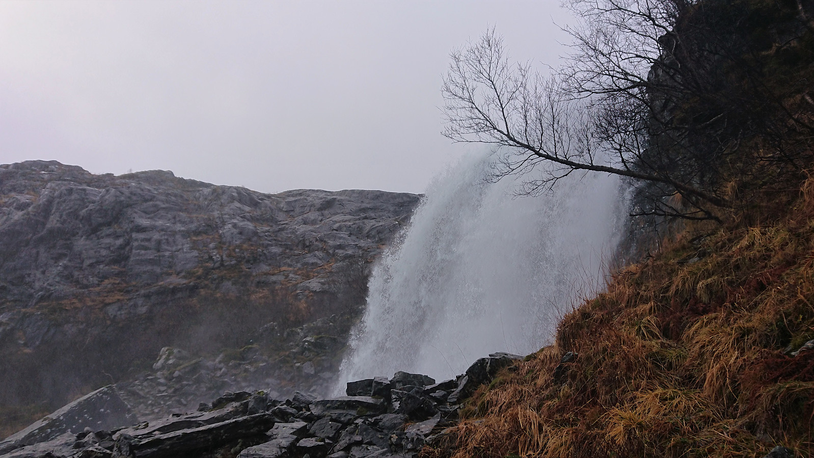
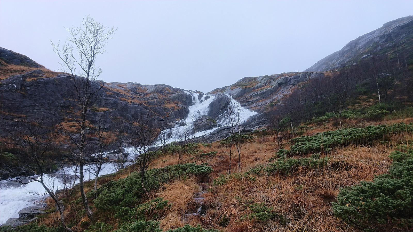
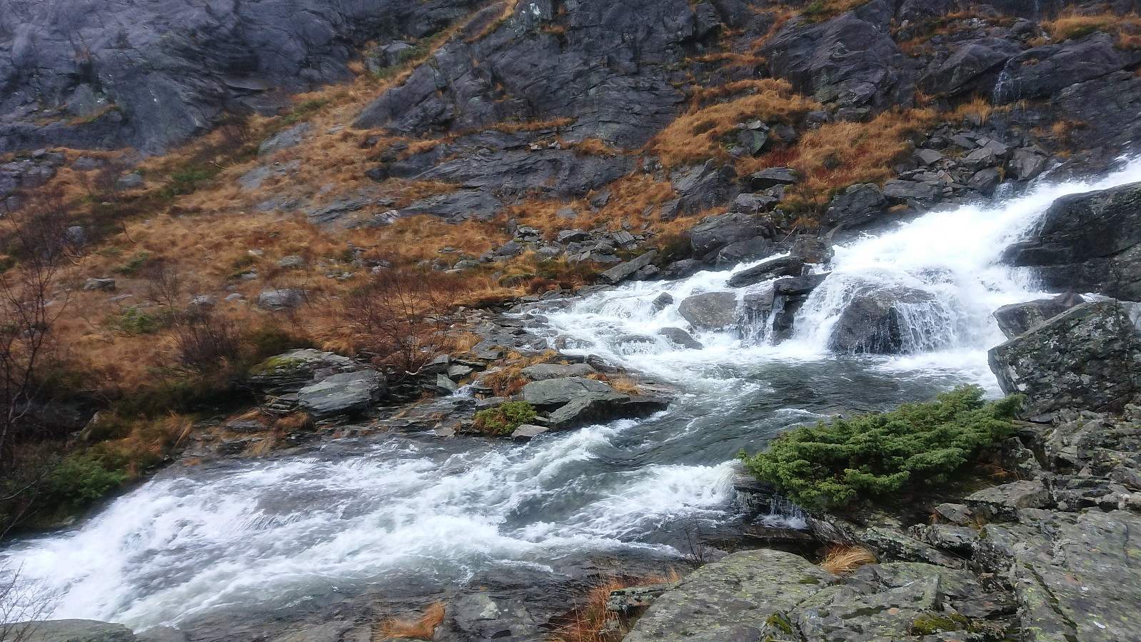
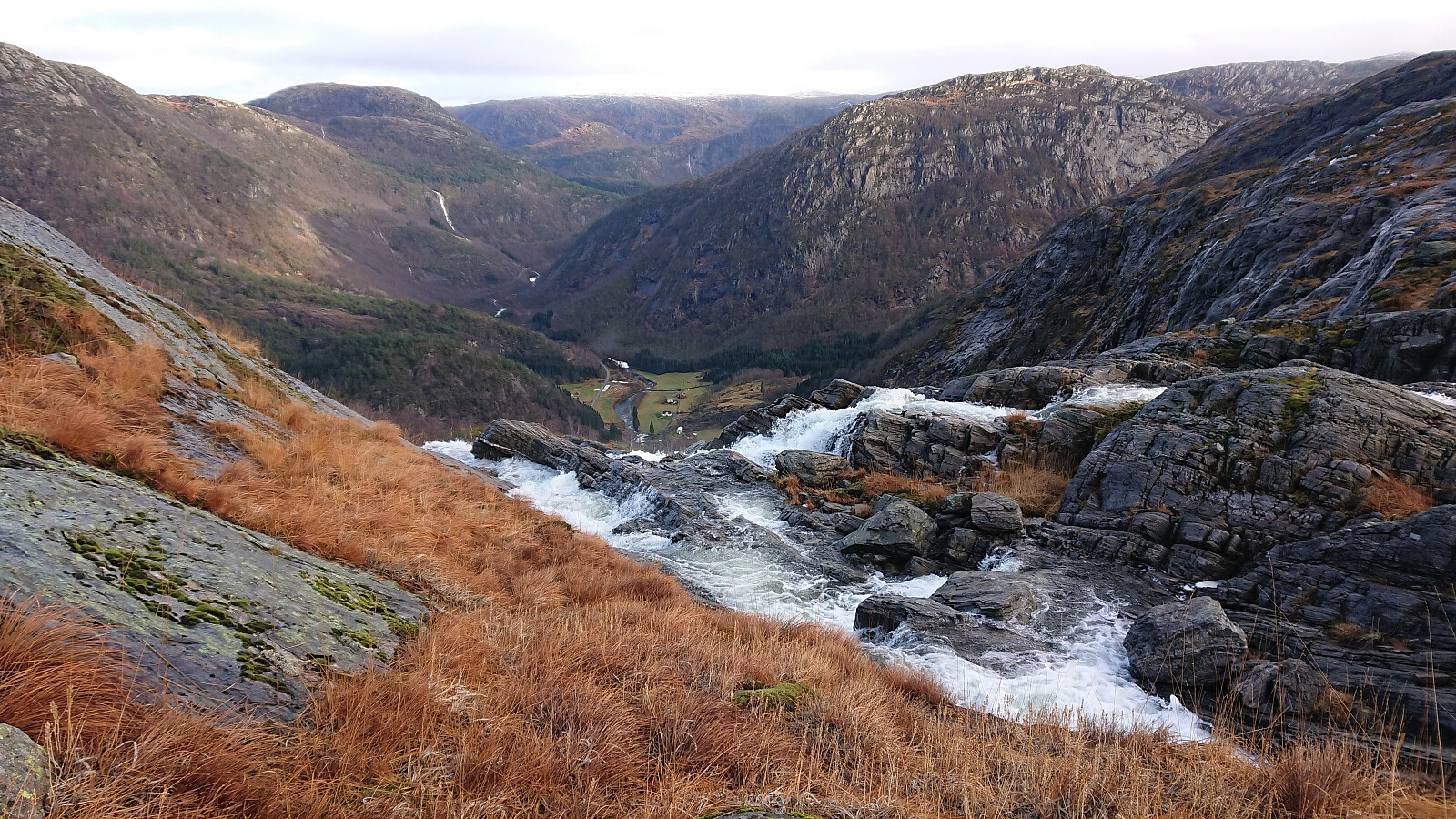
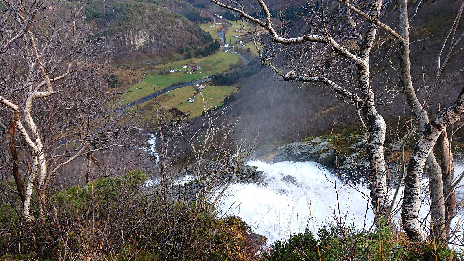
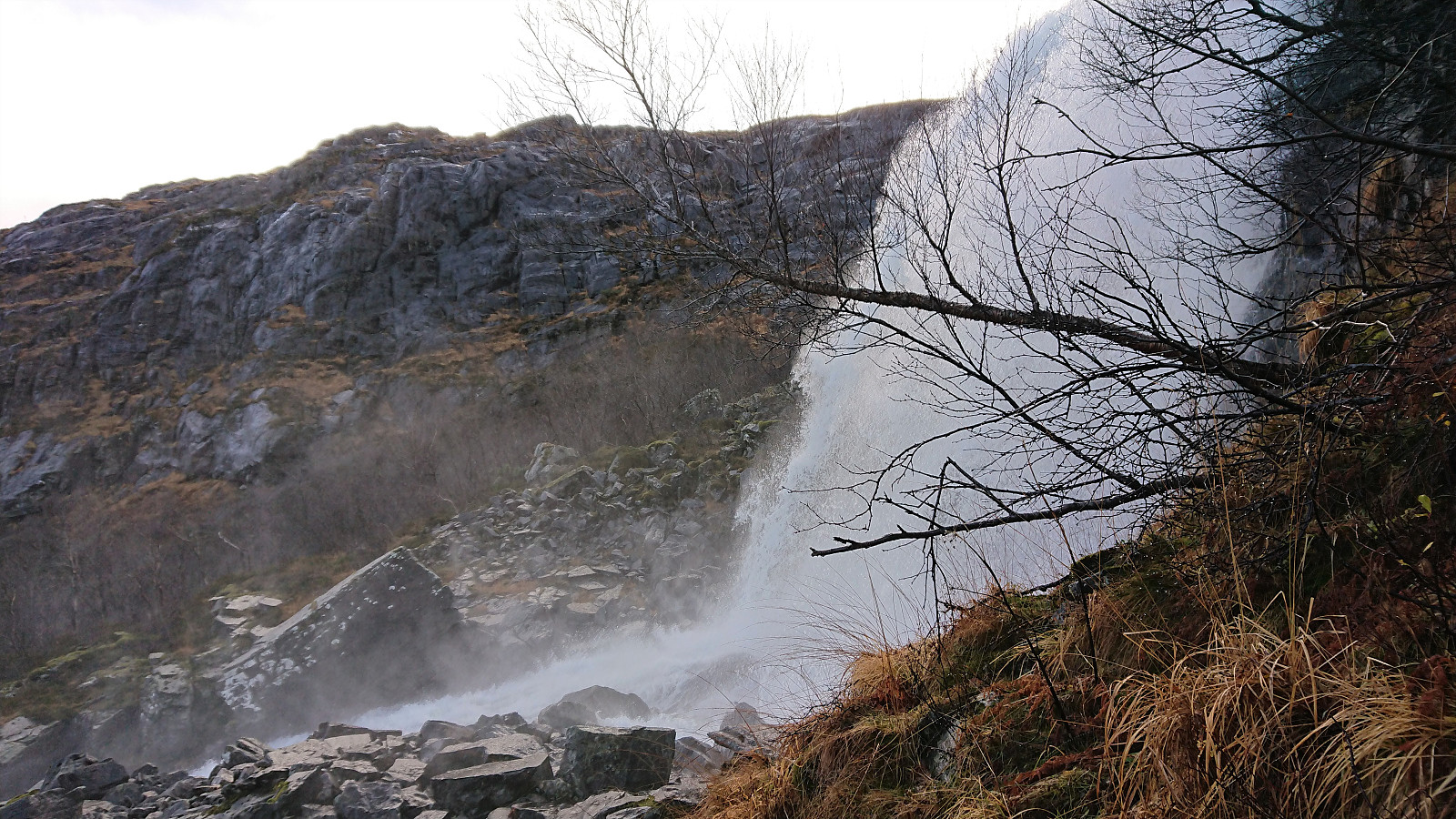
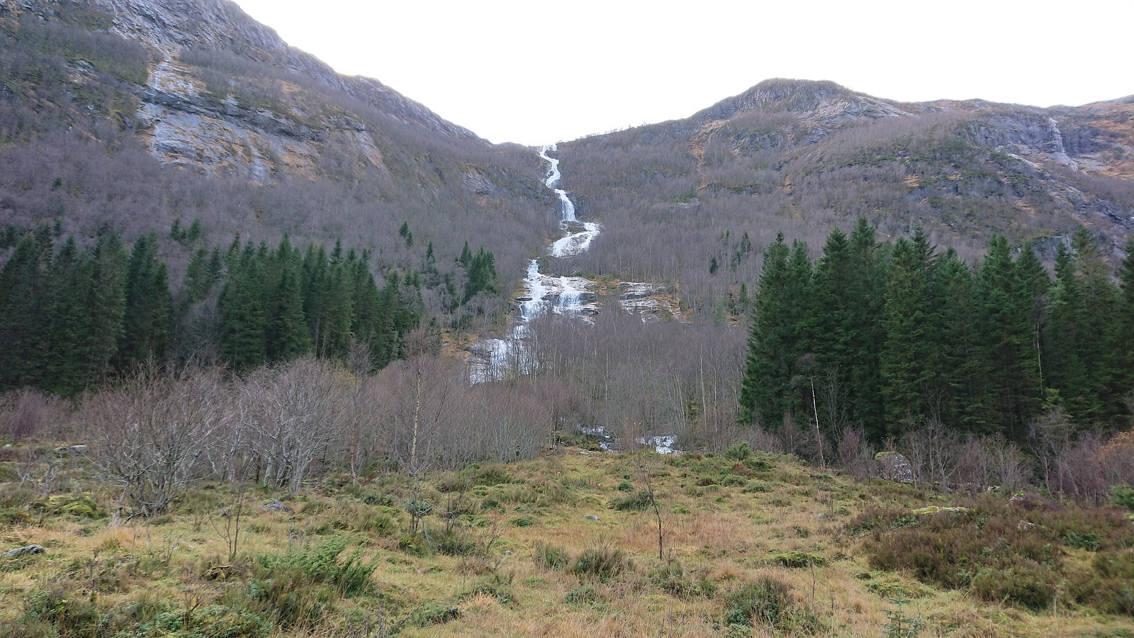
Just after passing by the impressive Fjellfossen there was a short steeper section where light scrambling was required. Two ropes and a short metal ladder however ensured that we could easily ascend. Shortly after the terrain now levelled off and we soon passed by an area in which other hikers had crossed the river on their way to Skarpefjellet. But again the river was too powerful, especially right above the waterfall, and we instead continued to Haugsdalsvatnet.
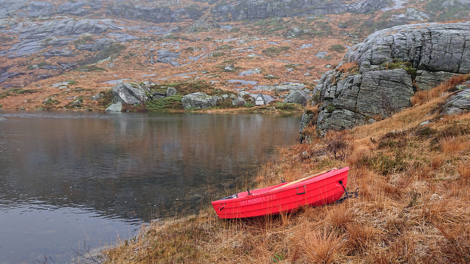
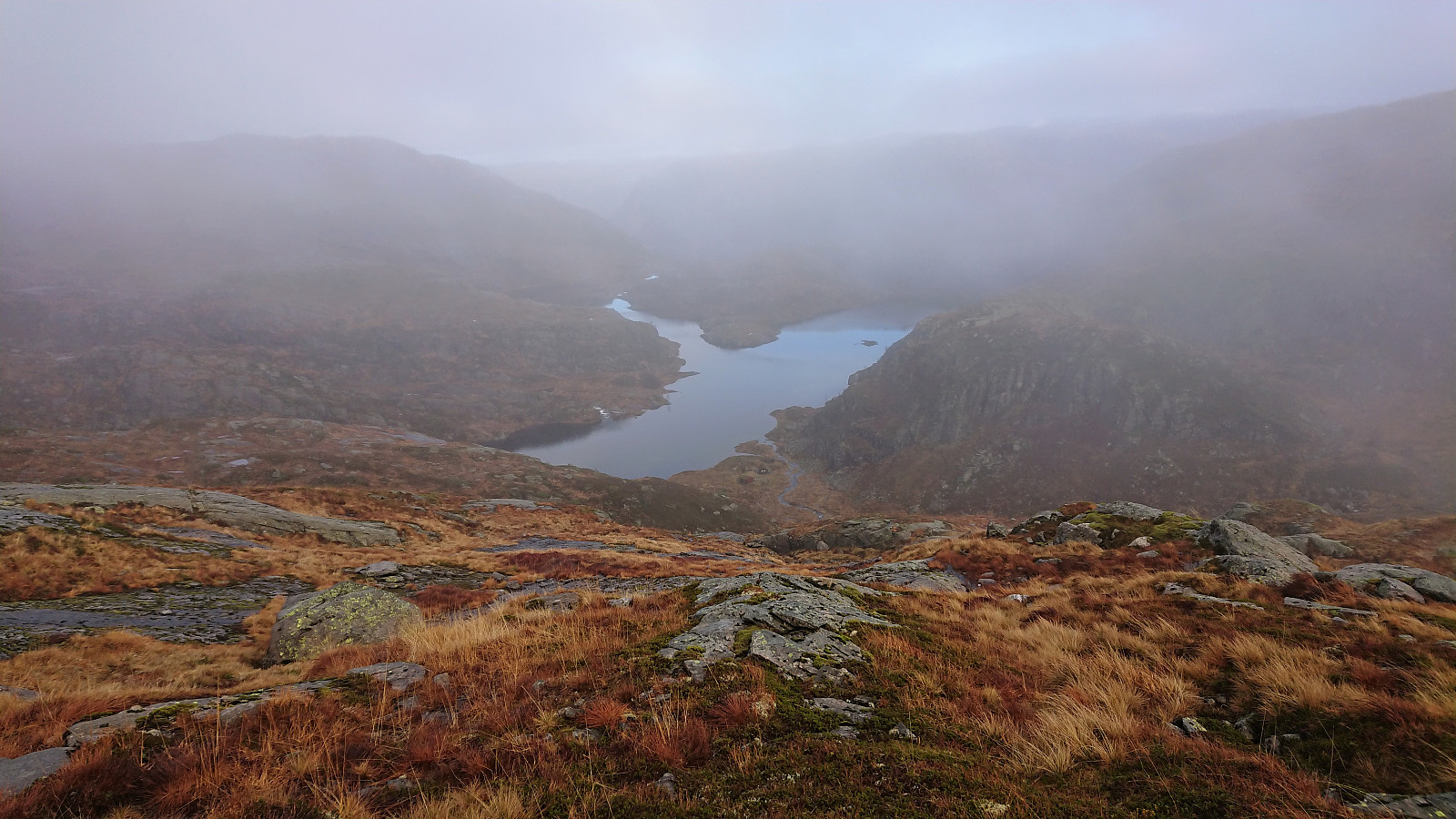
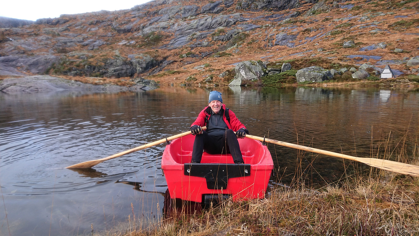
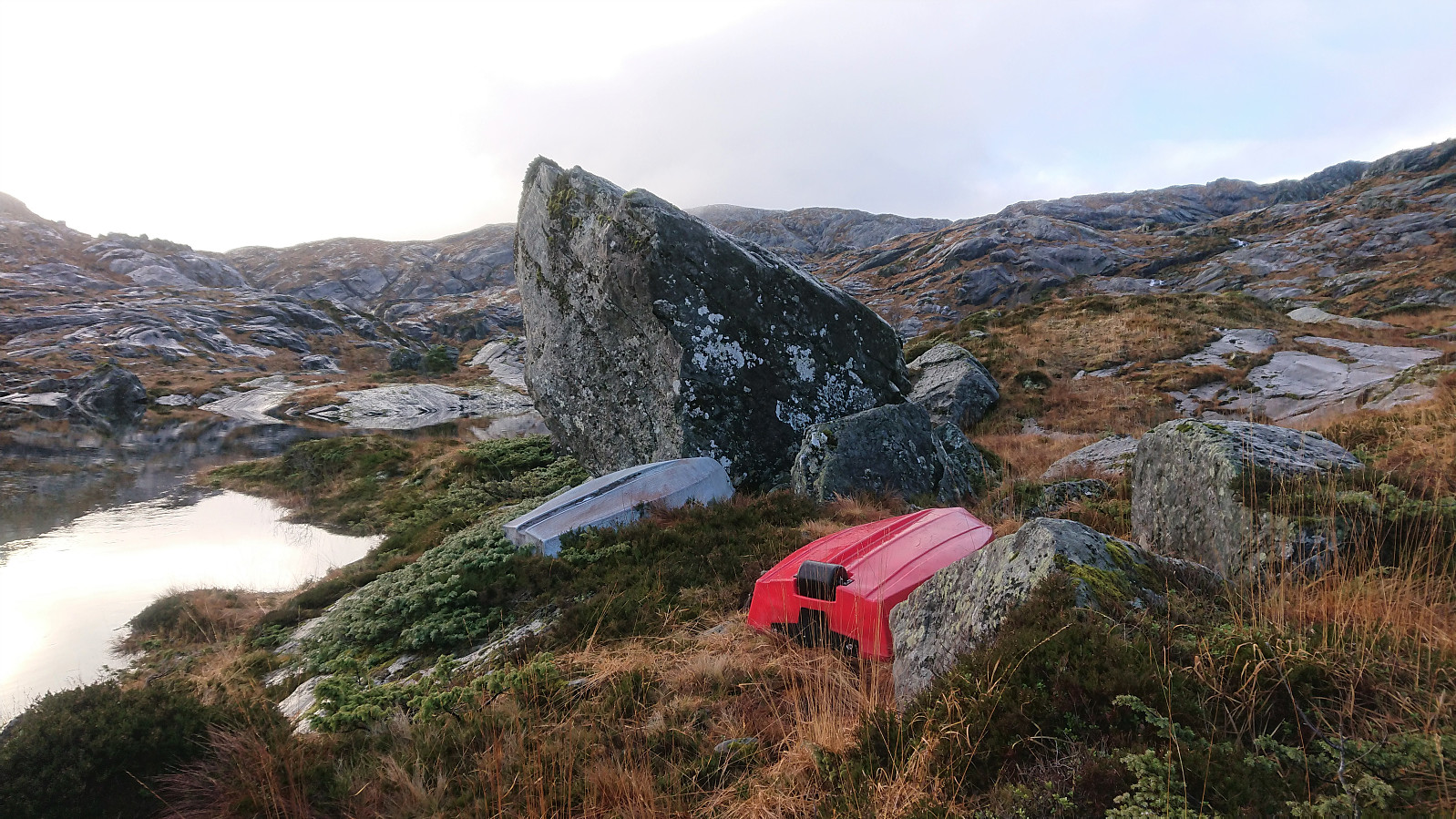
When getting to Haugsdalsvatnet we still had not found a way to safely cross the river. But just as we started thinking about having to go around Haugsdalsvatnet, we came across a pair of small boats. Petter suggested that instead of the longer detour, we could borrow one of the boats, as we were pretty sure that no other hikers would be needing them on this gray and foggy day. A closer inspection revealed that one of the boats had a big hole in it, but the other one looked ok and even had a pair of oars hidden underneath it. The small plastic boat was quickly put on the water a safe distance from the river and within a minute or two we had rowed to other side of the lake.
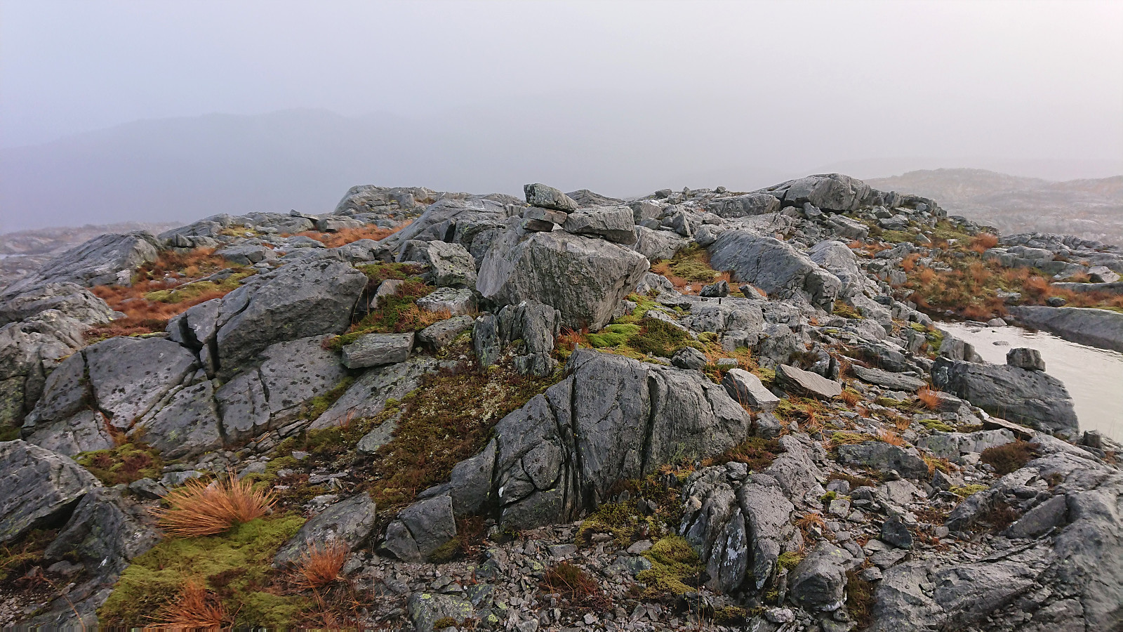
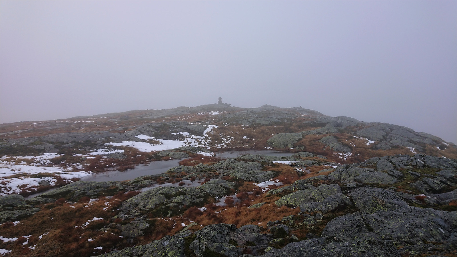
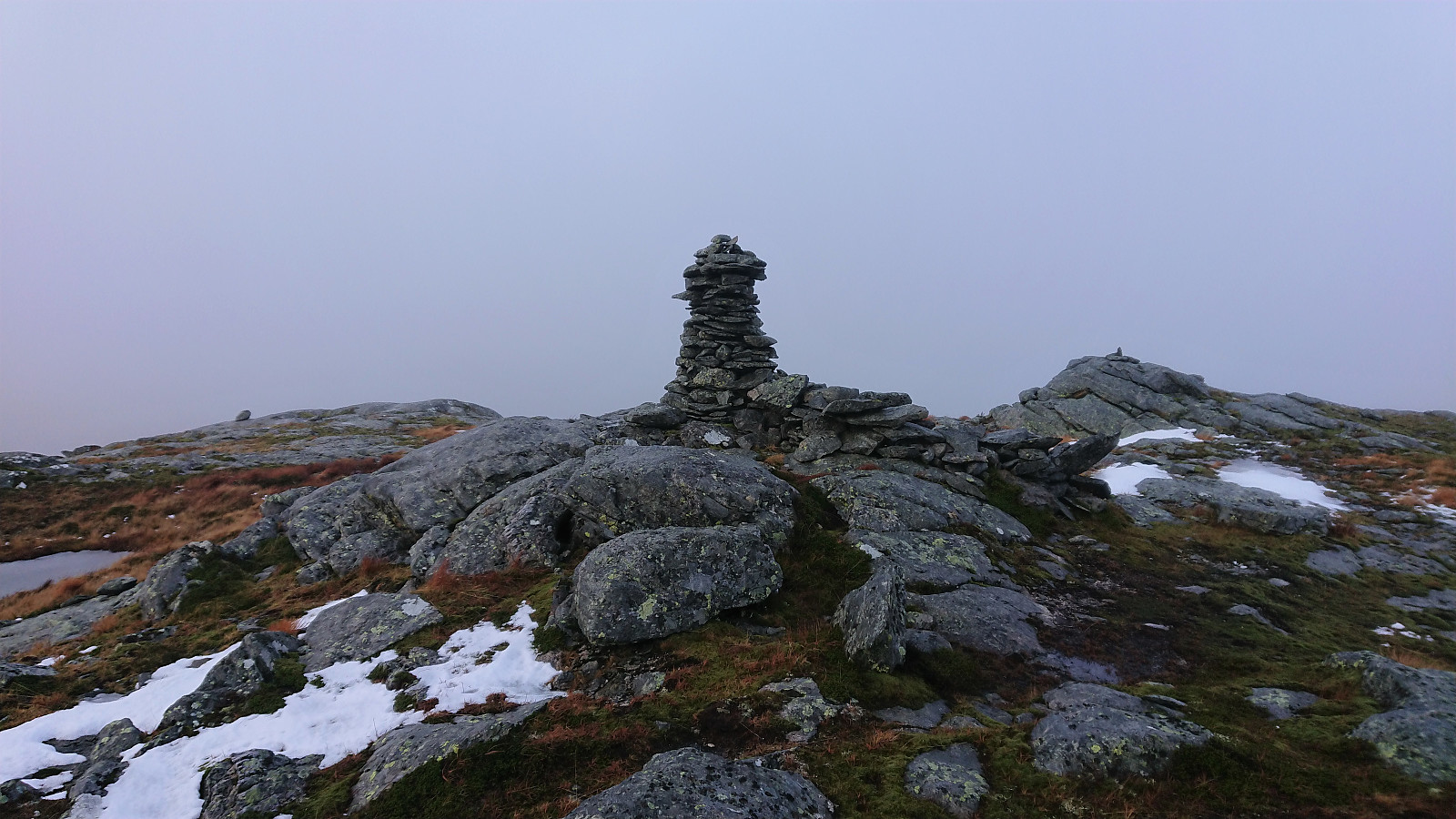
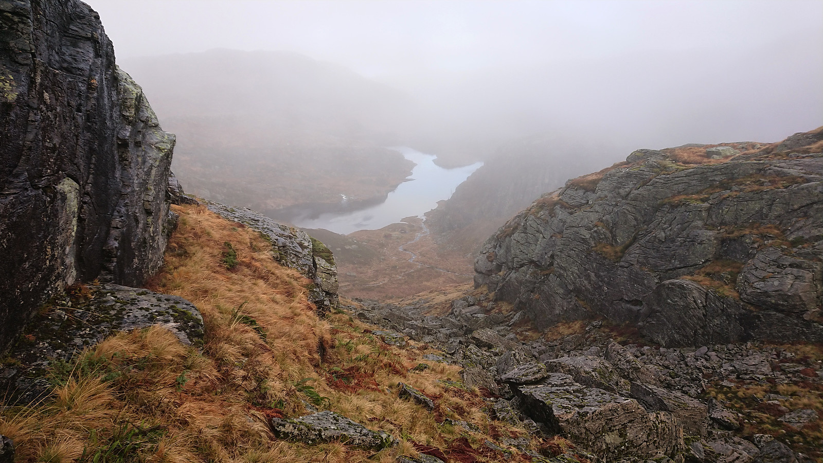
With the boat secured at the bank of the lake, we were finally ready to head off-trail towards Skarpefjellet, which we shortly reached without any further difficulties. After visiting all of the almost-equal height small hills at the summit area, we concluded that we should still have time for a visit of Torhaugen and soon continued off-trail in that direction. First by descending into the valley between Skarpefjellet and Torhaugen, before following a pretty straight route towards the summit, with the only challenge being a couple of slippery sections consisting of wet rocky surfaces.
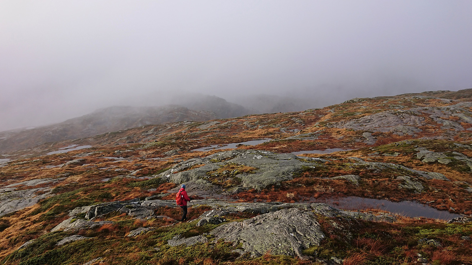
The summit of Torhaugen probably provides great views, however we cannot really comment on this as they were all hidden by the dense fog. We therefore did not stay long before starting our descent. After a shortcut to get into the valley south of Haugsdalsvatnet, we continued up the small valley east of the 617 hill, and after a bit of light scrambling headed east before taking yet another shortcut down to the small lake east of Haugsdalsvatnet. Here there were some steep areas to avoid, but other than that the descent was straightforward.
Upon returning the boat to its original location on the other side of the lake, we had a short break before continuing our descent along the same route as for the ascent, making sure to be extra careful due to all of the wet and slippery surfaces. All that remained was then a second river crossing at the end of the river, this time without me going for a swim, and the final short walk back to the car.
In summary, a slightly wetter hike than expected due to the two river crossings, but overall a very enjoyable hike. One should not have too high expectations with regards to trail quality though. The highlight of the trip was the unexpected short boat trip. However this part is most likely not needed if done during less wet periods of the year. Note also that Torhaugen is much more easily accessible from the west if our route is not to your liking.
| Starttidspunkt | 07.11.2021 08:57 (UTC+01:00) |
| Sluttidspunkt | 07.11.2021 15:02 (UTC+01:00) |
| Totaltid | 6t 04min |
| Bevegelsestid | 5t 24min |
| Pausetid | 0t 40min |
| Snittfart totalt | 2,0km/t |
| Snittfart bevegelsestid | 2,3km/t |
| Distanse | 12,4km |
| Høydemeter | 1157m |

Kommentarer
PF Blåfjellet
Skrevet av Runemb 08.11.2021 20:52Har sjekket kartet og er enig med dere. PF er under 100 m. Jeg retter PB til 99 m.
Re: PF Blåfjellet
Skrevet av hbar 08.11.2021 21:23Takk! Rett skal jo være rett. :)
Det gjelder å ikke gi opp!
Skrevet av knutsverre 08.11.2021 09:52Godt gjort av dere å gjennomføre denne turen under slike forhold! Kreativ løsning for å unngå å gå rundt Haugsdalsvatnet!
Re: Det gjelder å ikke gi opp
Skrevet av hbar 08.11.2021 11:39Takk! Ja, det er viktig med litt kreativitet om man skal komme seg helt på toppen når forholdene ikke var på vår side. :)