Melandsnipo and Krossfjellet (17.10.2020)

| Start point | Meland (101m) |
|---|---|
| Endpoint | Flatøy terminal (11m) |
| Characteristic | Hillwalk |
| Duration | 2h 30min |
| Distance | 8.5km |
| Vertical meters | 381m |
| GPS |
|
| Ascents | Melandsnipo (239m) | 17.10.2020 |
|---|---|---|
| Moldekleivfjell (287m) | 17.10.2020 | |
| Visits of other PBEs | Nordnipa (238m) | 17.10.2020 |
Melandsnipo and Krossfjellet
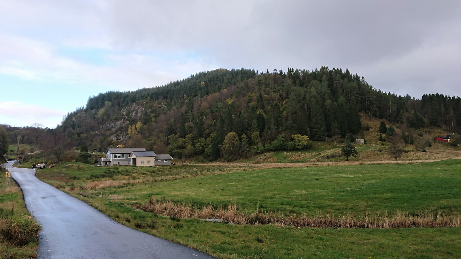
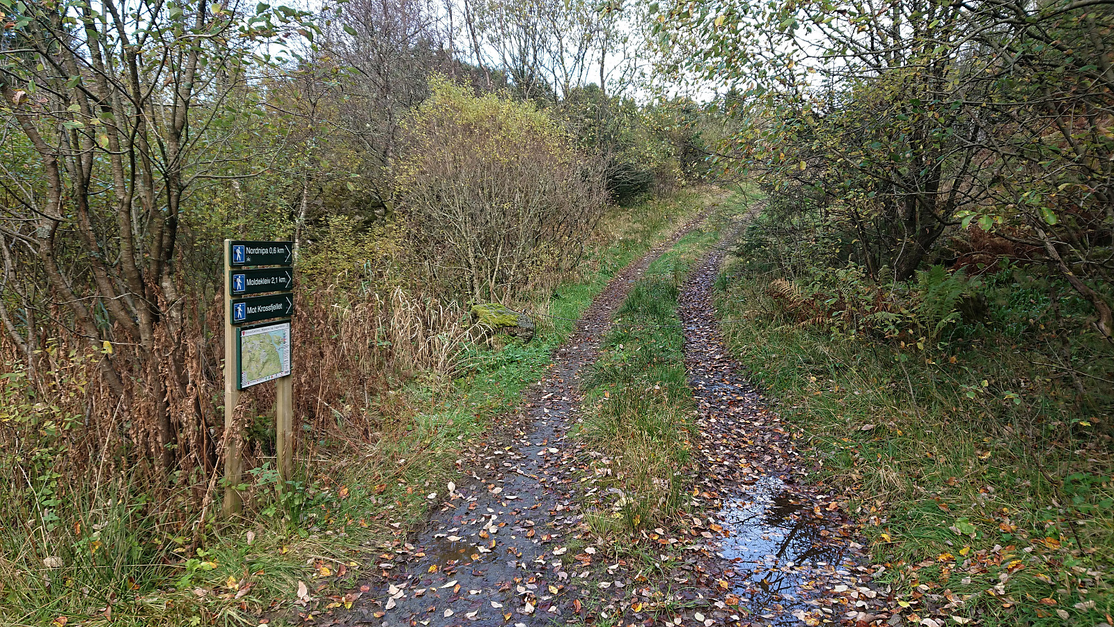
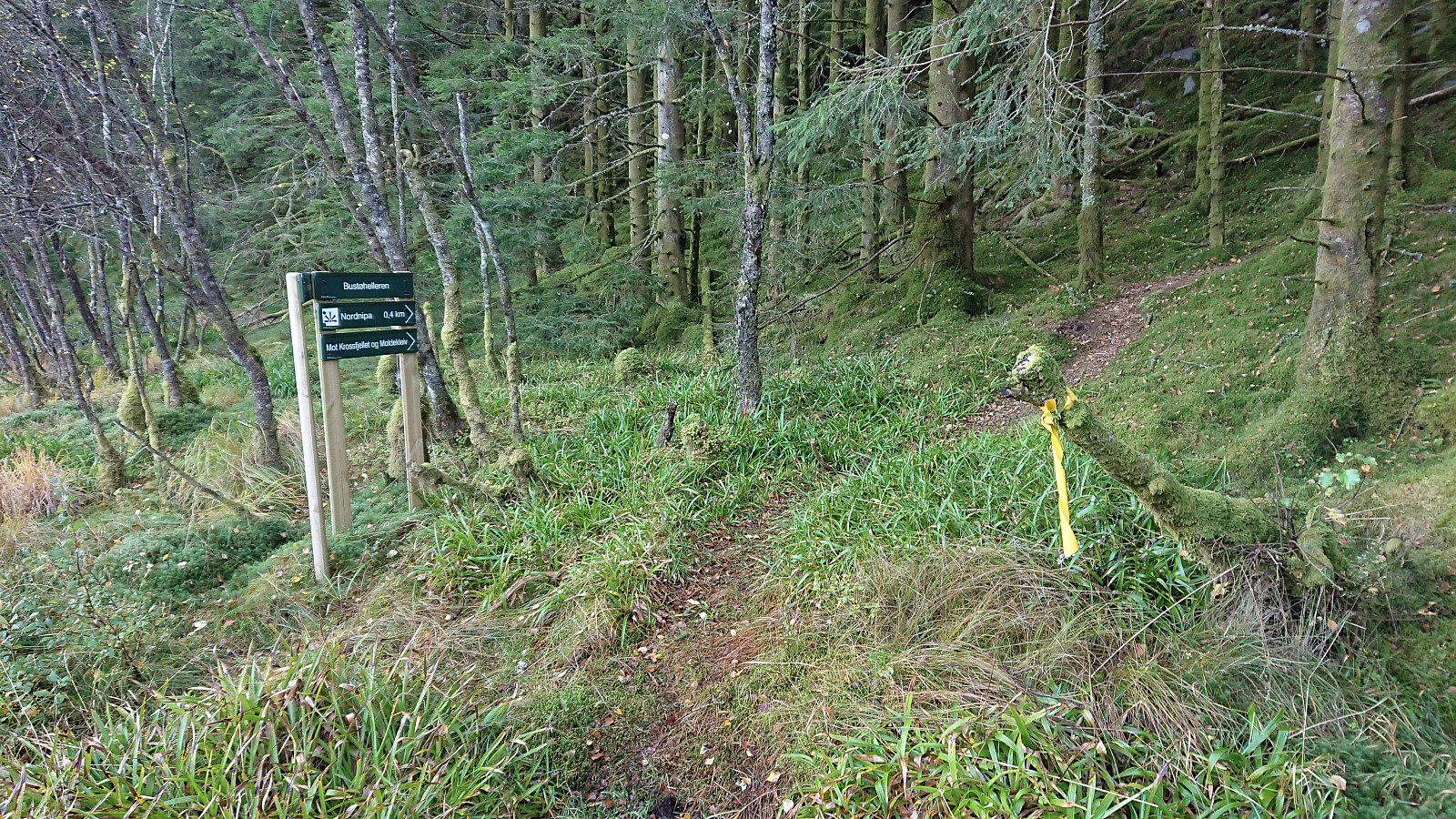

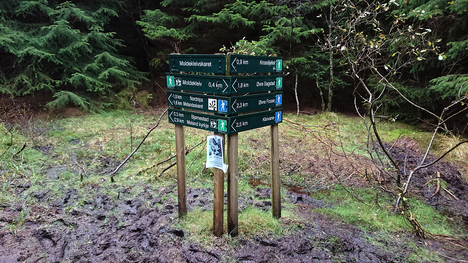
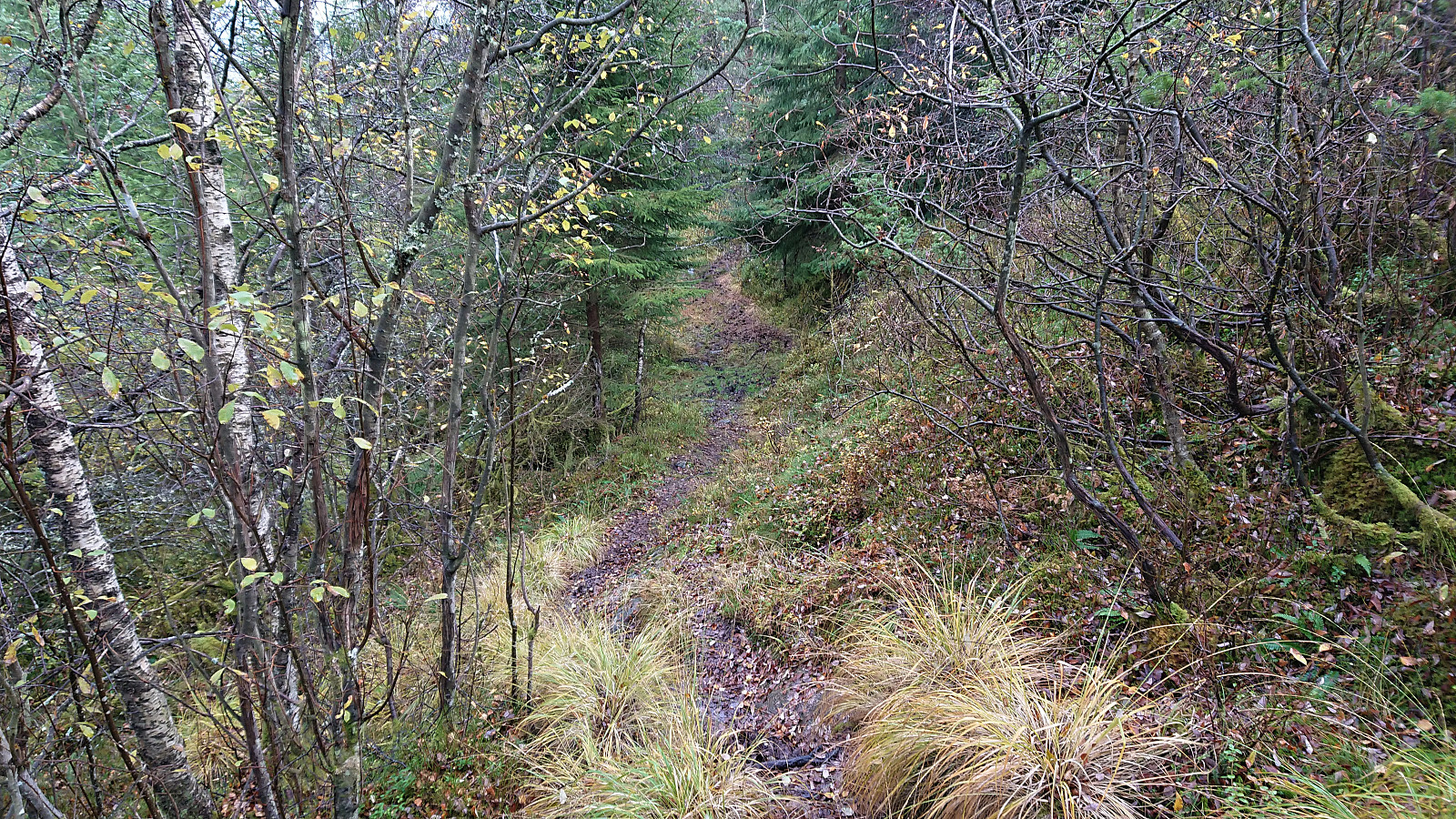
I started by taking the bus (or rather buses, four in total, the last three with scheduled connections) to Meland (bus stop "Meland sør") and from there following the road to the marked trailhead west of Nordnipa that I had discovered on my recent cycling trip to the area. The trail/road started out rather wet, but this improved when the trail started climbing towards the summit.
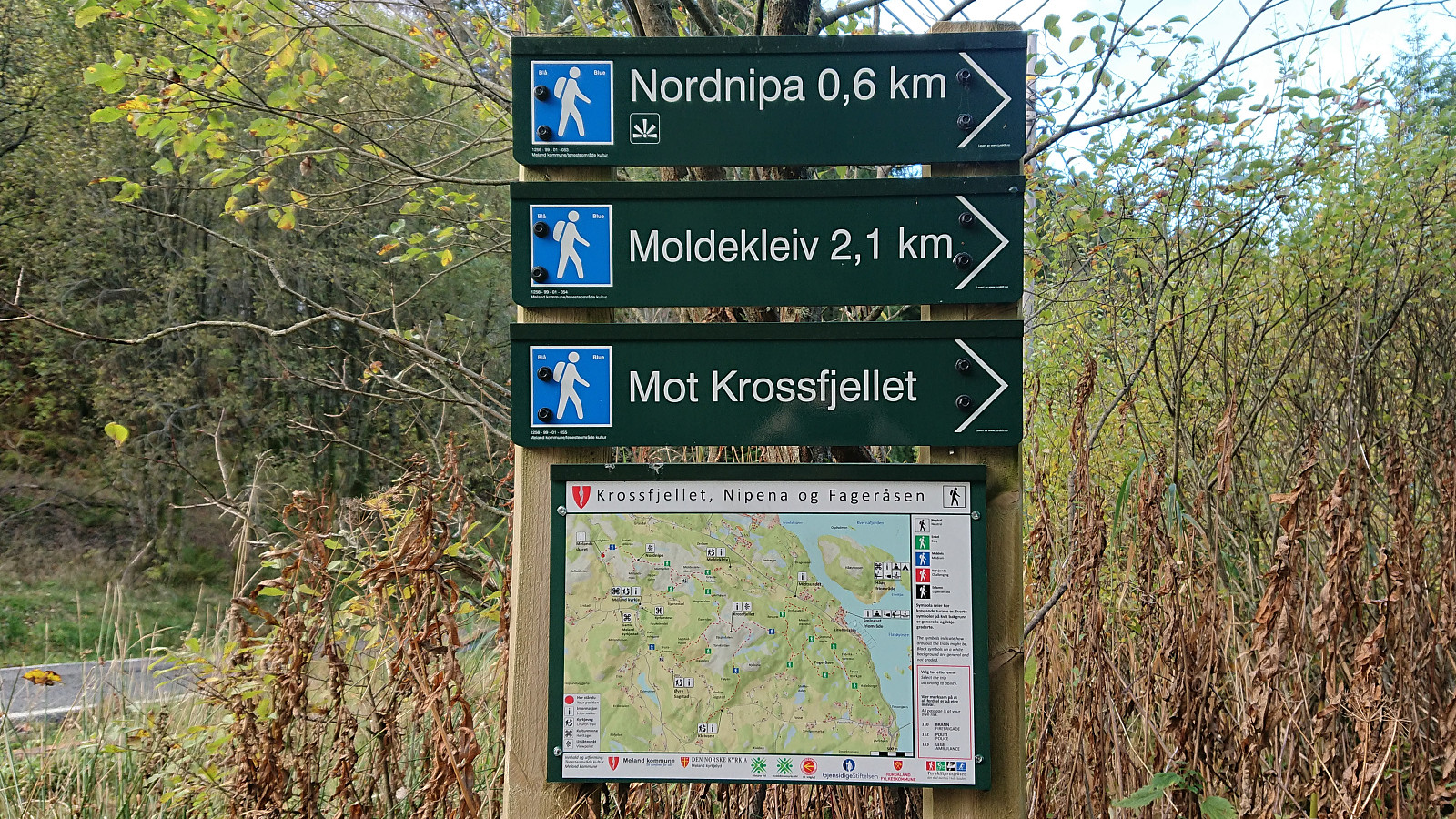
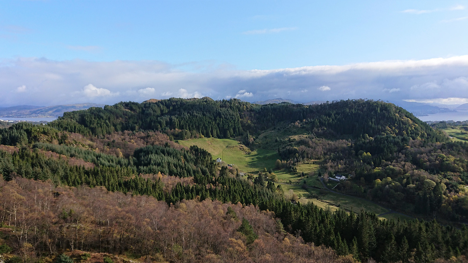
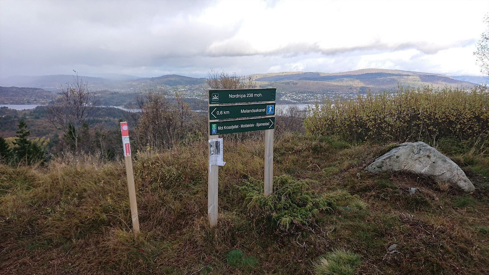
At the summit area there were at least three distinct summits and it was difficult to confidently identify the highest point. It was however clear that the two southern summits, jointly referred to as Sørnipa on the map, are slightly higher than the northern one, referred to as Nordnipa on the map. The information sign at the trailhead refers to Sørnipa as Melandsnipo, but which of the two southern summits it refers to is unclear.
I later checked with hoydedata.no, which indicated that the northern of the two southern summits contained the highest point. I have therefore moved the PB-element to this point, and in the process also updated the primary factor and changed the name to Melandsnipo (given that this is the one used on the information sign). Nordnipa has instead been re-added as a view point at the location of the Nordnipa sign.
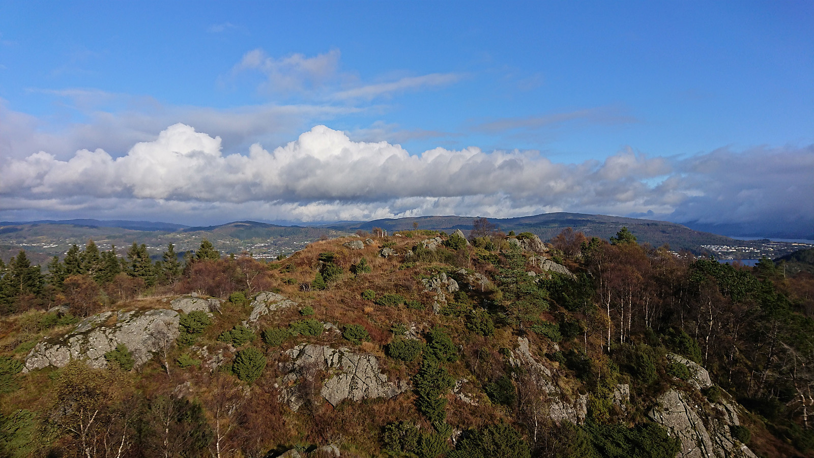
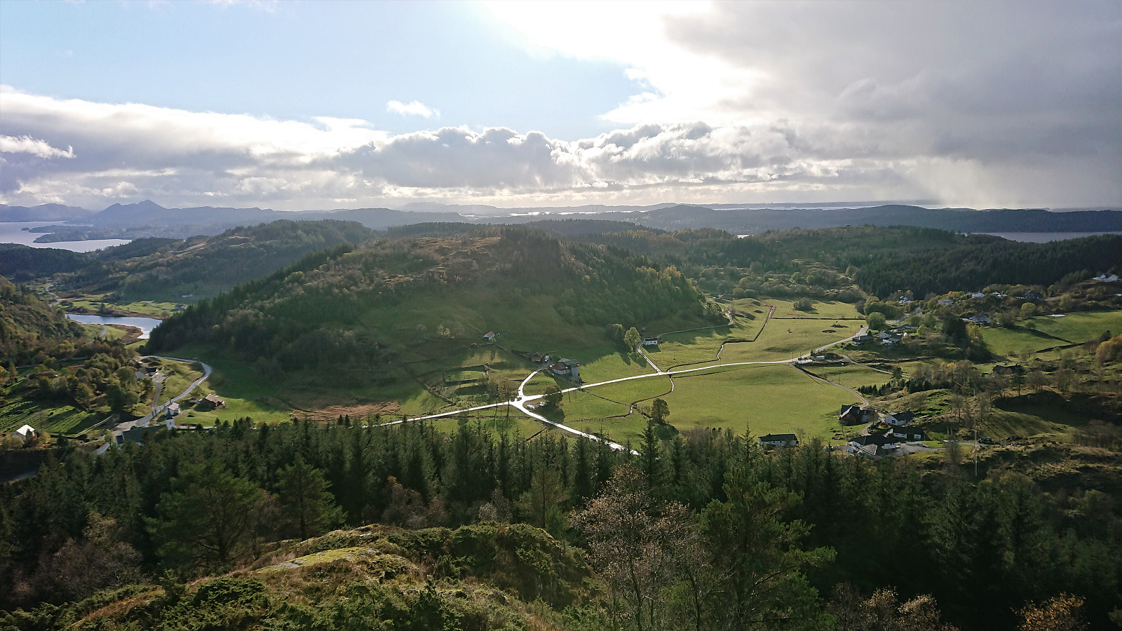
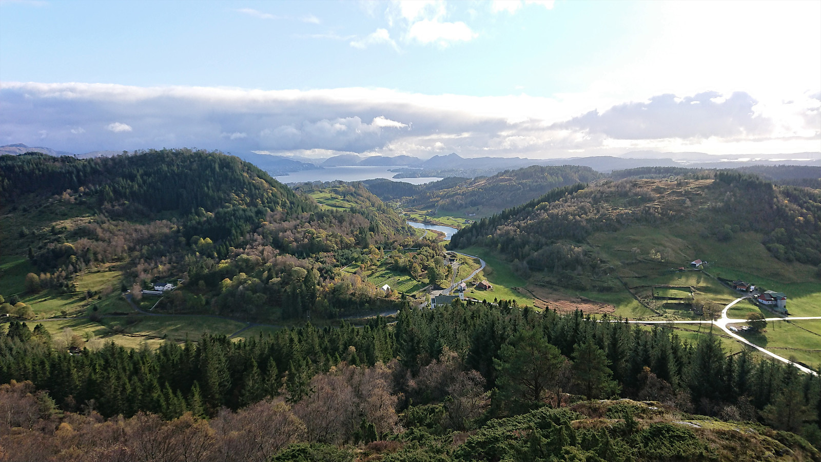
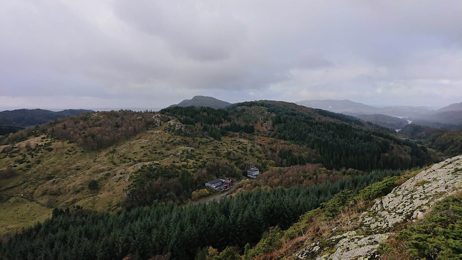
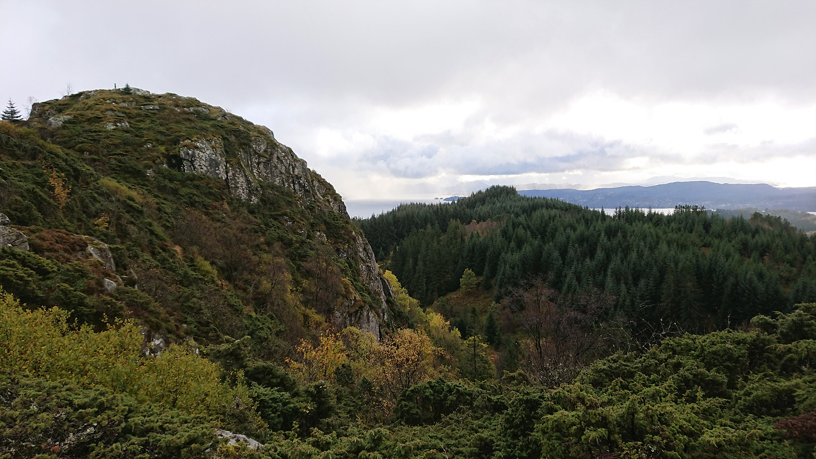
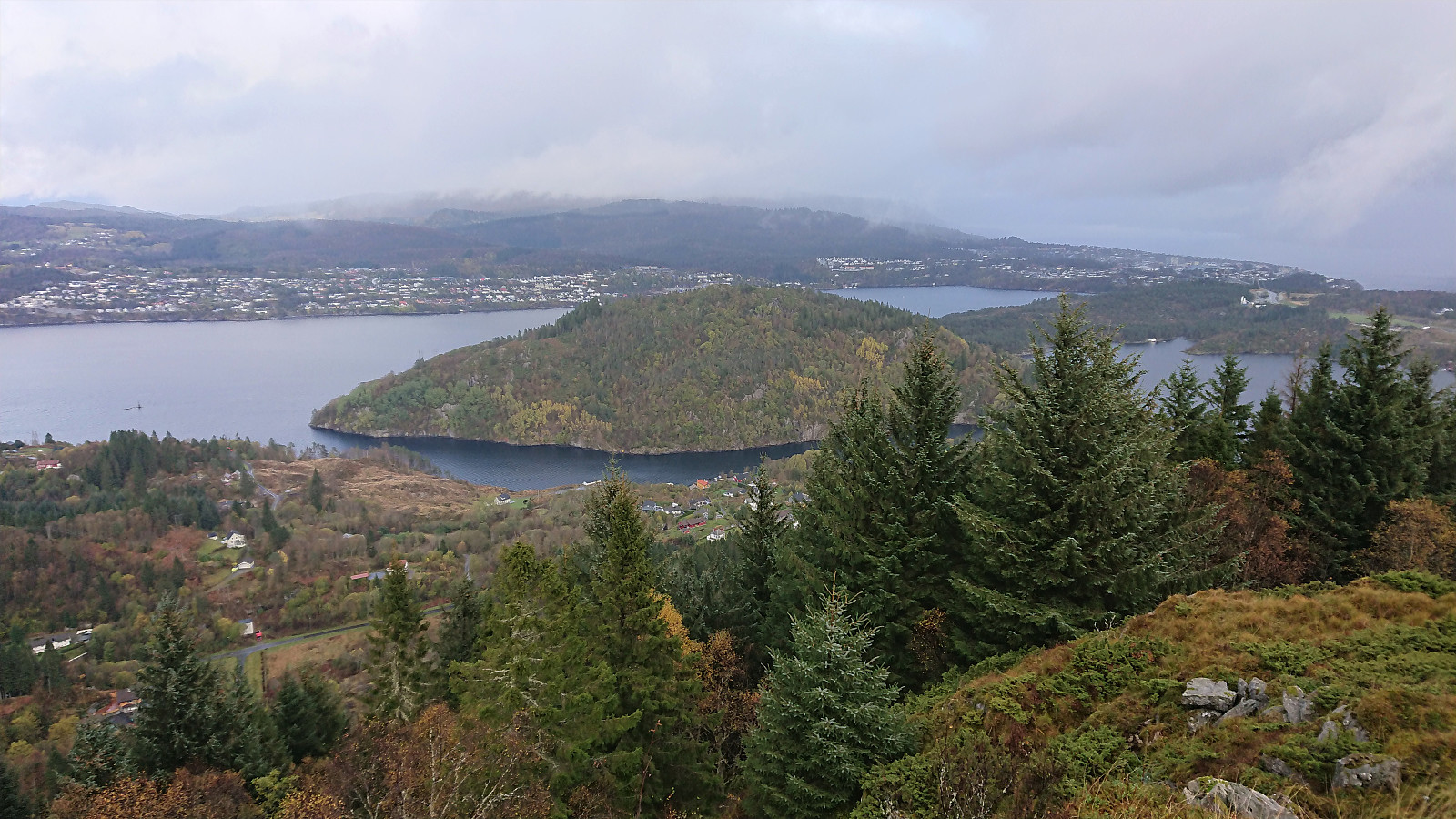
Interestingly, the best views were not obtained from neither Melandsnipo nor Nordnipa (or at least not from the PB-elements with those names), but rather from the slightly lower hill south of Melandsnipo, which can easily be reached via a weaker trail and is definitely worth the extra meters.
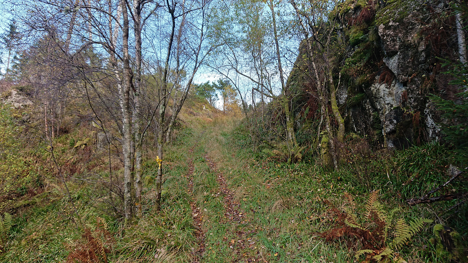
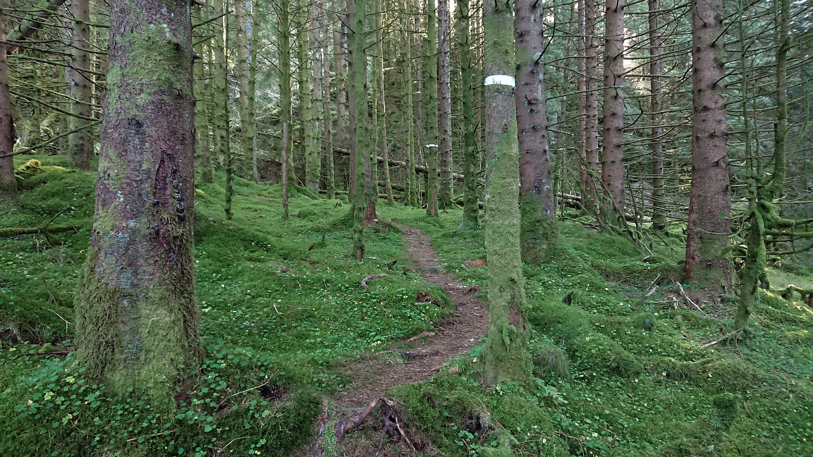
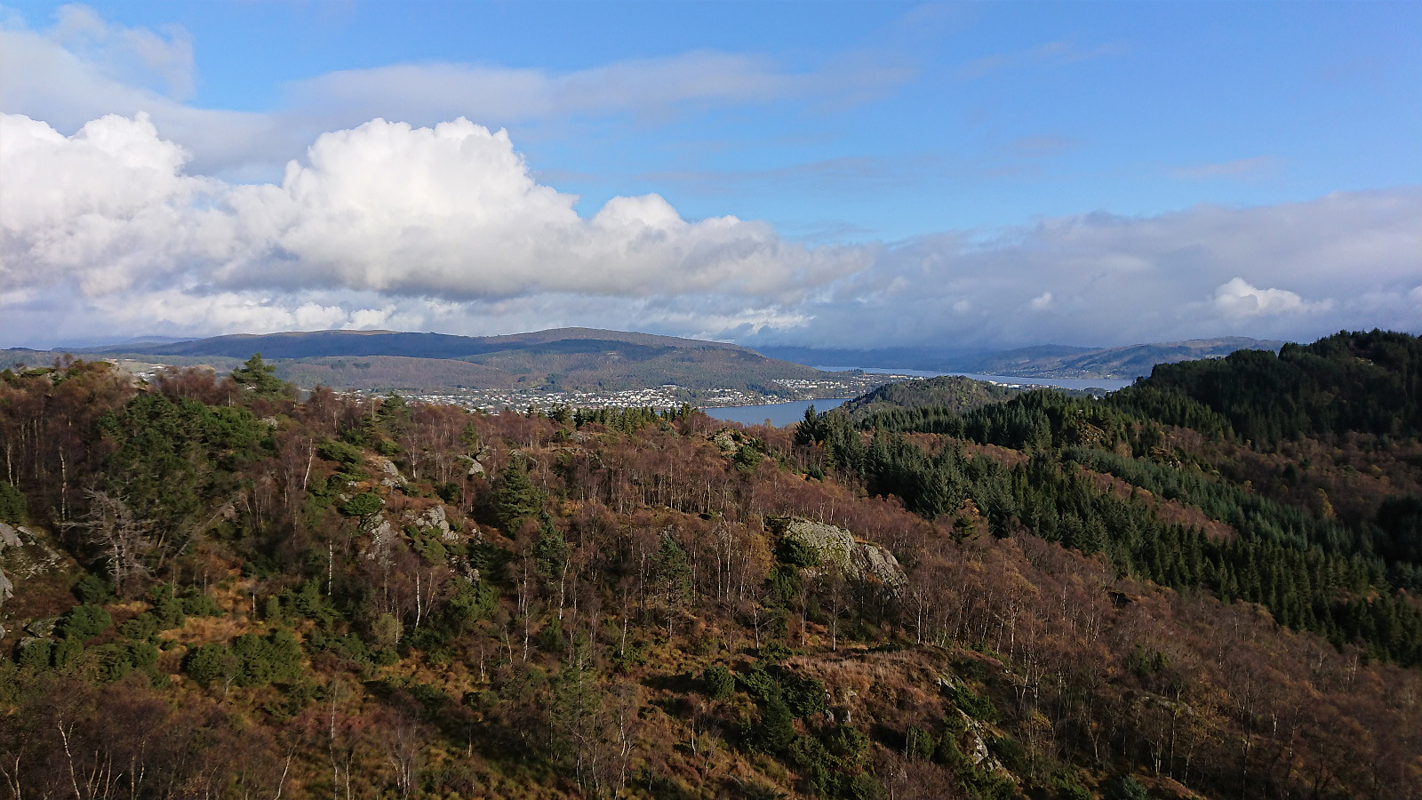
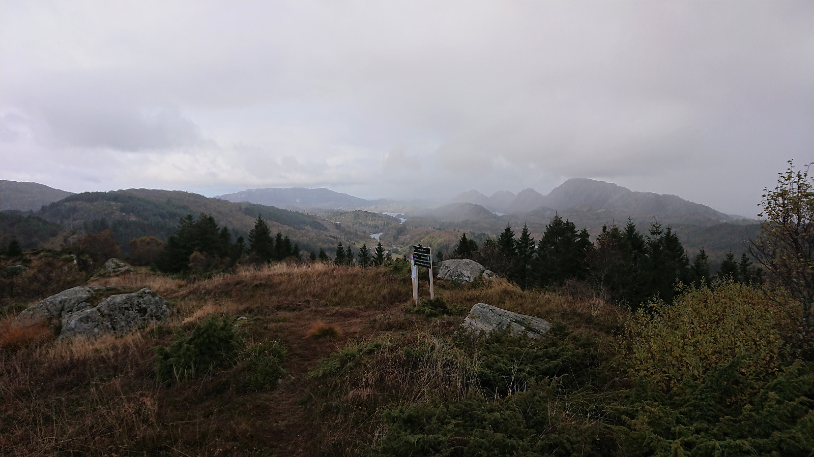
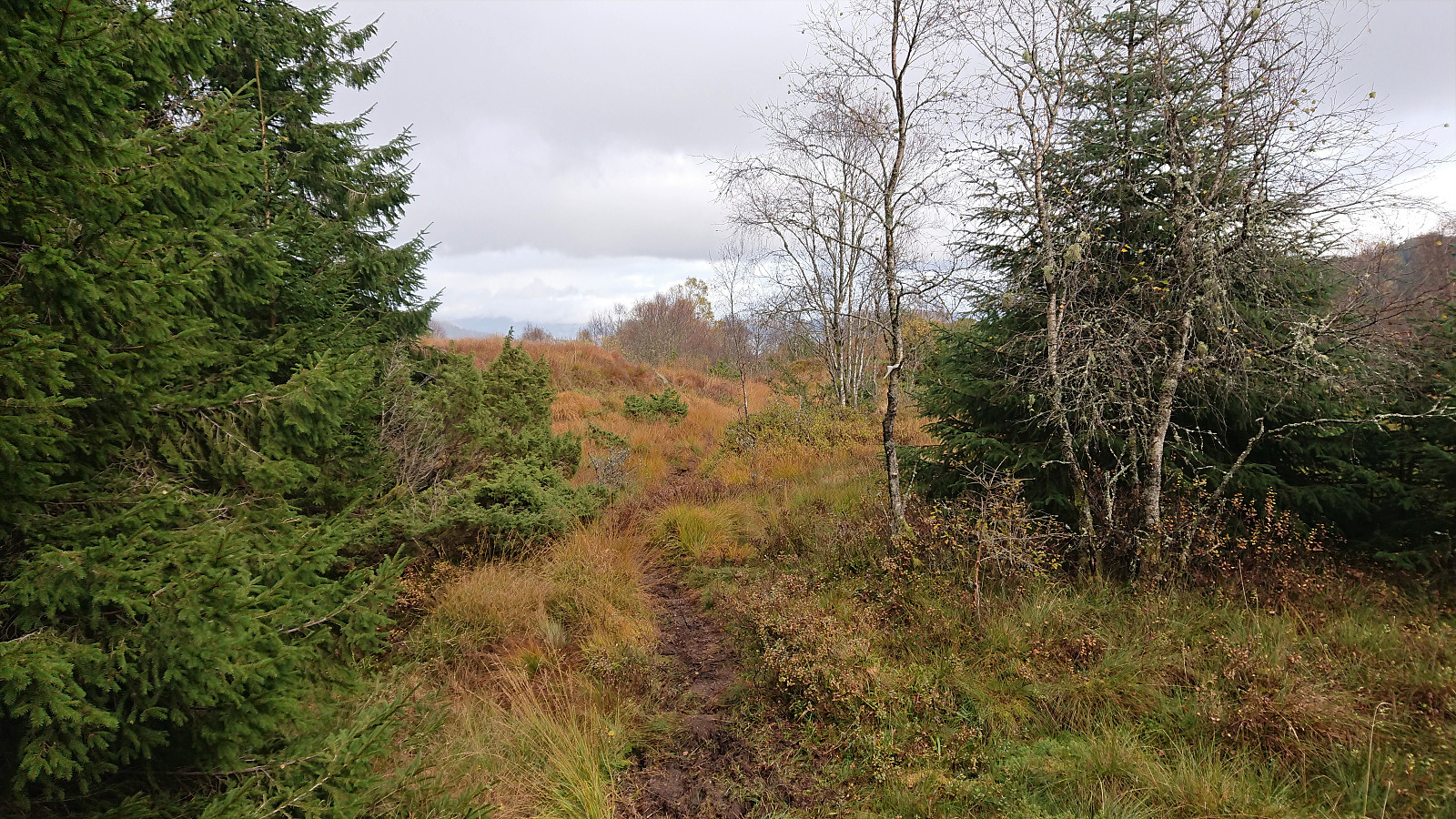
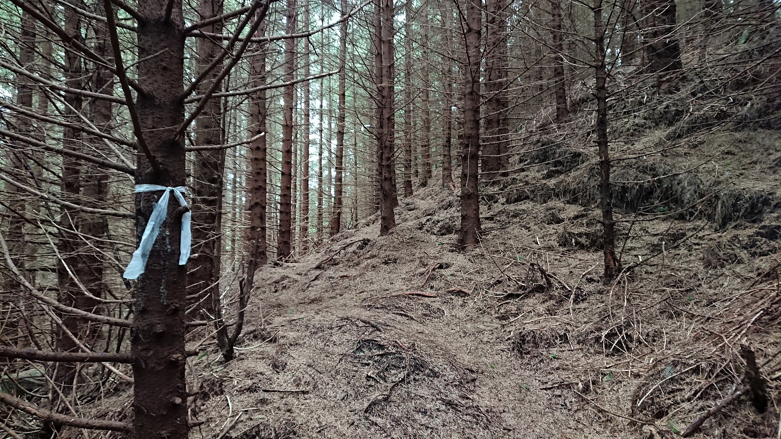
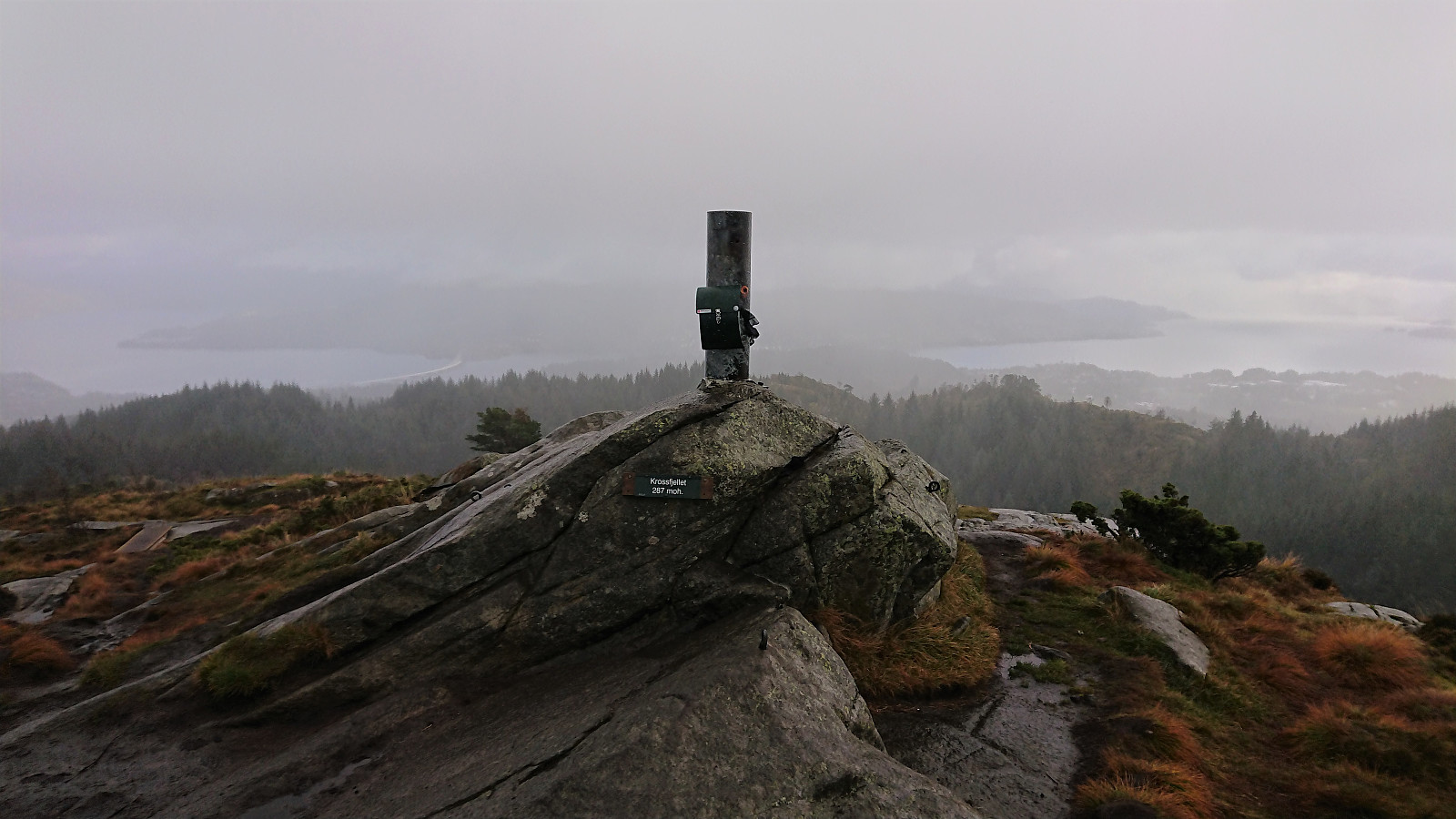
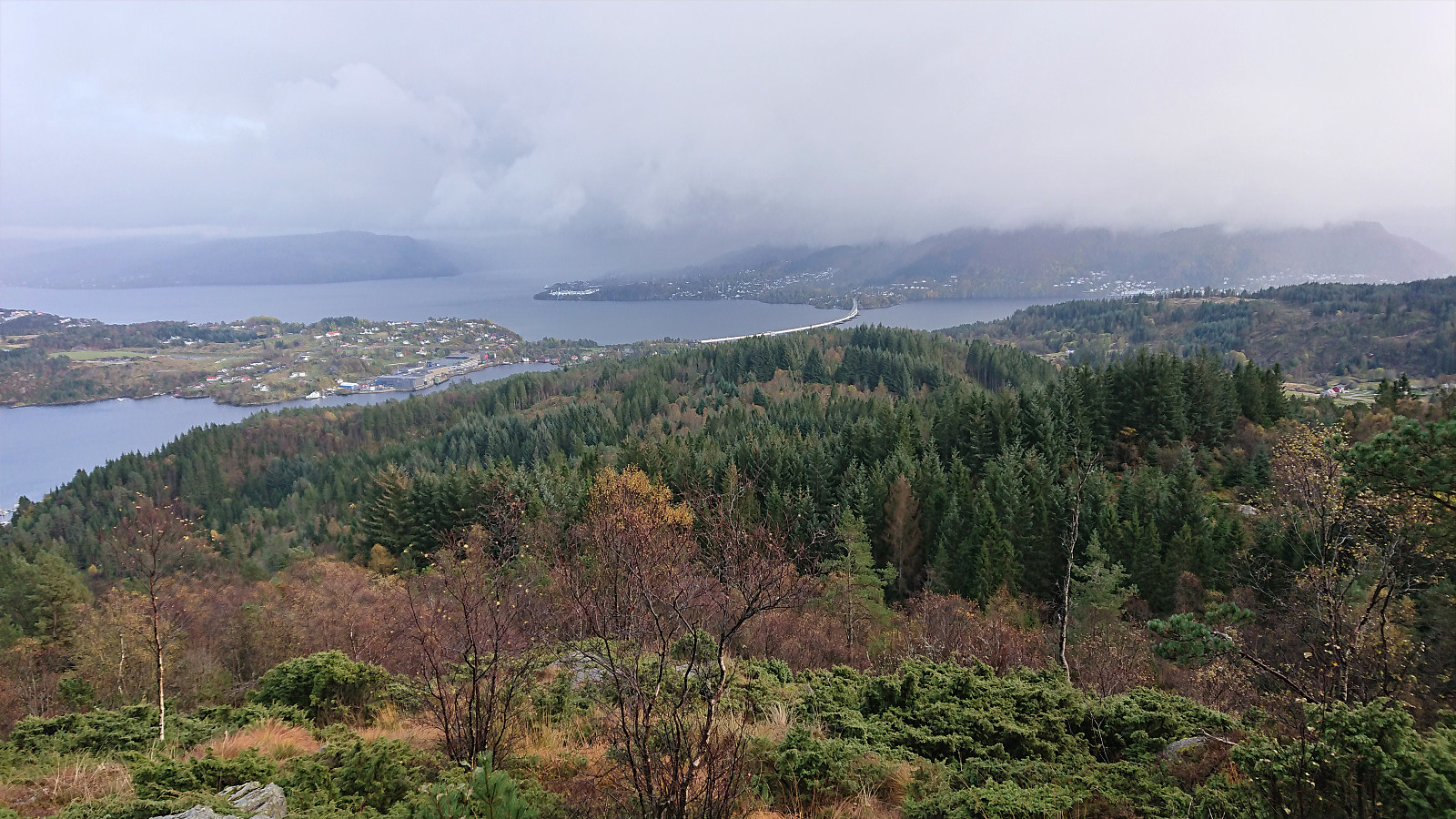
After also visiting Nordnipa, I continued along the marked trail to Krossfjellet. The trail was generally easy to follow and the white plastic ribbons came in handy when passing through the dense forest. The summit of Krossfjellet was thus reached without any difficulties. My lunch plans at the summit had to be discarded though due to increasing winds and rain showers, and I instead quickly continued east along a weaker trail.
My plan was to follow the trail over Fageråsen, but I failed to find the trail heading in that direction. The fact that the trail disappeared when zooming on the map was also not a good sign. After wasting some time searching for the trail towards Fageråsen, I gave up and headed for Dalen and the road to Fosse instead, which I proceeded to follow back to the main road and onwards to Flatøy terminal for the bus back home.
To conclude, while not exactly the hike I had planned, it was still enjoyable and with interesting new views along the way, although the trail quality often left a lot to be desired. The highlight was clearly the views from Melandsnipo, of which a visit can be highly recommended.
For more information about the recent trail markings in the area, please see https://kirken.no/nn-NO/fellesrad/alver-fellesr%C3%A5d/kyrkjelydar/meland/nyhetsarkiv2/skilting-nordnipa.
| Start date | 17.10.2020 14:01 (UTC+01:00 DST) |
| End date | 17.10.2020 16:32 (UTC+01:00 DST) |
| Total Time | 2h 30min |
| Moving Time | 2h 21min |
| Stopped Time | 0h 9min |
| Overall Average | 3.4km/h |
| Moving Average | 3.6km/h |
| Distance | 8.5km |
| Vertical meters | 381m |

User comments