Burdalsfjellet and Botlenipa (11.12.2016)

| Startsted | Knarrevik (45moh) |
|---|---|
| Sluttsted | Knarrevik (43moh) |
| Turtype | Fjelltur |
| Turlengde | 2t 16min |
| Distanse | 6,8km |
| Høydemeter | 292m |
| GPS |
|
| Bestigninger | Botlanipene SØ (123moh) | 11.12.2016 |
|---|---|---|
| Botlenipa (124moh) | 11.12.2016 | |
| Burdalsfjellet (102moh) | 11.12.2016 | |
| Andre besøkte PBE'er | Botlanipene p-lomme (112moh) | 11.12.2016 |
Burdalsfjellet and Botlenipa
Started by taking the bus to Knarrevik and trying to locate the trail on the north side of Rv. 555 for the start of the hike. However, this turned out to be more difficult than expected, as I quickly found myself on the wrong side of a busy road with no zebra crossings to be found. I therefore ended up walking along the road towards Sotra, but in the end I gave up looking for a crossing and managed to find a short break in the traffic and finally managed to safely reach the other side of the road.
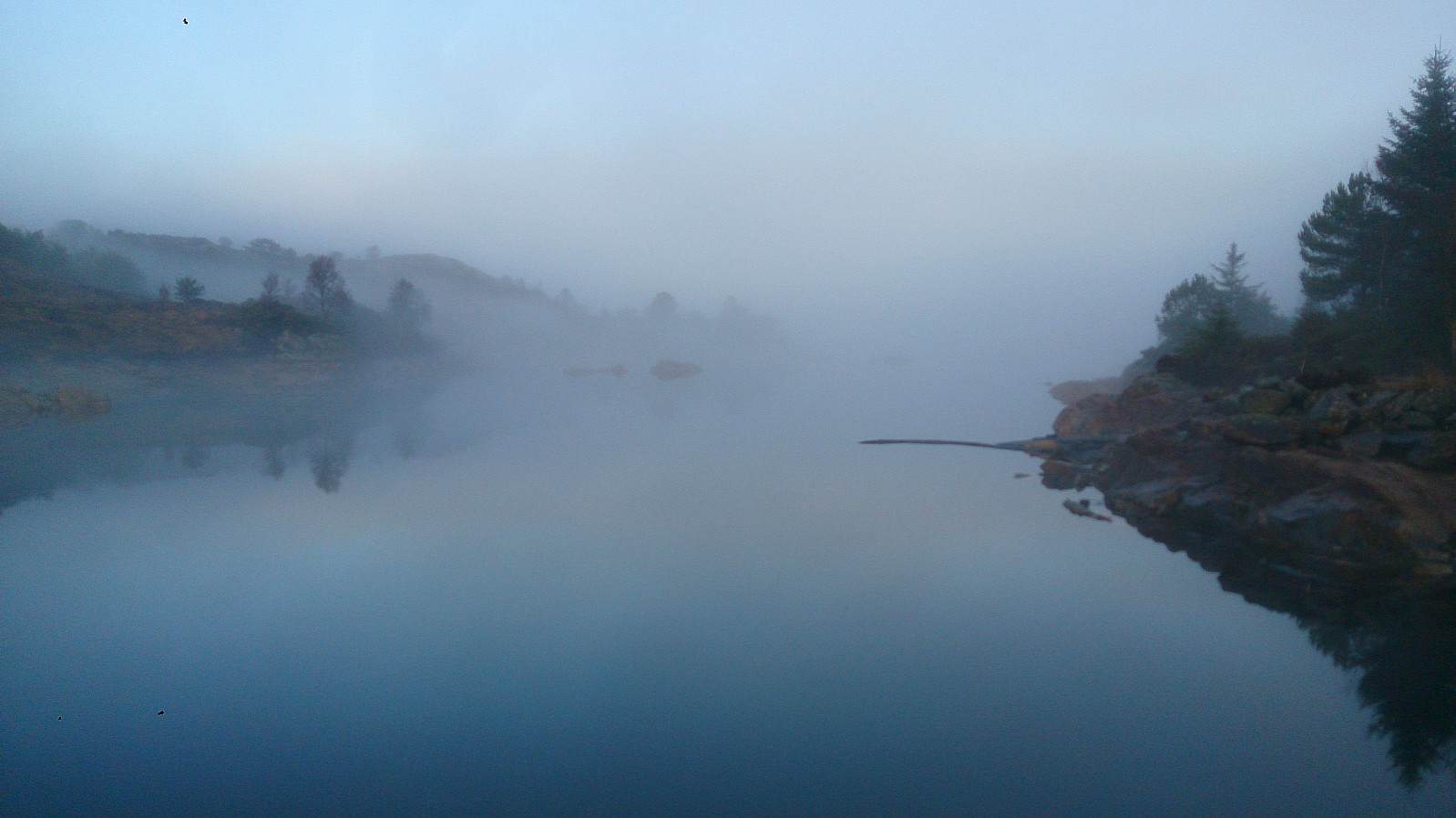
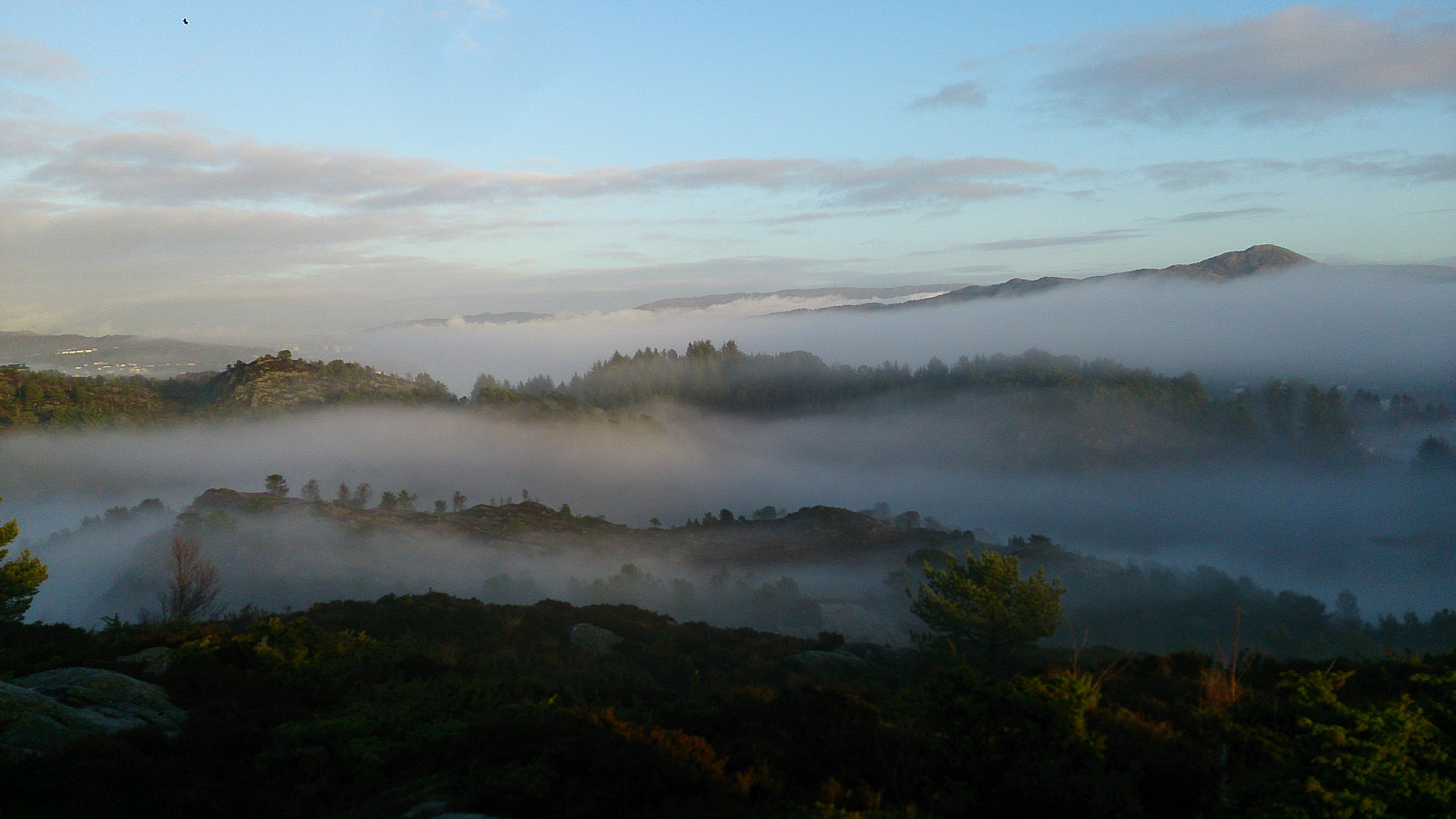
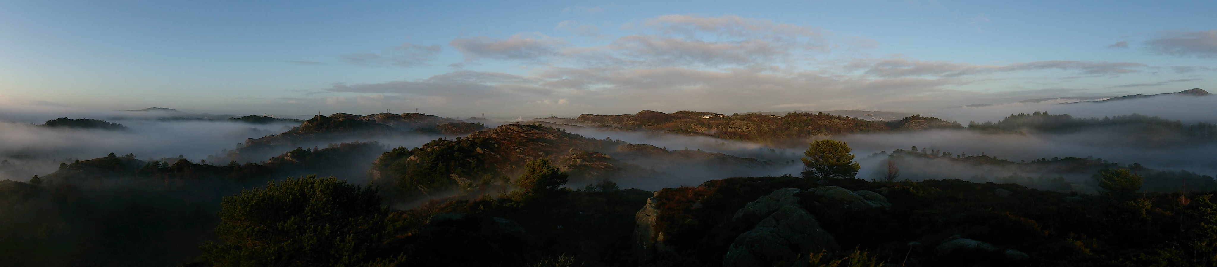
Next, I located a trail taking me to Storavatnet and then onwards to Burdalsfjellet. Even in quite dense fog, the trail was easy to follow and I quickly arrived at the summit for some nice atmospheric pictures. I continued along the trail towards the small piece of land connecting the two lakes of Storavatnet and Magnusvatnet. My short detour towards the small 97.2 m hill made me lose the trail though, and the following "shortcut" back to the trail turned out to be even wetter than the already wet and muddy trail itself. The area is also a lot more hilly than expected, and hence taking shortcuts is not straightforward.
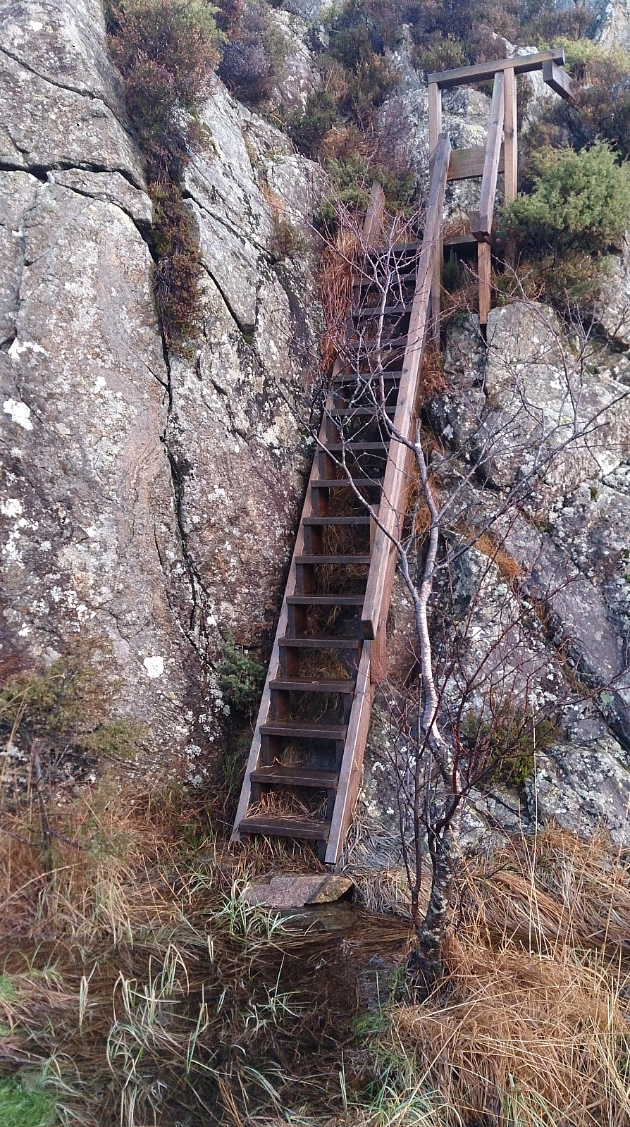
At the connection between the two lakes there was a wooden staircase that enabled me to easily ascend a quite steep area (see picture). From the top of the stairs I continued in the northeastern direction along the trail, until hitting a crossroads where I took left towards the Lyklavatnet. Getting down to the actual lake was more complicated than expected though, as the last part involved a bit of climbing. Nothing too difficult, but an unexpected obstacle when following a marked trail in otherwise simple terrain. Given the slippery conditions I first decided to look for alternative routes, but quickly concluded that the alternatives were either more difficult or required long detours.
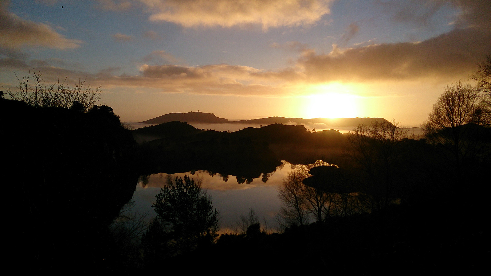
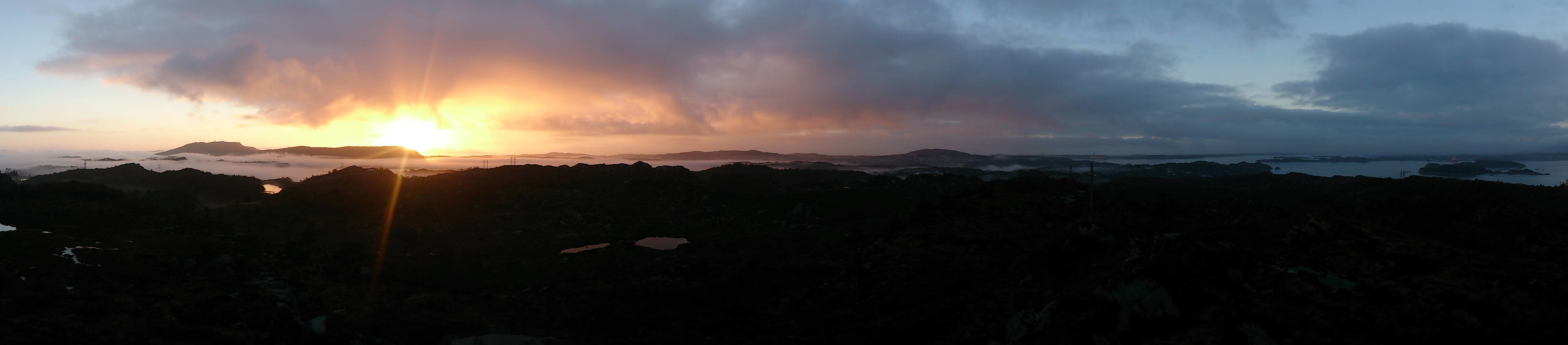
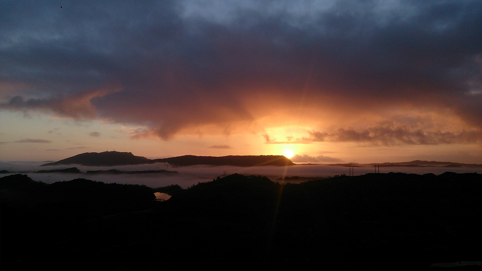
After the short climb, the trail connected to a gravel road heading northeast, and I followed this for about 200 meters, while looking for a trail towards Botlenipa. But though a trail was indicated on the map (except for the starting point...), I failed to locate a proper trail and again ended up on a rather wet hike through the terrain to reach the end of Høgafjellsvegen. Here, I again failed to locate the trail towards to the summit, but as it was only a matter of around 100 meters I simply took the shortest route, reaching the summit of Botlenipa just in time for the sunset.
Leaving Botlenipa, I managed to locate the trail back to Høgafjellsvegen that I had missed going the other way (see GPS track for details). The hike was concluded by following Høgafjellsvegen and later Hjelteryggvegen back to the Sotra bridge for the bus back to the city. Overall a nice (though very wet) hike, with a couple of unexpected challenges along the way and some very nice views, including both dense fog and a beautiful sunset.
| Starttidspunkt | 11.12.2016 13:31 (UTC+01:00) |
| Sluttidspunkt | 11.12.2016 15:47 (UTC+01:00) |
| Totaltid | 2t 16min |
| Bevegelsestid | 2t 03min |
| Pausetid | 0t 12min |
| Snittfart totalt | 3,0km/t |
| Snittfart bevegelsestid | 3,3km/t |
| Distanse | 6,8km |
| Høydemeter | 292m |

Kommentarer