Archiv - Nach Datum
Archiv - Nach Aktivität
-
Andere Tour (1)
- Expedition (1)
-
Andere Wintertour (10)
- Schneeschuhtour (10)
- Fahrradtour (2)
- Fußtour (228)
-
Klettern (8)
- Alpinklettern (7)
- Mixed-Klettern (1)
-
Skitour (49)
- Randonnée/Telemark (49)


Gesammelte Listen
-
Romsdal ≥ 100m pf.
(134/301)
 44%
44% -
Sunnmøre ≥ 100m pf.
(78/531)
14%
-
Norges 1000 største fjell målt i primærfaktor
(52/1000)
5%

Randonne-tur til Finnan og til Alnestinden
- Datum:
- 16.05.2026
- Tourcharakter:
- Randonnée/Telemark
- Tourlänge:
- 5:37h
- Entfernung:
- 10,9km
Randonnee-tur til Skarven i Isfjorden / ved Loftskaret
- Datum:
- 15.02.2025
- Tourcharakter:
- Randonnée/Telemark
- Tourlänge:
- 4:00h
- Entfernung:
- 9,9km
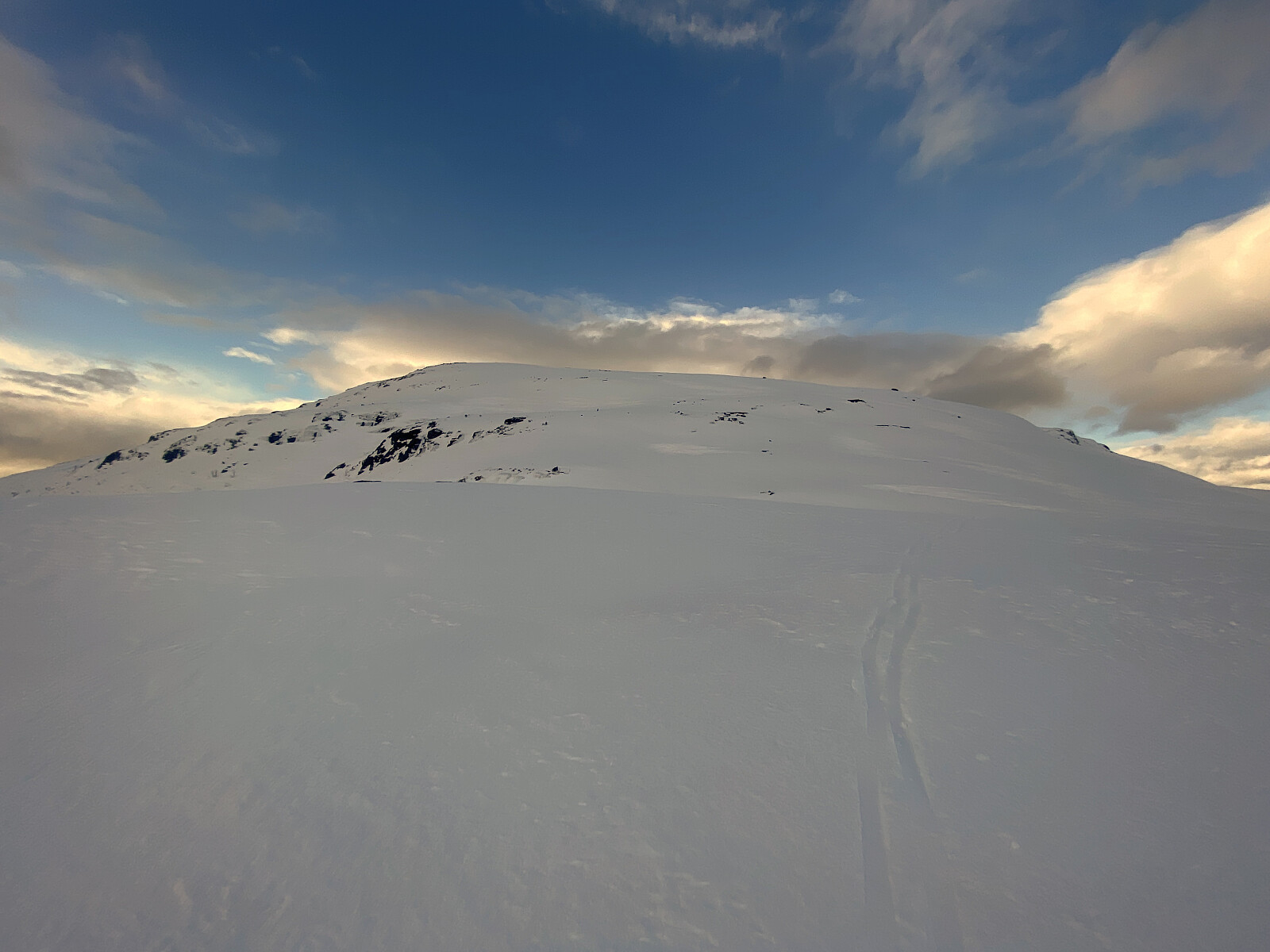
 Det hadde stort sett vært i minste laget med snø så langt denne vinteren, men jeg hadde fått med meg, via noen turgrupper på Facebook, at folk hadde gått diverse skiturer med parkeringsplassen på Hellerøra i Isfjorden som utgangspunkt. Så jeg tok med meg skiene, og kjørte dit inn, i håp om å kunne få meg en tur opp på Skarven i Isfjorden [1143 m.o.h.]. Det hadde helt sikkert vært mulig å komme seg like opp på Klauva [1512], eller i hvert fall Søre Klauva [1356 m.o.h.] også, men da måtte jeg ha startet en god del tidligere på dagen.
Første halvannen kilometer av turen går langs samme trasé som når man går via Steinberget opp på Kyrkjetaket; dvs. man følger seterveien mot Kavlisetra om lag 1/2 kilometer, før man tar av mot venstre, i retning Loftskaret (se kartet). >>>
Det hadde stort sett vært i minste laget med snø så langt denne vinteren, men jeg hadde fått med meg, via noen turgrupper på Facebook, at folk hadde gått diverse skiturer med parkeringsplassen på Hellerøra i Isfjorden som utgangspunkt. Så jeg tok med meg skiene, og kjørte dit inn, i håp om å kunne få meg en tur opp på Skarven i Isfjorden [1143 m.o.h.]. Det hadde helt sikkert vært mulig å komme seg like opp på Klauva [1512], eller i hvert fall Søre Klauva [1356 m.o.h.] også, men da måtte jeg ha startet en god del tidligere på dagen.
Første halvannen kilometer av turen går langs samme trasé som når man går via Steinberget opp på Kyrkjetaket; dvs. man følger seterveien mot Kavlisetra om lag 1/2 kilometer, før man tar av mot venstre, i retning Loftskaret (se kartet). >>>
Randonnee-tur til Husnebba
- Datum:
- 11.01.2025
- Tourcharakter:
- Randonnée/Telemark
- Tourlänge:
- 3:20h
- Entfernung:
- 15,3km
 Jeg var seint ute denne dagen, og hadde ikke tid til noen lang tur. Turen opp til Husnebba [808 m.o.h.], kunne imidlertid umulig være så skrekkelig lang, og den manglet jeg jo på lista mi over Romsdalstopper med PF > 100 meter. Og ganske riktig, dette viste seg å være en nokså kort tur; faktisk brukte jeg lengre tid med bil hjemmefra og inn til Innfjorden, enn det jeg brukte fra Hellerøra og opp på Husnebba. Jeg kjørte forbi Romsdal Lodge, og opp til parkeringsplassen på Hellerøra. Der traff jeg et par langrennsløpere som jeg sa hei til i det jeg steg ut av bilen. Jeg spente på meg rando-støvlene, og løftet skiene ut av bilen, og så bar det avsted. Det er mye av vinteren (så sant det er nok snø, formodentlig), tråkket langrennsspor opp fra Hellerøra til Kavlisetra. Dette >>>
Randonne-tur til Nonstinden i Rauma
- Datum:
- 06.04.2024
- Tourcharakter:
- Randonnée/Telemark
- Tourlänge:
- 3:14h
- Entfernung:
- 8,7km
 Snøen hadde minket på en hel del den siste tiden, så man måtte litt opp i høyden for å finne gode skiforhold. Bøstølen ligger imidlertid ca. 420 m.o.h., og Nedre Røsta Parkeringsplass ligger 440 m.o.h. Da min eldste sønn tok turen opp på Nonstinden i begynnelsen av Mars, var ikke veien brøytet helt inn til Bøstølen, og han måtte parkere nede ved Herdslan Parkeringsplass [355 m.o.h.] og gå derfra; hvilket gjør turen 3,5 km lengre i hver retning, dvs. 7 km lengre tur retur. Jeg var derfor litt spent på om veien inn til Bøstølen nå var åpen, og hadde mentalt egentlig forberedt meg på eventuelt å måtte gå helt nede fra Herdslan jeg også. Veien var imidlertid åpen, men telehivet hadde sluppet taket, så veibanen var som gelé å kjøre på, og jeg måtte holde tunga beint >>>
Til Tarløysa med mine to døtre
- Datum:
- 30.03.2024
- Tourcharakter:
- Randonnée/Telemark
- Tourlänge:
- 5:07h
- Entfernung:
- 7,3km
 Jeg hadde begge døtrene på besøk denne helga, og dermed ble vi enige om å legge ut på en topptur sammen. Vi forsøkte å velge ut en topp som ikke skulle være for høy og strabasiøs, og så falt valget på Tarløysa, for der kan man jo vanligvis parkere på ca. 400 høydemeter, og dermed blir det ikke mer enn drøyt 600 høydemeter opp til toppen, selv om denne rager mer enn 1000 meter opp fra havnivået. Dette viste seg imidlertid å være en tabbe, for Tarløysa var mer avblåst, og der var mindre snø her, enn på mange andre fjell i nærheten. Hadde vi for eksempel kjørt opp i Skorgedalen, ville vi riktignok måttet parkere på bare 300 høydemeter, men der var mer snø der, så vi hadde nok spart en del krefter på å slippe å måtte av og på med skiene flere ganger.
Vi tok dessverre >>>
Jeg hadde begge døtrene på besøk denne helga, og dermed ble vi enige om å legge ut på en topptur sammen. Vi forsøkte å velge ut en topp som ikke skulle være for høy og strabasiøs, og så falt valget på Tarløysa, for der kan man jo vanligvis parkere på ca. 400 høydemeter, og dermed blir det ikke mer enn drøyt 600 høydemeter opp til toppen, selv om denne rager mer enn 1000 meter opp fra havnivået. Dette viste seg imidlertid å være en tabbe, for Tarløysa var mer avblåst, og der var mindre snø her, enn på mange andre fjell i nærheten. Hadde vi for eksempel kjørt opp i Skorgedalen, ville vi riktignok måttet parkere på bare 300 høydemeter, men der var mer snø der, så vi hadde nok spart en del krefter på å slippe å måtte av og på med skiene flere ganger.
Vi tok dessverre >>>
Med eldste datter til Frostadtinden
- Datum:
- 23.03.2024
- Tourcharakter:
- Randonnée/Telemark
- Tourlänge:
- 4:25h
- Entfernung:
- 9,6km
 Denne turen ble på en måte topptur-debuten for eldste dattera mi. Hun har hatt telemarkski i mange år, men kun brukt dem i alpinanlegg. Nå hadde hun imidlertid fått seg feller til å ha under skiene, så nå var det duket for å prøve seg på en topptur. I og med at det var første turen hennes, plukket jeg ut en "snill" fjelltopp, slik at hun ikke skulle få avsmak med tanke på senere. Vi kjørte innover i Engsetdalen, tok veien oppover Øyedalen, og parkerte akkurat der bomvegen begynner oppe ved Øyane, for lengre var ikke veien brøytet. Her spente vi på oss skiene, og la av sted oppover mot Høgsætra. Jeg hadde egentlig tenkt å ta veien opp over Småheiane, men på avstand så denne fjellryggen ut til å være temmelig avblåst, og dermed ble det til at vi valgte å >>>
Rando-tur til Vesleskåla
- Datum:
- 24.02.2024
- Tourcharakter:
- Randonnée/Telemark
- Tourlänge:
- 2:52h
- Entfernung:
- 9,7km
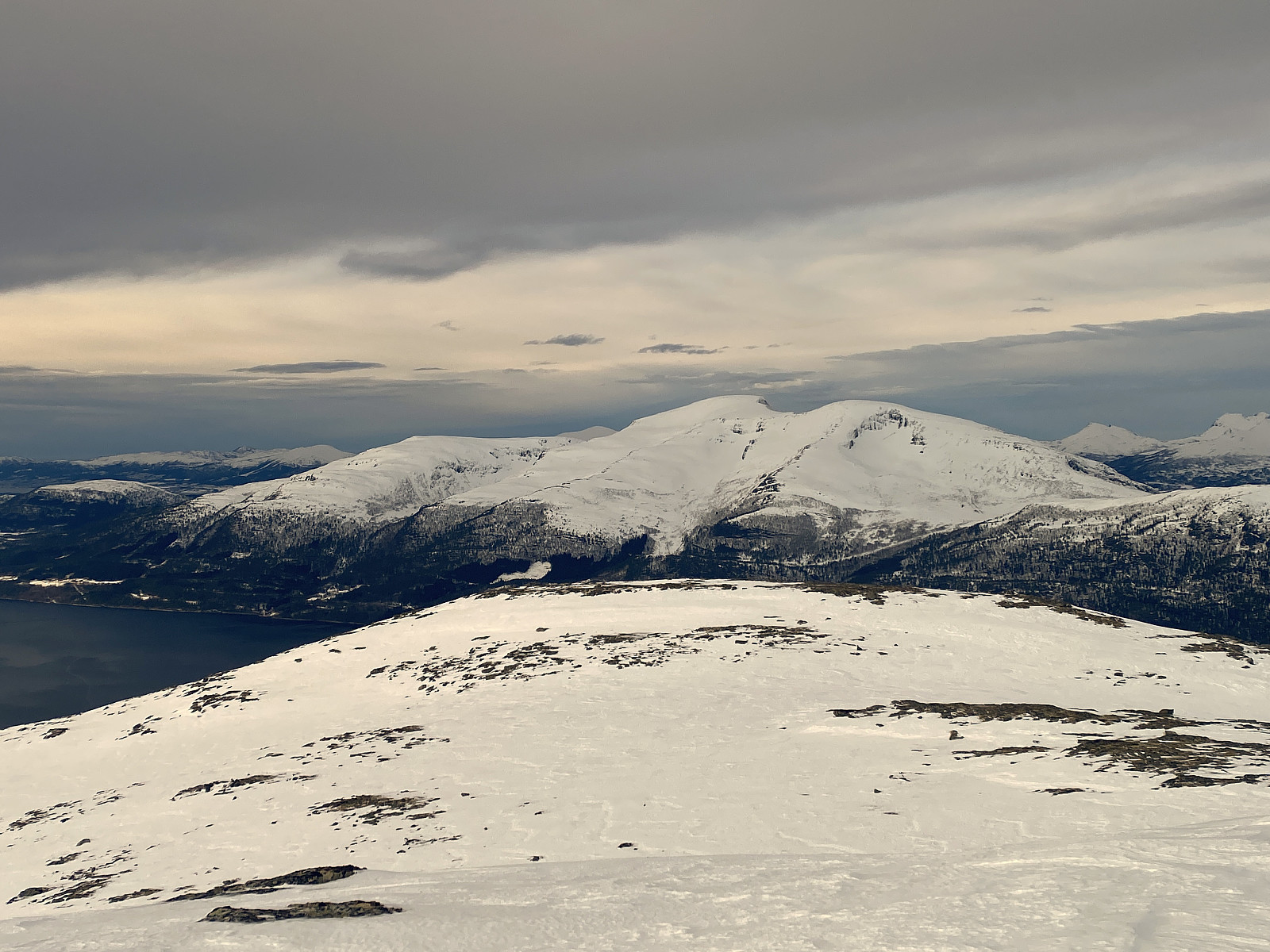
 Jeg har lenge hatt lyst til å ta turen opp på Vesleskåla [901 m.o.h.], Skåla [1127 m.o.h.] og Skålaksla [1076 m.o.h.] på Skålahalvøya i Molde kommune, for jeg har ofte sett over mot disse vakre fjellene når jeg har vært på ski- og fotturer på andre sida av Langfjorden. Det artigste hadde selvfølgelig vært å ta alle tre toppene i én tur, men en slik langtur skulle det ikke bli denne dagen, for jeg var ikke kjent i området, og det, i tillegg til at jeg hadde langt å kjøre for å komme meg til Skålahalvøya, gjorde at jeg kom nokså seint i gang med turen denne dagen. Jeg kjørte til Vestnes, tok ferja over til Molde, tok tunellen under fjorden til Bolsøya, og kjørte inn til Skålahalvøya. Jeg hadde lurt litt på å bestige Skåla fra nordsida, for jeg så for meg at det >>>
Randonnee-tur til Rjuptind og til Snarketind
- Datum:
- 22.02.2024
- Tourcharakter:
- Randonnée/Telemark
- Tourlänge:
- 5:55h
- Entfernung:
- 14,1km
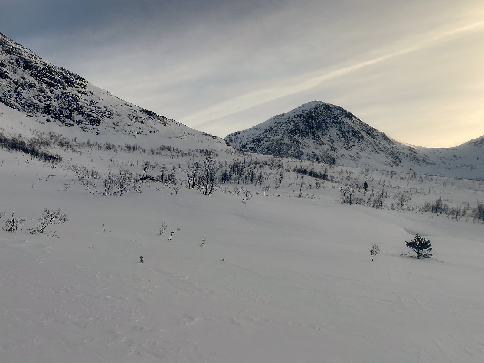
 Jeg fikk idéen til denne turen i forbindelse med at jeg gikk flere andre randonee-turer i området. Tidligere på vinteren var Skrokkenseterveien brøytet ganske langt oppover i dalen, men da jeg tok turen opp på Skrokkenfjellet for knappe to uker siden, var det kun brøytet opp til Ellingsetra [225 m.o.h.]. Ut fra kartet så imidlertid Ellingsetra ut til å være et ypperlig utgangspunkt for å bestige både Rjuptinden og Snarketinden, og det skulle være lett også å unngå skredterreng med dette utgangspunktet (bilde #7). Jeg kjørte med andre ord inn til Mittet, og innover Mittetdalen, forbi Dale, og opp til Ellingsetra. Der var det brøytet en stor snu- og parkeringsplass, og der parkerte jeg bilen, og tok på meg utstyret. Det var ingen merket skitrasé gjennom skogen der jeg hadde >>>
Randonnee-tur til Skrokkenfjellet
- Datum:
- 10.02.2024
- Tourcharakter:
- Randonnée/Telemark
- Tourlänge:
- 4:10h
- Entfernung:
- 13,7km
 Jeg var på rando-tur til fjellet Nebba [1105 m.o.h.] i Mittet tre uker før denne turen, og fikk da idéen om også å ta turen opp på Skrokkenfjellet [1058 m.o.h.], som jeg kikket rett bortpå når jeg var på vei ned igjen fra Nebba. Jeg kjørte derfor inn til Mittet denne dagen, hvor jeg tok av, og fulgte Dalevegen [FV 6008] innover Mittetdalen, og fra Dale videre innover Skrokkenvegen, hvor man ved passering belastes kr. 60. Denne dagen var det imidlertid ikke brøytet like langt oppover i dalen som sist, men kun opp til Ellingsetra [255 m.o.h.], hvor det var brøytet en slags snuplass, hvor det også var mulig å parkere. Her satte jeg fra meg bilen, spente på meg skiene, og gav meg i veg videre oppover mot Skrokkensetra [420 m.o.h.].
Jeg passerte Skrokkensetra, og fortsatte oppover >>>
Jeg var på rando-tur til fjellet Nebba [1105 m.o.h.] i Mittet tre uker før denne turen, og fikk da idéen om også å ta turen opp på Skrokkenfjellet [1058 m.o.h.], som jeg kikket rett bortpå når jeg var på vei ned igjen fra Nebba. Jeg kjørte derfor inn til Mittet denne dagen, hvor jeg tok av, og fulgte Dalevegen [FV 6008] innover Mittetdalen, og fra Dale videre innover Skrokkenvegen, hvor man ved passering belastes kr. 60. Denne dagen var det imidlertid ikke brøytet like langt oppover i dalen som sist, men kun opp til Ellingsetra [255 m.o.h.], hvor det var brøytet en slags snuplass, hvor det også var mulig å parkere. Her satte jeg fra meg bilen, spente på meg skiene, og gav meg i veg videre oppover mot Skrokkensetra [420 m.o.h.].
Jeg passerte Skrokkensetra, og fortsatte oppover >>>
Randonnee-tur til Nebba i Mittet
- Datum:
- 20.01.2024
- Tourcharakter:
- Randonnée/Telemark
- Tourlänge:
- 3:27h
- Entfernung:
- 10,7km
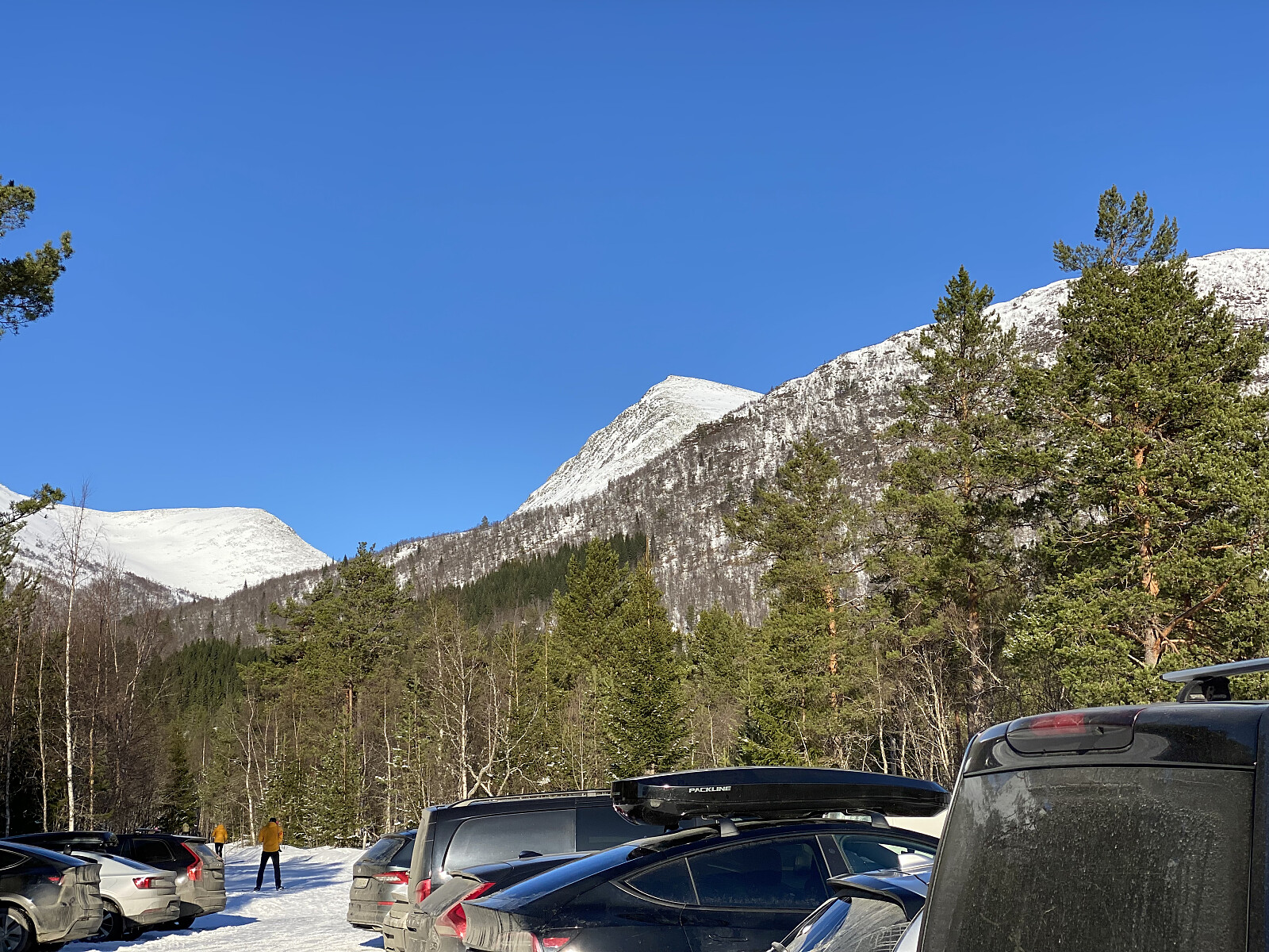
 Turen opp på Nebba i Mittet [1105 m.o.h.], er en grei tur å ta når det er meldt stor skredfare [3!], for denne turen går det an å legge slik at den snor seg mellom de bratte partiene. Jeg kjørte inn til Mittet på halvøya mellom Langfjorden og Romsdalsfjorden, og tok av til høyre ikke så lenge etter brua, og fulgte Fylkesvei 6008 ("Dalevegen") innover Mittetdalen. Etter bygda Dale, fortsetter veien som Skrokkenvegen. Denne er bompengebelastet med kr. 60,- (pr. 2024), men belastningen skjer elektronisk (via YouPark), så man behøver ikke ha penger med seg på turen. Jeg fortsatte oppover dalen så langt opp som veien var brøytet (bilde #1), dvs. opp til 301 m.o.h. Her parkerte jeg bilen, spente på meg skiene, og så bar det av sted. Kort etter meg kom også en kar med traktor, >>>
