Archive - Date
Archive - Activity
- Bike trip (2)
-
Climbing (8)
- Alpine climbing (7)
- Mixed climbing (1)
-
Other trip (1)
- Expedition (1)
-
Other winter trip (10)
- Snowshoe trip (10)
-
Ski trip (49)
- Randonnée/Telemark (49)
-
Trip by foot (228)
- Alpine trip (57)
- Hike (69)
- Hillwalk (89)
- Jogging (11)


Collected lists
-
Romsdal ≥ 100m pf.
(134/301)
 44%
44% -
Sunnmøre ≥ 100m pf.
(78/531)
14%
-
Norges 1000 største fjell målt i primærfaktor
(52/1000)
5%

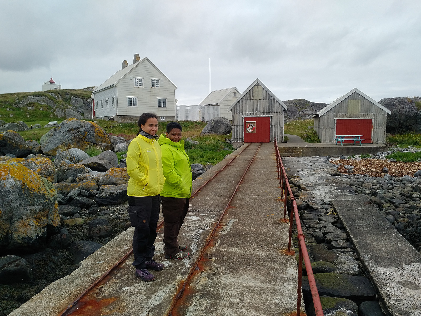
To Mount Gamlemsveten in Not So Much Snow
- Date:
- 14.12.2019
- Characteristic:
- Hike
- Duration:
- 2:21h
- Distance:
- 9.0km
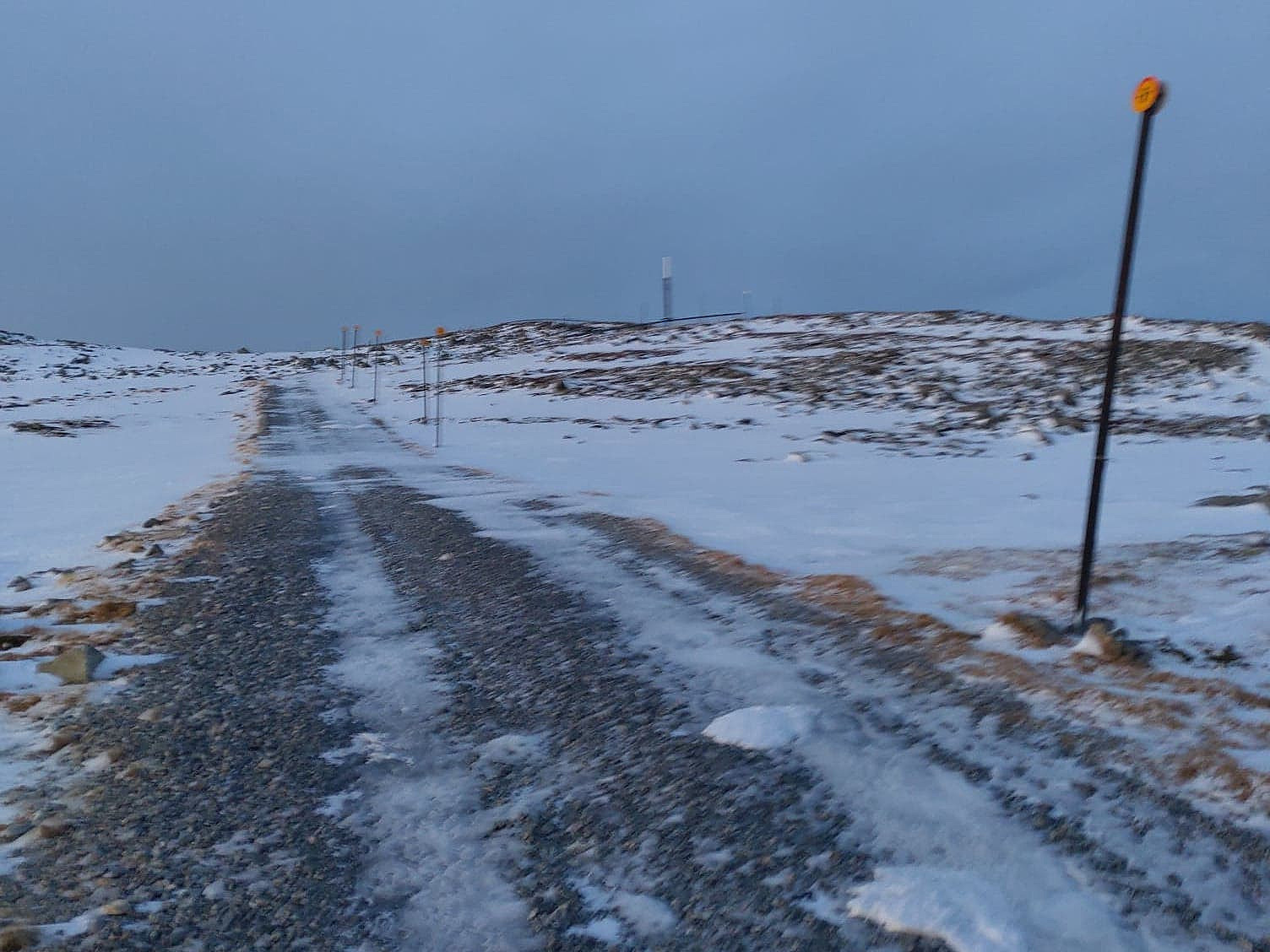 The amount of snow along the Norwegian west coast is varying quite much throughout the winter, as well as from one winter to another. Typically, low pressure weather systems that come in from the northwest bring snow, whereas those coming in from the southwest bring rain; and so the snow may come and go as the whether changes. On this day, therefore there was some snow in the mountains along the coast, but not very much.
We've climbed Mount Gamlemsveten many times, my son Dag and I, so this is a very familiar mountain to us; especially to Dag, as he has climbed it many more times than what I have done. I did, however, once even climb it on a 29" Gary Fisher bicycle; something he hasn't done; hence I tend to claim it's a little bit my mountain too... We drove to the usual parking lot in >>>
The amount of snow along the Norwegian west coast is varying quite much throughout the winter, as well as from one winter to another. Typically, low pressure weather systems that come in from the northwest bring snow, whereas those coming in from the southwest bring rain; and so the snow may come and go as the whether changes. On this day, therefore there was some snow in the mountains along the coast, but not very much.
We've climbed Mount Gamlemsveten many times, my son Dag and I, so this is a very familiar mountain to us; especially to Dag, as he has climbed it many more times than what I have done. I did, however, once even climb it on a 29" Gary Fisher bicycle; something he hasn't done; hence I tend to claim it's a little bit my mountain too... We drove to the usual parking lot in >>>
To Mount Storhornet and Mount Skålbotsheia in Snow
- Date:
- 07.12.2019
- Characteristic:
- Hike
- Duration:
- 3:10h
- Distance:
- 8.9km
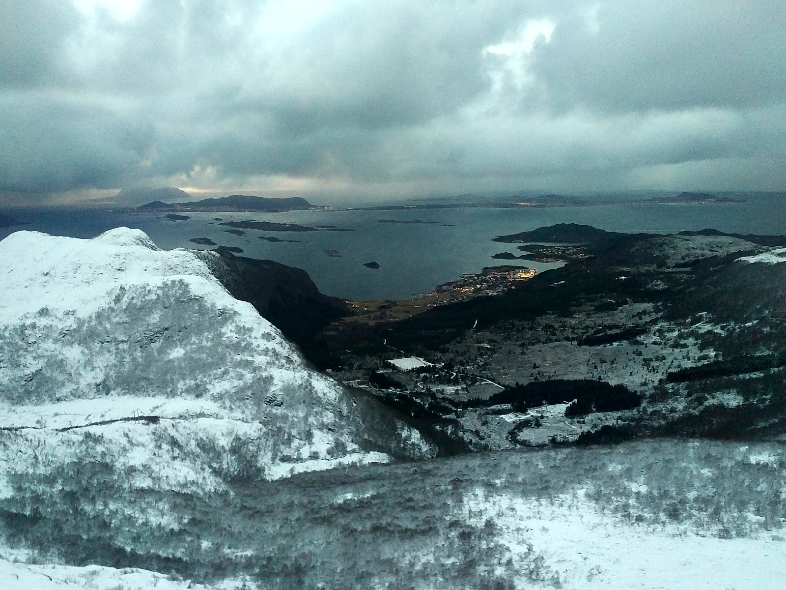 I have previously visited many of the mountains in the municipality of Haram , a municipality that is soon to be merged with the town of Ålesund. While ascending mount Tverrbotshornet and mount Gamlemsveten, I have been looking at a number of smaller peaks and mountains in the vicinity, desiring to ascend even them. My son Dag had been on most of them, however, and on this day he agreed to take me up to one or two of them. (During summer, I could've found my way up there by myself, but on this day there was about 30 cm of snow along most of the route, hence you wouldn't be able to follow the trail unless you knew where it was). We drove to Søvikdalen parking lot, and started trekking from there. We followed a forest road further into the valley. After about 800 meters, we came to a shooting >>>
To Mount Sulafjellet in Somewhat Deep Snow
- Date:
- 30.11.2019
- Characteristic:
- Hike
- Duration:
- 3:15h
- Distance:
- 11.8km
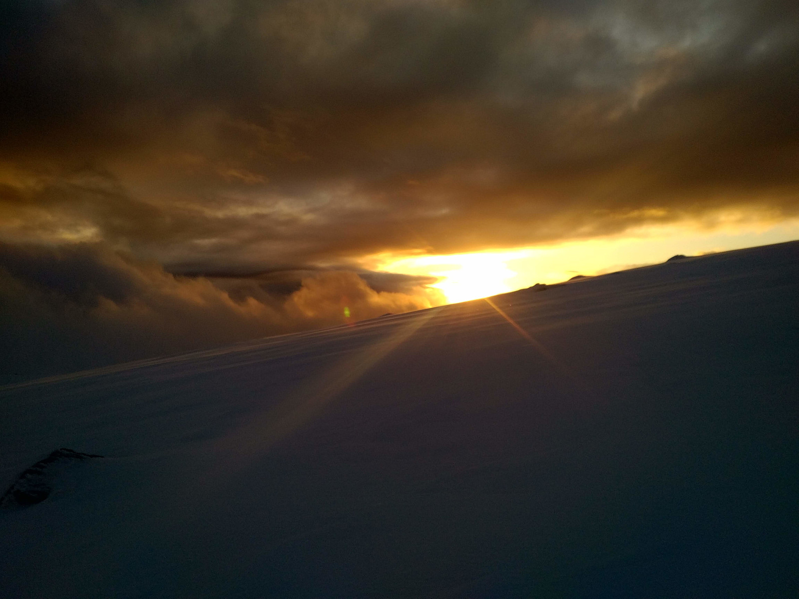 I went hiking on Mount Sulafjellet on the island of Sula with my oldest son this day. We started out from the parking spot at Mauseid, and followed the forest road up to a cabin called Rollonhytta (390 m.a.m.s.l.). At this cabin the forest road as well as the forest ends, but there is a narrow path or trail that you may usually follow further up the mountain, and so we did for a km or so. At that point, however we lost the path. There was a lot of snow in the mountain side on this day, hence much of the time we couldn't actually see the path. The trail is, however, marked by small cairns all along its course, and this had helped us until the snow became so deep that the cairns disappeared beneath them. We've been on this mountain many times before, however, so we just continued in somewhat >>>
Climbing the Meche Awoknesh Mountain
- Date:
- 25.11.2019
- Characteristic:
- Hike
- Duration:
- 2:21h
- Distance:
- 5.6km
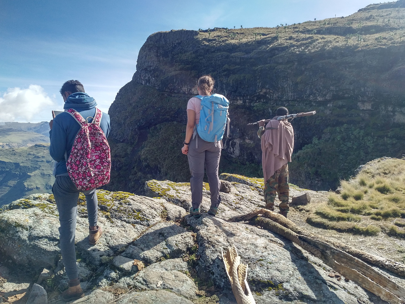 As we had skipped the hike to the village of Amiwalka (see previous tour description), we were now having one day of mountain trekking left, that we had already paid for, despite being back at the Chennek camp site. In my mind we were having two options for this day: We could either climb the Meche Awoknesh mountain, which is located just east of the camp site; or we could go for Mount Enatye, which is west of the camp site. I had previously climbed both of these mountains (i.e. in 2018), whereas my daughter, who was with me on this tour, hadn’t been on any of them. The Enatye must be said to be a mountain by itself, as it has an elevation of 4070 m.a.m.s.l., and a vertical separation of just a little less than 500 meters; though it is located within a mountain range that also includes Imet >>>
Evening hike to Gara Furi Terara
- Date:
- 31.10.2019
- Characteristic:
- Hike
- Duration:
- 4:25h
- Distance:
- 19.8km
 I have been to Addis Ababa several times in connection with my work, and I've realized that this city really does offer some nice treks in the mountains that surround it. Moreover, Addis Ababa is located about 2400 m.a.s.l., and is therefore perfectly located for someone who wants to get some altitude acclimatization in advance of a mountain trek at even higher altitudes, whether that be a trek to Kilimanjaro, Mount Kenya, Rwenzori or Ras Dashen. I was planning to climb Ras Dashen along with my Daughter during this visit to Ethiopia, but prior to that I was going to work for two and a half weeks at the Black Lion Hospital in Addis Ababa. In order to get even better adapted to the altitude, however, I had on this occasion decided to go to Addis three days in advance of my colleagues from our >>>
Til Signalen og Storefjellet på Valderøya med min datter
- Date:
- 20.07.2019
- Characteristic:
- Hike
- Duration:
- 1:21h
- Distance:
- 3.9km
 Jeg benyttet i stor grad denne lørdagen til å slappe av etter en hard arbeidsuke på jobb, men så utpå ettermiddagen hadde jeg behov for litt frisk luft, og jeg spurte min eldste datter om hun ville være med på en aldri så liten fjelltur. Vi plukket ut Valderøyfjellet som dagens mål, kjørte til Gjøsundsæter, og parkerte på en greit opparbeidet parkeringsplass helt nederst i Sætredalen.
Fra parkeringsplassen gikk vi opp til den gamle demningen i Sætredalen. Inntil for få år siden lå det i Sætredalen et oppdemmet vann. Dammen var for mange år siden drikkevannskilde for befolkningen på Valderøya, og etter at Alnesvatnet ble tatt i bruk som drikkevannskilde for hele Giske Kommune, tjente Sætredammen som reserve-vannkilde gjennom mange år. De siste årene har man imidlertid >>>
Jeg benyttet i stor grad denne lørdagen til å slappe av etter en hard arbeidsuke på jobb, men så utpå ettermiddagen hadde jeg behov for litt frisk luft, og jeg spurte min eldste datter om hun ville være med på en aldri så liten fjelltur. Vi plukket ut Valderøyfjellet som dagens mål, kjørte til Gjøsundsæter, og parkerte på en greit opparbeidet parkeringsplass helt nederst i Sætredalen.
Fra parkeringsplassen gikk vi opp til den gamle demningen i Sætredalen. Inntil for få år siden lå det i Sætredalen et oppdemmet vann. Dammen var for mange år siden drikkevannskilde for befolkningen på Valderøya, og etter at Alnesvatnet ble tatt i bruk som drikkevannskilde for hele Giske Kommune, tjente Sætredammen som reserve-vannkilde gjennom mange år. De siste årene har man imidlertid >>>
Til Skulen med datter og hustru
- Date:
- 13.07.2019
- Characteristic:
- Hike
- Duration:
- 4:09h
- Distance:
- 8.2km
 Jeg var for ikke lenge siden på Flemsøya og fjellet Skulen sammen med min eldste sønn, og da hun hørte oss fortelle fra turen, og så bildene vi hadde tatt, fikk hun lyst til å bestige Skulen hun også. Vår eldste datter, som er musikklærer har ferie, og har vært på besøk hjemme hos oss de siste ukene, og slik hadde det seg at jeg, min kone og vår eldste datter, la sammen ut på tur denne dagen.
Så kjørte vi da ut til Skjeltene i datterens bil, tok ferga over til Austenes, og kjørte videre derfra ut til Flem. Fra Flem tok vi samme skogsvei som sist (se turbeskrivelse fra 01.06.19: Fjelltur til Skulen på Flemsøya med min sønn ), og parkerte på ca. 160 m.o.h. oppe i skogen akkurat slik som sist, og derfra tok vi beina fatt. Vi fulgte grusveien opp til Bergedalen, og tok så stien til høyre, og fulgte denne først over heiene >>>
Jeg var for ikke lenge siden på Flemsøya og fjellet Skulen sammen med min eldste sønn, og da hun hørte oss fortelle fra turen, og så bildene vi hadde tatt, fikk hun lyst til å bestige Skulen hun også. Vår eldste datter, som er musikklærer har ferie, og har vært på besøk hjemme hos oss de siste ukene, og slik hadde det seg at jeg, min kone og vår eldste datter, la sammen ut på tur denne dagen.
Så kjørte vi da ut til Skjeltene i datterens bil, tok ferga over til Austenes, og kjørte videre derfra ut til Flem. Fra Flem tok vi samme skogsvei som sist (se turbeskrivelse fra 01.06.19: Fjelltur til Skulen på Flemsøya med min sønn ), og parkerte på ca. 160 m.o.h. oppe i skogen akkurat slik som sist, og derfra tok vi beina fatt. Vi fulgte grusveien opp til Bergedalen, og tok så stien til høyre, og fulgte denne først over heiene >>>
Fjelltur til Skulen på Flemsøya med min sønn
- Date:
- 01.06.2019
- Characteristic:
- Hike
- Duration:
- 2:48h
- Distance:
- 9.0km
 Denne turen var det min eldste sønn som dro meg med på. Fjellet Skulen ligger på Flemsøya i kystkommunen Haram, enskjønt hele Haram Kommune etter planen skal innlemmes i Ålesund Kommune om ikke lenge. Flemsøya har navnet sitt fra gårdsbruket Flem, som ligger nokså langt vest på øya. Fra gammelt av ble øya også kalt Skuløya etter navnet på fjellet, men med tiden har det vokst fram et ørlite tettsted på Longva som ligger omtrent midt på sørsida av øya; og når man i dag spør folk fra Flemsøya om hvor de kommer fra, er det stadig flere som svarer at de kommer "fra Longva." Min sønn hadde nylig vært på Flemsøya og Skulen for å få brukt opp et fergekort som var i ferd med å gå ut på dato, og fasinert av hvor fint det var der ute, sa han en dag til meg: "Pappa, >>>
Climbing the Mountain Overlooking the Chennek Camp Site
- Date:
- 24.11.2018
- Characteristic:
- Hike
- Duration:
- 3:06h
- Distance:
- 5.3km
 On this morning, I was somehow confined to the Chennek camp site in the Simien Mountains National Park. I had been trekking from the Buyit Ras area via Sankaber, Gich, Imet Gogo and Enatye to Chennek over the previous three days along with my wife, our guide Tadlo, and a ranger. Our original plan had been to continue on to Mount Bwahit, and then even further to the Ambiko camp site and Ras Dashen; but then my wife had become so severely stricken by altitude sickness, that we had had to change our plans. [I'm including this information in my narration, as I believe that ability to change a plan, is a very important ability in mountain trekking and in mountaineering; and there might even be times when your survival will depend upon that ability]. I was still thinking there was a possibility of >>>
Trekking the Simien Mountains of Ethiopia
- Date:
- 23.11.2018
- Characteristic:
- Hike
- Duration:
- 51:28h
- Distance:
- 36.9km
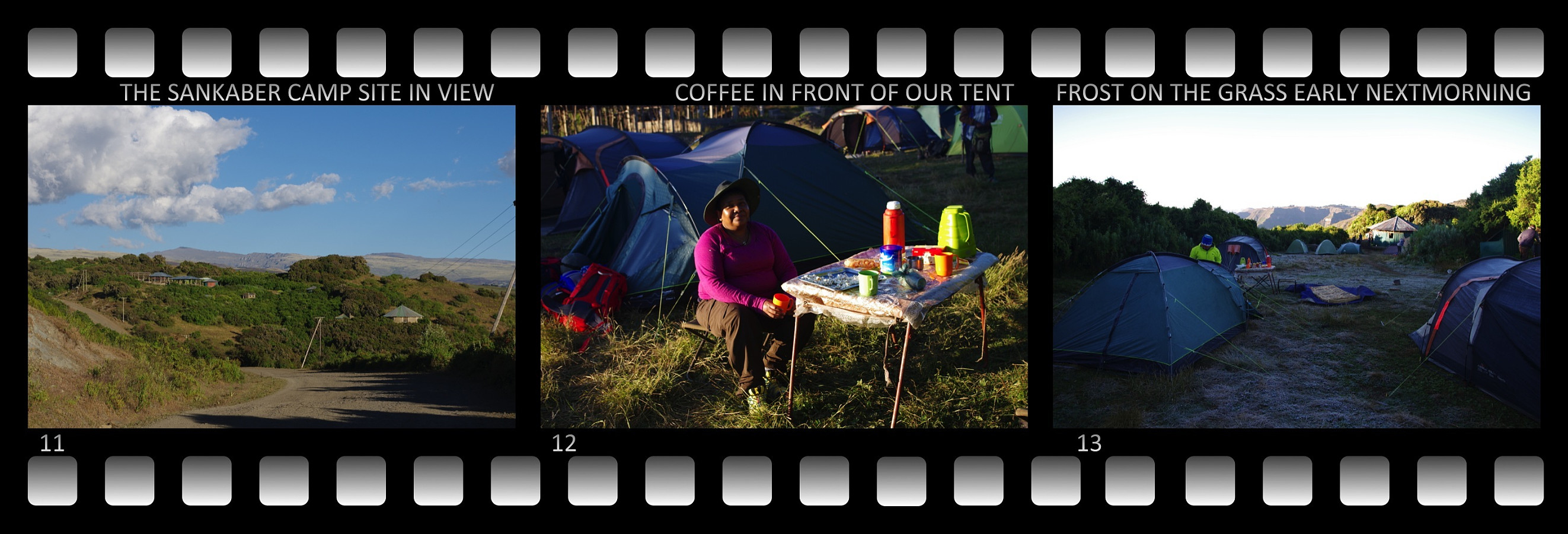 Working for two and a half week in a health care project in Addis Ababa, and then go mountain trekking immediately afterwards, is genius. Addis Ababa is located about 2400 m.a.m.s.l. (depending a little on where in the city you are), and with a little amount of training while there, you do get exactly the altitude adaption that you need to better enjoy your hike in the higher mountains after your stay in Addis. Not many of us can afford to take two and a half week off from work just for elevation acclimation, and then be another week and a half away from work while mountain trekking; hence when I had the opportunity to be in Addis Ababa this long "at work", I had to grab the chance. I had my wife with me on this trip. She had some remaining vacation left over, that she hadn't used >>>
