Archive - Date
Archive - Activity
- Bike trip (2)
-
Climbing (8)
- Alpine climbing (7)
- Mixed climbing (1)
-
Other trip (1)
- Expedition (1)
-
Other winter trip (10)
- Snowshoe trip (10)
-
Ski trip (49)
- Randonnée/Telemark (49)
-
Trip by foot (228)
- Alpine trip (57)
- Hike (69)
- Hillwalk (89)
- Jogging (11)


Collected lists
-
Romsdal ≥ 100m pf.
(134/301)
 44%
44% -
Sunnmøre ≥ 100m pf.
(78/531)
14%
-
Norges 1000 største fjell målt i primærfaktor
(52/1000)
5%

Til Skolma og Sneldelida på Hareidlandet
- Date:
- 07.05.2022
- Characteristic:
- Hike
- Duration:
- 3:54h
- Distance:
- 11.8km
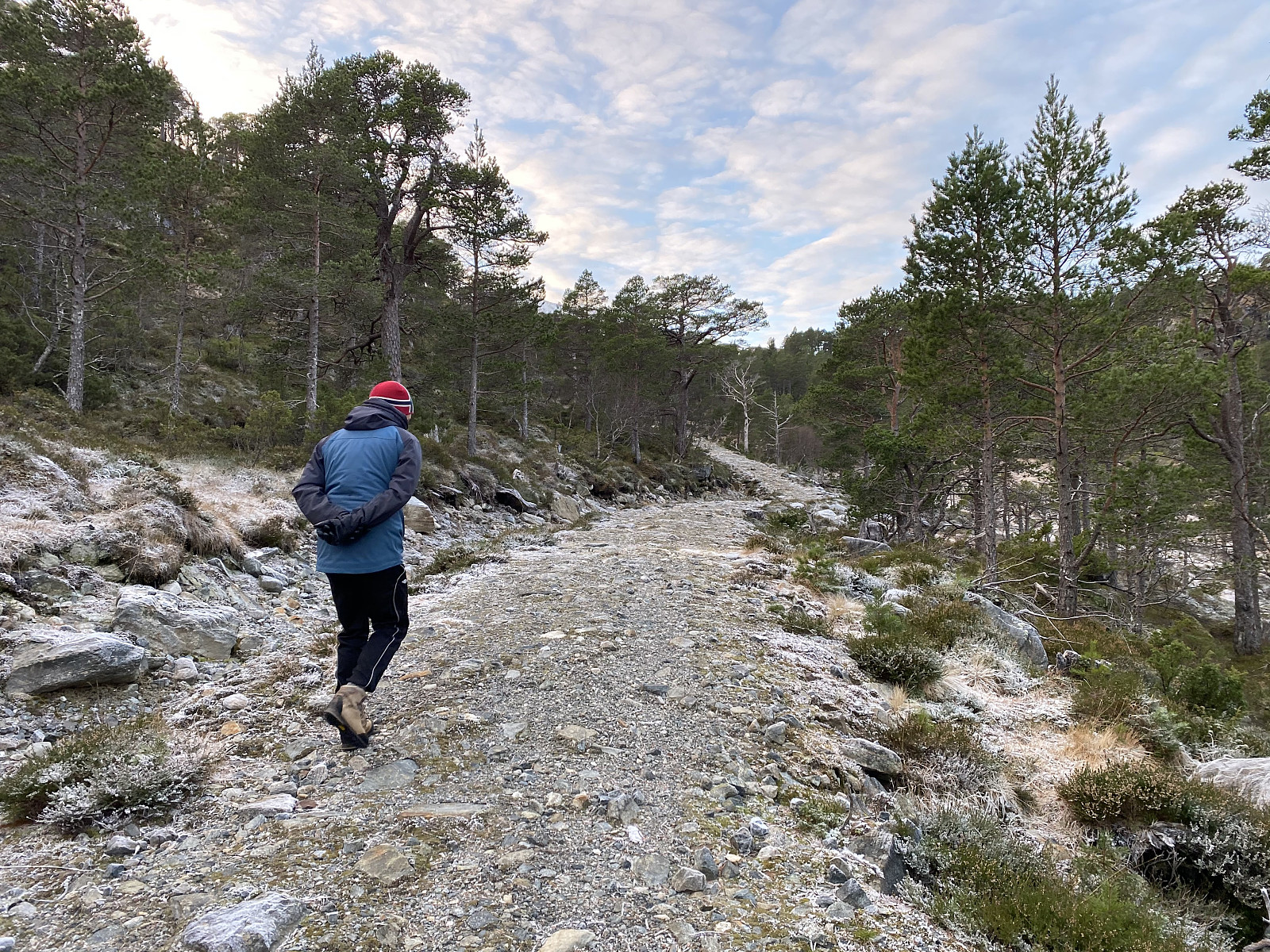
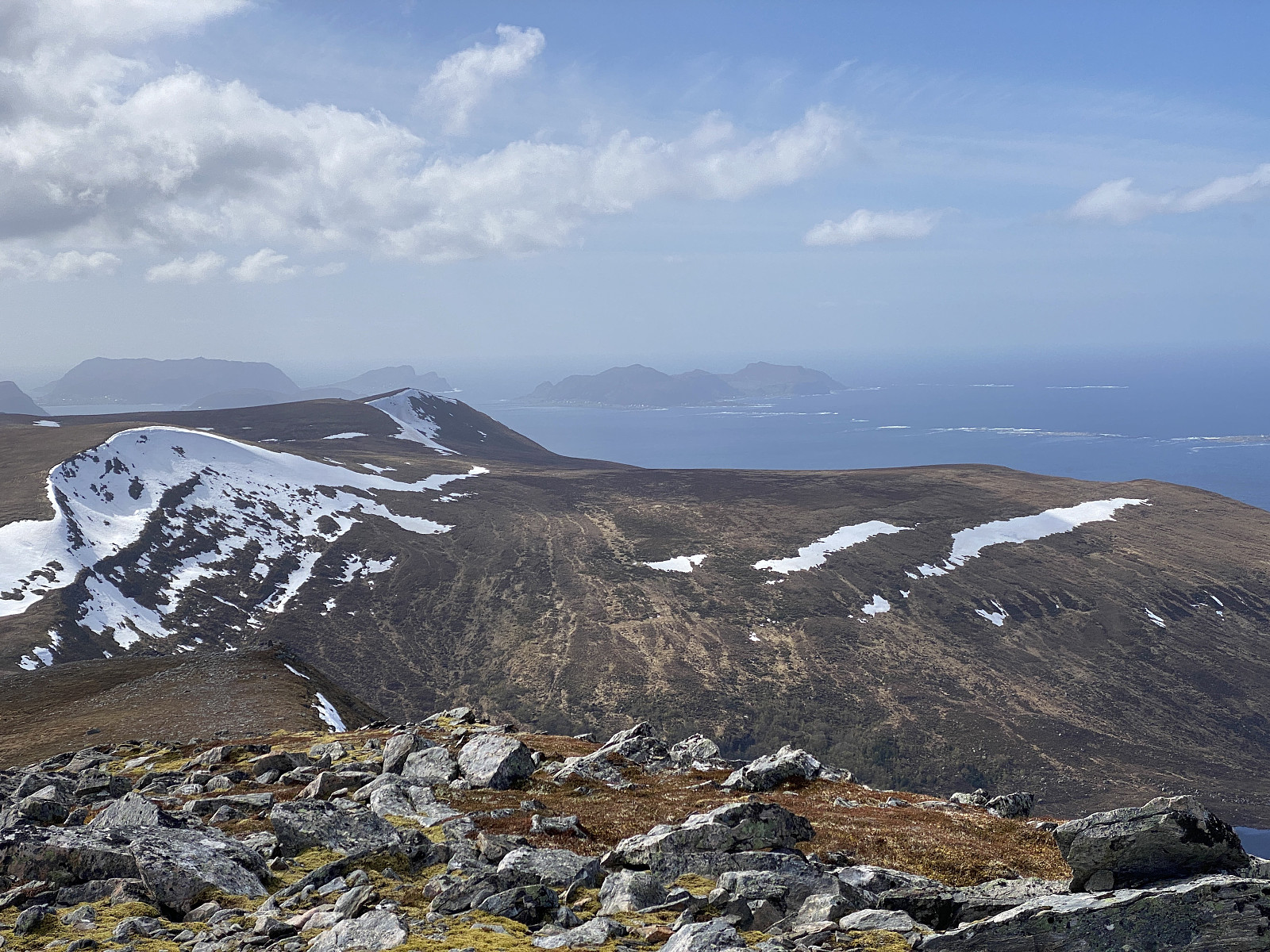 I begynnelsen av mai måned er det som regel fortsatt mye snø i fjellet i indre strøk, og det visste vi at det også var i år, så vi (jeg og Dag) bestemte oss for å ta en tur ute ved kysten denne dagen; og da falt valget på Hareidlandet. Vi kjørte til Sulesund, og tok ferja over til Hareid, og derfra kjørte vi så ut til Brandal; hvor vi tok av fra hovedveien, og fulgte en smal sidevei oppover Ytredalen så langt opp som veien gikk, dvs. opp til Øvrebø, hvor vi parkerte. Fra Øvrebø gikk det en slags traktor- eller skogbruksvei (Bilde #1) omtrent opp til ei seter. På kartet står denne kun angitt som Sætra, men jeg har i et foredrag om seterdrift på Hareidlandet, som ligger tilgjengelig i pdf-format på nettet, sett den omtalt som sætra i ytre dalen ; og der er den samtidig også >>>
Til Vasskarbolten og Synnalandsheia med Sol
- Date:
- 03.07.2021
- Characteristic:
- Hike
- Duration:
- 2:21h
- Distance:
- 6.1km
 Jeg har tre ganger tidligere vært på Synnalandshornet og borte ved Vasskarbolten. Først lette jeg opp bolten 22.09.18, etter å ha lest om den på Facebook-gruppa Toppturer i Nordvest. Deretter tok jeg min yngste datter med dit uka etterpå ( Til Synnalandshornet og Vasskarbolten ), og så tok jeg min kone med dit i April 2019 ( Med konen til Synnalandshornet og Vasskarbolten ). To av gangene jeg har vært der, har været vært elendig. Nå var det sol og sommer, og min eldste datter var hjemme på ferie, så jeg tenkte Vasskarbolten var et fint sted å ta henne med på tur. Vi kjørte til Brattvågen og parkerte ved enden av Synnalandsvatnet. Derfra fulgte vi grusveien forbi vassverket, og opp i fjellsida ovenfor, og fulgte så en traktorvei nordover (det er bare å følge skiltingen mot Synnalandshornet). Der veien gikk over i sti, fulgte vi rødmerkingen videre. Utsikten >>>
To Mount Verahornet
- Date:
- 12.06.2021
- Characteristic:
- Hike
- Duration:
- 1:17h
- Distance:
- 3.6km
 Det ble en kort og grei tur denne dagen. Vi kjørte til Sjøholt, og tok den gamle bilveien opp bakkene i retning Solnørdalen. Når vi nærmet oss toppen av bakken, tok vi til høyre langs Eggeveien, og kjørte ca. 1 kilometer, før vi kom til parkeringslomma vi hadde sett omtalt på nettet. Her satte vi bilen fra oss, og begynte å gå.
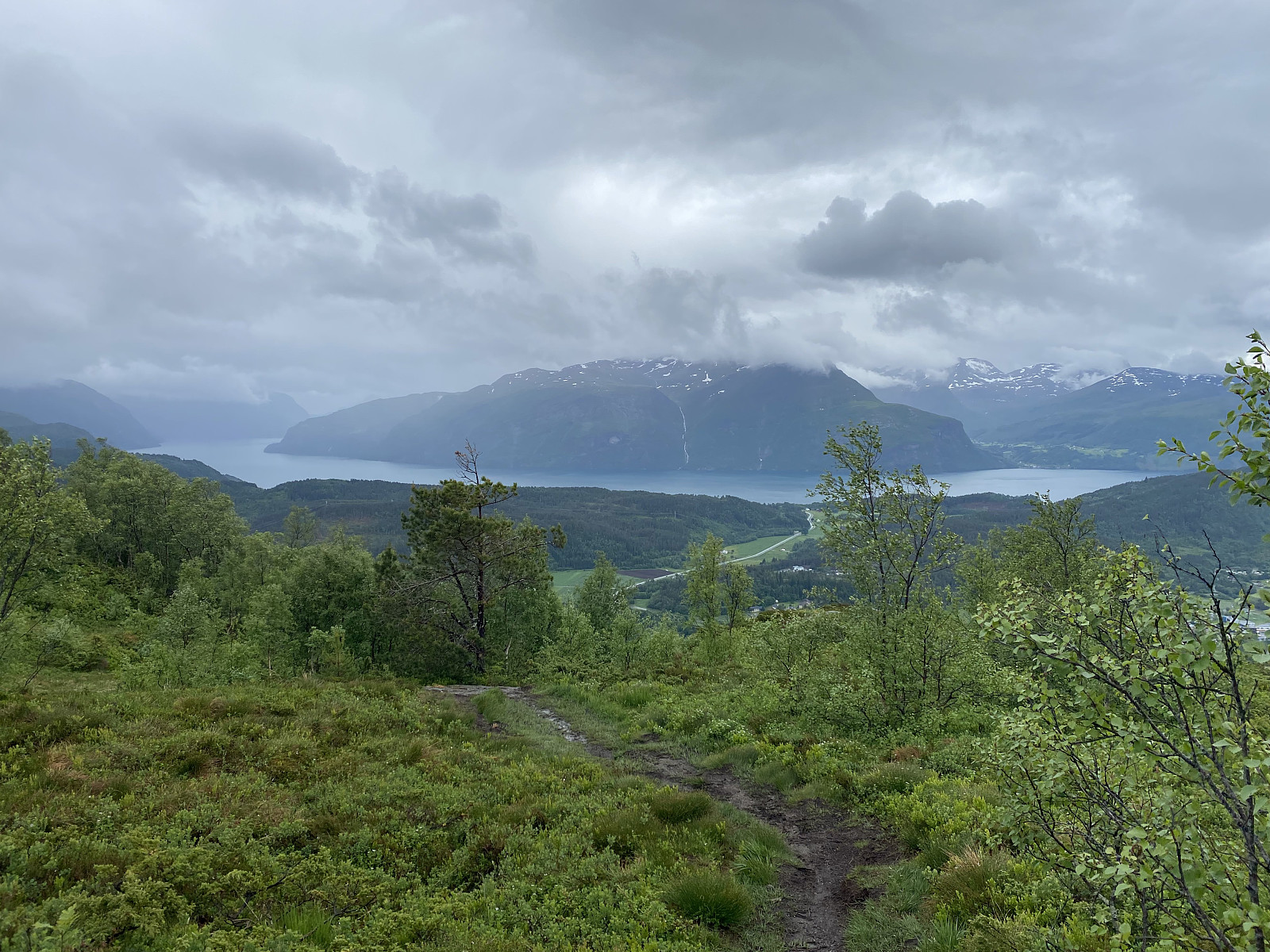
Stien fra Egge Parkeringslomme opp til topps på Verahornet var svært lett å følge, og det er tydelig at den er mye brukt. Den tar av fra Eggeveien bare en 30-40 meter etter parkeringslomma, og første delen går gjennom bjørkeskog (bilder ##1 & 2). Etterhvert kommer man ut av skogen, og får god utsikt både til høyre og til venstre og bakover.
På venstre hånd ser man innover mot Engesetdalen (bilde #8), til høyre ser man Storfjorden innover i retning >>>
Det ble en kort og grei tur denne dagen. Vi kjørte til Sjøholt, og tok den gamle bilveien opp bakkene i retning Solnørdalen. Når vi nærmet oss toppen av bakken, tok vi til høyre langs Eggeveien, og kjørte ca. 1 kilometer, før vi kom til parkeringslomma vi hadde sett omtalt på nettet. Her satte vi bilen fra oss, og begynte å gå.
Stien fra Egge Parkeringslomme opp til topps på Verahornet var svært lett å følge, og det er tydelig at den er mye brukt. Den tar av fra Eggeveien bare en 30-40 meter etter parkeringslomma, og første delen går gjennom bjørkeskog (bilder ##1 & 2). Etterhvert kommer man ut av skogen, og får god utsikt både til høyre og til venstre og bakover.
På venstre hånd ser man innover mot Engesetdalen (bilde #8), til høyre ser man Storfjorden innover i retning >>>
To Mount Svarttinden and Mount Jamtetinden
- Date:
- 05.06.2021
- Characteristic:
- Hike
- Duration:
- 4:32h
- Distance:
- 12.8km
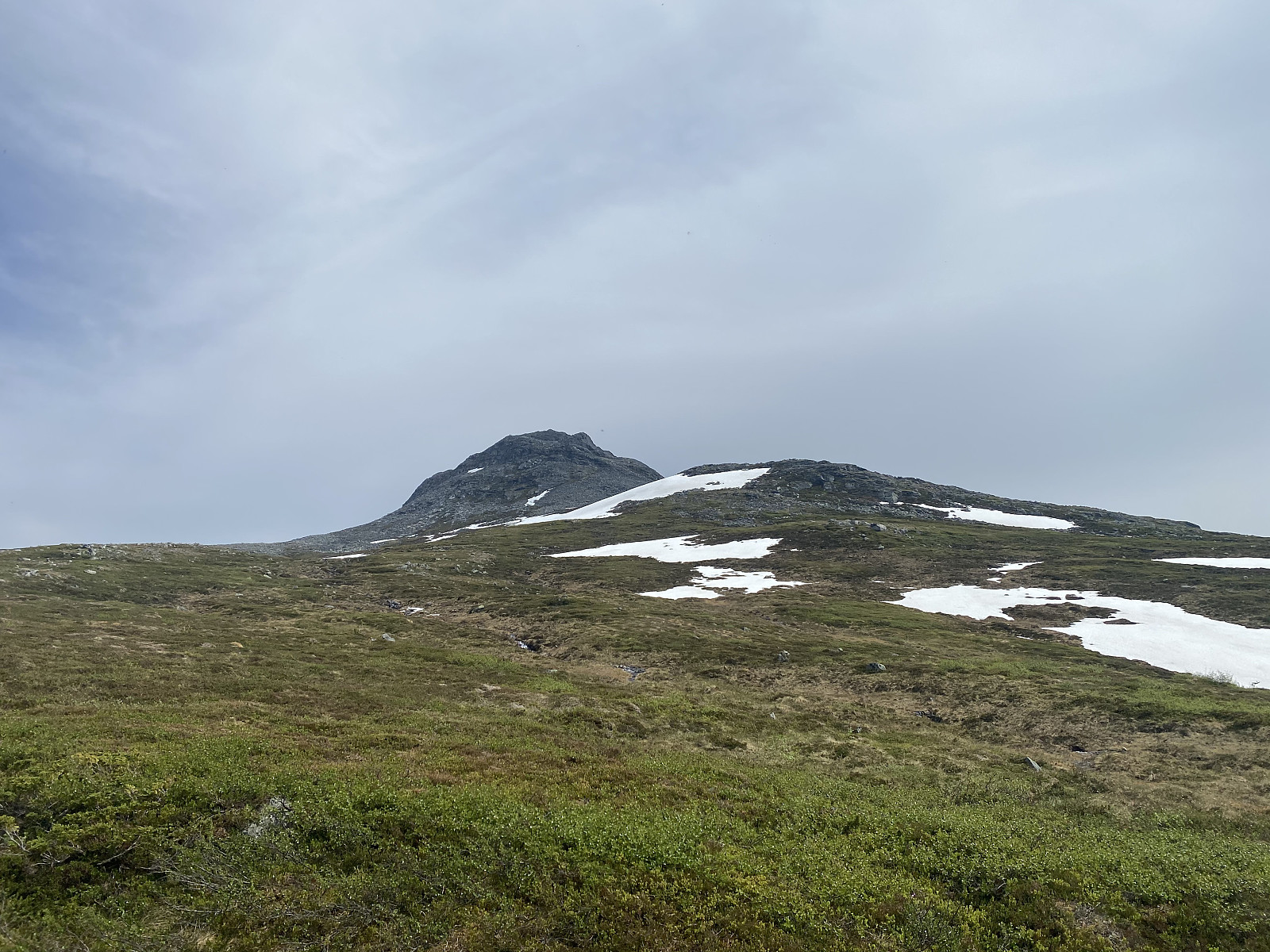 On this day we drove to the Valley of Vistdal in the eastern part of the county of Møre & Romsdal, intending to hike to a peak called Svarttinden [i.e. "The Black Peak"]. We followed some online instructions that my son had found for this particular trek, and left the county road for a gravel road about midway in the valley (see map). We followed this road past a farm or two and into the forrest; where we parked at a large clearing in the forrest where the forrest road made its first hairpin-bend.
This parking lot is located at about 170 m.a.m.s.l., and from there the gravel road climbs up the mountain side to about 500 m.a.m.s.l., making a total of 8 hairpin bends; and where the road ends, the trail continues as an ordinary forrest path. We followed the road and then the trail >>>
On this day we drove to the Valley of Vistdal in the eastern part of the county of Møre & Romsdal, intending to hike to a peak called Svarttinden [i.e. "The Black Peak"]. We followed some online instructions that my son had found for this particular trek, and left the county road for a gravel road about midway in the valley (see map). We followed this road past a farm or two and into the forrest; where we parked at a large clearing in the forrest where the forrest road made its first hairpin-bend.
This parking lot is located at about 170 m.a.m.s.l., and from there the gravel road climbs up the mountain side to about 500 m.a.m.s.l., making a total of 8 hairpin bends; and where the road ends, the trail continues as an ordinary forrest path. We followed the road and then the trail >>>
To Mount Storheimshornet with my Son Dag
- Date:
- 29.05.2021
- Characteristic:
- Hike
- Duration:
- 8:24h
- Distance:
- 18.3km
 It was my son who suggested Mount Storheimshornet for this day's hike. He had read about the mountain on a web site, and so we went to Stordalen Valley this morning, from where the hike goes. According to the web site, the best place to park when hiking this mountain, would be at Mo Bedehus [i.e. "Mo Prayer House"]. The little place called Mo was easy enough to find, but locating the Prayer House was a little bit more tricky, simply because it didn't look like a prayer house, but more like an ordinary house. (A Norwegian Prayer House is a religious building without the pomp and splendor of a Church, and is usually operated by lay people and not by clergymen).
At the Prayer House parking lot you could conveniently pay for the parking using instant money transfer by use of the Norwegian >>>
It was my son who suggested Mount Storheimshornet for this day's hike. He had read about the mountain on a web site, and so we went to Stordalen Valley this morning, from where the hike goes. According to the web site, the best place to park when hiking this mountain, would be at Mo Bedehus [i.e. "Mo Prayer House"]. The little place called Mo was easy enough to find, but locating the Prayer House was a little bit more tricky, simply because it didn't look like a prayer house, but more like an ordinary house. (A Norwegian Prayer House is a religious building without the pomp and splendor of a Church, and is usually operated by lay people and not by clergymen).
At the Prayer House parking lot you could conveniently pay for the parking using instant money transfer by use of the Norwegian >>>
Hiking to Mount Grisetskolten with my Son
- Date:
- 16.05.2021
- Characteristic:
- Hike
- Duration:
- 4:05h
- Distance:
- 7.7km
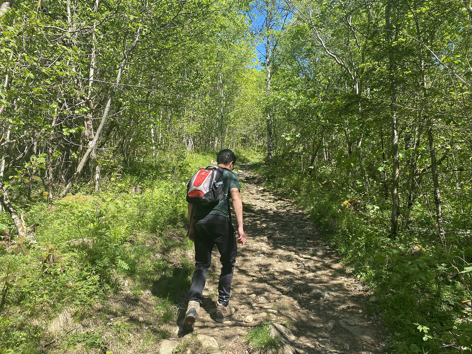
 Mount Grisetskolten [1068 m.a.m.s.l.] is a mountain in the municipality of Rauma, in the county of Møre & Romsdal on the west coast of Norway. I have previously visited a number of mountains in this area, but not Mount Grisetskolten. My son, however, had visited it once before; and so on this Sunday, he offered to take me there.
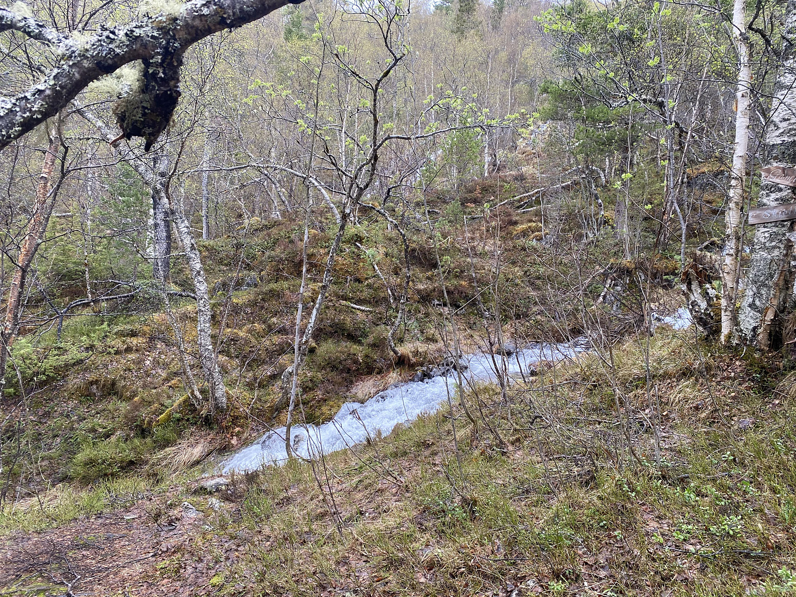
Video #1: Waterfall of the Tverråa River.
We went by car to the fjord called Innfjorden, and drove up the mountain side along a narrow forest road, that took us up to a little parking lot above a farm called Griset, after which Mount Grisetskolten has actually been named. We started trekking almost immediately after we arrived there. The trail was well marked and the first part of it was also readily visible. The trail took us through forest, mainly birch forest, >>>
Mount Grisetskolten [1068 m.a.m.s.l.] is a mountain in the municipality of Rauma, in the county of Møre & Romsdal on the west coast of Norway. I have previously visited a number of mountains in this area, but not Mount Grisetskolten. My son, however, had visited it once before; and so on this Sunday, he offered to take me there.
Video #1: Waterfall of the Tverråa River.
We went by car to the fjord called Innfjorden, and drove up the mountain side along a narrow forest road, that took us up to a little parking lot above a farm called Griset, after which Mount Grisetskolten has actually been named. We started trekking almost immediately after we arrived there. The trail was well marked and the first part of it was also readily visible. The trail took us through forest, mainly birch forest, >>>
Hiking to Mount Hornelen with my Son
- Date:
- 09.05.2021
- Characteristic:
- Hike
- Duration:
- 5:32h
- Distance:
- 13.4km
 On this day, my son and I were driving from Ålesund to Bergen, on the west coast of Norway, and so we had discussed in advance of our journey, to have a break from driving, and ascend some mountain while on our way to Bergen; and our choice fell on Mount Hornelen in the municipality of Bremanger, as we had been told that it is the highest ocean cliff in Europe, and that it could be a little bit challenging to ascend. We drove along county road 61 south to the little coastal town of Måløy (image #1), from where we crossed over to the island of Bremanger by ferry (images ## 1 & 2).
We disembarked the ferry at the Oldeide ferry quai, and drove to a parking lot at a spot called Hornskor (image #3), where we parked our car, and started our trek. The very first part of the trail had been nicely >>>
On this day, my son and I were driving from Ålesund to Bergen, on the west coast of Norway, and so we had discussed in advance of our journey, to have a break from driving, and ascend some mountain while on our way to Bergen; and our choice fell on Mount Hornelen in the municipality of Bremanger, as we had been told that it is the highest ocean cliff in Europe, and that it could be a little bit challenging to ascend. We drove along county road 61 south to the little coastal town of Måløy (image #1), from where we crossed over to the island of Bremanger by ferry (images ## 1 & 2).
We disembarked the ferry at the Oldeide ferry quai, and drove to a parking lot at a spot called Hornskor (image #3), where we parked our car, and started our trek. The very first part of the trail had been nicely >>>
To Mount Grøtshornet with my Son Dag
- Date:
- 27.02.2021
- Characteristic:
- Hike
- Duration:
- 3:28h
- Distance:
- 10.5km
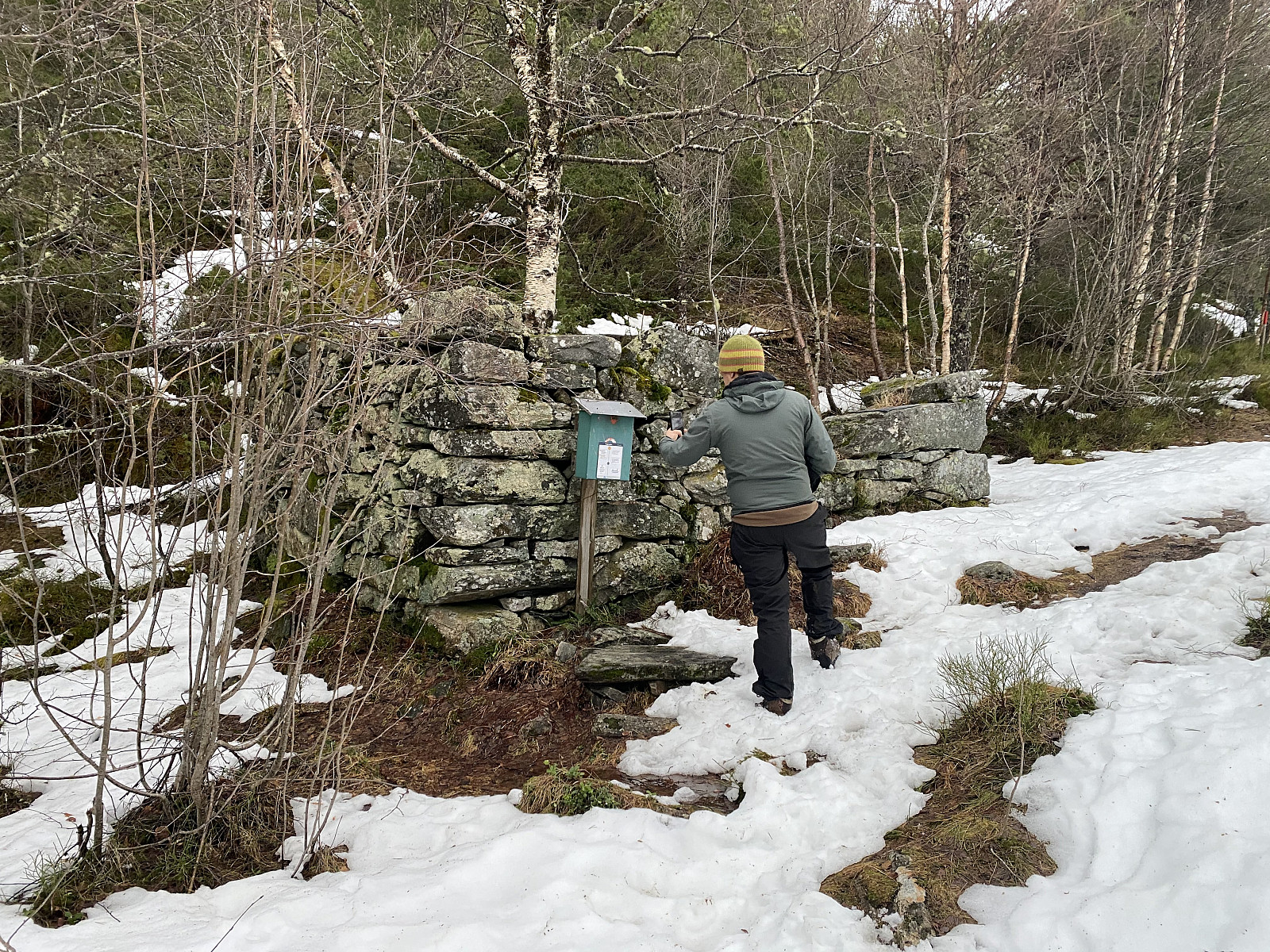 I have on one previous occasion ascended Mount Grøthornet along with my oldest son and my youngest daughter, but on that occasion the weather was so rainy and foggy that we didn't see a thing from up there; so when my son now asked me if I'd like to have another hike up there, I immediately responded with a "yes". And so we went by car to a location called Vatneeidet (see map), and parked outside the supermarket there. (The parking lot is, strictly speaking, reserved for customers at the supermarket and some nearby stores; but they don't have that many customers on Saturdays, so it's very unlikely that they will have your car removed).
Setting out from the parking lot, we crossed county road 661, and then followed an old forest road in a westward direction (see GPS tracking). After >>>
I have on one previous occasion ascended Mount Grøthornet along with my oldest son and my youngest daughter, but on that occasion the weather was so rainy and foggy that we didn't see a thing from up there; so when my son now asked me if I'd like to have another hike up there, I immediately responded with a "yes". And so we went by car to a location called Vatneeidet (see map), and parked outside the supermarket there. (The parking lot is, strictly speaking, reserved for customers at the supermarket and some nearby stores; but they don't have that many customers on Saturdays, so it's very unlikely that they will have your car removed).
Setting out from the parking lot, we crossed county road 661, and then followed an old forest road in a westward direction (see GPS tracking). After >>>
To Mount Sulafjellet in Bad Weather
- Date:
- 09.01.2021
- Characteristic:
- Hike
- Duration:
- 2:46h
- Distance:
- 11.4km
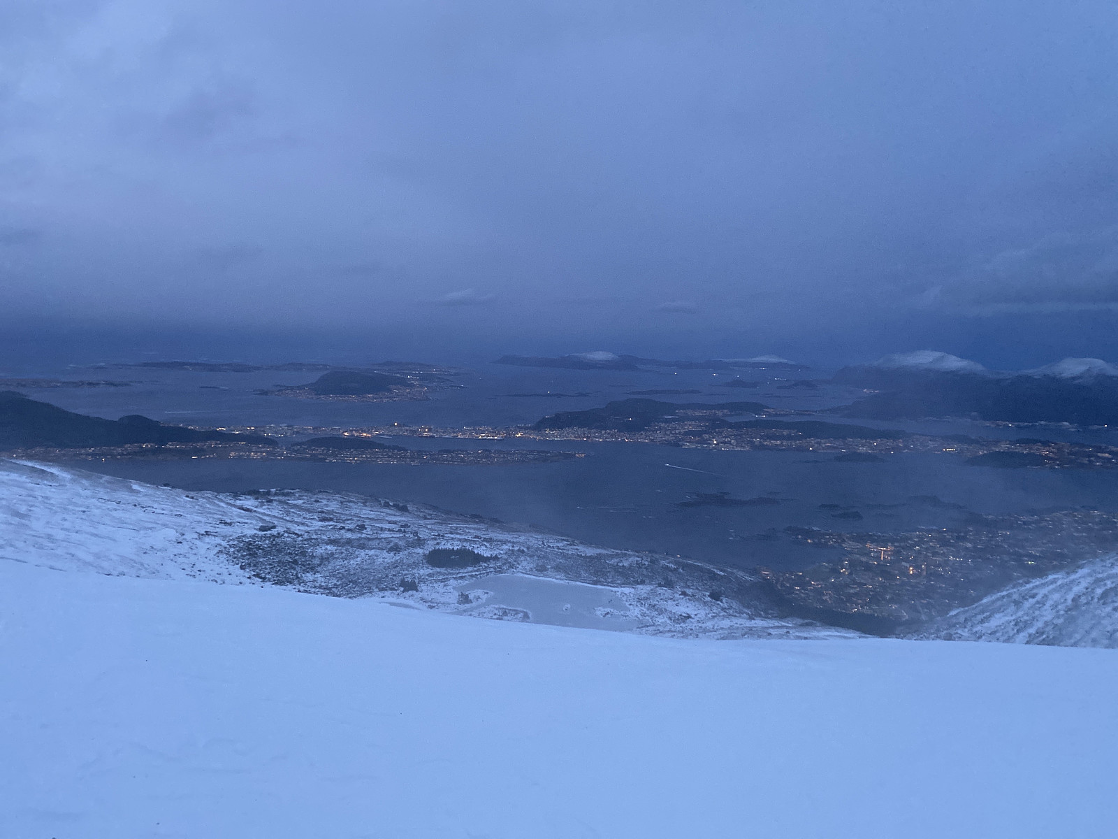 Mount Sulafjellet is a mountain that I've ascended multiple times, and yet I will probably ascend that mountain even more times in the future; as it is not too far away from where we live, and also because it's feasible to climb even when there's too much snow to climb many other mountains around here. The mountain has several peaks, the highest of which has been named Tverrfjellet [i.e. "The Transverse Mountain"], though most people today just call it Vardane [i.e. "The Cairns"], due to the many cairns that mountain hikers have built up there.
The most feasible way to ascend this mountain is to start out from the parking lot at Mauseid (see map), and then follow a gravel road through the forests up to a cottage called Rollonhytta . The parking lot is located at about 50 m.a.m.s.l.; >>>
Mount Sulafjellet is a mountain that I've ascended multiple times, and yet I will probably ascend that mountain even more times in the future; as it is not too far away from where we live, and also because it's feasible to climb even when there's too much snow to climb many other mountains around here. The mountain has several peaks, the highest of which has been named Tverrfjellet [i.e. "The Transverse Mountain"], though most people today just call it Vardane [i.e. "The Cairns"], due to the many cairns that mountain hikers have built up there.
The most feasible way to ascend this mountain is to start out from the parking lot at Mauseid (see map), and then follow a gravel road through the forests up to a cottage called Rollonhytta . The parking lot is located at about 50 m.a.m.s.l.; >>>
To Mount Heggdalshornet and Mount Opstadhornet
- Date:
- 12.12.2020
- Characteristic:
- Hike
- Duration:
- 4:27h
- Distance:
- 15.8km
 Winter had definitely arrived by now, and there was snow up in the higher mountains, especially in inland areas; though it was still not enough snow for skiing in most places. There had been some snow in October and November, but then most of it had disappeared again. Nevertheless, many of the smaller mountains in the coastal area were currently without snow (or without any amount worth mentioning), and so on this day my son and I opted for two of the peaks on an island called Otrøya . So, we drove to the village of Brattvåg, and went by the ferry over to the tiny island of Dryna. Dryna is connected to the larger island called Midøya with a little bridge, and Midøya is in turn connected to Otrøya Island with an even larger bridge (see map). I had previously never ascended any of the many >>>
