Archiv - Nach Datum
Archiv - Nach Aktivität
-
Andere Tour (1)
- Expedition (1)
-
Andere Wintertour (10)
- Schneeschuhtour (10)
- Fahrradtour (2)
- Fußtour (228)
-
Klettern (8)
- Alpinklettern (7)
- Mixed-Klettern (1)
-
Skitour (49)
- Randonnée/Telemark (49)


Gesammelte Listen
-
Romsdal ≥ 100m pf.
(134/301)
 44%
44% -
Sunnmøre ≥ 100m pf.
(78/531)
14%
-
Norges 1000 største fjell målt i primærfaktor
(52/1000)
5%

Randonnee-tur til Gravfjellet
- Datum:
- 28.12.2022
- Tourcharakter:
- Randonnée/Telemark
- Tourlänge:
- 6:41h
- Entfernung:
- 18,0km
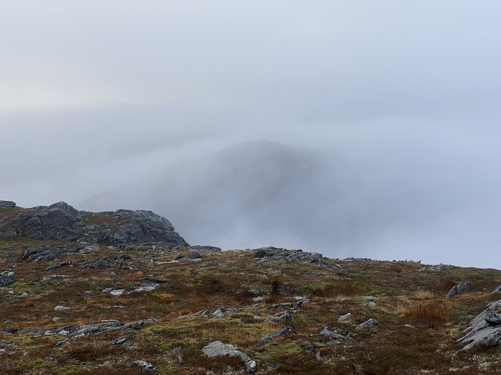
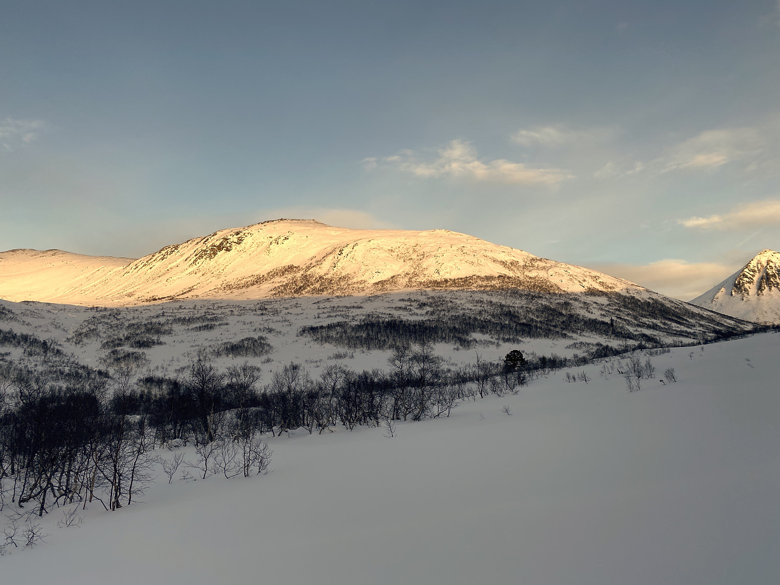 Denne onsdagen fant jeg ut at jeg ville prøve meg på en tur opp på Gravfjellet. Jeg kjørte hjemmefra mot Åndalsnes i 9-tiden, og fortsatte fra Åndalsnes via Isfjorden og opp til Skorgedalen, hvor jeg fulgte bomvegen opp til Rauma Skisenter, hvor det er godt med parkeringsplasser. Der spente jeg på meg skiene, og la av sted.
Det største problemet med Gravfjellet, er at transportetappen fra Rauma Skisenter og bort til foten av fjellet er hele 6 km. I tillegg klarte jeg å gjøre den tabben at jeg havnet på feil side av Ljøsådalen og elva Ljøsåa. Jeg har tidligere vært på Smørbotstinden flere ganger, og uten å ha tenkt så nøye gjennom det, så jeg for meg at det bare var å forlate traséen til Smørbottinden litt etter at man er kommet ut av Fuglehaugen hyttefelt, og så begi >>>
Denne onsdagen fant jeg ut at jeg ville prøve meg på en tur opp på Gravfjellet. Jeg kjørte hjemmefra mot Åndalsnes i 9-tiden, og fortsatte fra Åndalsnes via Isfjorden og opp til Skorgedalen, hvor jeg fulgte bomvegen opp til Rauma Skisenter, hvor det er godt med parkeringsplasser. Der spente jeg på meg skiene, og la av sted.
Det største problemet med Gravfjellet, er at transportetappen fra Rauma Skisenter og bort til foten av fjellet er hele 6 km. I tillegg klarte jeg å gjøre den tabben at jeg havnet på feil side av Ljøsådalen og elva Ljøsåa. Jeg har tidligere vært på Smørbotstinden flere ganger, og uten å ha tenkt så nøye gjennom det, så jeg for meg at det bare var å forlate traséen til Smørbottinden litt etter at man er kommet ut av Fuglehaugen hyttefelt, og så begi >>>
A Day-Trip to the Summit of Mount Hanang
- Datum:
- 04.12.2022
- Tourcharakter:
- Bergtour
- Tourlänge:
- 7:05h
- Entfernung:
- 16,7km
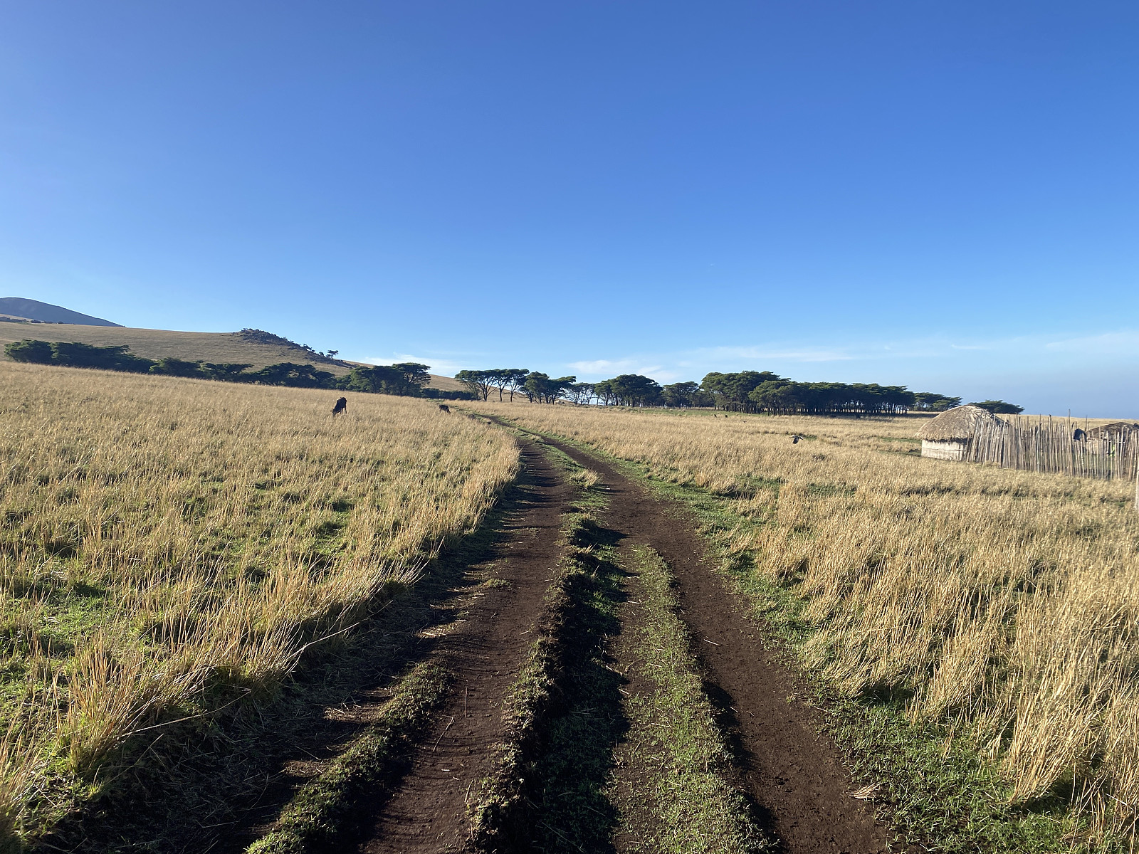
 We met with Samwel Magabe, our local Hanang guide at a pavement cafeteria in Babati, a town located just about 60 kms from Mount Hanang. Babati is the capital and the administrative centre of the Manyara Region in Tanzania; and has a lot of shops and other facilities, though the spot was merely a village 40 years ago, and has been developing quite rapidly since then. My friend and tour operator Frank, with whom I had booked this hike, had been in touch with Samwel in advance of our journey, and they had then agreed to meet at this location. When talking with Frank, Samwel had insisted that an ascent of Hanang is a two day hike, and that you have to spend one night at a camp site high up on the mountain ridge leading to the summit. Frank had, however, refused, and insisted that this particular >>>
Hiking to the Eyasi Viewpoint on Mount Oldeani
- Datum:
- 02.12.2022
- Tourcharakter:
- Wanderung
- Tourlänge:
- 1:25h
- Entfernung:
- 5,8km
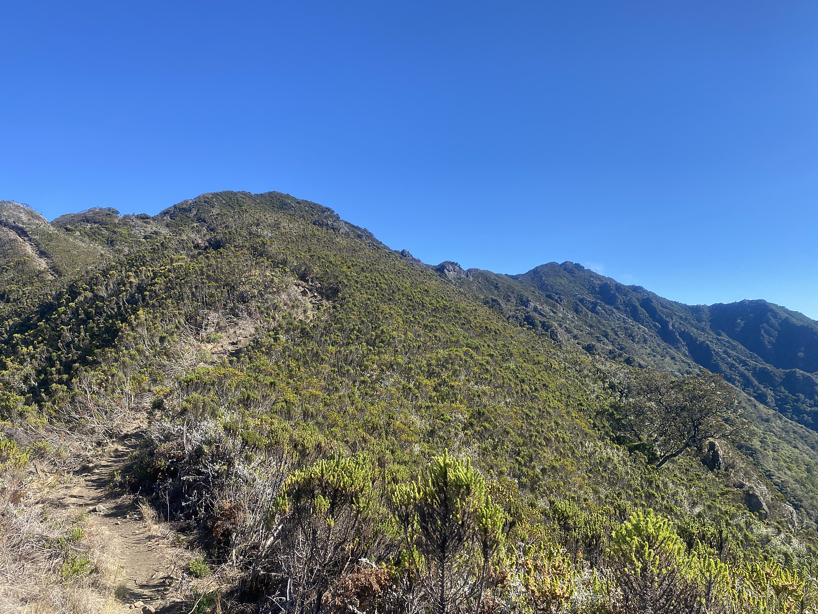
 After our hike to Mount Loolmalasin , Frank and I and our driver spent the night at a nice little lodge just outside of the Ngorongoro Conservation Area, but the very next morning we drove back into the very same conservation area, intending to climb Mount Oldeani [3206 m.a.m.s.l.]. Frank had been in contact with a ranger outpost just by the foot of the mountain, and we went there quite early, eager to meet the ranger that was going to come along with us on our hike. We were at the outpost shortly after seven o'clock, and there we met Elisha Goodluck . He jumped into the car with us, and then we started driving towards our start out point, according to his instructions. To begin with, the road made sense, as it brought us gradually closer to Oldeani, which we had actually had in sight most of >>>
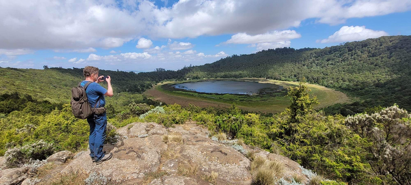
Visiting Mount Loolmalasin and the Ngorongoro crater
- Datum:
- 01.12.2022
- Tourcharakter:
- Bergtour
- Tourlänge:
- 5:44h
- Entfernung:
- 12,8km
 After my ascent of Kilimanjaro, I still had almost 10 full days in Tanzania before I was heading back to Norway, and I therefore asked Frank, my friend and tour operator, about the possibility to ascend another 3 mountains (i.e. Loolmalasin, Oldeani and Hanang) before leaving for home. And so, he checked out with local guides and rangers about the possibility, and came back to me with a price fore the mentioned three mountains, a price that also included rental of a safari vehicle with a driver. (The reason I still had 10 days in Tanzania, was that that I had booked my flight back to Norway so that I had the opportunity to prolong my Kilimanjaro climb, in case I acquired sickness of some kind while up in the mountain, or in case I found out while up there, that I needed more days for altitude >>>
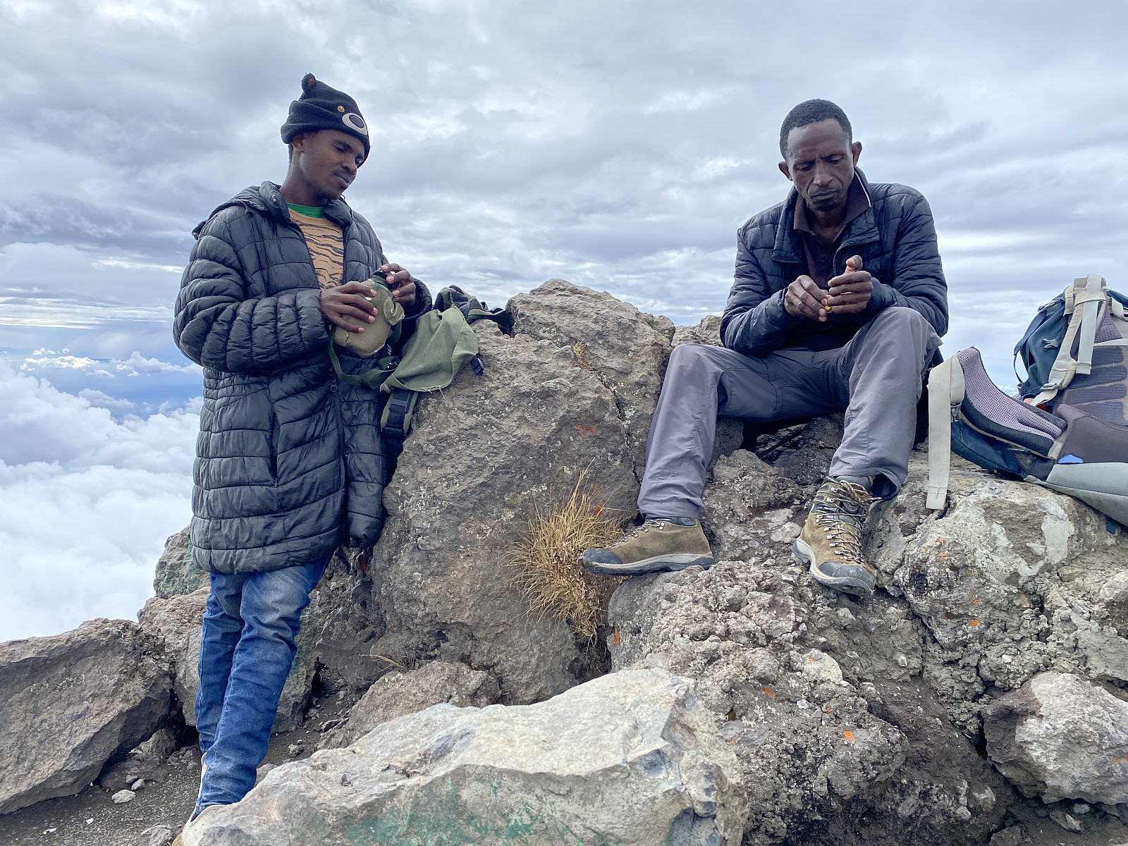
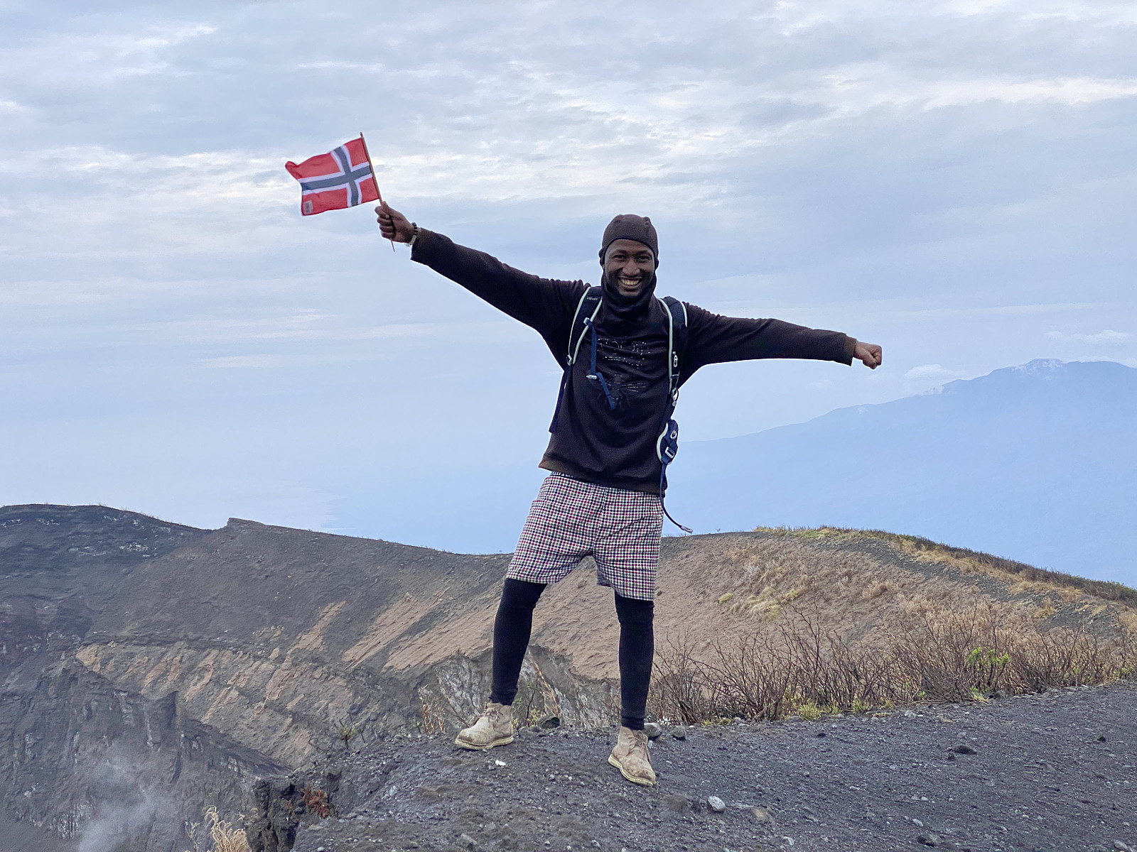
Ascending the Peak of Freedom
- Datum:
- 25.11.2022
- Tourcharakter:
- Bergtour
- Tourlänge:
- 118:40h
- Entfernung:
- 70,3km
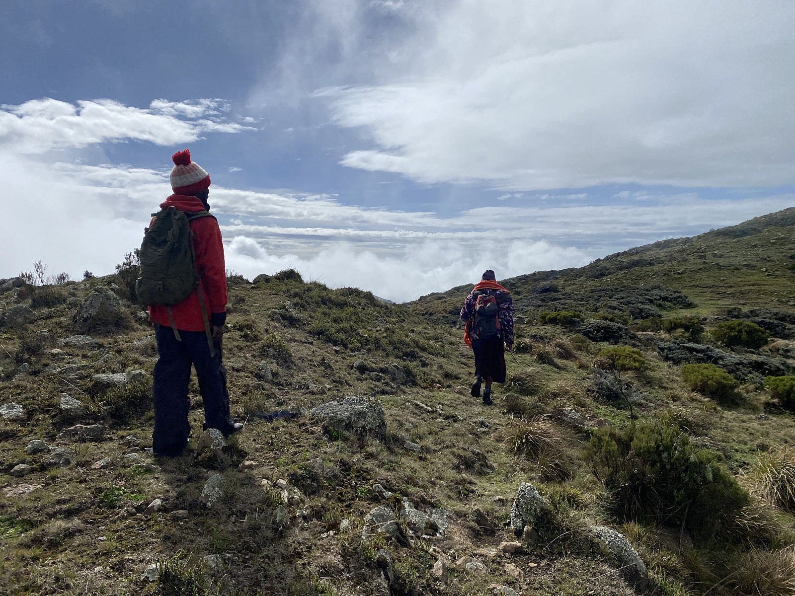
 Ascending Mount Kilimanjaro has been a longstanding dream of mine. As a teenager living in Africa back in the 1980s I occasionally heard of people that had ascended Kilimanjaro (or attempted to do so), but travelling from the DRC to Tanzania was quite costly back then; and so I never had the opportunity. When my employer started sending me to Addis Ababa in Ethiopia for work every now and then, I saw this as an opportunity for trekking Kilimanjaro, however, as Addis is located about 2400 m.a.m.s.l., and 2 weeks there offers good altitude acclimatisation. And so, I got in touch with a guy named Frank Fred Lyimo, and booked a hike of Kilimanjaro with him; scheduling it to the days immediately after a two week stay in Addis.
According to what I've read, between 5 and 10 % of people who attempt >>>
Ascending Mount Kilimanjaro has been a longstanding dream of mine. As a teenager living in Africa back in the 1980s I occasionally heard of people that had ascended Kilimanjaro (or attempted to do so), but travelling from the DRC to Tanzania was quite costly back then; and so I never had the opportunity. When my employer started sending me to Addis Ababa in Ethiopia for work every now and then, I saw this as an opportunity for trekking Kilimanjaro, however, as Addis is located about 2400 m.a.m.s.l., and 2 weeks there offers good altitude acclimatisation. And so, I got in touch with a guy named Frank Fred Lyimo, and booked a hike of Kilimanjaro with him; scheduling it to the days immediately after a two week stay in Addis.
According to what I've read, between 5 and 10 % of people who attempt >>>
Ascending Mount Meru in Arusha
- Datum:
- 20.11.2022
- Tourcharakter:
- Hochtour
- Tourlänge:
- 44:51h
- Entfernung:
- 31,4km
 I have for years been having a dream of climbing Mount Kilimanjaro one day, and then a few years ago, I read on a web site that you could increase your chances of reaching the summit by first climbing Mount Meru [4562 m.a.m.s.l.] . The particular web site was that of a UK based tour operator, who stated they had a success rate of bringing their clients to the Uhuru Peak [5895 m.a.m.s.l.] of 93%, but 97% among those who ascended Meru prior to embarking on Kilimanjaro. These numbers could of course be interpreted in various ways, but the most likely explanation is of course, that altitude acclimatisation actually helps. Now, in addition to this trek of Mount Meru, my acclimatisation plan also included a two week stay in Addis Ababa (at 2400 m.a.m.s.l.) prior to my journey to Tanzania; as well >>>
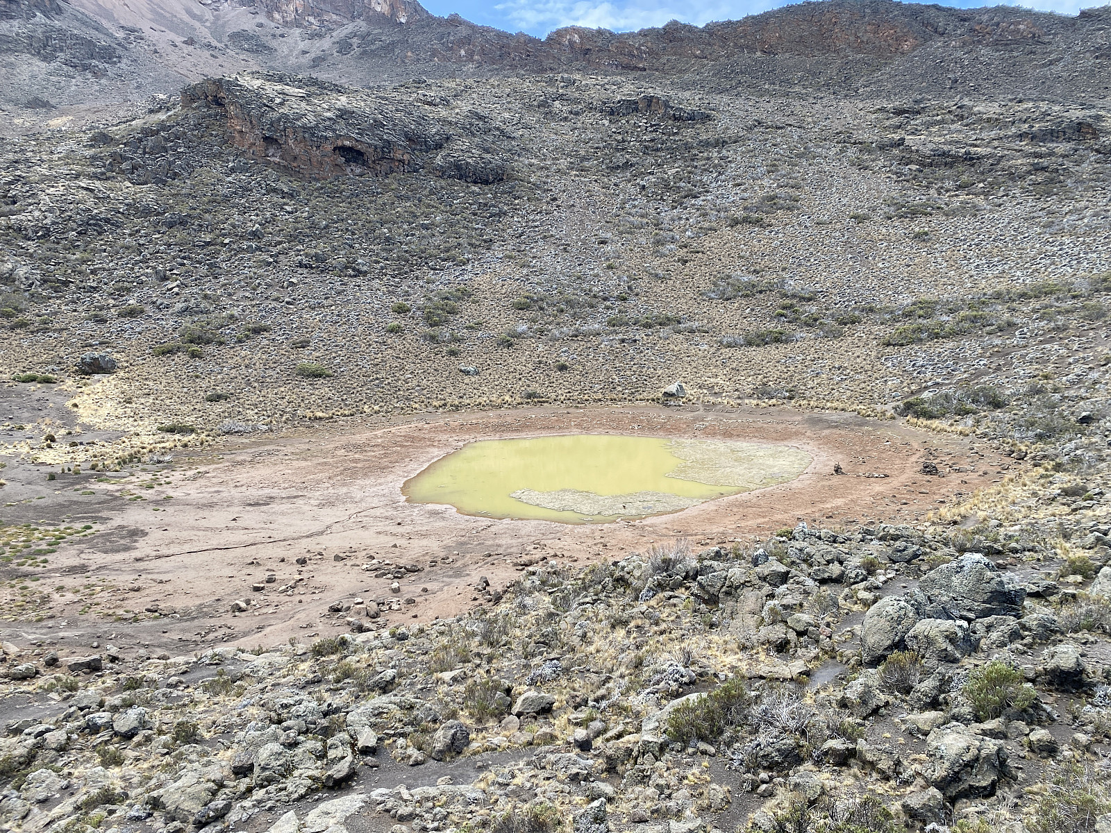
Climbing the Mountain of God
- Datum:
- 18.11.2022
- Tourcharakter:
- Bergtour
- Tourlänge:
- 8:54h
- Entfernung:
- 12,6km
 For me, this hike was all about altitude acclimatisation in anticipation of climbing Mount Kilimanjaro. I had planned to summit Kilimanjaro about a week later, and in order not to fail in my attempt at doing so; I had figured out the following plan for gradually getting the necessary habituation:
Ascend as many >1500 meter summits as possible in Norway before I leave for Africa. Stay two weeks at 2400 m.a.m.s.l. in Addis Ababa with running/jogging almost every day. Ascend at least one >3000 meter summit while in Ethiopia. Ascend Mount Ol Doinyo Lengai [2962 m.a.m.s.l.] immediately after my arrival in Tanzania. Ascend Mount Meru [4562 m.a.m.s.l.]. Ascend Mount Kilimanjaro [5895 m.a.m.s.l.]. I am quite sure a lot of those who fail to reach the summit of Kilimanjaro do so, due to poor planning; >>>
For me, this hike was all about altitude acclimatisation in anticipation of climbing Mount Kilimanjaro. I had planned to summit Kilimanjaro about a week later, and in order not to fail in my attempt at doing so; I had figured out the following plan for gradually getting the necessary habituation:
Ascend as many >1500 meter summits as possible in Norway before I leave for Africa. Stay two weeks at 2400 m.a.m.s.l. in Addis Ababa with running/jogging almost every day. Ascend at least one >3000 meter summit while in Ethiopia. Ascend Mount Ol Doinyo Lengai [2962 m.a.m.s.l.] immediately after my arrival in Tanzania. Ascend Mount Meru [4562 m.a.m.s.l.]. Ascend Mount Kilimanjaro [5895 m.a.m.s.l.]. I am quite sure a lot of those who fail to reach the summit of Kilimanjaro do so, due to poor planning; >>>
To Mount Zuqualla in Oromia, Ethiopia
- Datum:
- 13.11.2022
- Tourcharakter:
- Bergtour
- Tourlänge:
- 5:55h
- Entfernung:
- 17,5km
 We had been in Addis Ababa for about a week for a cardiology and cardiac surgery mission at the Black Lion Hospital, when we finally had this one day off, as it was weekend, and there were not any procedures scheduled for Sunday. I had booked the trip through a guy called Johnny Gondar, whom I had met for the first time shortly after I arrived in Addis. I asked some of my colleagues whether they would like to join me for the hike. When I first asked, there were three people that were interested; but when the day finally arrived, only one of them came along, however, namely Bjørg Anita, who proved to be very well fitted for mountaineering. For me, this hike was all about altitude acclimatisation, as I was planning to ascend Mount Kilimanjaro in Tanzania [5985 m.a.m.s.l.] less than two weeks >>>
Til Blåtinden og Haddalshornet
- Datum:
- 29.10.2022
- Tourcharakter:
- Bergtour
- Tourlänge:
- 4:04h
- Entfernung:
- 9,3km
 Været var ikke noe særlig noe sted i fylket vårt denne dagen, og dermed foreslo min sønn Dag at vi valgte oss noen mindre fjelltopper i ytre strøk som turmål, fremfor de høye toppene på indre strøk. Vi kjørte derfor til Sulesund, tok ferja over til Hareid, og kjørte sørover, forbi Ulsteinvik, og frem til bygda Haddal . Her kjørte vi bare et lite stykke opp i Ringstaddalen, opp til en parkeringsplass som var avmerket på Peakbook-kartet. Der parkerte vi, og gav oss i kast med stien oppover mot Blåtinden [697 m.o.h.]. Første del av stien gikk over litt myrlendt og vått terreng, men ikke verre enn at man kunne hoppe litt fra stein til stein, og fra gresstue til gresstue, og på den måten unngå å bli veldig våt i skoene.
Etter kort tid nådde stien foten av fjellet, og skrået >>>
Været var ikke noe særlig noe sted i fylket vårt denne dagen, og dermed foreslo min sønn Dag at vi valgte oss noen mindre fjelltopper i ytre strøk som turmål, fremfor de høye toppene på indre strøk. Vi kjørte derfor til Sulesund, tok ferja over til Hareid, og kjørte sørover, forbi Ulsteinvik, og frem til bygda Haddal . Her kjørte vi bare et lite stykke opp i Ringstaddalen, opp til en parkeringsplass som var avmerket på Peakbook-kartet. Der parkerte vi, og gav oss i kast med stien oppover mot Blåtinden [697 m.o.h.]. Første del av stien gikk over litt myrlendt og vått terreng, men ikke verre enn at man kunne hoppe litt fra stein til stein, og fra gresstue til gresstue, og på den måten unngå å bli veldig våt i skoene.
Etter kort tid nådde stien foten av fjellet, og skrået >>>
Over Midøya via Litlekulten og Bløkallen
- Datum:
- 23.10.2022
- Tourcharakter:
- Hochtour
- Tourlänge:
- 6:23h
- Entfernung:
- 17,0km
 Ti dager før jeg la ut på denne turen, kjørte jeg over Midøya, og la merke til en fjellrygg opp på vestsida av øya. Jeg tenkte at opp der var det sikkert fint å klyve, så jeg studerte kartet nøye, og begynte å planlegge en tur, der jeg i alle fall stakk oppom Litlekulten [446 m.o.h.] og Bløkallen [522 m.o.h.], de to røde PBE'ene som er å finne på denne øya.
Jeg kjørte til Brattvågen, tok ferja over til Dryna; fortsatte videre til Midøya, og parkerte på Bjørnaremshellaren p-plass, omtrent akkurat der den gamle fogderigrensa krysser øya. Jeg fulgte så veien sørover igjen til den nevnte ryggen opp mot Litlekulten, og straks jeg var ved foten av ryggen, la jeg i vei oppover i fjellsida. Sett nede fra fylkesveien, var det ikke åpenbart at det ville la seg gjøre å komme helt >>>
Ti dager før jeg la ut på denne turen, kjørte jeg over Midøya, og la merke til en fjellrygg opp på vestsida av øya. Jeg tenkte at opp der var det sikkert fint å klyve, så jeg studerte kartet nøye, og begynte å planlegge en tur, der jeg i alle fall stakk oppom Litlekulten [446 m.o.h.] og Bløkallen [522 m.o.h.], de to røde PBE'ene som er å finne på denne øya.
Jeg kjørte til Brattvågen, tok ferja over til Dryna; fortsatte videre til Midøya, og parkerte på Bjørnaremshellaren p-plass, omtrent akkurat der den gamle fogderigrensa krysser øya. Jeg fulgte så veien sørover igjen til den nevnte ryggen opp mot Litlekulten, og straks jeg var ved foten av ryggen, la jeg i vei oppover i fjellsida. Sett nede fra fylkesveien, var det ikke åpenbart at det ville la seg gjøre å komme helt >>>
