Archiv - Nach Datum
Archiv - Nach Aktivität
-
Andere Tour (1)
- Expedition (1)
-
Andere Wintertour (10)
- Schneeschuhtour (10)
- Fahrradtour (2)
- Fußtour (228)
-
Klettern (8)
- Alpinklettern (7)
- Mixed-Klettern (1)
-
Skitour (49)
- Randonnée/Telemark (49)


Gesammelte Listen
-
Romsdal ≥ 100m pf.
(134/301)
 44%
44% -
Sunnmøre ≥ 100m pf.
(78/531)
14%
-
Norges 1000 største fjell målt i primærfaktor
(52/1000)
5%

Til Syltefjellet i Valldalen
- Datum:
- 18.12.2021
- Tourcharakter:
- Bergtour
- Tourlänge:
- 5:06h
- Entfernung:
- 16,0km
 Denne turen var, i likhet med så mange andre, en tur min sønn foreslo at vi kunne ta. Han hadde gått deler av den tidligere en gang, og så hadde han tenkt ut at vi i tillegg til å gå over fjellet fra Sylte til Ytterlia, også kunne legge turen oppom toppen på Syltefjellet, også kalt Ytterlinakken. Vi kjørte inn til Valldalen, og parkerte nede ved småbåthavna, og begynte å gå derfra.
Første del av turen var langs den såkalte Olavsvegen (bilde #1). Fra Sylte, dvs. fra "Valldalen sentrum", er fjellsida såpass bratt, at det ikke går noen sti rett opp der. For å komme opp på utsiktspunktet Kamben [325 m.o.h.], eller opp på den knausen av Syltefjellet som kalles Klosterfjellet [382 m.o.h.]; går man derfor først ca. 1 km nordover langsetter Olavsvegen, før man tar av >>>
Denne turen var, i likhet med så mange andre, en tur min sønn foreslo at vi kunne ta. Han hadde gått deler av den tidligere en gang, og så hadde han tenkt ut at vi i tillegg til å gå over fjellet fra Sylte til Ytterlia, også kunne legge turen oppom toppen på Syltefjellet, også kalt Ytterlinakken. Vi kjørte inn til Valldalen, og parkerte nede ved småbåthavna, og begynte å gå derfra.
Første del av turen var langs den såkalte Olavsvegen (bilde #1). Fra Sylte, dvs. fra "Valldalen sentrum", er fjellsida såpass bratt, at det ikke går noen sti rett opp der. For å komme opp på utsiktspunktet Kamben [325 m.o.h.], eller opp på den knausen av Syltefjellet som kalles Klosterfjellet [382 m.o.h.]; går man derfor først ca. 1 km nordover langsetter Olavsvegen, før man tar av >>>
Randonee-tur til Hunden ved Lingåsen
- Datum:
- 11.12.2021
- Tourcharakter:
- Randonnée/Telemark
- Tourlänge:
- 4:24h
- Entfernung:
- 10,9km
 Vi hadde lurt litt på å ta skituren opp på Berdalsnibba [1344 m.o.h.] denne dagen, men forstod egentlig allerede på vei innover mot Valldalen at vi antagelig var litt seint ute med tanke på en såpass lang tur, så vi hadde litt i tankene at vi kanskje skulle ta sikte på Hunden [943 m.o.h.] i stedet. Vi parkerte der bomvegen begynner oppe på Lingåsen, og spente på oss skiene, og så fulgte vi veien oppover mot Klovset. Det var uansett alt for mye snø til at vi kunne fortsatt med bil oppover, men det gikk helt greit å gå på ski opp disse bakkene; med unntak av et par plasser hvor det var såpass avblåst at man kunne risikere å ripe opp skia på grusen, med mindre man passet på å passere disse stedene ved å gå ute i grøfta.
Vi passerte Klovsetsetra på baksida, i skogen litt >>>
Vi hadde lurt litt på å ta skituren opp på Berdalsnibba [1344 m.o.h.] denne dagen, men forstod egentlig allerede på vei innover mot Valldalen at vi antagelig var litt seint ute med tanke på en såpass lang tur, så vi hadde litt i tankene at vi kanskje skulle ta sikte på Hunden [943 m.o.h.] i stedet. Vi parkerte der bomvegen begynner oppe på Lingåsen, og spente på oss skiene, og så fulgte vi veien oppover mot Klovset. Det var uansett alt for mye snø til at vi kunne fortsatt med bil oppover, men det gikk helt greit å gå på ski opp disse bakkene; med unntak av et par plasser hvor det var såpass avblåst at man kunne risikere å ripe opp skia på grusen, med mindre man passet på å passere disse stedene ved å gå ute i grøfta.
Vi passerte Klovsetsetra på baksida, i skogen litt >>>
Til Hellsetnakken, Ellingholnakken og Vikenakken
- Datum:
- 13.11.2021
- Tourcharakter:
- Bergtour
- Tourlänge:
- 4:16h
- Entfernung:
- 14,4km
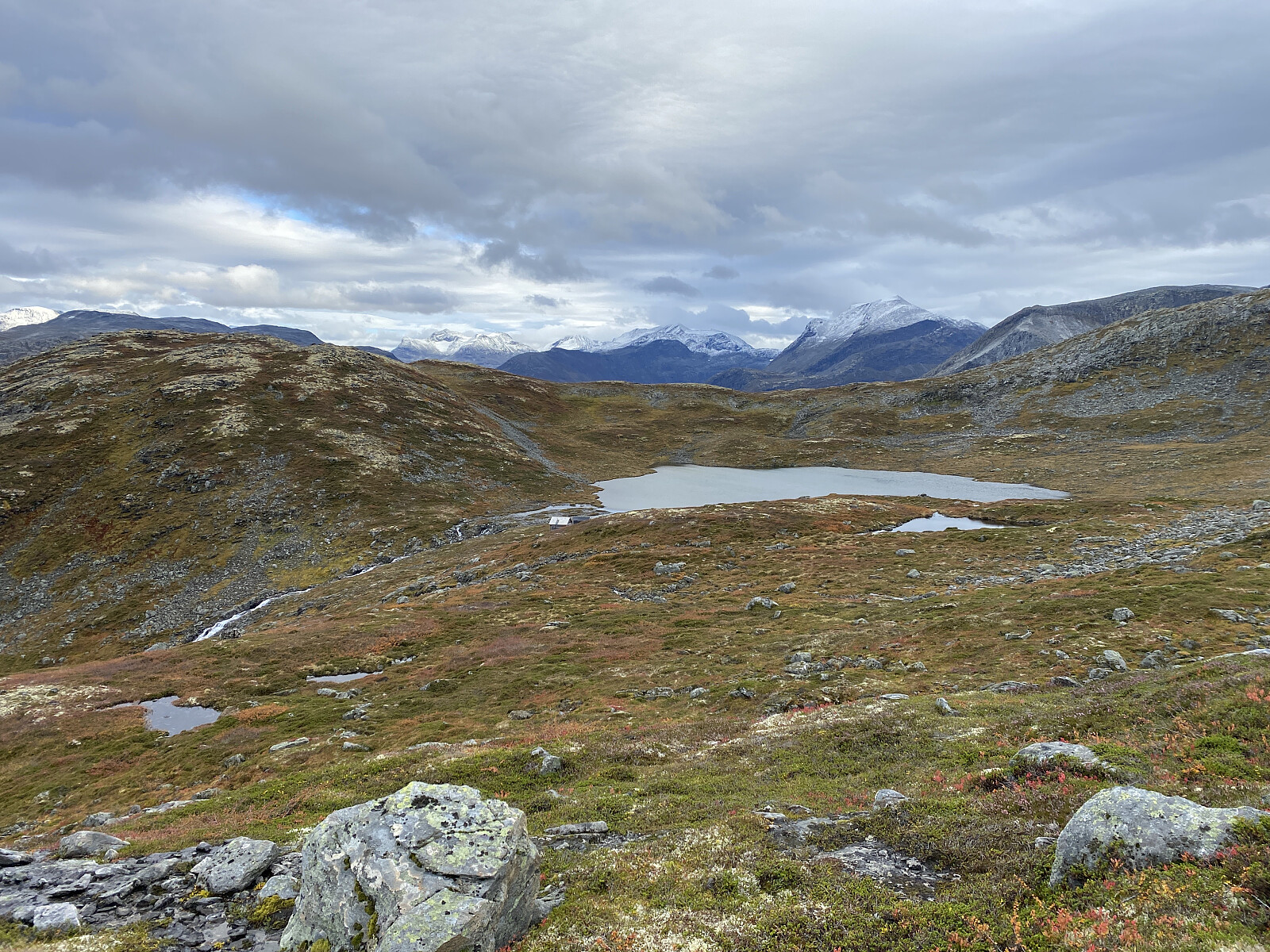
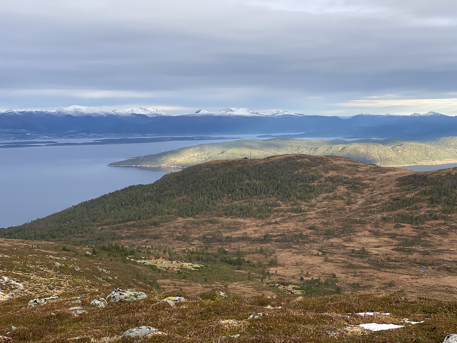 Vi hadde sett oss ut Helsetnakken [674 m.o.h.] som turmål for denne dagen, og kjørte til Vikebukt, hvor vi parkerte på nedsida av Coop-butikken, rett ved gamle ferjekaia. Like etter at vi hadde passert Brastad, på vestsida av Tresfjorden, fikk vi veldig fin utsikt over mot Helsetnakken, og vi stoppet og tok noen bilder av fjellet vi var tenkt oss opp på (bilde #1).
Vi fulgte den gamle landeveien (Fylkesvei 5981) sørover til Indre Vike, hvor vi tok av på en vei vi hadde sett førte forbi et par gårdstun, og videre derfra oppover fjellsida. Der fjellsida bratnet til, var det lagt inn hårnålssvinger. Ved omkring 340 høydemeter tok veien brått slutt, men derifra var det en fin sti som vi fulgte videre oppover. Desto høyere opp vi kom, desto bedre ble utsikten (bilde #2), og snart var >>>
Vi hadde sett oss ut Helsetnakken [674 m.o.h.] som turmål for denne dagen, og kjørte til Vikebukt, hvor vi parkerte på nedsida av Coop-butikken, rett ved gamle ferjekaia. Like etter at vi hadde passert Brastad, på vestsida av Tresfjorden, fikk vi veldig fin utsikt over mot Helsetnakken, og vi stoppet og tok noen bilder av fjellet vi var tenkt oss opp på (bilde #1).
Vi fulgte den gamle landeveien (Fylkesvei 5981) sørover til Indre Vike, hvor vi tok av på en vei vi hadde sett førte forbi et par gårdstun, og videre derfra oppover fjellsida. Der fjellsida bratnet til, var det lagt inn hårnålssvinger. Ved omkring 340 høydemeter tok veien brått slutt, men derifra var det en fin sti som vi fulgte videre oppover. Desto høyere opp vi kom, desto bedre ble utsikten (bilde #2), og snart var >>>
Til Skarven i Mittet (ved Langfjorden)
- Datum:
- 06.11.2021
- Tourcharakter:
- Bergtour
- Tourlänge:
- 2:43h
- Entfernung:
- 6,3km
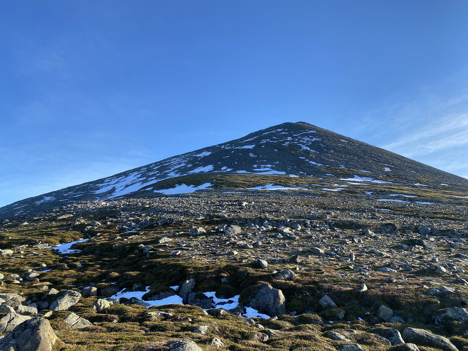
 Innerst i Romsdal finnes ei slags halvøy omgitt av Eresfjorden, Langfjorden, Romsdalsfjorden og Isfjorden. Denne halvøya har mange fine fjell, og jeg har tidligere vært på både Skarven ved Skorgedalen, Tarløysa, Smørbottstinden, Kvasstinden, Breivikheia, Kyrkjetaket og Jamtetinden; og min sønn Dag har vært på enda flere av disse toppene. Denne dagen foreslo Dag at vi tok turen opp på Skarven i Mittet ved Langfjorden, da det nok var i minste laget med snø for en skitur, samtidig som Skarven ikke var høyere enn at det burde la seg gjøre å nå toppen til tross for at man eventuelt ble gående og stampe i en del snø.
Vi kjørte inn til Mittet ved Langfjorden, og tok av på en vei som førte oss opp til Ytre Mittetsetrane, hvor vi parkerte bilen. Veien slutter like nedenfor selve >>>
Innerst i Romsdal finnes ei slags halvøy omgitt av Eresfjorden, Langfjorden, Romsdalsfjorden og Isfjorden. Denne halvøya har mange fine fjell, og jeg har tidligere vært på både Skarven ved Skorgedalen, Tarløysa, Smørbottstinden, Kvasstinden, Breivikheia, Kyrkjetaket og Jamtetinden; og min sønn Dag har vært på enda flere av disse toppene. Denne dagen foreslo Dag at vi tok turen opp på Skarven i Mittet ved Langfjorden, da det nok var i minste laget med snø for en skitur, samtidig som Skarven ikke var høyere enn at det burde la seg gjøre å nå toppen til tross for at man eventuelt ble gående og stampe i en del snø.
Vi kjørte inn til Mittet ved Langfjorden, og tok av på en vei som førte oss opp til Ytre Mittetsetrane, hvor vi parkerte bilen. Veien slutter like nedenfor selve >>>
Til Blåtinden og Midttinden ved Vågstranda
- Datum:
- 30.10.2021
- Tourcharakter:
- Bergtour
- Tourlänge:
- 5:55h
- Entfernung:
- 15,9km
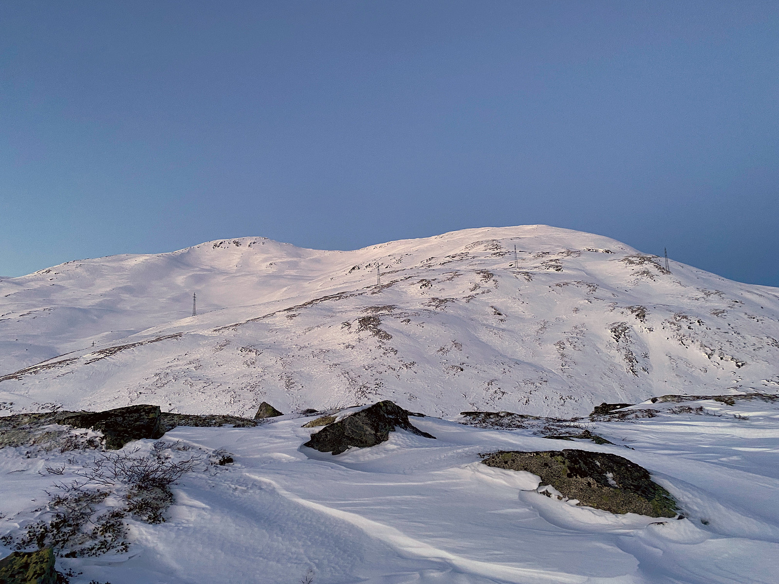
 Min sønn foreslo denne morgenen at vi kunne ta turen opp på fjellet Blåtinden på halvøya mellom Tresfjorden og Indre Romsdalsfjorden . Denne fjelltoppen er bare 1166 meter høy, og lå i øyeblikket derfor under snøgrensa, selv om det var snø i høyfjellet. Mellom Hjelvika og Vågstranda går det ikke mindre enn tre alternative veier; den ene er europaveien E136, den andre går nede ved sjøen (forbi Skålhamna ), og den tredje går over Vikåsen . Vi fulgte sistnevnte vei opp til nettopp Vikåsen, hvor det var en egnet parkeringsplass for turgåere. Der satte vi fra oss bilen, og la av sted på tur.
Vi fulgte en skogbruksveg oppover gjennom skogen i retning Skålsetra, til vi kom til en sti som tok av til venstre, og hvor det var det skilt som fortalte at dette var veien opp til Skålsetra. >>>
Min sønn foreslo denne morgenen at vi kunne ta turen opp på fjellet Blåtinden på halvøya mellom Tresfjorden og Indre Romsdalsfjorden . Denne fjelltoppen er bare 1166 meter høy, og lå i øyeblikket derfor under snøgrensa, selv om det var snø i høyfjellet. Mellom Hjelvika og Vågstranda går det ikke mindre enn tre alternative veier; den ene er europaveien E136, den andre går nede ved sjøen (forbi Skålhamna ), og den tredje går over Vikåsen . Vi fulgte sistnevnte vei opp til nettopp Vikåsen, hvor det var en egnet parkeringsplass for turgåere. Der satte vi fra oss bilen, og la av sted på tur.
Vi fulgte en skogbruksveg oppover gjennom skogen i retning Skålsetra, til vi kom til en sti som tok av til venstre, og hvor det var det skilt som fortalte at dette var veien opp til Skålsetra. >>>
Trugetur til Lingåsen og Vardefjellet
- Datum:
- 23.10.2021
- Tourcharakter:
- Schneeschuhtour
- Tourlänge:
- 6:11h
- Entfernung:
- 17,9km
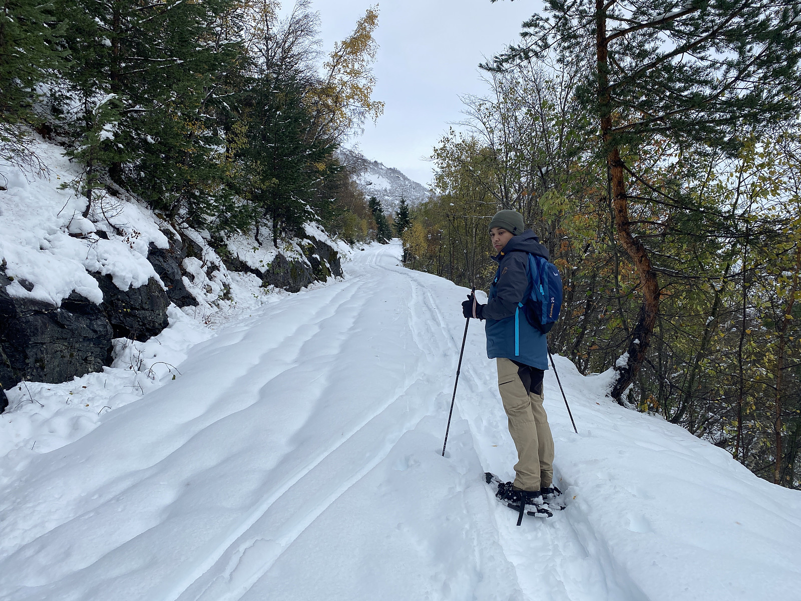 Video #1: På truger oppover Lingåsen.
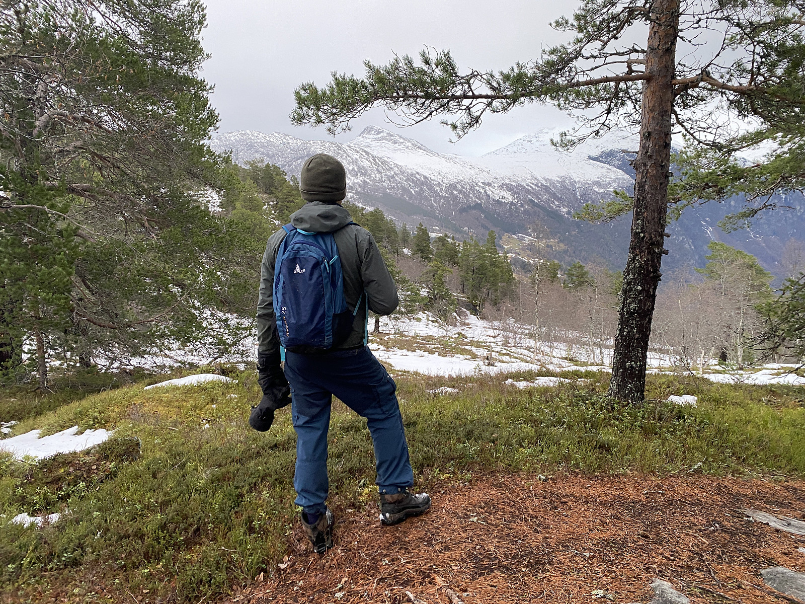
Denne Lørdagen hadde min sønn sett seg ut en fjellknaus, kalt Vardefjellet, beliggende omtrent rett ovenfor bygda Linge på nordsida av Storfjorden. Vi kjørte inn til Valldalen, parkerte ved ene butikken der, og begynte å gå oppover. Vi kunne saktens ha kjørt hårnålssvingene opp på Lingåsen, men da ville ikke turen ha blitt særlig lang; så for treningens del valgte vi å starte helt nede i Valldalen sentrum.
Video #2: På truger oppover mot Klovfjellet.
Vi gikk i relativt raskt tempo oppover den nevnte hårnålsveien, og kom etterhvert opp til et stort gårdsbruk oppe på det som kalles Lingåsen. Like etter dette gårsbruket er der en slags parkeringsplass, og rett etter den er veien videre skiltet som bomveg, og her kan man betale både med >>>
Video #1: På truger oppover Lingåsen.
Denne Lørdagen hadde min sønn sett seg ut en fjellknaus, kalt Vardefjellet, beliggende omtrent rett ovenfor bygda Linge på nordsida av Storfjorden. Vi kjørte inn til Valldalen, parkerte ved ene butikken der, og begynte å gå oppover. Vi kunne saktens ha kjørt hårnålssvingene opp på Lingåsen, men da ville ikke turen ha blitt særlig lang; så for treningens del valgte vi å starte helt nede i Valldalen sentrum.
Video #2: På truger oppover mot Klovfjellet.
Vi gikk i relativt raskt tempo oppover den nevnte hårnålsveien, og kom etterhvert opp til et stort gårdsbruk oppe på det som kalles Lingåsen. Like etter dette gårsbruket er der en slags parkeringsplass, og rett etter den er veien videre skiltet som bomveg, og her kan man betale både med >>>
Venjetindtraversen
- Datum:
- 09.10.2021
- Tourlänge:
- 9:46h
- Entfernung:
- 16,1km
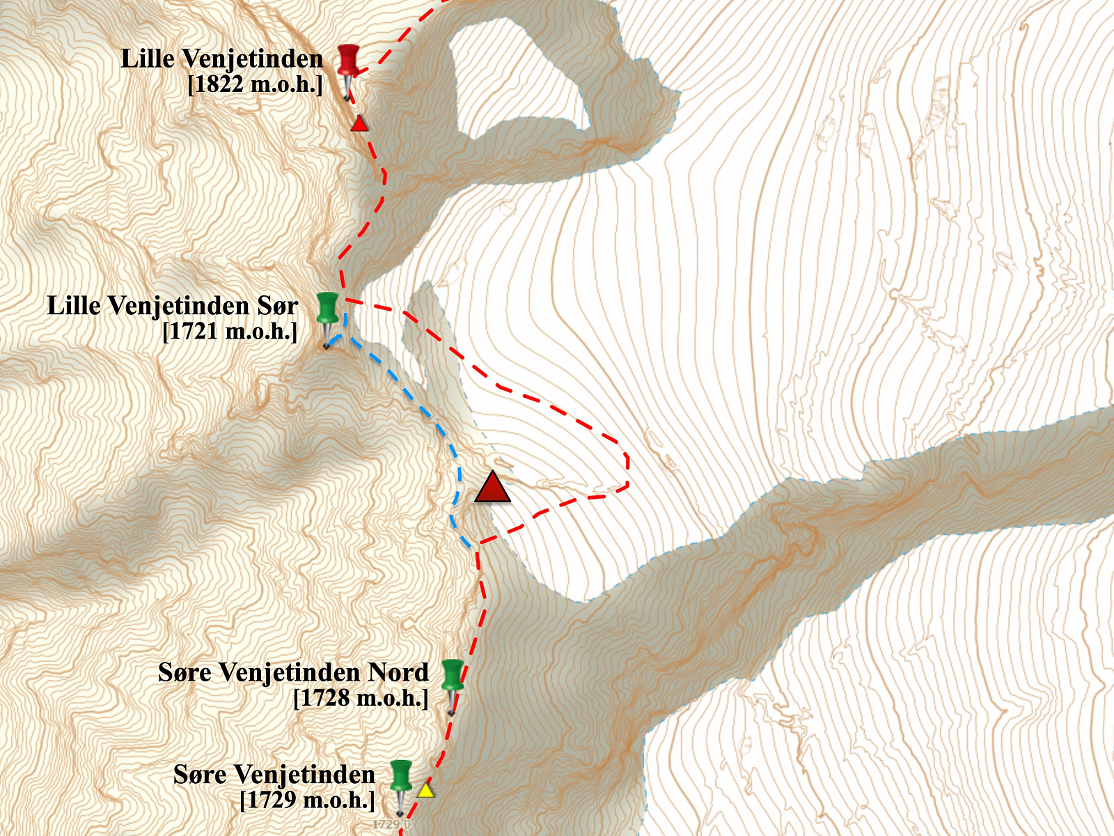 Etter å ha snudd knapt halvveis på Venjetindtraversen ei uke tidligere [Turbeskrivelse her: Søre Venjetinden ], var jeg nå veldig gira på å gjennomføre denne turen; og da været slo til denne lørdagen, var det bare å komme seg av gårde. Det var meldt tett snø i denne høyden de neste 14 dagene, så det lå i kortene at dette ville bli siste muligheten før neste sommer.
Jeg stod mye tidligere opp enn det jeg hadde gjort helgen før, og denne gangen passet jeg på å ha hodelykt med meg; og så kjørte jeg innover til Åndalsnes og Venjedalen, og parkerte helt øverst inne i dalen mellom Venjetindane og Romsdalshornet. Nå var jeg jo bedre kjent enn det jeg var forrige gang, så nå fulgte jeg riktig sti helt fra starten av; og det sparte jeg en del tid på. Jeg kom meg opp i hengedalen mellom Romsdalshornet >>>
Etter å ha snudd knapt halvveis på Venjetindtraversen ei uke tidligere [Turbeskrivelse her: Søre Venjetinden ], var jeg nå veldig gira på å gjennomføre denne turen; og da været slo til denne lørdagen, var det bare å komme seg av gårde. Det var meldt tett snø i denne høyden de neste 14 dagene, så det lå i kortene at dette ville bli siste muligheten før neste sommer.
Jeg stod mye tidligere opp enn det jeg hadde gjort helgen før, og denne gangen passet jeg på å ha hodelykt med meg; og så kjørte jeg innover til Åndalsnes og Venjedalen, og parkerte helt øverst inne i dalen mellom Venjetindane og Romsdalshornet. Nå var jeg jo bedre kjent enn det jeg var forrige gang, så nå fulgte jeg riktig sti helt fra starten av; og det sparte jeg en del tid på. Jeg kom meg opp i hengedalen mellom Romsdalshornet >>>
Søre Venjetinden
- Datum:
- 02.10.2021
- Tourcharakter:
- Hochtour
- Tourlänge:
- 7:22h
- Entfernung:
- 11,0km
 Jeg besøkte Store og Lille Venjetind i midten av august i år [Link til turen: Store og Lille Venjetind ], og har siden hatt lyst til å forsøke meg på å gå hele Venjetindtraversen. Imidlertid kom jeg meg litt sent av gårde denne dagen, og etter å ha kjørt en halvtimes tid på vei til Åndalsnes, kom jeg på at jeg hadde glemt å ta med hodelykt. Jeg visste at solen ville gå ned i syv-tiden, og at det ville være mørkt ca. kl. åtte om kvelden; men om jeg kunne komme i gang med å gå like etter klokken tolv, så hadde jeg jo om lag 8 timer på meg, hvilket jeg tenkte skulle holde.
Jeg kjørte opp til parkeringsplassen helt øverst i Venjedalen, satte bilen fra meg der oppe, og gav meg i kast med stien oppover mot den lille hengedalen mellom Romsdalshornet og Olaskarstinden (se kart). Jeg gikk imidlertid feil >>>
Jeg besøkte Store og Lille Venjetind i midten av august i år [Link til turen: Store og Lille Venjetind ], og har siden hatt lyst til å forsøke meg på å gå hele Venjetindtraversen. Imidlertid kom jeg meg litt sent av gårde denne dagen, og etter å ha kjørt en halvtimes tid på vei til Åndalsnes, kom jeg på at jeg hadde glemt å ta med hodelykt. Jeg visste at solen ville gå ned i syv-tiden, og at det ville være mørkt ca. kl. åtte om kvelden; men om jeg kunne komme i gang med å gå like etter klokken tolv, så hadde jeg jo om lag 8 timer på meg, hvilket jeg tenkte skulle holde.
Jeg kjørte opp til parkeringsplassen helt øverst i Venjedalen, satte bilen fra meg der oppe, og gav meg i kast med stien oppover mot den lille hengedalen mellom Romsdalshornet og Olaskarstinden (se kart). Jeg gikk imidlertid feil >>>
Til Kallskaregga og Vassdalshornet
- Datum:
- 25.09.2021
- Tourcharakter:
- Bergtour
- Tourlänge:
- 8:09h
- Entfernung:
- 16,0km
 Det var min sønn Dag som foreslo vi kunne ta denne turen når vi kvelden i forveien drøftet hvor vi skulle legge ut på tur. Han har gått en hel del i fjella i området, og vet om en hel del stier, og hvor det er parkeringsplass å finne etc. Vi parkerte på en åpen plass rett ved veien ved vest-enden av Onilsavatnet [177-160 m.o.h.].
Fra stedet der vi parkerte gikk første del av turen langs en skogsvei, og deretter fulgte vi en sti gjennom mer skog og over ei myr. Etterhvert bratnet turen imidlertid til, og stien fulgte ei steinete renne oppover til Kallskaret, som ligger på knappe 1000 høydemeter.
Fra Kallskaret fulgte vi en kant nordover, slik at vi hadde Kallskardalen på venstre hånd og den bratte fjellsida ned mot Tafjorden på høyre hånd. Vi så rester etter noen gamle stier >>>
Det var min sønn Dag som foreslo vi kunne ta denne turen når vi kvelden i forveien drøftet hvor vi skulle legge ut på tur. Han har gått en hel del i fjella i området, og vet om en hel del stier, og hvor det er parkeringsplass å finne etc. Vi parkerte på en åpen plass rett ved veien ved vest-enden av Onilsavatnet [177-160 m.o.h.].
Fra stedet der vi parkerte gikk første del av turen langs en skogsvei, og deretter fulgte vi en sti gjennom mer skog og over ei myr. Etterhvert bratnet turen imidlertid til, og stien fulgte ei steinete renne oppover til Kallskaret, som ligger på knappe 1000 høydemeter.
Fra Kallskaret fulgte vi en kant nordover, slik at vi hadde Kallskardalen på venstre hånd og den bratte fjellsida ned mot Tafjorden på høyre hånd. Vi så rester etter noen gamle stier >>>
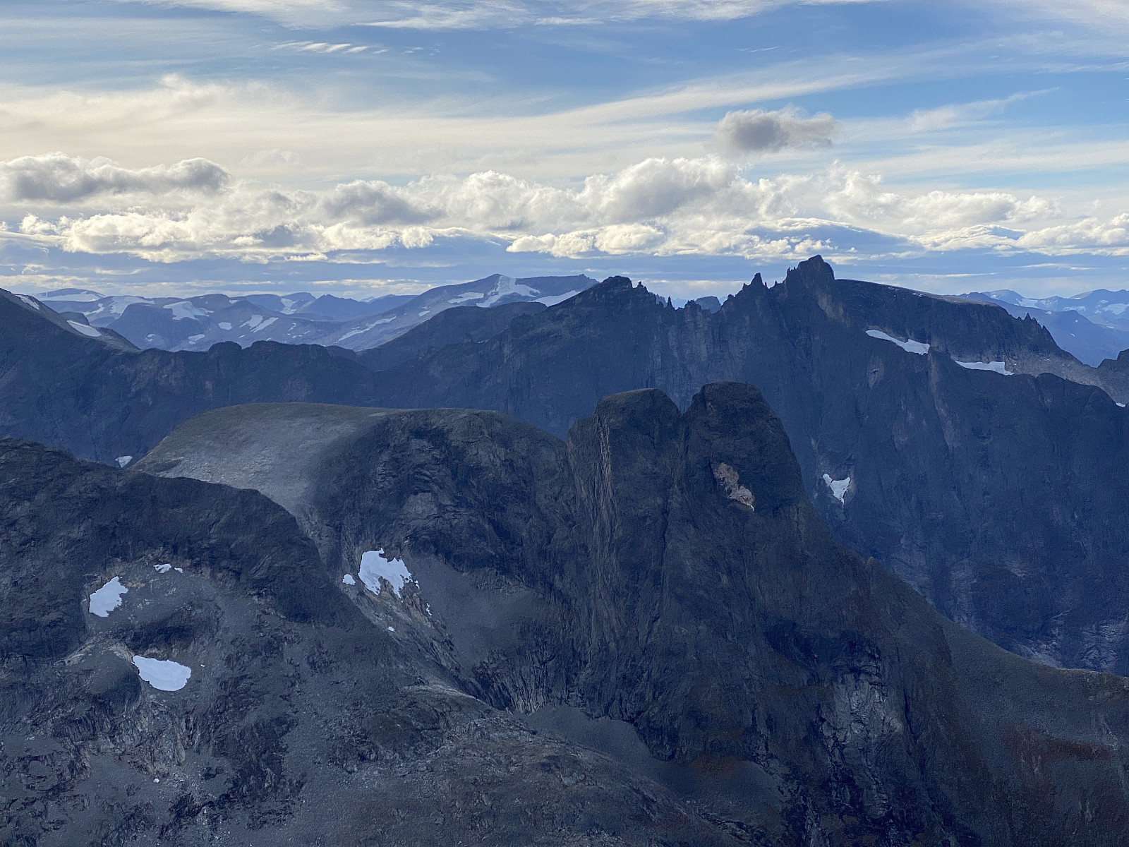
Dagstur til Pyttegga
- Datum:
- 19.09.2021
- Tourlänge:
- 13:44h
- Entfernung:
- 34,0km
 Til Pyttegga via Reindalsetra
Denne søndagen tok jeg en dagstur fra Zakariasdammen til Pyttegga [1999 m.o.h.]. Pyttegga er den høyeste fjelltoppen i Møre og Romsdal, og grensa mellom kommunene Fjord og Rauma er lagt akkurat over toppen. Man kan gå til Pyttegga enten fra Tafjorden på Sunnmøre, fra Ulvådalen oppe ved Bjorli i Romsdalen, eller man kan gå dit fra Billingen ved Skjåk øverst i Gudbransdalen. Fjellet ligger nokså avsides, så langt blir det uansett hvor man går fra; men den letteste ruta opp er den fra Ulvådalen via Pyttbua og opp. For meg var det imidlertid mye lengre å kjøre til Bjorli enn til Tafjorden, og etter å ha sett Pyttegga fra toppen på Svartegga helgen for 2 uker siden, var jeg sikker på at det var mulig å gå fram og tilbake fra Zakariasdammen til Pyttegga >>>
Til Pyttegga via Reindalsetra
Denne søndagen tok jeg en dagstur fra Zakariasdammen til Pyttegga [1999 m.o.h.]. Pyttegga er den høyeste fjelltoppen i Møre og Romsdal, og grensa mellom kommunene Fjord og Rauma er lagt akkurat over toppen. Man kan gå til Pyttegga enten fra Tafjorden på Sunnmøre, fra Ulvådalen oppe ved Bjorli i Romsdalen, eller man kan gå dit fra Billingen ved Skjåk øverst i Gudbransdalen. Fjellet ligger nokså avsides, så langt blir det uansett hvor man går fra; men den letteste ruta opp er den fra Ulvådalen via Pyttbua og opp. For meg var det imidlertid mye lengre å kjøre til Bjorli enn til Tafjorden, og etter å ha sett Pyttegga fra toppen på Svartegga helgen for 2 uker siden, var jeg sikker på at det var mulig å gå fram og tilbake fra Zakariasdammen til Pyttegga >>>
