Archivo - fecha
Archivo - actividad
- Ciclismo (2)
-
Escalada (8)
- Escalada alpino (7)
- Escalada mixta (1)
-
Excurción de esquí (49)
- Randonnée/Telemark (49)
-
Excurción de otro tipo (1)
- Expedicion (1)
- Excursión de invierno, otro tipo (10)
-
Senderismo (232)
- Excurción alpino (60)
- Running (11)
- Senderismo (69)
- Senderismo de montaña (90)


Listas obtenidas
-
Romsdal ≥ 100m pf.
(135/301)
 44%
44% -
Sunnmøre ≥ 100m pf.
(79/531)
14%
-
Norges 1000 største fjell målt i primærfaktor
(53/1000)
5%

Ski Touring to Mount Smørbotstinden with my son
- Fecha:
- 28.11.2020
- Tipo de excursión:
- Randonnée/Telemark
- Duración:
- 3:31h
- Distancia:
- 8.1km
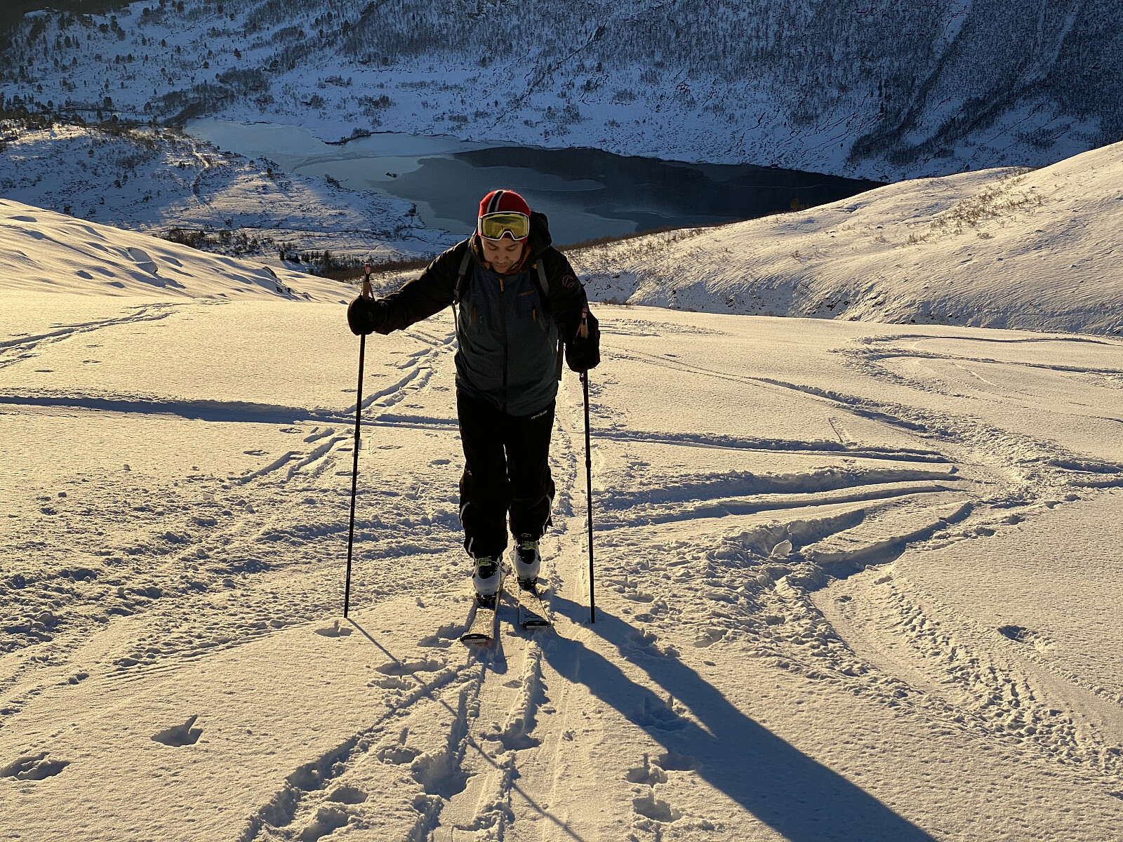 I have previously twice visited Mount Smørbottinden, the first time on Telemark skies, and the second time on alpine touring skis. For tour descriptions including a number of nice pictures, follow these links: Telemark Skiing to Mount Smørbottinden in Rauma Municipality and Alpine Ski Touring to Mount Smørbottind and Mount Kvasstind . The main difference this time compared to my two previous ascents of Mount Smørbotttinden, was that my son joined me this time, and it was actually he that suggested we make this trip. As on previous occasions we drove to Skorgedalen Valley in Rauma Municipality, parked at the parking lot by the ski resort in the valley; and from there we started skiing. The amount of snow was much less on this occasion compared to what it had been on my previous two visits. In the lower part of the trail, the snow was also wet and quite heavy; and at some places we had to cross some open creeks >>>
Til Niusen på Skøye med Dag
- Fecha:
- 21.11.2020
- Tipo de excursión:
- Senderismo
- Duración:
- 2:17h
- Distancia:
- 7.8km
 Det hadde nylig falt en del snø, slik at det i de høye fjellene var for mye snø til å gå vanlige fjellturer, men samtidig var det fortsatt for lite med tanke på å skulle gå på ski. Så da foreslo eldstegutten min at vi kunne gå på Nihusen på skøye. Dette fjellet er ikke særlig høyt, bare 438 høydemeter, så man kommer seg alltids både opp og ned igjen, selv om det er litt glatt, og man bruker litt tid på turen.
Vi kjørte til Skodje [lokal utt.: Skøye], og parkerte på parkeringsplassen bak rådhuset og legekontoret (se kart), og derfra fulgte vi Nihusvegen opp til skogen. Min sønn hadde vært på Nihusen før, og visste vegen, men med en god turbeskrivelse skulle det uansett ikke ha vært vanskelig å finne stien vi skulle følge gjennom skogen og opp på fjellet. Stien >>>
Det hadde nylig falt en del snø, slik at det i de høye fjellene var for mye snø til å gå vanlige fjellturer, men samtidig var det fortsatt for lite med tanke på å skulle gå på ski. Så da foreslo eldstegutten min at vi kunne gå på Nihusen på skøye. Dette fjellet er ikke særlig høyt, bare 438 høydemeter, så man kommer seg alltids både opp og ned igjen, selv om det er litt glatt, og man bruker litt tid på turen.
Vi kjørte til Skodje [lokal utt.: Skøye], og parkerte på parkeringsplassen bak rådhuset og legekontoret (se kart), og derfra fulgte vi Nihusvegen opp til skogen. Min sønn hadde vært på Nihusen før, og visste vegen, men med en god turbeskrivelse skulle det uansett ikke ha vært vanskelig å finne stien vi skulle følge gjennom skogen og opp på fjellet. Stien >>>
To Mount Saudehornet in Ørsta Municipality
- Fecha:
- 14.11.2020
- Tipo de excursión:
- Excurción alpino
- Duración:
- 4:20h
- Distancia:
- 10.4km
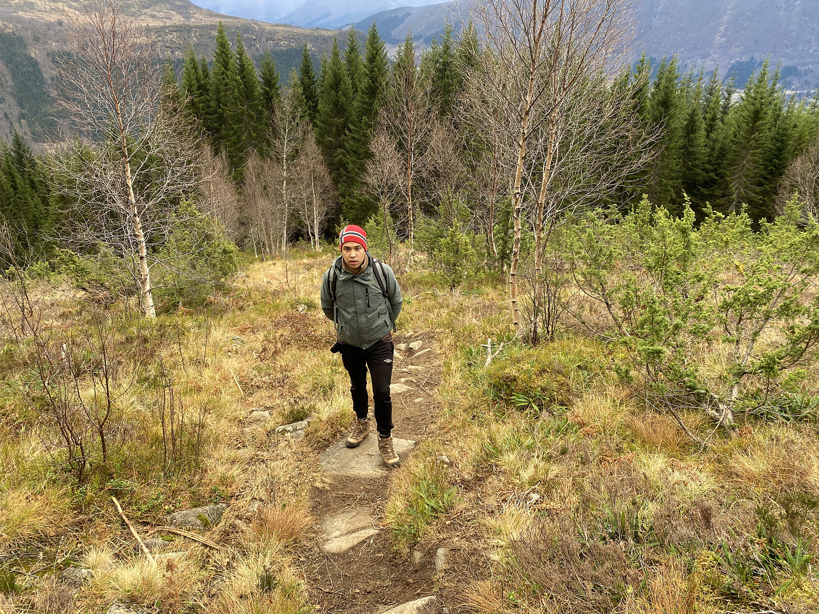 It had been snowing in the mountains lately, and so for this days mountain trek, we had been trying to pick a mountain not too high; in order to stay below the snow. And, as my son Dag had lately read a tour description about a mountain called Kyrkjetinden [i.e. "The Church Peak"] in Ørsta municipality in the County of Møre & Romsdal, we decided to go there. Kyrkjetinden is a peak located just about 6 kilometers or so from the town center of Ørsta, and it has an elevation of 1069 m.a.m.s.l.; and was thus located well beneath the altitude down to which the snow reached at this time.
We drove to Ørsta, and parked at a little parking lot by a road called Fonnavegen, just by a training ground for dogs, which is located between this road and a little river located just there. There >>>
It had been snowing in the mountains lately, and so for this days mountain trek, we had been trying to pick a mountain not too high; in order to stay below the snow. And, as my son Dag had lately read a tour description about a mountain called Kyrkjetinden [i.e. "The Church Peak"] in Ørsta municipality in the County of Møre & Romsdal, we decided to go there. Kyrkjetinden is a peak located just about 6 kilometers or so from the town center of Ørsta, and it has an elevation of 1069 m.a.m.s.l.; and was thus located well beneath the altitude down to which the snow reached at this time.
We drove to Ørsta, and parked at a little parking lot by a road called Fonnavegen, just by a training ground for dogs, which is located between this road and a little river located just there. There >>>
