Archiv - Nach Datum
Archiv - Nach Aktivität
-
Andere Tour (1)
- Expedition (1)
-
Andere Wintertour (9)
- Schneeschuhtour (9)
- Fahrradtour (2)
- Fußtour (222)
-
Klettern (8)
- Alpinklettern (7)
- Mixed-Klettern (1)
-
Skitour (48)
- Randonnée/Telemark (48)

Tour Skiing to Mount Alnestinden with my Son Dag
- Datum:
- 24.10.2020
- Tourcharakter:
- Randonnée/Telemark
- Tourlänge:
- 3:31h
- Entfernung:
- 6,7km
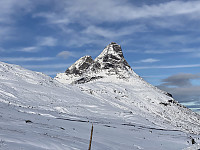
 There had been a substantial snowfall a few days ago, and we had lately seen some people sharing online that they had been tour skiing to the summit of Mount Alnestinden in the municipality of Rauma; and so my son and I decided to do the same. The local newspapers reported that there had just been a huge avalanche close to the summit of this mountain, though, but I knew this mountain quite well; and by that I mean well enough to be familiar with an alternative route that we could take to minimize the risk of being caught by an avalanche, if necessary. As we were heading towards Rauma this morning, however, I was a bit curious to see where the avalanche had been taking place, as there was something that didn’t quite add up in the newspaper report. First, the report said that the avalanche >>>
To Mount Breitinden and Mount Mannen with my Son
- Datum:
- 10.10.2020
- Tourcharakter:
- Hochtour
- Tourlänge:
- 7:04h
- Entfernung:
- 16,1km
 We did set out for the Mountain called Breitinden [i.e. "The Broad Peak"] one week prior to this trip, but we never reached it on that day, mainly because we had limited time available; so on this day we decided to make a new attempt. Moreover, in order not to fail a second time, we opted for a more regular route this time; and so we set out from the Trollstigen Tourist Center, into the valley called Stigebotnen (see map). From this valley we climbed onto the mountain ridge that interconnects Mount Storgrovfjellet and Mount Breitinden, and thereafter we followed that ridge up to the top of Mount Breitinden.
As you're coming up on the edge of this mountain ridge, you get a very good view of the peaks that the locals call the Troll Peaks [Norwegian: "Trolltindan"] i.e. the >>>
Over Stones and Rocks to Mount Stigebotshornet
- Datum:
- 03.10.2020
- Tourlänge:
- 3:55h
- Entfernung:
- 7,5km
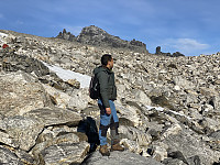
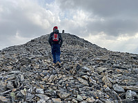
 On this day, my son Dag suggested that we trek from Trollstigen Tourist Center to Mount Breitinden [1797 m.a.m.s.l.]. I immediately agreed to his suggestion, but then I suggested we take an unusual route to Mount Breitinden, by climbing up Mount Stigbotthornet, and then follow the mountain ridge all the way to Mount Breitinden. So, we drove to Trollstigen Tourist Center, where we parked our car; and then we started climbing up the south west ridge of Mount Stigbotthornet.
This mountain ridge was quite steep, however. You can't just walk up there, you have to use both arms and legs, as you make your way upwards. The mountain was in no way too difficult for us to climb, but the climb was time consuming; and we had a bit limited time, as my son was scheduled to participate in a little party in >>>

