Arkiv - dato
Arkiv - aktivitet
-
Annen tur (1)
- Ekspedisjon (1)
-
Annen vintertur (10)
- Trugetur (10)
- Fottur (228)
-
Klatring (8)
- Alpin klatring (7)
- Miksklatring (1)
-
Skitur (49)
- Randonnée/Telemark (49)
-
Sykkeltur (2)
- Terrengsykling (1)


Lister jeg samler etter
-
Romsdal ≥ 100m pf.
(134/301)
 44%
44% -
Sunnmøre ≥ 100m pf.
(78/531)
14%
-
Norges 1000 største fjell målt i primærfaktor
(52/1000)
5%

Round Trip over Mountains Oterfjellet, Storhaugen and Melen
- Dato:
- 30.05.2020
- Turtype:
- Miksklatring
- Turlengde:
- 6:15t
- Distanse:
- 15,0km
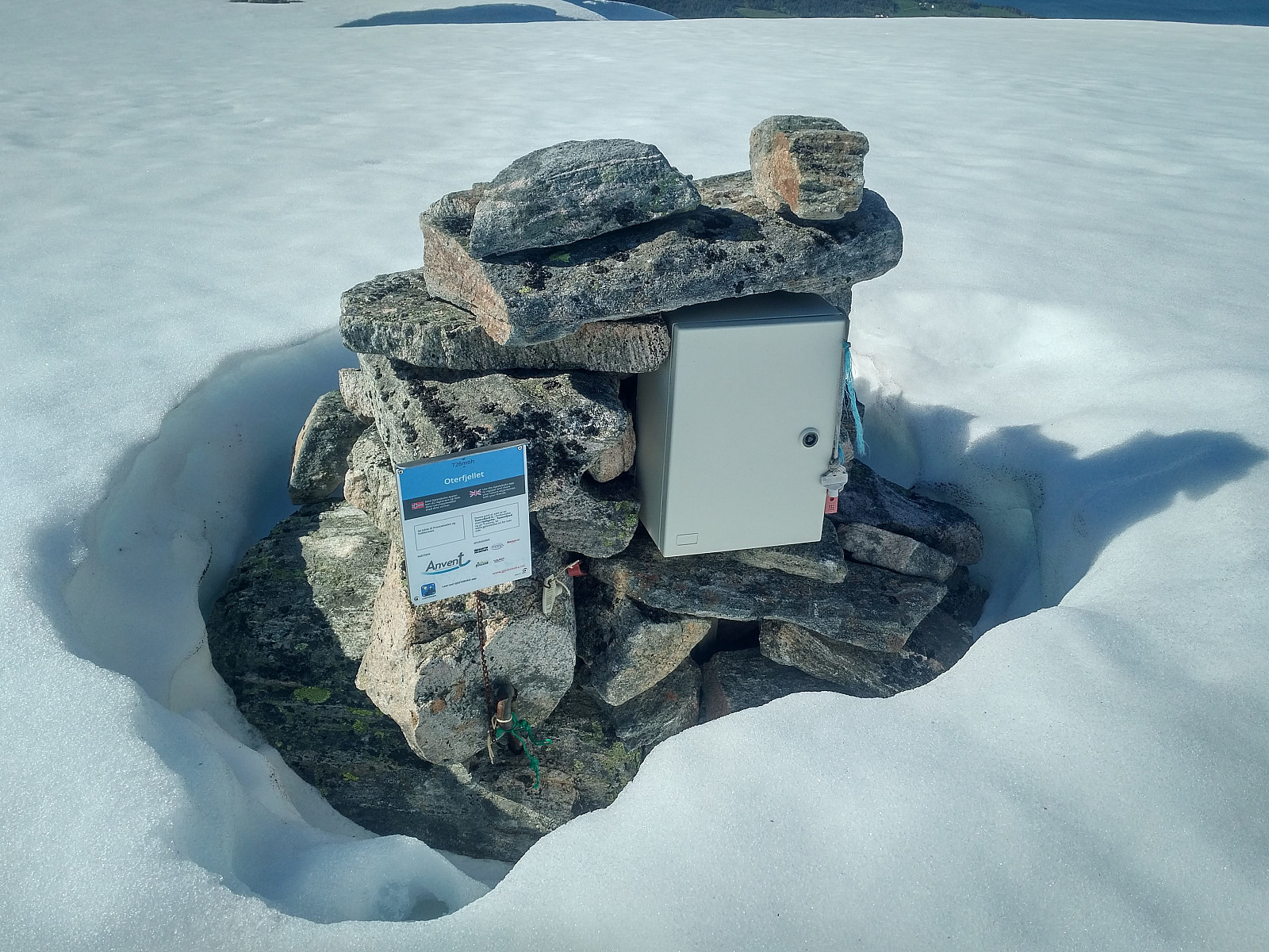 When trekking a very high mountain, it's usually sufficient to ascend one at a time. When climbing smaller mountains, however, it's often quite feasible to ascend two, three or four in a row; especially if they're interconnected by some sort of a ridge, so that you don't have to descend too much when traversing from one mountain to the next. Now, there are three mountains in the Vestnes Municipality in the County of Møre & Romsdal that I had never climbed before, and which I wanted to climb on this particular day. I have seen all three of them multiple times from afar, but I had not ascended any of them until now.
I drove to the Reset Parking Lot (see map and GPS-track) just on the border between the Municipalities of Ålesund and Vestnes, and started trekking from there. I passed south >>>
When trekking a very high mountain, it's usually sufficient to ascend one at a time. When climbing smaller mountains, however, it's often quite feasible to ascend two, three or four in a row; especially if they're interconnected by some sort of a ridge, so that you don't have to descend too much when traversing from one mountain to the next. Now, there are three mountains in the Vestnes Municipality in the County of Møre & Romsdal that I had never climbed before, and which I wanted to climb on this particular day. I have seen all three of them multiple times from afar, but I had not ascended any of them until now.
I drove to the Reset Parking Lot (see map and GPS-track) just on the border between the Municipalities of Ålesund and Vestnes, and started trekking from there. I passed south >>>
Tour Skiing to Mount Auskjeret with my Daugther
- Dato:
- 23.05.2020
- Turtype:
- Randonnée/Telemark
- Turlengde:
- 3:18t
- Distanse:
- 7,2km
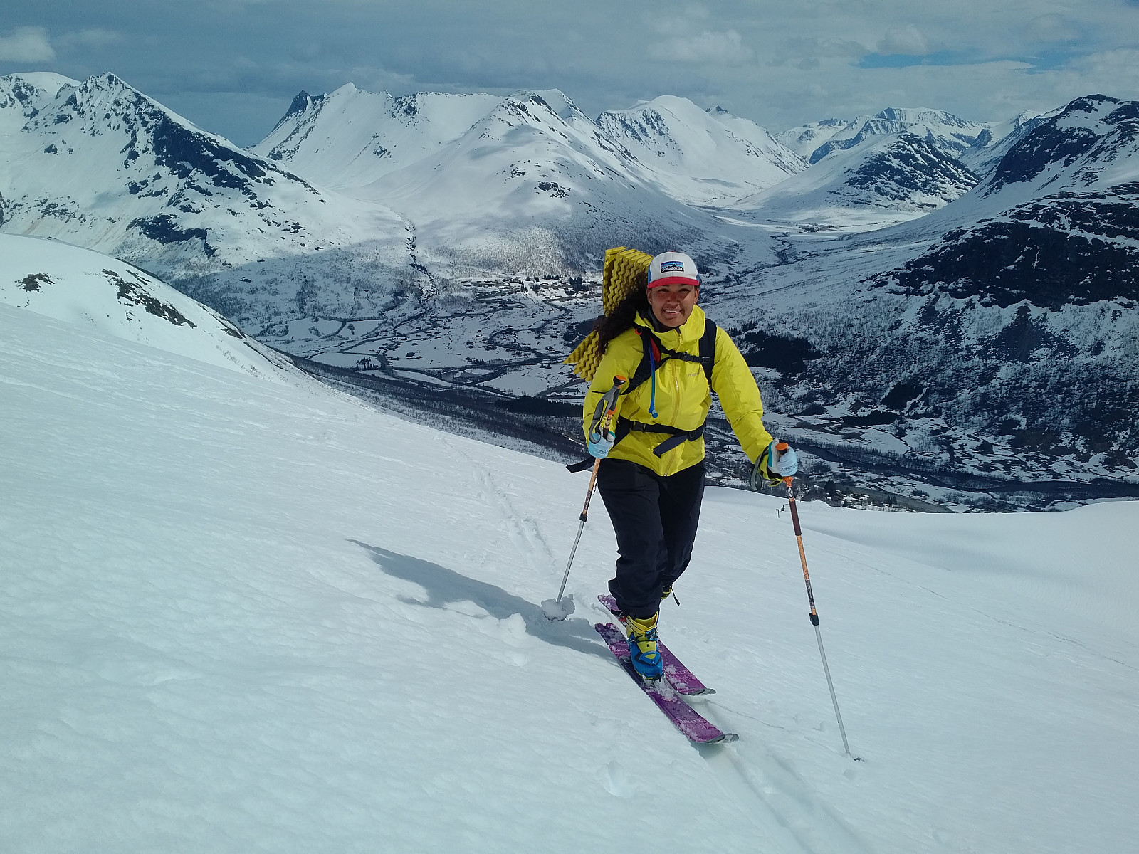 We woke up early this morning, and went in my daughter’s RAV4 to the Overøye Stordal Alpine Center [N: Overøye Stordal Skisenter]. Due to heavy snowfall over two weeks, followed by rapid thawing over the next few days, there had been a lot of avalanches over the last 4 days; hence when discussing this trip the previous evening, we had been quite eager to pick a mountain that we could hike without climbing any slopes exceeding 30°. Auskjeret in Fjord Municipality is well known as a “safe mountain”; i.e. people even climb it when huge avalanches have just occurred on the neighbour mountain which is called Ørastolen. [We actually climbed Mount Ørastolen a little more than a year ago, my daughter, and I; and just three weeks later there was a tremendous avalanche traversing the entire >>>
Ski Touring to Mount Kyrkjetaket [i.e. "The Church Roof"]
- Dato:
- 18.05.2020
- Turtype:
- Randonnée/Telemark
- Turlengde:
- 4:43t
- Distanse:
- 13,6km
 This was my second attempt at ascending Mount Kyrkjetaket [i.e. The Church Roof ] in Rauma Municipality in the County of Møre & Romsdal. My first attempt was about two weeks earlier, but then I climbed only up to Mount Steinberget (981 m.a.m.s.l.); where I turned around and went back down due to bad weather conditions and low visibility. It's a common saying in Norway, that There's no shame in turning around , meaning that if the weather's not on your side, it's better to abandon the goal for your ski tour and survive, than to push on, and then die in the attempt to reach the goal. Right now I was having one week off work, and I had been planning to make a new attempt on Mount Kyrkjetaket this week. I had actually been thinking of visiting the mountain on the wednesday or so, but according >>>
Alpine Ski Touring to Mount Smørbottind and Mount Kvasstind
- Dato:
- 09.05.2020
- Turlengde:
- 3:46t
- Distanse:
- 12,0km
 Whenever I’ve been mountain skiing throughout the last few years (i.e. on trips shared here on PeakBook), I’ve always been using my Scottybob Telemark skis. I have been dreaming of buying a nice pair of alpine touring skis as well, however, but due to the cost connected with such a procurement, I’ve not done it until now. I’ve been having a nice pair of off piste skis that have been stored in our garage, and which I haven’t been using for a numbers of years. I actually bought them as a pair of Telemark skis back in 2007 or 2008, and I used them quite a lot for the first few years, but I stopped using them after I got my Telemark-specific Scottybob skis. For a number of years now, I’ve been thinking of mounting some alpine bindings onto my old off piste skis, as the Völkl Mantra
There's no Shame in Turning Around
- Dato:
- 02.05.2020
- Turtype:
- Randonnée/Telemark
- Turlengde:
- 3:47t
- Distanse:
- 9,5km
 The Norwegian Mountain Code [Norw. Fjellvettreglene] is a set of rules made to ensure safe trekking and skiing in the mountains. Rule number 8 in this set of guidelines, reads Don't be ashamed to turn around. The point with this guideline, is that there are times when your survival in the mountains may depend upon your ability to change your plan. Anyone familiar with the changing weather conditions in the mountains, will know this. There are times when pressing on to reach a goal in spite of treacherous weather, and maybe in spite of bad planning, will mean inevitable death, or at least a high risk of death. On this day the weather forecast said weather was going to be cloudy, but otherwise pretty fair.
I had desired for a while to ascend Mount Kyrkjetaket [i.e. "The Church Roof"] >>>
The Norwegian Mountain Code [Norw. Fjellvettreglene] is a set of rules made to ensure safe trekking and skiing in the mountains. Rule number 8 in this set of guidelines, reads Don't be ashamed to turn around. The point with this guideline, is that there are times when your survival in the mountains may depend upon your ability to change your plan. Anyone familiar with the changing weather conditions in the mountains, will know this. There are times when pressing on to reach a goal in spite of treacherous weather, and maybe in spite of bad planning, will mean inevitable death, or at least a high risk of death. On this day the weather forecast said weather was going to be cloudy, but otherwise pretty fair.
I had desired for a while to ascend Mount Kyrkjetaket [i.e. "The Church Roof"] >>>
