Archive - Date
Archive - Activity
- Bike trip (2)
-
Climbing (8)
- Alpine climbing (7)
- Mixed climbing (1)
-
Other trip (1)
- Expedition (1)
-
Other winter trip (10)
- Snowshoe trip (10)
-
Ski trip (49)
- Randonnée/Telemark (49)
-
Trip by foot (228)
- Alpine trip (57)
- Hike (69)
- Hillwalk (89)
- Jogging (11)


Collected lists
-
Romsdal ≥ 100m pf.
(134/301)
 44%
44% -
Sunnmøre ≥ 100m pf.
(78/531)
14%
-
Norges 1000 største fjell målt i primærfaktor
(52/1000)
5%

Climbing Mount Ulriken in Bergen from the Rear Side
- Date:
- 23.04.2020
- Characteristic:
- Alpine trip
- Duration:
- 3:23h
- Distance:
- 9.9km
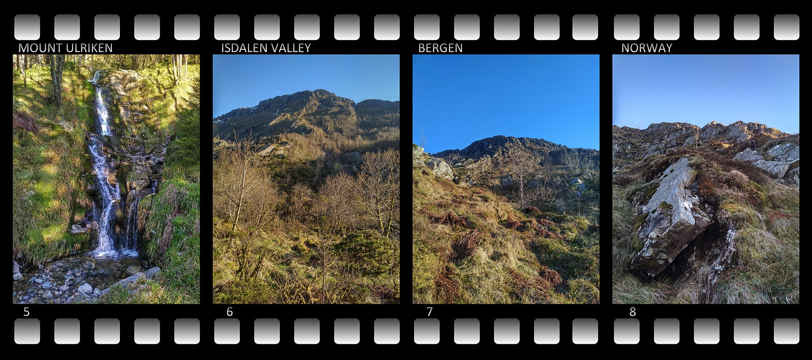 I do not know how many times I’ve climbed Mount Ulriken in the city of Bergen. There are three commonly used trails up to the top of this mountain, one with very nice stone stairs; and then there are 4 or 5 less commonly used trails. On this occasion, however, I had decided to climb the mountain from the rear side, where there’s no trail along which you may hike. Due to the Covid19 pandemic, all indoor facilities for climbing and bouldering have been closed for the last 6 weeks or so; and as the outdoor climbing season is quickly approaching, I wanted to do some practising on a not too difficult mountain, so it won’t be too exhausting for my arms when I embark on some really high and steep mountains.
I trekked around the northern side of a lake that in ancient times was called Alrekstadvatnet,
I do not know how many times I’ve climbed Mount Ulriken in the city of Bergen. There are three commonly used trails up to the top of this mountain, one with very nice stone stairs; and then there are 4 or 5 less commonly used trails. On this occasion, however, I had decided to climb the mountain from the rear side, where there’s no trail along which you may hike. Due to the Covid19 pandemic, all indoor facilities for climbing and bouldering have been closed for the last 6 weeks or so; and as the outdoor climbing season is quickly approaching, I wanted to do some practising on a not too difficult mountain, so it won’t be too exhausting for my arms when I embark on some really high and steep mountains.
I trekked around the northern side of a lake that in ancient times was called Alrekstadvatnet,
Running Across Mount Rundemanen and Mount Blåmanen
- Date:
- 22.04.2020
- Characteristic:
- Jogging
- Duration:
- 2:06h
- Distance:
- 14.1km
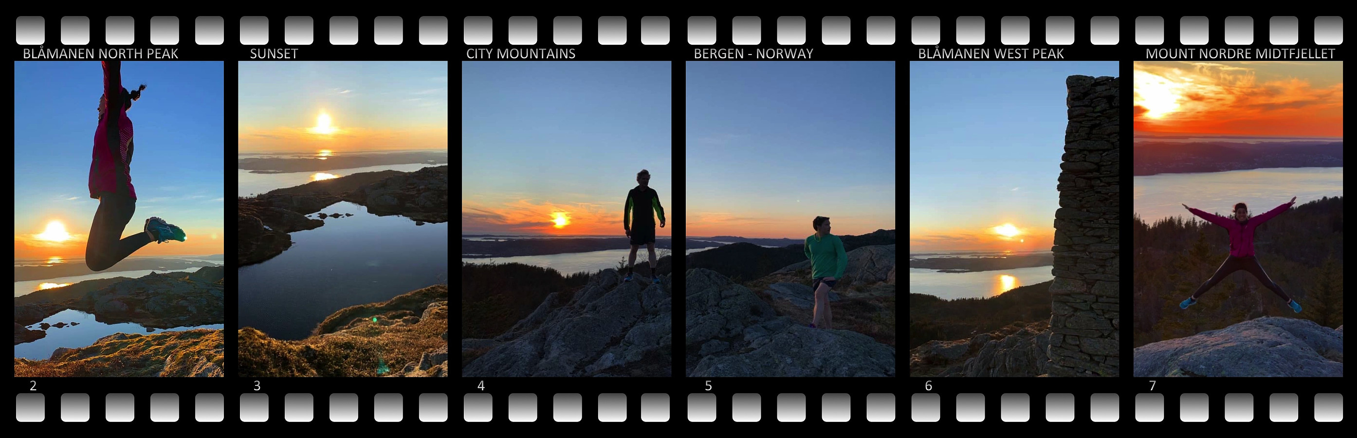 I have frequently been jogging/running across Mount Rundemanen in Bergen. For the last two years I've actually done that at least once a week whenever I've been in Bergen. For the most part I've been doing this run by myself, but on this occasion I went running with two colleagues of mine. They had both been jogging on this mountain before, but they weren't as familiar with the many paths and trails as I have become during the 7 years that I've been working in Bergen. After we had made it up the valley Våkendalen to the top of Mount Rundemanen, I therefore asked the two of them if they had ever been to the summits of the neighboring Mount Blåmanen; and since neither of them had, we took of from the mountain road descending from Mount Rundemanen along the west side of Mount Blåmanen, and >>>
Telemark Skiing to Mount Breivikheia in Rauma Municipality
- Date:
- 18.04.2020
- Characteristic:
- Randonnée/Telemark
- Duration:
- 3:42h
- Distance:
- 13.7km
 I have lately been skiing a number of the mountains between the two fjords Langfjorden and Romsdalsfjorden [i.e. The Long Fjord and The Rauma Valley Fjord, respektively]. Many of the mountains on the peninsula between these two fjords are readily accessible from the parking lot at the Rauma Ski Center in Skorgedalen Valley, where space for parking is also plentiful. You do have to pay a fee in order to drive up to the parking lot, though. The ski resort was closed at the moment due to the Covid-19 pandemia closedown, but in Norway we were still allowed to use parking lots like this one, and we were still allowed to go hiking and skiing in the mountains, as long as no more than five persons were out there together. I crossed the river Skorgeelva by use of a nice bridge that have been built there >>>
Telemark Skiing to Mount Tarløysa in Rauma Municipality
- Date:
- 11.04.2020
- Characteristic:
- Randonnée/Telemark
- Duration:
- 2:19h
- Distance:
- 8.3km
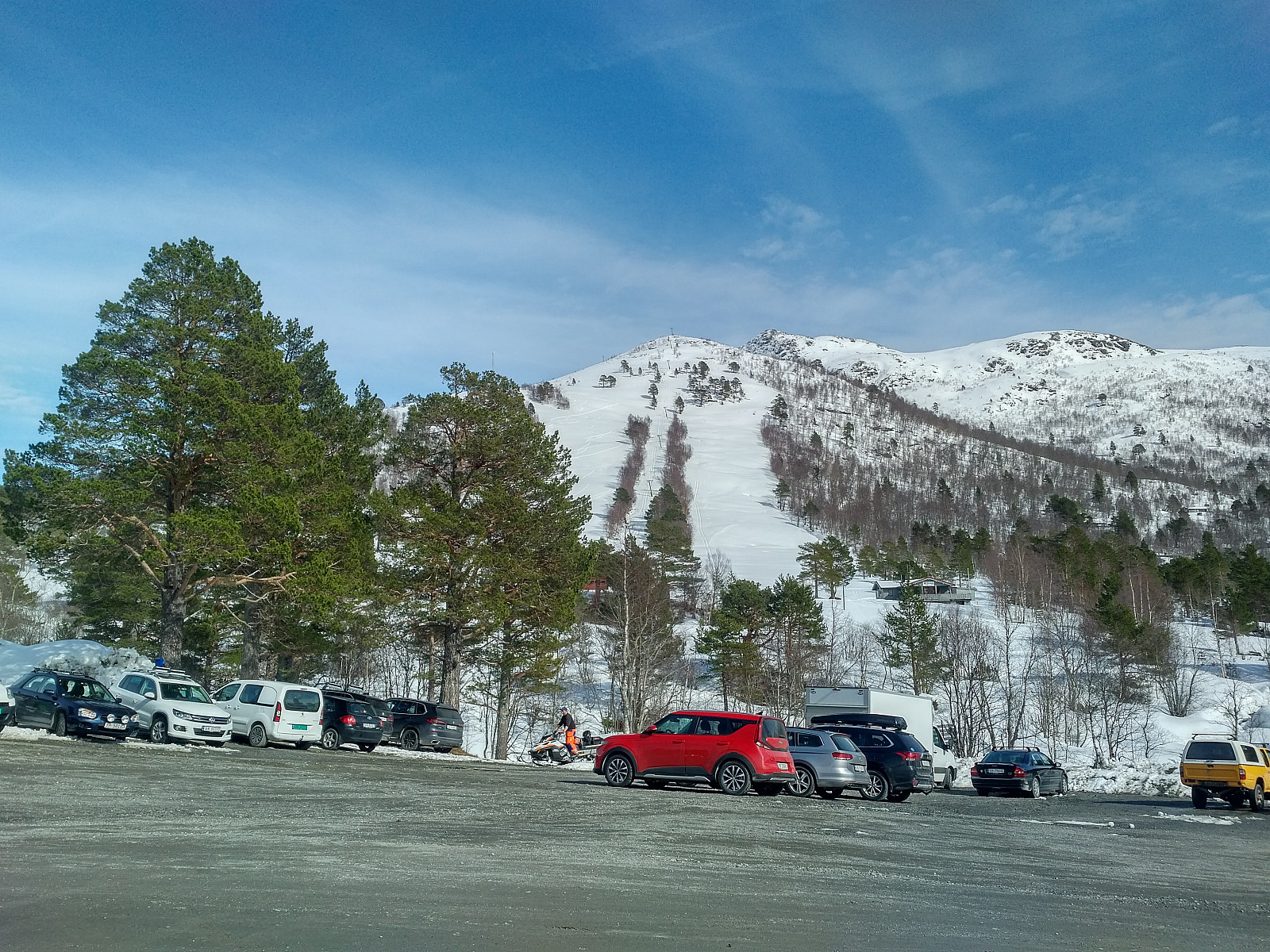
 The summit of Mount Tarløysa is located 1.086 m.a.m.s.l., but you don't have to ascend more than about 675 meters to get there, as the parking lot at Nyseter is located at an elevation of about 400 meters. To get there, you go by car to a village called Sandnes, a few kilometers before you reach Åfarnes, and there, at Sandnes, you take a little gravel road up the mountain side. The road has a few hairpin bends, and you have to pay a fee of about 60 NOK to be allowed to use it; but then, after a few minutes you arrive at the parking lot at Nyseter (image #1). As may be seen on the picture, the parking lot is quite spacious, though it is also used by cabin owners in the area. Snow had been quite scarce this winter (a month later it was abundant, though); and the advantage of setting out from >>>
Telemark Skiing to Mount Smørbottinden in Rauma Municipality
- Date:
- 04.04.2020
- Characteristic:
- Randonnée/Telemark
- Duration:
- 2:50h
- Distance:
- 8.0km
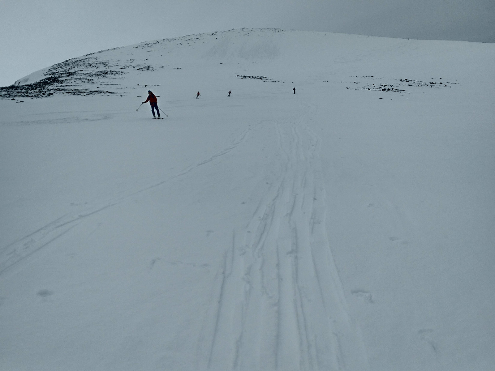
 On this day I went ski touring (by Telemark skies) to the summit of Mount Smørbottind. The mountain is not extremely high, only 1188 m.a.m.s.l., but you start out from a parking lot located at 315 meters, hence you do ascend almost 900 meters as you climb the mountain.
Due to the corona virus pandemic, the Norwegian society have been pretty much locked down for a few weeks. Our authorities have been encouraging hand cleaning and social distancing, as in most countries these days; and we are currently not allowed to travel abroad. Fortunately, though, we do have a lot of nice mountains in our own country, and the authorities have so far not imposed a curfew upon us. They discourage climbs in the higher mountains, as rescue resources may be limited these days, but it’s considered OK to climb >>>
On this day I went ski touring (by Telemark skies) to the summit of Mount Smørbottind. The mountain is not extremely high, only 1188 m.a.m.s.l., but you start out from a parking lot located at 315 meters, hence you do ascend almost 900 meters as you climb the mountain.
Due to the corona virus pandemic, the Norwegian society have been pretty much locked down for a few weeks. Our authorities have been encouraging hand cleaning and social distancing, as in most countries these days; and we are currently not allowed to travel abroad. Fortunately, though, we do have a lot of nice mountains in our own country, and the authorities have so far not imposed a curfew upon us. They discourage climbs in the higher mountains, as rescue resources may be limited these days, but it’s considered OK to climb >>>
