Archive - Date
Archive - Activity
- Bike trip (2)
-
Climbing (8)
- Alpine climbing (7)
- Mixed climbing (1)
-
Other trip (1)
- Expedition (1)
-
Other winter trip (10)
- Snowshoe trip (10)
-
Ski trip (49)
- Randonnée/Telemark (49)
-
Trip by foot (232)
- Alpine trip (60)
- Hike (69)
- Hillwalk (90)
- Jogging (11)


Collected lists
-
Romsdal ≥ 100m pf.
(135/301)
 44%
44% -
Sunnmøre ≥ 100m pf.
(79/531)
14%
-
Norges 1000 største fjell målt i primærfaktor
(53/1000)
5%

Telemark Skiing to Mount Litleskjerdingen
- Date:
- 15.02.2020
- Characteristic:
- Randonnée/Telemark
- Duration:
- 3:55h
- Distance:
- 8.4km
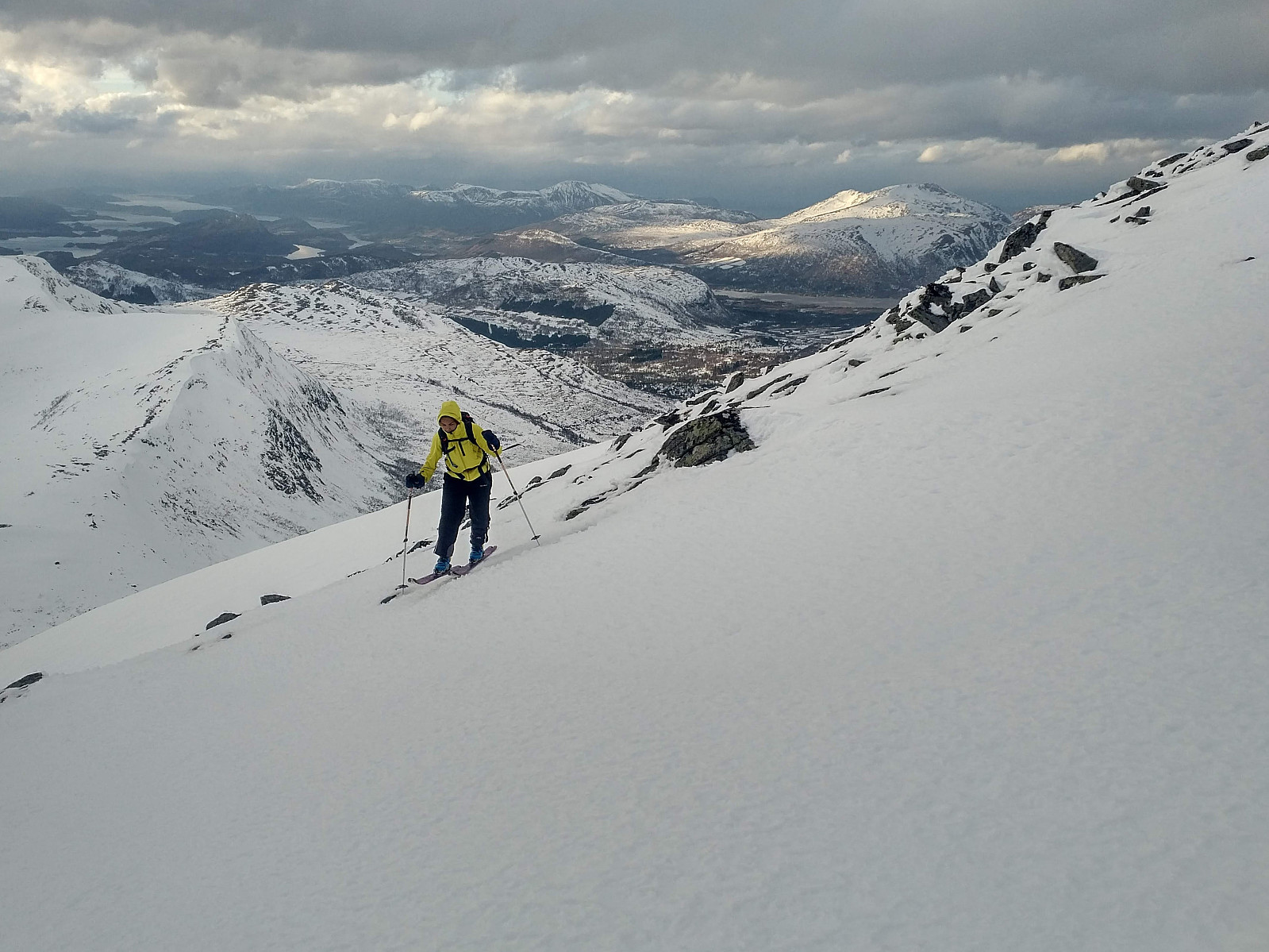
 On this particular afternoon I actually intended to go skiing to Mount Blåskjerdingen, but while on my way up there I had to change my destination slightly due to lack of snow. Mount Blåskjerdingen is quite steep on most sides, with snow shelves and a high risk of avalanches here and there, but the south ridge of the mountain is less steep, and is located on the windward side of the mountain ; hence you're unlikely to run into an avalanche when ascending along that ridge, and so, as long as you stick to the south ridge, Mount Blåskjerdingen is considered a relatively safe mountain for winter skiing (as long as you don't go upon the large snow shelves on the east side [i.e. the leeward side] of the summit area). On the other hand, as the south ridge is located on the windward side, snow tends >>>
Skiing to Mount Høgsvora along with my daughter
- Date:
- 08.02.2020
- Characteristic:
- Randonnée/Telemark
- Duration:
- 3:57h
- Distance:
- 11.9km
 Mount Høgsvora in the county of Møre & Romsdal is considered a relatively safe mountain to go ski touring as far as the avalanche risk is concerned, as long as you ascend the mountain along the usual route, i.e. the one you'll find on our GPS tracking of this trip. We drove to a camping site of Svarttjønnhaugen in a valley called Vaksvikdalen , me and my daughter Vår vaarsolholm (Vår Solholm) . This camping site has some cabins for hire, but the important thing for us was that they allow people to park on their site for a little fee, even if you're not going to hire a cabin or a spot for your tent; and once you've paid the fee, you're free to use their toilet facilities, which may be nice when you get back down from the mountain. When snow is scarce, you may drive all the way up to Sollisætra, which I once did >>>
Hiking to Mount Geitnausa with my daughter
- Date:
- 01.02.2020
- Characteristic:
- Hike
- Duration:
- 2:21h
- Distance:
- 8.1km
 The town of Ålesund is located on four islands in the county of Møre & Romsdal, beautifully, in between fjords and mountains. One of the four islands, the one called Uksenøya, has a mountain ridge generally referred to as Emblemsfjellet [i.e. the Emblem mountain, after a village called Emblem on the south side of the mountain. This mountain actually have a number of peaks, i.e. Høgkubben, Geitnausa, Vasstrandegga and Merafta .
Now, I've actually been to all of these summits, but the advantage of this mountain is that it is close to the town, and it's easy to get there whenever you want to. So, we drove to a place called Myrdalen, in the part of the town that is called Spjelkavika; and then we set out from there, aiming for the peak called Geitnausa. There actually is a nice forest road >>>
The town of Ålesund is located on four islands in the county of Møre & Romsdal, beautifully, in between fjords and mountains. One of the four islands, the one called Uksenøya, has a mountain ridge generally referred to as Emblemsfjellet [i.e. the Emblem mountain, after a village called Emblem on the south side of the mountain. This mountain actually have a number of peaks, i.e. Høgkubben, Geitnausa, Vasstrandegga and Merafta .
Now, I've actually been to all of these summits, but the advantage of this mountain is that it is close to the town, and it's easy to get there whenever you want to. So, we drove to a place called Myrdalen, in the part of the town that is called Spjelkavika; and then we set out from there, aiming for the peak called Geitnausa. There actually is a nice forest road >>>
