Archive - Date
Archive - Activity
- Bike trip (2)
-
Climbing (8)
- Alpine climbing (7)
- Mixed climbing (1)
-
Other trip (1)
- Expedition (1)
-
Other winter trip (10)
- Snowshoe trip (10)
-
Ski trip (49)
- Randonnée/Telemark (49)
-
Trip by foot (228)
- Alpine trip (57)
- Hike (69)
- Hillwalk (89)
- Jogging (11)


Collected lists
-
Romsdal ≥ 100m pf.
(134/301)
 44%
44% -
Sunnmøre ≥ 100m pf.
(78/531)
14%
-
Norges 1000 største fjell målt i primærfaktor
(52/1000)
5%

Visiting Mount Nordre Trolltind with my Son
- Date:
- 19.09.2020
- Characteristic:
- Alpine trip
- Duration:
- 7:00h
- Distance:
- 13.1km
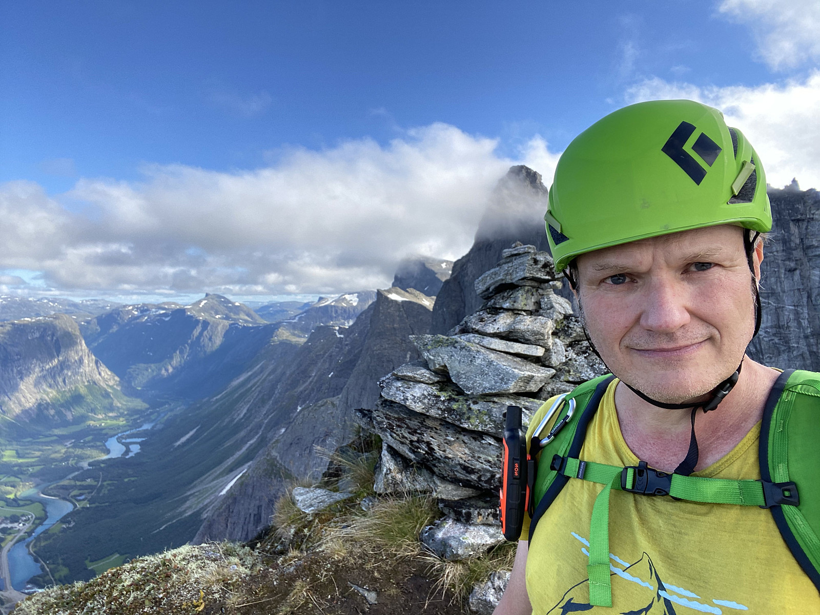
 I had previously visited Mount Nordre Trolltinden [1452 m.a.m.s.l.] once, in order to familiarize myself with this peak, and with a few other peaks around it; including Mount Store Trolltind [1788 m.a.m.s.l.]. A dream of mine is to one day join a team of climbers in an ascent from Mount Nordre Trolltinden [i.e. "Northern Troll Peak] to Mount Store Trolltinden [i.e. "Greater Troll Peak"], as these two peaks are interconnected by a ridge that may be climbed if you’re using ropes, and have the appropriate security equipment. [For a tour description of my previous climb to Mount Nordre Trolltinden, see Reconnaissance Hike to Mount Nordre Trolltind ]
On this day, my son Dag asked me to join him for a climb to Mount Nordre Trolltinden, as he had never been there. The weather forecast for the day was excellent, and so I decided >>>
I had previously visited Mount Nordre Trolltinden [1452 m.a.m.s.l.] once, in order to familiarize myself with this peak, and with a few other peaks around it; including Mount Store Trolltind [1788 m.a.m.s.l.]. A dream of mine is to one day join a team of climbers in an ascent from Mount Nordre Trolltinden [i.e. "Northern Troll Peak] to Mount Store Trolltinden [i.e. "Greater Troll Peak"], as these two peaks are interconnected by a ridge that may be climbed if you’re using ropes, and have the appropriate security equipment. [For a tour description of my previous climb to Mount Nordre Trolltinden, see Reconnaissance Hike to Mount Nordre Trolltind ]
On this day, my son Dag asked me to join him for a climb to Mount Nordre Trolltinden, as he had never been there. The weather forecast for the day was excellent, and so I decided >>>
To Mount Sandfjellet in Vestnes Municipality
- Date:
- 05.09.2020
- Characteristic:
- Hike
- Duration:
- 3:51h
- Distance:
- 10.7km
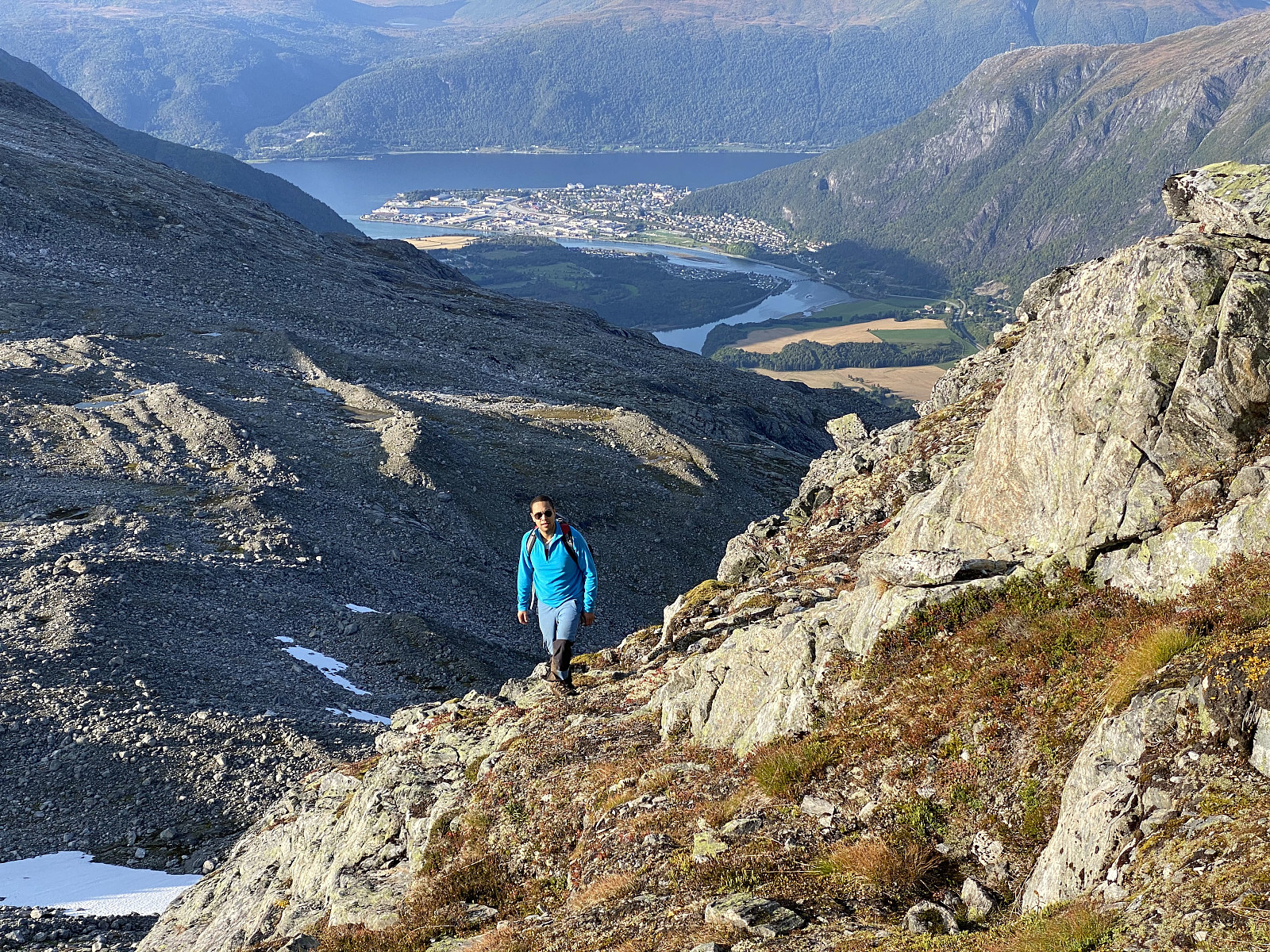
 This particular hike was one that my oldest son, Dag, recommended me to do. He had himself ascended this mountain, and said it was a nice day-trip that is feasible to realize. He explained to me how to get there, and where to park the car; and before leaving home, I even consulted some tour descriptions here on Peakbook. I drove to a fjord called Tresfjorden, in Vestnes Municipality, and then continued up a valley called Rypdalen. In the upper part of Rypdalen Valley, you have to pay a fee in order to continue. Now, the easiest way to pay that fee is to use the Swish app, though there was also a mailbox in which you could drop an envelope with money inside. Once you've payed the fee, you can continue upwards along a steep and narrow graveled road that takes you all the way up to a parking lot >>>
Hiking to Mount Honndalsrokken with My Oldest Son
- Date:
- 29.08.2020
- Characteristic:
- Hike
- Duration:
- 8:24h
- Distance:
- 18.6km
 On this day my son Dag asked me to join him for a hike to Mount Honndalsrokken . This mountain is widely known in our part of Norway, as its characteristic spikelike shape may be spotted from afar. The name of the mountain is actually also derived from its shape: The spikelike summit of the mountain looks a bit like the spindle of a traditional spinning wheel, and rokk is the Norwegian word for such a spinning wheel. [Officially, the mountain is actually called Hornindalsrokken, but most locals refer to it as Honndalsrokken]. I have for several years been thinking of hiking this mountain, and so I immediately agreed to his suggestion, and went with him.
We parked our car in the parking lot just by Honndøla Bru, i.e. the bridge across Honndøla River (see image ##1 and 26), and from there we >>>
On this day my son Dag asked me to join him for a hike to Mount Honndalsrokken . This mountain is widely known in our part of Norway, as its characteristic spikelike shape may be spotted from afar. The name of the mountain is actually also derived from its shape: The spikelike summit of the mountain looks a bit like the spindle of a traditional spinning wheel, and rokk is the Norwegian word for such a spinning wheel. [Officially, the mountain is actually called Hornindalsrokken, but most locals refer to it as Honndalsrokken]. I have for several years been thinking of hiking this mountain, and so I immediately agreed to his suggestion, and went with him.
We parked our car in the parking lot just by Honndøla Bru, i.e. the bridge across Honndøla River (see image ##1 and 26), and from there we >>>
Hiking the Entire Length of Isterdalstindane Mountain Range.
- Date:
- 27.08.2020
- Duration:
- 18:18h
- Distance:
- 26.5km
 In the Rauma Municipality in Norway, there are three exciting mountains called the Bishop, the King and the Queen [in Norwegian Bispen, Kongen and Dronninga]. I don’t think they have been named after the pieces of the chessboard, because in Norwegian the Bishop of the chess game is called the runner [Norw.: Løperen]. Anyway, these three mountains are the first three mountains of a mountain range stretching from the site of the famous Trollstigen Escarpment Road to the little town of Åndalsnes, which is located by the shores of the fjord called Romsdalsfjorden, and yet is surrounded by amazing mountains on all sides. Now, being inspired by some ladies that had climbed The Bishop, The King, and The Queen in one single row, and in one single day; I had been planning for some time to do a similar >>>
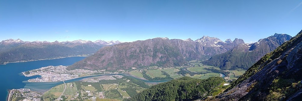
Hiking to Lake Svartbotsvatnet and Mount Svartbotstinden
- Date:
- 22.08.2020
- Characteristic:
- Alpine climbing
- Duration:
- 10:01h
- Distance:
- 19.1km
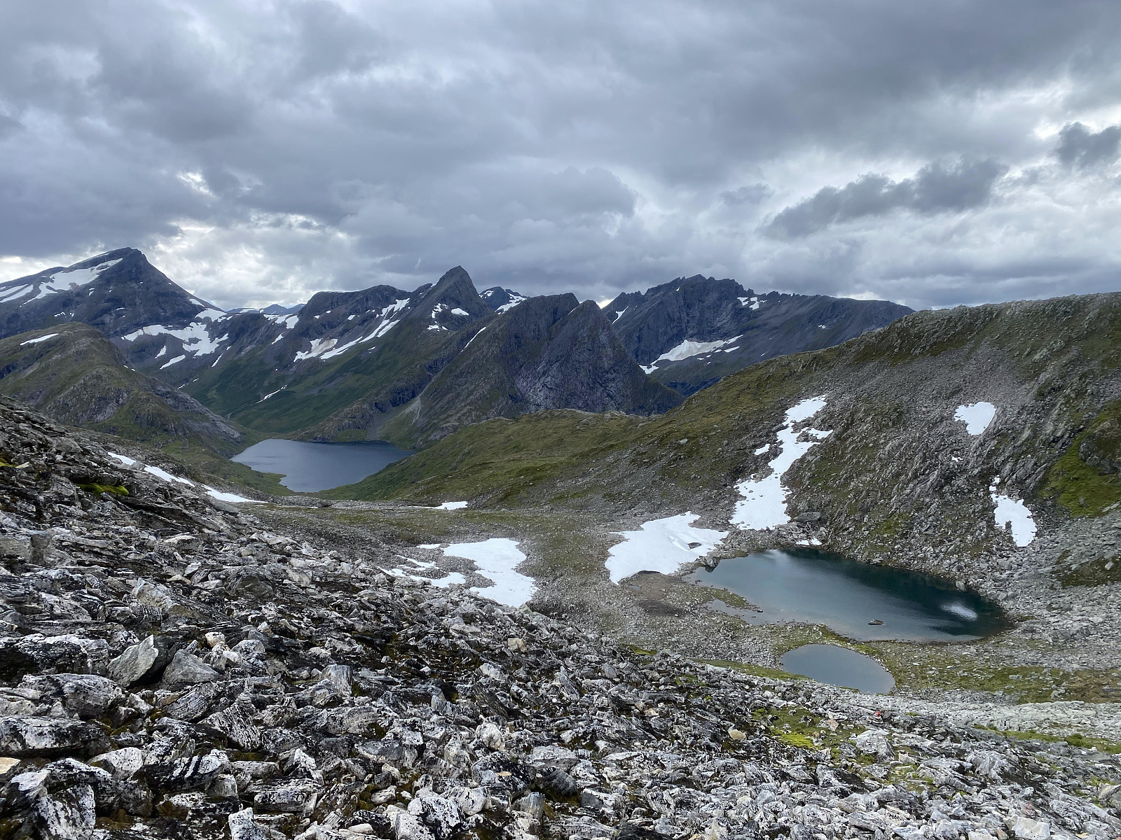
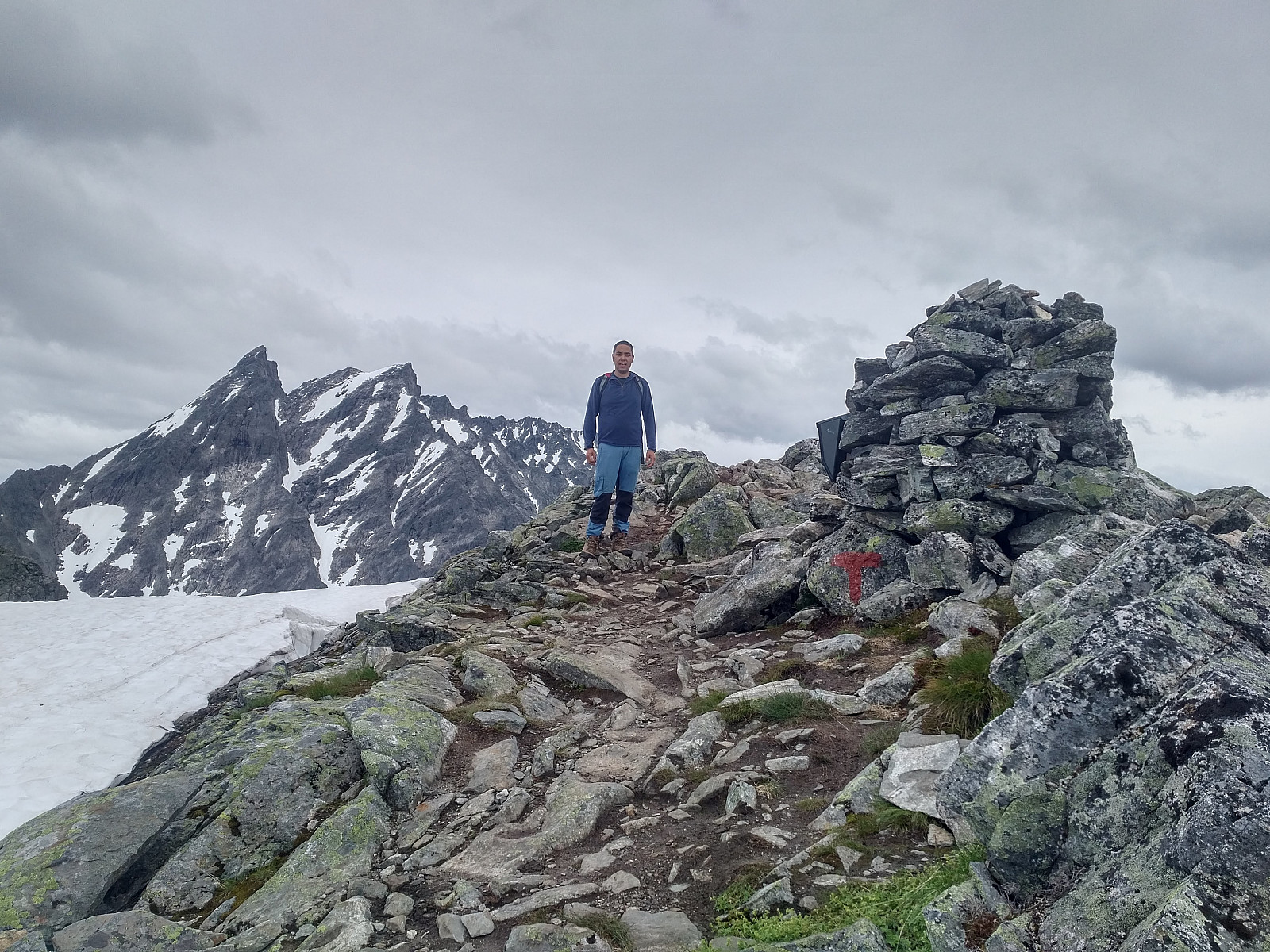
 There's a mountain range close to the town of Åndalsnes in Rauma municipality in the county of Møre & Romsdal in Norway, that has three mountains that are called Bispen [i.e. "The Bishop"], Kongen ["The King"] and Dronninga ["The Queen"] respectively. The mountain range actually has about 8 mountains interconnected by mountain ridges (depending a little on how you count them), and the three mentioned mountains are just the southernmost three of the 8 mountains of the range. Another one is Mount Svatbotstinden, which I visited on this particular day. I have for some years been planning to hike the southernmost 4 of the 8 mountains of this mountain range; starting out from Trollstigen Tourist Center (Image #3), and ending up on the shores of the fjord called >>>
Reconnaissance Hike to Mount Nordre Trolltind
- Date:
- 15.08.2020
- Characteristic:
- Alpine trip
- Duration:
- 6:15h
- Distance:
- 12.8km
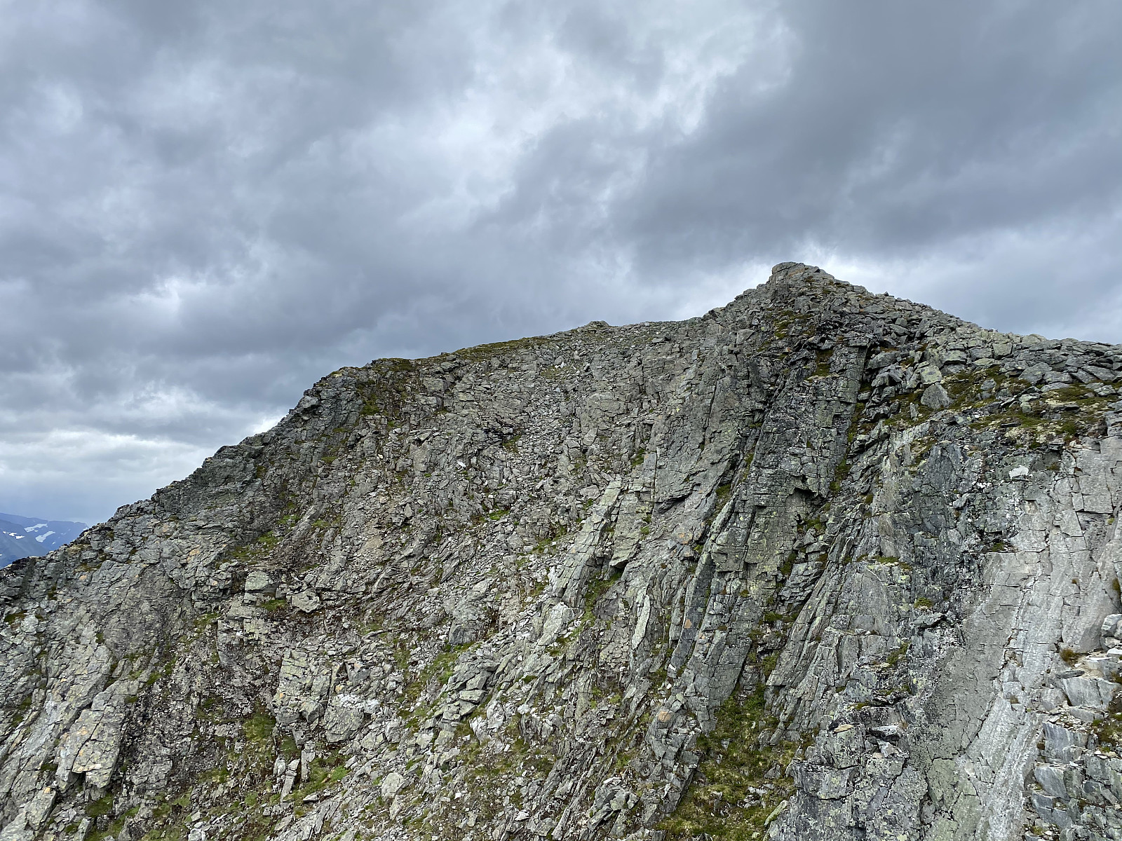
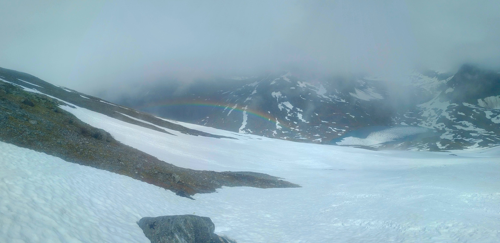
 I've read somewhere here on Peakbook, about various groups of people that have climbed from Mount Nordre Trolltind [i.e. Northern Troll Peak] up to Mount Store Trolltind [i.e. Greater Troll Peak]. The two peaks are interconnected with a very steep ridge, and all those that have done the climb; or at least all those that I have read about, have used advanced climbing gear including ropes. I would indeed like to do that climb as part of a climbing team at some time in the future, and so on this day I decided to climb Mount Nordre Trolltind just as a reconnaissance climb/hike; in order to learn more about the two mountains. I did not bring any climbing gear with me on this trip, however, as I wasn't going to climb beyond Mount Nordre Trolltind; but I had with me a pair of binoculars, so as to >>>
Trekking an Extreme Variant of Romsdalseggen Mountain Ridge
- Date:
- 18.07.2020
- Characteristic:
- Alpine trip
- Duration:
- 6:47h
- Distance:
- 16.9km
 I have previously trekked the mountain range called Romsdalseggen with my oldest son and a nephew of me. A link to my tour description of that hike is here: Blånebba og Romsdalseggen The text in that tour description is in Norwegian, but there are some pictures there, that will do even for an international audience. There have, however, been described three different routes called Romsdalseggen by the local tour operators in the Rauma Municipality: There's what they call Romsdalseggen Light . Then there's Romsdalseggen Regular . And finally, there's what has been referred to as Romsdalseggen Extreme .
The regular route follows the blue GPS-track on the map of Image#5, and is even the one described in my above mentioned tour description of July 14th 2018. The light route follows the regular route from the parking lot at >>>
I have previously trekked the mountain range called Romsdalseggen with my oldest son and a nephew of me. A link to my tour description of that hike is here: Blånebba og Romsdalseggen The text in that tour description is in Norwegian, but there are some pictures there, that will do even for an international audience. There have, however, been described three different routes called Romsdalseggen by the local tour operators in the Rauma Municipality: There's what they call Romsdalseggen Light . Then there's Romsdalseggen Regular . And finally, there's what has been referred to as Romsdalseggen Extreme .
The regular route follows the blue GPS-track on the map of Image#5, and is even the one described in my above mentioned tour description of July 14th 2018. The light route follows the regular route from the parking lot at >>>
Halvmarathon på Emblemsfjellet i Ålesund
- Date:
- 17.07.2020
- Characteristic:
- Jogging
- Duration:
- 4:40h
- Distance:
- 22.7km
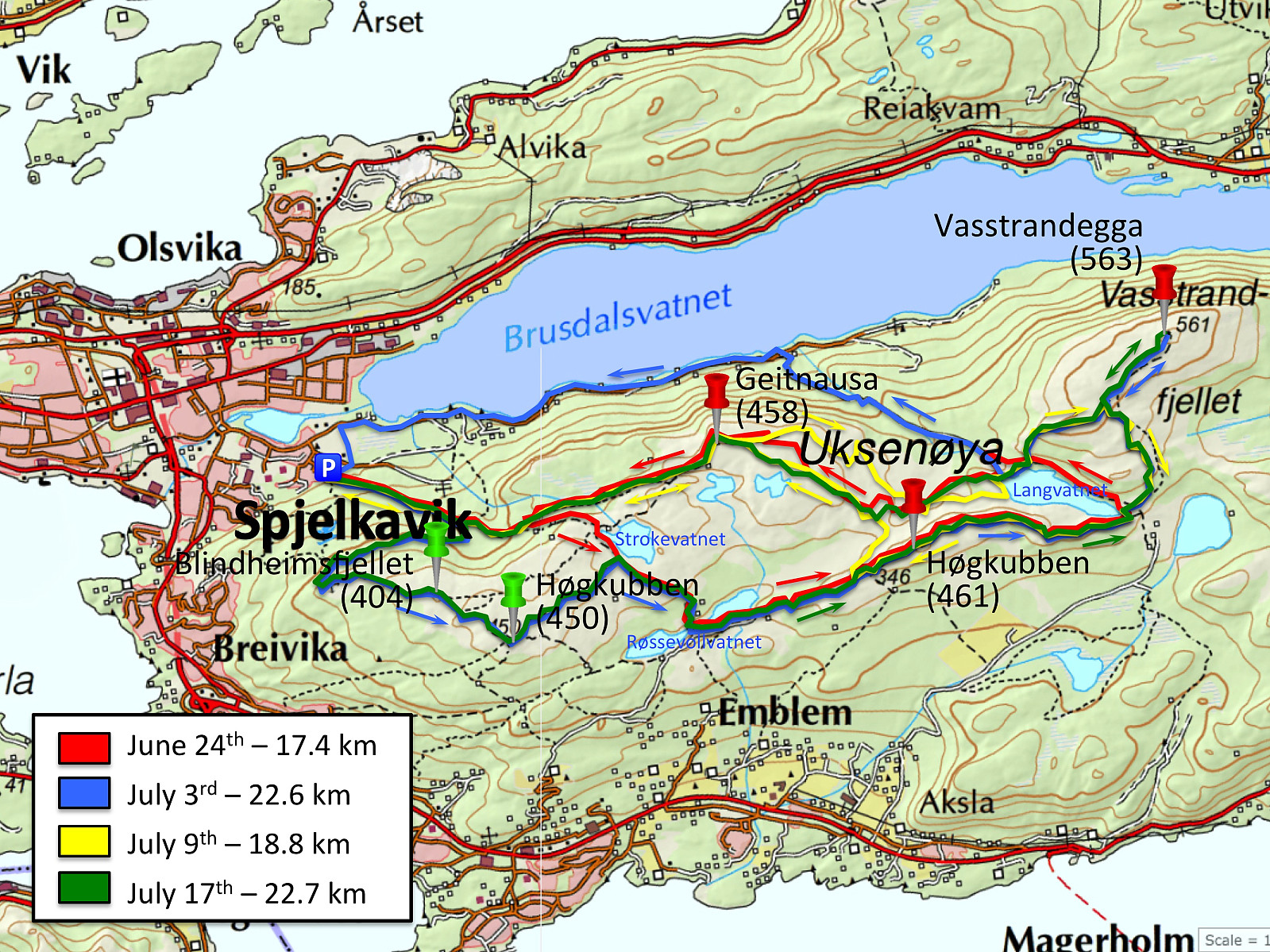 For dem av oss som ikke bare går turer i fjellet, men også driver og løper litt, så går det an å plukke med seg noen ikke altfor høye topper når man likevel er på løpetur. Jeg har de siste syv årene ukependlet mellom Bergen og Ålesund, og pleier hver å få meg en løpetur over Rundemanen i løpet av arbeidsuka i Bergen; mens jeg i løpet av helga hjemme pleier å ta meg en fjelltur enten på Sunnmøre eller i Romsdalen. Når så sommeren kommer, pleier jeg å ta meg noen løpeturer om morgenen de stedene vi reiser på ferie, og jeg har funnet ut at det er en glimrende måte å bli kjent med geografien og omgivelsene på nye steder. Denne sommeren ble det imidlertid, på grunn av Covid-19-pandemien, ikke noen feriereise på oss; og de ukene vi skulle ha vært i Canada, ble hjemme >>>
Ascending Mount Setnesfjellet with my Son
- Date:
- 04.07.2020
- Characteristic:
- Alpine trip
- Duration:
- 6:28h
- Distance:
- 8.6km
 This morning, my son asked med if I would like to join him for a hike to the summit of Mount Setnesfjellet. He had been planning this climb for a few days, and had searched out some tour descriptions on the internet; and so he knew exactly where to park the car, and where to start hiking. So, after breakfast, we drove to the town of Åndalsnes in Rauma Municipality in the county of Möre & Romsdal. The drive to Åndalsnes takes a little less than two hours from where we live, and it is surrounded by a multitude of spectacular peaks and mountains; and the local tourist business association have nicknamed the town The Peak Capital [Norw.: Tindehovedstaden] , in order to draw more climbers and hikers to the area.
We parked the car by a local Church called Grytten Kirke, and started walking from >>>
This morning, my son asked med if I would like to join him for a hike to the summit of Mount Setnesfjellet. He had been planning this climb for a few days, and had searched out some tour descriptions on the internet; and so he knew exactly where to park the car, and where to start hiking. So, after breakfast, we drove to the town of Åndalsnes in Rauma Municipality in the county of Möre & Romsdal. The drive to Åndalsnes takes a little less than two hours from where we live, and it is surrounded by a multitude of spectacular peaks and mountains; and the local tourist business association have nicknamed the town The Peak Capital [Norw.: Tindehovedstaden] , in order to draw more climbers and hikers to the area.
We parked the car by a local Church called Grytten Kirke, and started walking from >>>
Alpine Ski Touring to Mount Alnestind
- Date:
- 01.07.2020
- Characteristic:
- Randonnée/Telemark
- Duration:
- 2:17h
- Distance:
- 5.2km
 Mount Alnestinden have for years been cherished by many Norwegians as a mountain that you may summit on skis long after the snow’s gone along the trails to the summit of other mountains. The mountain has a long ridge on the east side, and the ski route up to the summit runs along the north side of this ridge. As this is on the leeward side of the mountain, a lot of snow accumulates along the route during winter, and it takes time for it to melt away during the summer months. Moreover, there’s little sun on this north side of the ridge much of the year, and this further contributes to a rather slow meltdown of the snow. In late spring, and during the summer months, i.e. when the Trollstigen escarpment road has been plowed and reopened after the winter months; the skiing trip to Mount Alnestinden >>>
