Archive - Date
Archive - Activity
- Bike trip (2)
-
Climbing (8)
- Alpine climbing (7)
- Mixed climbing (1)
-
Other trip (1)
- Expedition (1)
-
Other winter trip (10)
- Snowshoe trip (10)
-
Ski trip (49)
- Randonnée/Telemark (49)
-
Trip by foot (228)
- Alpine trip (57)
- Hike (69)
- Hillwalk (89)
- Jogging (11)


Collected lists
-
Romsdal ≥ 100m pf.
(134/301)
 44%
44% -
Sunnmøre ≥ 100m pf.
(78/531)
14%
-
Norges 1000 største fjell målt i primærfaktor
(52/1000)
5%

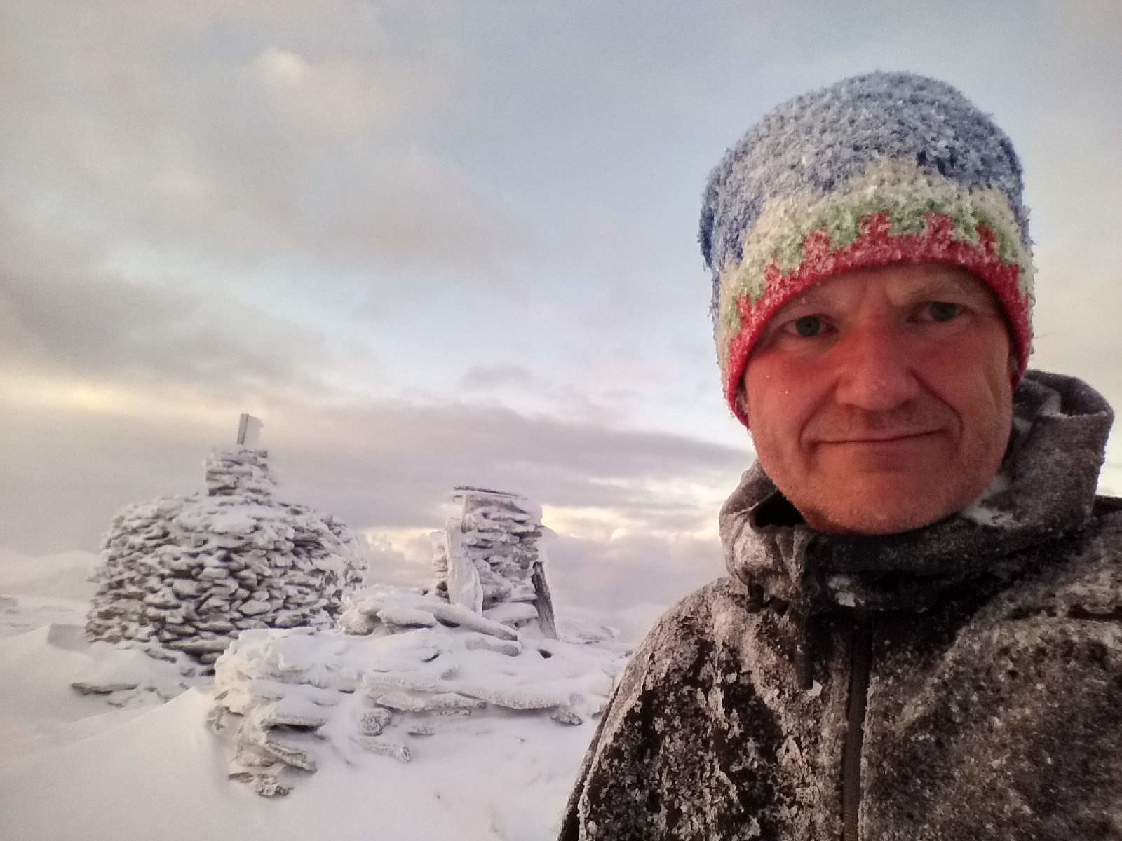
Icy Hike to the Peaks Litlehornet and Uggedalshornet
- Date:
- 28.12.2019
- Characteristic:
- Hike
- Duration:
- 1:49h
- Distance:
- 5.5km
 We have ascended Mount Gamlemsveten multiple times, my son and I but there have been a number of smaller mountains around Gamlemsveten that we haven't climbed yet; or at least I haven't, as my son have climbed a lot of mountains that I have yet to climb. So, we decided on this day to climb some of the nearby less-than-500-meters mountains, and took my son's car to the usual parking lot in Søvikdalen valley. The initial part of the route was the same as when we climbed Mount Storehornet and Mount Skålbotsheia 3 weeks earlier; i.e. you pass by a shooting range located about 800 meters from the parking lot, and then climb up from the innermost "bottom" of the valley, into a hanging valley called Engsetskaret and located at an elevation about 200 meters above the main valley [i.e. about >>>
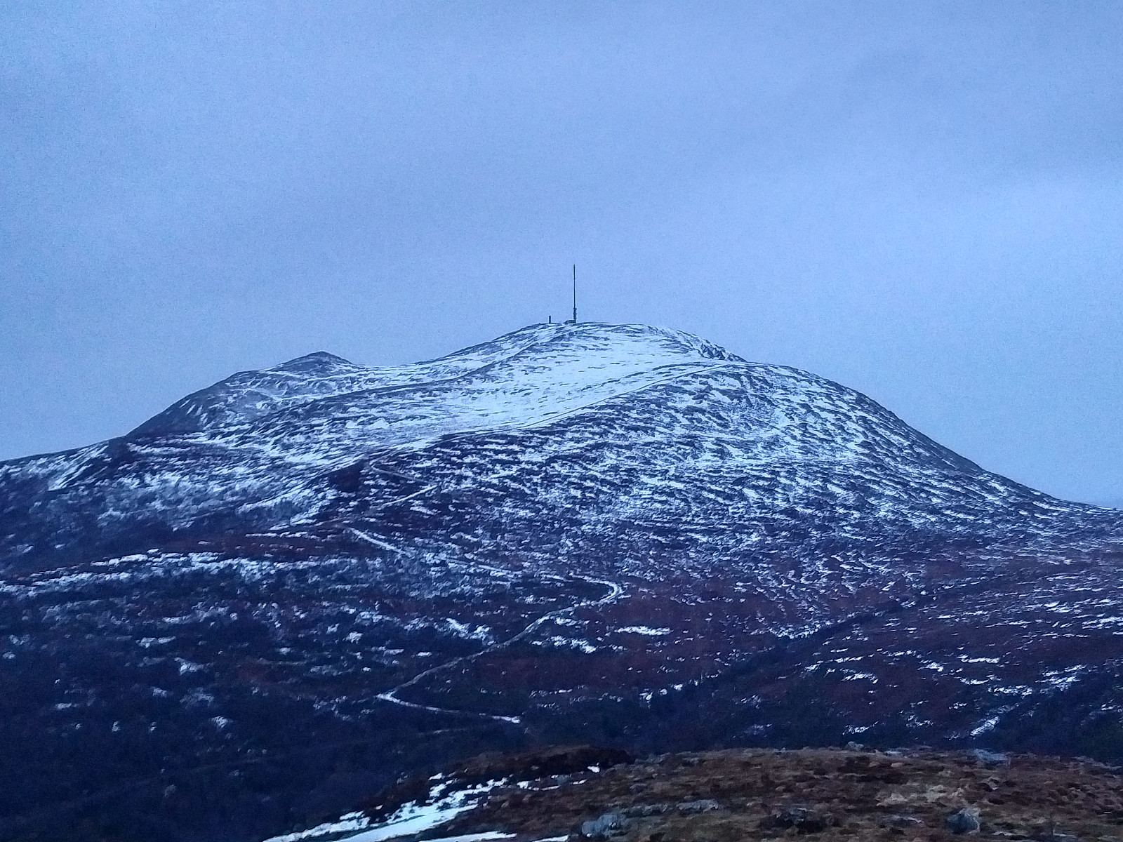
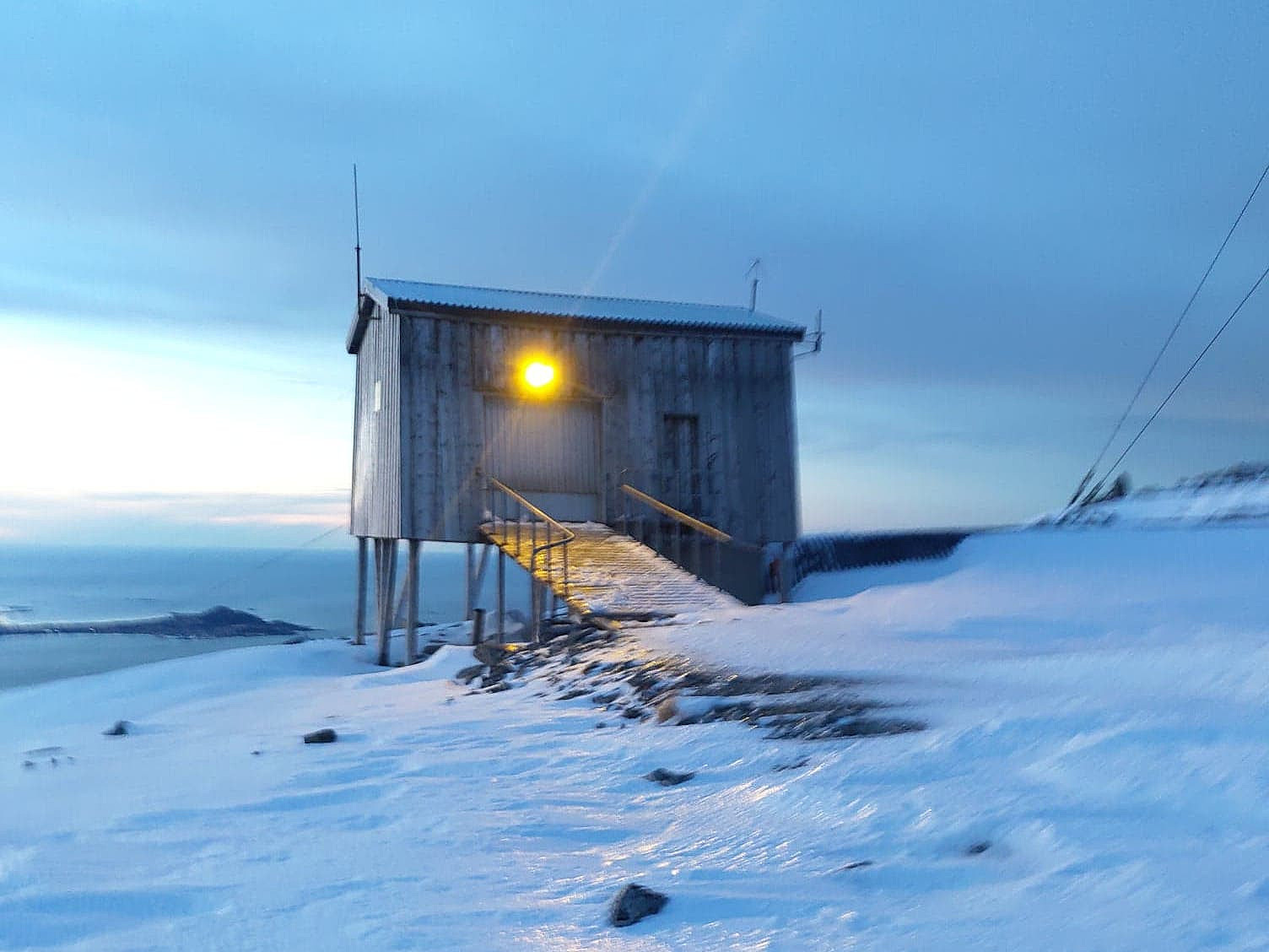
Winter Hike to Mount Tverrfjellet on Sula Island
- Date:
- 21.12.2019
- Characteristic:
- Hike
- Duration:
- 3:18h
- Distance:
- 11.7km
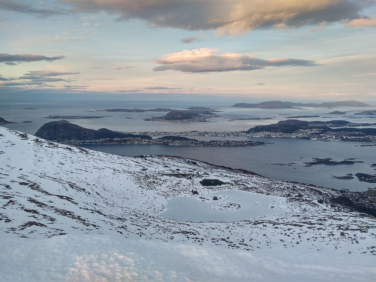 It was only 3 weeks since last time I ascended Mount Sulafjellet with my son, and yet we decided to go there again, as we regard this trip as a good workout. My youngest daughter vaarsolholm (Vår Solholm) also came along with us on this occasion. As previously, we walked the forest road up to Rollonhytta Cabin, and from there we just followed the mountain path that continues up to the summit of the mountain. Snow was less abundant now, compared to what it was three weeks ago; hence the cairns that mark the trail were easy to spot, and it was, therefore, much easier to follow the trail up to the summit of the mountain. We just shot a few pictures while at the top of the mountain, and then went back down to our car at Mauseid parking lot.
To Mount Gamlemsveten in Not So Much Snow
- Date:
- 14.12.2019
- Characteristic:
- Hike
- Duration:
- 2:21h
- Distance:
- 9.0km
 The amount of snow along the Norwegian west coast is varying quite much throughout the winter, as well as from one winter to another. Typically, low pressure weather systems that come in from the northwest bring snow, whereas those coming in from the southwest bring rain; and so the snow may come and go as the whether changes. On this day, therefore there was some snow in the mountains along the coast, but not very much.
We've climbed Mount Gamlemsveten many times, my son Dag and I, so this is a very familiar mountain to us; especially to Dag, as he has climbed it many more times than what I have done. I did, however, once even climb it on a 29" Gary Fisher bicycle; something he hasn't done; hence I tend to claim it's a little bit my mountain too... We drove to the usual parking lot in >>>
The amount of snow along the Norwegian west coast is varying quite much throughout the winter, as well as from one winter to another. Typically, low pressure weather systems that come in from the northwest bring snow, whereas those coming in from the southwest bring rain; and so the snow may come and go as the whether changes. On this day, therefore there was some snow in the mountains along the coast, but not very much.
We've climbed Mount Gamlemsveten many times, my son Dag and I, so this is a very familiar mountain to us; especially to Dag, as he has climbed it many more times than what I have done. I did, however, once even climb it on a 29" Gary Fisher bicycle; something he hasn't done; hence I tend to claim it's a little bit my mountain too... We drove to the usual parking lot in >>>
To Mount Storhornet and Mount Skålbotsheia in Snow
- Date:
- 07.12.2019
- Characteristic:
- Hike
- Duration:
- 3:10h
- Distance:
- 8.9km
 I have previously visited many of the mountains in the municipality of Haram , a municipality that is soon to be merged with the town of Ålesund. While ascending mount Tverrbotshornet and mount Gamlemsveten, I have been looking at a number of smaller peaks and mountains in the vicinity, desiring to ascend even them. My son Dag had been on most of them, however, and on this day he agreed to take me up to one or two of them. (During summer, I could've found my way up there by myself, but on this day there was about 30 cm of snow along most of the route, hence you wouldn't be able to follow the trail unless you knew where it was). We drove to Søvikdalen parking lot, and started trekking from there. We followed a forest road further into the valley. After about 800 meters, we came to a shooting >>>
To Mount Sulafjellet in Somewhat Deep Snow
- Date:
- 30.11.2019
- Characteristic:
- Hike
- Duration:
- 3:15h
- Distance:
- 11.8km
 I went hiking on Mount Sulafjellet on the island of Sula with my oldest son this day. We started out from the parking spot at Mauseid, and followed the forest road up to a cabin called Rollonhytta (390 m.a.m.s.l.). At this cabin the forest road as well as the forest ends, but there is a narrow path or trail that you may usually follow further up the mountain, and so we did for a km or so. At that point, however we lost the path. There was a lot of snow in the mountain side on this day, hence much of the time we couldn't actually see the path. The trail is, however, marked by small cairns all along its course, and this had helped us until the snow became so deep that the cairns disappeared beneath them. We've been on this mountain many times before, however, so we just continued in somewhat >>>
Climbing the Meche Awoknesh Mountain
- Date:
- 25.11.2019
- Characteristic:
- Hike
- Duration:
- 2:21h
- Distance:
- 5.6km
 As we had skipped the hike to the village of Amiwalka (see previous tour description), we were now having one day of mountain trekking left, that we had already paid for, despite being back at the Chennek camp site. In my mind we were having two options for this day: We could either climb the Meche Awoknesh mountain, which is located just east of the camp site; or we could go for Mount Enatye, which is west of the camp site. I had previously climbed both of these mountains (i.e. in 2018), whereas my daughter, who was with me on this tour, hadn’t been on any of them. The Enatye must be said to be a mountain by itself, as it has an elevation of 4070 m.a.m.s.l., and a vertical separation of just a little less than 500 meters; though it is located within a mountain range that also includes Imet >>>
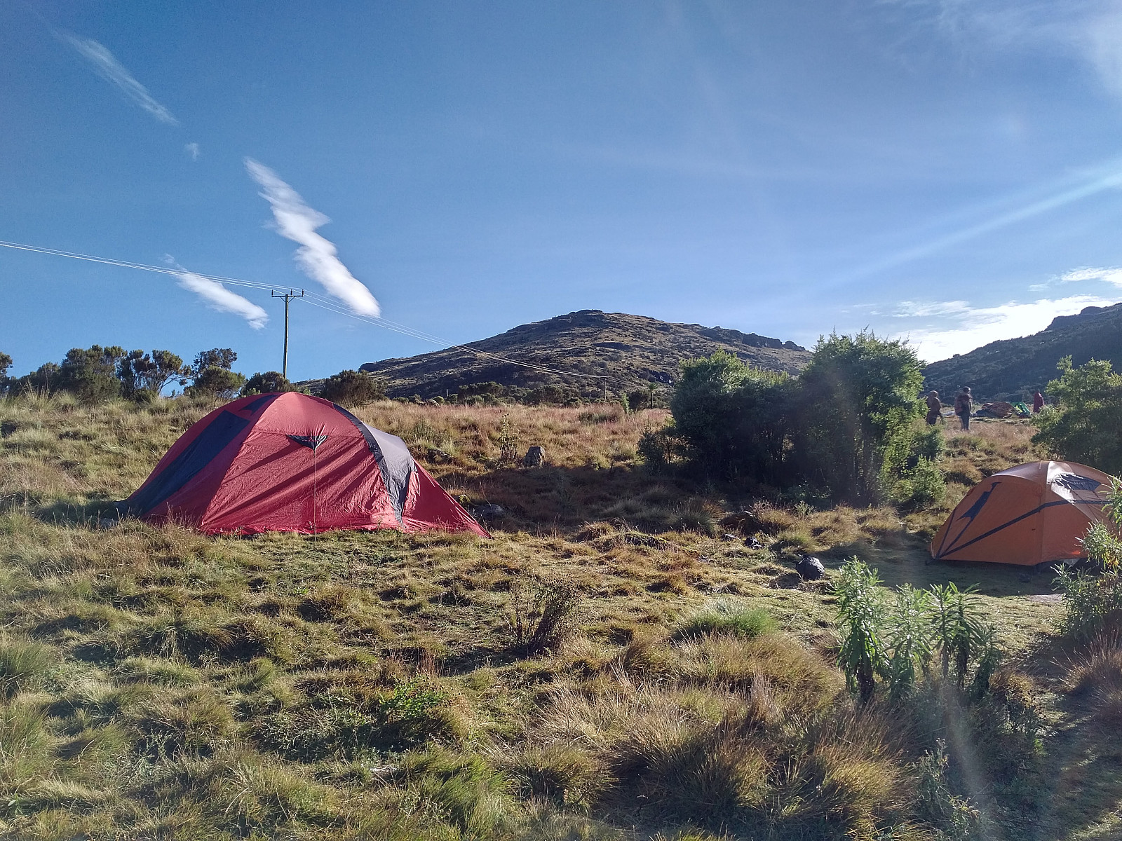
Round Trip in the Simien Mountains
- Date:
- 22.11.2019
- Characteristic:
- Alpine trip
- Duration:
- 96:21h
- Distance:
- 86.7km
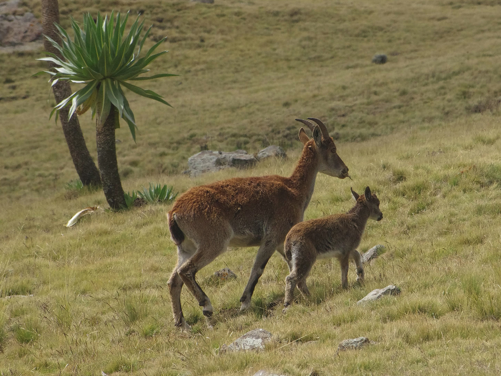 I think this mountain hike, which I did along with my youngest daughter Vår vaarsolholm (Vår Solholm) , our mountain guide Enyew Fikru and a park ranger; is one of the most spectacular hikes that I've ever done. Within just five days, we summited the mountains of Ras Bwahit (4,430 m.a.m.s.l.), Ras Dashen (4,553 meters), Kidis Yared (4,453 meters), Abba Yared (4,409 meters) and Silki (4,420 meters). I had communicated very thoroughly with Dawit (Dave) Yohannes of Ras Dejen Tours in advance of our journey, and we had planned the trip in detail. I knew Dave quite well from the previous year [i.e. 2018], when I visited Gondar, the Simien Mountains, Bahir Dar and The Blue Nile Falls along with my wife; and we had been friends on Facebook since then, hence our communication was now all on Messenger. [You may reach Dave at daveyohannes@yahoo.com >>>
Hiking to Entoto Mountain with my Daughter Vår
- Date:
- 18.11.2019
- Characteristic:
- Hillwalk
- Duration:
- 2:55h
- Distance:
- 16.7km
 I had been in Ethiopia and Addis Ababa for work slightly more than two weeks at this time, though I had also used some time on mountain trekking while there, as well as some time on running/jogging in the city. I had planned to visit the Simien Mountains along with my youngest Daughter vaarsolholm (Vår Solholm) after finishing our work at the Black Lion hospital, and in order to get a bit acclimatized to the altitude, I had even arrived in Addis a few days ahead of the rest of our team. And so, while in Addis I had climbed both the Mount Furi and Mount Wochecha, and I had also 5 times gone running in the streets of Addis. I had actually planned to go running or every second day or so, but then I got a terrible cold that forced me to be a bit careful. Nevertheless, I had been in Addis Ababa (2400 m.a.m.s.l.) long enough >>>
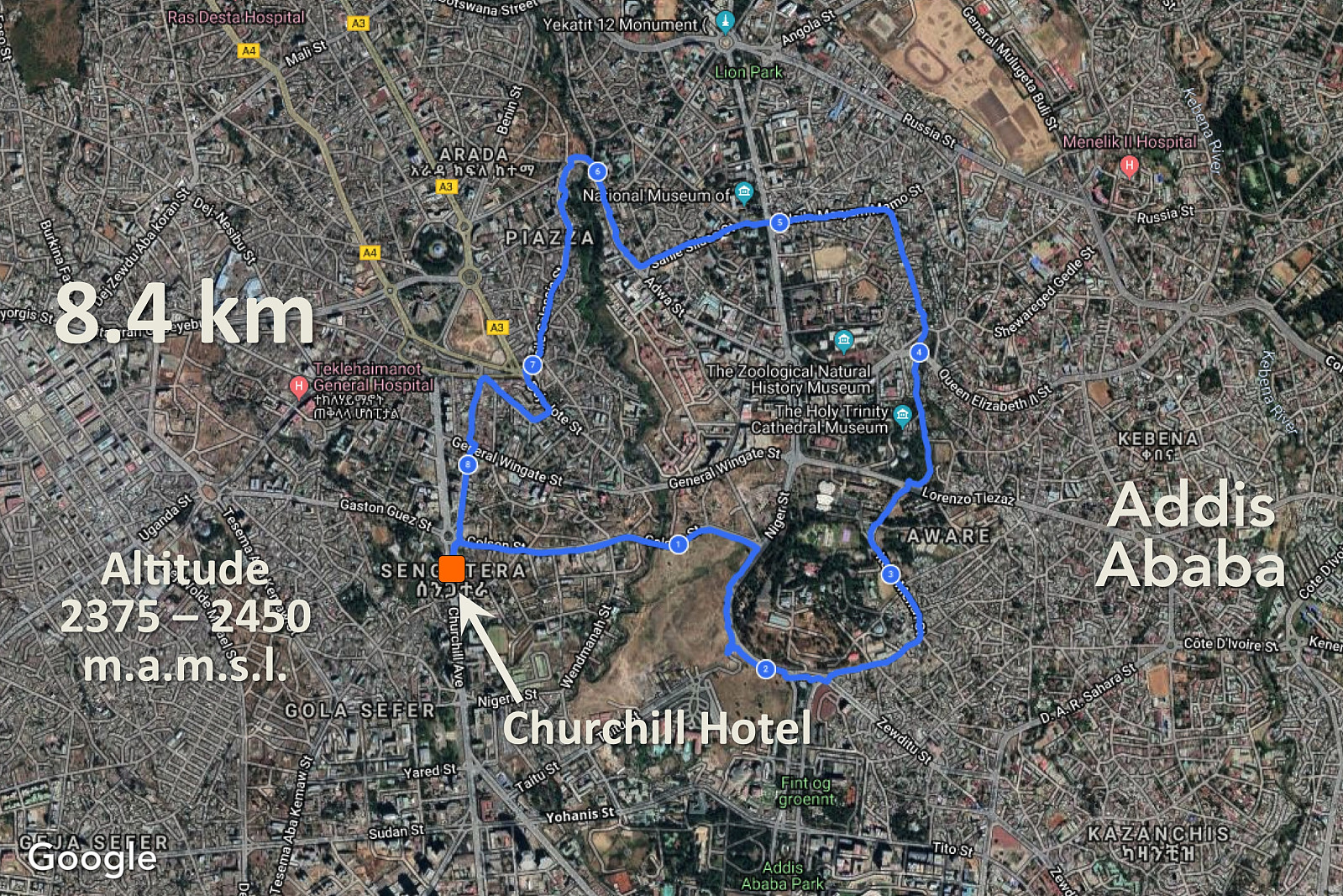
Climbing Mount Wochecha and encircling the old crater
- Date:
- 02.11.2019
- Characteristic:
- Hillwalk
- Duration:
- 8:40h
- Distance:
- 32.1km
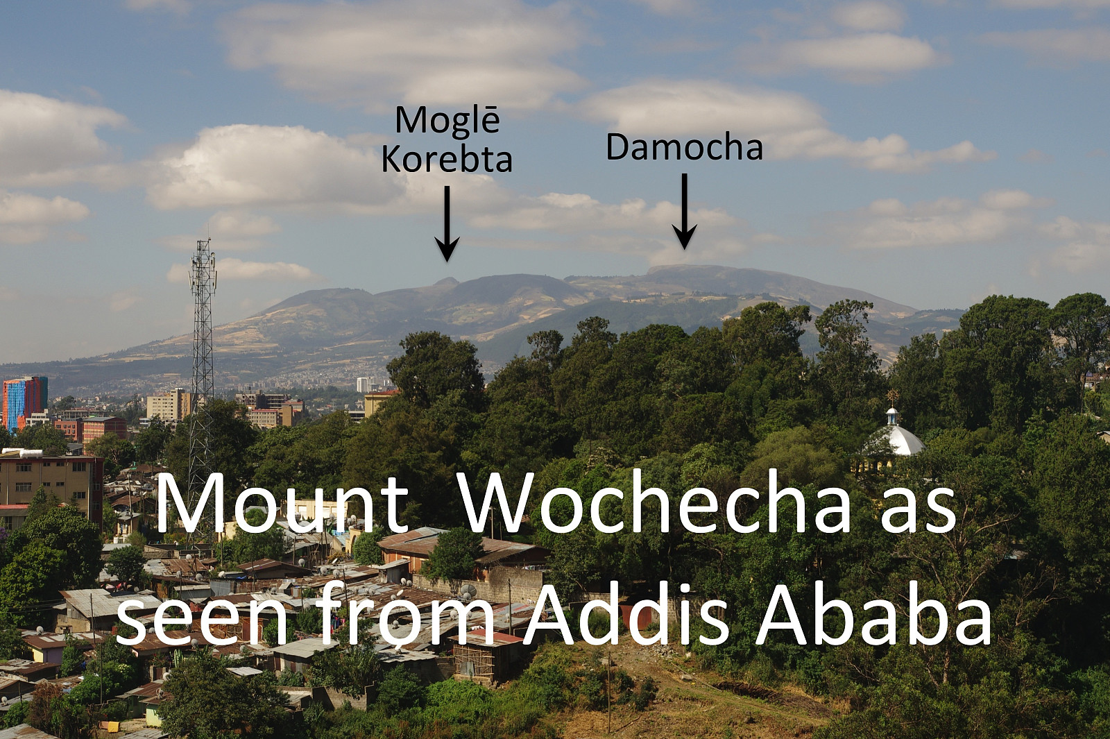 I have been to Addis Ababa in Ethiopia several times in connection with my work, and whenever I've been there, I've had a desire to climb or trek some of the mountains that surrounds the city, the highest of which is the Wochecha Mountain. I did actually climb that mountain when I visited Addis a year ago (see PB report in Norwegian dated November 11th 2018), but while standing on the summit, I realized that this mountain top was just the northern rim of an ancient volcanic crater; and you could actually see an almost circular mountain ridge surrounding the old crater while standing up there. As I was planning the current trip to Ethiopia, therefore, I had an idea of encircling the old crater; though I hesitated a little bit, realizing it wasn't quite straight forward to estimate how long time >>>
Evening hike to Gara Furi Terara
- Date:
- 31.10.2019
- Characteristic:
- Hike
- Duration:
- 4:25h
- Distance:
- 19.8km
 I have been to Addis Ababa several times in connection with my work, and I've realized that this city really does offer some nice treks in the mountains that surround it. Moreover, Addis Ababa is located about 2400 m.a.s.l., and is therefore perfectly located for someone who wants to get some altitude acclimatization in advance of a mountain trek at even higher altitudes, whether that be a trek to Kilimanjaro, Mount Kenya, Rwenzori or Ras Dashen. I was planning to climb Ras Dashen along with my Daughter during this visit to Ethiopia, but prior to that I was going to work for two and a half weeks at the Black Lion Hospital in Addis Ababa. In order to get even better adapted to the altitude, however, I had on this occasion decided to go to Addis three days in advance of my colleagues from our >>>
