Arkiv - dato
Arkiv - aktivitet
-
Annen tur (1)
- Ekspedisjon (1)
-
Annen vintertur (10)
- Trugetur (10)
- Fottur (228)
-
Klatring (8)
- Alpin klatring (7)
- Miksklatring (1)
-
Skitur (49)
- Randonnée/Telemark (49)
-
Sykkeltur (2)
- Terrengsykling (1)


Lister jeg samler etter
-
Romsdal ≥ 100m pf.
(134/301)
 44%
44% -
Sunnmøre ≥ 100m pf.
(78/531)
14%
-
Norges 1000 største fjell målt i primærfaktor
(52/1000)
5%

To Mount Sulafjellet in Bad Weather
- Dato:
- 09.01.2021
- Turtype:
- Fottur
- Turlengde:
- 2:46t
- Distanse:
- 11,4km
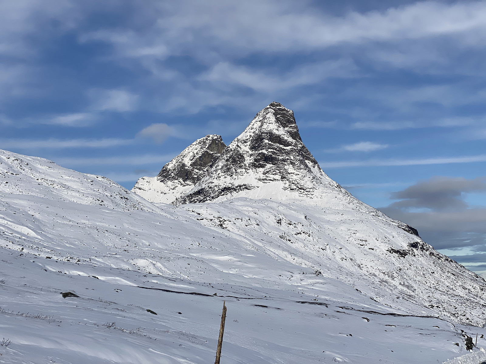
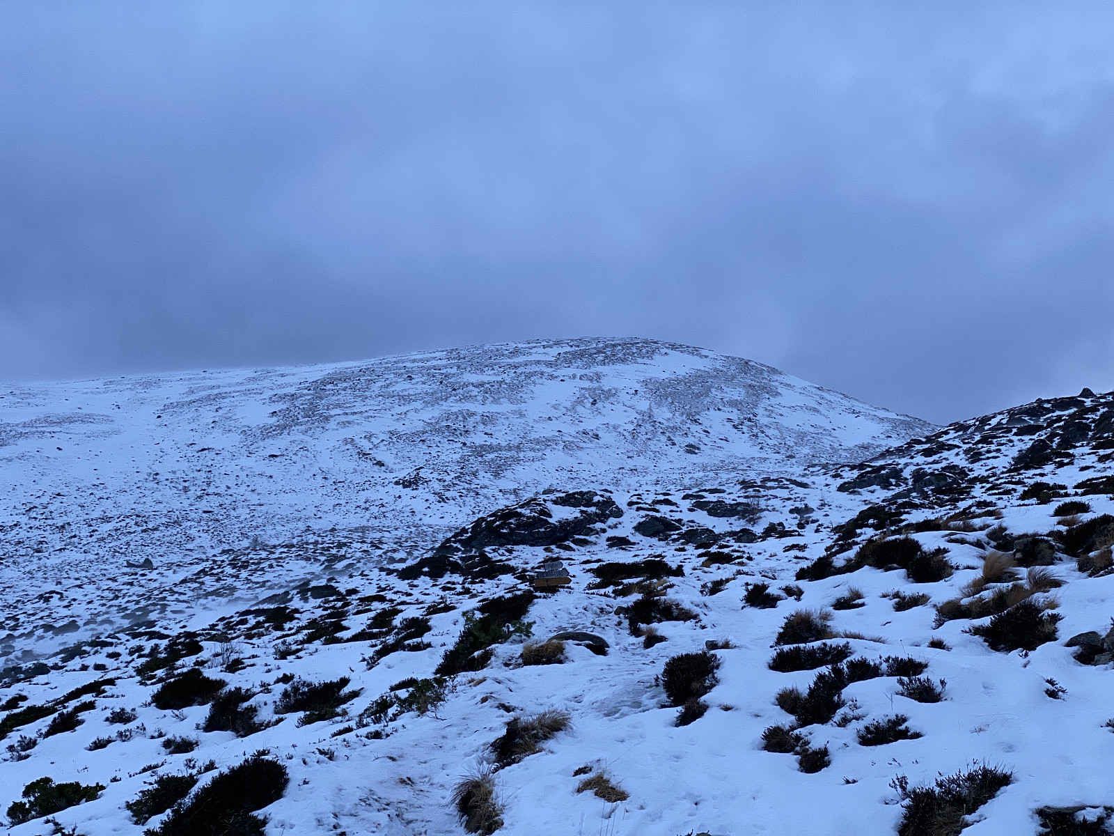 Mount Sulafjellet is a mountain that I've ascended multiple times, and yet I will probably ascend that mountain even more times in the future; as it is not too far away from where we live, and also because it's feasible to climb even when there's too much snow to climb many other mountains around here. The mountain has several peaks, the highest of which has been named Tverrfjellet [i.e. "The Transverse Mountain"], though most people today just call it Vardane [i.e. "The Cairns"], due to the many cairns that mountain hikers have built up there.
The most feasible way to ascend this mountain is to start out from the parking lot at Mauseid (see map), and then follow a gravel road through the forests up to a cottage called Rollonhytta . The parking lot is located at about 50 m.a.m.s.l.; >>>
Mount Sulafjellet is a mountain that I've ascended multiple times, and yet I will probably ascend that mountain even more times in the future; as it is not too far away from where we live, and also because it's feasible to climb even when there's too much snow to climb many other mountains around here. The mountain has several peaks, the highest of which has been named Tverrfjellet [i.e. "The Transverse Mountain"], though most people today just call it Vardane [i.e. "The Cairns"], due to the many cairns that mountain hikers have built up there.
The most feasible way to ascend this mountain is to start out from the parking lot at Mauseid (see map), and then follow a gravel road through the forests up to a cottage called Rollonhytta . The parking lot is located at about 50 m.a.m.s.l.; >>>
Two Trips to Mount Storehornet on Godøy Island
- Dato:
- 02.01.2021
- Turlengde:
- 2:14t
- Distanse:
- 6,9km
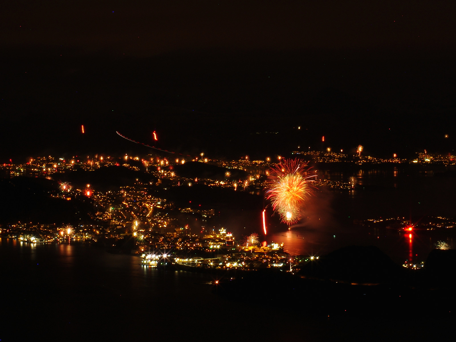 Mount Storehornet on Godøy Island is a mountain that I have frequently climbed. I usually don't publish my climbs of that mountain here on Peakbook, as I've climbed it so many times. I have, however, been having an idea of photographing the Norwegian costal town of Ålesund at the entrance to the Georgian New Year, as the people of this town usually have a spectacular firework at this time of the year. And so, in late evening of December 31st, I climbed the mountain again, this time carrying a backpack with a camera and some lenses, along with a tripod; planning to capture some long exposure photos up there. I sat out from the parking lot just outside the tunnel opening at the peninsula of Alnes shortly before 11 o'clock in the evening. Usually, an hour is plenty of time to climb the mountain, >>>
Tour Skiing to the Summit of Mount Roaldshornet
- Dato:
- 19.12.2020
- Turtype:
- Randonnée/Telemark
- Turlengde:
- 3:02t
- Distanse:
- 7,4km
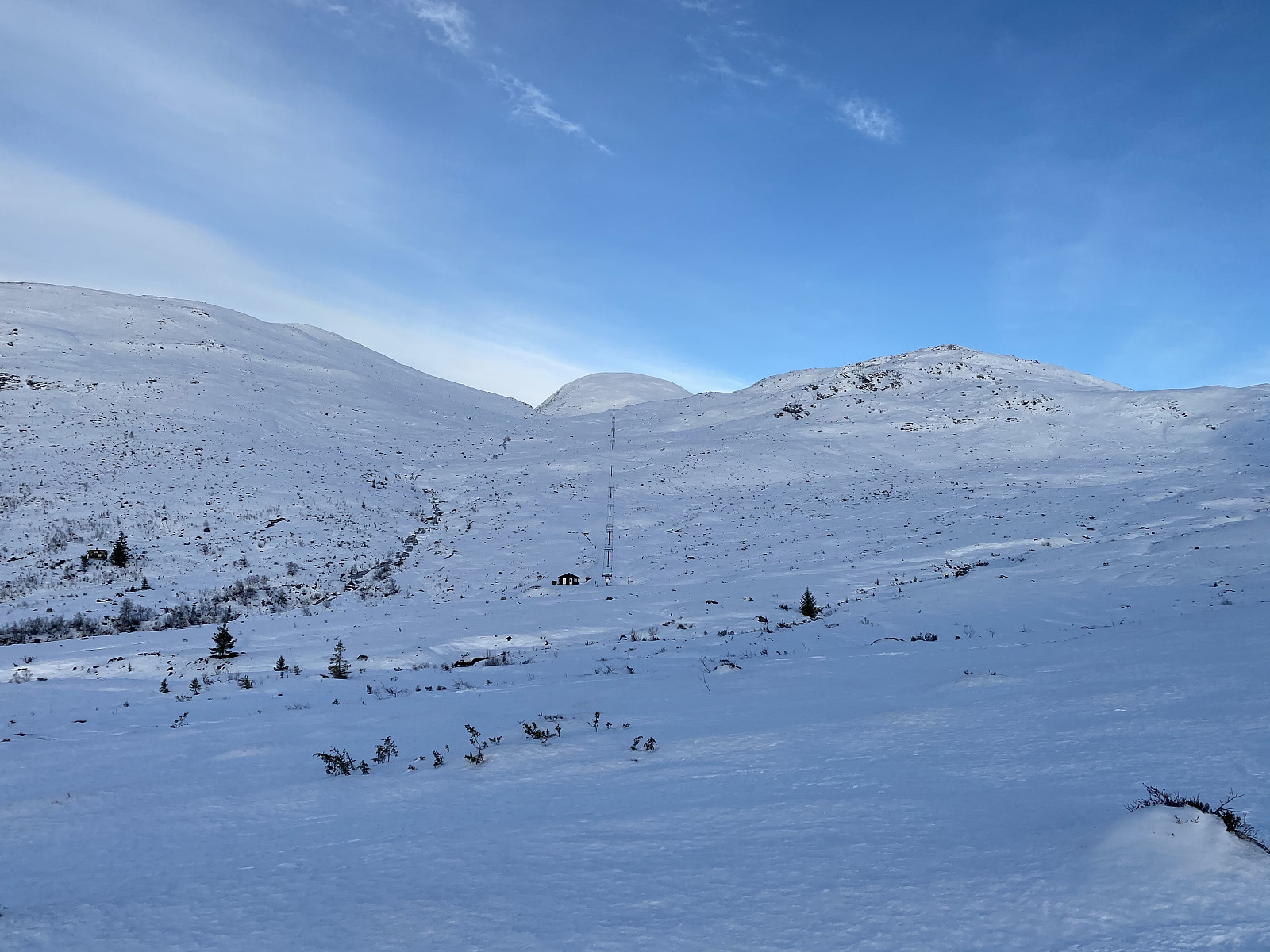
 On this day, we had been planning to ascend Mount Høgenibba in the Municipality of Volda, in the county of Møre & Romsdal; and so we went by car, one of my daughters, one of my sons, and myself, to a parking lot by the foot of the mountain; unfortunately, however, there amount of snow at the location was way too scarce for skiing, and so we embarked upon our return towards our home. On our way back home, however, we passed by the Strandafjellet Skiing Centre; and realized it should be possible to ascend Mount Roaldshornet [1230 m.a.m.s.l.] instead. This skiing resort has ski lifts on both sides of Fursetdalen valley. Generally speaking, there tends to be more snow on the south side of the valley, because the sun tends to shine upon the snow on the north side, and make it taw. Moreover, >>>
To Mount Heggdalshornet and Mount Opstadhornet
- Dato:
- 12.12.2020
- Turtype:
- Fottur
- Turlengde:
- 4:27t
- Distanse:
- 15,8km
 Winter had definitely arrived by now, and there was snow up in the higher mountains, especially in inland areas; though it was still not enough snow for skiing in most places. There had been some snow in October and November, but then most of it had disappeared again. Nevertheless, many of the smaller mountains in the coastal area were currently without snow (or without any amount worth mentioning), and so on this day my son and I opted for two of the peaks on an island called Otrøya . So, we drove to the village of Brattvåg, and went by the ferry over to the tiny island of Dryna. Dryna is connected to the larger island called Midøya with a little bridge, and Midøya is in turn connected to Otrøya Island with an even larger bridge (see map). I had previously never ascended any of the many >>>
To Mount Gryta in Stryn Municipality
- Dato:
- 05.12.2020
- Turtype:
- Fottur
- Turlengde:
- 2:30t
- Distanse:
- 7,4km
 On this day, there was some snow in the mountains, though not enough for skiing; at least most places. So my son and I opted for a mountain that we could ascend on foot on this day, and we were of course prepared to do the walk in snow about halfway up to our knees. A mountain well suited for such a trek, was Mount Gryta in Stryn Municipality in the County of Vestland. So we went to Stryn by car, and used Google map to find our way to Stryn Vinterskisenter [i.e. "Stryn Winter Skiing Center"]. This skiing center has been so named, because there is another one, much higher up in the mountains, that carries the name Stryn Sommerskisenter [i.e "Stryn Summer Skiing Center"]. From the parking lot at the ski centre, we followed a road through a cabin village called Bøasetra; a >>>
Ski Touring to Mount Smørbotstinden with my son
- Dato:
- 28.11.2020
- Turtype:
- Randonnée/Telemark
- Turlengde:
- 3:31t
- Distanse:
- 8,1km
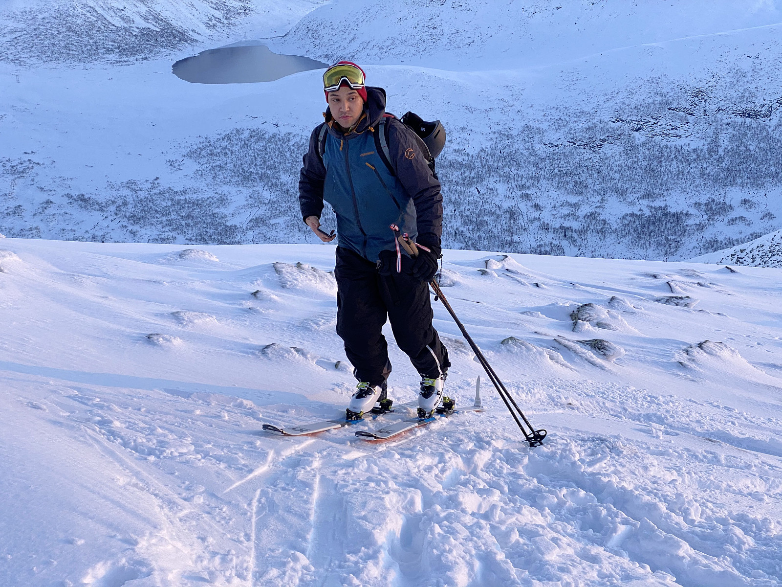 I have previously twice visited Mount Smørbottinden, the first time on Telemark skies, and the second time on alpine touring skis. For tour descriptions including a number of nice pictures, follow these links: Telemark Skiing to Mount Smørbottinden in Rauma Municipality and Alpine Ski Touring to Mount Smørbottind and Mount Kvasstind . The main difference this time compared to my two previous ascents of Mount Smørbotttinden, was that my son joined me this time, and it was actually he that suggested we make this trip. As on previous occasions we drove to Skorgedalen Valley in Rauma Municipality, parked at the parking lot by the ski resort in the valley; and from there we started skiing. The amount of snow was much less on this occasion compared to what it had been on my previous two visits. In the lower part of the trail, the snow was also wet and quite heavy; and at some places we had to cross some open creeks >>>
Til Niusen på Skøye med Dag
- Dato:
- 21.11.2020
- Turtype:
- Fottur
- Turlengde:
- 2:17t
- Distanse:
- 7,8km
 Det hadde nylig falt en del snø, slik at det i de høye fjellene var for mye snø til å gå vanlige fjellturer, men samtidig var det fortsatt for lite med tanke på å skulle gå på ski. Så da foreslo eldstegutten min at vi kunne gå på Nihusen på skøye. Dette fjellet er ikke særlig høyt, bare 438 høydemeter, så man kommer seg alltids både opp og ned igjen, selv om det er litt glatt, og man bruker litt tid på turen.
Vi kjørte til Skodje [lokal utt.: Skøye], og parkerte på parkeringsplassen bak rådhuset og legekontoret (se kart), og derfra fulgte vi Nihusvegen opp til skogen. Min sønn hadde vært på Nihusen før, og visste vegen, men med en god turbeskrivelse skulle det uansett ikke ha vært vanskelig å finne stien vi skulle følge gjennom skogen og opp på fjellet. Stien >>>
Det hadde nylig falt en del snø, slik at det i de høye fjellene var for mye snø til å gå vanlige fjellturer, men samtidig var det fortsatt for lite med tanke på å skulle gå på ski. Så da foreslo eldstegutten min at vi kunne gå på Nihusen på skøye. Dette fjellet er ikke særlig høyt, bare 438 høydemeter, så man kommer seg alltids både opp og ned igjen, selv om det er litt glatt, og man bruker litt tid på turen.
Vi kjørte til Skodje [lokal utt.: Skøye], og parkerte på parkeringsplassen bak rådhuset og legekontoret (se kart), og derfra fulgte vi Nihusvegen opp til skogen. Min sønn hadde vært på Nihusen før, og visste vegen, men med en god turbeskrivelse skulle det uansett ikke ha vært vanskelig å finne stien vi skulle følge gjennom skogen og opp på fjellet. Stien >>>
To Mount Saudehornet in Ørsta Municipality
- Dato:
- 14.11.2020
- Turtype:
- Alpintur
- Turlengde:
- 4:20t
- Distanse:
- 10,4km
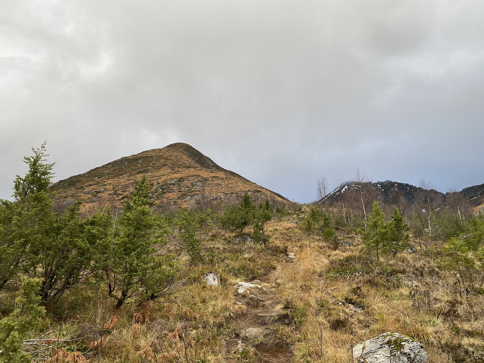 It had been snowing in the mountains lately, and so for this days mountain trek, we had been trying to pick a mountain not too high; in order to stay below the snow. And, as my son Dag had lately read a tour description about a mountain called Kyrkjetinden [i.e. "The Church Peak"] in Ørsta municipality in the County of Møre & Romsdal, we decided to go there. Kyrkjetinden is a peak located just about 6 kilometers or so from the town center of Ørsta, and it has an elevation of 1069 m.a.m.s.l.; and was thus located well beneath the altitude down to which the snow reached at this time.
We drove to Ørsta, and parked at a little parking lot by a road called Fonnavegen, just by a training ground for dogs, which is located between this road and a little river located just there. There >>>
It had been snowing in the mountains lately, and so for this days mountain trek, we had been trying to pick a mountain not too high; in order to stay below the snow. And, as my son Dag had lately read a tour description about a mountain called Kyrkjetinden [i.e. "The Church Peak"] in Ørsta municipality in the County of Møre & Romsdal, we decided to go there. Kyrkjetinden is a peak located just about 6 kilometers or so from the town center of Ørsta, and it has an elevation of 1069 m.a.m.s.l.; and was thus located well beneath the altitude down to which the snow reached at this time.
We drove to Ørsta, and parked at a little parking lot by a road called Fonnavegen, just by a training ground for dogs, which is located between this road and a little river located just there. There >>>
Tour Skiing to Mount Alnestinden with my Son Dag
- Dato:
- 24.10.2020
- Turtype:
- Randonnée/Telemark
- Turlengde:
- 3:31t
- Distanse:
- 6,7km
 There had been a substantial snowfall a few days ago, and we had lately seen some people sharing online that they had been tour skiing to the summit of Mount Alnestinden in the municipality of Rauma; and so my son and I decided to do the same. The local newspapers reported that there had just been a huge avalanche close to the summit of this mountain, though, but I knew this mountain quite well; and by that I mean well enough to be familiar with an alternative route that we could take to minimize the risk of being caught by an avalanche, if necessary. As we were heading towards Rauma this morning, however, I was a bit curious to see where the avalanche had been taking place, as there was something that didn’t quite add up in the newspaper report. First, the report said that the avalanche >>>
To Mount Breitinden and Mount Mannen with my Son
- Dato:
- 10.10.2020
- Turtype:
- Alpintur
- Turlengde:
- 7:04t
- Distanse:
- 16,1km
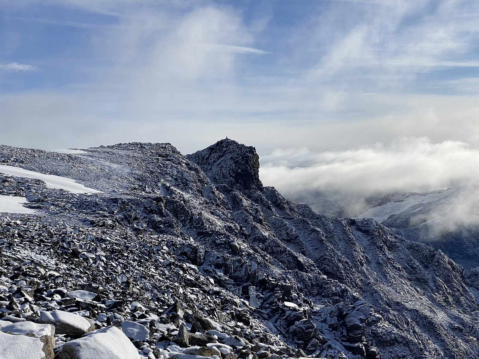 We did set out for the Mountain called Breitinden [i.e. "The Broad Peak"] one week prior to this trip, but we never reached it on that day, mainly because we had limited time available; so on this day we decided to make a new attempt. Moreover, in order not to fail a second time, we opted for a more regular route this time; and so we set out from the Trollstigen Tourist Center, into the valley called Stigebotnen (see map). From this valley we climbed onto the mountain ridge that interconnects Mount Storgrovfjellet and Mount Breitinden, and thereafter we followed that ridge up to the top of Mount Breitinden.
As you're coming up on the edge of this mountain ridge, you get a very good view of the peaks that the locals call the Troll Peaks [Norwegian: "Trolltindan"] i.e. the >>>
We did set out for the Mountain called Breitinden [i.e. "The Broad Peak"] one week prior to this trip, but we never reached it on that day, mainly because we had limited time available; so on this day we decided to make a new attempt. Moreover, in order not to fail a second time, we opted for a more regular route this time; and so we set out from the Trollstigen Tourist Center, into the valley called Stigebotnen (see map). From this valley we climbed onto the mountain ridge that interconnects Mount Storgrovfjellet and Mount Breitinden, and thereafter we followed that ridge up to the top of Mount Breitinden.
As you're coming up on the edge of this mountain ridge, you get a very good view of the peaks that the locals call the Troll Peaks [Norwegian: "Trolltindan"] i.e. the >>>
