Archiv - Nach Datum
Archiv - Nach Aktivität
-
Andere Tour (1)
- Expedition (1)
-
Andere Wintertour (10)
- Schneeschuhtour (10)
- Fahrradtour (2)
- Fußtour (228)
-
Klettern (8)
- Alpinklettern (7)
- Mixed-Klettern (1)
-
Skitour (49)
- Randonnée/Telemark (49)


Gesammelte Listen
-
Romsdal ≥ 100m pf.
(134/301)
 44%
44% -
Sunnmøre ≥ 100m pf.
(78/531)
14%
-
Norges 1000 største fjell målt i primærfaktor
(52/1000)
5%

To Mount Innerdalstårnet with my Son Dag
- Datum:
- 26.06.2021
- Tourcharakter:
- Bergtour
- Tourlänge:
- 6:43h
- Entfernung:
- 20,1km
 Min sønn Dag hadde lest om Innerdalstårnet på nettet, og lenge hatt lyst til å bestige dette fjellet. Værmeldingene for denne helgen hadde egentlig vært dårlige hele uka, men så bedret de seg kvelden før denne lørdagen, og da tok vi sjansen.
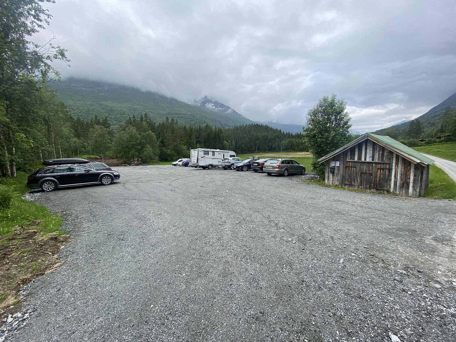
Vi stod tidlig opp, og kjørte de tre timene det tok til Sunndalsøra og videre til Ålvundeid, hvor vi tok til høyre ved landhandelen, og kjørte opp til Dalen Parkering, som er det nærmeste du lovlig kan komme Renndølsetra og Innerdalshytta med bil. Parkeringsavgiften ble betalt med Vipps-overføring, og så la vi i vei.
Fra Dalen går det en velholdt grusvei opp til Renndølsetra og Innerdalsvatnet. Den klatrer jevnt oppover, inntil man kommer opp på en berghammer med utsikt innover dalen; derfra går det så litt ned igjen før man kommer >>>
Min sønn Dag hadde lest om Innerdalstårnet på nettet, og lenge hatt lyst til å bestige dette fjellet. Værmeldingene for denne helgen hadde egentlig vært dårlige hele uka, men så bedret de seg kvelden før denne lørdagen, og da tok vi sjansen.
Vi stod tidlig opp, og kjørte de tre timene det tok til Sunndalsøra og videre til Ålvundeid, hvor vi tok til høyre ved landhandelen, og kjørte opp til Dalen Parkering, som er det nærmeste du lovlig kan komme Renndølsetra og Innerdalshytta med bil. Parkeringsavgiften ble betalt med Vipps-overføring, og så la vi i vei.
Fra Dalen går det en velholdt grusvei opp til Renndølsetra og Innerdalsvatnet. Den klatrer jevnt oppover, inntil man kommer opp på en berghammer med utsikt innover dalen; derfra går det så litt ned igjen før man kommer >>>
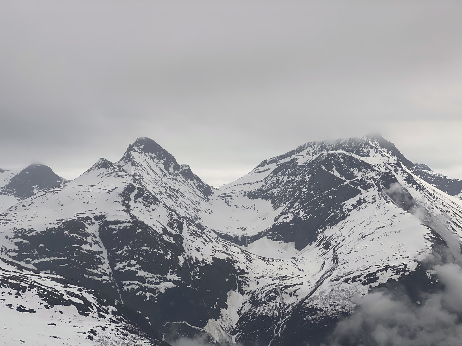
Fot- og klyvetur til Soggefjellet og Setergjelstinden
- Datum:
- 22.06.2021
- Tourcharakter:
- Hochtour
- Tourlänge:
- 9:58h
- Entfernung:
- 14,5km
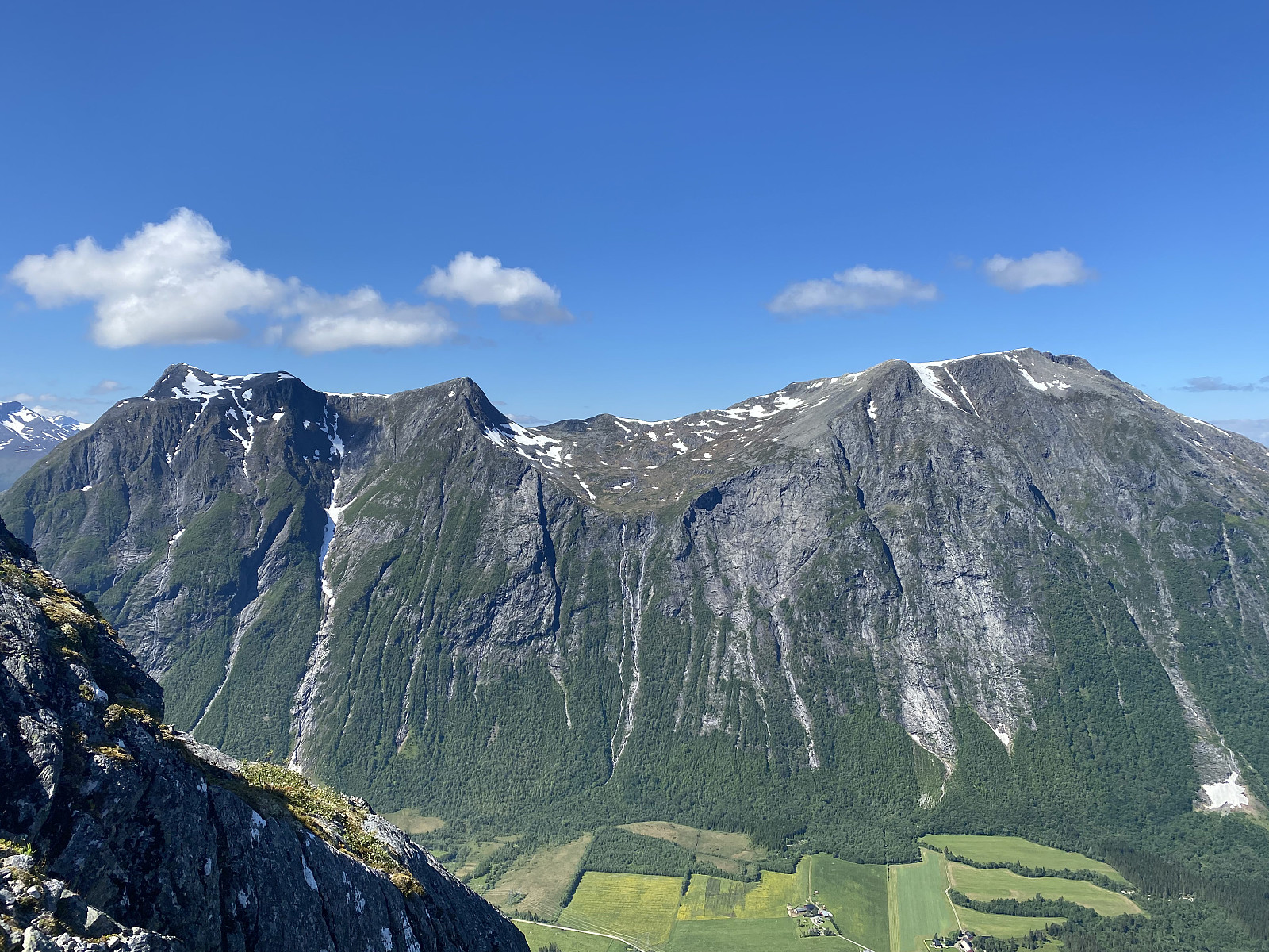 På denne tirdsagen besøkte jeg fjellryggen som flankerer vestsida av Adelsbreen i Rauma. Jeg har tidligere besøkt de tre toppene som ligger langs østsida av breen, dvs. Adelsfjellet, Middagsbarna og Nordre Trolltind; men nå var det altså Nonshaugen [1194 m.o.h.], Soggefjellet [1357 m.o.h.] og Setergjeltinden [1436 m.o.h.] som stod for tur. Jeg startet ved Soggemoen, og fulgte stien over Soggeberget opp til Orabotn, hvor jeg forlot stien, og la tvers gjennom skogen, krysset elva Oråa, og begynte å klatre oppover nordryggen på Nonshaugen (Bilder ## 1-4).
Jeg hadde nok spart en del tid ved å fortsette på stien opp til Norafjellet, og så krysse over til Nonshaugen derfra; men nordryggen på Nonshaugen er nokså bratt, og har har fint klatreterreng som jeg følte meg tiltrukket av, og >>>
På denne tirdsagen besøkte jeg fjellryggen som flankerer vestsida av Adelsbreen i Rauma. Jeg har tidligere besøkt de tre toppene som ligger langs østsida av breen, dvs. Adelsfjellet, Middagsbarna og Nordre Trolltind; men nå var det altså Nonshaugen [1194 m.o.h.], Soggefjellet [1357 m.o.h.] og Setergjeltinden [1436 m.o.h.] som stod for tur. Jeg startet ved Soggemoen, og fulgte stien over Soggeberget opp til Orabotn, hvor jeg forlot stien, og la tvers gjennom skogen, krysset elva Oråa, og begynte å klatre oppover nordryggen på Nonshaugen (Bilder ## 1-4).
Jeg hadde nok spart en del tid ved å fortsette på stien opp til Norafjellet, og så krysse over til Nonshaugen derfra; men nordryggen på Nonshaugen er nokså bratt, og har har fint klatreterreng som jeg følte meg tiltrukket av, og >>>
Til Varden og Stavneshornet ved Dyrkorn
- Datum:
- 19.06.2021
- Tourcharakter:
- Bergtour
- Tourlänge:
- 3:27h
- Entfernung:
- 8,4km
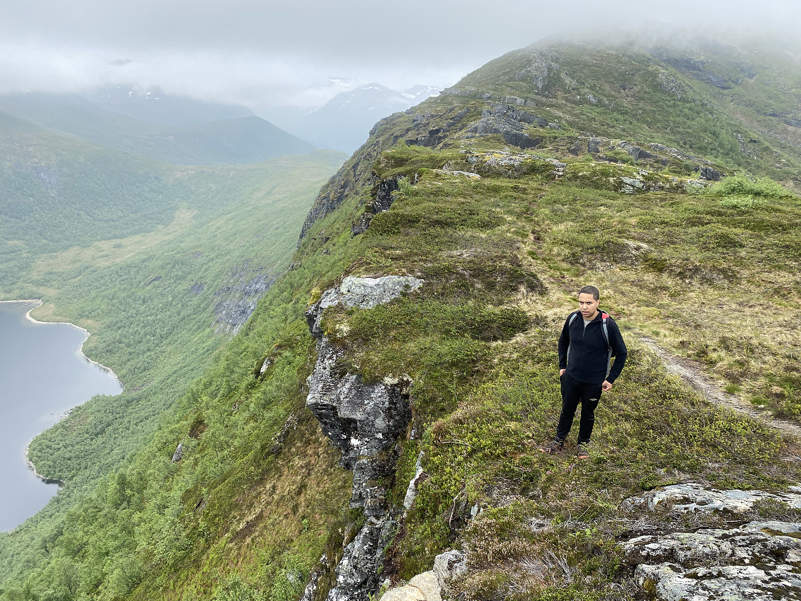 På forslag fra min eldste sønn, Dag, kjørte jeg og han inn til Dyrkorn denne dagen, for å bestige Stavneshornet og et fjell som av en eller annen grunn bare kalles "Varden". Man tar av fra Europavei E136 på Sjøholt, og følger fylkesvei 650 forbi Vestre og Vaksvika, og deretter gjennom Visettunnelen og Dyrkorntunnelen, og på den korte veistrekningen mellom Dyrkorntunnelen og Stordalstunnelen, tar man så av til venstre, og følger en smal hårnålsvei oppover bakkene i Dyrkorn-bygda. Dyrkorn-dalen er en slags hengedal i øst-vest-retning på østsida av denne delen av Storfjorden, slik at terrenget flater noe ut oppe i dalen, når man bare er kommet ovenfor den bratte oppstigningen fra hovedveien. Øverst oppe i bygda, ved Øvre Dyrkorn, deler veien seg i to; én som krysser >>>
To Mount Verahornet
- Datum:
- 12.06.2021
- Tourcharakter:
- Wanderung
- Tourlänge:
- 1:17h
- Entfernung:
- 3,6km
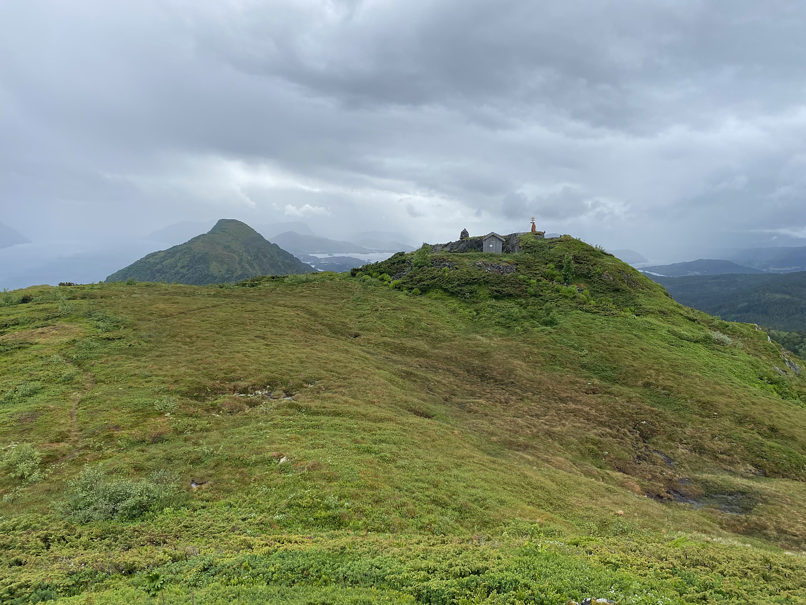 Det ble en kort og grei tur denne dagen. Vi kjørte til Sjøholt, og tok den gamle bilveien opp bakkene i retning Solnørdalen. Når vi nærmet oss toppen av bakken, tok vi til høyre langs Eggeveien, og kjørte ca. 1 kilometer, før vi kom til parkeringslomma vi hadde sett omtalt på nettet. Her satte vi bilen fra oss, og begynte å gå.
Stien fra Egge Parkeringslomme opp til topps på Verahornet var svært lett å følge, og det er tydelig at den er mye brukt. Den tar av fra Eggeveien bare en 30-40 meter etter parkeringslomma, og første delen går gjennom bjørkeskog (bilder ##1 & 2). Etterhvert kommer man ut av skogen, og får god utsikt både til høyre og til venstre og bakover.
På venstre hånd ser man innover mot Engesetdalen (bilde #8), til høyre ser man Storfjorden innover i retning >>>
Det ble en kort og grei tur denne dagen. Vi kjørte til Sjøholt, og tok den gamle bilveien opp bakkene i retning Solnørdalen. Når vi nærmet oss toppen av bakken, tok vi til høyre langs Eggeveien, og kjørte ca. 1 kilometer, før vi kom til parkeringslomma vi hadde sett omtalt på nettet. Her satte vi bilen fra oss, og begynte å gå.
Stien fra Egge Parkeringslomme opp til topps på Verahornet var svært lett å følge, og det er tydelig at den er mye brukt. Den tar av fra Eggeveien bare en 30-40 meter etter parkeringslomma, og første delen går gjennom bjørkeskog (bilder ##1 & 2). Etterhvert kommer man ut av skogen, og får god utsikt både til høyre og til venstre og bakover.
På venstre hånd ser man innover mot Engesetdalen (bilde #8), til høyre ser man Storfjorden innover i retning >>>
To Mount Svarttinden and Mount Jamtetinden
- Datum:
- 05.06.2021
- Tourcharakter:
- Wanderung
- Tourlänge:
- 4:32h
- Entfernung:
- 12,8km
 On this day we drove to the Valley of Vistdal in the eastern part of the county of Møre & Romsdal, intending to hike to a peak called Svarttinden [i.e. "The Black Peak"]. We followed some online instructions that my son had found for this particular trek, and left the county road for a gravel road about midway in the valley (see map). We followed this road past a farm or two and into the forrest; where we parked at a large clearing in the forrest where the forrest road made its first hairpin-bend.
This parking lot is located at about 170 m.a.m.s.l., and from there the gravel road climbs up the mountain side to about 500 m.a.m.s.l., making a total of 8 hairpin bends; and where the road ends, the trail continues as an ordinary forrest path. We followed the road and then the trail >>>
On this day we drove to the Valley of Vistdal in the eastern part of the county of Møre & Romsdal, intending to hike to a peak called Svarttinden [i.e. "The Black Peak"]. We followed some online instructions that my son had found for this particular trek, and left the county road for a gravel road about midway in the valley (see map). We followed this road past a farm or two and into the forrest; where we parked at a large clearing in the forrest where the forrest road made its first hairpin-bend.
This parking lot is located at about 170 m.a.m.s.l., and from there the gravel road climbs up the mountain side to about 500 m.a.m.s.l., making a total of 8 hairpin bends; and where the road ends, the trail continues as an ordinary forrest path. We followed the road and then the trail >>>
To Mount Storheimshornet with my Son Dag
- Datum:
- 29.05.2021
- Tourcharakter:
- Wanderung
- Tourlänge:
- 8:24h
- Entfernung:
- 18,3km
 It was my son who suggested Mount Storheimshornet for this day's hike. He had read about the mountain on a web site, and so we went to Stordalen Valley this morning, from where the hike goes. According to the web site, the best place to park when hiking this mountain, would be at Mo Bedehus [i.e. "Mo Prayer House"]. The little place called Mo was easy enough to find, but locating the Prayer House was a little bit more tricky, simply because it didn't look like a prayer house, but more like an ordinary house. (A Norwegian Prayer House is a religious building without the pomp and splendor of a Church, and is usually operated by lay people and not by clergymen).
At the Prayer House parking lot you could conveniently pay for the parking using instant money transfer by use of the Norwegian >>>
It was my son who suggested Mount Storheimshornet for this day's hike. He had read about the mountain on a web site, and so we went to Stordalen Valley this morning, from where the hike goes. According to the web site, the best place to park when hiking this mountain, would be at Mo Bedehus [i.e. "Mo Prayer House"]. The little place called Mo was easy enough to find, but locating the Prayer House was a little bit more tricky, simply because it didn't look like a prayer house, but more like an ordinary house. (A Norwegian Prayer House is a religious building without the pomp and splendor of a Church, and is usually operated by lay people and not by clergymen).
At the Prayer House parking lot you could conveniently pay for the parking using instant money transfer by use of the Norwegian >>>
Hiking to Mount Grisetskolten with my Son
- Datum:
- 16.05.2021
- Tourcharakter:
- Wanderung
- Tourlänge:
- 4:05h
- Entfernung:
- 7,7km
 Mount Grisetskolten [1068 m.a.m.s.l.] is a mountain in the municipality of Rauma, in the county of Møre & Romsdal on the west coast of Norway. I have previously visited a number of mountains in this area, but not Mount Grisetskolten. My son, however, had visited it once before; and so on this Sunday, he offered to take me there.
Video #1: Waterfall of the Tverråa River.
We went by car to the fjord called Innfjorden, and drove up the mountain side along a narrow forest road, that took us up to a little parking lot above a farm called Griset, after which Mount Grisetskolten has actually been named. We started trekking almost immediately after we arrived there. The trail was well marked and the first part of it was also readily visible. The trail took us through forest, mainly birch forest, >>>
Mount Grisetskolten [1068 m.a.m.s.l.] is a mountain in the municipality of Rauma, in the county of Møre & Romsdal on the west coast of Norway. I have previously visited a number of mountains in this area, but not Mount Grisetskolten. My son, however, had visited it once before; and so on this Sunday, he offered to take me there.
Video #1: Waterfall of the Tverråa River.
We went by car to the fjord called Innfjorden, and drove up the mountain side along a narrow forest road, that took us up to a little parking lot above a farm called Griset, after which Mount Grisetskolten has actually been named. We started trekking almost immediately after we arrived there. The trail was well marked and the first part of it was also readily visible. The trail took us through forest, mainly birch forest, >>>
Hiking to Mount Hornelen with my Son
- Datum:
- 09.05.2021
- Tourcharakter:
- Wanderung
- Tourlänge:
- 5:32h
- Entfernung:
- 13,4km
 On this day, my son and I were driving from Ålesund to Bergen, on the west coast of Norway, and so we had discussed in advance of our journey, to have a break from driving, and ascend some mountain while on our way to Bergen; and our choice fell on Mount Hornelen in the municipality of Bremanger, as we had been told that it is the highest ocean cliff in Europe, and that it could be a little bit challenging to ascend. We drove along county road 61 south to the little coastal town of Måløy (image #1), from where we crossed over to the island of Bremanger by ferry (images ## 1 & 2).
We disembarked the ferry at the Oldeide ferry quai, and drove to a parking lot at a spot called Hornskor (image #3), where we parked our car, and started our trek. The very first part of the trail had been nicely >>>
On this day, my son and I were driving from Ålesund to Bergen, on the west coast of Norway, and so we had discussed in advance of our journey, to have a break from driving, and ascend some mountain while on our way to Bergen; and our choice fell on Mount Hornelen in the municipality of Bremanger, as we had been told that it is the highest ocean cliff in Europe, and that it could be a little bit challenging to ascend. We drove along county road 61 south to the little coastal town of Måløy (image #1), from where we crossed over to the island of Bremanger by ferry (images ## 1 & 2).
We disembarked the ferry at the Oldeide ferry quai, and drove to a parking lot at a spot called Hornskor (image #3), where we parked our car, and started our trek. The very first part of the trail had been nicely >>>
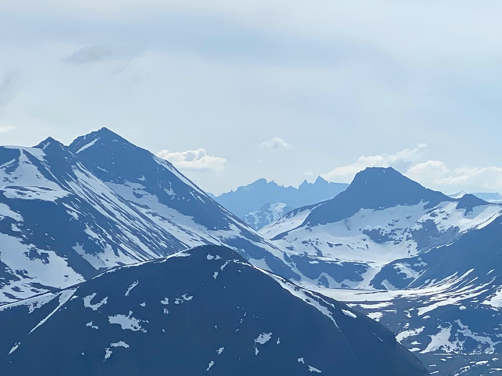
Tour Skiing to Mount Kragefjellet with my Son
- Datum:
- 01.05.2021
- Tourcharakter:
- Randonnée/Telemark
- Tourlänge:
- 4:43h
- Entfernung:
- 12,2km
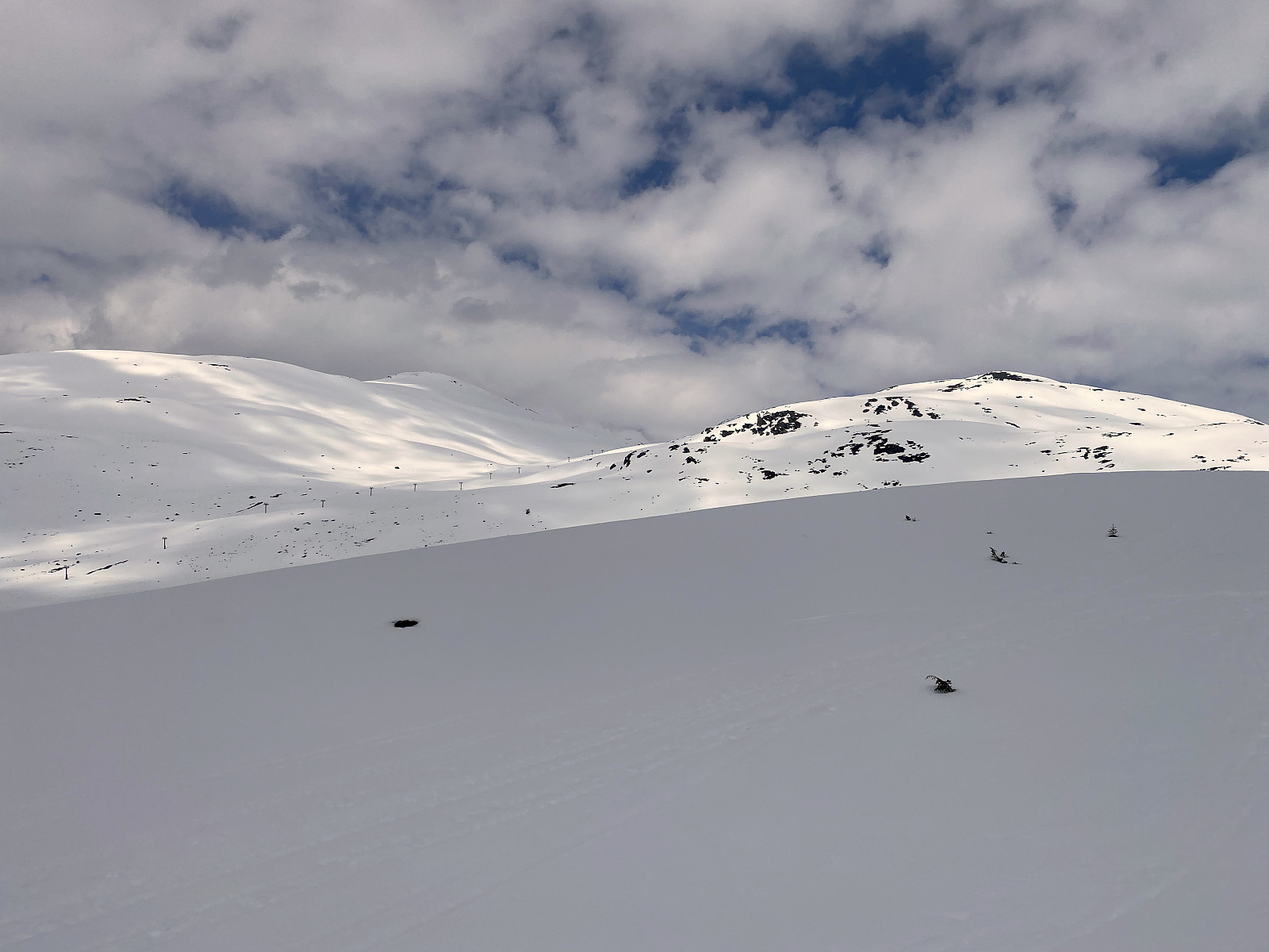 On this occasion, my son had read online a few days earlier, that it was still possible to go skiing to Mount Kragefjellet in the municipality of Stryn in the county of Vestland, and so we went to the site by car. Now, this municipality has two skiing centers, i.e. there is Stryn Summer Skiing Centre, and then there is Stryn Winter Skiing Centre; and in order to climb Mount Kragefjellet, the convenient place to park your car is at the winter skiing centre [the summer skiing centre is at a totally different location much higher up in the mountains].
As we parked at the winter skiing centre, we realized that snow was much more scarce than we had anticipated; i.e. it was not even enough to keep the skiing centre open. Nevertheless, there was a narrow strip of snow along the trail of the ski lift >>>
On this occasion, my son had read online a few days earlier, that it was still possible to go skiing to Mount Kragefjellet in the municipality of Stryn in the county of Vestland, and so we went to the site by car. Now, this municipality has two skiing centers, i.e. there is Stryn Summer Skiing Centre, and then there is Stryn Winter Skiing Centre; and in order to climb Mount Kragefjellet, the convenient place to park your car is at the winter skiing centre [the summer skiing centre is at a totally different location much higher up in the mountains].
As we parked at the winter skiing centre, we realized that snow was much more scarce than we had anticipated; i.e. it was not even enough to keep the skiing centre open. Nevertheless, there was a narrow strip of snow along the trail of the ski lift >>>
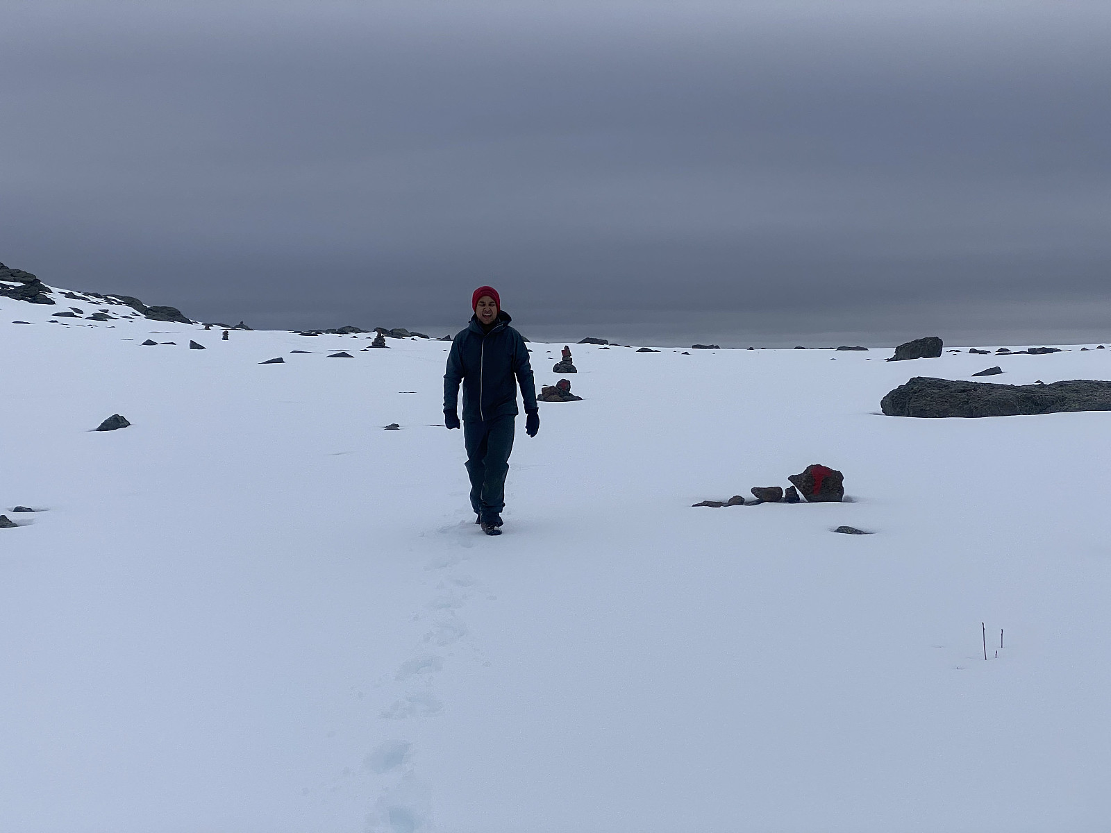
Tour Skiing to Mount Fingeren with my Daughter
- Datum:
- 25.04.2021
- Tourlänge:
- 2:58h
- Entfernung:
- 6,9km
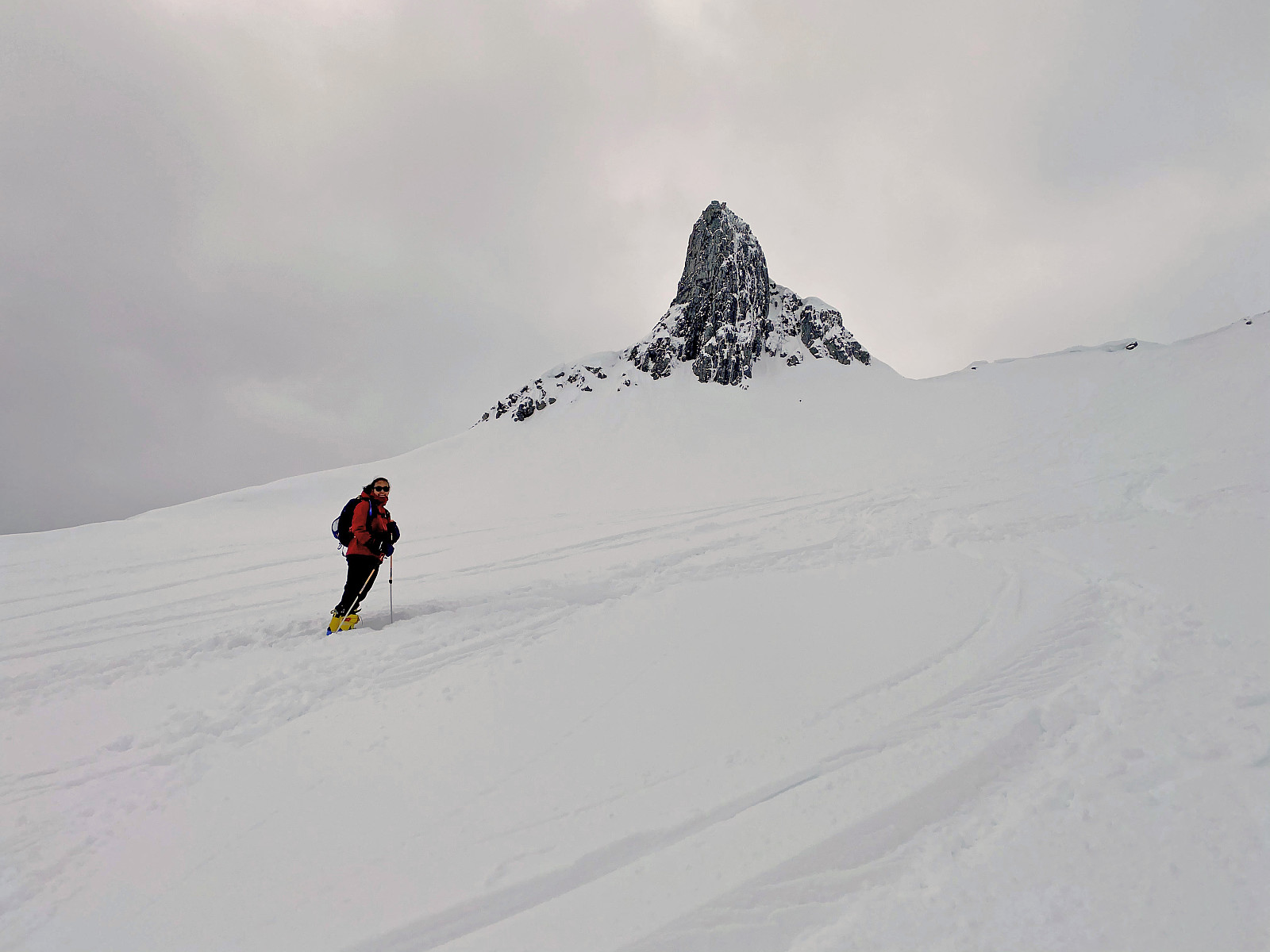 This morning my daughter suggested to me that we make a ski tour to Mount Fingeren. This mountain is actually just a peak on the southwest ridge of the much greater Mount Kolåstinden, but it has become a popular destination for ski touring during winter, as well as for hiking in summer. During the winter season it is common just to go skiing up to a viewpoint just northeast of the peak; whereas during summer, and especially so when weather is nice, it is actually possible to climb up to the summit of the peak itself. The trail most commonly used to the summit of Mount Kolåstinden, however, goes on the opposite side of the mountain, and actually crosses a glacier on its way up to the summit. The peak on the southeast ridge has been named "The Finger", because it looks like a third >>>
