A Day-Trip to the Summit of Mount Hanang (04.12.2022)

| Start point | Katesh (1,966m) |
|---|---|
| Endpoint | Katesh (1,985m) |
| Characteristic | Hillwalk |
| Duration | 7h 05min |
| Distance | 16.7km |
| Vertical meters | 2,455m |
| GPS |
|
| Ascents | Hanang (3,420m) | 04.12.2022 |
|---|
We met with Samwel Magabe, our local Hanang guide at a pavement cafeteria in Babati, a town located just about 60 kms from Mount Hanang. Babati is the capital and the administrative centre of the Manyara Region in Tanzania; and has a lot of shops and other facilities, though the spot was merely a village 40 years ago, and has been developing quite rapidly since then. My friend and tour operator Frank, with whom I had booked this hike, had been in touch with Samwel in advance of our journey, and they had then agreed to meet at this location. When talking with Frank, Samwel had insisted that an ascent of Hanang is a two day hike, and that you have to spend one night at a camp site high up on the mountain ridge leading to the summit. Frank had, however, refused, and insisted that this particular stranger is very strong, and has just been on Ol Doinyo Lengai, Meru, Kilimanjaro and Loolmalasin; and he will do the hike in a single day; and Samwel had finally accepted this, as Frank had said to him that we were not going to book the hike unless we could do it in one day. As Samwel came walking towards our table at the pavement café, he looked at me with a certain amount of scepticism, but he didn't object verbally, as the premises had already been laid by Frank in advance. We had just finished eating, our driver, Frank and myself; so Frank ordered some food even for Samwel, as it is the custom to let people have something to eat before you start discussing business; but once Samwel had finished eating, we started discussing the details of the next days hike. Have you at any time had any tourists that have done the hike in just one day? Frank asked him. Yes, he answered, I once had a visitor that did the entire hike in just 8 hours; but he was a native Tanzanian. When our discussion had come to an end, we paid for the food, and then jumped into our Safari Land Cruiser; and continued our drive down to the village of Katesh, from where we were to start our hike the next morning.
In the village of Katesh, by the foot of Hanang, we spent the night at a hotel called The Summit Hotel. It was certainly not the best hotel that I've stayed in, but the rooms were decent enough, and the shower and the toilet were OK. We had agreed upon turning out of bed quite early, so that we could start hiking at 6 o'clock, but this morning everybody seemed to be a little bit too late. I did indeed wake up at 5, but then I used a little longer than I had planned to pack my stuff. That didn't matter much, however, as Frank only showed up as I was about to finish packing. The driver was waiting for us by the car, as we came there with my suitcases, but Samwel was no where to be seen. Frank then phoned him, and they agreed that we should wait for him at a crossroads a short distance from the hotel. I believe we waited there for almost ten minutes, and when Samwel finally showed up, he had with him two younger lads, of whom one was his brother. The two boys had decided to join him for this hike, in order to try to learn the work of mountain guiding. We let the three of them into the car with us, and then drove up to the Jorodom Gate of the Hanang National Park, where the park fee was paid, and we were properly registered in a park protocol.
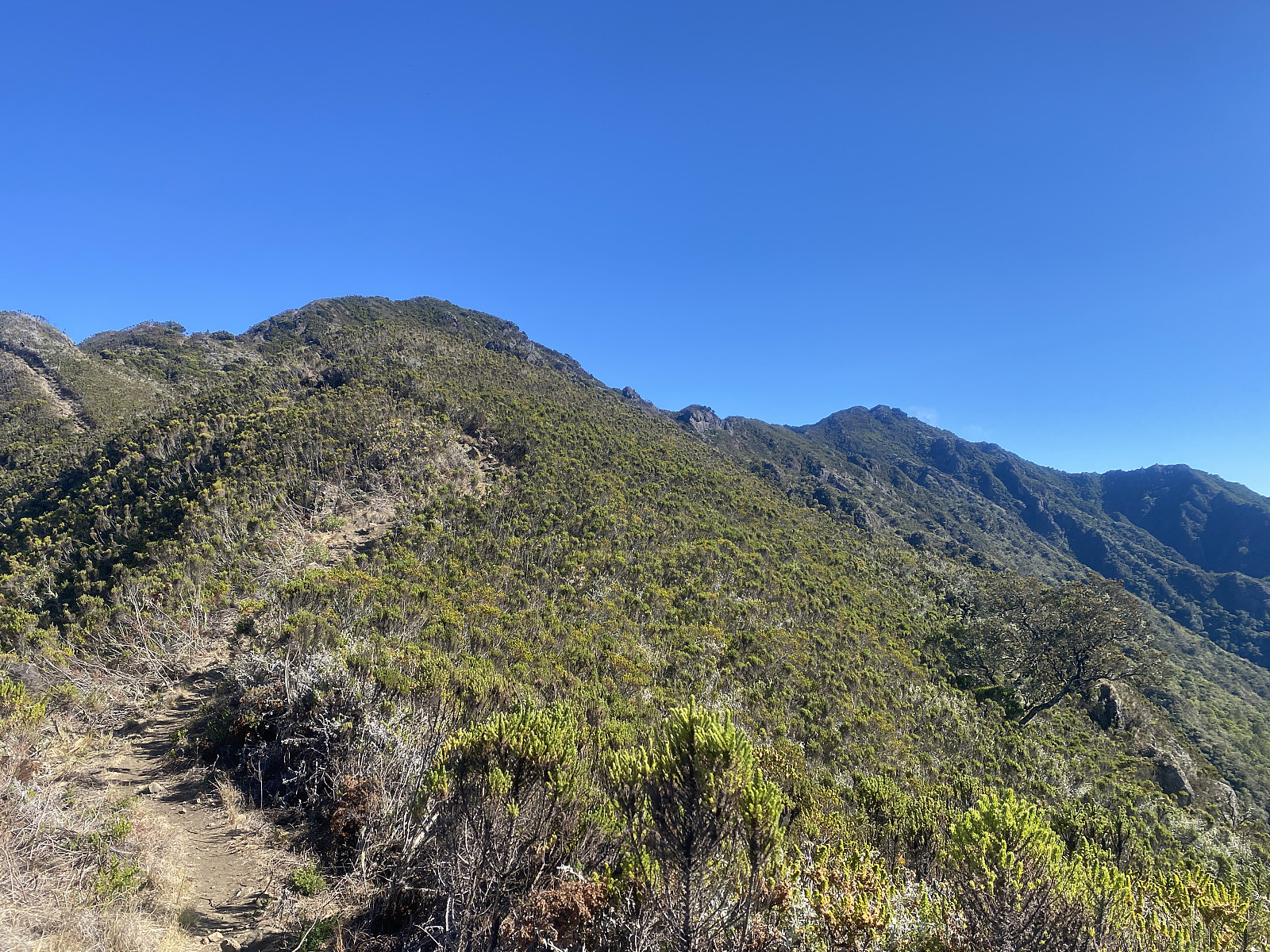
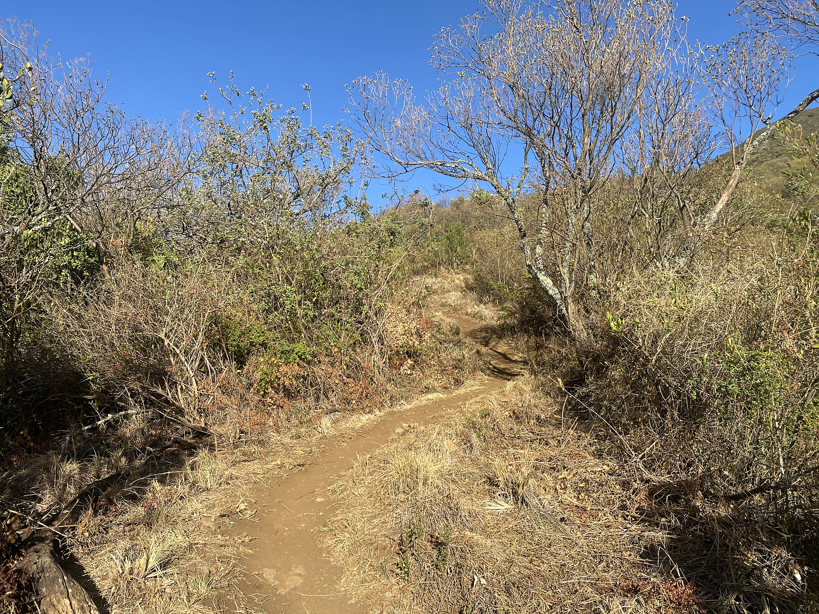
The Jorodom Gate is located at about 1990 m.a.m.s.l., and we started trekking from there at about a quarter to seven. The trail was initially quite broad, so I could easily walk side by side with Samwel; and so I pushed on in the speed that I wanted; as I was well acclimatised to altitude after the above mentioned mountain climbs, and I saw no reason to go slowly on this occasion. And when the trail after a few minutes got a little bit narrower, Samwel actually allowed me to lead the way, and just corrected my direction if I was about to choose an inappropriate path. After a while we passed a little sign pointing at a side trail to the right; announcing there was a waterfall in that direction. Samwel also mentioned this waterfall to me, and told me it was a beautiful one, and so I agreed that we could visit it on our way back down, if there was still time for it. The trail that we were following was initially not very steep, but the inclination of the mountain ridge in front of us then increased rather sharply, and the trek then became a little harder. Mount Hanang has one mountain ridge on the west side, and another on the east side of a central valley, and the summit is located in the north, where the two ridges meet. The valley between the two ridges is one with tropical rain forest, and a river that leaves the valley towards the south. This river is called the Himit River, and the above mentioned waterfall is located along the course of this river. Mount Hanang is actually an old volcanic mountain, and the two mentioned mountain ridges, which together form a semicircular shape around the Himit Valley are the remains of the old crater ridge; and the valley itself is the remnant of the crater.
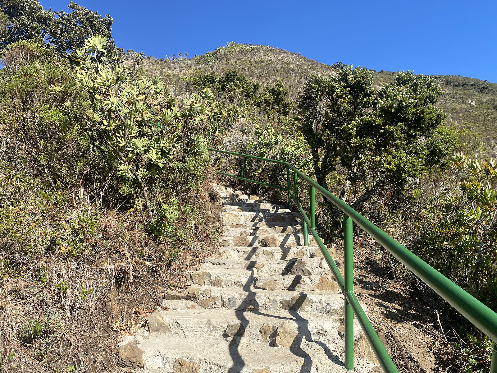
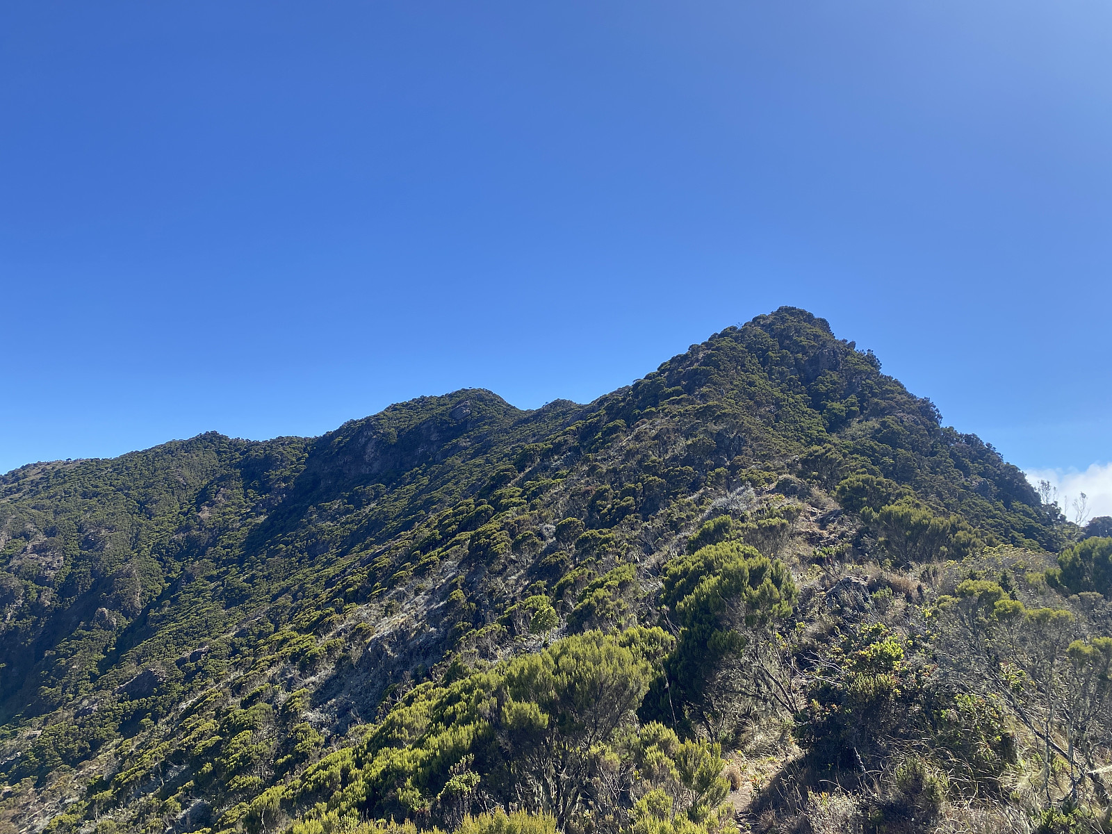
The trail from the Jorodom Gate up to the summit of Hanang follows the mountain ridge on the west side of the Himit Valley. At one point along the route, we stopped, and had a rest for about 5 minutes or so, in order to allow for Frank to catch up with us, as he had taken a trip to the toilet down by the gate, and allowed us to just go ahead in advance of him. As the ridge was becoming increasingly steep, we all of a sudden came to a place where concrete stairs had been built (image #3), in order to facilitate the hike for the tourists, and especially so in case of rain. We continued up the stairs, myself first, then Samwel, next Samwel's brother, and finally Frank, who had just been catching up with us. The third local guy had given up the hike, and left for home, as he was unable to keep up with our speed. Frank later told me that the boy had just stopped at some point, shaken his head in disbelief, dropped his daypack beside the trail; and then turned around. Samwel's younger brother did continue along with us for the entire hike, however, and that was a bit impressive despite his young age, as the boy was not used to mountain trekking the way his older brother was.
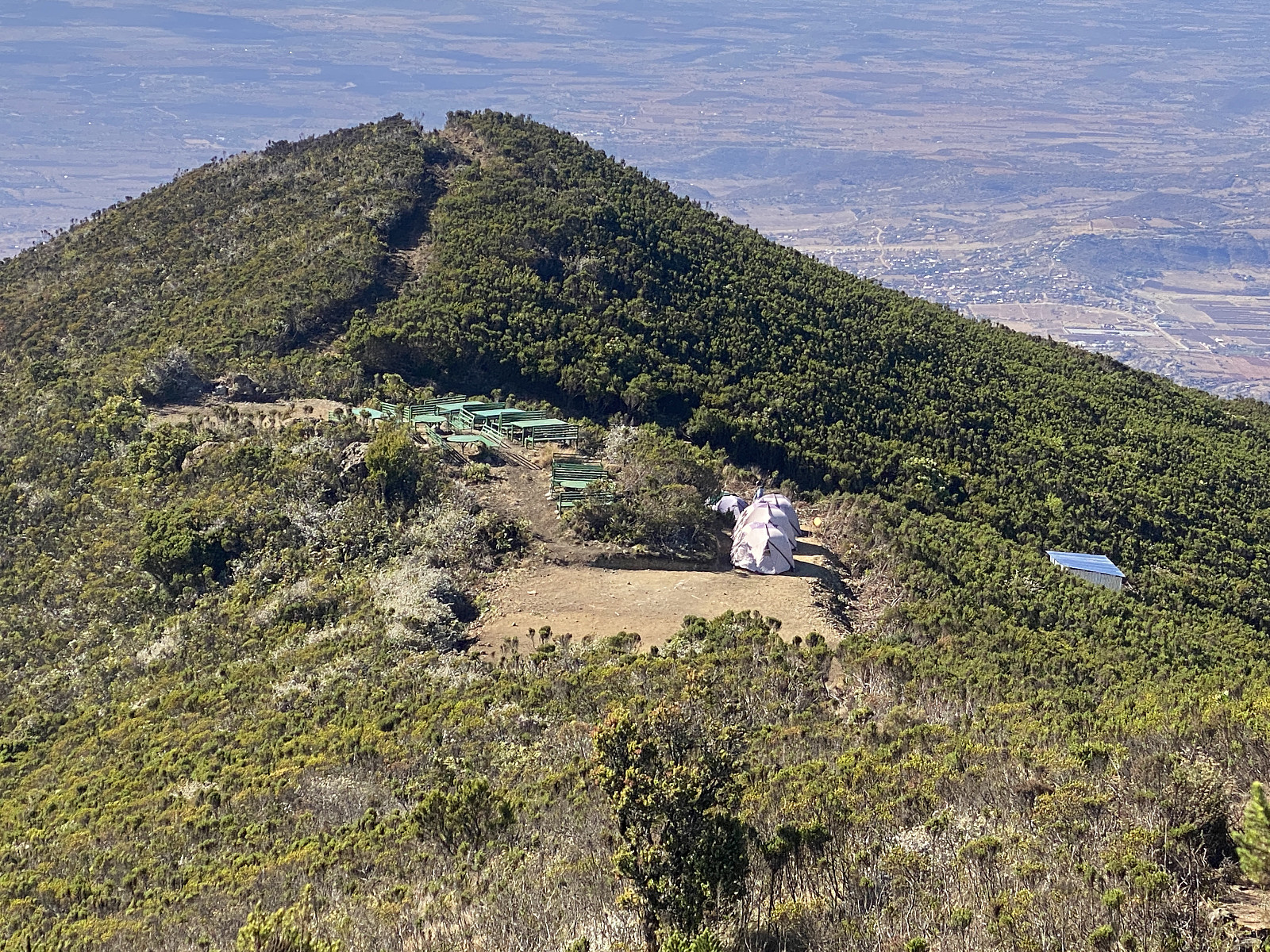
At about 3090 m.a.m.s.l., the mountain ridge flattens out a bit, and this is where the Hanang Public Camp Site is located. This point along the trail is a bit similar to Gilman's Point on Mount Kilimanjaro, in that the trail is quite steep up to that point; but then flattens substantially out once you've past the point, though you still have to climb another 300 elevation metres in order to get to the summit. And, just as with Gilman's point, you could say that the one that reaches this spot, will also reach the summit. On Mount Hanang, however, this particular spot was actually called The Death Point, as one young Tanzanian boy had once upon a time actually dropped dead the very moment he reached this particular point. The trek from the gate up to the camp site was 4.6 kms long, and we used about 2 hours and 5 minutes to reach the spot. There was still a number of tents pitched at the camp site (image #5), as a company of 5 other tourists had just spent the night there. The usual concept when guiding tourists up Hanang along the Jorodom Route, is to take them up to the camp site the first day, then have them spend the night at the camp site, before you take them up to the summit in early morning the next day. Usually, they would get up early on the day of the summit push, in order to have the sun rise while at the summit, as that is supposed to be a very beautiful sight. The group of tourists will thereafter return to the camp site for lunch, before they descend back down to the gate the way they came up the previous day; and so the tents remain pitched at the camp site until the group have been there for lunch, but are taken down by the porters the moment the tourists leave for the gate.
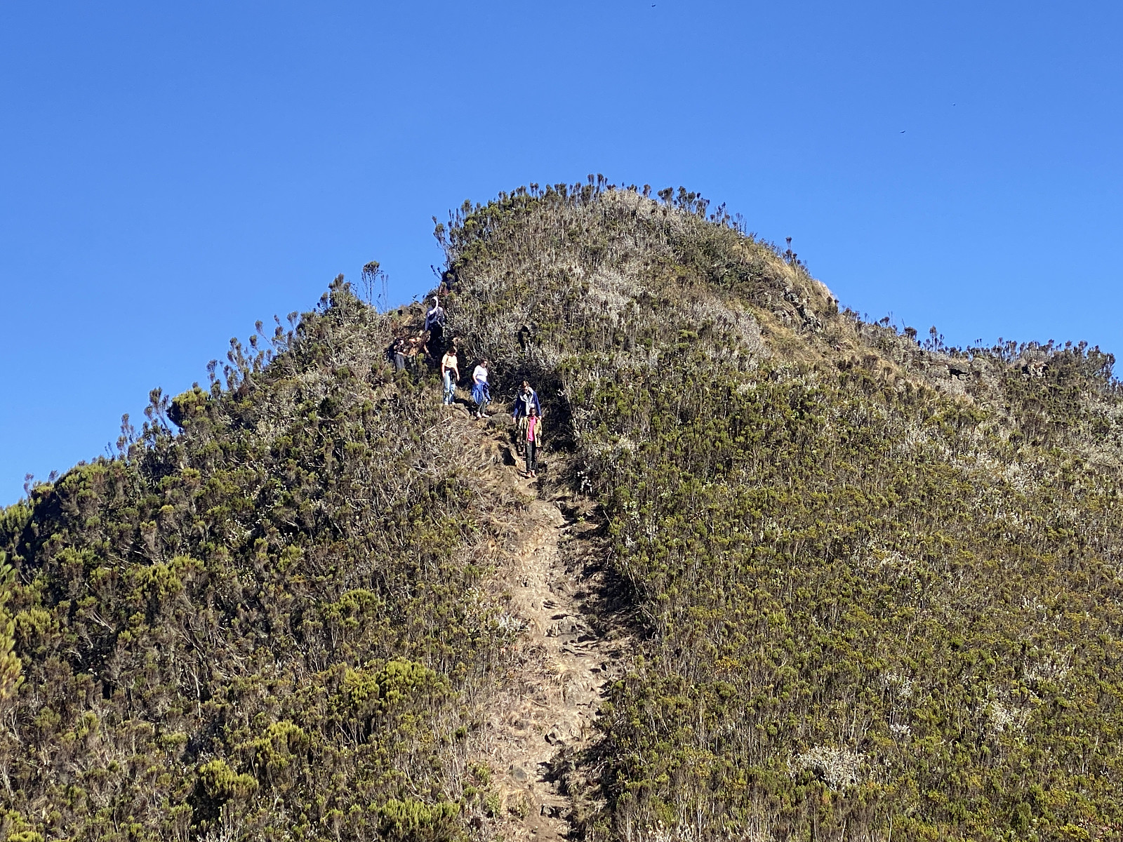
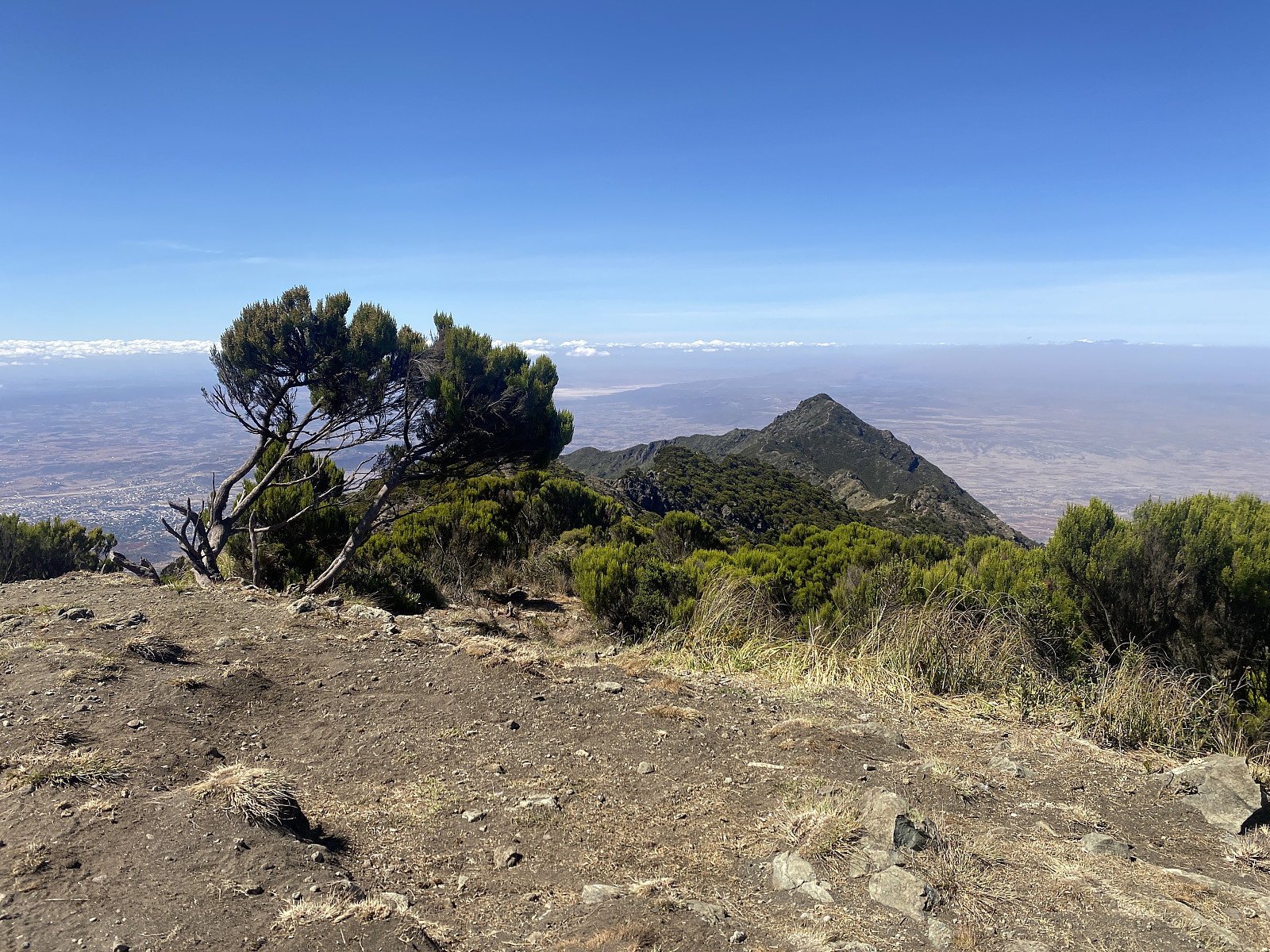
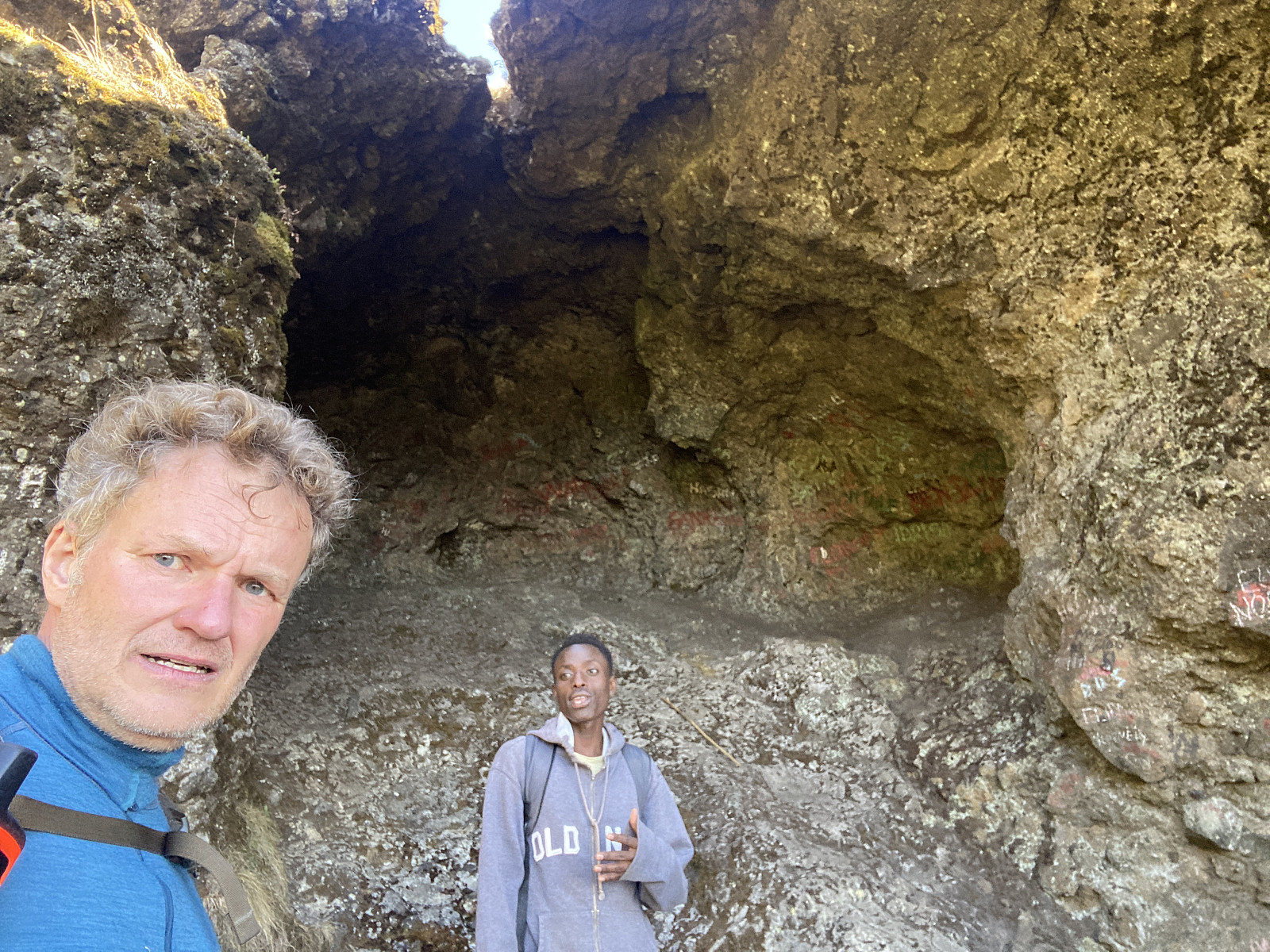
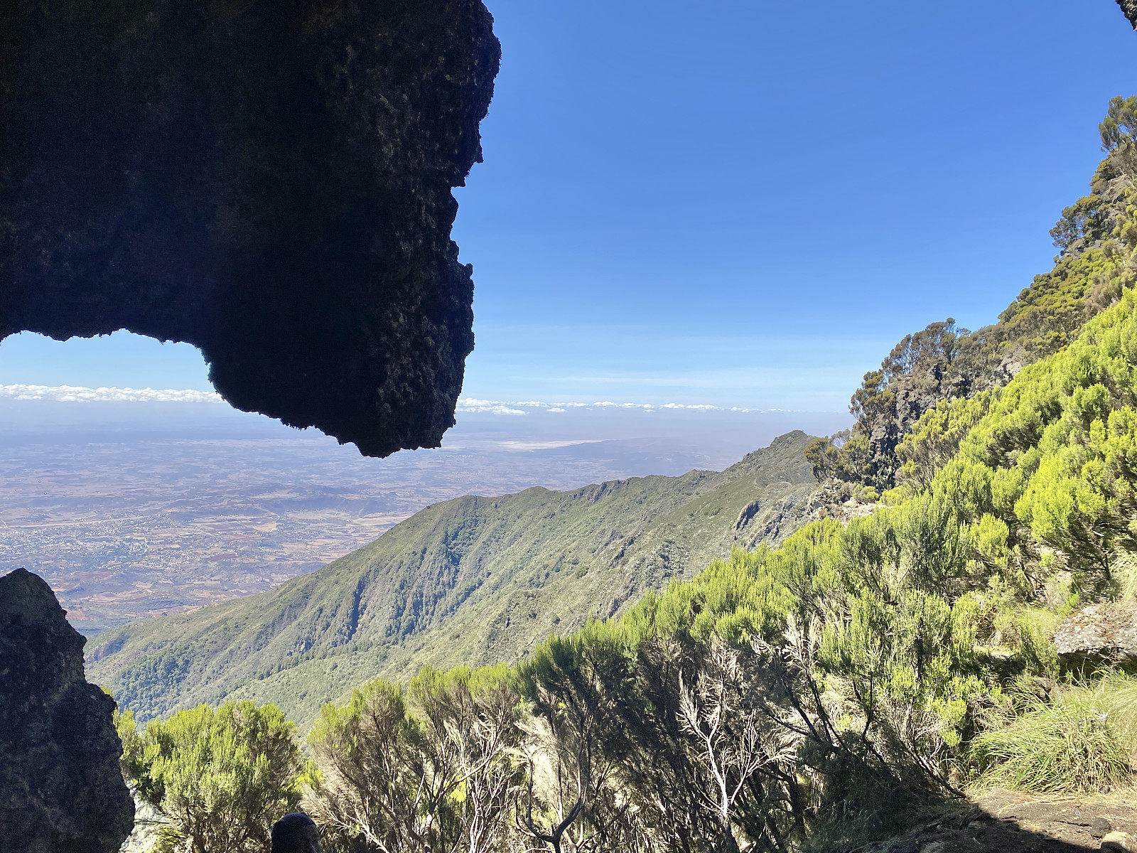
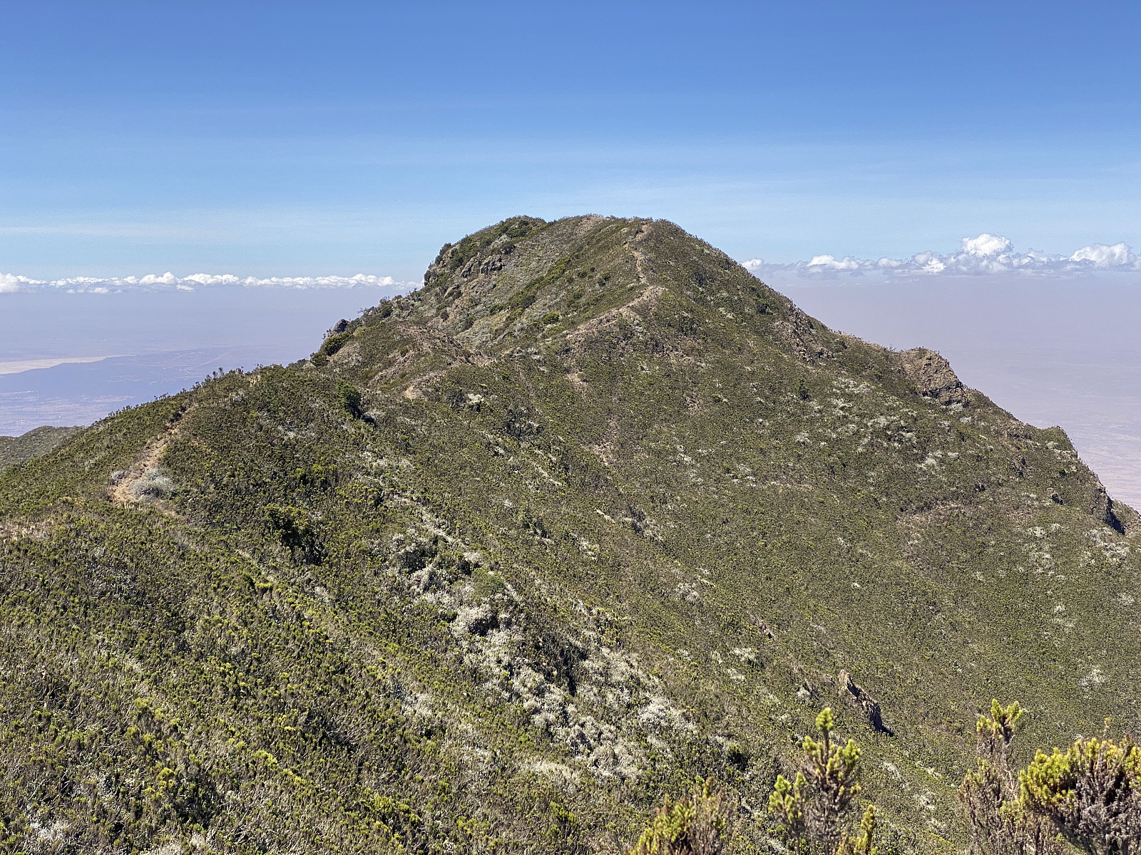
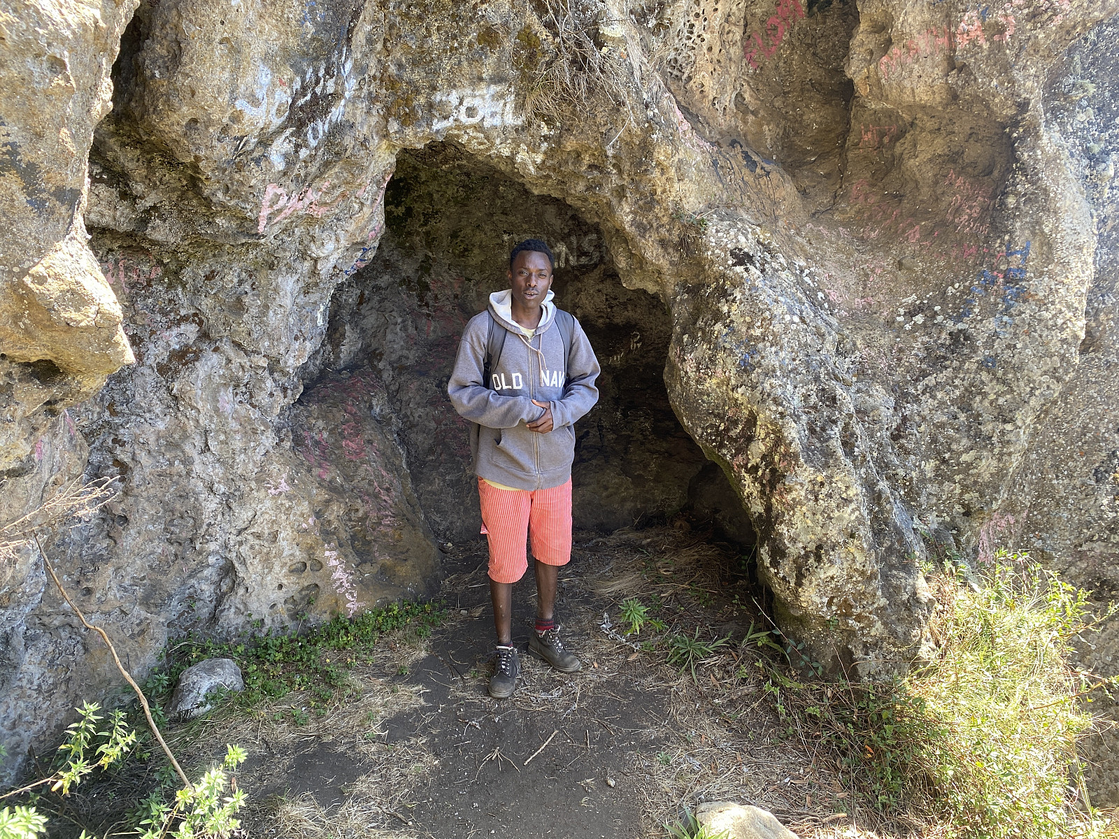
As we continued our hike, we passed a little cave (image #21) that Samuel wanted to show us, but I told him I would rather do that kind of sight seeing on our way back down, as I wanted us to just push on for the summit right now. A little later we met with the above mentioned group of tourists, who were now heading back from the summit towards the camp site for lunch (image #7). They had started out from the camp site at five o'clock in order to be at the summit at the time of sunrise, and now they were on their way back. We didn't stop to exchange ideas with them, we just greeted them "hello" as we met them, and then continued on towards the summit. Now this western ridge of Mount Hanang has a secondary peak with an elevation of about 3280 meters, and beyond that one, you have to descend about 50 elevation metres before you embark upon the ascent towards the summit itself. And there's no trail circumventing this mentioned secondary peak, so you just have to follow the trail over the top of it.
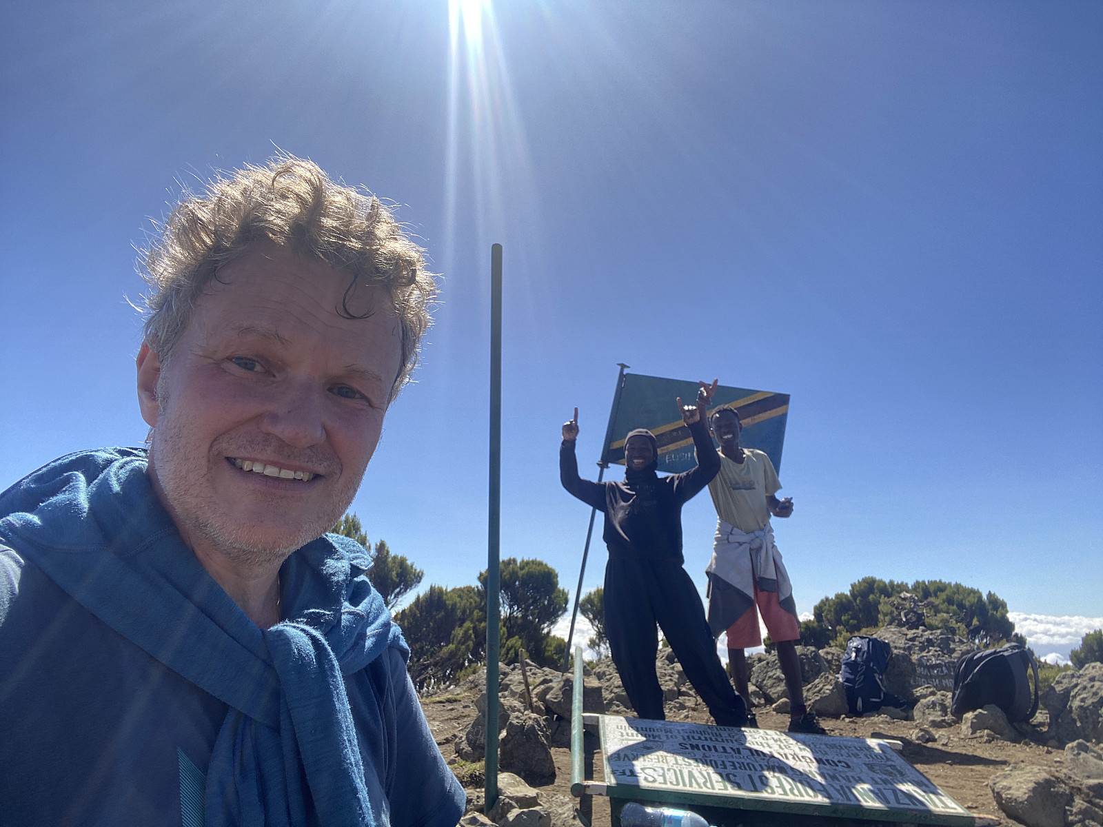
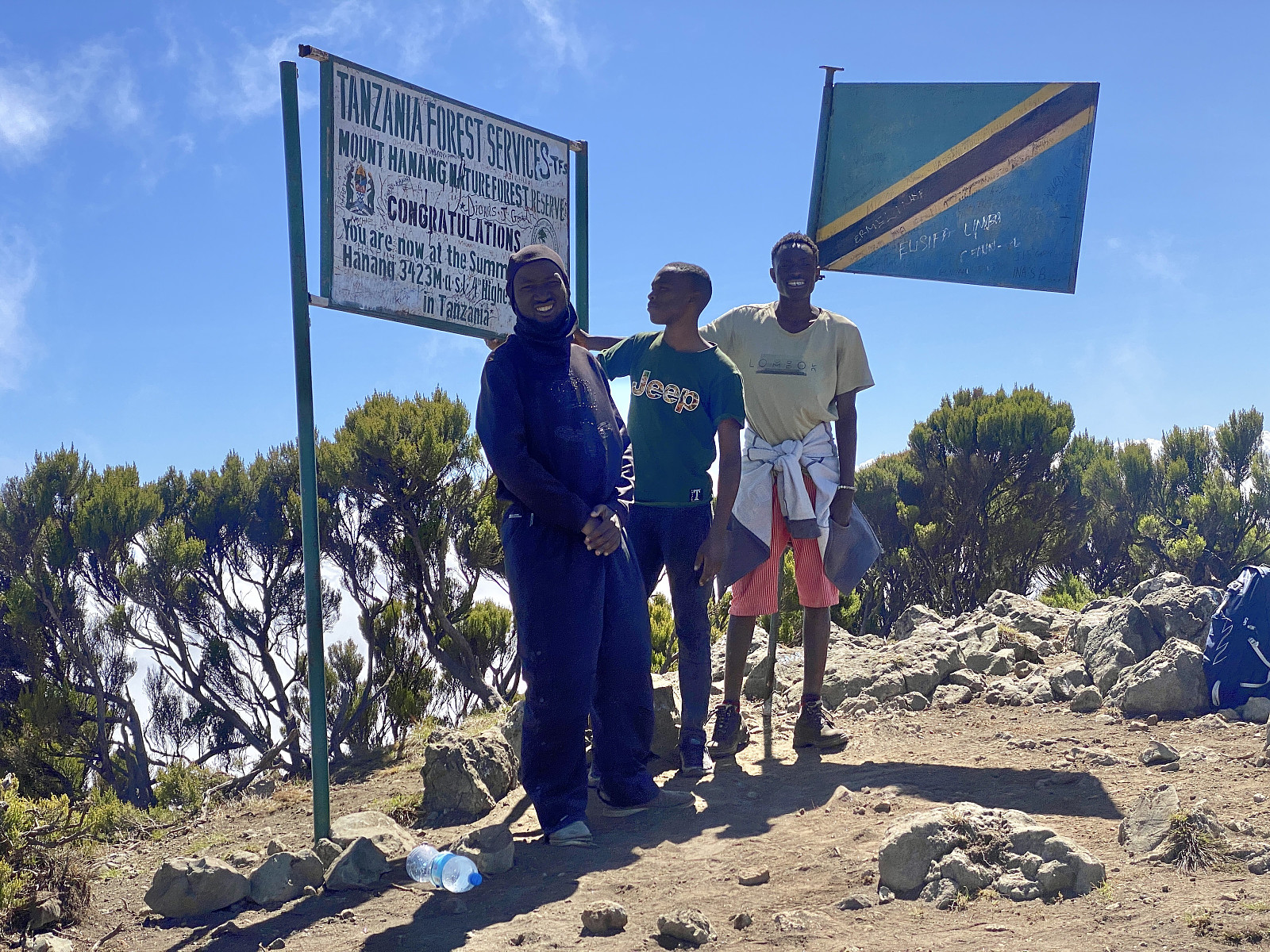
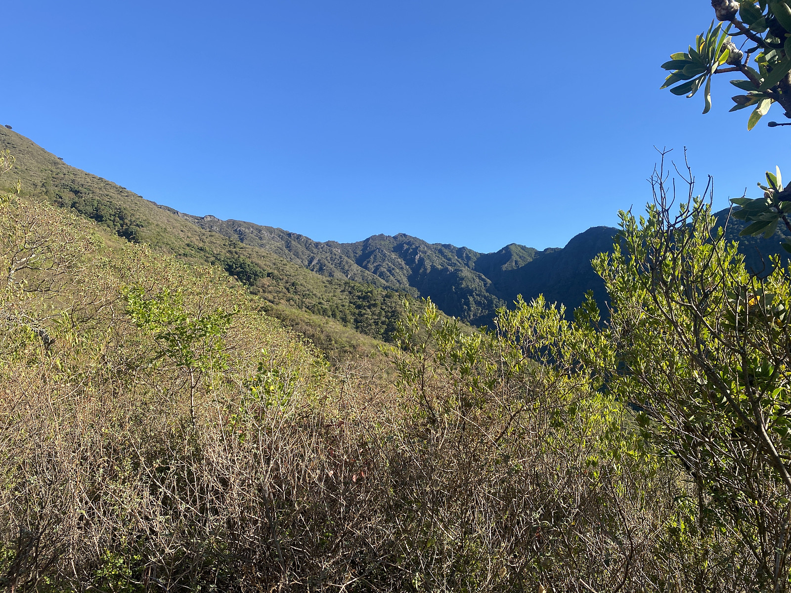
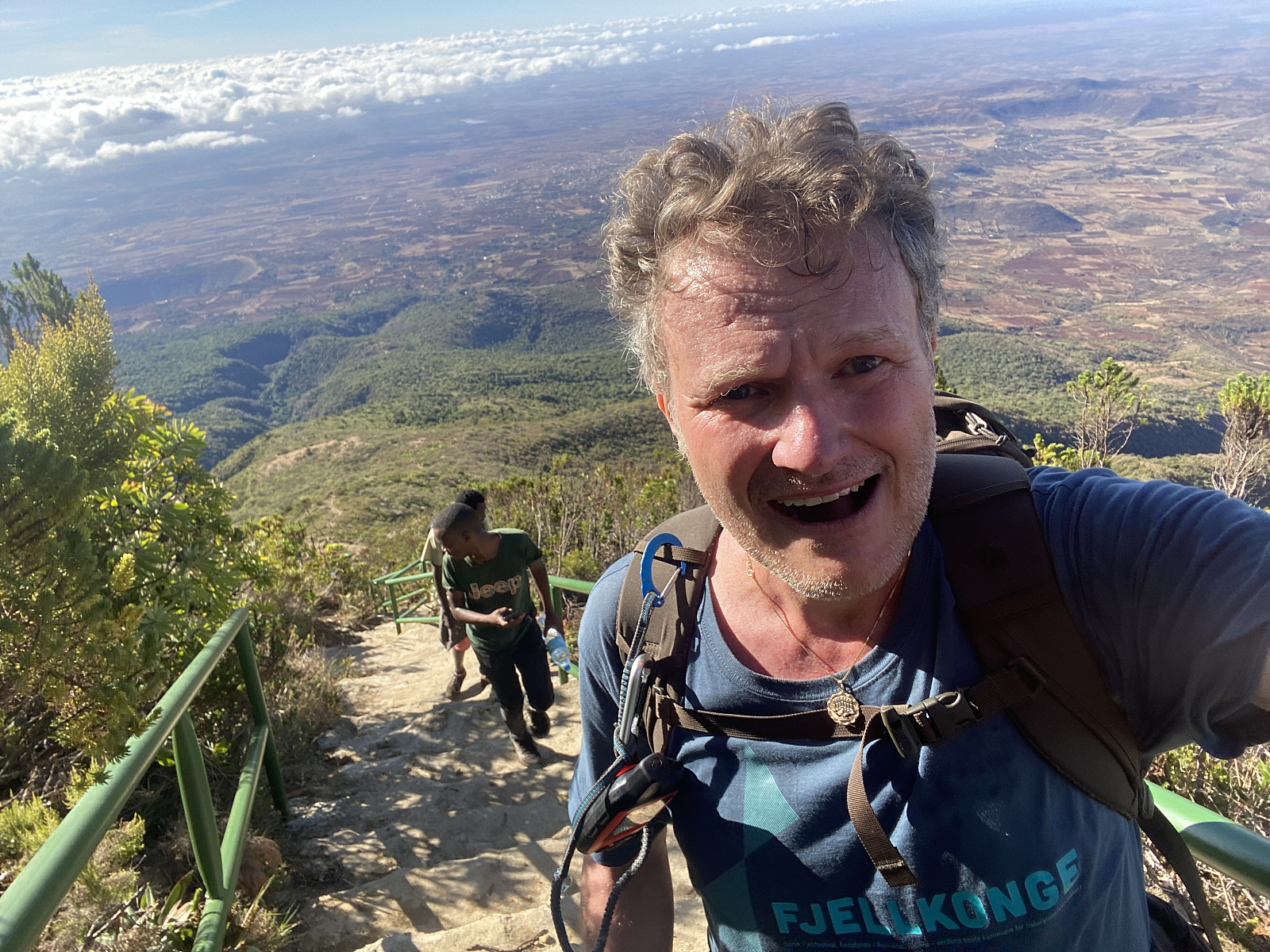
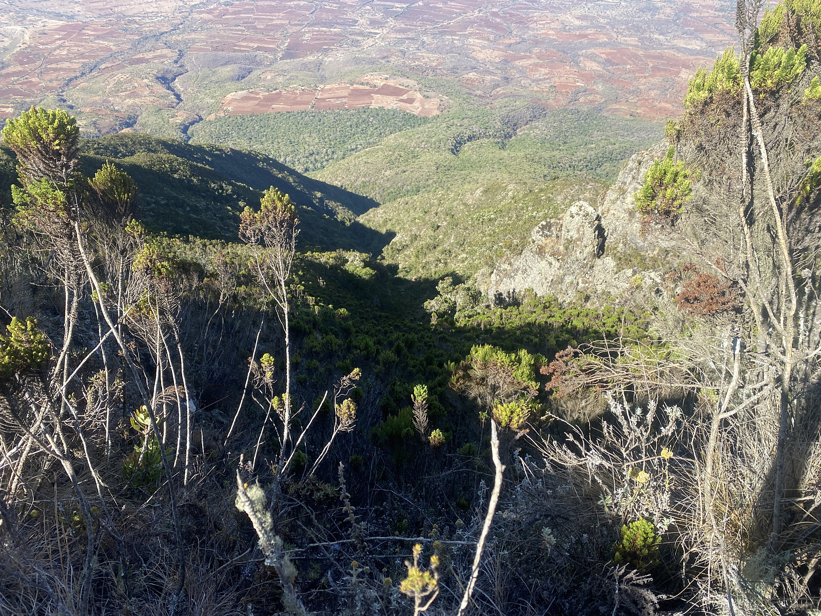
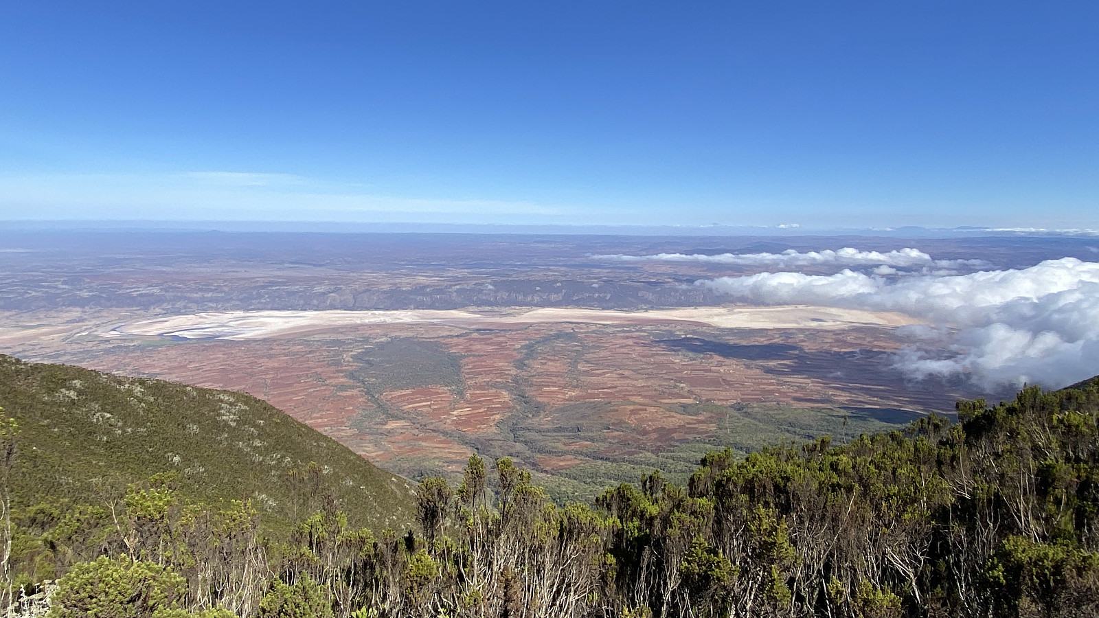
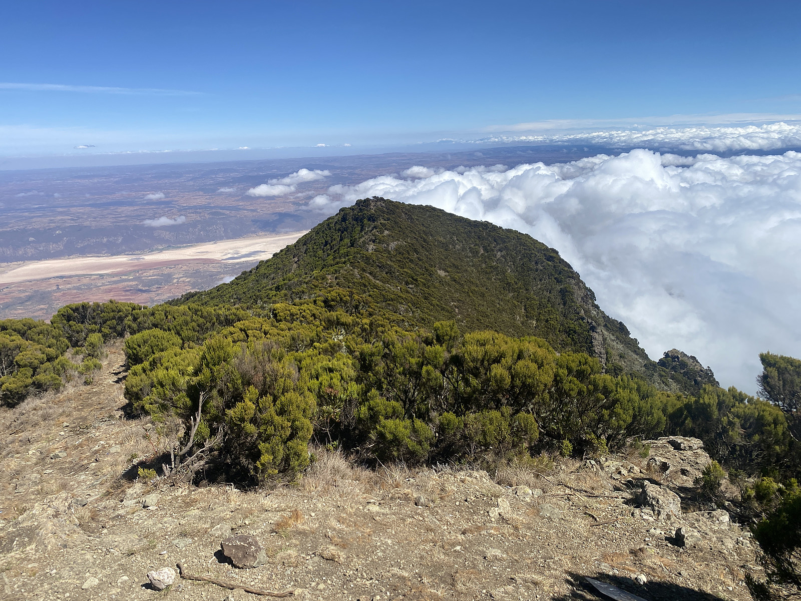
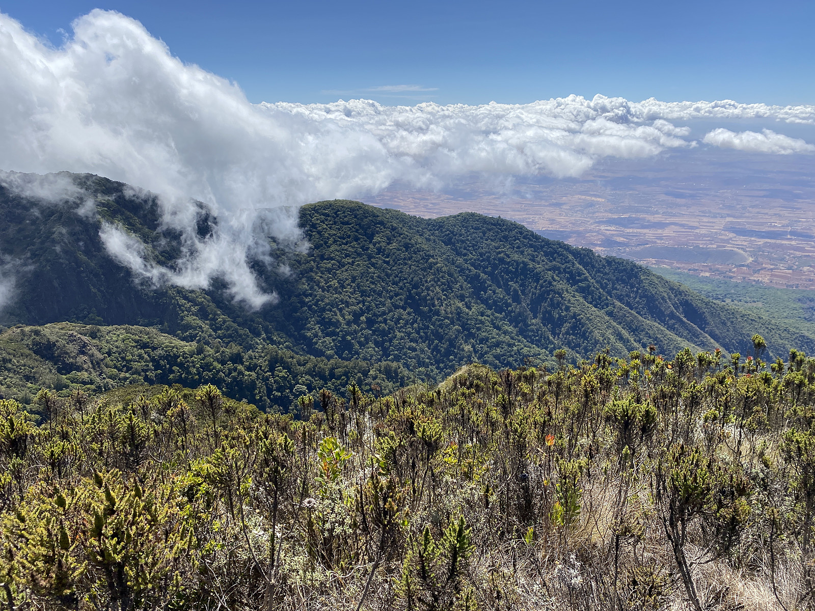
As we were approaching the summit, Frank asked Samwel if he had ever had a tourist that had done this hike in shorter time than we had done, and then Samwel told us that he had once climbed this mountain with an Israeli tourist that had used 3 hours for the ascent, and one and a half hour for the descent. It was a pity he hadn't told us that the previous day in Babati, as we would sure have pushed on harder in order to beat that record, had we been aware of it. We reached the summit 3 hours and 18 minutes after we had started out from the gate. The view, especially towards the west, had been magnificent all since we had passed the camp site, and at the summit it became even better in all directions, except towards the north, where it was getting increasingly cloudy (image #15).
Hanang is recognised as the 4th highest mountain in Tanzania, after Kilimanjaro, Meru, and Loolmalasin; provided you don't count Mawenzi and Shira as separate mountains, but as secondary peaks on Kilimanjaro. From the summit of Hanang we could se a trail along the north ridge of the mountain. This trail comes up from the Barjomot Gate, and offers an alternative route for those with a desire to ascend Mount Hanang. There is actually a camp site even along this route, called The Special Camp Site, located pretty close to the summit; probably put there in order that even those who ascend the mountain along the Barjomot Route might have the opportunity to spend a night in the mountain, and on the following morning see the sunrise as it appears at the summit. It is, however, probably possible to ascend the mountain in about two or two and a half hours by way of the Barjomot Route, and so I believe most trekkers using this route would rather choose to ascend and descend the mountain within just one day if allowed to.
We remained on top of the mountain just for the time we needed for a few photos, and in order to eat and drink a little; and then we embarked upon our descent. On our way down, we now took time to visit two caves that we had just passed quickly bye on our way up. The upper cave (images ## 16 & 17), which was located not very far from the summit, was the larger one. Samwel explained to us that this cave had traditionally been used for offerings to the gods whenever their forefathers had problems that affected the larger society; i.e. the whole tribe, or at least a whole village. If the rain didn't come at the time it's supposed to, for instance, the tribe would bring an offering, such as an ox or a goat to this cave; and as soon as it had been slaughtered and burned in the cave, rain would follow. And in like manner, at times of war between the various tribes in the area, an offering could be brought in order to ensure the tribe would get help from their gods in the particular battles. After our visit to the upper cave, we continued along the west ridge of the mountain along the same trail that we had been following up to the summit (image #19). Again, we had to pass over the above mentioned secondary peak on this ridge, but once we had passed that peak, the rest of the trail to the camp site and actually all the way down to the gate was just going down, without any further ascents.
We next took time to stop at the lower cave (image #21), and Samwel now explained to us that whereas the upper cave had been used for offerings important for the larger society, this lower cave had traditionally been used for more private matters; i.e you could bring an offering there if you wanted help from the gods in solving a matter pertaining to yourself or your immediate family, but one that didn't affect the rest of the tribe. The offering brought in these instances could be a hen, for instance, and this was the spot to which you would bring an offering if one of your wives was barren from having children, for instance. After our visit to this cave, we continued down to the Hanang Public Camp site, where we stopped for a few minutes, as the sun had now become quite sharp, and I wanted to add some solar protection moisture to the skin of my face and my arms before continuing. The camp site had now been abandoned. The tourists that we had previously met were no longer there, nor were their guides and their porters; and even the tents had been taken down and carried away. I had some chocolate to eat before we continued downwards, and as I found it wise even to have some head protection against the sharp sun; I now put on even my Jewish kippah, which I hadn't previously been wearing while in Tanzania. As we were about to continue, Samwel smiled at me and said: Now you have to take the lead, as you are now Moses, and according to scripture, Moses was the one leading the rest of the people.
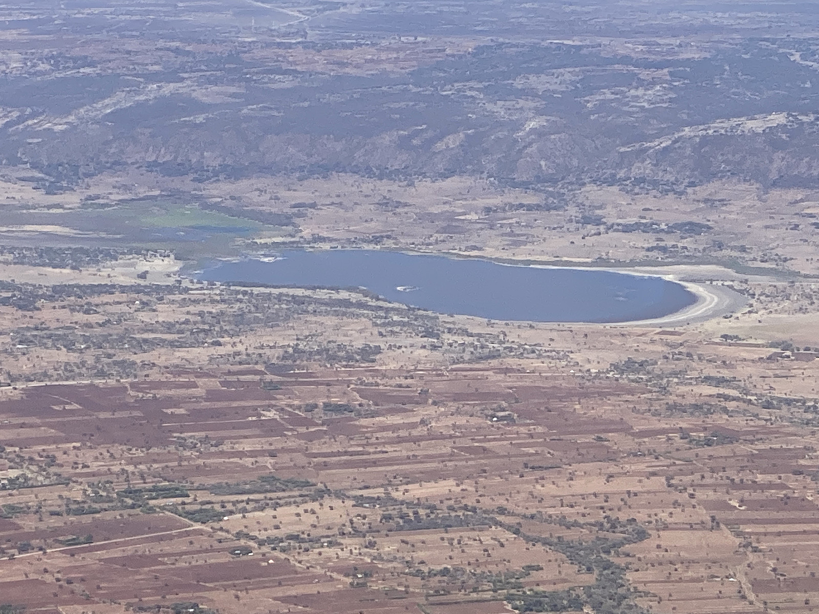
We next embarked upon descending the steeper part of the western ridge of the Hanang mountain, and since I was leading the way, I started jogging downwards, so as to maintain the high speed that we had been having throughout the day so far. We have some mountains back home in Norway, where they've had Sherpas from Nepal build stone stairs; and I've developed a way of running down such stairs with small quick steps in a very quick manner: You need to get into a steady rhythm with your steps, and then you move steadily down the staircase, trying as hard as you can not to get out of the rhythm, unless you have to, in order to prevent a fall, or something. I've found out it's easier to concentrate on this challenging footwork if you don't have to concentrate on using your arms at the same time, and so the arms are usually best maintained along the sides of your body, just the way Irish dancers keep their arms when river dancing. And so, as we arrived at the concrete stairs, I applied that very technique, and moved very fast downwards in this river dance manner; giving Frank and Samwel and Samwel's brother a very hard time to keep up with me, or actually making it impossible for them to do so. We soon caught up with the group that had spent the night on the mountain, and I then slowed down, and walked along with them for a few minutes, in order to exchange some words with them. They proved to be one British guy and 4 or 5 dutch women currently working at the Haydom Lutheran Hospital, which is located about 50 kms north west of Mount Hanang when measured as the crow flies, though about 100 kms when measured along the roads. One of the ladies told me they were working at the hospital as volunteers, and I somehow got the impression they were nurses, but I can't remember whether I actually asked them about their professions. After walking along with them for a few minutes, I wished them a nice day, and then increased the speed again, and now I didn't stop until we reached the crossroads where we had to take left in order to go to the Himit Waterfall.
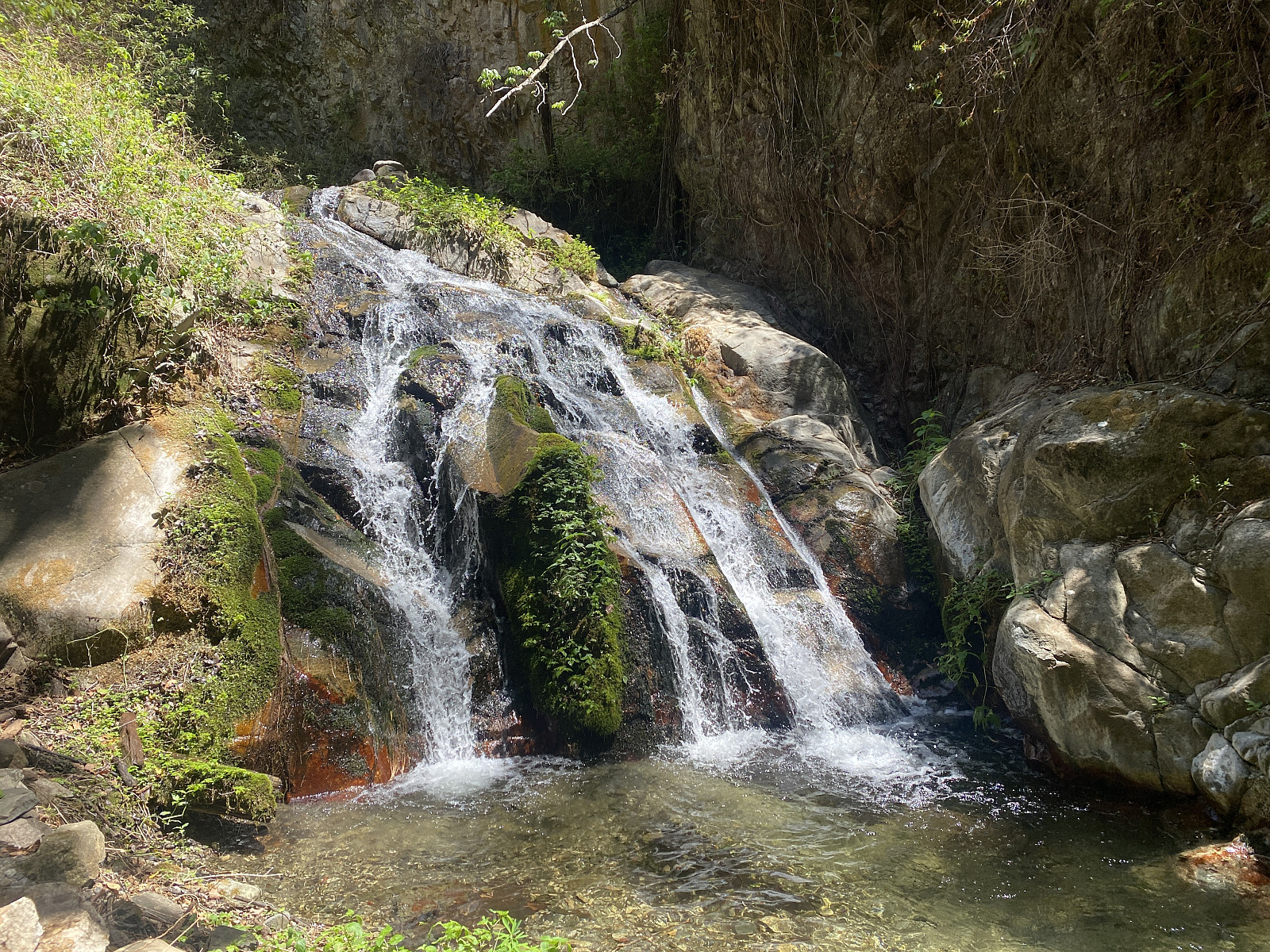
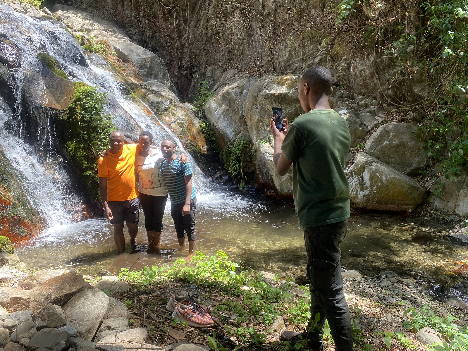
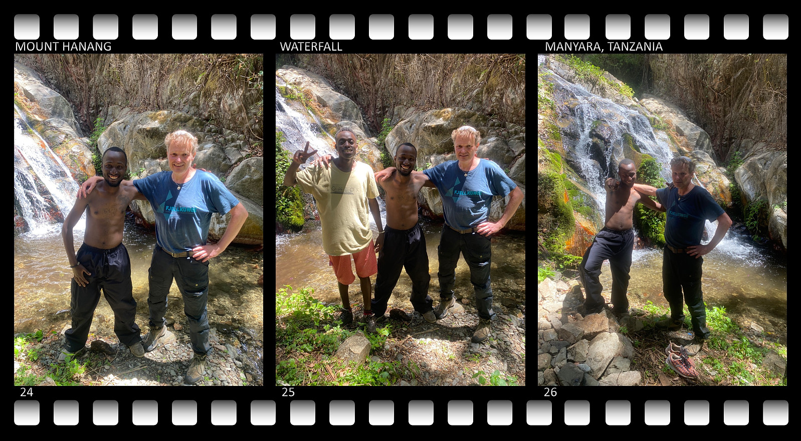
Just as we arrived at this crossroads, we encountered a group of joggers, that we had actually past while driving up to the Jorodom Gate early in the morning. They told us they had originally planned to go jogging just up to the gate, but then they had decided to make an attempt at ascending the mountain. They had, however, unfortunately not taken enough water with them, and now they were extremely thirsty and exhausted, due to the sunshine and the heat of the day, and they had literally run out of water. We offered them what we had left of water ourselves, but that wasn't much, as we had already spent most of what we had, so we suggested they come with us to the Himit River, as Samwel could confirm that the water of the river was clean and potable. The trail into the Himit Valley followed just a gentle slope downwards to begin with, but then got extremely steep as we were approaching the river. We were the first down to the river, myself, Frank, and Samwel, as the others were lagging behind; but then, the moment we had crossed the river, and started following it upwards in order to get to the waterfall, I realised I had just run out of energy myself. I had to stop and sit down and find some lemon juice and some fruit to eat from my lunch box; before we continued slowly up to the waterfall. Once we were there, Samwel went back for the others, and while he was gone, I slowly regained my strength. After some minutes Samwel came back with his younger brother and the three joggers, who were happy now, as there was plenty of water at this place, and as the four of us shared what we had left of food with them.
Video #1: A short video from the Himit River and the waterfall that we visited in the rain forest of the valley between the eastern and western ridges of Mount Hanang, i.e. the Himit Valley.
After finishing eating, drinking, and taking pictures, we followed the trail back to where we had first crossed the river, and from there we followed a different trail further down along the river, before we crossed it at a much lower point, not very far from the Jorodom entrance to the park. From the point that we now crossed the river, the trail back up from the valley followed a much more gentle slope, and soon we were back up on the main trail, and shortly afterwards we were back down at the gate, where we all received a Mount Hanang diploma from the park authorities. A little later, we were back in our car. I gave Samwel a nice tip, before we dropped him and his brother off at Katesh; and then we drove off to the outskirts of Babati, where we were going to spend the coming night, before heading back to Arusha the next morning.

User comments