Hiking to the Eyasi Viewpoint on Mount Oldeani (02.12.2022)

| Startsted | Elmuk Residential Area (2477moh) |
|---|---|
| Sluttsted | Elmuk Residential Area (2488moh) |
| Turtype | Fottur |
| Turlengde | 1t 25min |
| Distanse | 5,8km |
| Høydemeter | 309m |
| GPS |
|
| Andre besøkte PBE'er | Lake Eyasi Viewpoint (2560moh) | 02.12.2022 07:55 |
|---|
After our hike to Mount Loolmalasin , Frank and I and our driver spent the night at a nice little lodge just outside of the Ngorongoro Conservation Area, but the very next morning we drove back into the very same conservation area, intending to climb Mount Oldeani [3206 m.a.m.s.l.]. Frank had been in contact with a ranger outpost just by the foot of the mountain, and we went there quite early, eager to meet the ranger that was going to come along with us on our hike. We were at the outpost shortly after seven o'clock, and there we met Elisha Goodluck. He jumped into the car with us, and then we started driving towards our start out point, according to his instructions. To begin with, the road made sense, as it brought us gradually closer to Oldeani, which we had actually had in sight most of the time since we entered the conservation area. After a while, however, we left the main road (i.e. B144) for a smaller one, and that road passed through a village, and then started curving southwards little by little, so as to bring us over to the west side of the mountain.
As we drove along this road, Elisha started explaining to us that this isn't a very long trip, and that the hike up to the viewpoint to which we were going takes about 1 1/2 hour, but shorter for those that are in a good shape. That was when it started dawning upon me and Frank that we weren't actually going up to the summit of the mountain on this day. We explained to Elisha that we thought we were going up to the summit, but then he answered: No, no, we're going to a viewpoint overlooking Lake Eyasi, that's were we take all the tourists. Going up to the summit is actually prohibited, he said, you may encounter wild animals up there. Well, had we known that in advance, we sure wouldn't have booked this hike in the first place, but when Frank had been in touch with the ranger outpost a few days earlier, and told them he had a tourist that wanted to climb Oldeani, they hadn't mentioned by a word that you were only allowed to hike over to a stupid viewpoint. Anyway, we figured, both of us, that we just had to play along, and rather hope we could convince Elisha to take us to the summit for an additional tip or something. As we walked over to the viewpoint, however, we soon realised that Elisha was indeed a very decent and honest man, who did everything by the book. We did indeed ask him again, while at the viewpoint, but we didn't try to bribe him.
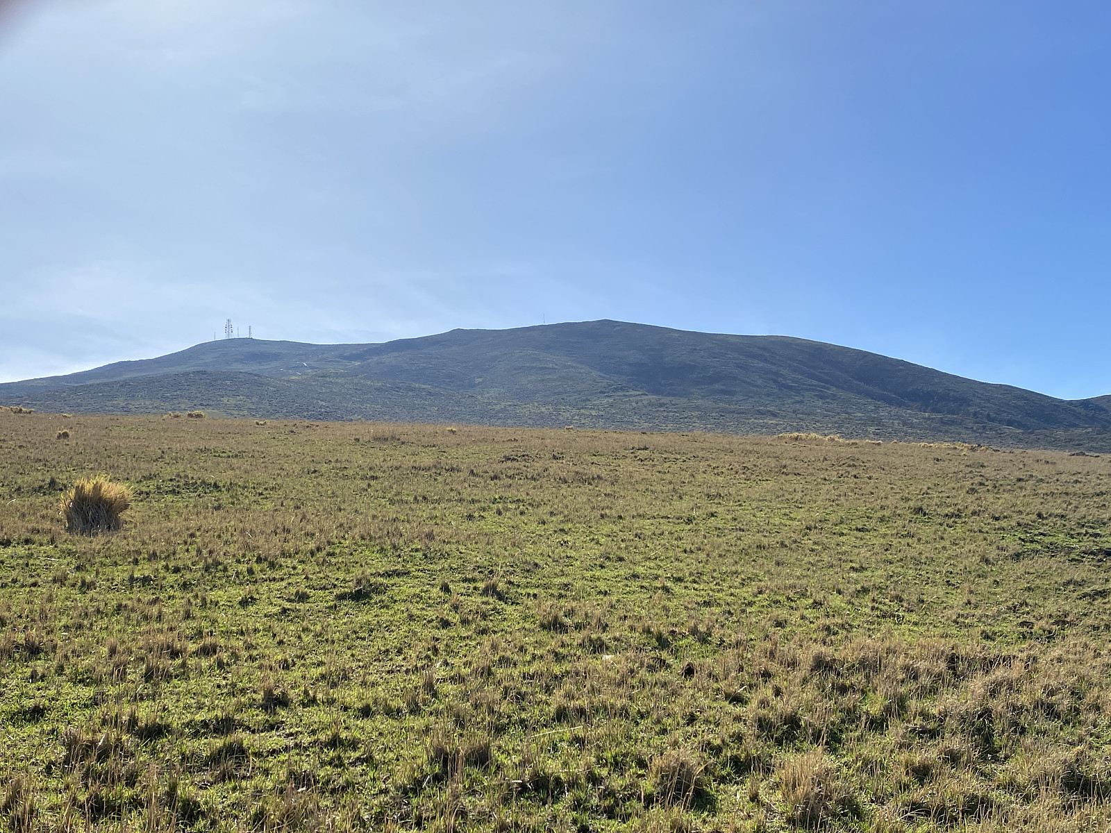
![Image #6: Looking further up towards the summit of Mount Oldeani [3206 m.a.m.s.l.]. The ranger agreed to let us continue as far up as there were houses and cattle.](https://images2.peakbook.org/images/14939/Solan_20230312_640e3d2dd9b28.jpg?p=xtralarge)
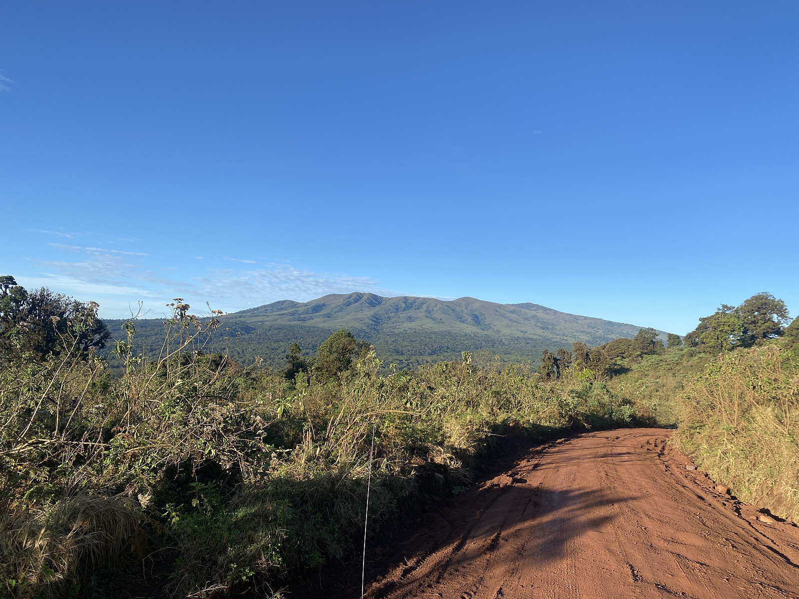
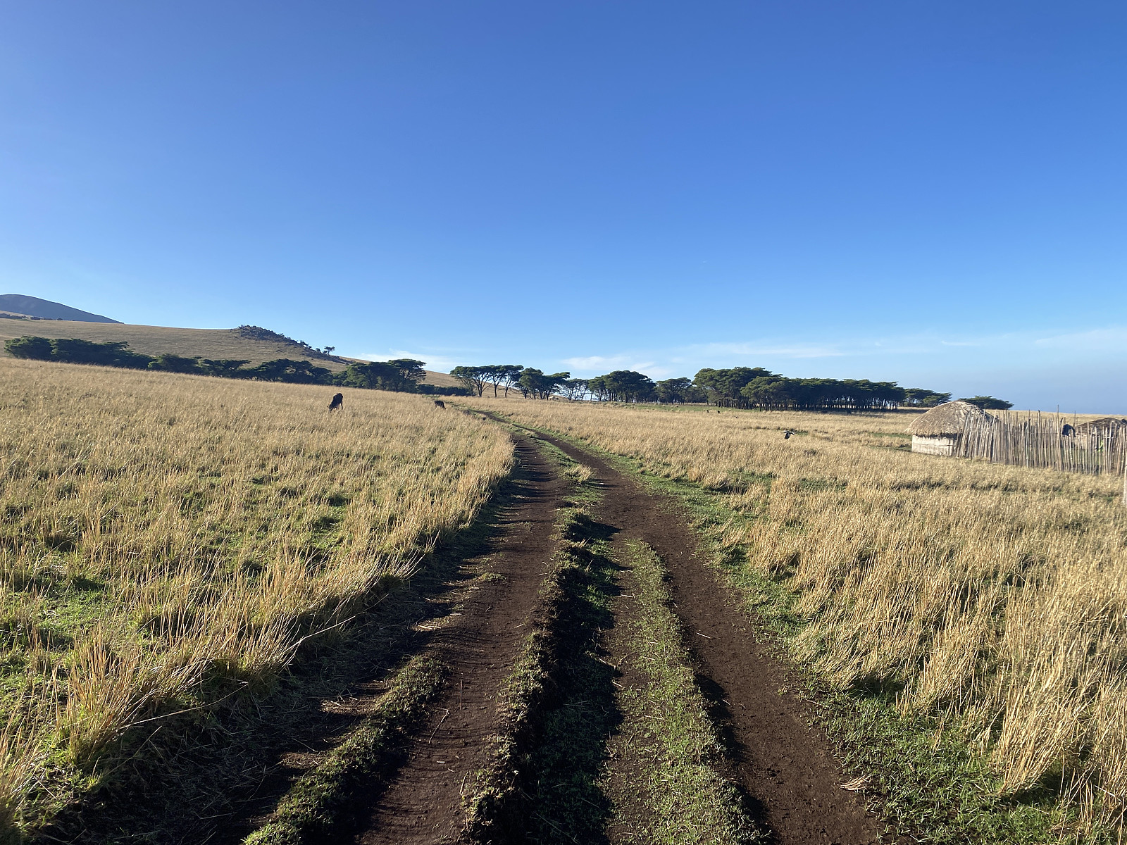
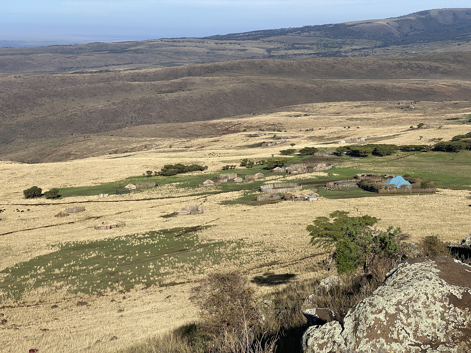
As we were driving through the village of Elmuk, we took left once again, and after about 1 1/2 km we arrived at a spot where they were carving out soil that was being used for road repairs within the Ngorongoro Conservation Area, as the roads within the conservation area are without concrete or asphalt. Here the driver parked the car, and Frank, Elisha and myself started walking; and time was about 5 minutes to 8 as we set out. We first walked along a tiny soil road (image #2) that we followed over to a little village, or actually just a cluster of houses (image #5), some would say. The walk over there took us about 20 minutes. We next turned slightly left, and started ascending the mountain side towards the viewpoint that was our destination. As we left the cluster of houses, Elisha pointed towards some huge boulders up in the mountain side, and told us: That's the spot that we're heading for.
![Image #7: View towards the road and the village by which we had just arrived. The high mountain in the right half of the picture is Mount Lemakarot [3168 m.a.m.s.l.].](https://images2.peakbook.org/images/14939/Solan_20230312_640e3dce8f38a.jpg?p=xtralarge)
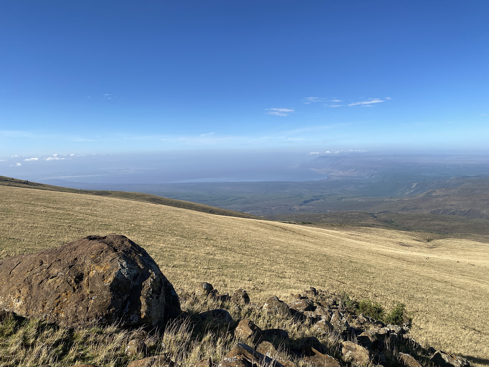
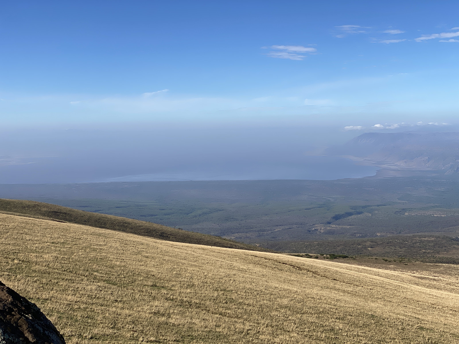
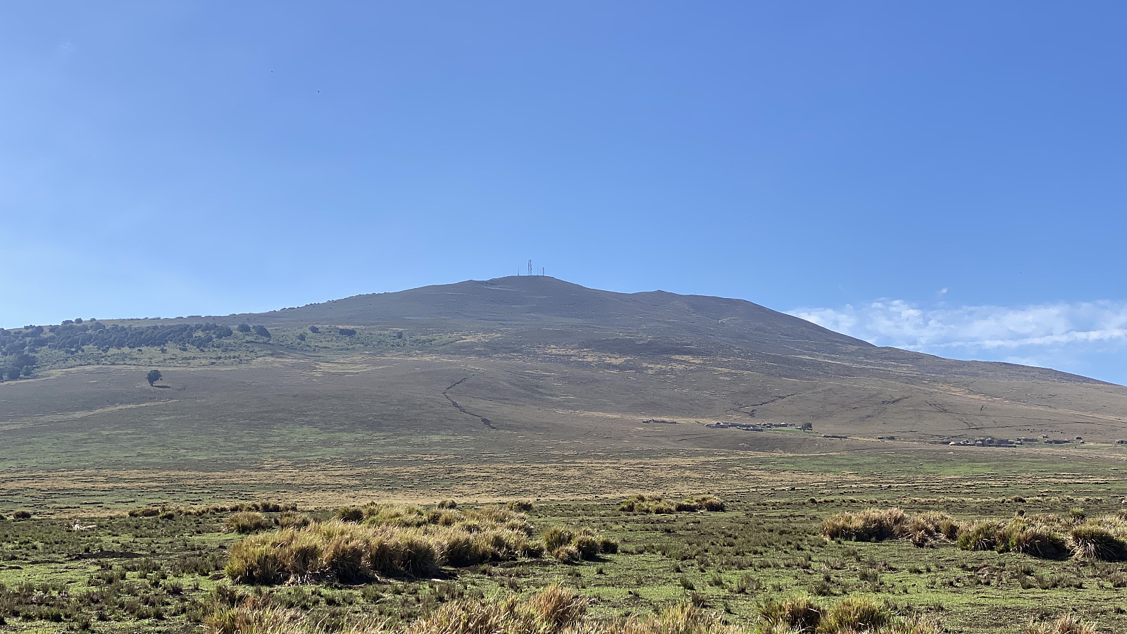
The ascent from the little village up to the viewpoint only took about 8 minutes or so. As we got further up towards the boulders, we got a gradually better view of Lake Eyasi. From such a distance, it looks like a deep body of water, but the truth is that this lake is actually a quite shallow endorheic salt lake, with an average depth of only about 1 meter. At the Eyasi Viewpoint, which is located at 2560 m.a.m.s.l.; we captured some pictures (images ## 3 - 5), and then we asked Elisha if it was really not possible to continue up to the summit of the mountain. He answered again that it was prohibited due to the dangers that wild animals pose up there, but then he pointed at a herd of cows that were grassing further up in the mountain side, and said he could take us up to that spot without violating any regulations.
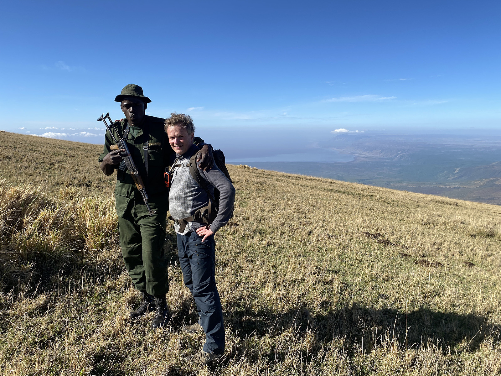
And so he did. We walked upwards for another 20 minutes or so, until we had passed the herd of cattle that he had been pointing at. The summit got gradually closer, but then at 2730 m.a.m.s.l. we had to stop and turn around, which was a pity, as there was only about 500 elevation meters remaining up to the summit. We captured some more pictures up there (images ## 8 - 10). Thereafter, we embarked upon our descent. Now there was no point in going back down to the little village that we had passed through, so we headed directly towards the spot where the car and the driver were waiting for us (see GPS tracking). We tried to keep our mood up, Frank and I, though we were both a bit disappointed that we couldn't summit the mountain. And Elisha must have noticed it, because in an attempt to excuse himself and the park regulations, he said to me: Look at it this way: When you invite someone into your house for a cup of tea, you will show them everything that is in the living room, but you won't take the stranger into your bedroom. You will always keep something for yourself, that you don't share with strangers. I kind of accepted his excuse, as there was nothing I could do about the situation anyway; but I have to say his excuse doesn't really hold water, as we should then not be allowed to visit Kilimanjaro, Meru and Loolmalasin either, not to mention the sacred Ol Doinyo Lengai, the mountain of God. And, moreover, should he at any time come to visit Norway, I will gladly take him to any mountain that we have in our country; as it's not our custom to keep any of the Norwegian mountains to ourselves.
![Image #11: Mount Lemakarot [3168 m.a.m.s.l.] as seen from our way back to the car. The driver and the vehicle were waiting at the wound seen in the landscape, i.e. in the right half of the picture, where they have been digging in the ground.](https://images2.peakbook.org/images/14939/Solan_20230312_640e4267a5fab.jpg?p=xtralarge)
On our way back down to the car, we passed some herds of sheep, goats and cattle, that were being guarded by some young men. But then all of a sudden, we even encountered a black-backed jackal that was roaming around in search for something eat; and it passed only a few metres from us. We were back at the car at about 20 minutes past 9, i.e. about 1 hour and 25 minutes after we had left. We then drove back to the ranger outpost, where we said goodbye to Elisha. I gave him a quite decent tip, but I definitely would've given him more had he taken us all the way up to the summit. We thereafter started our drive towards the city of Babati and the village of Katesh, from where we were to start out for Mount Hanang the following day. As we were driving off, Frank and I were eagerly discussing how we might make a new attempt at climbing Oldeani at some time in the future, if I ever come back to Tanzania for more hiking. It might be necessary to obtain a special permission from the Ngorongoro Concervation Area in order to be allowed to summit the mountain, though.

Kommentarer