Visiting Mount Loolmalasin and the Ngorongoro crater (01.12.2022)

| Start point | Bulati (2,580m) |
|---|---|
| Endpoint | Bulati (2,580m) |
| Characteristic | Hillwalk |
| Duration | 5h 44min |
| Distance | 12.8km |
| Vertical meters | 1,140m |
| GPS |
|
| Ascents | Mount Loolmalasin (3,682m) | 01.12.2022 |
|---|
After my ascent of Kilimanjaro, I still had almost 10 full days in Tanzania before I was heading back to Norway, and I therefore asked Frank, my friend and tour operator, about the possibility to ascend another 3 mountains (i.e. Loolmalasin, Oldeani and Hanang) before leaving for home. And so, he checked out with local guides and rangers about the possibility, and came back to me with a price fore the mentioned three mountains, a price that also included rental of a safari vehicle with a driver. (The reason I still had 10 days in Tanzania, was that that I had booked my flight back to Norway so that I had the opportunity to prolong my Kilimanjaro climb, in case I acquired sickness of some kind while up in the mountain, or in case I found out while up there, that I needed more days for altitude acclimatisation).
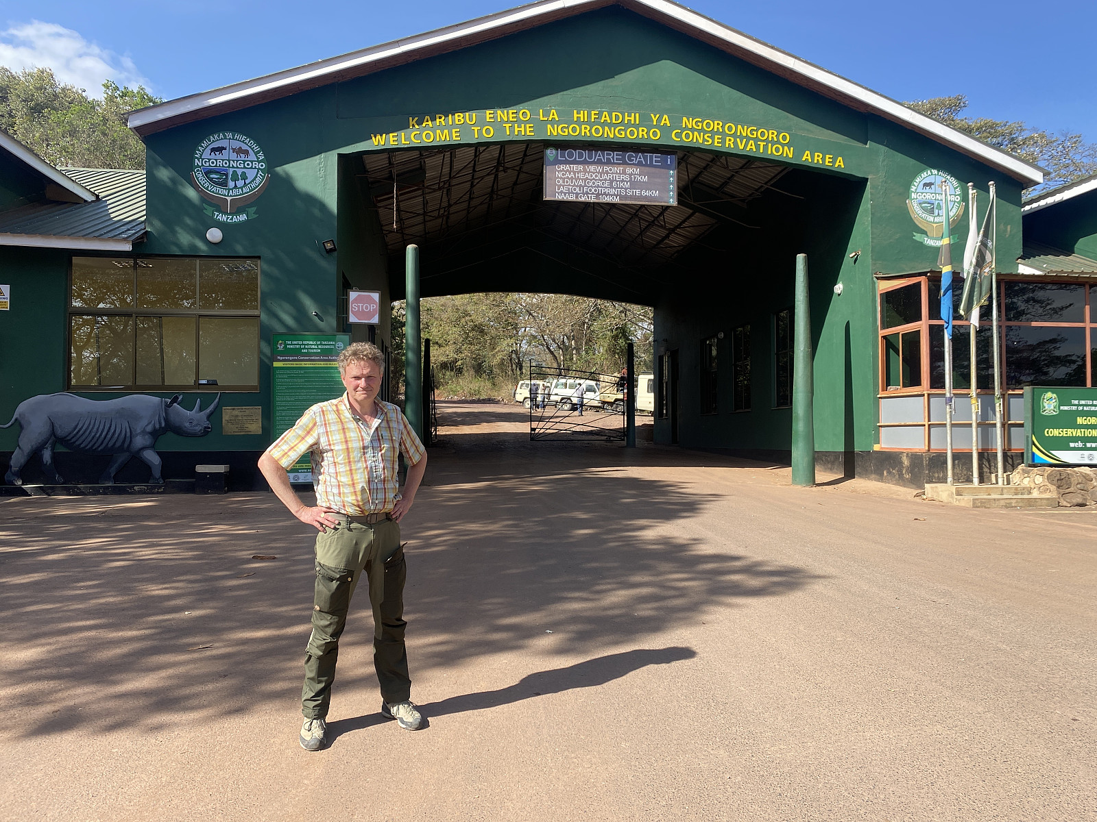
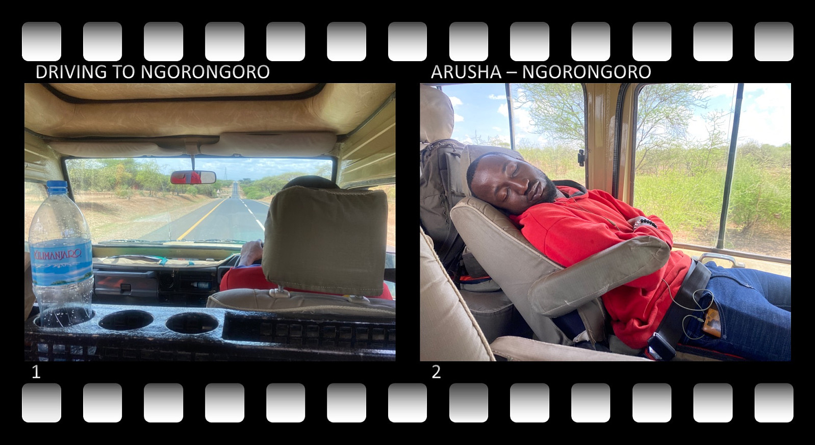
So after just one night at a hotel in Marangu, and another two nights at the Meru View Lodge outside of Arusha, we headed west, towards the Ngorongoro Conservation Area, myself, Frank and a driver called Anthony Mato. We had a safari version Toyota Landcruiser, with a roof that could be opened. In order to get to the foot of Loolmalasin, we had to drive up to the Ngorongoro crater (image #7), and then along the rim on the east side of the crater (image #8), and from there further on to a village called Bulati, from where we were to start our hike. About 17 km before Bulati, we were to stop in another village; i.e. one named Nainokanoka, to pick up a guide and a park ranger that were to come with us on this particular trek. Mount Loolmalasin and the two villages mentioned are all located within the Ngorongoro Conservation Area, which means you have to have permission from the park authorities for whatever you're going to do here; and due to the wildlife, which includes lions, jackals, buffaloes, and elephants, you're not allowed to trek Mount Loolmalasin, unless you have a park ranger with you. Now, there is a ranger outpost located at the outskirts of the village of Nainokanoka, which was where we were supposed to pick up our ranger.
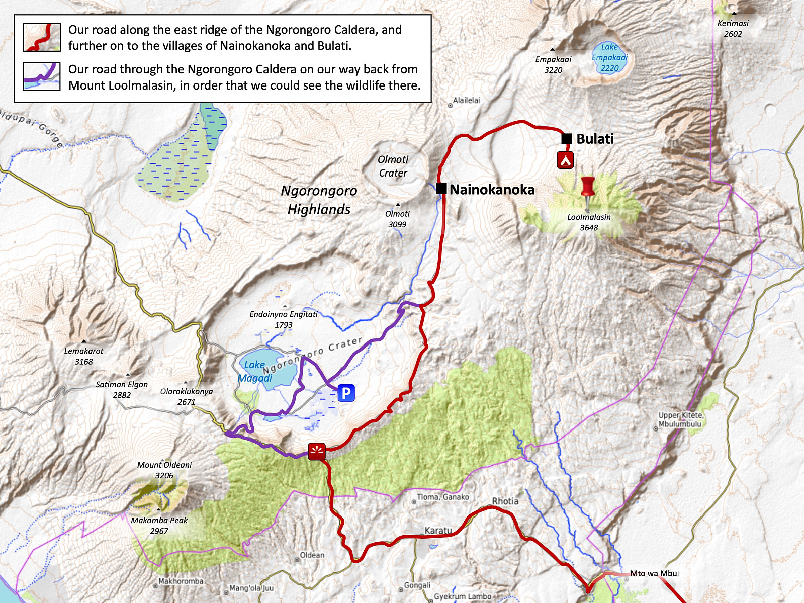
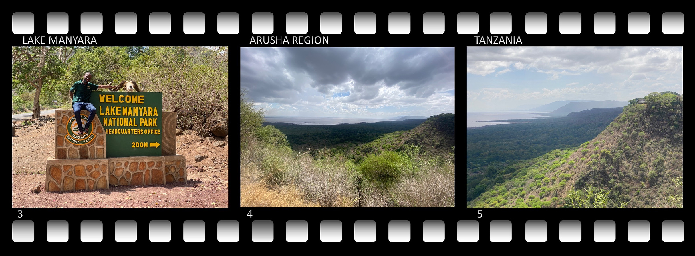
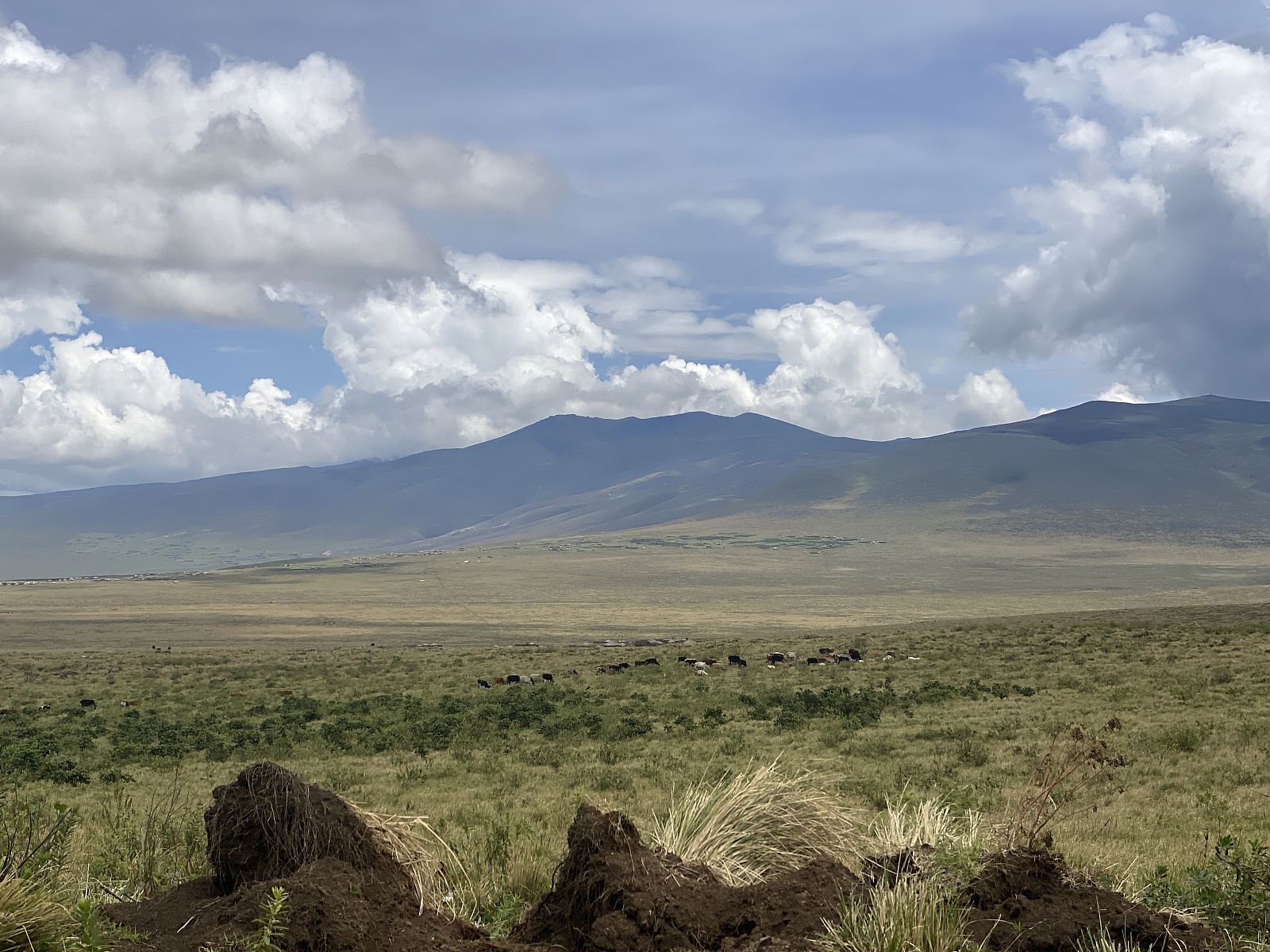
So, in summary, we followed road A104 from Arusha to Makuyuni, where we took right, and followed road B144. Next, we drove through the little town of Mto Wa Mbu [literally: The River of Mosquitos], but stopped in the outskirts of the town, on the west side of it, at a rental shop where you could rent all sorts of safari equipment; and there we rented a tent for our journey. Shortly afterwards, we stopped at the African Galleria, a huge souvenir shop just about 7,5 kms from Mto Wa Mbu; where we had our dinner, as they also have a nice café/restaurant there. After dinner, we drove up to the rim of the Ngorongoro crater, where we took off from B144, and followed a much smaller road along the eastern rim of the crater (see map on image #8). Where the road left the rim of the crater, we came to a crossroads, where one road went down into the Ngorongoro crater; while the other went northwards to the village of Nainokanoka, and so we continued along the latter. The road then went along wast fields, where the Masai people were having their cattle. There can't be many lions out here, I thought by myself, at least not during daytime, as sheep, cattle, people, and even small children were walking around unprotected.
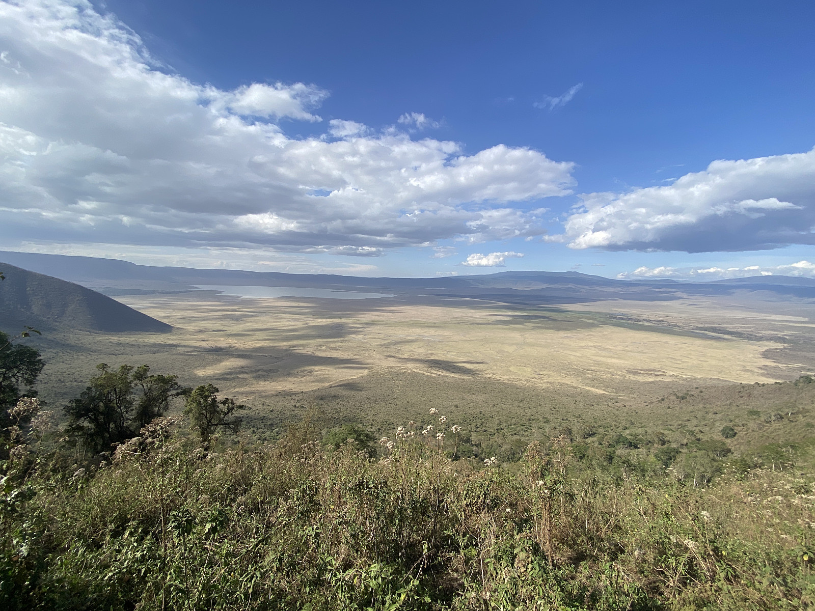
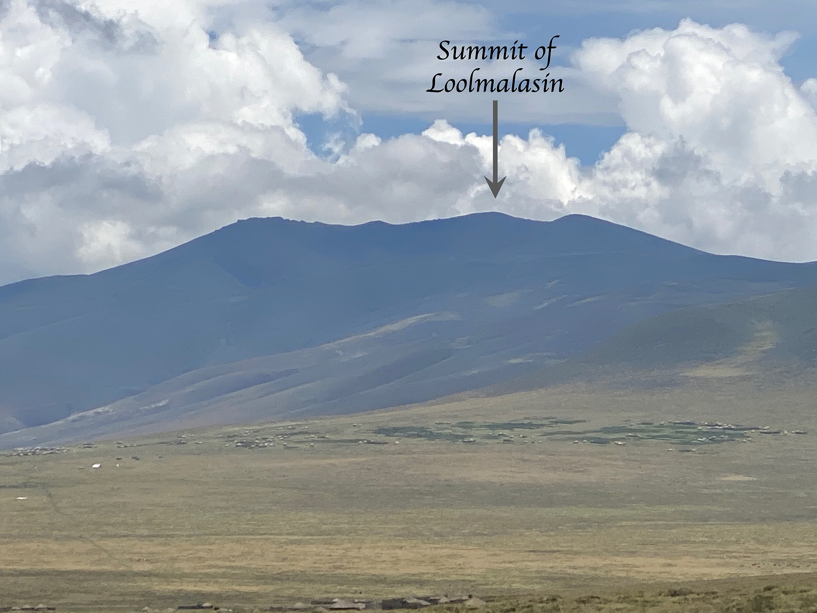
Video #1: An overview of the Ngorongoro Crater, from a viewpoint by Road B144, i.e. the main road from Manyara to Serengeti. This "crater" isn't just an ordinary volcanic crater, though; it's actually a huge caldera, i.e. the remnants of a huge volcanic mountain after its collapse into the huge subterranean cavities that were once filled with liquid lava. Towards the end of the video, I zoom in on Mount Loolmalasin, which we were going to climb the following day. Loolmalasin is usually regarded as Tanzania's 3rd highest mountain, provided you count Mawenzi and Shira as par of Kilimanjaro, and not as separate mountains.
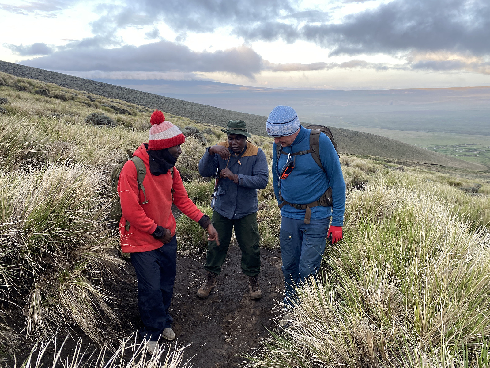
At the village of Nainokanoka, we asked for the way to the ranger outpost, and were told to take left at the next crossroad; and then we would find the outpost just at the end of the road to the left. At the outpost we were introduced to our ranger, who was called Olais; and we also introduced ourselves properly. He looked at me with sceptical eyes, however, and then said he wanted to talk to Frank in private. They went aside about 30 meters, and had a slightly heated discussion, where Frank explained to him that I had just summited Kilimanjaro, and that I was in good shape, and well fitted to ascend even this mountain. I don't know what it is with Tanzanians, they always seems to think the White Man is weak and unfit for mountaineering; or maybe it's me, maybe I don't look like a guy that runs around in the mountains. Nevertheless, when the discussion was set, Olais went for his trekking equipment, and a little later, even our local guide, who was called Makamero Wilfred came up from the village, and thereafter we drove off for the next village along the road, i.e. the village of Bulati.
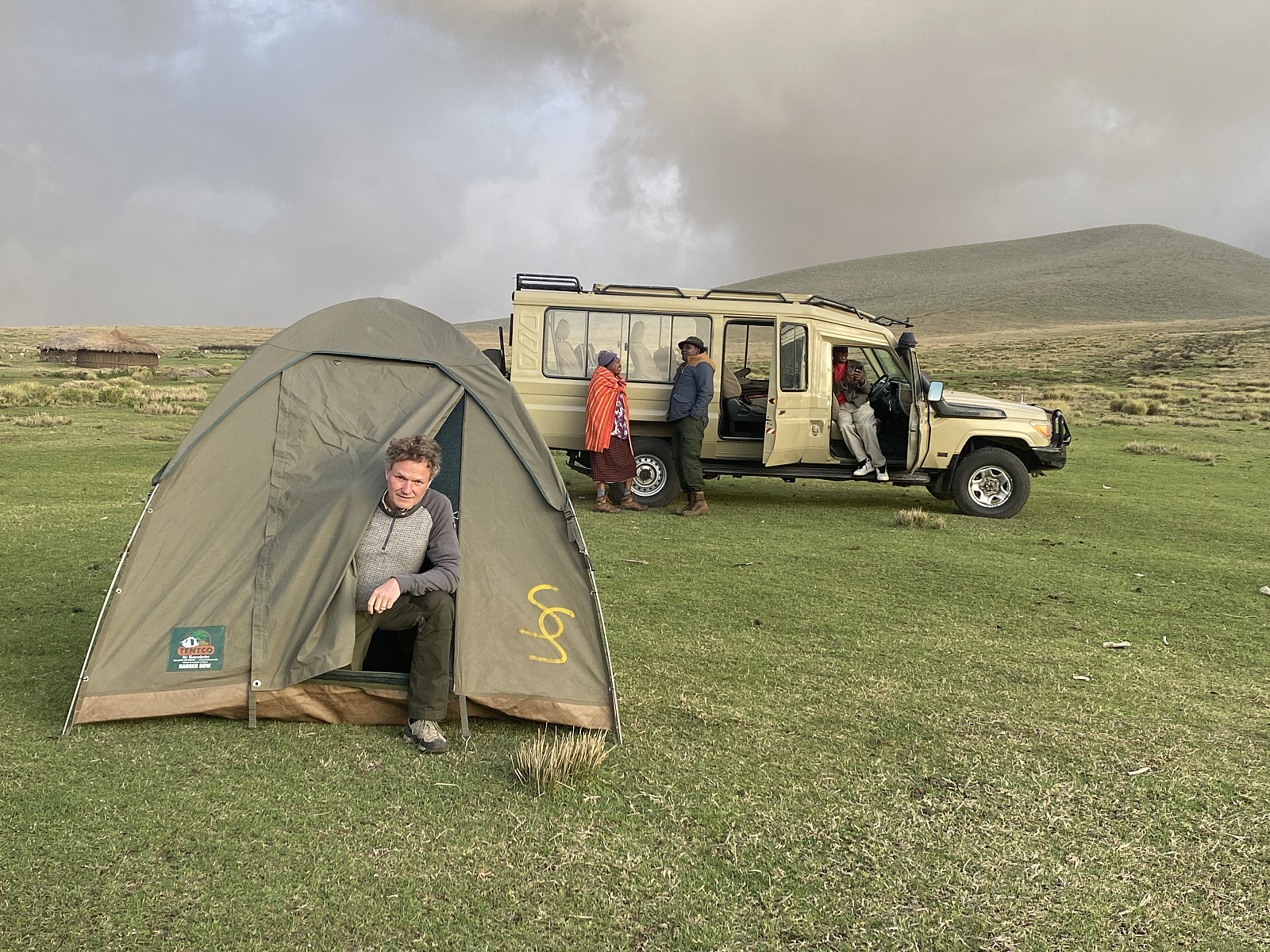
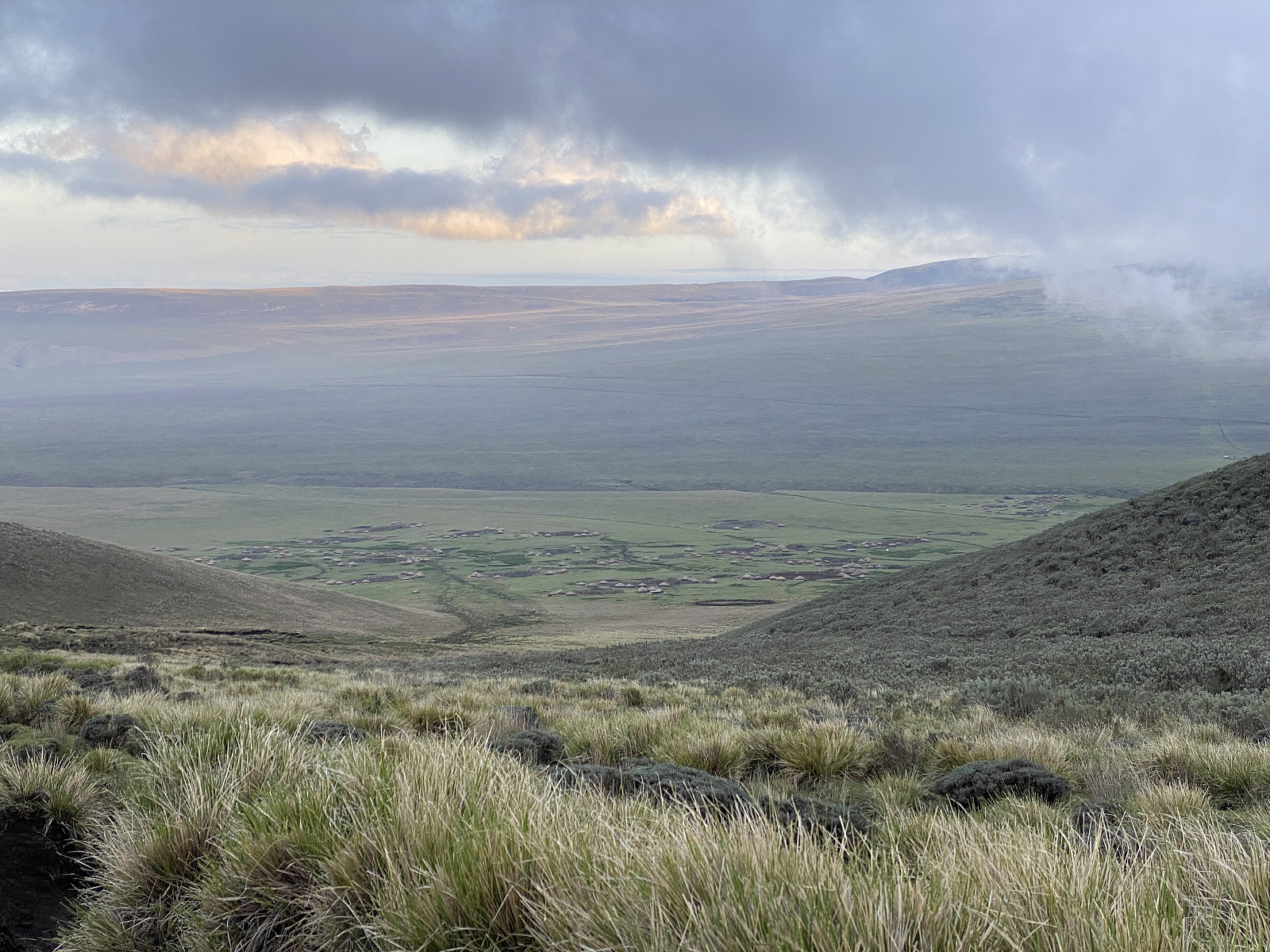
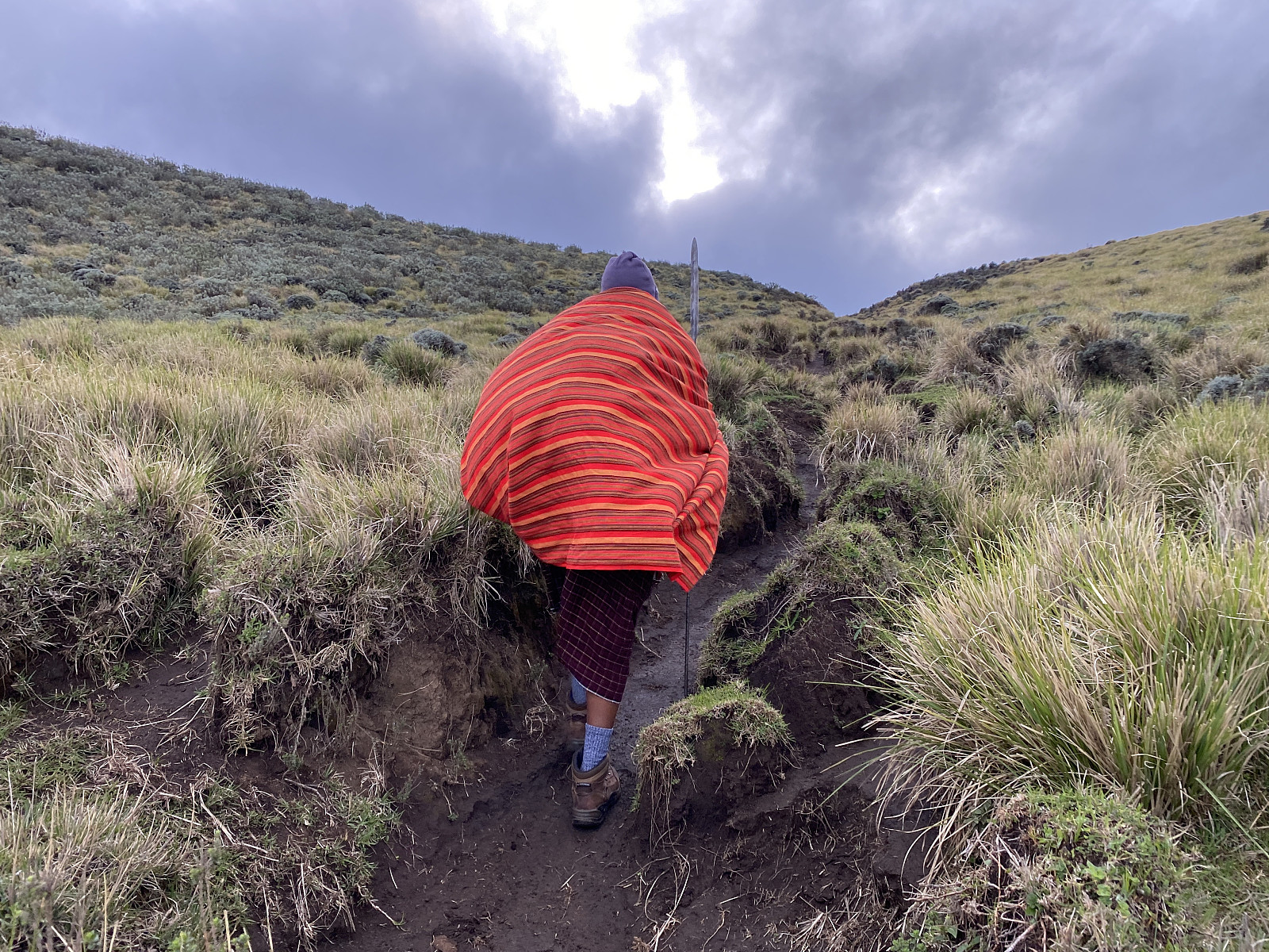
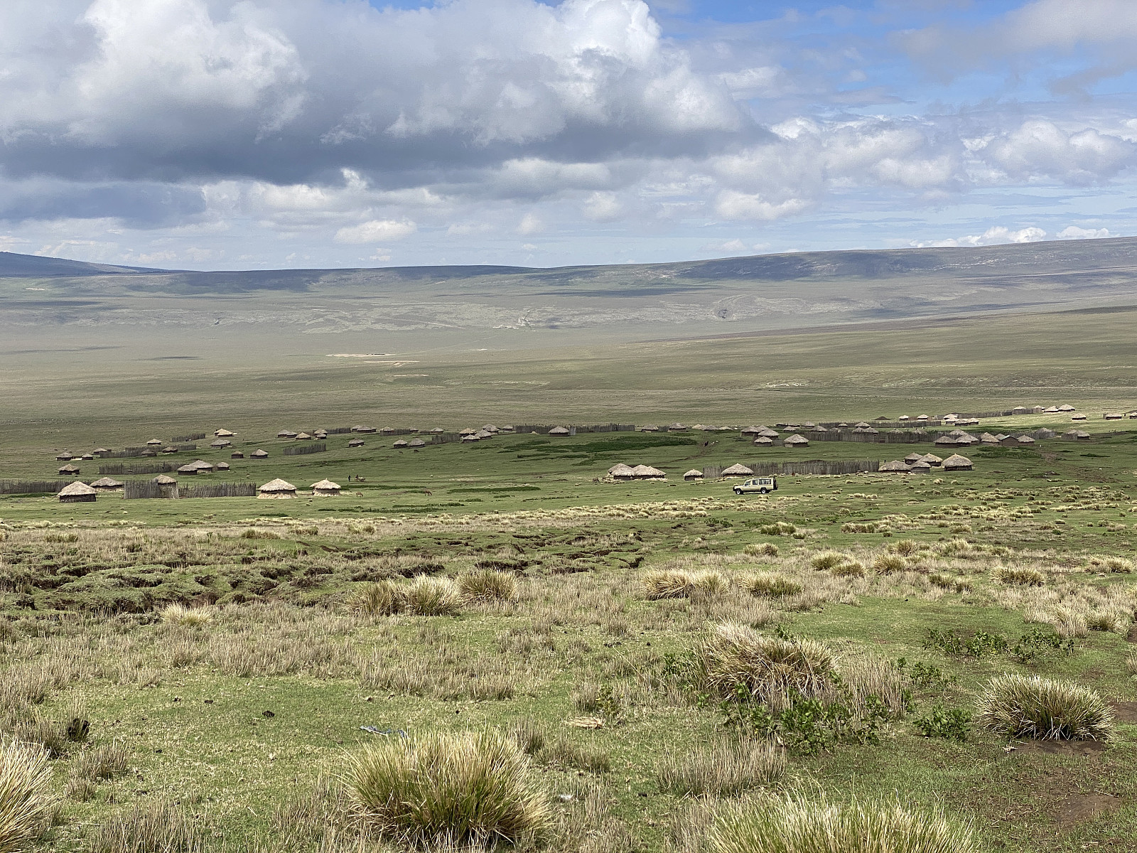
About 5 or 6 kms north of Nainokanoka, the road turned eastwards, and descended into a depression in the terrain, with no river outlet, and yet no lake and at least no visible mire. The rain water coming in this depression must somehow be drained away underground, I said to myself, as evaporation at this cold altitude [i.e. 2300 m.a.m.s.l. at the bottom of the depression] is unlikely to be sufficient to keep water from collecting into at least a shallow pond. Maybe there is actually a pond in the depression at times during rain season, but at the moment there was no such thing to be seen. The road continued east, climbing out of the depression, and up to the village of Bulati. Just outside the village, there was another crossroads, with the road to the left going up to the rim of the Empakaai crater; while the right goes into the village of Bulati. The Empakaai crater is another volcanic caldera with a lake within it, though in no way as huge as the Ngorongoro crater (see images ## 8 & 9, and also the GPS trekking map). We took the right road, and drove through part of Bulati, before we took right again, and headed towards the southern outskirts of the village. Once there, we pitched the tent (image #11), and made ourselves ready for the night. Had it been up to me, we would have rented two tents, i.e. one for Frank and me, and the other for the guide and the ranger, or, if available, we could have rented a bigger one, one that would accommodate us all. In Tanzania, however, there's so much emphasis among mountain guides on keeping the costs down, so it had already been decided, that the tent was for me, the mgeni [i.e. the guest or the stranger]; and the other four were going to sleep in the car. (The driver would probably have wanted to sleep in the vehicle even if a tent had been available for him; as being responsible for the vehicle, he would feel like he needed to watch over it, and keep an eye on it, so to say).
We woke up early next morning, had a little to eat, and then started trekking at 5 minutes past 6 o'clock. To begin with there was a nice trail that we could follow, and the vegetation was mainly grass, and there were virtually no bushes, as the Masai people use this area as a pasture land for their cattle. While driving from Nainokanoka to Bulati the previous afternoon, we had actually observed how the cattle of the local Masais were grassing side by side with herds of zebras. Frank had explained to me that the reason it is called the Ngorongoro Conservation Area, and not the Ngorongoro National Park, is that the local Masai population is allowed to live within it, and even to have their livestock grassing there. People are not allowed to live in a National Park, Frank said; but they are allowed to do so within a Conservation Area, though their numbers, the number of their cattle, and their impact on the nature is closely monitored.
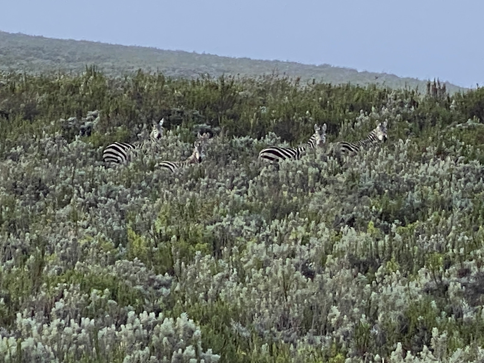
Video #2: After we had been trekking for awhile, at about 2800 m.a.m.s.l., we all of a sudden encountered a herd of Zebras right in front of us.
The local guide, i.e. Makamero, was carrying a traditional Masai spear, whereas Olais was having a rifle. The lions are usually located within the Ngorongoro crater, and not up here, but you could in theory encounter a roaming animal [i.e. a lone male]; and so one shouldn't go trekking on this mountain without some weapons for protection. As mentioned above, however, the cattle of the Masai seemed to be grassing peacefully in the area, with just young boys without spears taking care of the; which wouldn't have been the case had lone roaming male lions been a common thing in the area. The people living in the conservation area are not allowed to hunt down lions and other predators nowadays, but you can be assured the Masai still do it, though secretly, if their livestock is attacked; just as farmers back home in Norway secretly hunt down wolves in the mountain, whenever they pose a treat to their sheep. And this of course explains why there virtually aren't any lions around this mountain: The lions living in a pack are thriving within the Ngorongoro crater; and the lone males are hunted down and killed as back in the old days; though it isn't done as openly as it used to be.

After a short while, Makamero stopped, and pretended to be listening to something for half a minute or something like that. We are going too fast, he then said, because I can hear that our guest is breathing too heavily. This is actually a smart Masai way of doing it, i.e.; instead of admitting that the pace is too high for yourself, you pretend that you're thinking of the guest that you're having with you. And moreover, you pretend that you're living in harmony with nature, and that you're listening to the sounds of the nature, when you're looking for an argument to support your case. The truth, however, was that I was indeed the most fit of our little group, and I could easily outrun the others in a mountain like this one. He always breathes like that, Frank answered, and yet he runs faster than the rest of us. And so we continued upwards pretty much at the same speed as we had had up to now. After a little longer, Olais started lagging behind, and so Frank offered to help him with his backpack, to make it easier for him to keep up with us. At first Olais refused, but after a few hundred meters more, he allowed Frank to help him. We then joked about being eaten by a lion because Olais were unable to shoot it since Frank was having all the ammunition, but as we continued upwards it was now much easier for Olais to keep up with the pace of the rest of us.
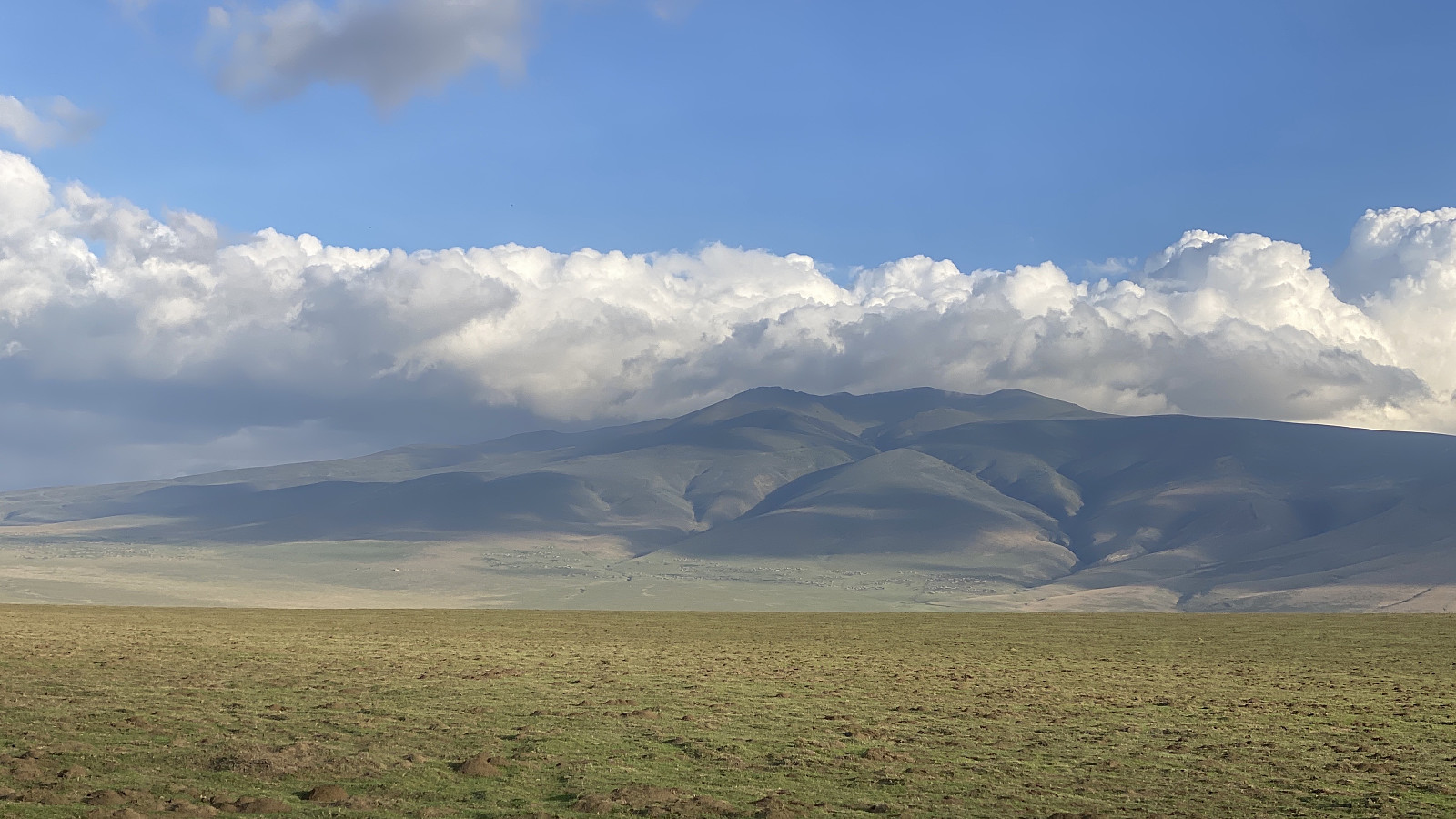
![Image #19: View towards the Ngorongoro crater. The high mountain seen on the other side of the crater is Oldeani [3220 m.a.m.s.l.].](https://images2.peakbook.org/images/14939/Solan_20230305_64045a1520e6a.jpg?p=xtralarge)
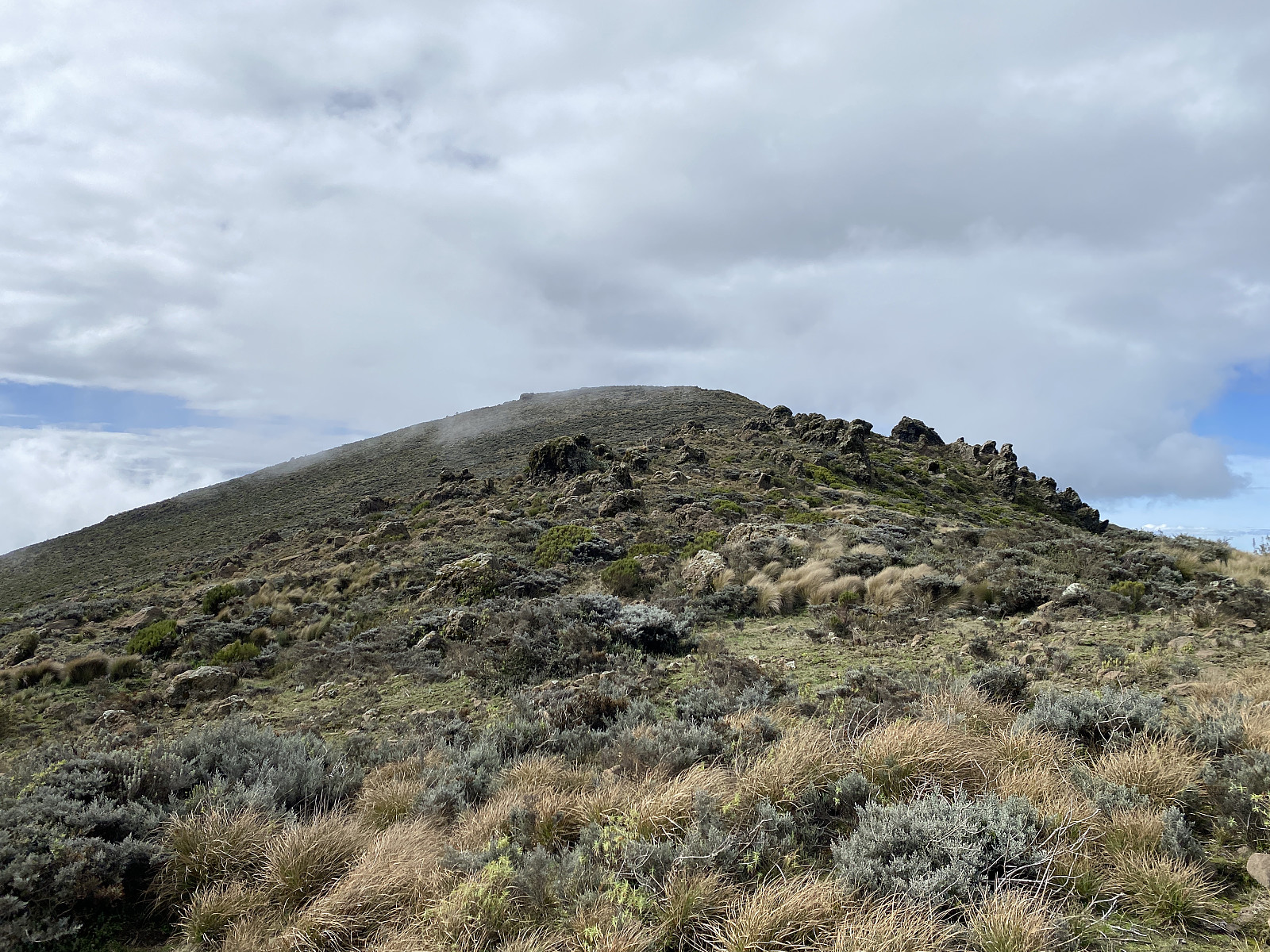
As we continued upwards, there were more and more bushes around us, and the bush eventually became so dense that we had to make our way through it at places. There was no longer any real mountain path, only animal tracks here and there. Suddenly Makamero stopped again, and this time he pointed at some poo on the ground, and said: There's been zebras here tonight. And then, only about half a minute later, or so; there was a herd of maybe 10 or 15 zebras just in front of us (image #15 & video #2). The zebras were a little frightened by the sight of us, and immediately started moving westwards, and one by one they disappeared behind the mountain ridge just to the right of us. After the zebras had left, I expected Makamero to take us directly up to the knoll seen on image #17, but for some reason he took us along the mountain side to the left of the knoll. I believe this wasn't the wisest thing to do, as that mountain side was packed with very dense bushes; which was quite challenging to get through. Had we headed directly up to the nearby knoll, our climb would indeed have been a little bit steeper up to that point, but thereafter it would probably have been much easier to just follow the upper edge of the mountain ridge over to the summit.
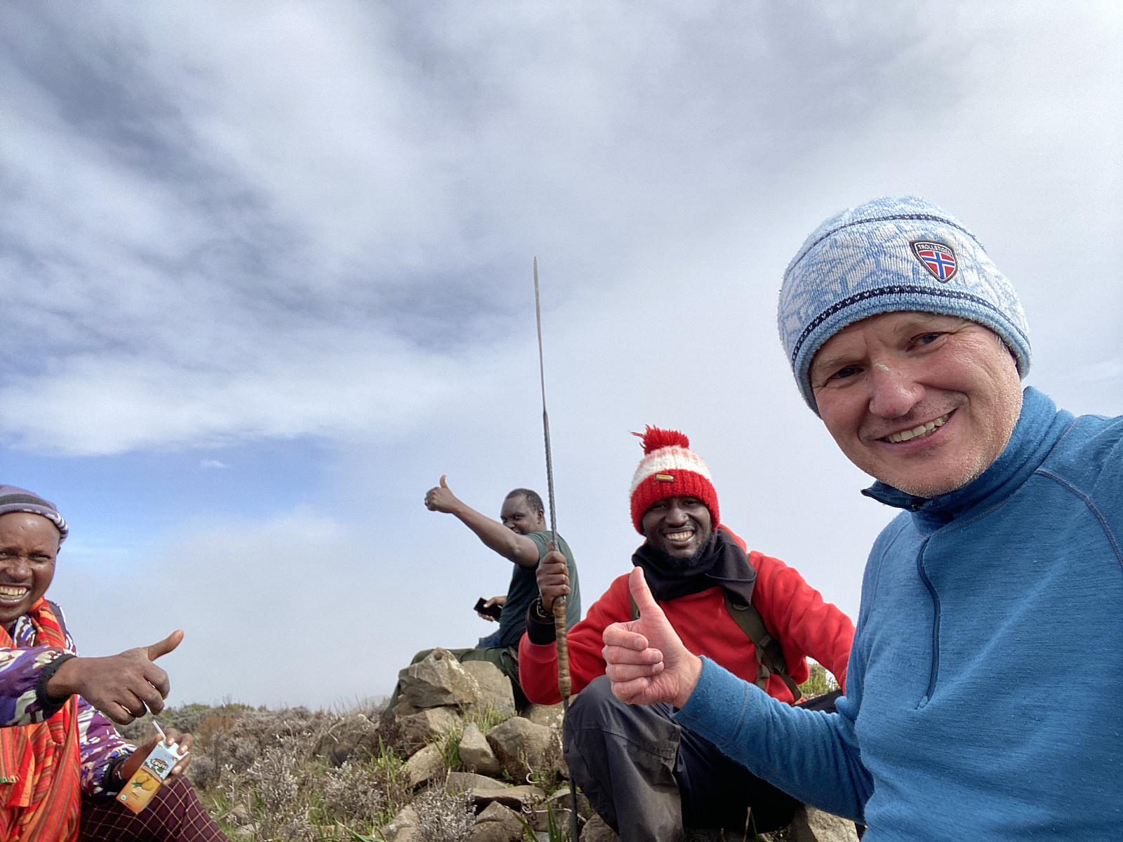
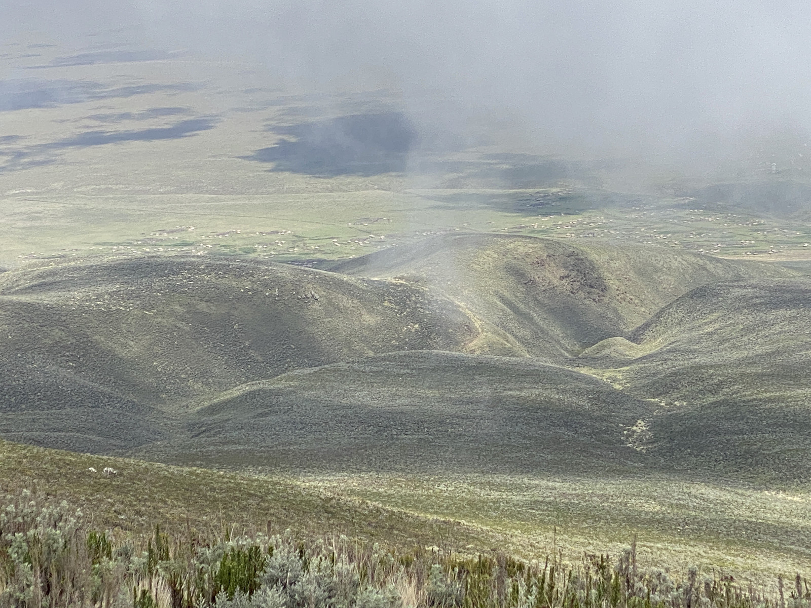
From the east face of the mountain, we now had a very nice view into a rather green valley beneath us, though clouds were coming and going, and partly obscuring the scenery. We arrived at the top ridge of the mountain coming up from the east side; and once up there, we could not only see over to the summit, but on the right side of the summit, we could actually see all the way to the Ngorongoro crater, as well as to Mount Oldeani beyond it (image #19). We continued towards the summit, now just following the upper ridge of the mountain. Mount Loolmalasin is usually recognised as the 3rd highest mountain in Tanzania, assuming that you don't count the summits of Mawenzi and Shira as separate mountains, but as part of Kilimanjaro. If you count Mawenzi and Shira as separate mountains, they are both higher than Loolmalasin. We finally reached the summit [at 3682 m.a.m.s.l.], and there we sat down to have something to eat and drink, as well as to relax for a little while. By now all the scepticism that I had encountered prior to our ascent was gone, as both our local guide, and our ranger, now realised that I was fully capable of ascending this mountain (and I even think they both realised I could've done it a bit faster without them).
![Image #23: The Ngorongoro caldera as seen from the summit of Loolmalasin. The mountains beyond the caldera is Oldeani [3220 m.a.m.s.l.] to the left, and Lemakarot [3133 m.a.m.s.l.] to the right.](https://images2.peakbook.org/images/14939/Solan_20230305_64047dbc0e24e.jpg?p=xtralarge)
At the summit, we ate our lunch, and we also did some photographing, before we embarked upon our descent. The scenery would of course have been even better, had the day not been so cloudy; but we were at least able to see all the way over to the Ngorongoro crater, and to the mountains beyond it (image #23). Our descent went along the very same route that we had used for our ascent, though we could now speed up a little, as descending is much easier than ascending. We made our way through the bushes in the upper part of the route, until we reached the the spot where we had encountered the zebras while ascending; from about there we were back on a trail that it was possible to follow. A little bit lower down we passed a woman and some children that were digging in a field, and seemed to be cultivating something just beside the trail; and even further down, we met some young boys that were herding some cattle. The last part of the trail was rather straight forward, and soon afterwards, we were back at the outskirts of Bulati, where our car and our driver was waiting for us (image #26).
The driver had taken down the tent while we had been in the mountain, and so we just got into the car, and started driving back towards Nainokanoka. Our local guide, Makamero, now invited us to have tea in his house before leaving, and while we were still on our way, he phoned his wife, and asked her to make things ready for our arrival. When we arrived at his house, they brought hot water from the kitchen for us to wash our feet, and then we were invited into their living room, where his wife brought us tea with milk and a lot of sugar. I lived in Africa for many years during my childhood, and I'm very much aware that there are parts of Africa where the main source of milk is the Nido dry milk from Nestle. This was different, however, as this was in Masai land, and our host was himself a Masai. This tea was served with proper milk from the cattle of the Masais.
Video #3: Between our camp site in the outskirts of Bulati, and the centre of the village, there's a shallow gorge in the terrain, where the road isn't very good. The video shows our drive through this gorge.
After a while, we thanked Makamero and his wife for their hospitality, and then I gave him and Olais each a very nice tip, before we left for the Ngorongoro crater. While on our way from Arusha to the Ngorongoro Conservasion Area, I had been studying my roadmap, and I had noticed there was a road that we could follow right through the Ngorongoro crater on our way back, instead of driving back the same road on the eastern ridge of the crater (see map in image #8). When I asked Frank about this possibility, however, he told me there would be a park fee of an additional 400 USD for entering into the crater; but I thought it was worth it, as I can't be sure that I will ever visit this area of Tanzania again. Prior to our ascent on Loolmalasin, Frank therefore contacted his friend and colleague Augusto in Kili Hike Adventures; who made an advance payment for us, so that we could follow the road through the Ngorongoro crater on our return from Loolmalasin.
Video #4: Some elephants that we encountered on our way down the escarpment into the Ngorongoro Caldera.
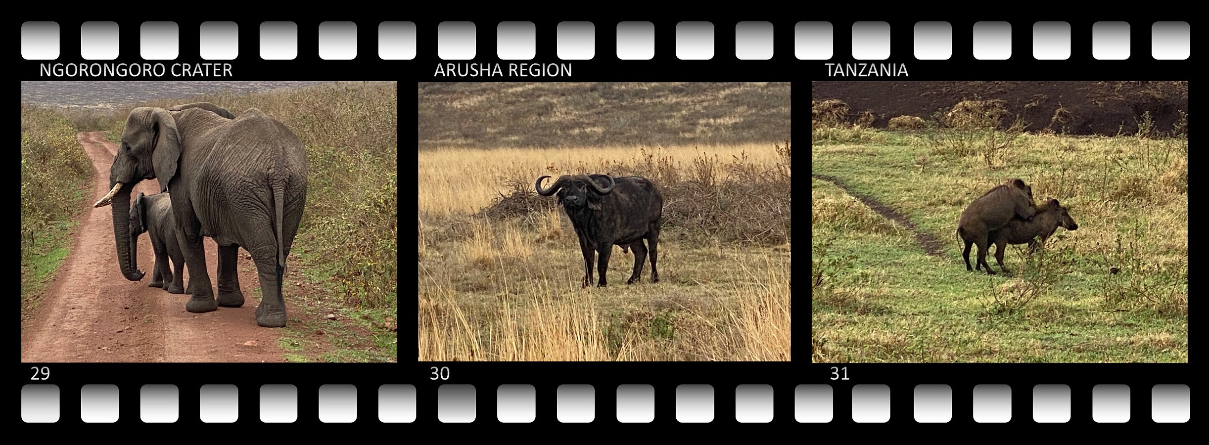
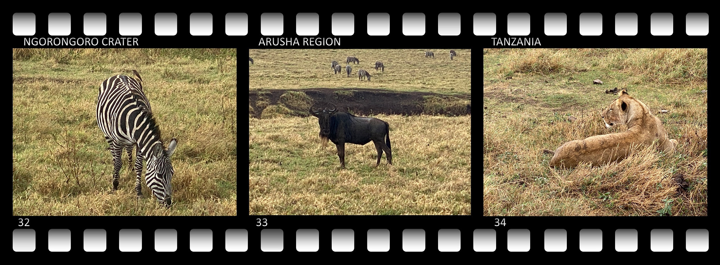
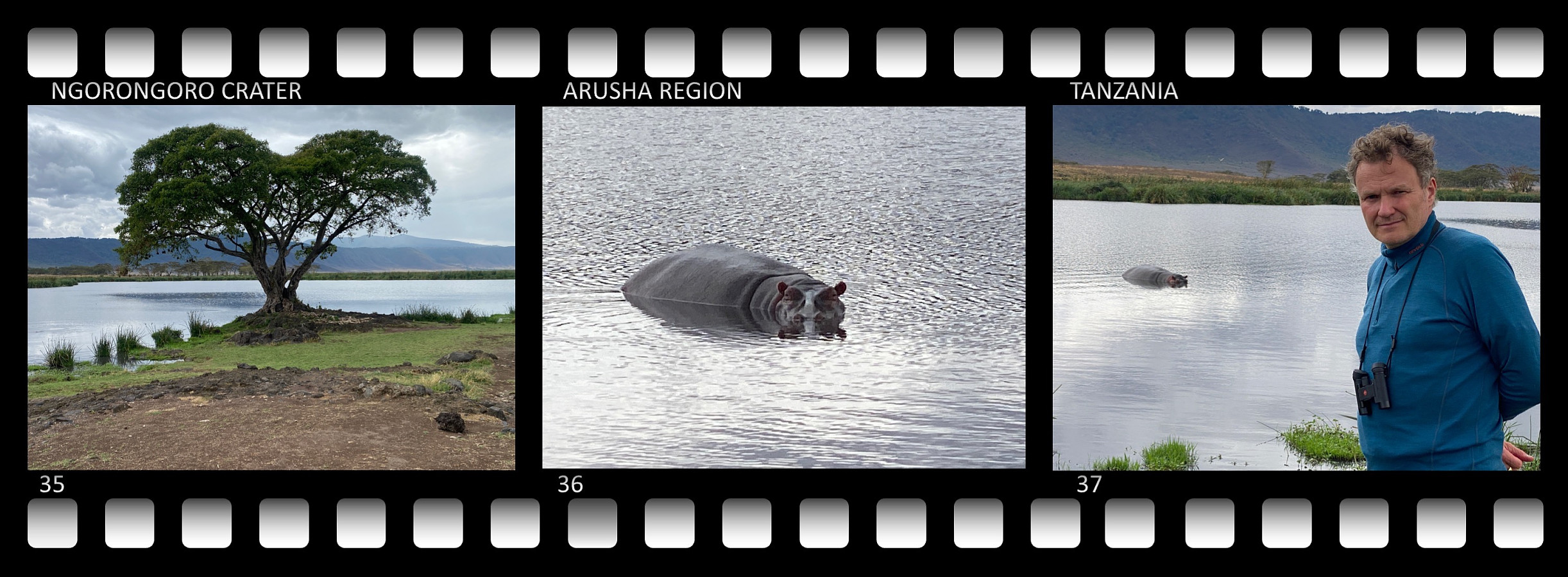
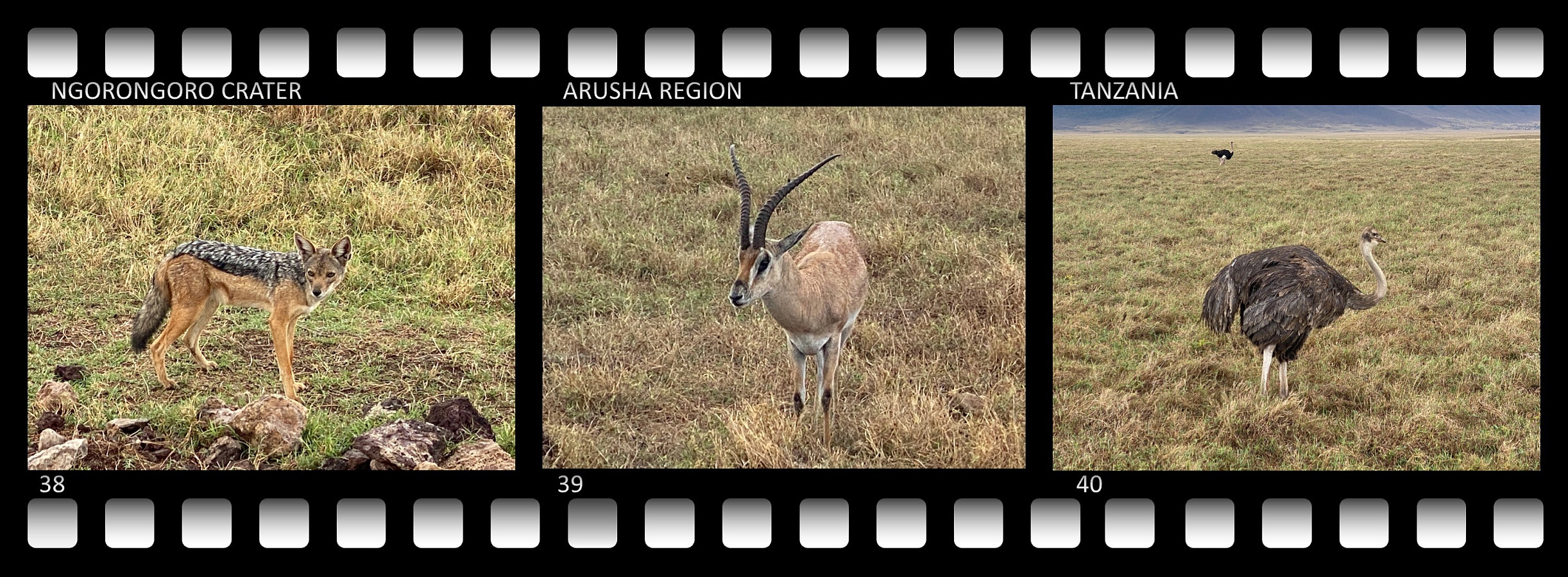
A road trip through the Ngorongoro Caldera is a fascinating one, we encountered a lot of animals; the only species we actually missed was the rhinos, which are hard to spot these days, as their numbers has been decreasing quite a bit over the last 40 years or so. We did however, encounter elephants, lions, buffaloes, warthogs, zebras, gazelles, wildebeest, jackals, hippos, ostriches, and a large number of various other birds. Video #4, and images ## 29-40 shows most of the animals that we spotted in the Ngorongoro Caldera on this occasion.

User comments