Ascending Mount Meru in Arusha (20.11.2022)

| Characteristic | Alpine trip |
|---|---|
| Duration | 44h 51min |
| Distance | 31.4km |
| Vertical meters | 4,943m |
| GPS |
|
| Ascents | Little Meru (3,820m) | 20.11.2022 |
|---|---|---|
| Meru (4,566m) | 20.11.2022 | |
| Rhino Point (3,855m) | 20.11.2022 | |
| Visits of other PBEs | Miriakamba hut (2,490m) | 20.11.2022 |
| Momella (1,590m) | 20.11.2022 | |
| Saddle hut (3,560m) | 20.11.2022 |
Introduction
I have for years been having a dream of climbing Mount Kilimanjaro one day, and then a few years ago, I read on a web site that you could increase your chances of reaching the summit by first climbing Mount Meru [4562 m.a.m.s.l.]. The particular web site was that of a UK based tour operator, who stated they had a success rate of bringing their clients to the Uhuru Peak [5895 m.a.m.s.l.] of 93%, but 97% among those who ascended Meru prior to embarking on Kilimanjaro. These numbers could of course be interpreted in various ways, but the most likely explanation is of course, that altitude acclimatisation actually helps. Now, in addition to this trek of Mount Meru, my acclimatisation plan also included a two week stay in Addis Ababa (at 2400 m.a.m.s.l.) prior to my journey to Tanzania; as well as a trek to Mount Zuqualla [3019 m.a.m.s.l.] in Ethiopia [Link: To Mount Zuqualla in Oromia, Ethiopia], and to Mount Ol Doinyo Lengai [2962 m.a.m.s.l.] just south of Lake Natron in the eastern branch of the African Rift Valley [Link: Climbing the Mountain of God]. I had booked this hike of Mount Meru, along with the one of Ol Doinyo Lengai, and the one of Kilimanjaro with a guy named Frank Fred Lyimo, who works with an Arusha based tour company called Kili Hike Adventures. Frank is indeed a skilled tour operator, but after I spent three weeks with him in various Tanzanian mountains; I no longer regard him as just a business partner with whom I may book hikes in the African mountains, Frank has actually become my friend.
Day 1 - From Momella to the Miriakamba Camp Site
I spent the night prior to our hike at the Meru View Lodge, where Frank and the rest of the guys picked me up in the early morning. Frank first introduced me to Holson Mamuya, a man about my own age; and explained to me: Holson is my teacher. He has taught me everything I know. Now, as I spent quite a bit of my childhood in Afrika, I know statements like this may be difficult to interpret, as it may just be someone's way to honour his teacher. As I got to know both of them a bit better, thought; I learned that the statement might be true as far as mountains are concerned, because Holson is above all a mountain guy that knows what there is to know about Kilimanjaro and Meru. Frank, however, also have quite some knowledge of wildlife safaris and other things that tourists do in Africa, and his skills in organising various tours to the various parts of Tanzania, is more likely something he learned at the National College of Tourism in Dar es Salaam.
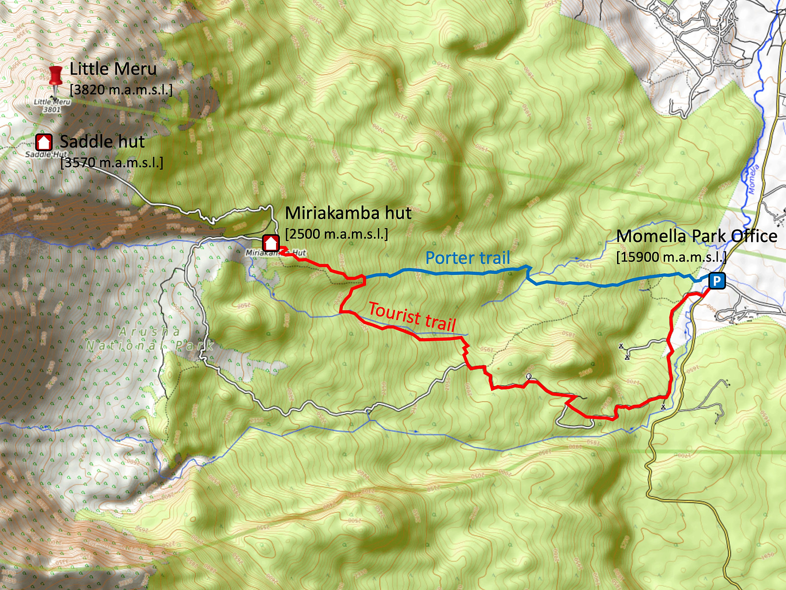
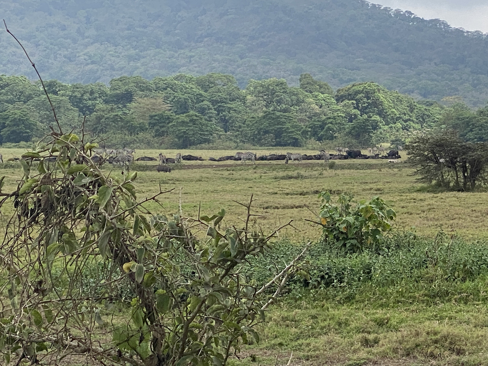
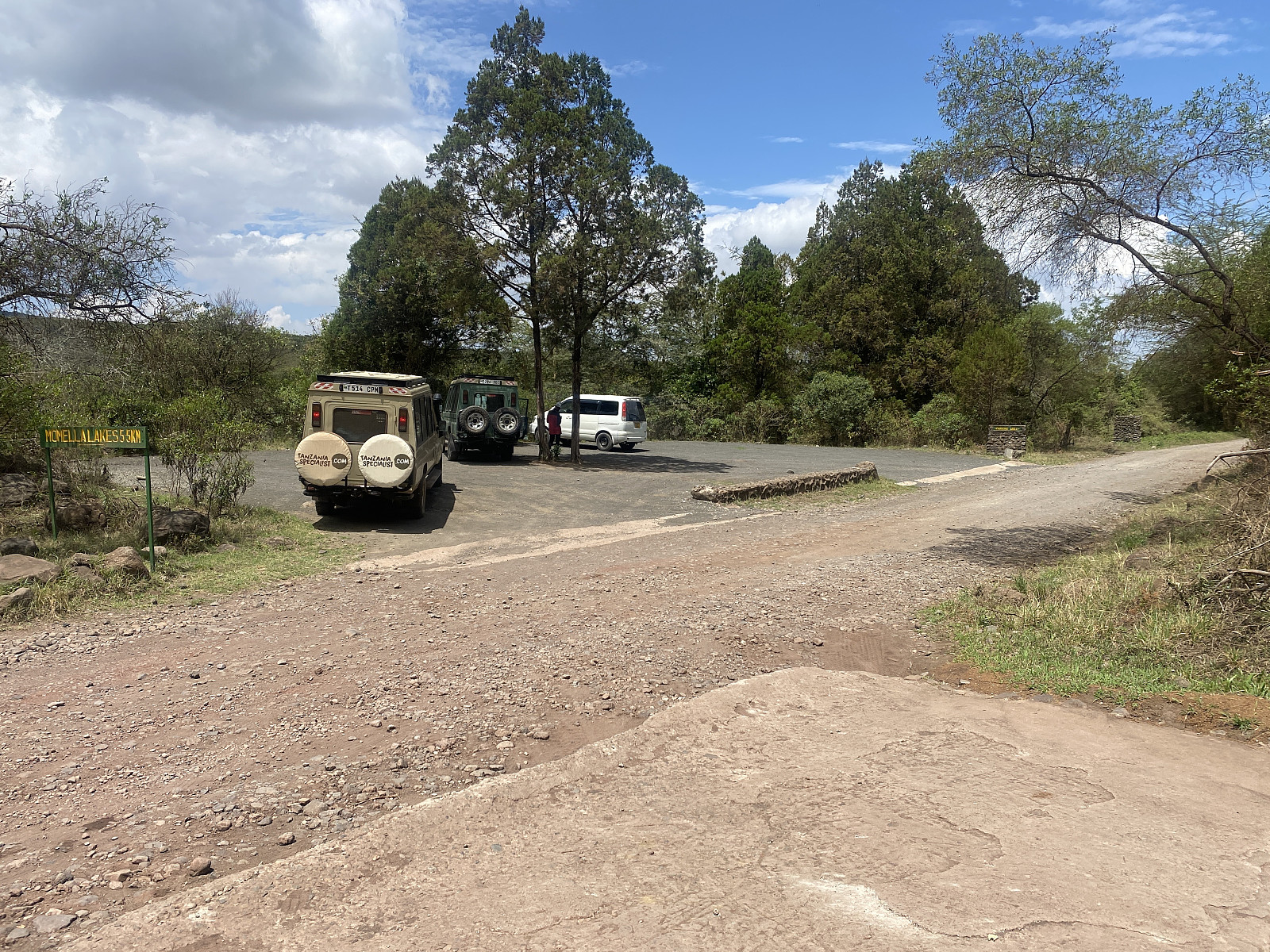
The Meru View Lodge is located on the way towards the Arusha National Park, in which Mount Meru is located, and so we just continued along the road up to the gate to the park; where we were granted access, and from there we continued towards Momella, where the park offices are located. The Arusha National Park is said to have the world's largest population of giraffs, and shortly after we had passed the entrance on our way to Momella, we actually spotted a number of them. I didn't have my mobile phone camera ready right then, however, so I was unable to shoot an image before they were gone. Half a minute later, we encountered a herd of zebras, however. By now I had the camera ready, but they were a bit too far away for me to have a nice shot of them (image #1).
A few minutes later we arrived at the park office at Momella, where our planned trek was properly registered, with the number of participants and everything. We were 7 people all inn all, i.e. myself, Frank, Holson, a chef, and three porters. In addition, two park rangers were going to come along with us, to protect us from the wildlife of the park. Along with the registration, everything had to be weighted properly by the park authorities, to make sure the porters aren't forced to carry too heavy loads. These things are strictly regulated in Tanzania, and no porter is allowed to carry more than 20 kg. After every matter was sorted out, we still had to sit down and wait a little longer, as one ranger is allowed to escort up to six tourist; and I was the only tourist that had arrived so far this morning, and so we had to wait a little longer to see if any more were going to show up.
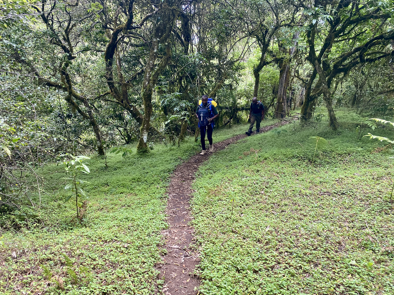
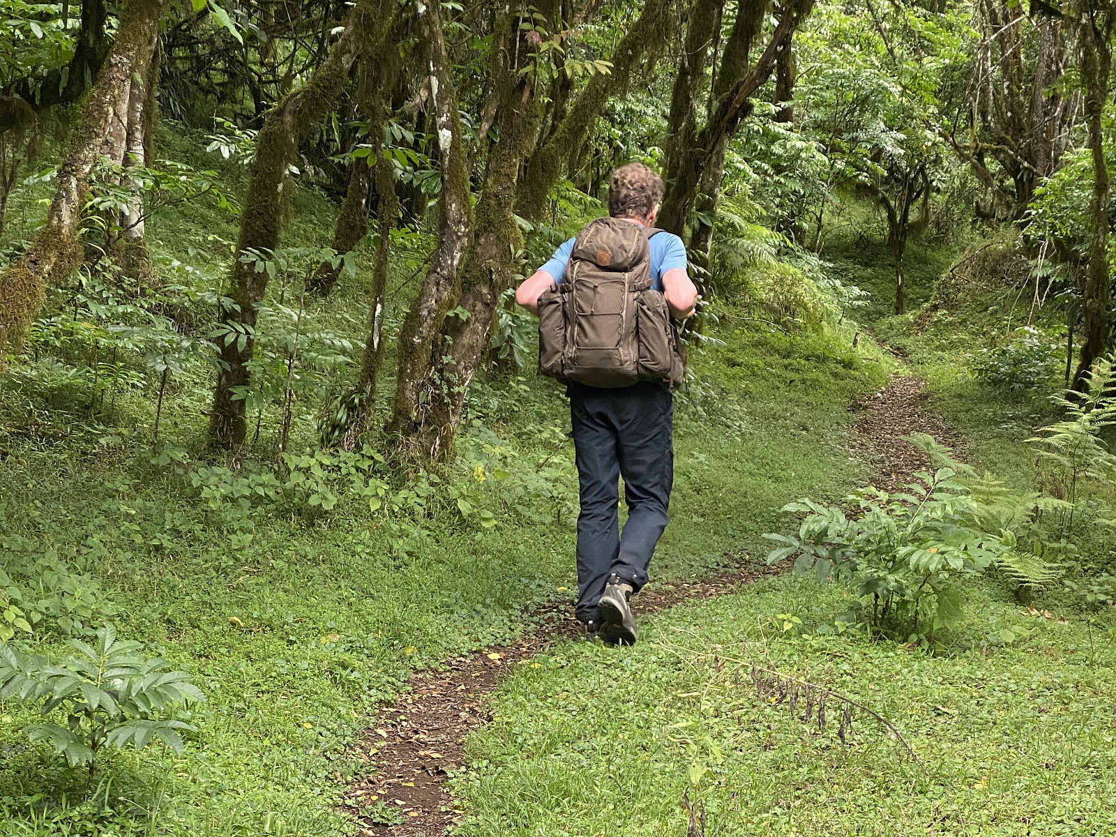
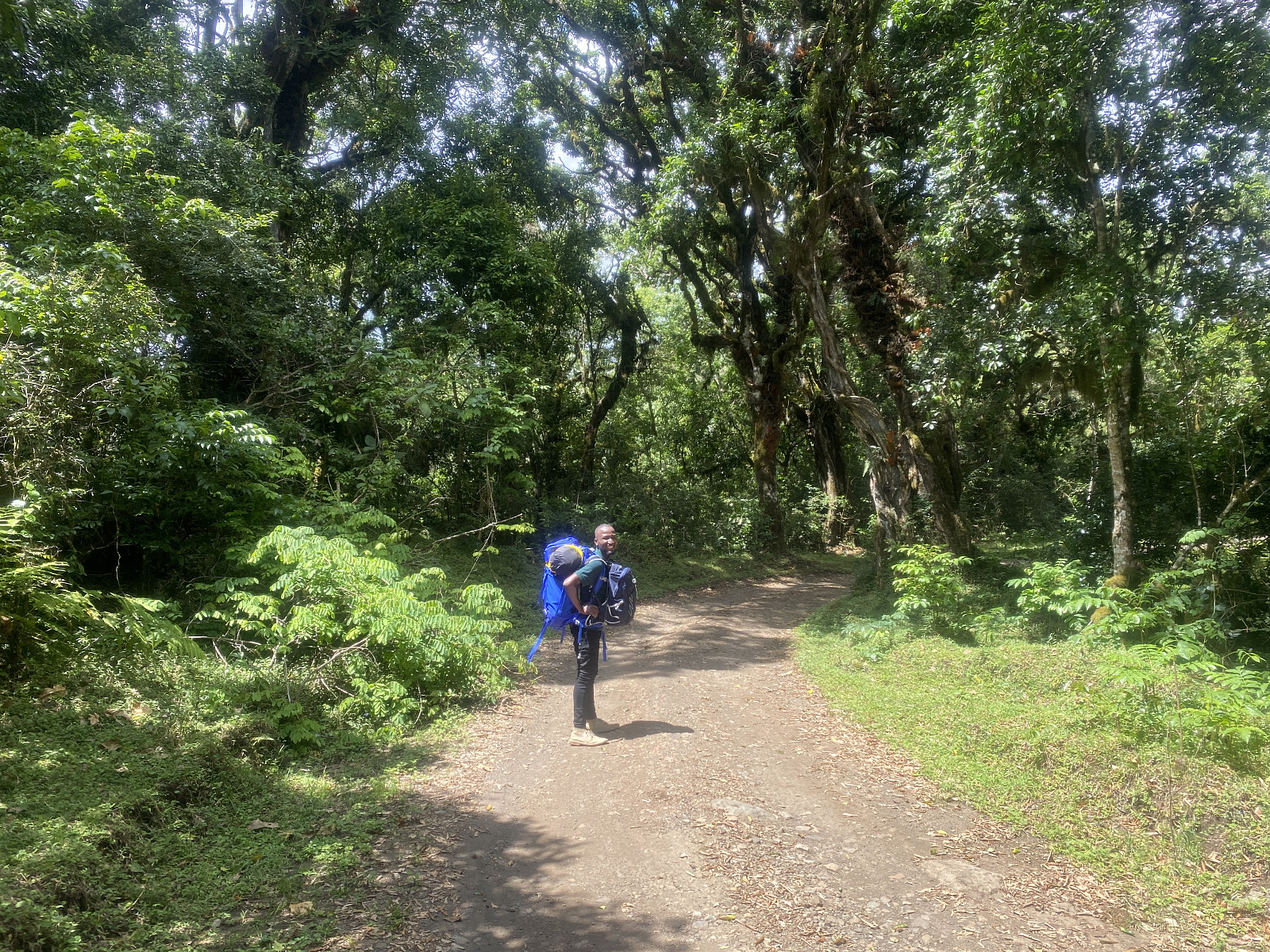
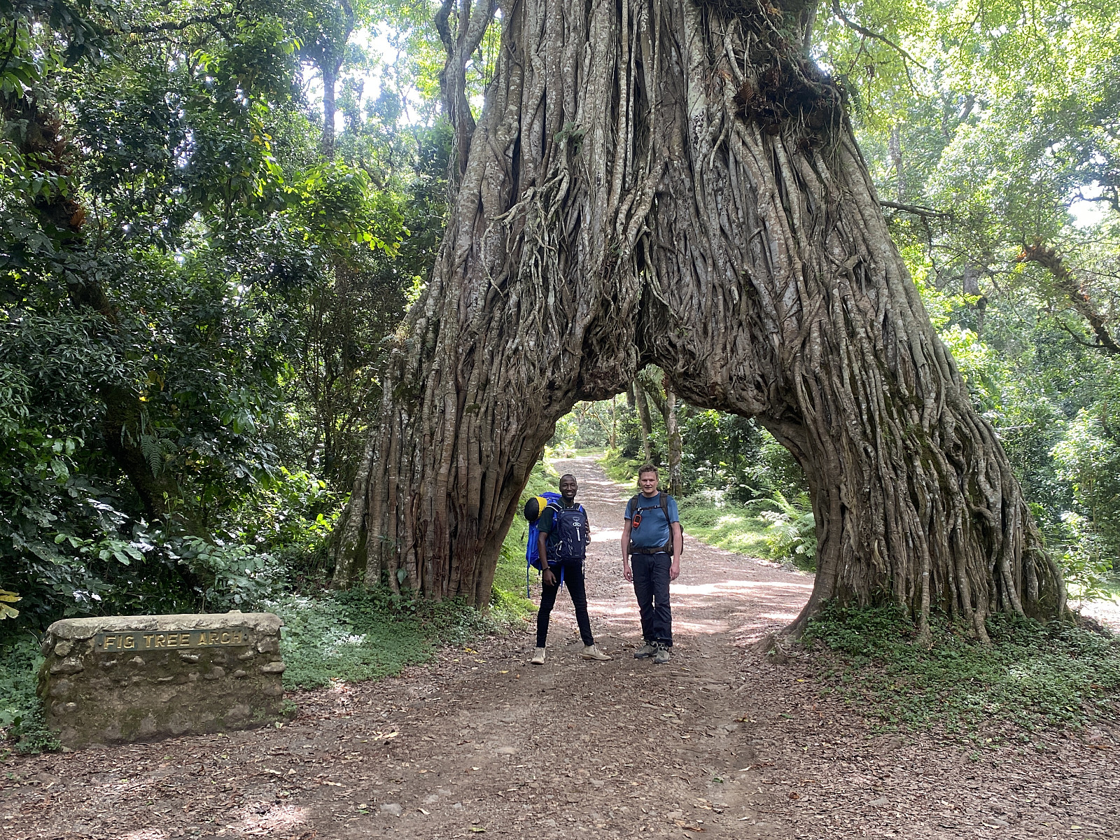
Fortunately, no other tourists showed up, and I was happy about that, as I knew it would pretty much allow me to set the pace. We set out from Momella at about 20 minutes to 1, along a forest road; myself, Frank and one of the rangers. What about the others? I asked. They will catch up with us later, Frank replied. The road was broad enough for the three of us to walk side by side, which allowed me to set out in any speed I wanted. I used the first 10 minutes or so to test out how fast Frank and the ranger would be able to walk, but I had to watch them closely, as I knew they would both be quite reluctant to admit it if they weren't able to keep up with my pace. After a while we came to a fig tree that forms an arch over the forest road (image #7), and we stopped there to shoot some photos, and also to drink some water before continuing.
There was a sign at the spot, that explained how the fig tree arch had come into being. Fig tree seeds were originally dropped in the fork of an earlier host tree by birds, and so a fig tree started growing right there in the fork of this earlier tree. As the fig tree enlarged, its roots eventually grew down to the ground along the trunk of the host tree; and as time passed, the fig tree became large enough to choke the host tree, which eventually withered, and thus the current arch was formed. The road was obviously later built right through the arch in order to create a tourist attraction along the route, and it is large enough that one may drive a Toyota Landcruiser or similar right through it.
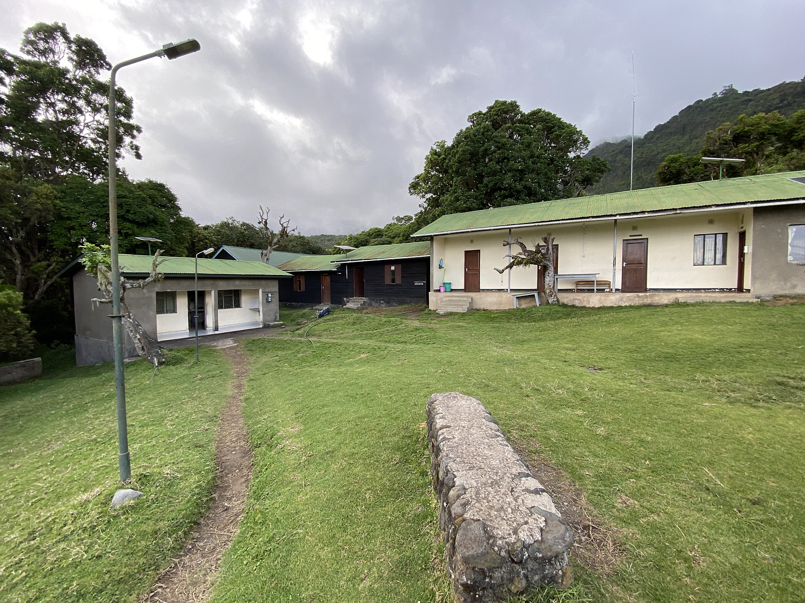
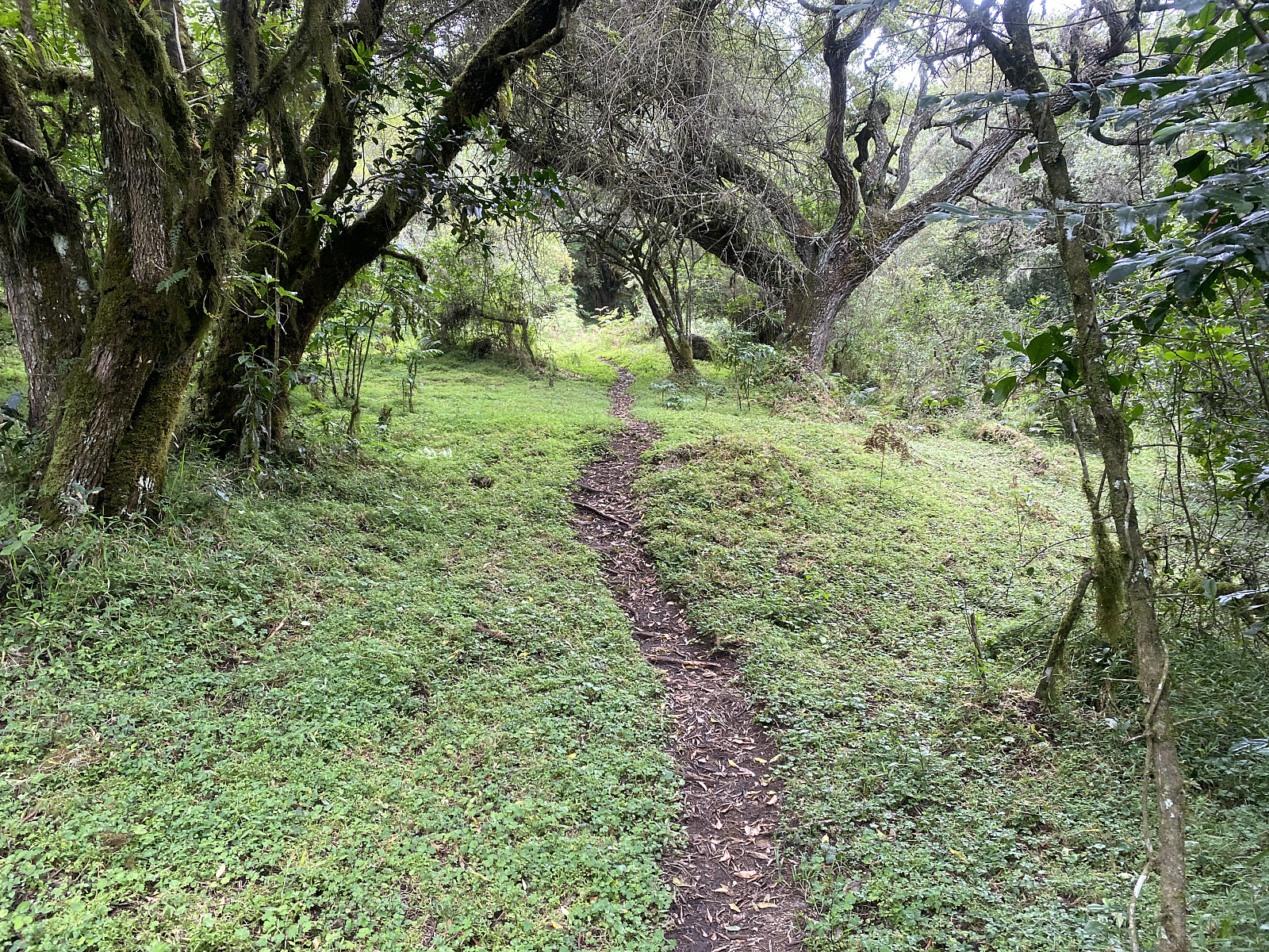
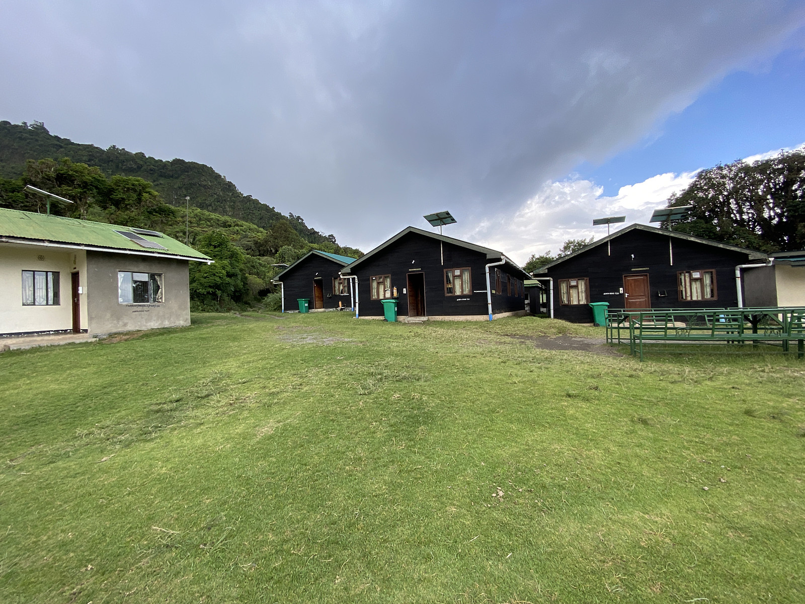
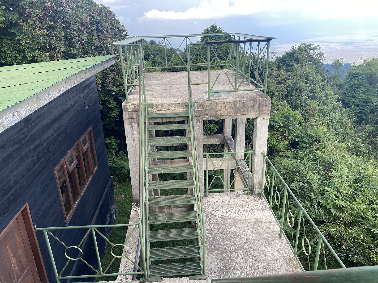
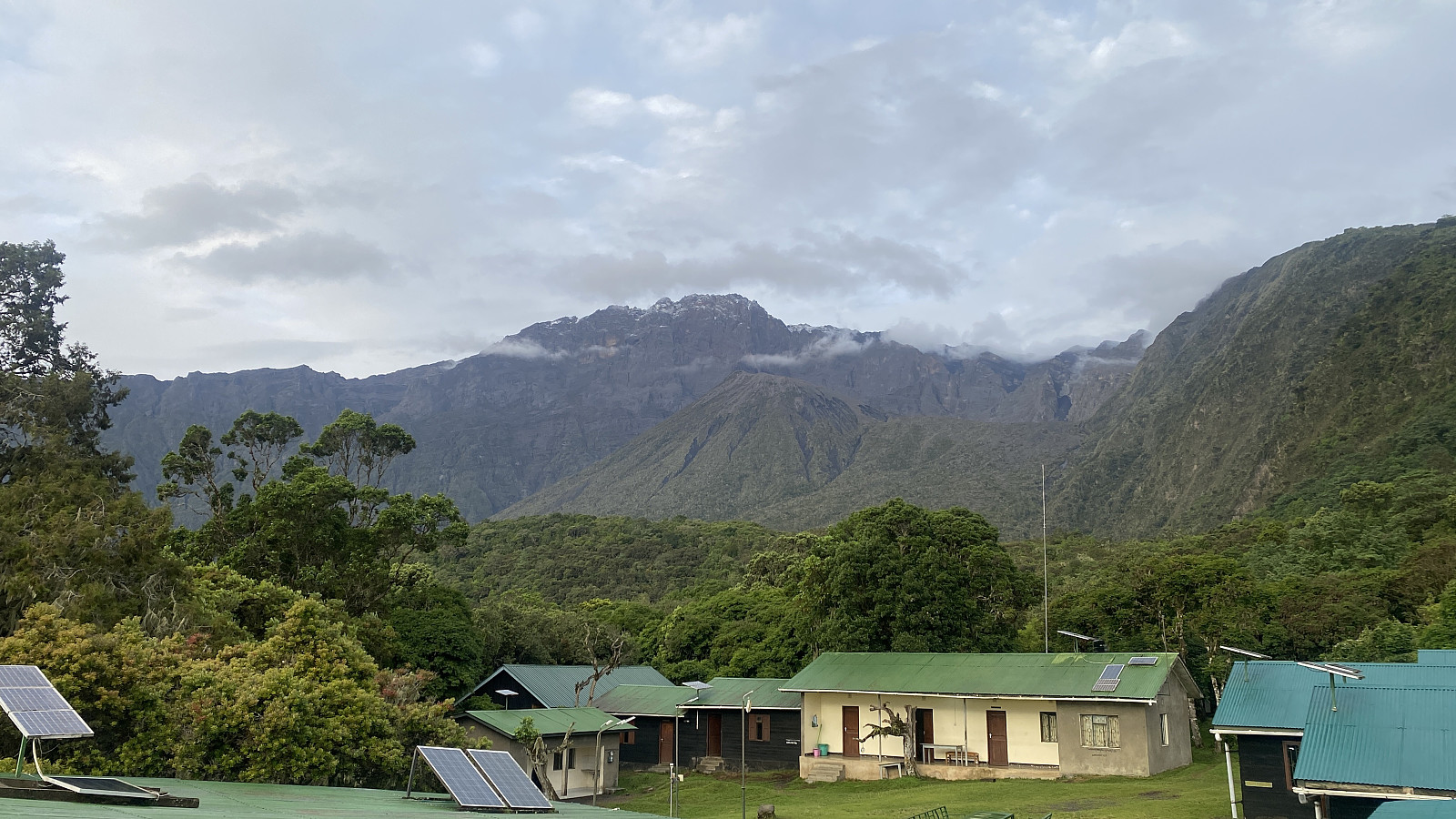
When we left the road for a forest trail, the ranger allowed me to walk first, which suited me well. After a while I asked Frank whether Holson and the rest would be coming this way or another way, and he then replied that they were going a different, and slightly shorter route (image #5). I then learned that part of their concept is to lead the tourists a slightly longer way, so that when they arrive at the camp site, the chef and the porters will already be there, and even dinner will be ready for the tourists. I believe this concept dates back all the way to the colonial era, when the Muzungu [i.e. the white man] was treated like a king, with a number of servants around him. Much have of course change since then, but when it comes to this concept, the major change is that the tourists are now called wageni [i.e. visitors], and they are no longer always white. I did ruin their concept on this particular day, however, as we arrived way too early at the camp site of Miriakamba. Holson stood on top of a little tower on the downhill side of the dining hall (image #15), welcoming me as I arrived. He asked me about the other two, and I replied that they were just half a minute behind me. He and the chef and the porters had arrived at the camp site merely minutes before we arrived, however, and they were surprised by the speed that we had been able to keep. I tried to explain that to me it's not important that everything be ready for me the moment I arrive at the camp site (it's more important for me to be allowed to walk at a pace that I enjoy); but the concept of making everything ready before the guest arrives is so deeply incorporated into the way these guys do things, that they were not at all comforted by me saying it didn't matter.
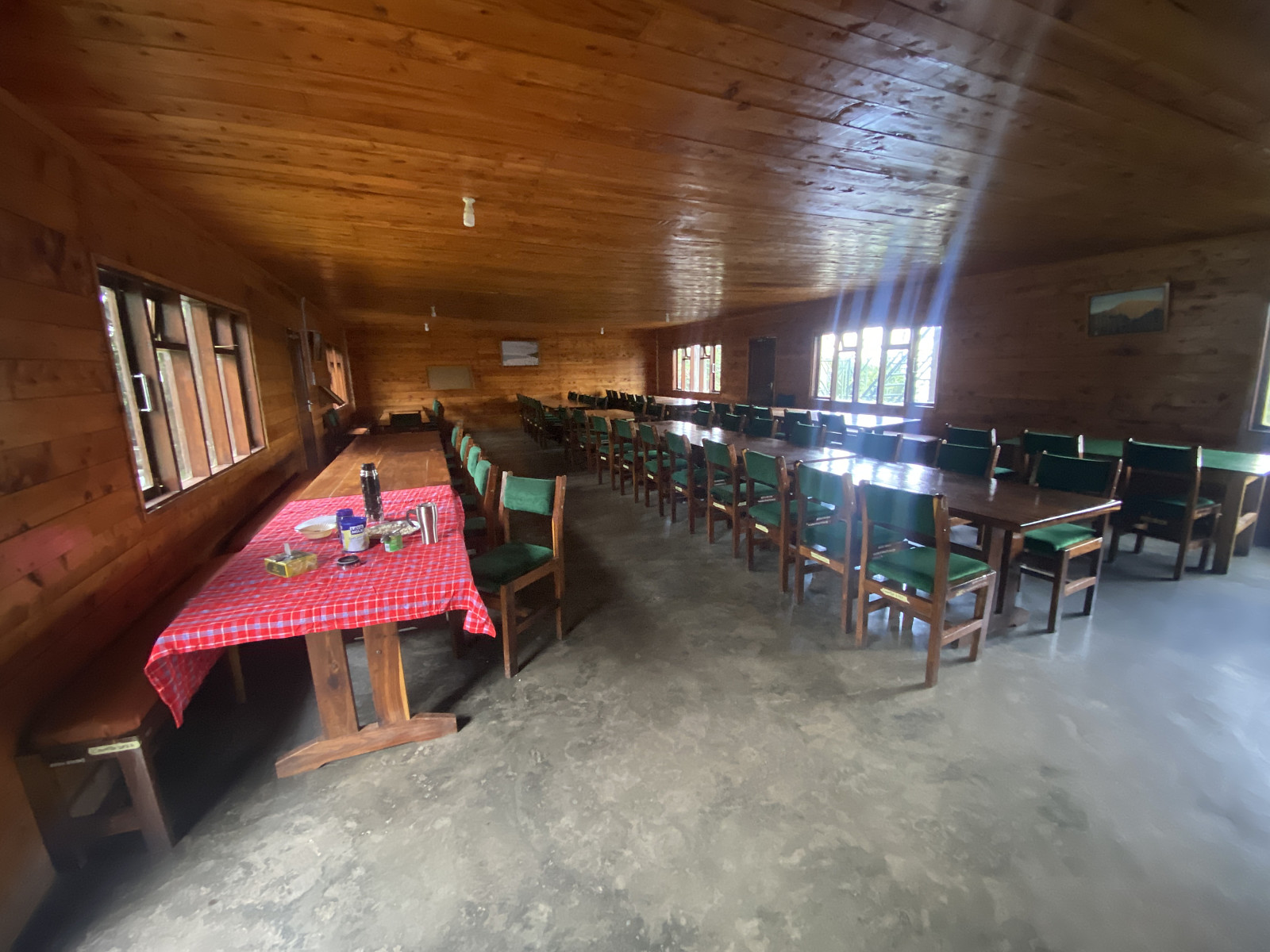
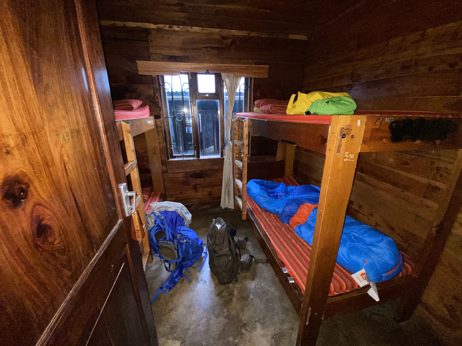
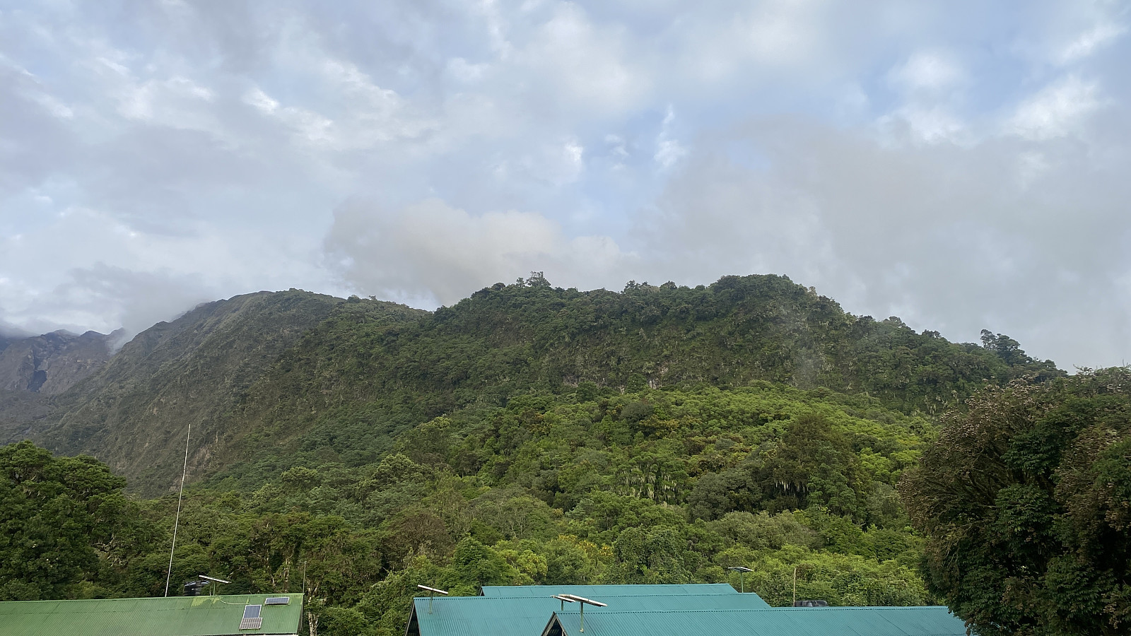
I enjoyed Miriakamba [2490 m.a.m.s.l.] very much. The site is beautifully located on a mountain ridge, and surrounded by forest. There were plenty of rooms for tourists, each with 4 beds as far as I could see (image #18), and the dining room/hall was also spacious (image #17). Moreover, the toilets were decent, and shortly after I had arrived, they brought me hot water behind the hut where I was going to spend the night; so that I could clean up a bit before dinner. I was thereafter served dinner in the dining hall, which was an awkward experience, I have to say. The dinner itself was an excellent three course meal, with soup first, then the main course, and finally dessert. What I found awkward, was that I was sitting there all by myself, with no one else in the dining room, while the rest of our company was eating in the kitchen. As a Norwegian, I'm not very used to this kind of class distinction. And then I missed the company, of course. Had I been trekking with, lets say three other tourists or so, I might not have felt that awkward. The fact that I was trekking alone was largely my own fault, though. I had insisted I didn't want to be put in a group of tourists that were unfamiliar to me, as you can't then know in advance how fast the rest will be able to go etc.; and so I didn't want to risk being slowed down by the rest of the group, or to be the one slowing the others, for that matter. So I knew I just had to get used to eating alone, as it was going to be the reality on Kilimanjaro, as well as here on Meru. After I finished eating, I walked around in the camp to capture some pictures, and when Holson saw me throug the kitchen door, he invited me into the kitchen to sit down and have a chat. Inside the kitchen, the chef was making food for the rest of our company, and a radio was on, broadcasting a football match between two Tanzanian football teams.
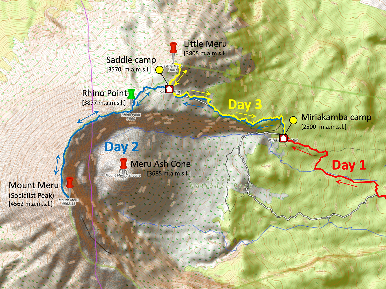
Day 2 - From Miriakamba to the Summit, and then back to the Saddle Hut
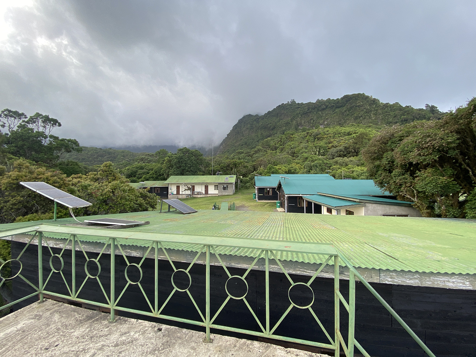
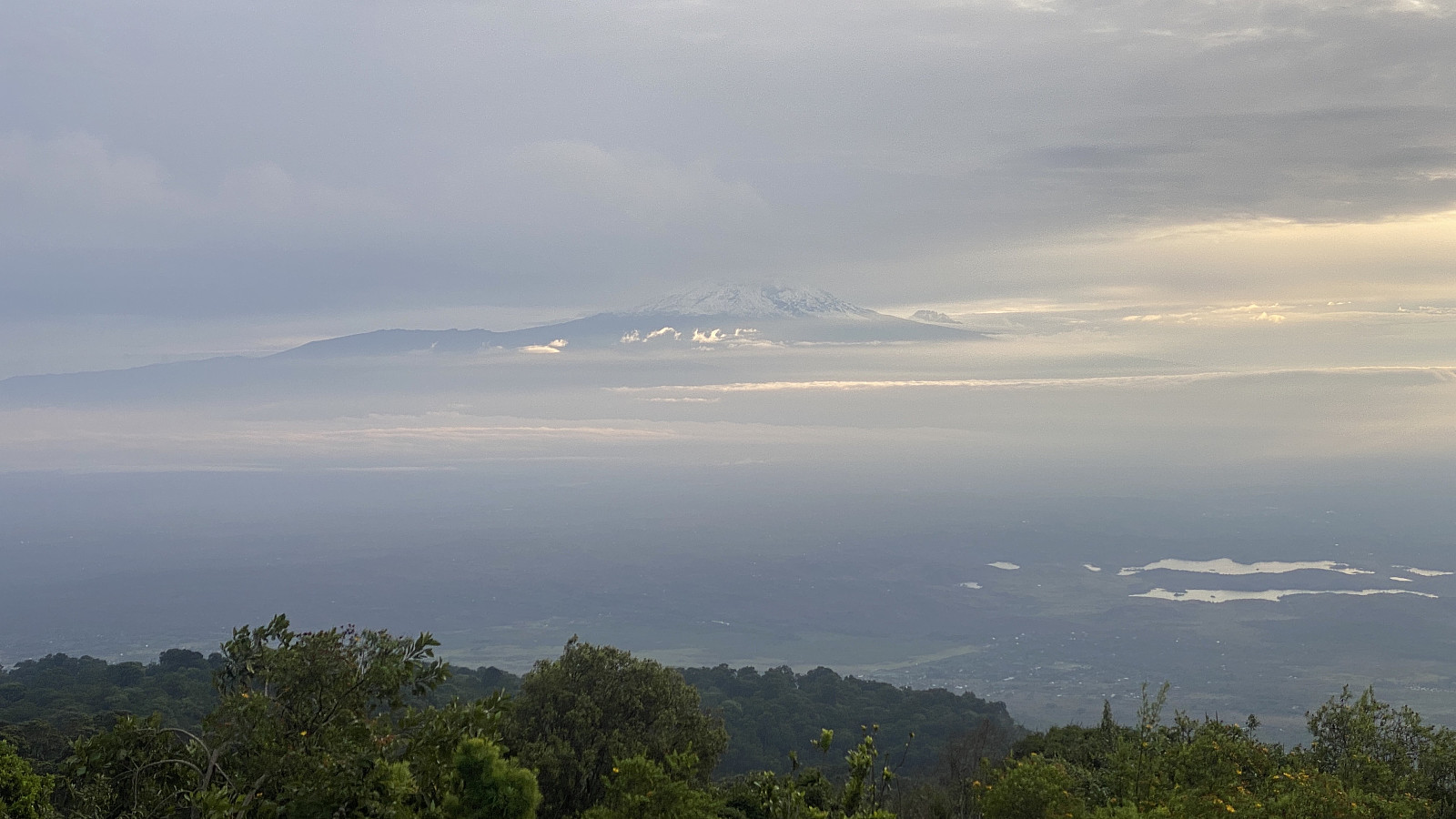
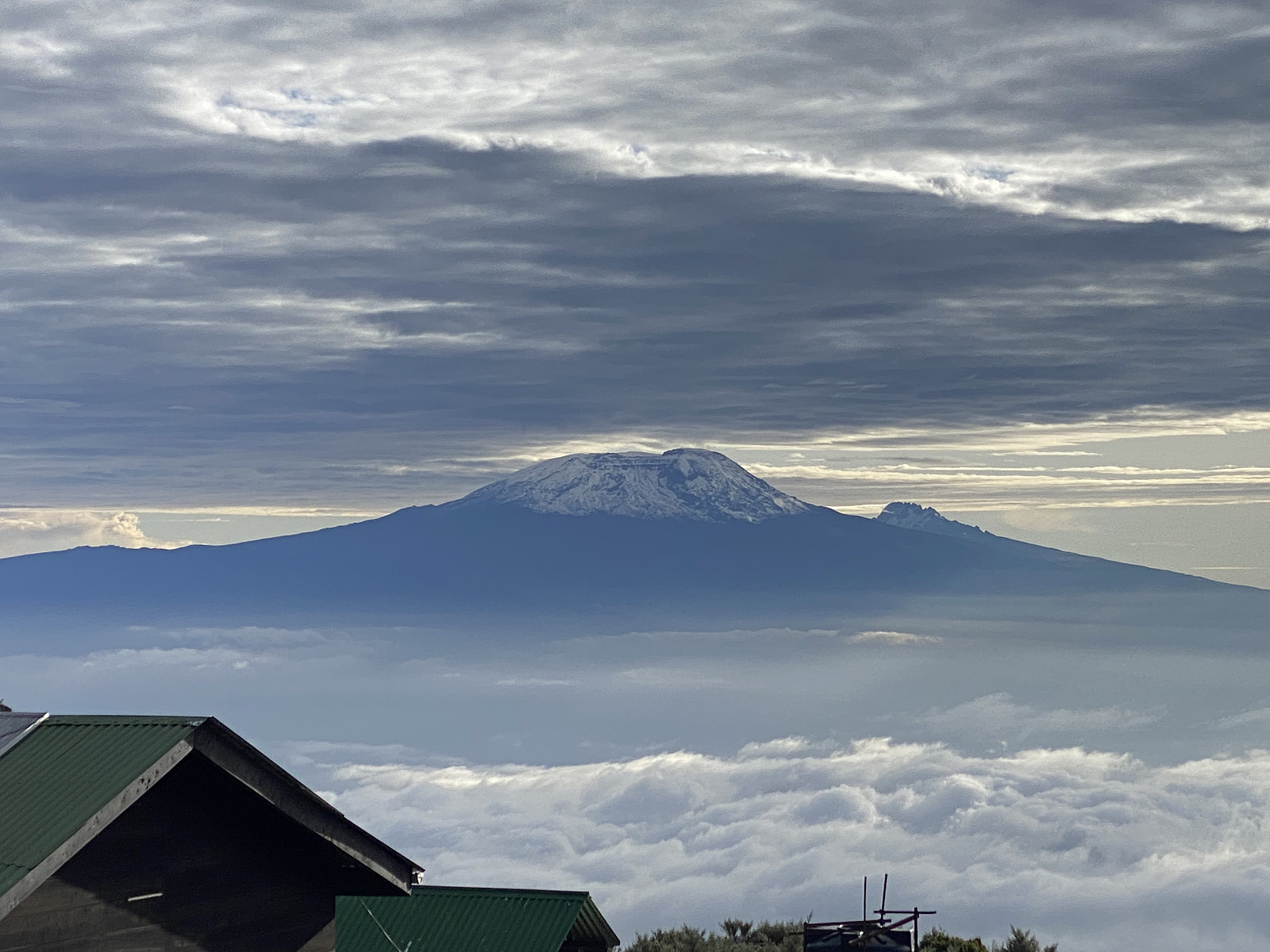
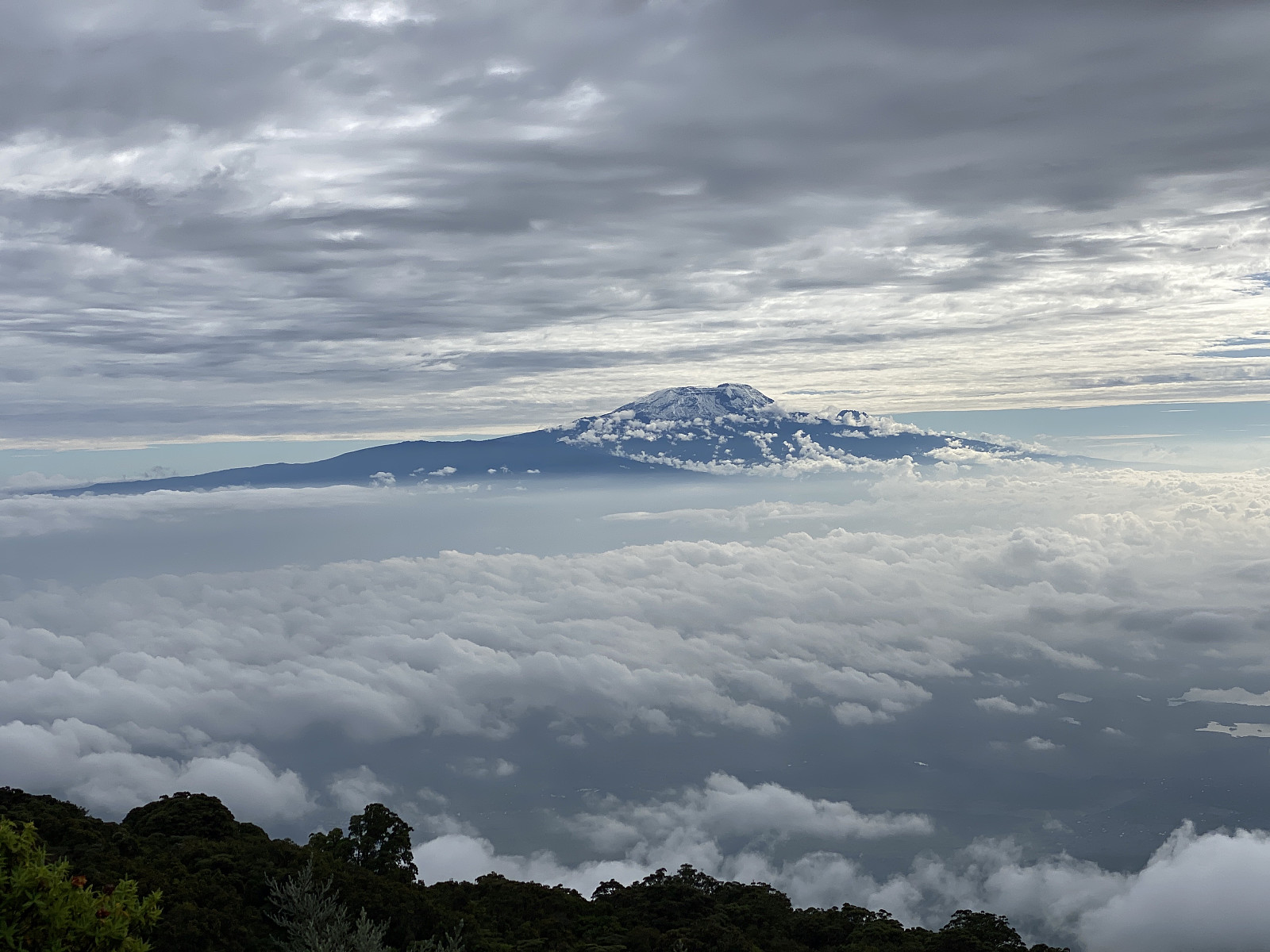
I woke up at about 6 a.m. the next morning after a good nights sleep. I stuffed my sleeping bag back into its storage sack, and started getting ready for the new day. Outside, the weather was not as cloudy as it had been on the previous day, and we could actually see mount Kilimanjaro in the north east, though the summit was covered by clouds. I went through the dining hall, and climbed one of the two towers on the downhill side of it; in order to shoot some pictures and even a video (images ##19-22 and video #1). I soon had to come back down, however, as the one porter that was also the chef's assistant was bringing me hot water, so that I could clean up before breakfast.
The breakfast was served at the same spot that I had received dinner the night before, and it was actually a four-course breakfast. First you get a plate of sliced fresh fruits: Banana, mango, pineapple and avocado. Next, you get served a portion of oatmeal porridge. Third, they bring you an omelett, and finally, you get some bread and a number of pancakes that you're supposed to eat with jam or chocolate spread. This all tastes wonderful, but you have to take care not to have too much porridge, or you'll be unable to have any pancakes. Fortunately, I had told Frank in advance that I'm not a person that eats much, and that they should not expect me to eat as much as other tourists. The reason I had chosen to say this to Frank in advance, was because I had previously had a challenge along this line in the Simian Mountains in Ethiopia, i.e. the staff makes you a huge amount of food, and if you don't consume it all, they get a bit disappointed. The idea is, that unless you eat enough, you won't be able to endure a long day's mountain trek. The truth, however, is that if you actually eat everything that the staff brings you, you won't be able to walk afterwards. Now I have to emphasise, that I'm not including these things in my tour description in order to put the chef, or any of the other staff members in a bad light; I include it in my description in order that my readers might have an idea as to what they should expect when they go mountain trekking in these mountains. The food was great, but the amount of it was way too abundant for me to consume it all.
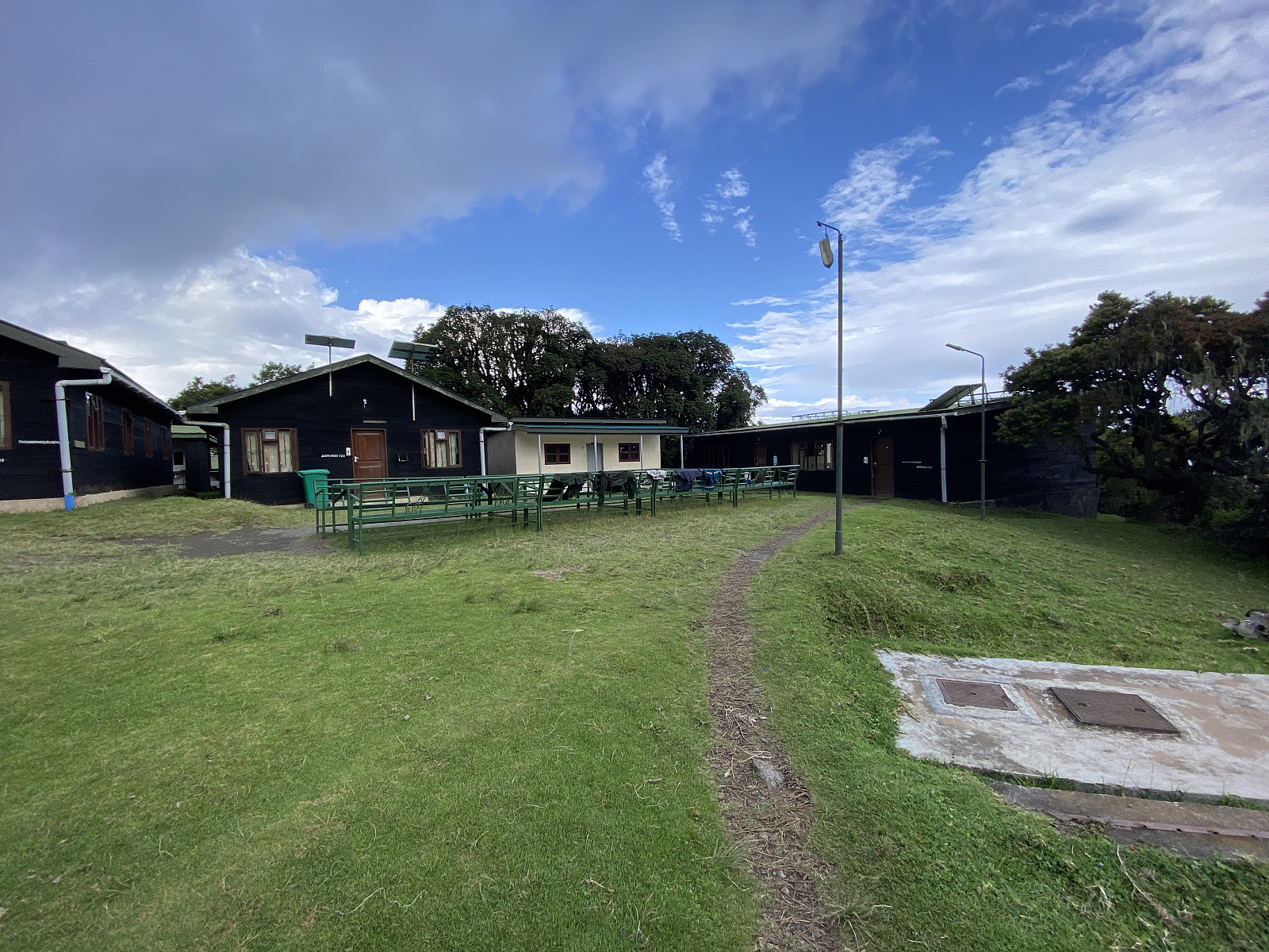
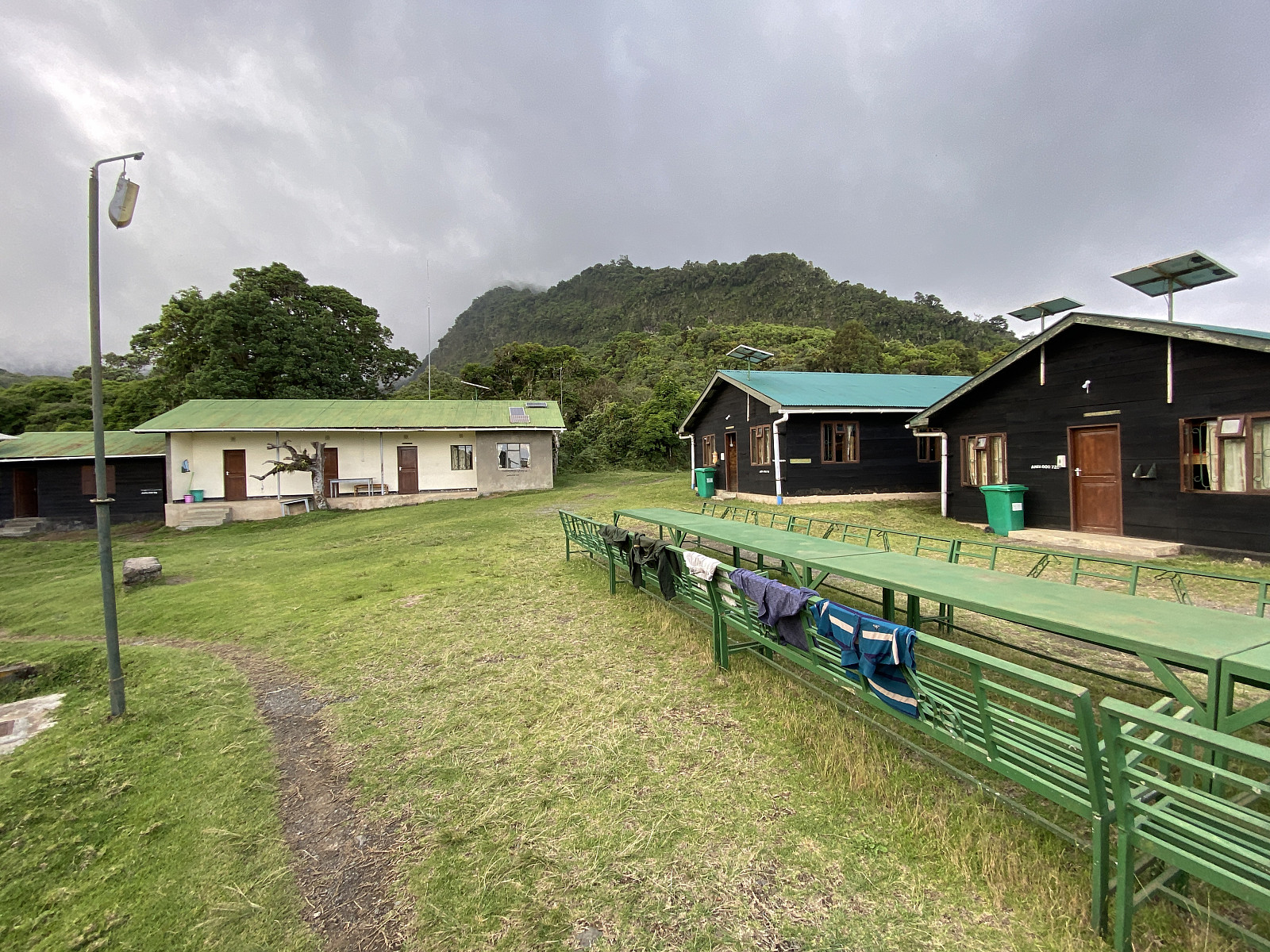
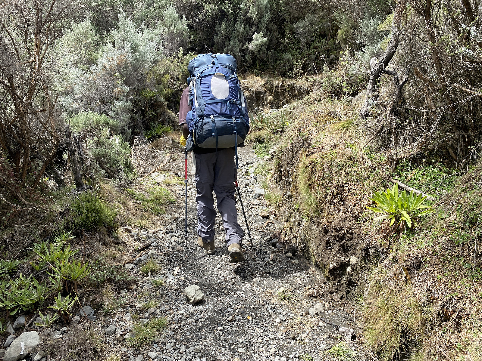
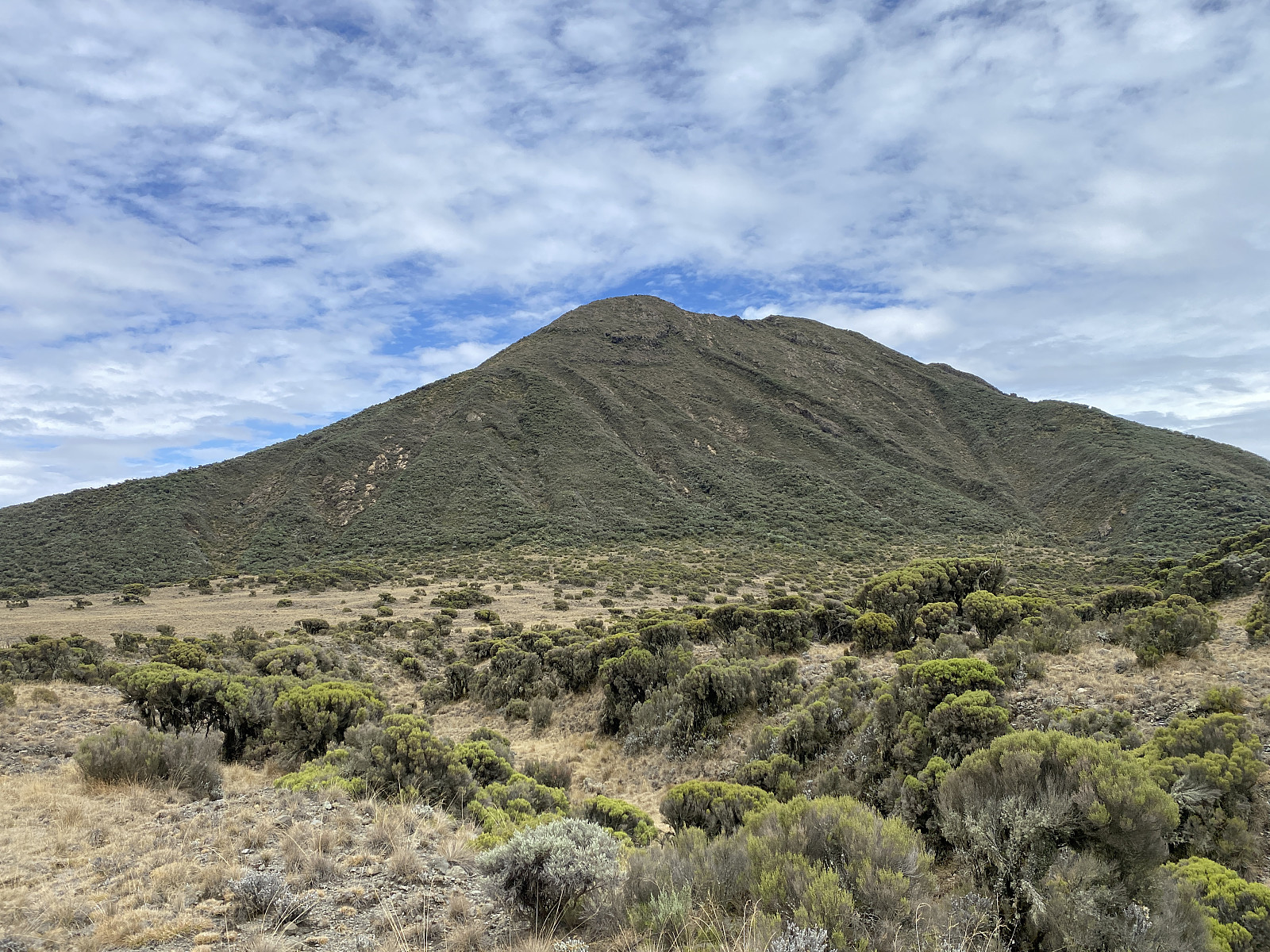
After breakfast I brushed my teeth, and then packed the rest of my stuff. This morning the four of us set out from Miriakamba at about 8:20 p.m.; Holson, me, Frank and the ranger. We hadn't walked long, before we encountered large cake-like poo discs on the trail; larger than cow poo, but smaller than elephant poo. These are buffalo poo, the ranger explained to us, and from their fresh appearance, he could tell that they were only a few hours old. The trail went north to begin with, but then it turned west, and upwards along the mountain ridge that leads up to the Saddle Camp Site [i.e. the mountain ridge seen on image #22]. On all maps that I've seen, as well as on web sites and in tourist brochures, the accommodations on Mount Meru are always referred to as the Miriakamba Hut and the Saddle Hut. I believe these names date back to a time when there was actually just one hut on each of the two sites. Since the two facilities have later expanded, so that there are currently multiple huts on each site, I have largely chosen to refer to them as the Miriakamba Camp Site and The Saddle Camp Site in this tour description.
While we were heading towards the Saddle Camp Site [3560 m.a.m.s.l.], Holson said he had a suggestion he wanted to make for me. He explained that their usual concept is to go to the Saddle Hut, and then up to the summit of Little Meru [3805 m.a.m.s.l.] on the second day of the Mount Meru hike. That usually gives the chef and the porters enough time to bring everything up to the camp, and to prepare things; so that the dinner will be ready when the visitors come back down to the Saddle Hut after their ascent of Little Meru. You are, however, walking too fast for this to work out, he explained to me. So my suggestion is that we have our lunch at the Saddle Hut, and then you and I continue up to the summit of Mount Meru, today instead of tomorrow, while the rest remain at the Saddle Hut to make things ready; and then we ascend Little Meru tomorrow in the early morning before we start our descent from the mountain. I had no objection to his suggestion, as I felt I was already quite well acclimatised, at least to the current altitude; and so I just said I thought it was a good idea. Another great advantage of this slight change of plans, was that it would allow us to get earlier back down to Momella [i.e. the park office site] on the third day; compared to if we were to hike all the way up to the Meru summit prior to our descent from the mountain, which would be good as we were going to transfer to Moshi and Marangu on that day, for our trek on Kilimanjaro.
We arrived at the Saddle Camp Site at about 11:20 a.m., i.e. three hours after we left Miriakamba. Lunch had been prepared for us in advance by the chef, and put in lunch boxes, that we opened, as we sat down on some benches outside the huts of the camp in order to eat. There was a Danish couple at the camp site at the moment, who had just descended from the mountain (whether from the Meru summit or from Little Meru i didn't ask), but they were going to descend from the mountain once they had had their lunch, so even today I was going to be the only mgeni [i.e. visitor] in the camp.
Video #1: The view from the northern "dining hall tower" at Miriakamba the next morning. First we have a fairly nice view of Kilimanjaro, though obscured a bit by clouds. I next turn around to look at the summit of Mount Meru (by some also called the "Socialist Peak"), before I complete my turn to look back once more at Mount Kilimanjaro. My comments in this video are in Swahili, but it shouldn't be too hard to figure out what I'm saying, as I'm just naming the mountains seen.
We spent less than an hour at the camp site, Holson and I, before we embarked on our summit push at about a quarter past 12. We didn't know whether we were going to make it back to the Saddle Camp before darkness or not, so we had our headlights with us in our backpacks. The trail first went westward up to the saddle between Meru and Little Meru, and then turned south west towards a peak called the Rhino Point, located on the ridge between Meru and Little Meru. Holson explained to me that the peak was carrying this name because a Rhino was once encountered up there. I remember i did find the story a bit hard to believe, as the peak is located at 3855 metres above sea level; but on the other hand Rhinos once used to live in abundance by the foot of Mount Meru, so I can't just rule the incident out as impossible. As we were approaching the Rhino point, we noticed a young man that was following us, and who seemed to be catching up with us little by little. As he came closer, we recognised him as a park employee that was currently working at the Saddle Camp as a cleaner. When he finally did catch up with us, he explained that he had never ascended the summit of Meru before, and that he would like to join us for the ascent, if it was OK with us. None of us had any objection, and so he came along with us all the way up to the summit, and thereafter back down to the Saddle Camp.
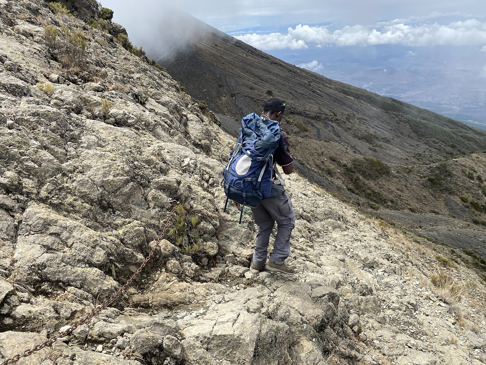
Along the trail, there were some places that were a bit steep sideways, and at these passages chains had been put up (image #26), for trekkers to hold onto if the ground was wet and slippery, for instance. As we made our way towards the summit of Meru, the ground was dry, however, so we were able to just rush past these places. We were a bit worried that it could start raining, though; as there was some thundering and lightening in the distance. I was thinking at a time, that if the lightening continued, and maybe even increased, it could be wise to abort our summit push. After a while the lightening abated, however, and so we just continued towards the summit of the mountain.
![Image #27: View from Mount Meru towards Ol Doinyo Lengai [2962 m.a.m.s.l.] and Mount Kitumbeine [2867 m.a.m.s.l.].](https://images2.peakbook.org/images/14939/Solan_20230122_63cdaf80d1e4e.jpg?p=xtralarge)
![Image #28: View of the Meru Ash Cone, a cone shaped peak [3685 m.a.m.s.l.] with its own crater; located within the larger caldera of Mount Meru.](https://images2.peakbook.org/images/14939/Solan_20230122_63cdb2cb11a87.jpg?p=xtralarge)
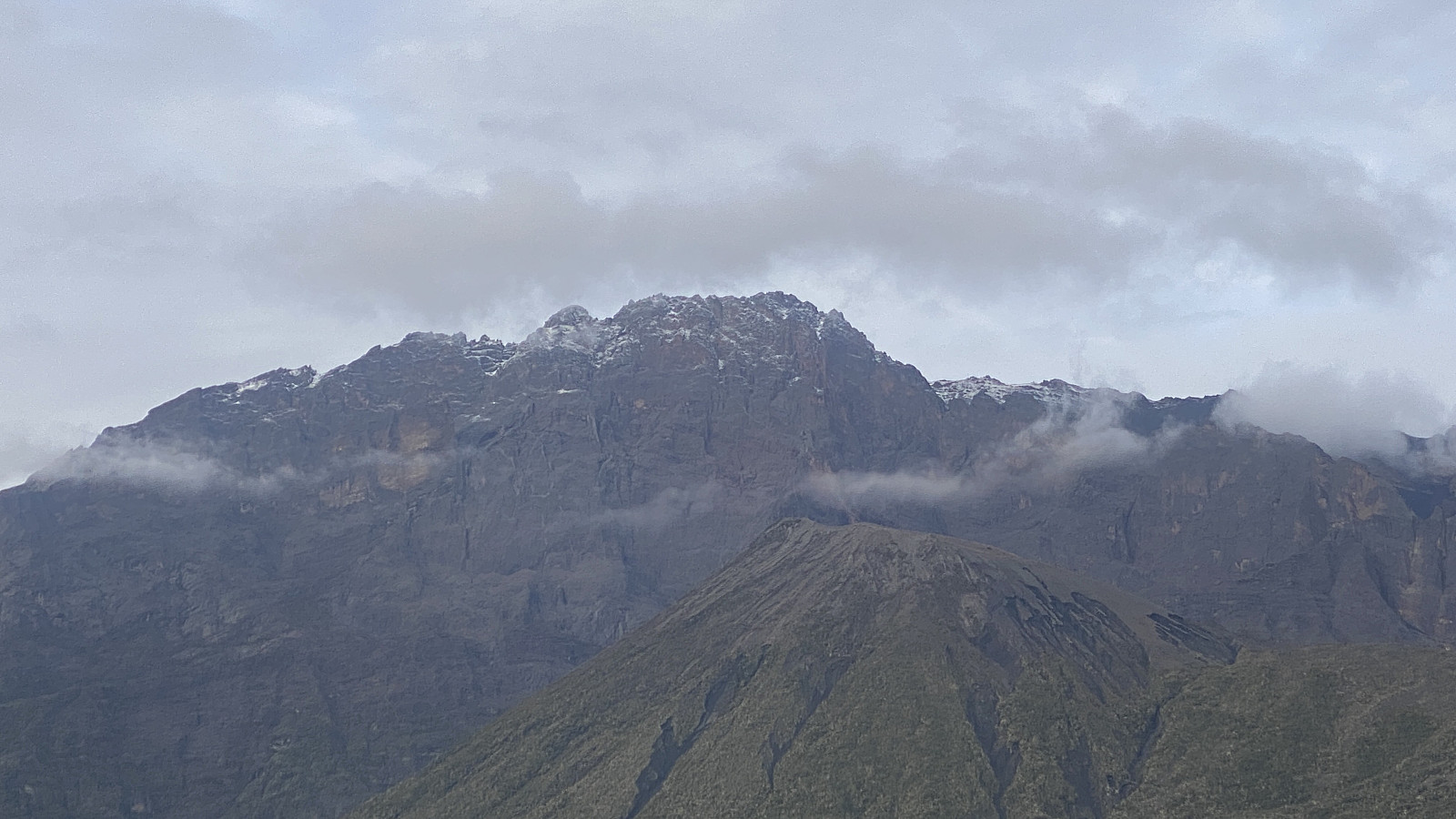
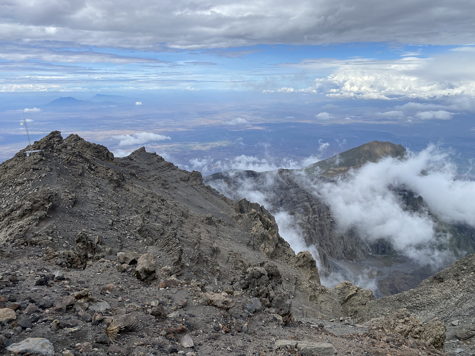
The mountain ridge that we were following is actually the rim of an old volcanic caldera; and as it is curving in a circular fashion; we got to see the steep inside wall of the summit area every now and then from various points along our trail (image #30). Down below us, on the inside of the huge caldera, we could also see the Meru Ash Cone, though it was in part covered by clouds that came and went. The Ash Cone is a smaller, cone shaped volcanic mountain located within the caldera of Meru. It actually has a crater of its own, and had its last eruption in 1910. Unfortunately, I hadn't booked a trek to the Ash Cone this time, but I certainly will if I visit Meru again at some time in the future. [For readers unfamiliar with the term caldera as opposed to a crater: A crater is the opening that is formed when a volcano erupts, whereas a caldera is formed when a volcanic mountain collapses into a subterranean cavity that has previously been filled with magma. A caldera is, therefore, generally speaking, much larger than a crater; and yes, the Ngorongorro "crater" is indeed also actually a caldera].
![Image #30: The summit of Mount Meru [4562 m.a.m.s.l.] in view.](https://images2.peakbook.org/images/14939/Solan_20230123_63ce6e8b892a6.jpg?p=xtralarge)
In the north west we could see Mount Ol Doinyo Lengai [2962 m.a.m.s.l.] and Mount Kitumbeine [2867 m.a.m.s.l.] in the distance (image #27). I had climbed Ol Doinyo Lengai with Frank just a few days earlier, and so it was easy for me to recognise the shape of the mountain. As we spotted it, Holson immediately asked me to shoot a picture of it, as he had been having a discussion with some other mountain guides as to whether it was possible to see Ol Doinyo Lengai from Meru or not. Now he wanted to prove to them that it could be seen from Meru, and so I shot some photos of it for him, first from the ridge on which we were walking, and later on from the very summit of Meru. (At the summit of Meru, there is actually a plate with an inscription that mentions a number of mountains that may be seen from up there, and Ol Doinyo Lengai is mentioned among them).
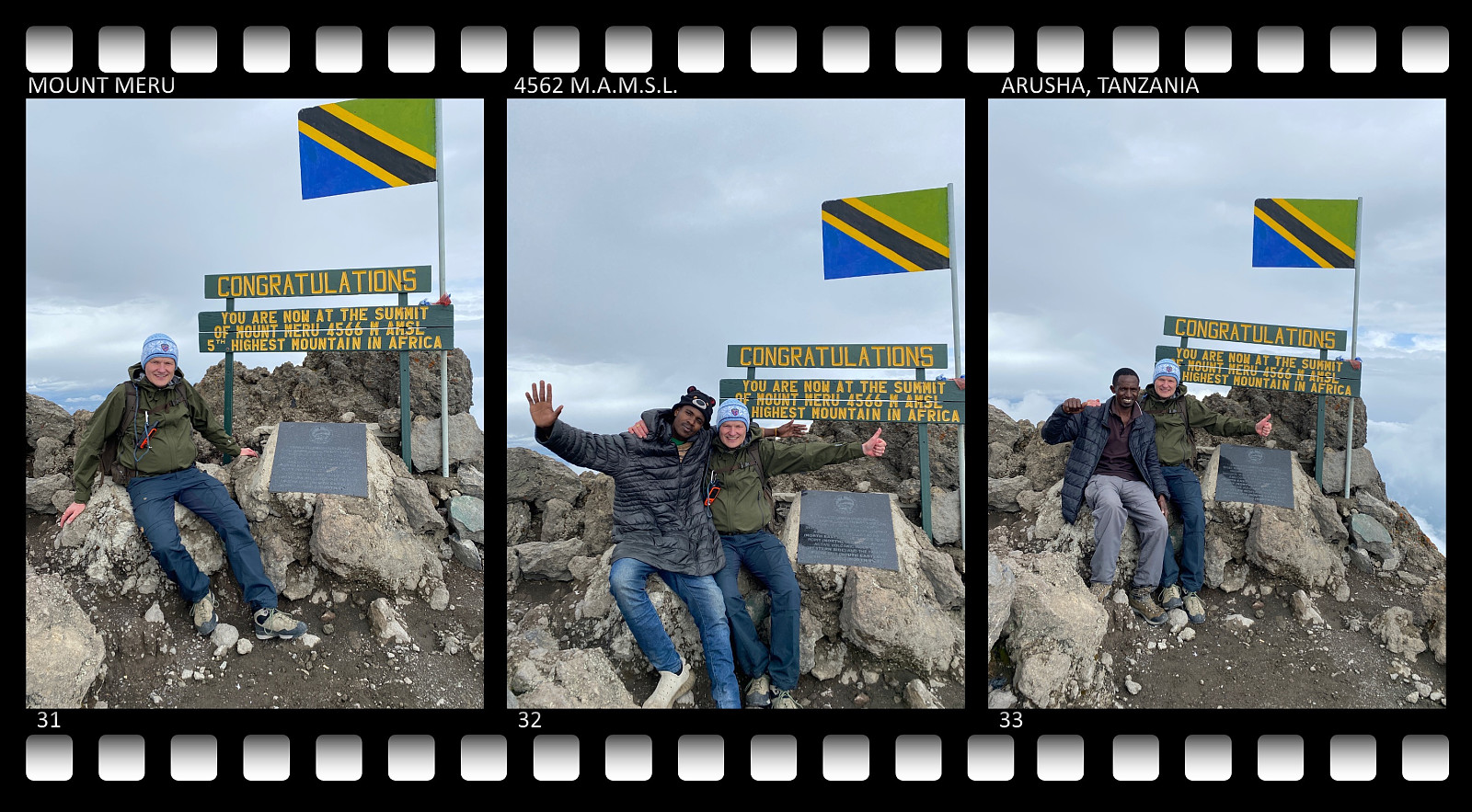
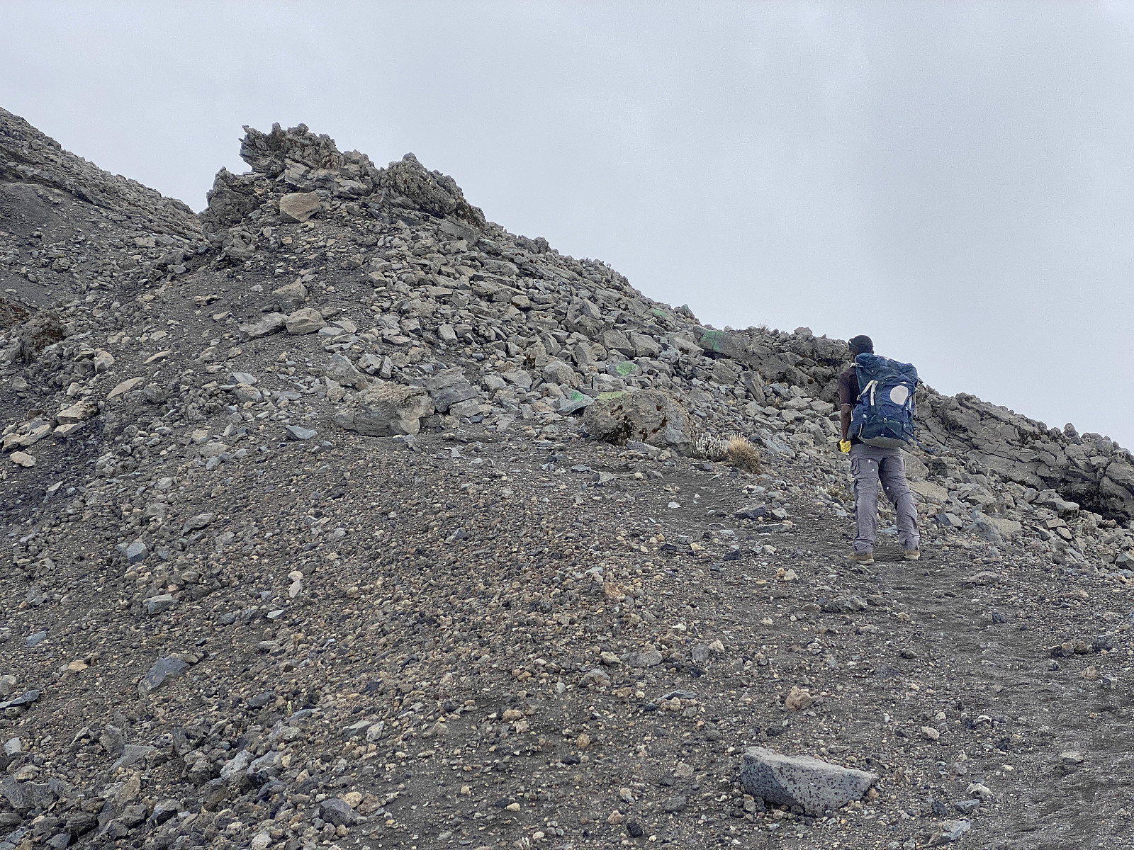
A little later, we passed a huge antenna up there on the mountain ridge, and shortly after we embarked on the final climb towards the summit. We had been gaining altitude little by little most of the way along the ridge (apart from when we descended from the Rhino Point, of course), but there are two places were the climb is quite a bit steeper than elsewhere; the first being the climb up to the Rhino Point, and the second being the final climb up to the Meru summit. Until now I had been quite fine, but as we were climbing the final fifty elevation metres towards the summit, I was definitely feeling a shortness of breath. I was happy I didn't have any symptoms of altitude sickness, however; no headache and no nausea. It meant that my strategy for acclimatisation had worked so far, and a little shortness of breath was of course something that should be expected at this altitude.
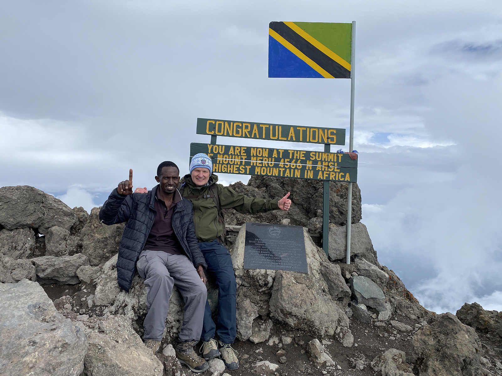
We reached the summit at about 10 past 3, a little less than three hours after we left the Saddle Camp. At the summit we congratulated each other, the young park employee and I; and we were both congratulated by Holson, who had been at this summit many times before. We then captured a lot of pictures, before we sat down and had something to eat and drink. We were at the summit for about half an hour, and then we started descending. Our descent followed the same route that we had used for our ascent. To begin with we had to go slowly and carefully, in order not to trip in the steep mountain side, but as the slopes became less steep, we started jogging a little; since we were now going downhill, and downhill direction allows jogging, even at this altitude. When we reached the slopes leading up to the Rhino Point, I took a deep breath, and then pressed on as hard as I could for this short climb, as I regarded it as an opportunity to get even more altitude training, and thereby hopefully even more elevation adaption. We had a short break on top of the Rhino Point, in order to regain breath, as well as to have some more water. The trek from the Rhino Point down to the camp was uneventful, though I had to stop once to empty my trekking boots for small stones, as the ground here was quite sandy, and sand and small gravel stones tended to enter into my boots.
![Image #37: The Meru Ash Cone [3685 m.a.m.s.l.] as seen from the summit of Mount Meru. As the semicircular mountain ridge that forms Mount Meru and its ridges, is what remains of a very old volcano, the Ash Cone is actually a young volcano within an older one. It is possible even to summit the Ash Cone setting out from Miriakamba, but I hadn't included that in my booking for the current trip.](https://images2.peakbook.org/images/14939/Solan_20230123_63ce860e66924.jpg?p=xtralarge)
We were back down at the Saddle Camp at about a quarter to six, i.e. 5 1/2 hour after we left. The rest of our company hadn't expected us back this soon, but dinner was nevertheless soon ready. The Saddle Camp was quite nice, and had about the same facilities as the Miriakamba Camp. My room was a four bed room almost identical to the one that I had had at Miriakamba. The dining room was a little bit smaller, but still more than large enough, especially since I was the only one eating in there. I went to bed early even this evening, as I knew I had to get up early the next morning. Holson had told me that the sunrise might be quite beautiful on Little Meru, so we should try to be up there in time for us to get a view of it.
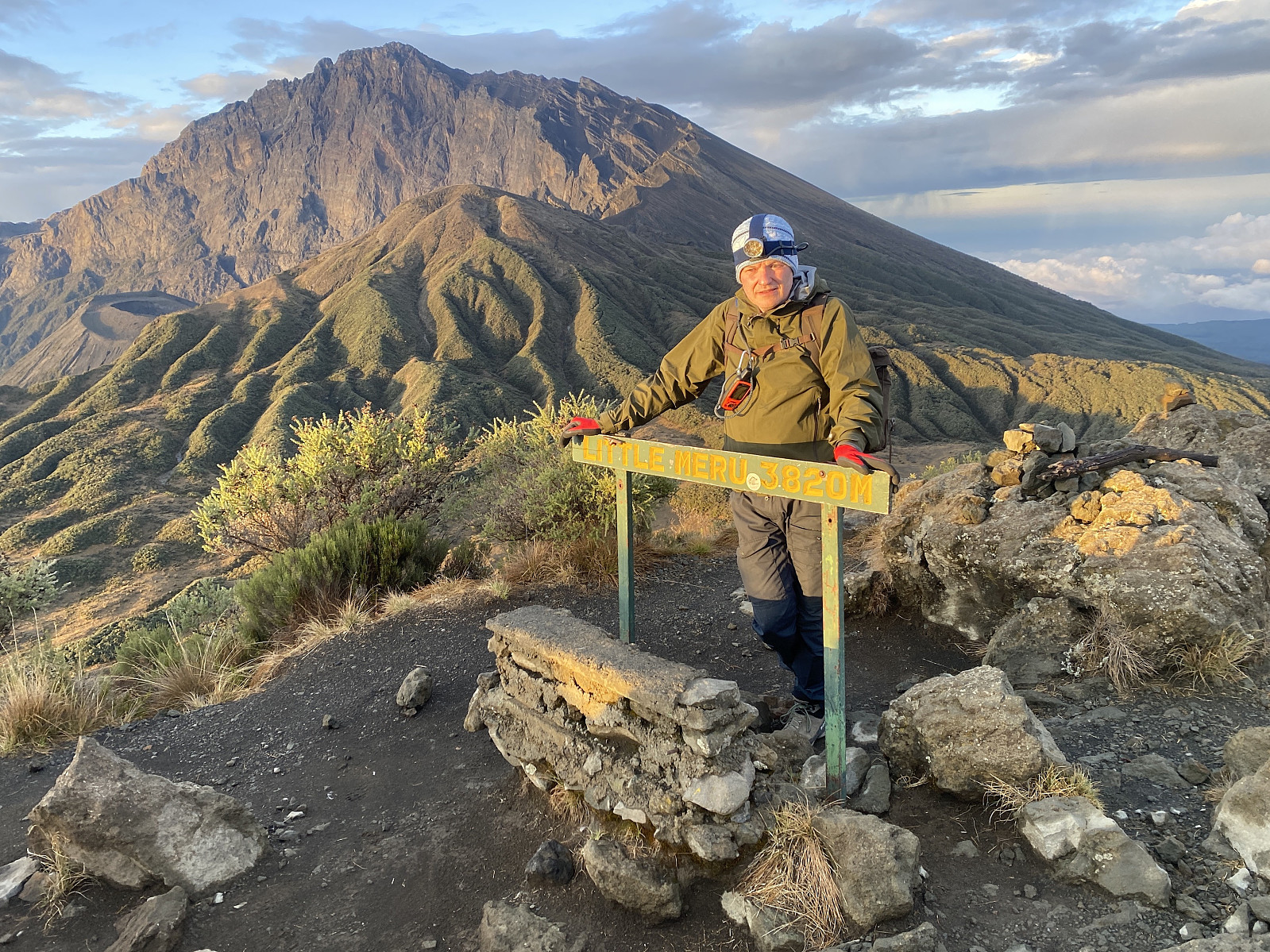
Day 3 - To Little Meru, and Down to Miriakamba
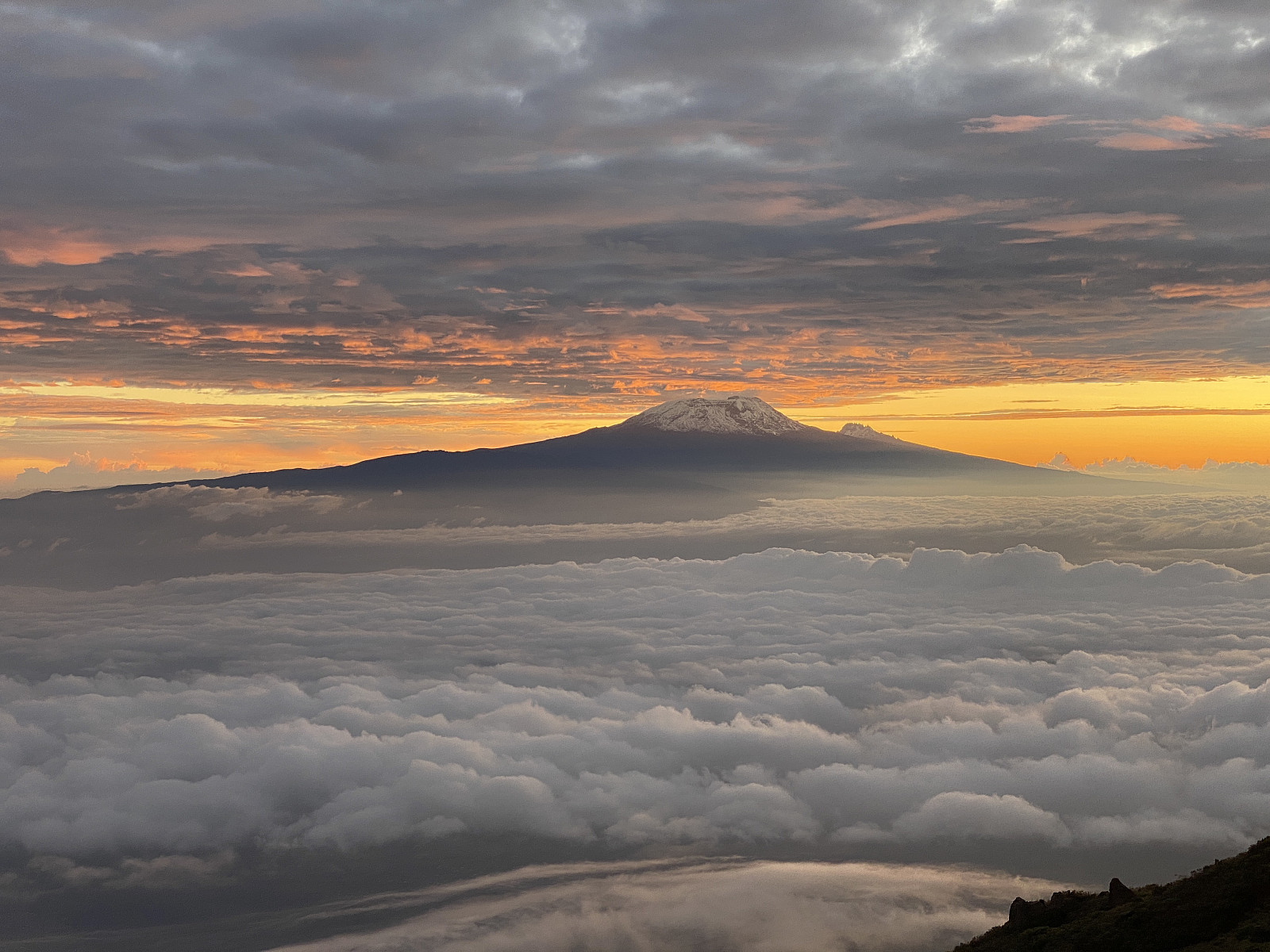
I woke up before 5 this morning, as our plan was to be on top of Little Meru by sunrise. We had agreed to start our climb by half past five, Holson and I, but we were both a little bit delayed, so we didn't start until twenty to six. Nevertheless, we pressed about as hard as we could up the slopes, in order to reach the top of this peak in time for the sunrise. Det hike from the Saddle Camp up to Little Meru is not long; the climb is only about 240 elevation meters, and about 700 meters along the trail, and so we reached the top about 2 minutes past six or so. Whether that was in time for the sunrise or not, I'm not sure; as it was anyway too cloudy for the sunrise to be seen from this location. Mount Kilimanjaro was, however, bathed in a very nice morning light (images ##40-41 & video #2), and even the peak of Mawenzi [5149 m.a.m.s.l.] could be seen very well in the same morning light just to the right of Kilimanjaro.
![Image #41: Zooming slightly in on Mount Kilimanjaro. Mawenzi [5149 m.a.m.s.l.] is the peak to the right.](https://images2.peakbook.org/images/14939/Solan_20230123_63ce8e9b35a85.jpg?p=xtralarge)
In the opposite direction we could see the Meru summit bathed in a similar morning light, and the Rhino Point as well as the Ash Cone below it. And down there, below the Rhino Point was the basecamp, i.e. the Saddle Camp. We stood there on top of Little Meru fore a while, and captured a number of photos while we admired the view; and then we descended back down to the Saddle Camp. Back down in the camp, the others were also up by now, and breakfast was almost ready. While Holson and I had been at the summit of Meru the previous afternoon, Frank had been busy on phone and online, making the final arrangements for our next hike (i.e. the Kilimanjaro hike).
Video #2: The sunrise is said to be quite nice when observed from Little Meru. On this particular morning it was obscured by clouds, however, but we did get a very nice view of Kilimanjaro [5895 m.a.m.s.l.] and the peak called Mawenzi [5149 m.a.m.s.l.], which is the steep one just to the right of Kilimanjaro. In this movie I turn around to face the summit of Mount Meru [4562 m.a.m.s.l.], as well as the peak called the Rhino Point [3877 m.a.m.s.l.]. I then turn towards the Meru Ash Cone [3685 m.a.m.s.l.], and finally towards the Saddle Camp Site [3570 m.a.m.s.l.], before I turn back towards Mount Kilimanjaro and Mawenzi once again.
![Image #42: A view of the Meru summit [4562 m.a.m.s.l.] from Little Meru. The peak in front of it is the Rhino Point [3877 m.a.m.s.l.], and down to the left, the Meru Ash Cone may be spotted [3685 m.a.m.s.l.].](https://images2.peakbook.org/images/14939/Solan_20230123_63ce98f9bc757.jpg?p=xtralarge)
![Image #43: The Saddle Camp Site [3570 m.a.m.s.l.] as seen from Little Meru. We started out from the camp site at 5:40 a.m., Holson and I, and were able to reach the summit at about sunrise.](https://images2.peakbook.org/images/14939/Solan_20230123_63ce99f95a34d.jpg?p=xtralarge)
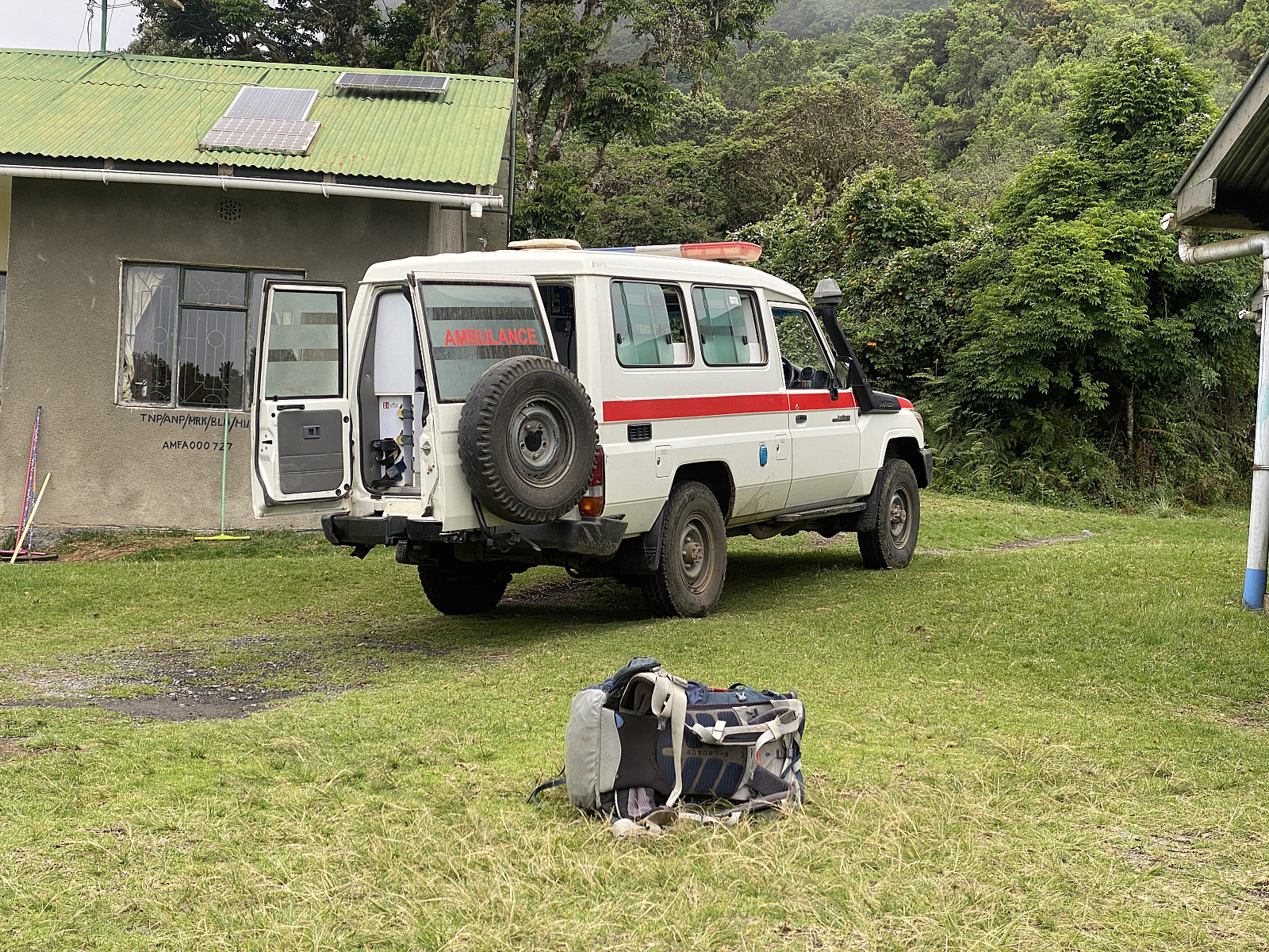
What concerned Frank a bit, was that we were going to embark on our Kilimanjaro climb the very next day, and we had to pick up two tents in Moshi, among other things, prior to that climb. Frank was a bit eager, therefore, to be able to sort out all such things this very day, so that we wouldn't be delayed by these issues the next morning prior prior to our trek on Kilimanjaro. Now there is a drive of about 2 hours from Momella to Moshi (about 75 km), and so Frank wanted us to get quickly down from Meru, in order that we could transfer early to Moshi; and he had therefore been busy on the phone in order to arrange for a park vehicle to meet us at Miriakamba and take us down to the park office at Momella.
![Image #45: On Little Meru [3805 m.a.m.s.l.], with Kilimanjaro [5895 m.a.m.s.l.] and Mawenzi [5149 m.a.m.s.l.] in the background.](https://images2.peakbook.org/images/14939/Solan_20230123_63cea179aeb62.jpg?p=xtralarge)
The hike down from the Saddle Camp to Miriakamba was uneventful. We started out at five minutes to eight, and followed the same trail down as we had followed upwards the previous morning; and arrived at the Miriakamba Camp at half past nine. At Miriakamba a park vehicle (image #49) was waiting for us. We ate what we had in our lunch boxes, and then got into the car, and followed the forest road down to Momella.
The trip down to Momella by car didn't take long. The road was rather narrow, but concrete had been casted in two long stripes (for the right and left wheels, respectively) along the steepest and previously muddiest parts of the road. The driver obviously knew the road by heart, as he was driving much faster than I would've been able to do along this narrow road. Even he got a surprise at one point, however, as we came out of a particular curve, and only barely escaped a herd of buffaloes that were just about to cross the road. The lower part of the road was the very same that we had been walking on as we made our way up to Miriakamba two days earlier, and yes, we did drive right through the fig tree arch, without even slowing down a bit... At Momella our own driver from Kili Hike Adventures was waiting for us with a car that took us to Moshi, and thereafter to the village of Marangu for our next mountain hike.

User comments