Tour Skiing to Mount Fingeren with my Daughter (25.04.2021)

| Start point | Standalsvatnet Parking Lot (370m) |
|---|---|
| Endpoint | Standalsvatnet Parking Lot (370m) |
| Duration | 2h 58min |
| Distance | 6.9km |
| Vertical meters | 775m |
| GPS |
|
| Visits of other PBEs | Standalhytta (396m) | 25.04.2021 12:58 |
|---|---|---|
| Standalsvatnet parkeringsplass (370m) | 25.04.2021 12:58 | |
| Ved Fingeren (1,140m) | 25.04.2021 12:58 |
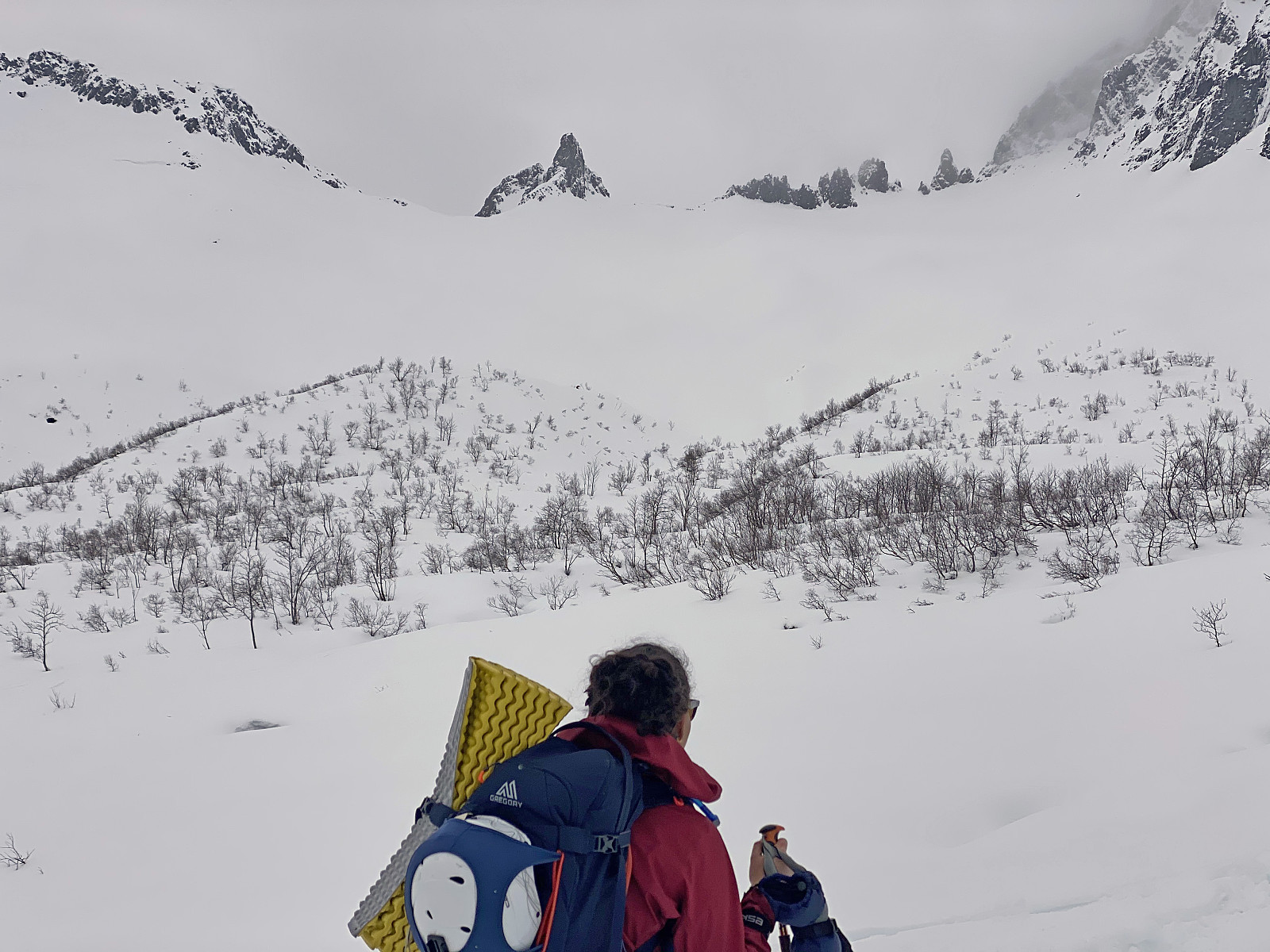
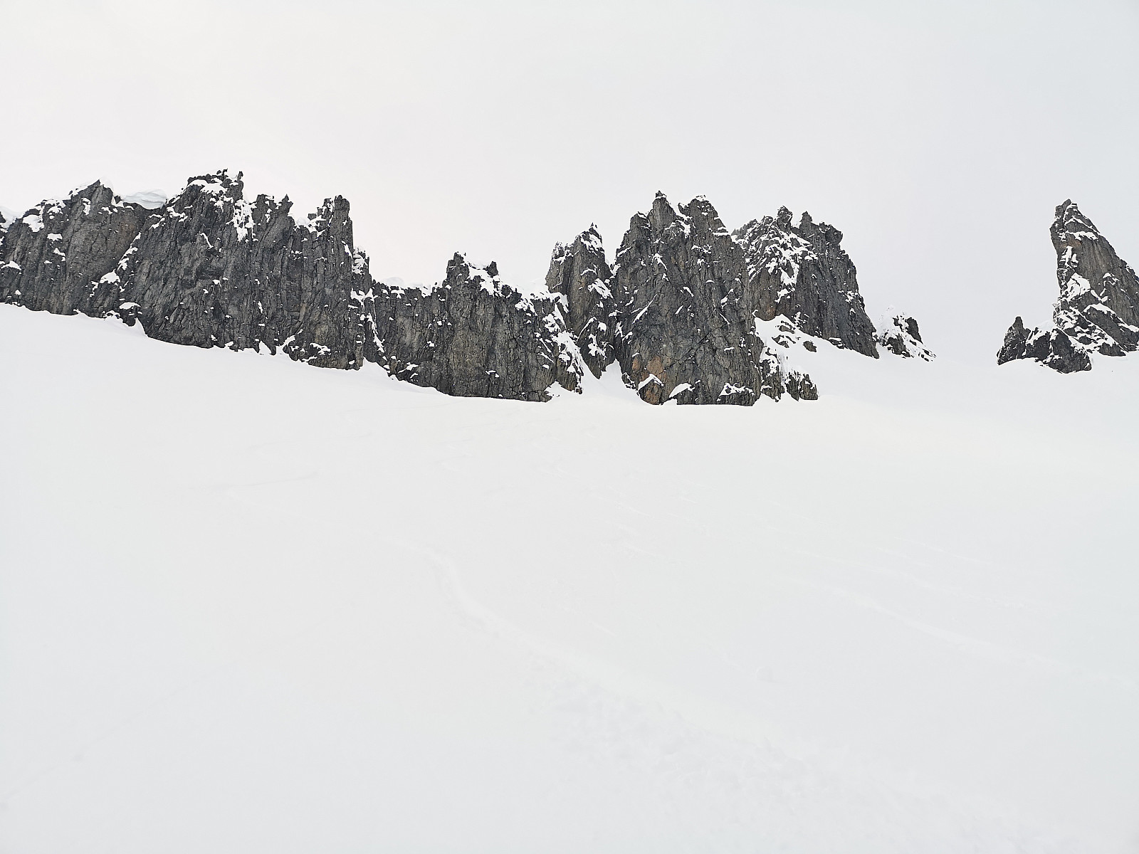
This morning my daughter suggested to me that we make a ski tour to Mount Fingeren. This mountain is actually just a peak on the southwest ridge of the much greater Mount Kolåstinden, but it has become a popular destination for ski touring during winter, as well as for hiking in summer. During the winter season it is common just to go skiing up to a viewpoint just northeast of the peak; whereas during summer, and especially so when weather is nice, it is actually possible to climb up to the summit of the peak itself. The trail most commonly used to the summit of Mount Kolåstinden, however, goes on the opposite side of the mountain, and actually crosses a glacier on its way up to the summit. The peak on the southeast ridge has been named "The Finger", because it looks like a third digit pointing upward in a "fuck you" manner.
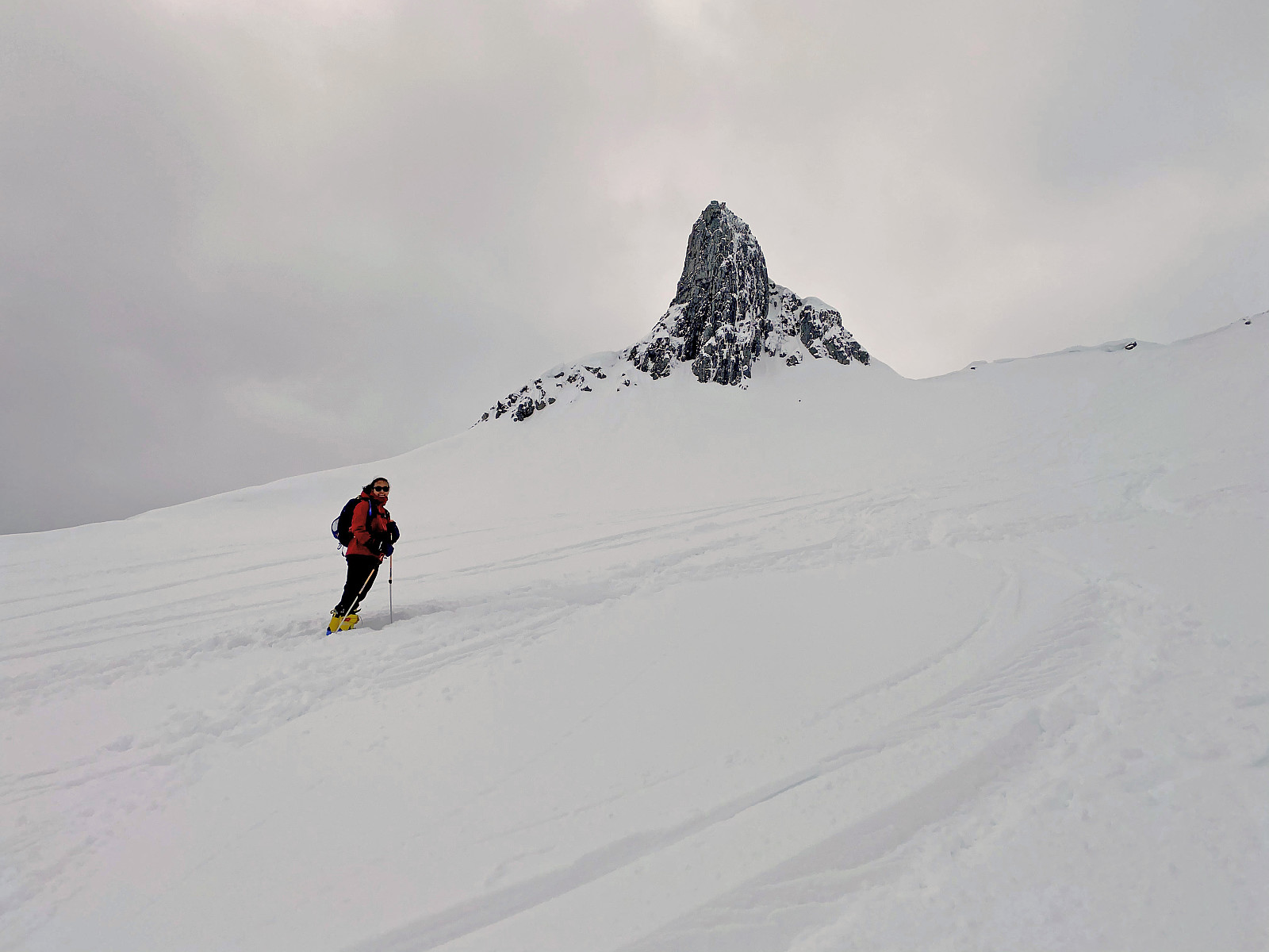
![Image #4: "The Finger" is actually not really a mountain per se, but rather a knoll on the southwest ridge of the much larger Mount Kolåstinden [1432 m.a.m.s.l.].](https://images2.peakbook.org/images/14939/Solan_20210804_610af3ca914cf.jpg?p=xtralarge)
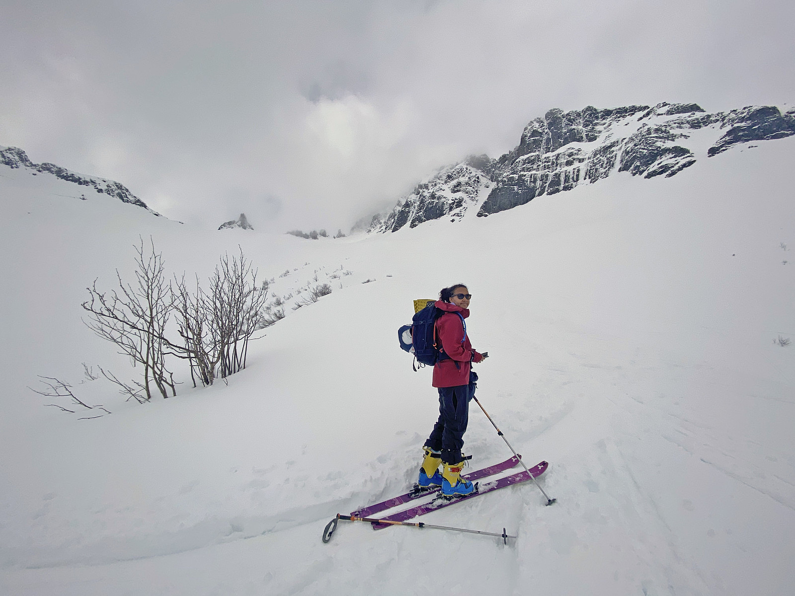
We drove in my daughter's car, crossed the ford by ferry; and continued on to the village of Store-Standal. From there we drove up in the mountain area, until we reached the parking lot at a mountain cabin called Standals-hytta (see map). We left the car there, had our skis on, and started skiing. Once we had passed Standals-hytta cabin, we could actually see "The Finger" far up in the mountain. The weather was a bit cloudy, but not in such a manner that it caused any fog below the altitude of about 1200 meters or so. A lot of people had gone skiing to "The Finger" earlier this day, and so there were a lot of trails to follow. We took care, though, to avoid going too close to the east ridge of Mount Kolåstinden, as we figured there was likely to be a slight risk of being caught by an avalanche if we were keeping too close to that mountain ridge. We eventually reached the "foot" of "The Finger", where we took our skis off; and had a little to eat and drink before we embarked upon our descent from the mountain.
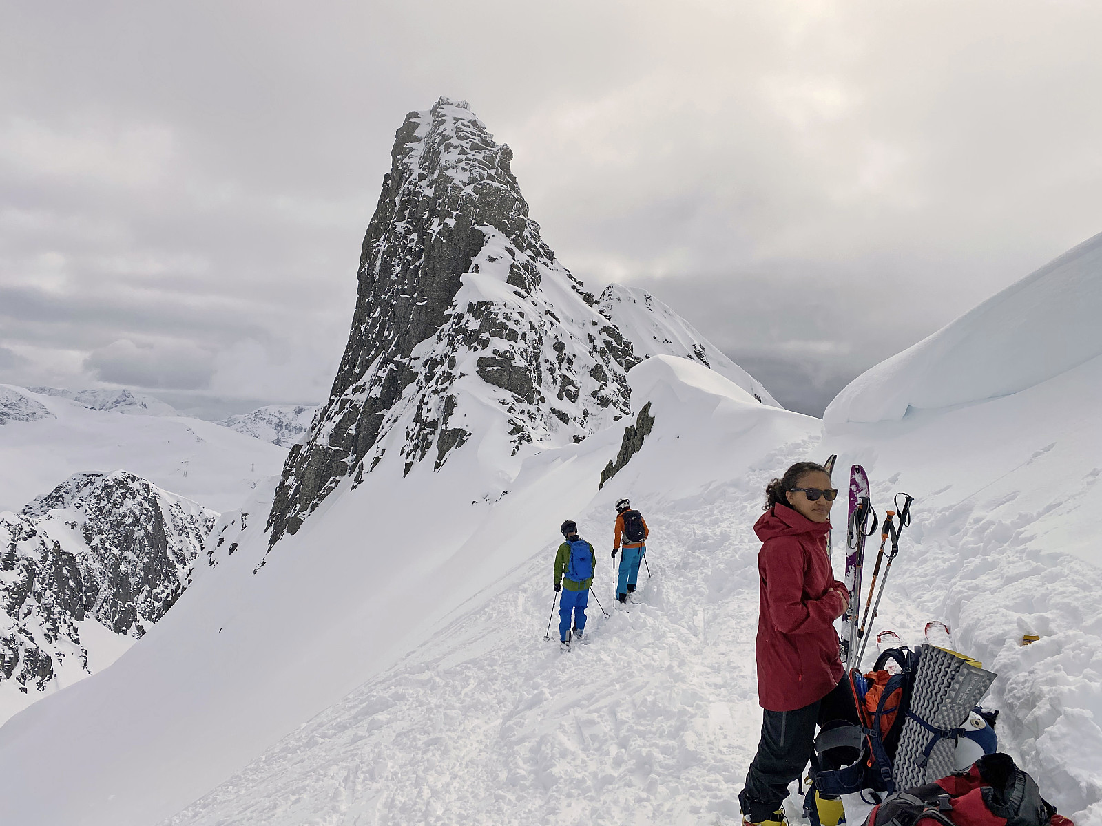
While eating and drinking, we even shot some images up there, and then we put our helmets on, removed the skins from underneath our skis; and embarked upon our descent. Going downhill was quite funny on this day, as the upper 20 or 30 cm of snow was indeed very powder-like. Shortly later we were back by my daughter's car, where we changed back to ordinary clothes; and thereafter started driving homewards.
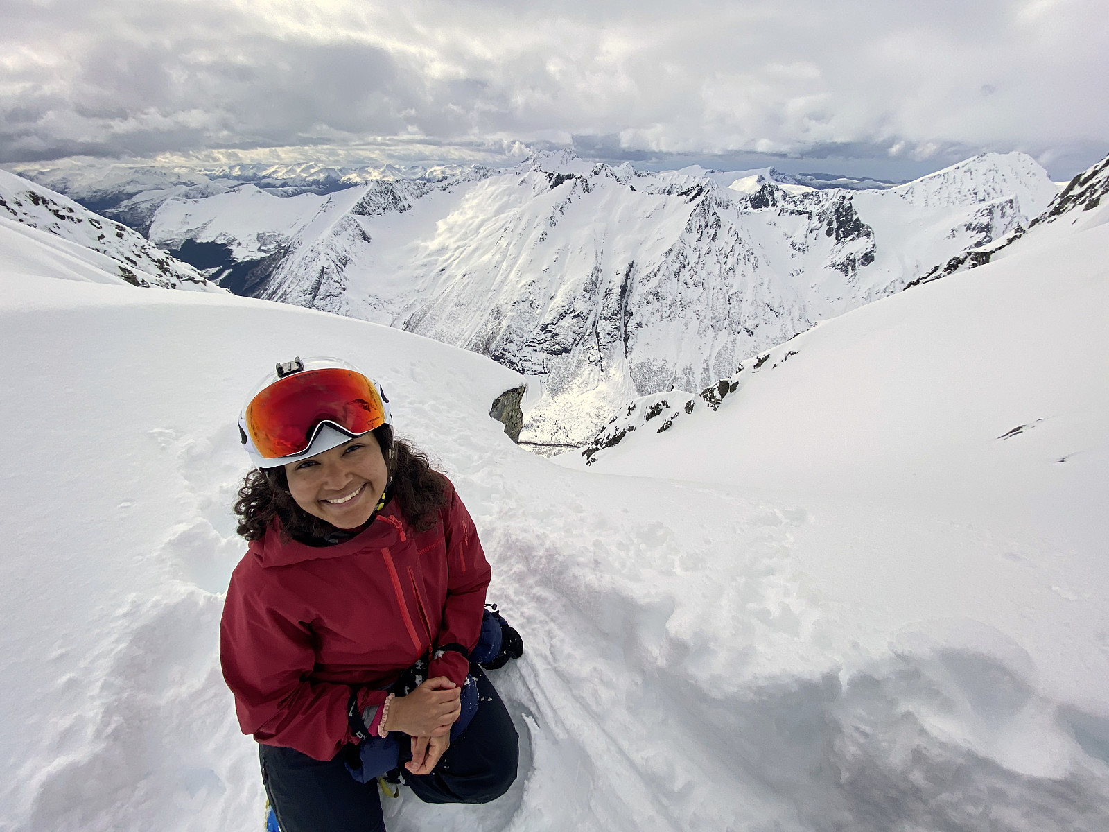
![Image #8: Standing in front of the mighty Mount Kolåstinden [1432 m.a.m.s.l.]. The southwest ridge of the mountain is seen in the left part of the picture.](https://images2.peakbook.org/images/14939/Solan_20210804_610b00b01a684.jpg?p=xtralarge)

User comments