Alpine Ski Tour to Mount Litleskjerdingen with my Daughter (24.04.2021)

| Turlengde | 3t 40min |
|---|---|
| Distanse | 9,3km |
| Høydemeter | 840m |
| GPS |
|
| Bestigninger | Litleskjerdingen (678moh) | 24.04.2021 |
|---|---|---|
| Andre besøkte PBE'er | Reset p-plass (305moh) | 24.04.2021 |
![Image #1: At Reset Parking Lot [312 m.a.m.s.l.], which is located on the mountain ridge that separates Nakkedalen Valley from Vatnedalen Valley. This parking lot is frequently also used by people ascending Mount Frostatinden.](https://images1.peakbook.org/images/14939/Solan_20210424_60847d27af203.jpg?p=xtralarge)
![Image #2: Mount Litleskjerdingen [678 m.a.m.s.l.] as seen from the parking lot. We usually start out from a parking lot further down the valley when ascending Mount Skjerdingen, but that one had no vacant places on this particular day.](https://images1.peakbook.org/images/14939/Solan_20210424_60847d971e982.jpg?p=xtralarge)
I have ascended Mount Blåskjerdingen [1069 m.a.m.s.l.] multiple times, on foot during summer, as well as on skis during winter; thought I have to point out that we’re generally satisfied with visiting the south summit [1061 m.a.m.s.l.] of the mountain during winter, as the north, or main summit, is generally inaccessible when you go skiing. And so, the south peak of the mountain was actually our goal even on this occasion. Nevertheless, on this particular day, my daughter and I ended up with turning around at about 800 m.a.m.s.l.; and so we didn't actually reach any of the two summits of Mount Skjerdingen/Blåskjerdingen.
![Image #4: On top of Mount Litleskjerdingen [678 m.a.m.s.l.], with Mount Blåskjerdingen [1069 m.a.m.s.l.] in the background.](https://images1.peakbook.org/images/14939/Solan_20210424_60847f8a97b03.jpg?p=xtralarge)
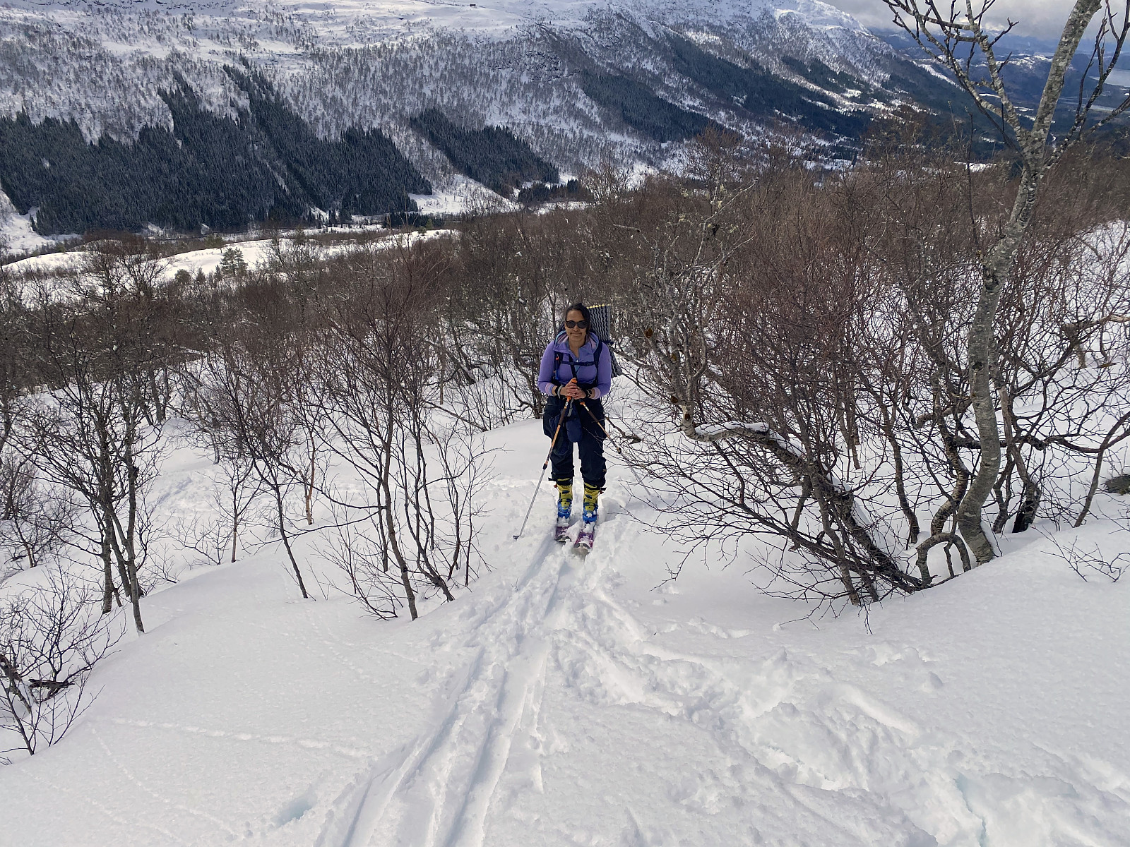
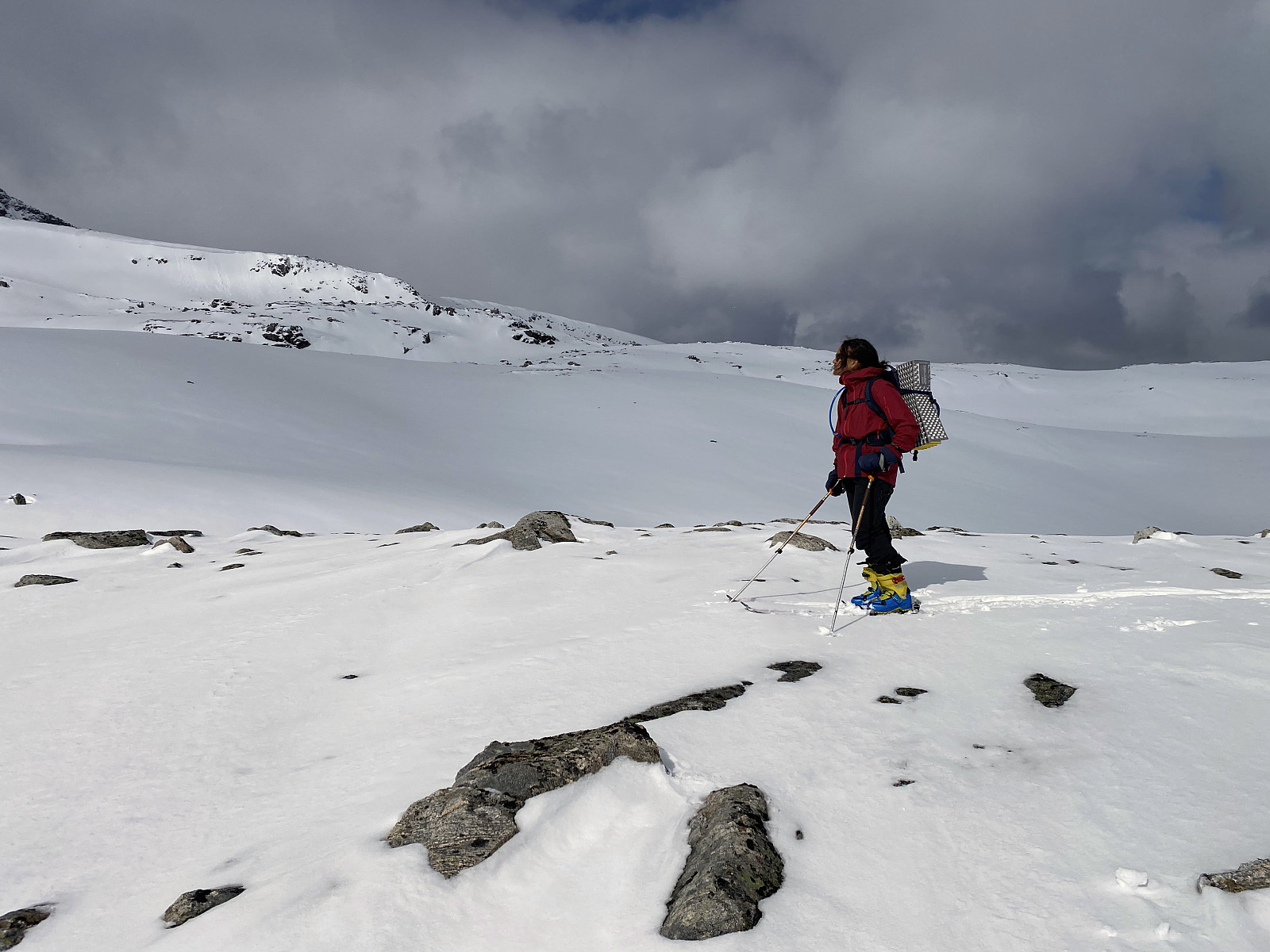
When ascending Mount Blåskjerdingen, we usually park at a little parking lot located at about 214 m.a.m.s.l. in the valley called Vatnedalen (se map / GPS tracking). On this day, there were no vacant parking spots down there, however, and we drove up to the watershed area between the valleys of Nakkedalen and Vatnedalen; where there is a much more spacious parking lot (image #1), and started skiing from there. When starting out from that spot, however, you have to either circumvent Mount Litleskjerdingen [678 m.a.m.s.l.], or cross over it in some manner. Now, on this day, a couple of ladies had just set out from the same parking lot on snowshoes, apparently aiming for the same mountains as us; and so we just followed their trail, assuming they were familiar with the route. The trail that they had left behind led us across Mount Litleskjerdingen, though about four hundred meters west of the summit; and since my daughter hadn’t previously been on top of Mount Litleskjerdingen, we left the trail of the ladies for a short while, aiming for the summit of Litleskjerdingen. As we were moving east along the top plateau of the mountain, snow started sticking to my daughter’s ski skins, however, in such a manner that skiing became quite challenging for her. As we reached the summit, she was quite happy to remove the skins, therefore; and switch her shoes and bindings into downhill mode.
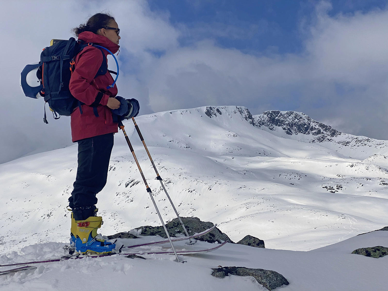
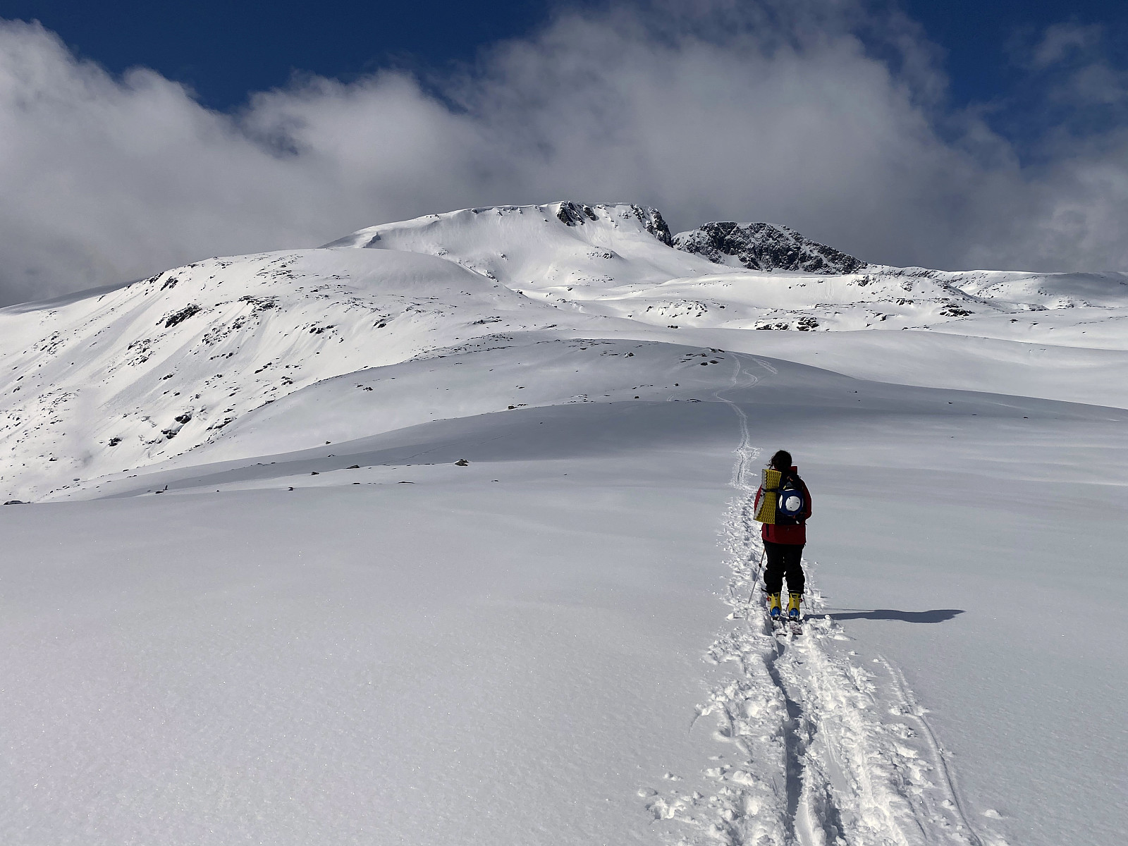
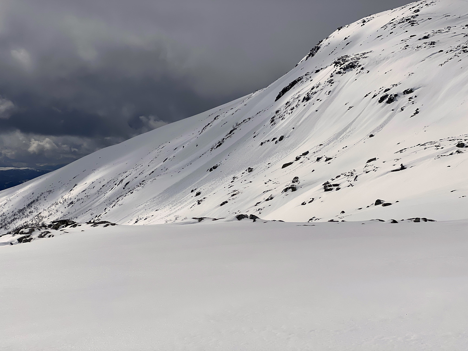
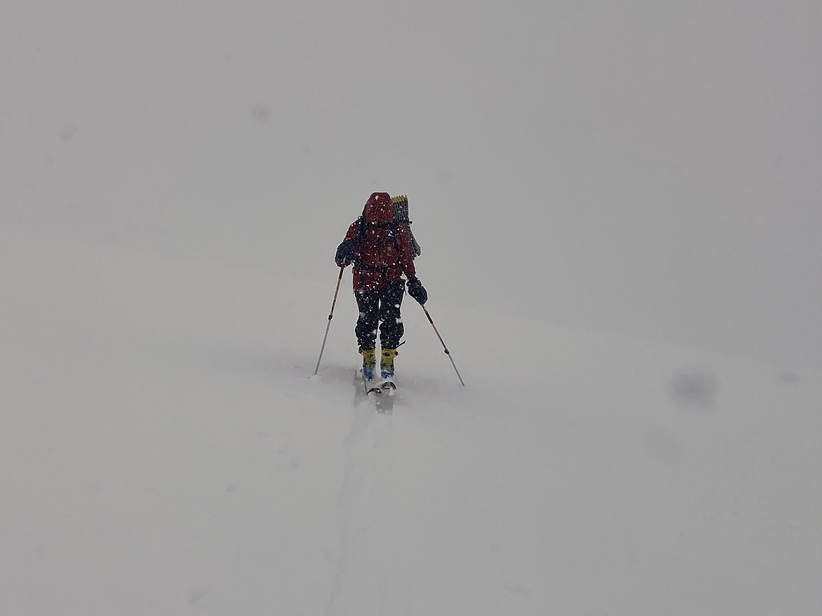
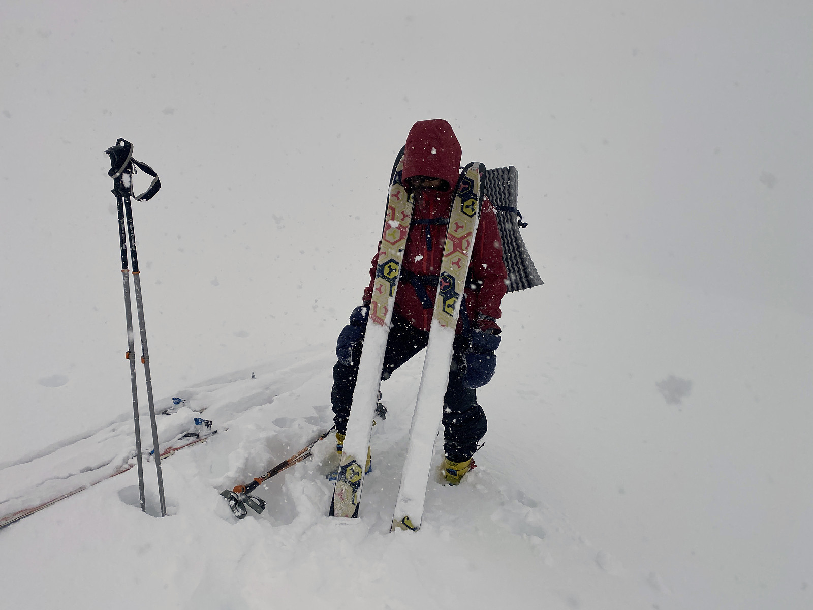
We went back to the snowshoe trail that we had been following, and continued along the trail, down from Mount Litleskjerdingen onto a ridge that connects Mount Litleskjerdingen to Mount Blåskjerdingen; i.e. the ridge called Skjerdingsreset. On the lowest point of this ridge we had to stop and put our skins back onto our skis, however; and even set our boots and bindings back into walking mode. We started climbing again, and at first we were quite fine. Approaching Mount Blåskjerdingen from this angle offered a new view of the mountain's east side, and suddenly it dawned upon me why the mountain is called Blåskjerdingen. Now, blå is the Norwegian word for blue, and the mountain is interchangeably called Skjerdingen and Blåskjerdingen by different people; but my impression has been that the locals living nearby the mountain, actually uses the term Skjerdingen in reference to the south peak of the mountain, and Blåskerdingen in reference to the north peak of the mountain. When approaching the mountain from the angle that we now did, that made perfectly sense, as so much of the blue/grayish rock of the northern half of the mountain was visible from where we were now coming. We checked an inclination app to make sure we didn't run into an avalanche risk by climbing in too steep a mountainside; as this was a different route up Mount Blåskjerdingen from what we had previously used. We could see that a number of avalanches had recently taken place in a rather steep mountainside to the left of us (image #7); but the route that the two ladies with snowshoes had taken was nowhere so steep to make it risky. As we continued upwards, snow started sticking onto my daughter's skies again, however; making it increasingly difficult for her to continue upwards. The problem was that the snow had been quite wet below 600 m.a.m.s.l. or so, but had thereafter become increasingly dry as we gained altitude; so now she had a thin layer of ice on her ski skins, to which dry snow was increasingly sticking (image #10). It soon started to snow heavily (image #9), and that made the problem even worse. At about 800 m.a.m.s.l. we decided to abandon our attempt at reaching the south summit of the mountain on this day, as my daughter was really struggling with snow underneath her skies; and in such an amount that it felt like walking upon some sort of pillows that tended to roll over to one side or the other all the time. An so we decided to just remove the skins from our skis and head back towards my daughter's car; and of course purchase some wax for impregnation of the skins prior to our next skiing tour.
The route that we had now been climbing, actually meets the route that we have previously been using at about 800 or 850 m.a.m.s.l.; and so we decided to use the regular route, at least for the upper part of our tour back down, as we figured that was the part of the mountainside that would offer the best downhill skiing. The snow in this upper part of the mountainside was indeed like powder; and it was quite fun going down there. As we approached the foot of the southwestern ridge of Mount Blåskjerdingen, however, we had to turn eastwards to get back to our car. We crossed a little river still covered by some snow bridges, and then down through the forest we tried to maintain altitude as much as we could, until we were back on the trail by which we had climbed Mount Litleskjerdingen about three hours earlier; and then we had some more fun by going really downhill skiing back down to the parking lot.

Kommentarer