Attempt at Ski Touring to Mount Hesten in Rauma Municipality (16.01.2021)

| Startpunkt | Herdslan parking lot (355m) |
|---|---|
| Endpunkt | Herdslan parking lot (355m) |
| Tourcharakter | Randonnée/Telemark |
| Tourlänge | 4h 17min |
| Entfernung | 7,4km |
| Höhenmeter | 1.092m |
| GPS |
|
| Besuche anderer PBE | Herdslan parkeringsplass (355m) | 16.01.2021 14:24 |
|---|---|---|
| Hesten utsiktspunkt (1.385m) | 16.01.2021 14:24 |
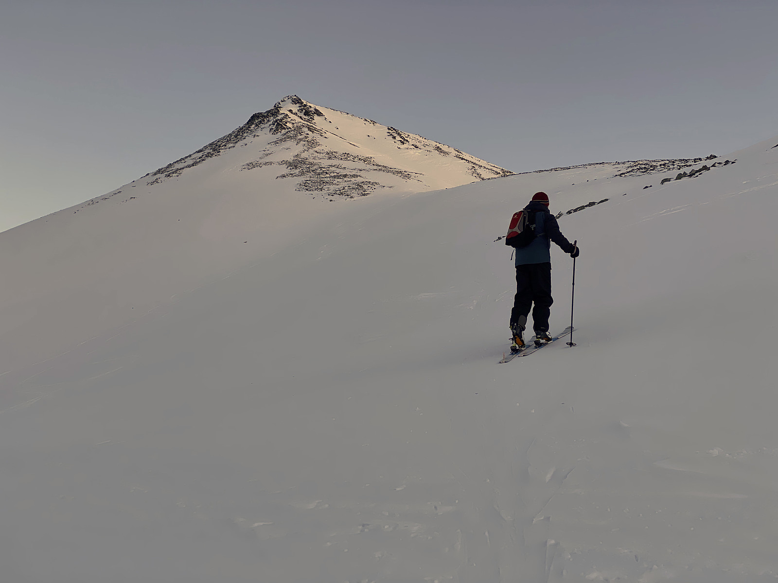
![Image #1: There were nice ski trails that we could follow on this day. The mountain straight ahead is Mount Gamlestølsfjellet [1528 m.a.m.s.l.]. Part of Mount Hesten is seen to the left.](https://images1.peakbook.org/images/14939/Solan_20210329_6061dcbd37787.jpg?p=xtralarge)
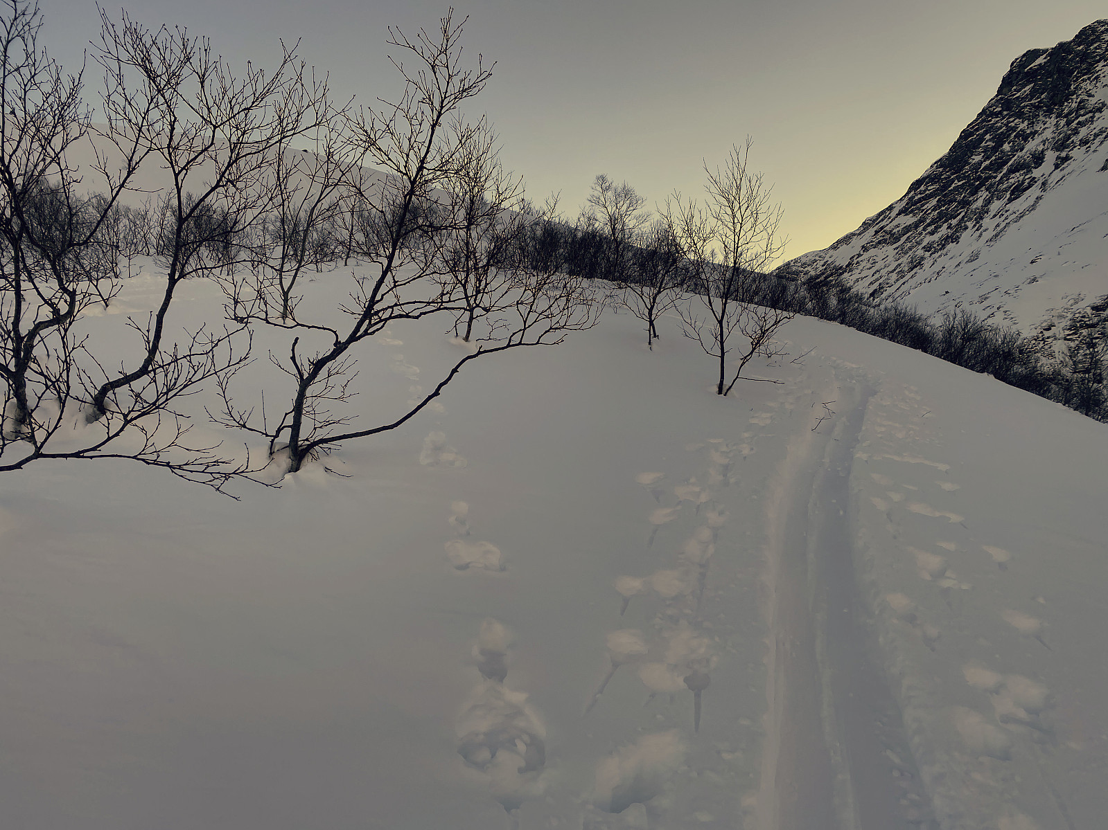
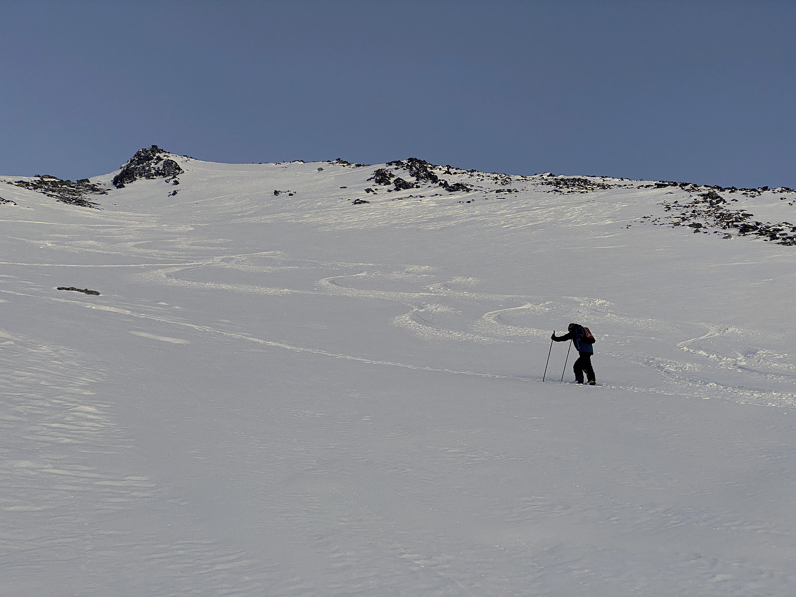
![Image #2: My son Dag in the ski trail. The first part of the route up Mount Hesten [i.e. "The Horse"] goes through birch forest, part of which is located in rather steep slopes, varying between 25 and 35°.](https://images1.peakbook.org/images/14939/Solan_20210329_6061dda0385ae.jpg?p=xtralarge)
On this day, my son asked me if I'd like to join him on an alpine skiing tour to Mount Hesten. He had resently read a brief tour report on Facebook by someone who had recently visited the mountain on skis, and so he had figured he'd give the mountain a try as well. Mount Hesten is a mountain located in Rauma Municipality in the County of Møre & Romsdal. The mountain has several peaks located in a horseshoe-fashion. Here on Peakbook they have been named Hesten Northwest [1481 m.a.m.s.l.], Hesten [1610 m.a.m.s.l.], Hesten S1 [1580 m.a.m.s.l.], Hesten S2 [1590 m.a.m.s.l.], Hesten S3 [1634 m.a.m.s.l.], Hesten S4 [1560 m.a.m.s.l.], Hesten S5 [1650 m.a.m.s.l.], Hesten Southwest [1570 m.a.m.s.l.], and Litlehesten [1575 m.a.m.s.l.]. The meaning of the Norwegian word Hesten is The Horse, and the meaning of Litlehesten is The Little Horse. The 1610-peak and the 1650-peak both have a vertical separation > 100 meters; whereas the rest of them has a vertical separation < 100 meters.During summer, it should be possible to trek or climb all of them, but for skiing during winter, The northwest peak of 1481 meters, and the "main peak", of 1610 meters, seemed to be more realistic. Odd as it may seem, the 1610-peak is usually considered to be the main peak, and not the 1650-peak; possibly because the 1610-peak is the one visible from the farms in the valleys beneath the mountain.
Unfortunately, we didn't get up that early on this particular morning, but after breakfast we drove to the fjord called Innfjorden in Rauma Municipality; took a small county road from there, and tried to locate our planned set out spot using Google maps. Unfortunately again, mobile phone coverage, as well as GPS coverage is a bit poor in some of these narrow valleys; and so we did pick the wrong road one or two times, but then got back on track. There's a 2 km long toll road that you have to use to get up to the parking lot from which we intended to start skiing, and we had to pay 90 NOK [Norwegian Crowns] to get past the automatic crash beam gate guarding the toll road. We eventually reached the Herslan Parking Lot (Norwegian: Herdslan parkeringsplass), and started skiing as soon as we'd got our skis on.
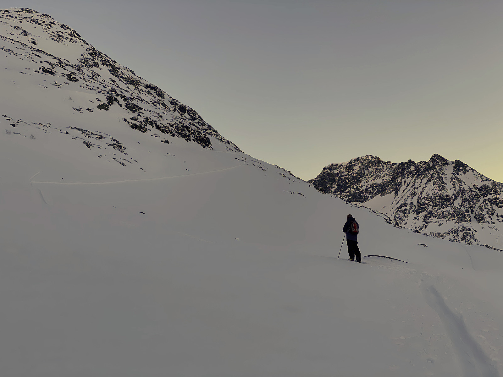
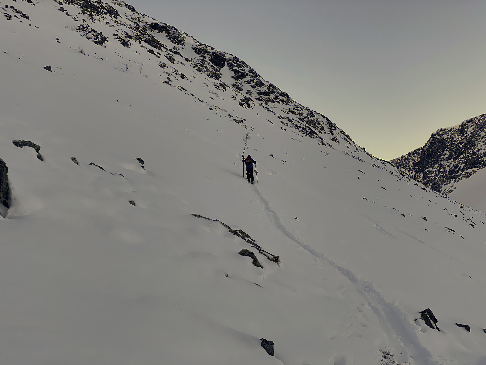
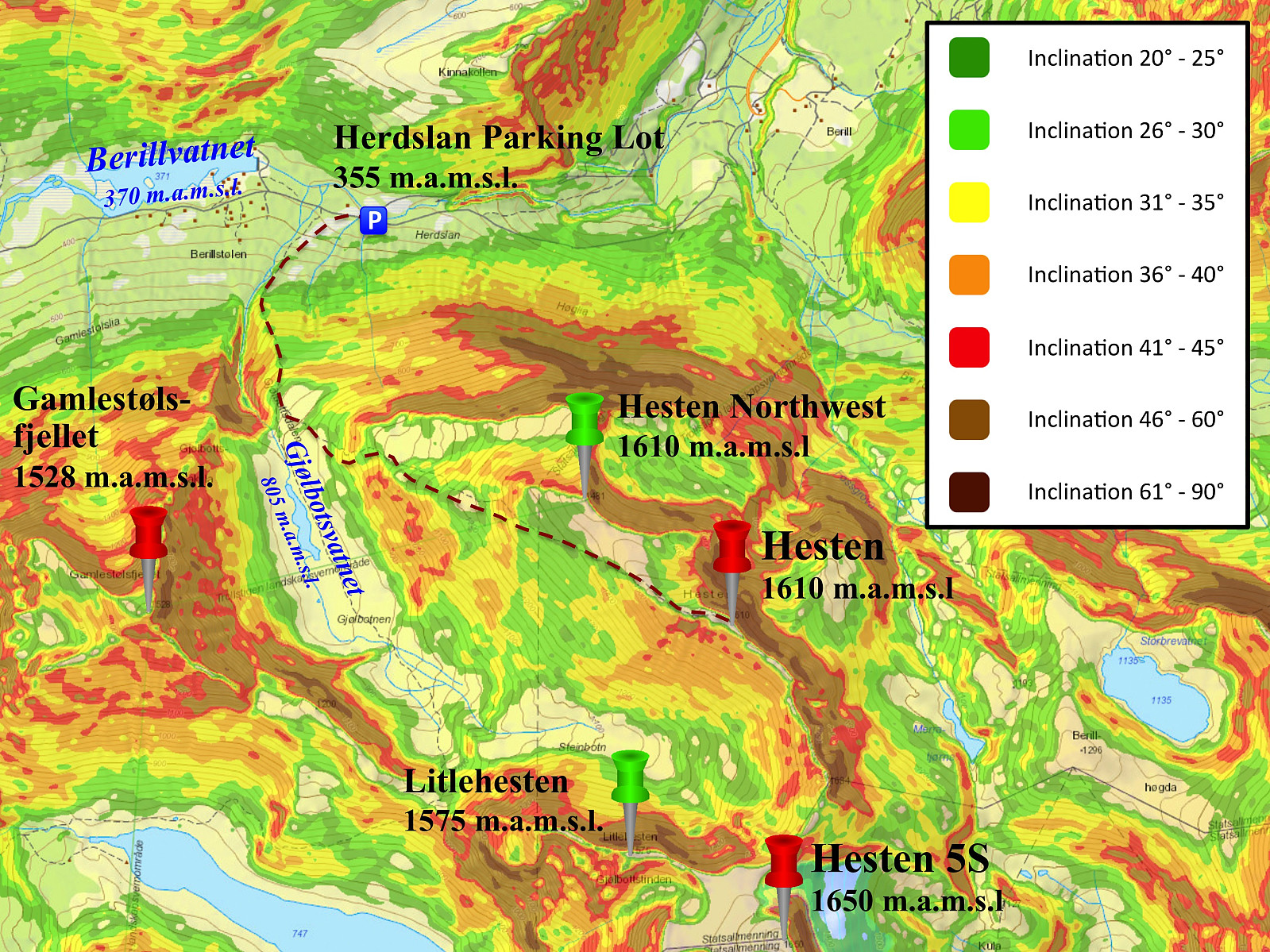
The parking lot is located at 355 m.a.m.s.l., and the first part of the route from the parking lot up the mountain side of Mount Hesten goes up a rather steep slope with birch forest of varying density. We had carefully studied an inclination map in advance (image #3), and our intention was to follow a route were we were trying to avoid any too steep slopes; at least those with an inclination > 35°, as an avalanche risk of 3 on a scale from 1 to 5 had been forecasted for this area on this particular day. Others had been doing the trip in advance of us, however, and so in the lower part of the route, we ended up by just following the ski trails that were already there (images ## 1, 2 & 4). The trail eventually led us into a hanging valley called Gjølbotnen at about 800 m.a.m.s.l. This hanging valley has a little lake located at 805 m.a.m.s.l., though at this time of the year, with between -15 and -10°C; the lake was of course covered by ice and snow, and couldn't be seen. We continued up the left side of the hanging valley, which is the proper route up Mount Hesten. Much of the snow that we had expected, based on the snow falls that had been lately, had been blown away, however, and that prevented us from following quite the safe route that we had planned to. This mountain side has ridges and chutes running up and down along the slopes, and stones were protruding through the snow like shark fins every here and there even in the chutes, and the ridges were generally impossible to cross, unless you would remove your skis. We reached a little knoll at about 1000 m.a.m.s.l. Up to that point we had been zigzagging up the mountain side a little bit east of where we had planned to; and from there we ended up zigzagging a bit west of where our original plan had been [compare our GPS tracking with our planned route on image #3, in order to get an idea.
The west ridge of Mount Hesten, on which the west peak [1481 m.a.m.s.l.] is located, even has a knoll with a nice viewpoint located at about 1385 m.a.m.s.l. (see images ## 7 & 8). As we were approaching that knoll, the sun was already down, and it was getting dark, as the days are rather short at this time of the year; and so we ended up with following a chute on the left side of the ridge on which the knoll is located, in stead of following the chute to the right of the knoll (see image #8). This chute proved to be a dead end, however, and so we had to take our skis off, and cross the ridge between the two chutes on foot, in order to get up to the 1385 meters viewpoint. The viewpoint really offered a very nice view of the surrounding valleys, and a nice cairn has been built upon it; as this spot is actually visible from the valley beneath, whereas the close-by 1481 peak isn't. We would have loved to continue up to the 1481 peak (Hesten Northwest), but there were almost no snow on it. We could even spot the main peak, i.e. the 1610 peak from where we were standing, but it was getting dark now, and we realized it would be dangerous for us to continue; and so we decided to embark upon our return back down to the parking lot and our car. It was way to dark to go skiing downhill by now, however, so we picked our headlamps out of our backpacks; put them on our heads, turned them on; and embarked upon our descent. We more or less used the same route for our descent as we had used for our climb. In the upper part of the route the greatest challenge was trying to spot the shark fin stones that were just beneath the surface of the snow, trying to ruin our skis; and in the final part of our descent the great challenge was to avoid crashing into the trees of the forest. With our headlamps on, however, we managed to get safely back down to our car; determined to make a second attempt at Mount Hesten at some later time.
![Image #9: View of the peaks called Litlehesten [1575 m.a.m.s.l.] and Hesten S5 [1650 m.a.m.s.l.] as the sun was setting.](https://images1.peakbook.org/images/14939/Solan_20210329_60622d3b47d59.jpg?p=xtralarge)
![Image #10: Approaching the viewpoint at 1385 m.a.m.s.l., just beneath the west peak of Mount Hesten [1481 m.a.m.s.l.]. In order to get across this little stone ridge, we had to take our skis off.](https://images1.peakbook.org/images/14939/Solan_20210329_60622df568ebb.jpg?p=xtralarge)

Benutzerkommentare