Tour Skiing to the Summit of Mount Roaldshornet (19.12.2020)

| Start point | Strandafjellet Skiing Centre (440m) |
|---|---|
| Endpoint | Strandafjellet Skiing Centre (440m) |
| Characteristic | Randonnée/Telemark |
| Duration | 3h 02min |
| Distance | 7.4km |
| Vertical meters | 847m |
| GPS |
|
| Ascents | Roaldshornet (1,230m) | 19.12.2020 |
|---|---|---|
| Visits of other PBEs | Strandafjellet skisenter parkering (440m) | 19.12.2020 |
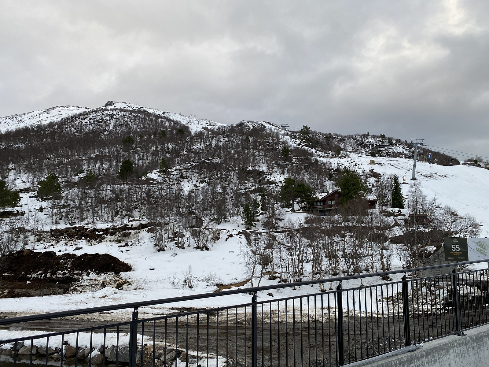
On this day, we had been planning to ascend Mount Høgenibba in the Municipality of Volda, in the county of Møre & Romsdal; and so we went by car, one of my daughters, one of my sons, and myself, to a parking lot by the foot of the mountain; unfortunately, however, there amount of snow at the location was way too scarce for skiing, and so we embarked upon our return towards our home. On our way back home, however, we passed by the Strandafjellet Skiing Centre; and realized it should be possible to ascend Mount Roaldshornet [1230 m.a.m.s.l.] instead. This skiing resort has ski lifts on both sides of Fursetdalen valley. Generally speaking, there tends to be more snow on the south side of the valley, because the sun tends to shine upon the snow on the north side, and make it taw. Moreover, they have snow producing machines on the south side of the valley; and so the ski lifts on that side are often in use even when those of the north side are closed due to lack of snow.
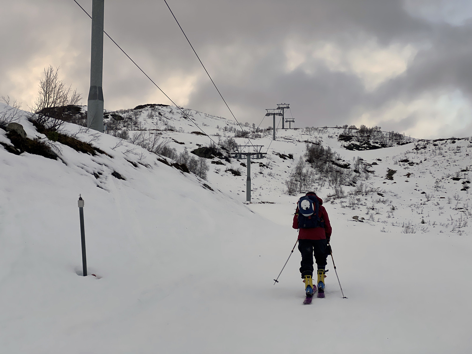
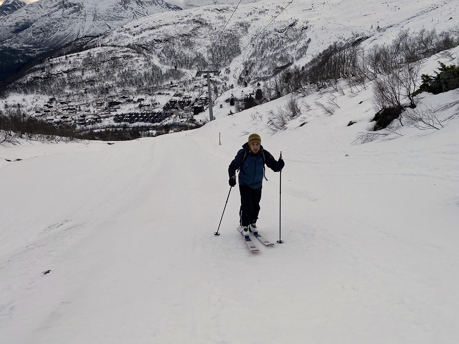
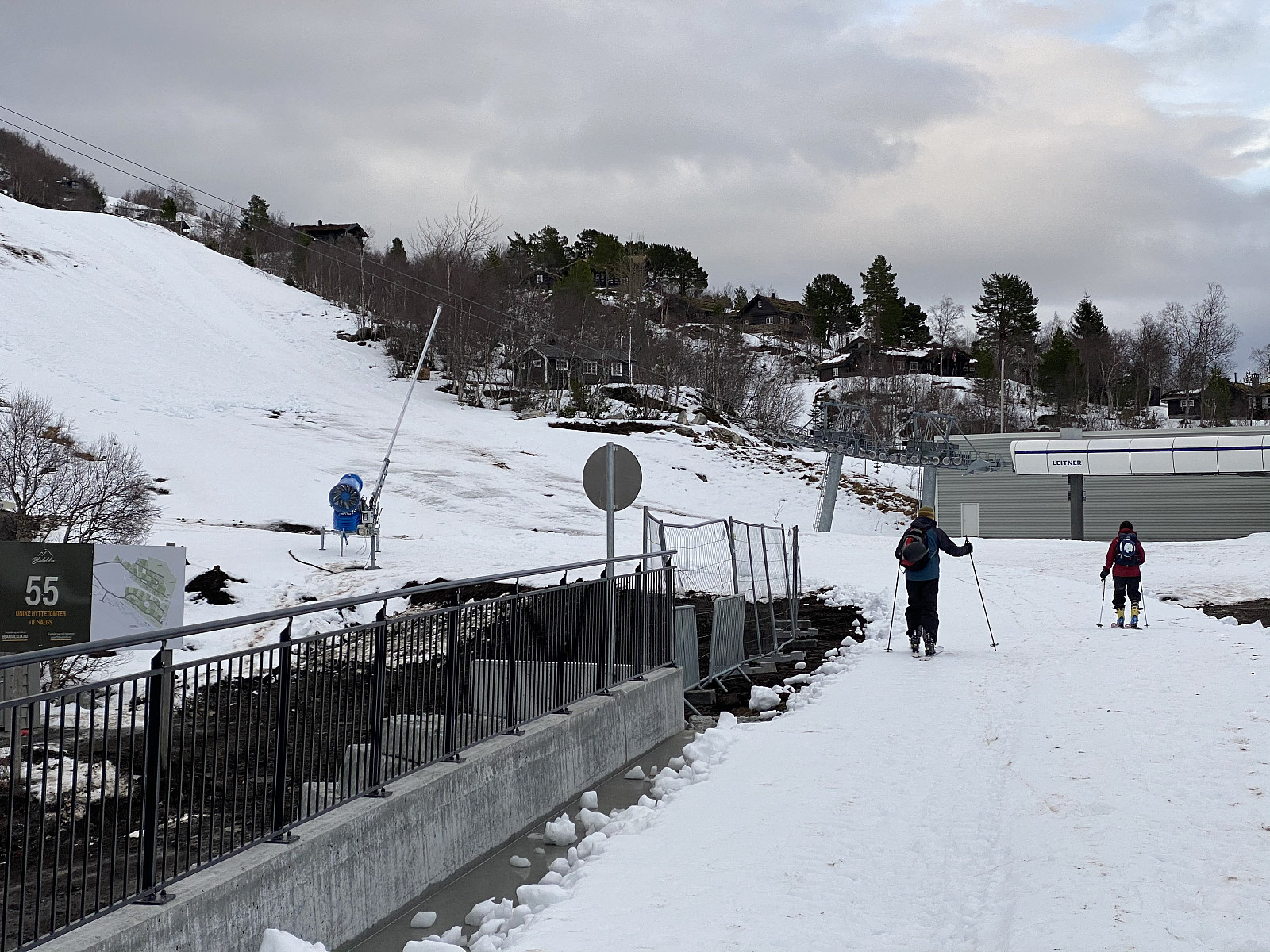
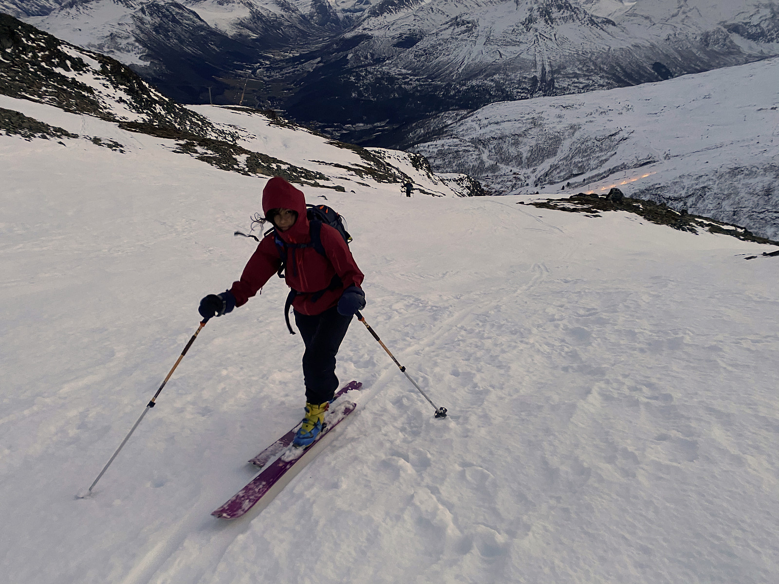
We parked our car at the parking lot of the skiing resort. Now, Mount Roaldshornet, which we intended to ascend, is the mountain on the north side of the valley (image #1), and the ski lifts on that side were indeed closed, as we had been expecting. The alpine downhill trails had, however, been very well prepped by snowcats earlier on this month; and those trails had more than enough snow for a climb and a descent on alpine tour skis, even though the amount of snow was indeed insufficient for keeping the trails open for ordinary downhill skiing. We crossed the Fursetelva River using the bridge that has been built across it (image #2), and started climbing up the mountainside (images ## 3 & 4). We followed one of the downhill trails upwards. Whenever the ski lift is open, it would be extremely dangerous to do that, as you would be likely to be hit by a downhill skier, and thereby cause an accident. Moreover, going uphill these trails is also forbidden whenever they are open for downhill skiing.
This southern mountainside of Mount Roaldshorn has two ski lifts, i.e. one aerial lift with both chairs and gondolas that might take you up to 1060 m.a.m.s.l.; and then there is an upper surface lift, that will take you from about 850 m.a.m.s.l. to 1150 m.a.m.s.l. So whenever the ski lifts are operating, you could, if you so desire, go by the lifts, and then you only have to go skiing for the last 80 elevation meters or so, to get up to 1230 m.a.m.s.l. I have actually once done that, but on that occasion I was actually telemark skiing in the downhill trails, and I hadn't even brought with med skins to put underneath my skis; and so it was quite an effort to get up these 80 elevation meters, as my skies was very slippery.
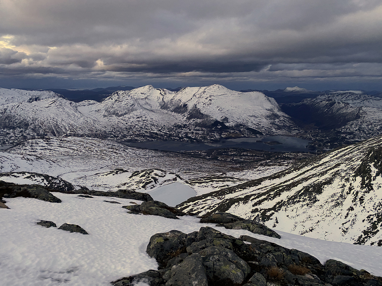
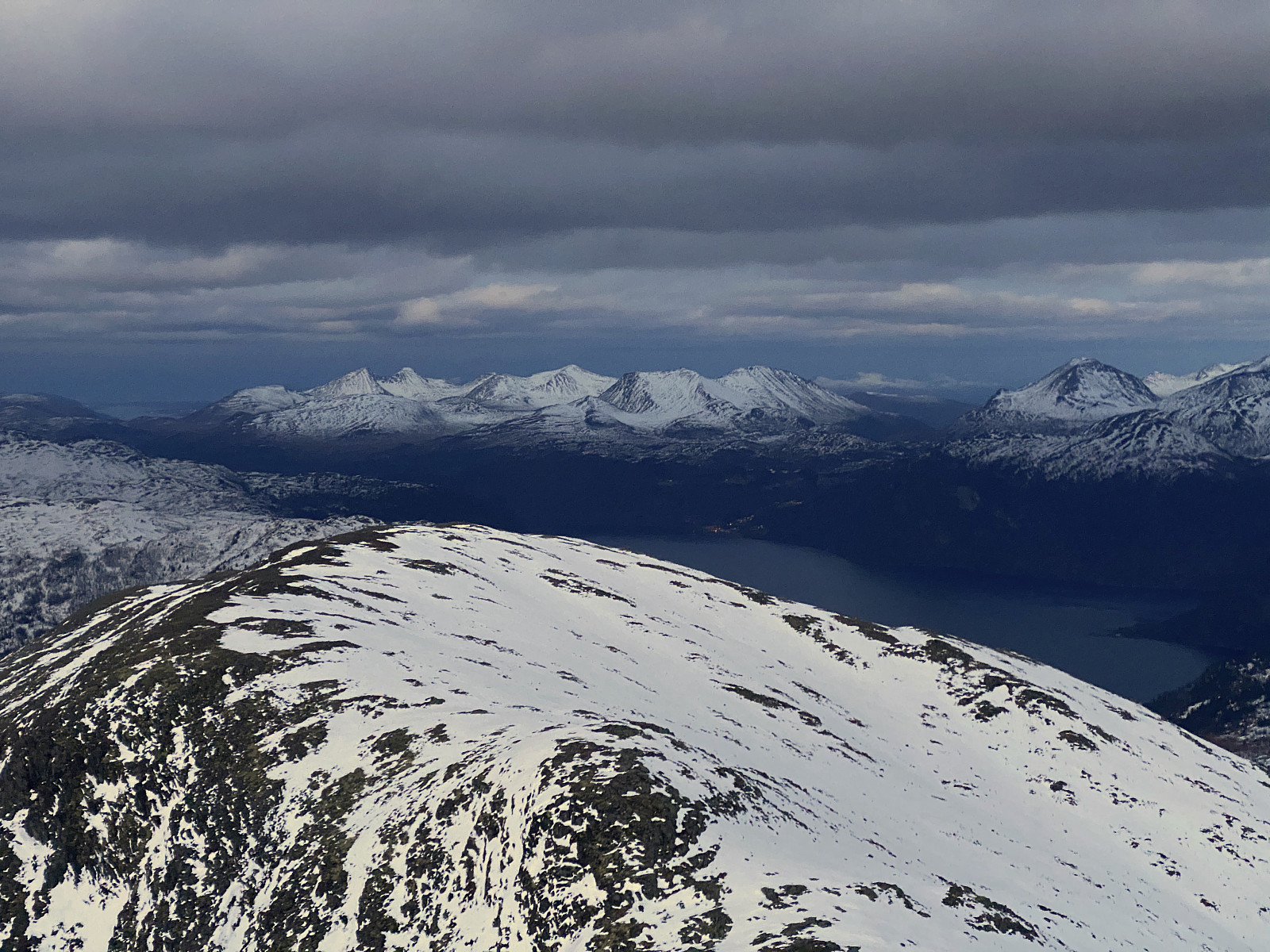
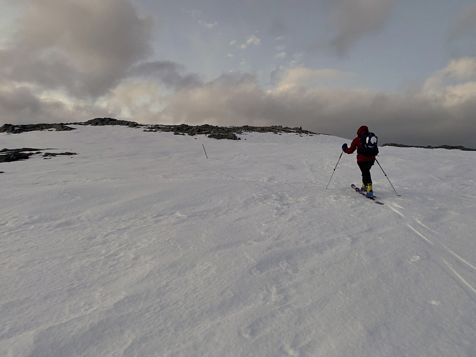
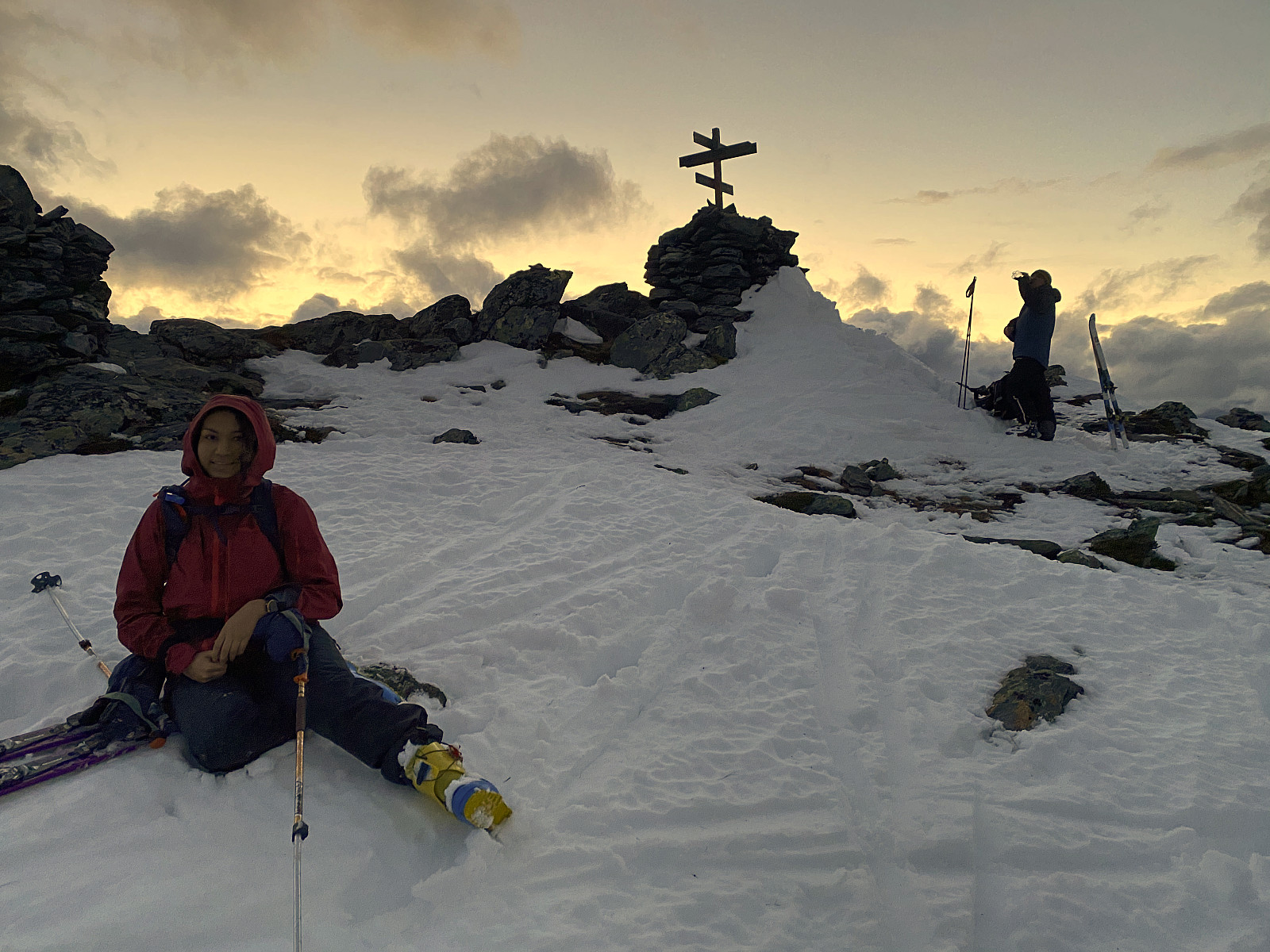
We have, all three of us, been downhill and telemark skiing in these trails plenty of times, and so we were quite familiar with the trails. As soon as we reached the upper station of the aerial lift, we curved left towards the upper station of the surface lift (see GPS tracking), and from there we just continued up to the summit of the mountain (images # 5 & 6). On top of the mountain, we admired the view for a few minutes, and shot some photos (images # 7 & 8); before we removed the skins from underneath our skis, switched the bindings into descent mode, and embarked upon our way back down to the car.

User comments