To Mount Gryta in Stryn Municipality (05.12.2020)

| Start point | Stryn Vinterskisenter (325m) |
|---|---|
| Endpoint | Stryn Vinterskisenter (325m) |
| Characteristic | Hike |
| Duration | 2h 30min |
| Distance | 7.4km |
| Vertical meters | 761m |
| GPS |
|
| Ascents | Gryta varde (1,031m) | 05.12.2020 |
|---|---|---|
| Visits of other PBEs | Stryn vinterski (325m) | 05.12.2020 12:27 |
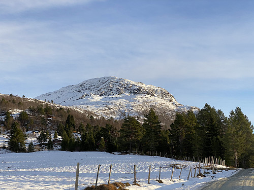
![Image #2: View from Bøasetra towards Mount Karifjellet [in the middle of the picture] and Mount Sølvberget [to the right].](https://images1.peakbook.org/images/14939/Solan_20210304_604112dea2409.jpg?p=medium)
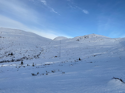
On this day, there was some snow in the mountains, though not enough for skiing; at least most places. So my son and I opted for a mountain that we could ascend on foot on this day, and we were of course prepared to do the walk in snow about halfway up to our knees. A mountain well suited for such a trek, was Mount Gryta in Stryn Municipality in the County of Vestland. So we went to Stryn by car, and used Google map to find our way to Stryn Vinterskisenter [i.e. "Stryn Winter Skiing Center"]. This skiing center has been so named, because there is another one, much higher up in the mountains, that carries the name Stryn Sommerskisenter [i.e "Stryn Summer Skiing Center"]. From the parking lot at the ski centre, we followed a road through a cabin village called Bøasetra; a route that we had seen described in online tour descriptions. As we approached the end of the road, we turned right, and followed another road towards the mountain that we were seeking to climb. That road soon proved to be a dead end, however, and so we had to turn around, and head back to the previous road (see GPS tracking). We now followed the first road to the very end, and than turned right again; and this time we were successful. After another 200 meters or so, we found a foot trail leading up the mountain side, and this trail was actually very well marked with red paint spots along the route; though the red spots were covered by snow here and there. Following the trail wasn't very difficult, however, and weather was quite nice, so we could anyway just head towards the mountain that we were intending to climb.

![Image #4: View towards Mount Gryta [1032 m.a.m.s.l.], with the the upper end of the lower ski lift in front. For our descent after we had been to the summit, we just followed the ski lift down.](https://images1.peakbook.org/images/14939/Solan_20210304_604114a764243.jpg?p=medium)
We saw one alpine tour skier as we were climbing, but he was heading in a slightly different direction; so after a little while he disappeared from our sight, and thereafter we didn't see more of him. The amount of snow was a little insufficient for skiing, however, and I did actually feel some pity for his skis. After a while we came to the upper end of the lower ski lift of Stryn Winter Skiing Center (Image #4). This skiing center actually has two lifts, one lower lift that will take you from the parking lot up to the spot that we had just arrived at; and the other being an upper one, that will take you further up into the mountains (Images ##3 & 6). At the moment the ski lifts weren't operating, however, and the skiing center was actually closed, as there wasn't enough snow for skiing in the alpine trails yet. As we were climbing, my son and I had been wondering about whether we should first trek into the valley in front of us, and then approach the summit of the mountain from the north east; or, alternatively, just try to climb the mountain from the west side. We had seen on the maps that both routes should be possible, at least during summer, when there wasn't any snow. With the current amount of snow, we were, however, a little bit concerned about the direct route; but as we came closer, we thought it looked feasible, and so we decided to give it a try.
![Image #5: The summit of Mount Gryta [1032 m.a.m.s.l.]. A large cairn has been built on top of this mountain.](https://images1.peakbook.org/images/14939/Solan_20210304_604117fa45ebe.jpg?p=medium)
After a little while, we came to a very steep mountain side, where climbing was a little bit tricky, however; but it in the steepest part it was possible to make deep holes with the toes of our boots, and then use these holes as some sort of a ladder. About halfway up this steep mountain side, we caught eye of a young women some distance behind us; and we realized she was heading in the same direction as we were. As we were struggling ahead in some rather deep snow that had been brought there by the wind, we noticed that the woman was actually catching in on us. It is of course possible that she was better fit than us, but we convinced each other that the only reason she was catching in on us, was because we had been paving the way for her. We reached the summit of the mountain, and the young woman arrived there shortly after us. None of us remained long on top of the mountain, however, as the days are short at this time of the year, and we wanted to get back down before dark. The young woman was nice and polite, and she joined us on our way back down. Before leaving the summit area, I got a nice shot of the sky of the sunset (Image #7). Where the climb up had been steepest, we just sat on our butts, and slided down the mountain side. As we came back down to the upper end of the lower ski lift, we turned left, and just followed the ski lift and slalom trail down to the parking lot; where we wished our tour companion a good bye, and then headed back home in our car.
![Image #7: View in a westward direction. The fjord seen in the southwest is Nordfjord, and the fjord-like lake seen in the northwest is Lake Honndalsvatnet. The mountain seen by the right edge of the image is Mount Gulkoppen [1306 m.a.m.s.l.].](https://images1.peakbook.org/images/14939/Solan_20210304_604119fc6628d.jpg?p=medium)
![Image #8: A telephoto image of part of the same view as on the previous picture. The lake in the left part of the image is called Lake Svingesetvatnet, and the mountain behind it is Mount Glitregga [1297 m.a.m.s.l.]. The lake in the far is Lake Honndalsvatnet, and the mountain just to the right of it is Mount Øyenibba [848 m.a.m.s.l.].](https://images1.peakbook.org/images/14939/Solan_20210304_60411b9a6b6d4.jpg?p=medium)

![Image #6: View towards Mount Sølvberget [1303 m.a.m.s.l.] and Mount Kragefjellet [1400 m.a.m.s.l.].](https://images1.peakbook.org/images/14939/Solan_20210304_60411867cb8c2.jpg?p=medium)

User comments