Ski Touring to Mount Smørbotstinden with my son (28.11.2020)


| Startsted | Skorgedalen Parking (324moh) |
|---|---|
| Sluttsted | Skorgedalen Parking (298moh) |
| Turtype | Randonnée/Telemark |
| Turlengde | 3t 31min |
| Distanse | 8,1km |
| Høydemeter | 914m |
| GPS |
|
| Bestigninger | Smørbottinden (1189moh) | 28.11.2020 |
|---|---|---|
| Andre besøkte PBE'er | Parkering Skorgedalen (305moh) | 28.11.2020 |

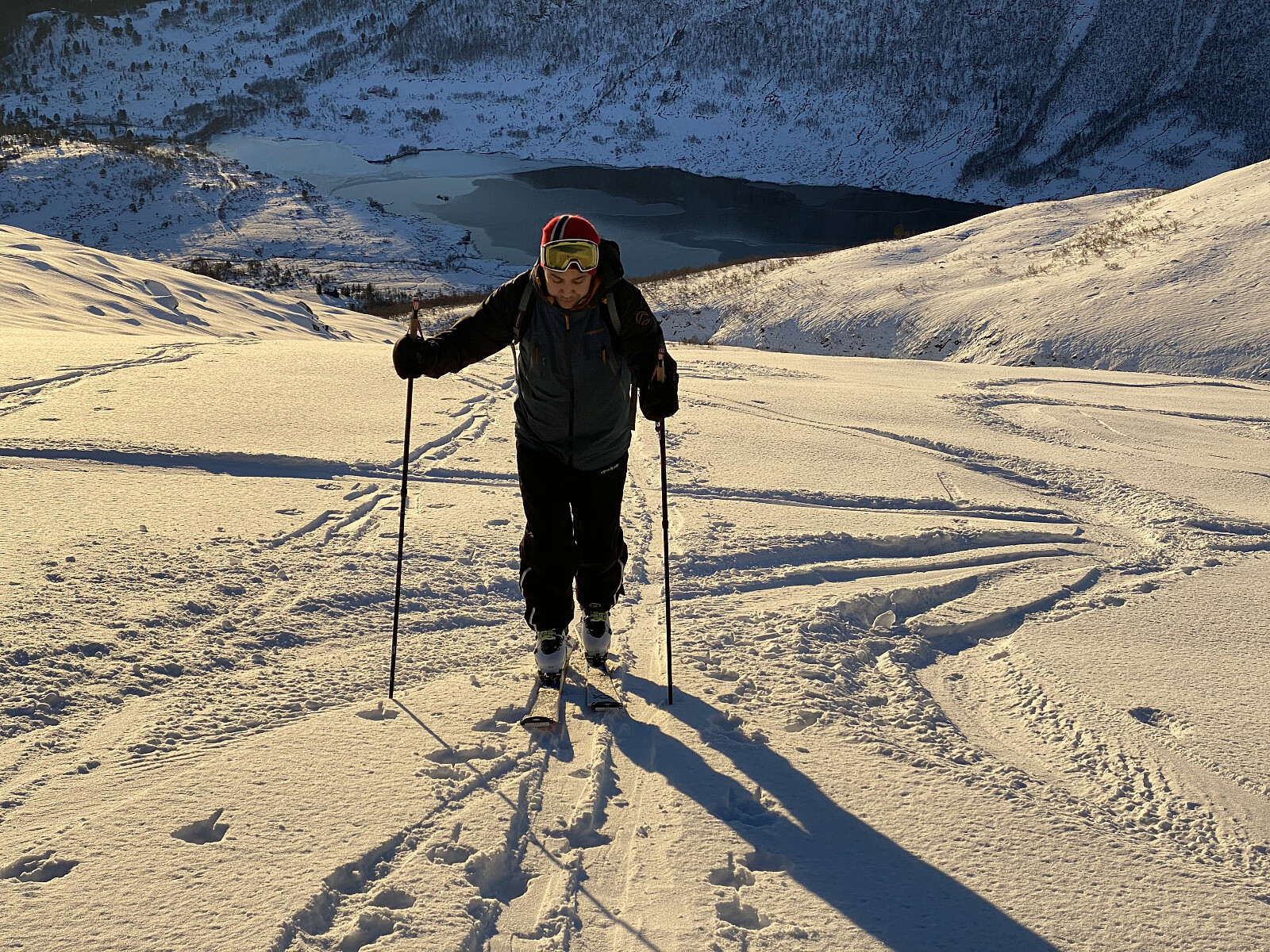
I have previously twice visited Mount Smørbottinden, the first time on Telemark skies, and the second time on alpine touring skis. For tour descriptions including a number of nice pictures, follow these links: Telemark Skiing to Mount Smørbottinden in Rauma Municipality and Alpine Ski Touring to Mount Smørbottind and Mount Kvasstind. The main difference this time compared to my two previous ascents of Mount Smørbotttinden, was that my son joined me this time, and it was actually he that suggested we make this trip. As on previous occasions we drove to Skorgedalen Valley in Rauma Municipality, parked at the parking lot by the ski resort in the valley; and from there we started skiing. The amount of snow was much less on this occasion compared to what it had been on my previous two visits. In the lower part of the trail, the snow was also wet and quite heavy; and at some places we had to cross some open creeks that were not yet covered by snow, as the winter had just started, and we hadn't had that many snowfalls yet. Nevertheless, the snow improved, and became dryer as we gained altitude, and from about 7 or 800 m.a.m.s.l. the snow was almost powder-like.
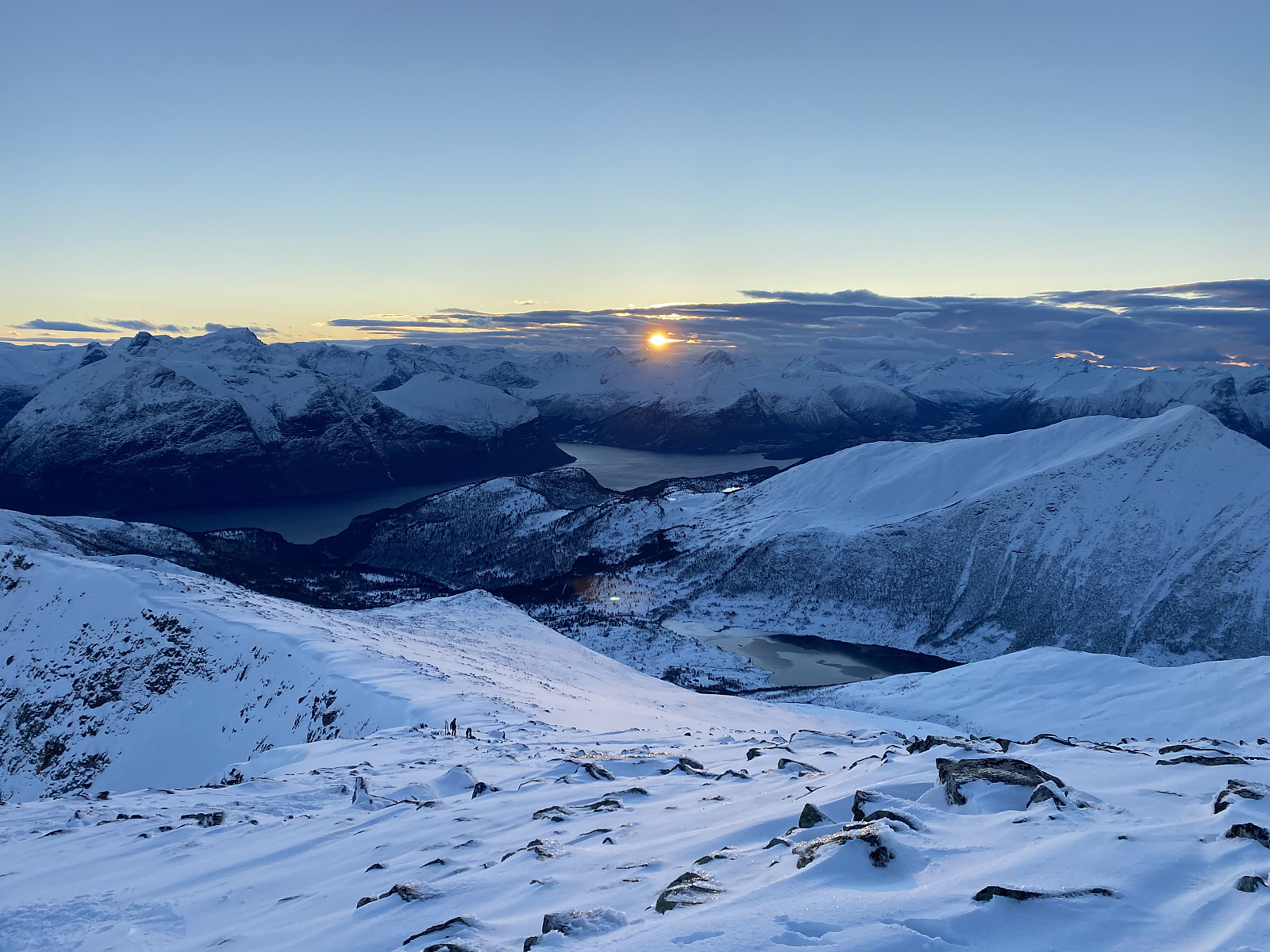
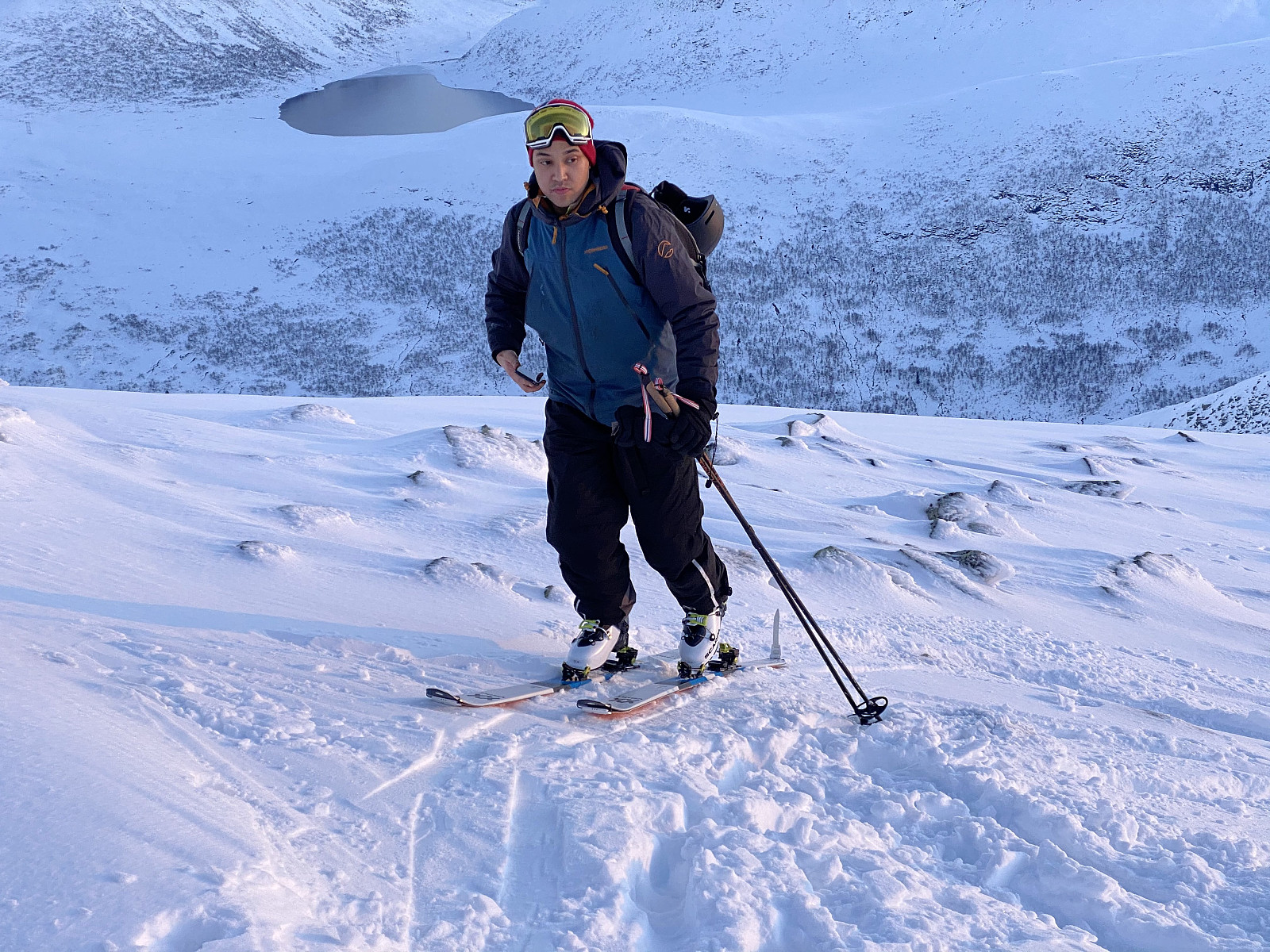
We climbed the mountain following the valley between the southwest ridge of Mount Smørbottind and southwest ridge of Mount Kvasstinden ["The Sharp Peak"]. The peaks of Mount Kvasstinden [1180 m.a.m.s.l.] and Mount Smørbottinden [1188 m.a.m.s.l.] are like twin peaks on the same mountain. The valley that we followed upwards is quite steep on the left (i.e. west side) of the little river that follows the bottom of the valley, whereas the slopes on the right, or east side of the river are less steep; and therefore generally considered to be quite safe pertaining to avalanches (i.e. you can climb this mountain without exceeding a 25° climb at any place). In the top area you usually have to beware of snow shelves on the leeward side of the mountain (see photos in my previous tour descriptions), but that is a different story; and on this particular day there were no such snow shelves to be seen. When I ascended this mountain on alpine tour skis in May this year, I even took time to ascend Mount Kvasstinden before I went back down from the mountain. Today, however, snow was scarce on Mount Kvasstinden, and stones were protruding everywhere from the snow like sharp shark fins; and so we avoided going up there. On our descent we enjoyed very much the fine powder snow in the upper part of the trail, but as we got further down, the snow became increasingly wet, and making turns became increasingly difficult. We managed to get back down to the parking lot and the car without any great difficulty, however. I had feared that descending would be a bit tricky in the lower parts of the trail, but it actually proved to be easier than I had been anticipating.
![Image #5: Mount Kvasstinden [1180 m.a.m.s.l.] as seen from Mount Smørbottinden.](https://images1.peakbook.org/images/14939/Solan_20210228_603bfb1371d35.jpg?p=xtralarge)
![Image #6: View from Mount Smørbottinden towards Mount Skarven [1048 m.a.m.s.l.]. The slopes back down from Mount Smørbottinden were fabulous with nice "powder" snow in the upper parts of the mountain, and then more icy and wet in the lower parts.](https://images1.peakbook.org/images/14939/Solan_20210228_603bfb9c127b5.jpg?p=xtralarge)

Kommentarer