To Mount Breitinden and Mount Mannen with my Son (10.10.2020)

| Startpunkt | Trollstigen Tourist Center (691m) |
|---|---|
| Endpunkt | Trollstigen Tourist Center (695m) |
| Tourcharakter | Hochtour |
| Tourlänge | 7h 04min |
| Entfernung | 16,1km |
| Höhenmeter | 1.297m |
| GPS |
|
| Besteigungen | Breitinden (1.797m) | 10.10.2020 |
|---|---|---|
| Mannen (1.294m) | 10.10.2020 | |
| Besuche anderer PBE | Trollstigen Parkeringsplass (697m) | 10.10.2020 |
![Image #1: View from Stigbotnen Valley towards Trollstigen Mountain road and the mountains of Bispen, Kongen og Dronninga [i.e. The Bishop, The King and The Queen]. In the background are also seen Mount Finnan and Mount Alnestinden.](https://images1.peakbook.org/images/14939/Solan_20210122_600aaf0621f90.jpg?p=xtralarge)
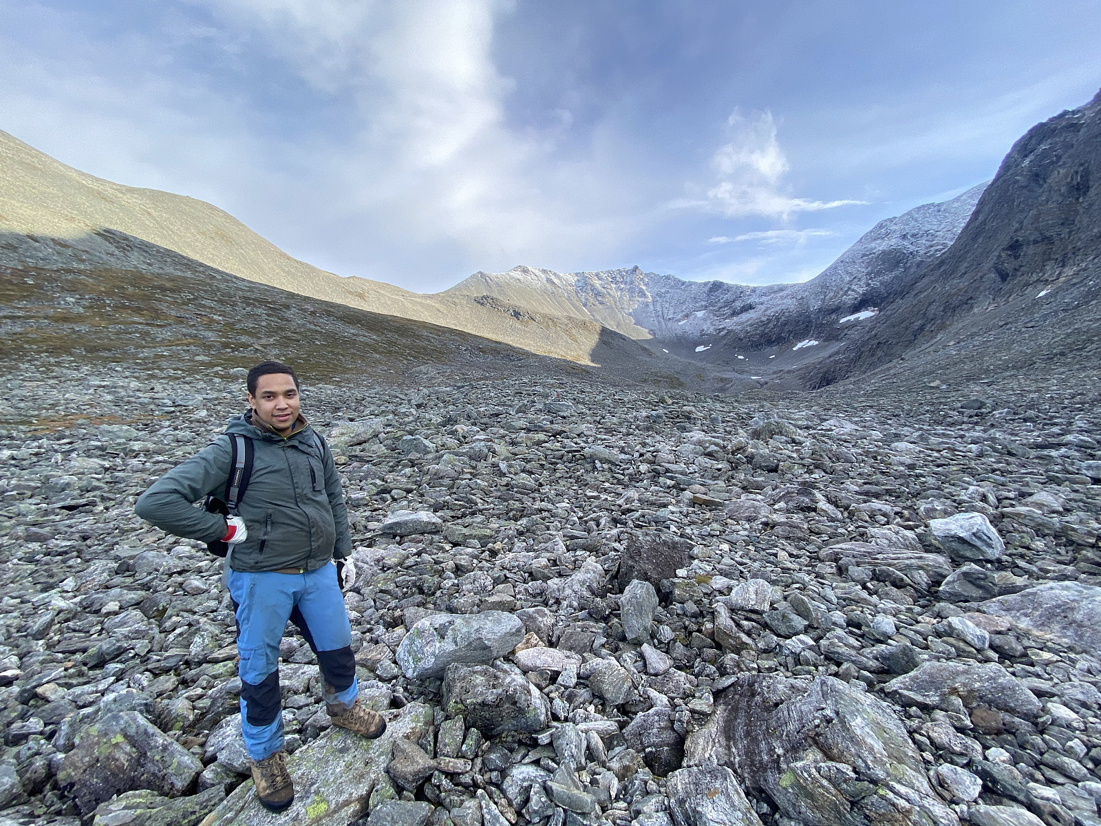
We did set out for the Mountain called Breitinden [i.e. "The Broad Peak"] one week prior to this trip, but we never reached it on that day, mainly because we had limited time available; so on this day we decided to make a new attempt. Moreover, in order not to fail a second time, we opted for a more regular route this time; and so we set out from the Trollstigen Tourist Center, into the valley called Stigebotnen (see map). From this valley we climbed onto the mountain ridge that interconnects Mount Storgrovfjellet and Mount Breitinden, and thereafter we followed that ridge up to the top of Mount Breitinden.
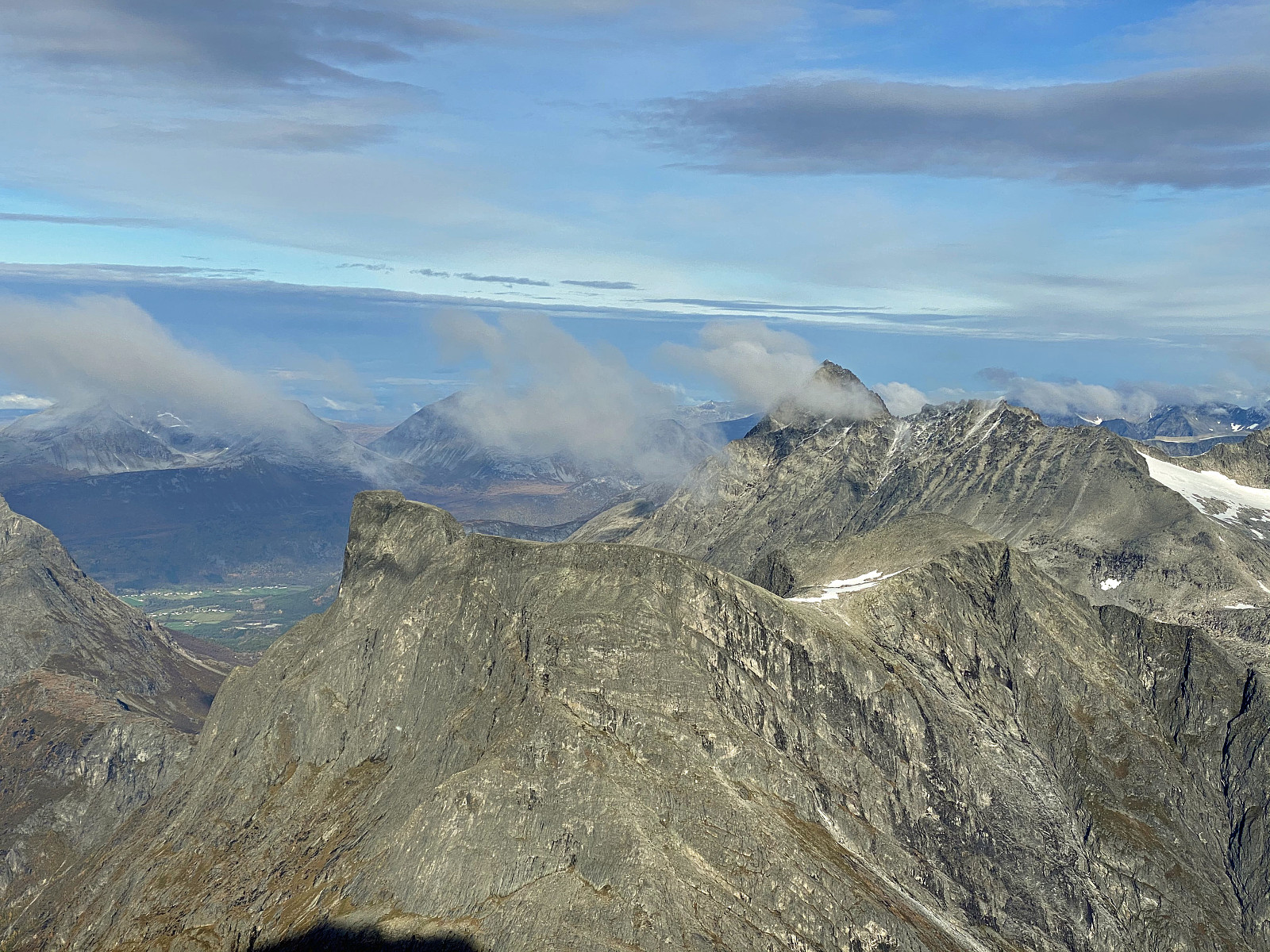
As you're coming up on the edge of this mountain ridge, you get a very good view of the peaks that the locals call the Troll Peaks [Norwegian: "Trolltindan"] i.e. the peaks that flank the top of the renown more than 1000 meter high cliff called Trollveggen [i.e. "The Troll Wall]. The peaks readily discerned on image #6 are Mount Store Trolltinden [1788 m.a.m.s.l.], Brurjentene [1620], Mount Trollspiret [1670], and Mount Trollryggen [1725]. Mount Brudgommen is actually also seen, but it's positioned right in front of Mount Store Trolltinden, so it might be a bit tricky to discern from that higher peak behind it. Anyway, you don't se the Troll Wall from this position, as this high vertical cliff is located on the other side of this chain of peaks.
![Image #5: View towards "The Troll Peaks" [Norwegian: Trolltindane], the highest of which is Mount Store Trolltinden [i.e. "The Greater Troll Peak" - 1788 m.a.m.s.l.]. The second highest is Mount Trollryggen [i.e. "The Troll's Back" - 1725 m.a.m.s.l.].](https://images1.peakbook.org/images/14939/Solan_20210122_600ab7f248809.jpg?p=xtralarge)
![Image #6: A closer (zoom) view of the Troll Peaks. These peaks are actually lining the top of 1000 meter high vertical cliff known as Trollveggen [i.e. "The Troll Wall"]. These peaks are usually climbed from this side; the vertical cliff being on the other side.](https://images1.peakbook.org/images/14939/Solan_20210122_600ab97b34934.jpg?p=xtralarge)
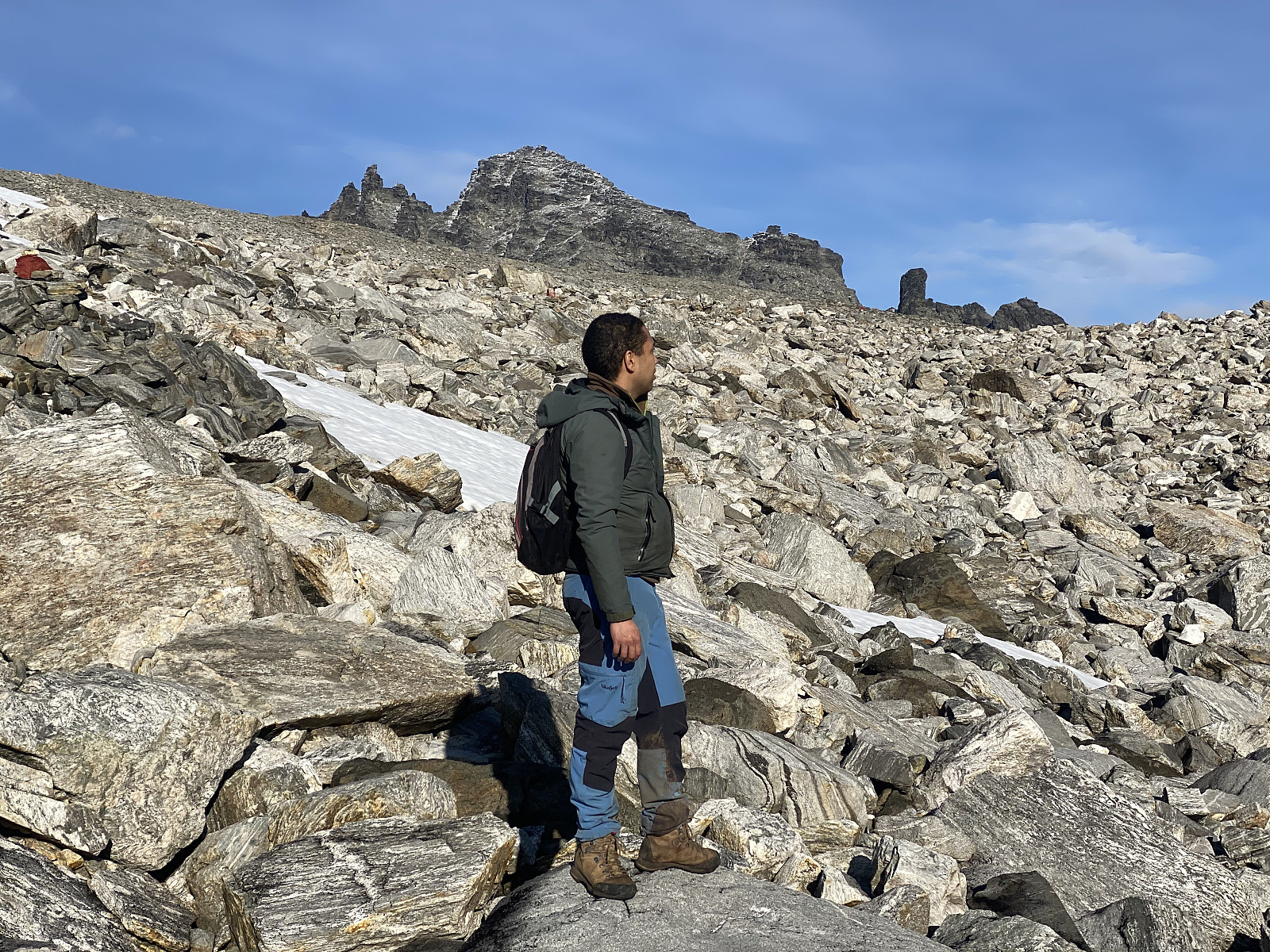
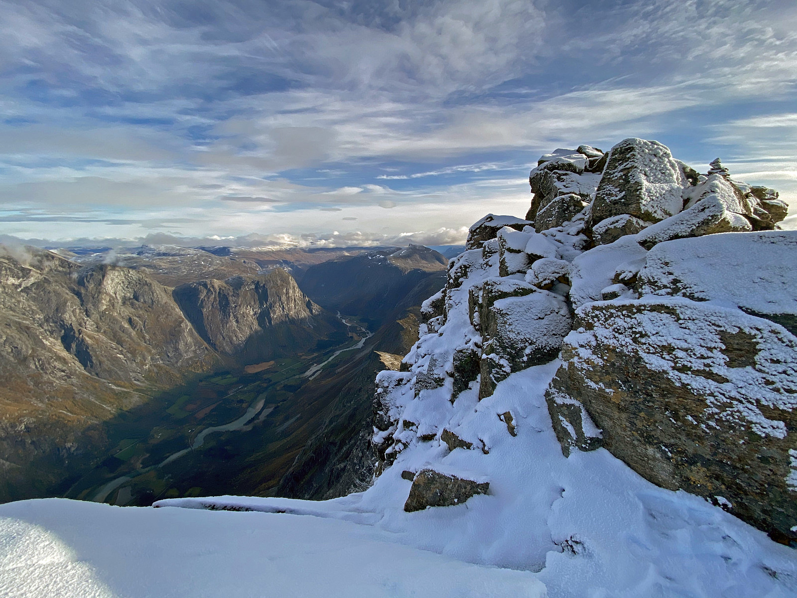
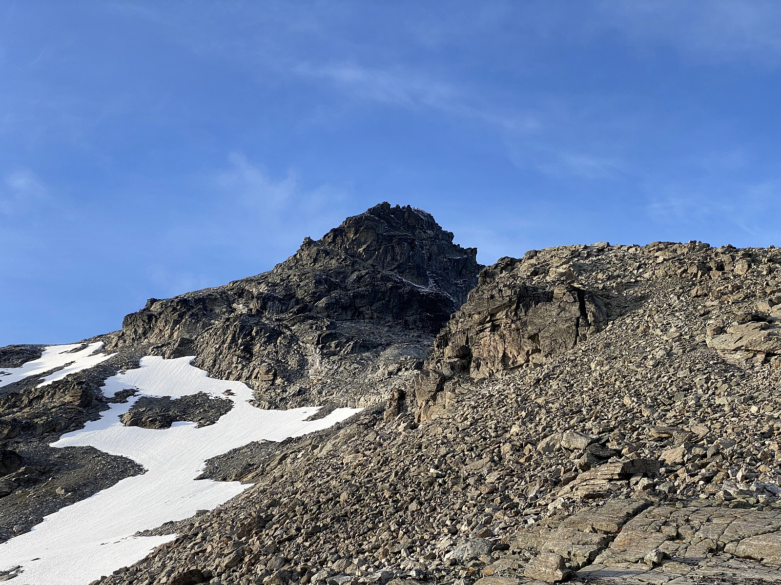
We continued up the west ridge of Mount Breitinden (i.e. the ridge that connects the mountain to Mount Storegrovhornet). It had been snowing lately, and so from about 1300 m.a.m.s.l., there was a thin layer of snow upon the stones that we were walking on; and so we had to take care not to slip as we were climbing upwards. This western ridge of Mount Breitinden is a little bit steeper than most ordinary mountain trails, and so at places you have to use your arms in addition to your legs; nevertheless, the climb doesn't pose any greater challenge if you're a bit used to mountain trekking. As we were approaching the top area of Mount Breitinden, we passed by a prominent knoll with a large cairn built upon it. This knoll, or prominence measures 1720 m.a.m.s.l., and has been named Lille Breitinden [i.e. "The Little Broad Peak].
![Image #7: On the west ridge of Mount Breitinden, the summit being hidden behind the knoll that appears to be the summit on this image. The knoll to the right is called Mount Lille Breitinden [i.e. "The Little Broadpeak"].](https://images1.peakbook.org/images/14939/Solan_20210122_600af76553513.jpg?p=xtralarge)
![Image #8: A view of Storgrova Valley from the west ridge of Mount Breitinden. On the left side of the valley is Mount Storgrovfjellet [1629 m.a.m.s.l.], and on the east side is Mount Store Trolltinden [1788 m.a.m.s.l.].](https://images1.peakbook.org/images/14939/Solan_20210122_600afaf0cde2c.jpg?p=xtralarge)
The layer of snow that we were walking upon, became thicker as we came higher up, and by the time we reached the top of Mount Breitinden it was about 5 cm thick. The area before you arrive at the summit feels like a huge plateau, but it is a bit tilted; and so it isn't really an actual plateau. When trekking towards the summit, you actually continue upwards along a slope (Image #10) until you reach the summit; where you all of a sudden find yourself on top of a huge cliff, which is indeed part of the Trall Wall cliff.
![Image #9: A view of the knoll called Mount Lille Breitinden [1720 m.a.m.s.l.], as we were heading up the final part of the west ridge of Mount Breitinden. What looks like a person standing on top of the knoll, is just a cairn that has been built up there.](https://images1.peakbook.org/images/14939/Solan_20210122_600afc6f09e28.jpg?p=xtralarge)
![Image #10: The summit of Mount Breitinden [i.e. "The Broad Peak"] coming into sight (left part of the picture), with the knoll called Lille Breitinden [i.e. "The Little Broadpeak"] slightly to the right of it.](https://images1.peakbook.org/images/14939/Solan_20210122_600afd1e63628.jpg?p=xtralarge)
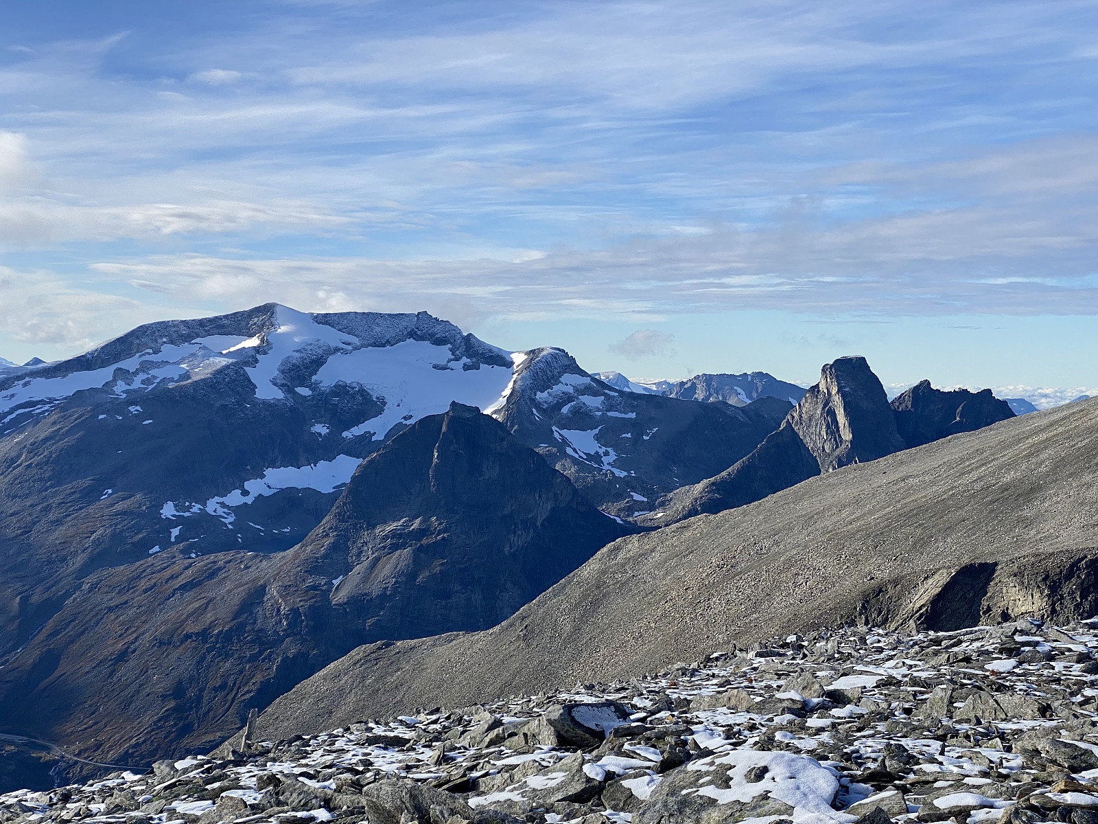
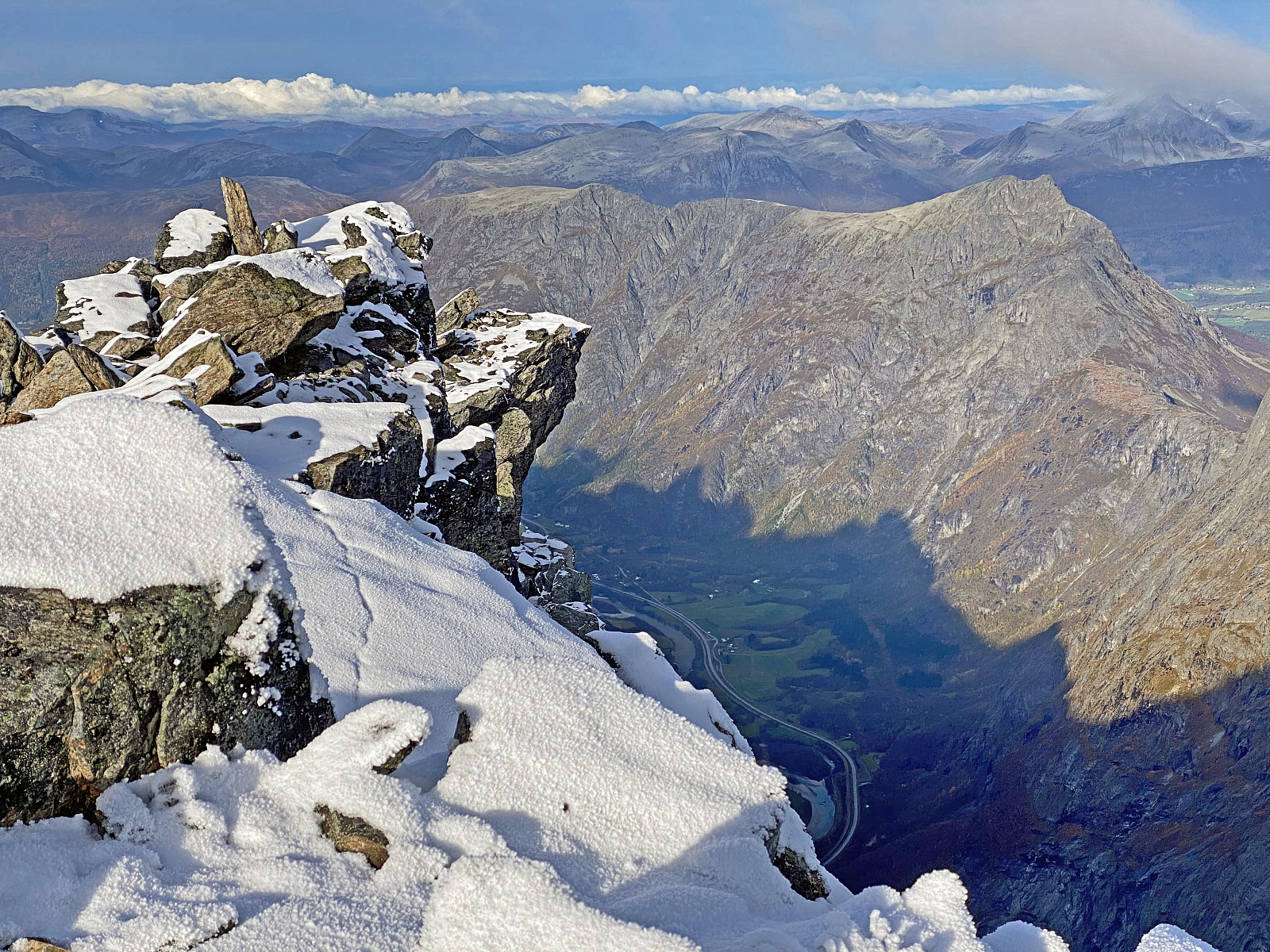
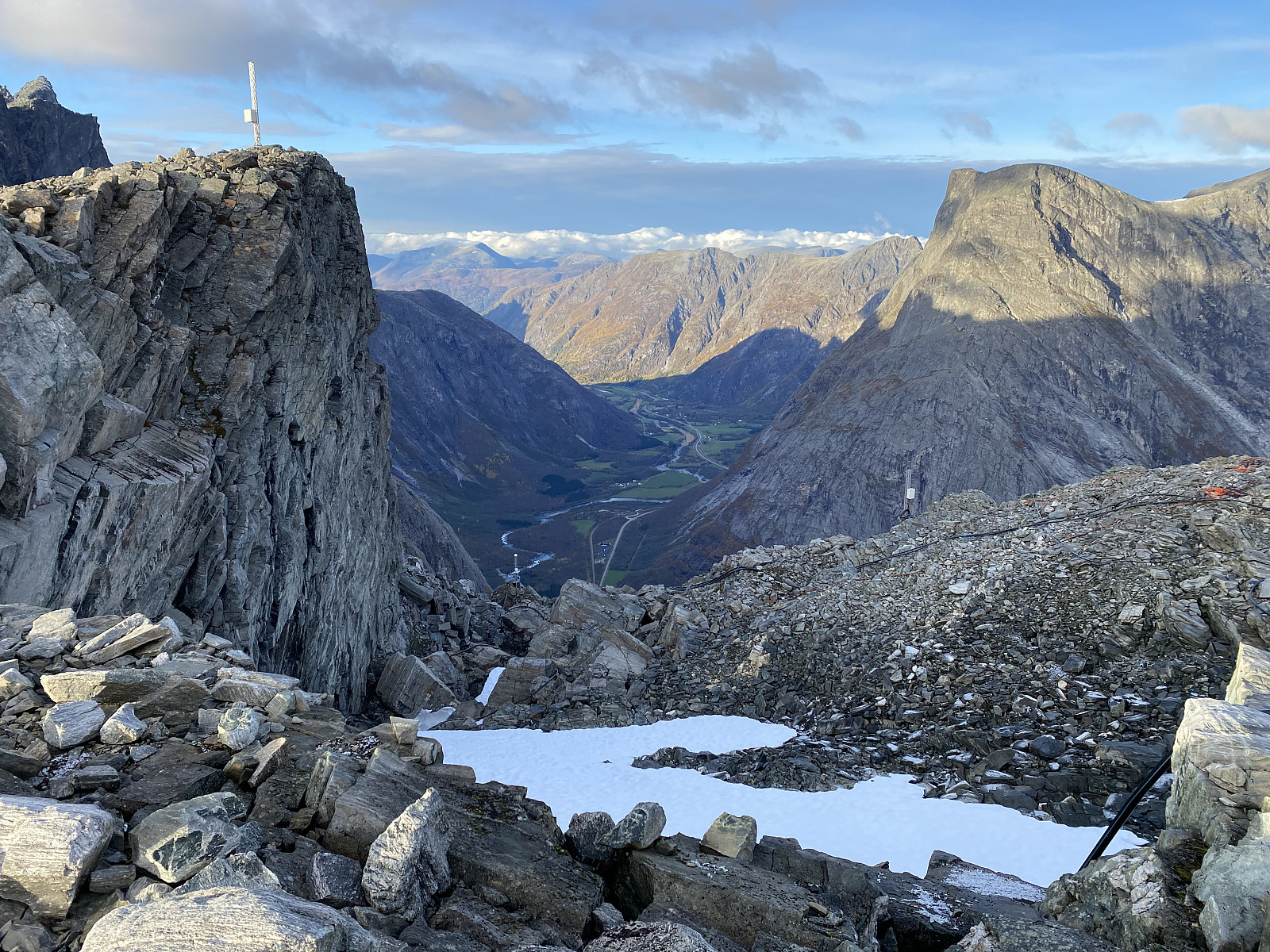
On top of the Mountain we shot some photos of the mountain and the Rauma Valley beneath it. We also had a little to eat and drink, and then started trekking in a southward direction. We didn't want to go the same way back to our car if not necessary, as it is always more exciting to be trekking new routes. I had already been thinking of the option of trekking along the ridge interconnecting Mount Breitinden with Mount Stigebotshornet on our way back, but my son was a bit eager to show me another mountain, called Mount Mannen; a mountain that he had visited on several occasions, but which I had yet to visit. "I don't know if it's possible to descend from Mount Breitinden [1797 m.a.m.s.l.] down to Mount Mannen [1294 m.a.m.s.l.]", he explained to me, "but let's walk over to that edge and have a look."
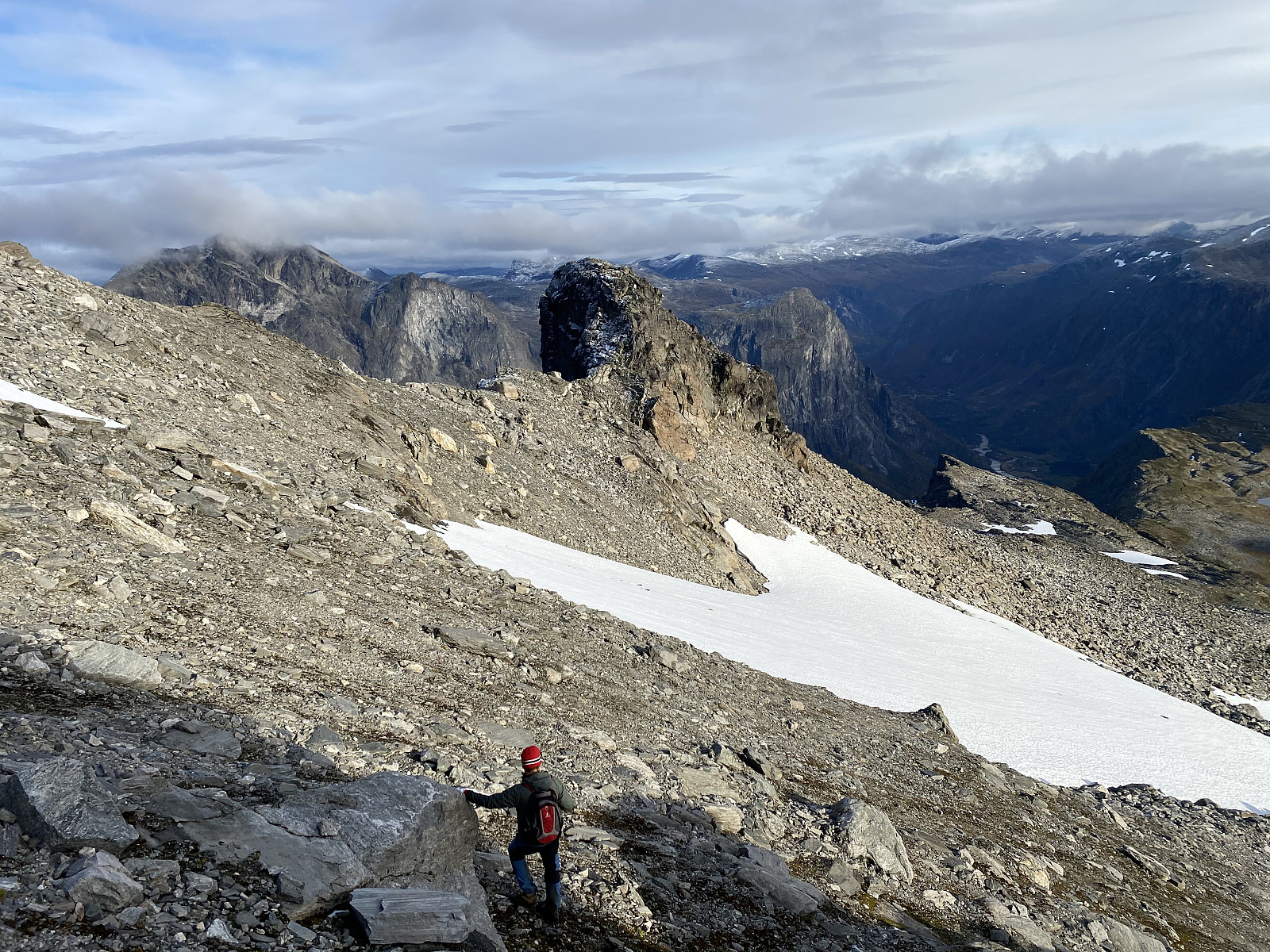
We went over to the edge that he mentioned, and looked down. A large portion of the mountain side beneath us was covered by snow from last winter, and the slopes were at the same time so steep that there was a substantial risk of sliding at a very high speed down the mountain side if we attempted at descending on the snow. And where there wasn't any snow, the mountain was a bit steep in the upper part; and so there wasn't any really inviting place for a descent, I have to say. Nevertheless, we found a spot where we could carefully climb down while bypassing the huge snow patch. The route was indeed a bit steep, and we had to climb upon loose stones at places; but fortunately there was even solid rock to hold onto, and so we managed little by little to get down towards Mount Mannen.
As we were descending the mountain side, the slope gradually became less steep, and when we came to another snow patch further down, you could actually save time at places by walking on the snow instead of jumping from stone to stone. As we were descending, we could look right into a beautiful hanging valley with two lakes, just on the other side of the valley into which we were descending (Image #16).
![Image #16: View towards Lake Nørdre Isglupen and Lake Søre Isglupen. The mountain on the other side of the lakes, and on the right side of them is Mount Skarfjellet [1723 m.a.m.s.l.]; and the one on the left side of the lakes is Mount Tua [1693 m.a.m.s.l.].](https://images1.peakbook.org/images/14939/Solan_20210122_600b0f0c39ed0.jpg?p=xtralarge)
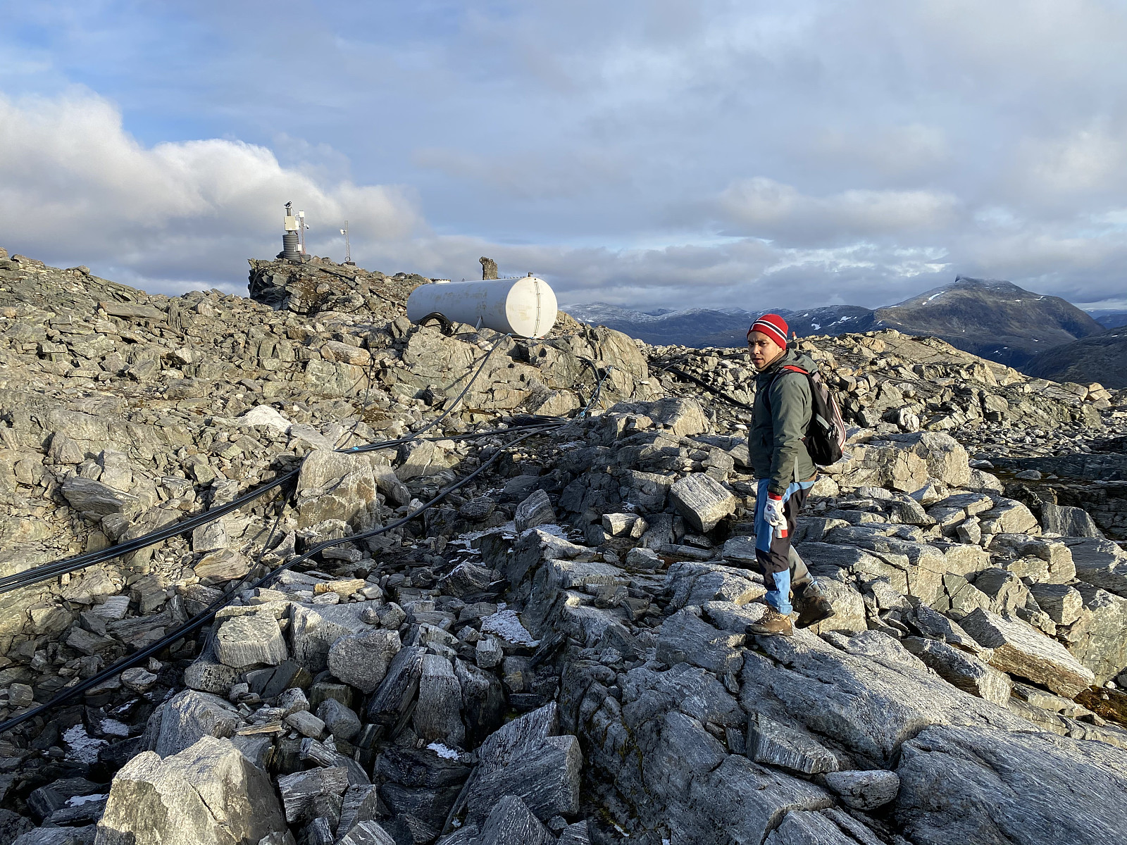
Mount Mannen has become renown in this part of Norway due to a landslide that was anticipated many years before it happened. Based upon geological reports, the population in the Rauma Valley beneath had been evacuated several times as the landslide was considered to be imminent; but after a while they had always been allowed to move back into their homes when the risk was considered to be less, either due to frost in the ground, or because it hadn't been raining for a while. Finally though, on September 12th 2019, a huge landslide occurred, in which more than 54.000 cubic meters of rock and stone fell from the part of the mountain called Veslemannen. Nevertheless, there are still huge fissures and cracks in this mountain, and the Norwegian Water Resources and Energy Directorate has maintained a lot of surveillance equipment up there; so no one should be surprised if further landslides from that mountain occur at some time in the future.
Mount Mannen [i.e. "The Man"] has a vertical separation of only about 5 meters, and so it could be claimed that it isn't really a separate mountain per se, but just a part of Mount Breitinden. You could actually look at Mount Breitinden as the head, and Mount Mannen as the shoulder of the same mountain. Nevertheless, Mount Mannen has traditionally been having its own name, as it somehow looks like a mountain from the valley beneath.
![Image #20: Mount Breitinden as seen from Mount Mannen. In the right part of the picture part of the cliff called Trollveggen [i.e. "The Troll Wall"] is seen, along with the peaks of Store Trolltinden, Trollryggen, and Nordre Trolltinden.](https://images1.peakbook.org/images/14939/Solan_20210122_600b1cf97a8ba.jpg?p=xtralarge)
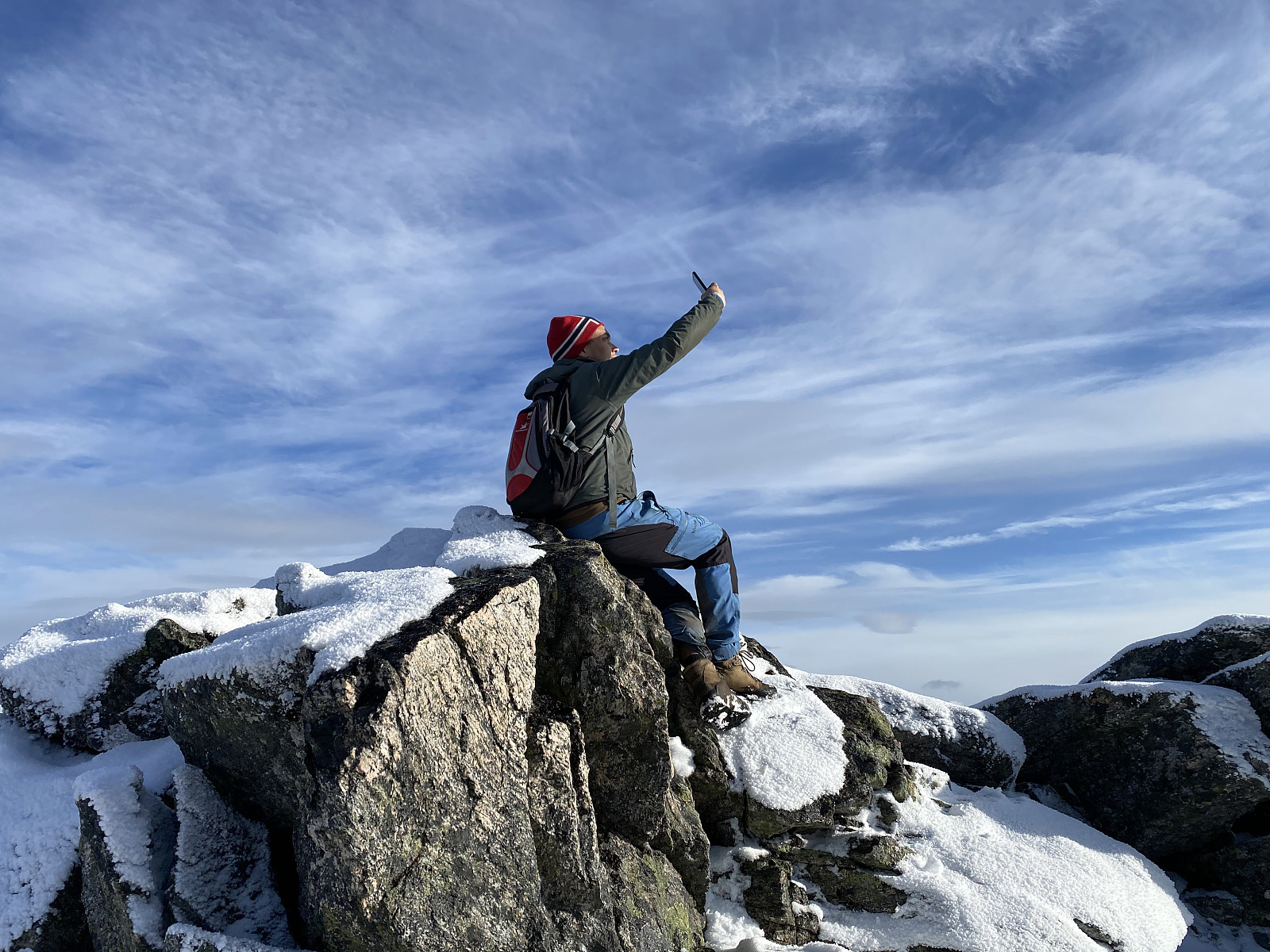
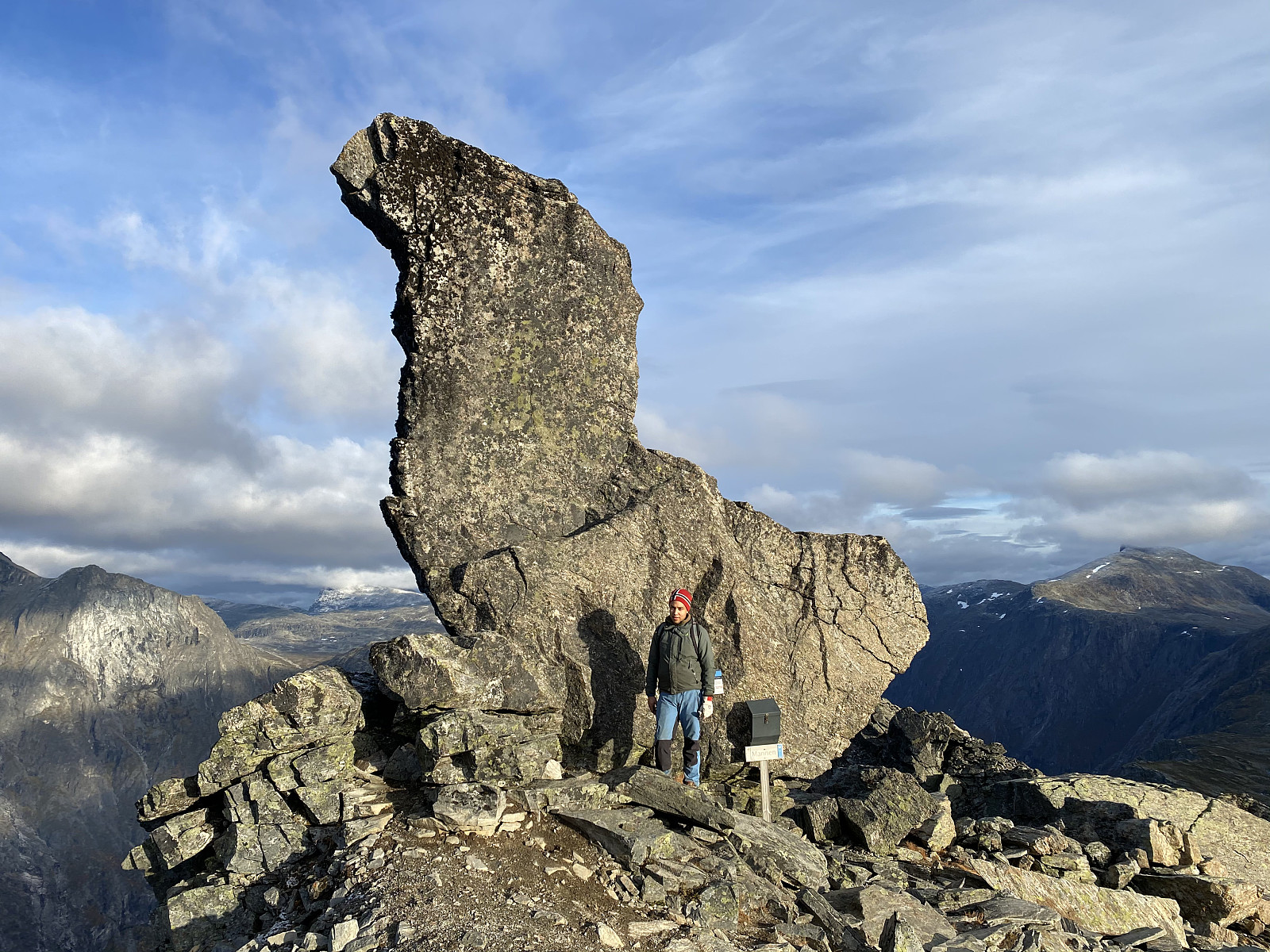
Mount mannen has a huge boulder with a shape somewhat resembeling a swan (Image #21). I managed to climb onto the back of it, but not all the way to the top, though my son told me he had actually climbed all the way up last time he was there. My son explained to me, that on one of his previous visits on Mount Mannen, there were a lot of families with kids at the spot, and many of the kids actually climbed up to the top of the boulder; and he just did it the way he saw them doing it. I should probably start training in a climbing wall, maybe that would enable me to climb all the way up this stone next time I visit this spot, as I believe there is going to be a next time, since there is such a huge number of marvelous mountains on all sides around this spot.
The trek back from Mount Mannen to the parking lot with our car was more or less striaght forward. The first kilometer or so is a descent from Mount Mannen into the valley of Alnesdalen, but thereafter you just follow a nice, and readily well marked trail along the bottom of this valley, until the valley opens up into the valley in which the Trollstigen Tourist Center is located. At Mount Mannen we met a couple that had been trekking directly up there from the Trollstigen area. They left Mount Mannen about half an hour before us, heading back towards their car, and now that even we were heading back, we could see them far ahead of us. We walked quite quickly, and even run a little at times; and frankly speaking I would have guessed that we were going to overtake this elderly couple at some point, but we never did. They were just about a hundred yards ahead of us when we arrived at the Trollstigen Tourist Road, but we never really managed to catch up with them. I think they were indeed quite fit for the trek, and moreover, they were probably rushing ahead a bit, just as we were; intending to get back to their car before it was running dark.

Benutzerkommentare