Ascending Mount Setnesfjellet with my Son (04.07.2020)


| Start point | Grytten Kirke (12m) |
|---|---|
| Endpoint | Grytten Kirke (12m) |
| Characteristic | Alpine trip |
| Duration | 6h 28min |
| Distance | 8.6km |
| Vertical meters | 1,494m |
| GPS |
|
| Ascents | Setnesfjellet (1,238m) | 04.07.2020 13:07 |
|---|---|---|
| Visits of other PBEs | Nuken utsiktsplass (320m) | 04.07.2020 13:07 |
| Setnesfjellet antenne (745m) | 04.07.2020 13:07 |
This morning, my son asked med if I would like to join him for a hike to the summit of Mount Setnesfjellet. He had been planning this climb for a few days, and had searched out some tour descriptions on the internet; and so he knew exactly where to park the car, and where to start hiking. So, after breakfast, we drove to the town of Åndalsnes in Rauma Municipality in the county of Möre & Romsdal. The drive to Åndalsnes takes a little less than two hours from where we live, and it is surrounded by a multitude of spectacular peaks and mountains; and the local tourist business association have nicknamed the town The Peak Capital [Norw.: Tindehovedstaden], in order to draw more climbers and hikers to the area.
We parked the car by a local Church called Grytten Kirke, and started walking from there. We first had to find our way through a residential area in the outskirts of Åndalsnes [i.e. in a village called Veblungsnes], but my son had an online map with a gps track on his cell phone, and so it was quite easy to find the way to where the trail started. Where the residential area and the street that we followed ended, we had to go through a hole in a fence, and then we had to climb a slope of about 50 meters of pastureland [Image #2]; before we reached the outskirts of the forest.
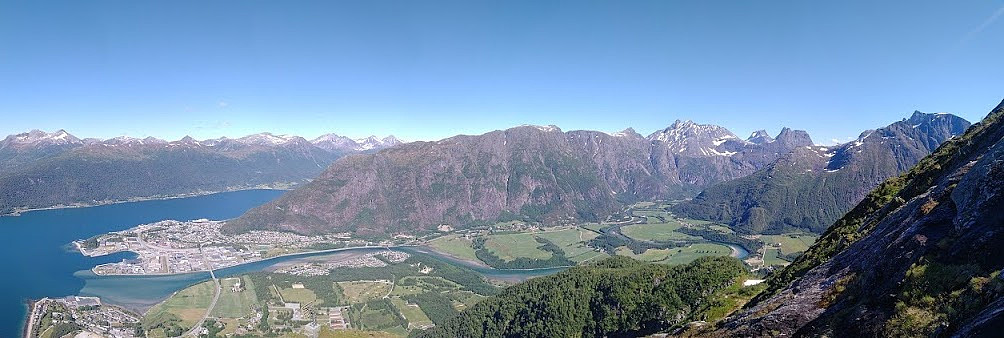
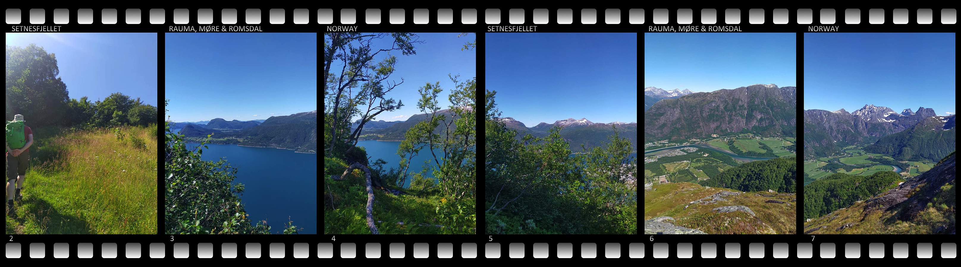
![Image #8: This picture shows how steep the climb up Mount Setnesfjellet really is. In the background you may see Mount Store Trolltind [i.e. "Greater Troll Peak"]. Image #9: Mount Setnesfjellet has a summit located at 1238 m.a.m.s.l., but in addition, it has a smaller peak just south of the summit, and another just north of it. Here I'm standing on the northern peak of the mountain. Image #10: The view from the top ridge of Mount Setnesfjellet towards Raumadalen Valley. Image #11: Heading from the north peak of the mountain towards the main summit. The mountains of Bispen [i.e. "The Bishop"], Kongen [The King"], and Mount Finnan are seen in the background. Image #12: View of the fjord Romsdalsfjorden. Image #13: View of a western ridge of the mountain.](https://images1.peakbook.org/images/14939/Solan_20201004_5f79a17cc5e23.jpg?p=xtralarge)
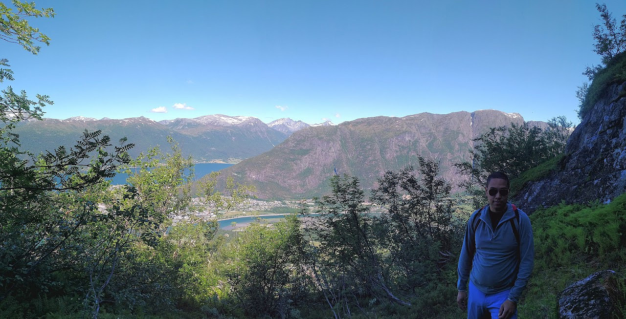
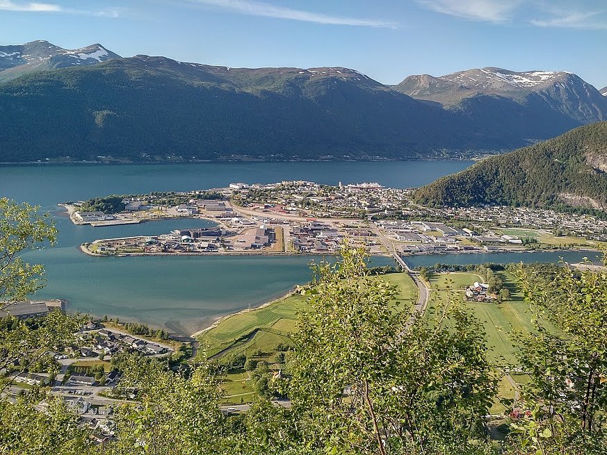
The lower half of the climb of Mount Setnesfjellet goes through a forest. After entering the forest, you very soon get to a spot where the trail passes around some old open water reservoirs that are currently empty, as they are no longer in use. The forest is not a very dense one, like a jungle or something; it's an ordinary Norwegian deciduous forest, mainly composed of birch trees. The climb up the mountain side is quite steep, however, and many places, the birch trees is actually what you're holding onto as you're climbing. At about 320 m.a.m.s.l.; you arrive at a nice viewpoint, called Nuken viewpoint [Norw.: Nuken utsiktspunkt], which offers a picturesque view of the fjord, the town of Åndalsnes, and the Rauma Valley. We didn't take time to admire the view on our way up the mountain side, however, as we thought it was better to do such stops on our way back down later that day.
The trail up this mountain was quite wet and muddy at places, even though it hadn't been raining for a few days; so we were glad we were using rather high trekking boots. At about 600 m.a.m.s.l. or so, the trees became more scarce; and soon afterwards we were out of the forest. At about 745 m.a.m.s.l. there is a funny rectangular (but probably parabolic) antenna. Up to this point the trail is quite well marked by red spots on stones and trees, but thereafter there are no markings. Nevertheless, it's just to follow the direction of the chutes and rocky ridges; which are running up to the northern peak of the mountain, hence in such nice weather as we had on this occasion, finding the way up is not difficult. There are places along this upper part of the trek, where you may practice your climbing skills if you like; but if you're not up to that, there are alternative paths that you may use to bypass the steepest places.
![Image #15: On the top ridge of Mount Setnestinden. Here my son Dag is standing on the northern peak, and the summit is seen behind him. The two highest mountains visible in the background is Mount Kongen [i.e.: "The King"] (left) and Mount Finnan (right).](https://images1.peakbook.org/images/14939/Solan_20201004_5f7a1d70454a4.jpg?p=xtralarge)
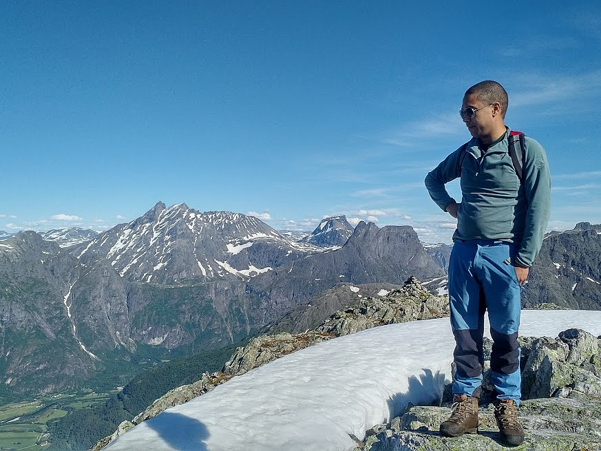
![Image #16: On the very summit of the Mountain. In the background Mount Store Trolltinden [Greater Troll Peak] is seen to the left, while the Bishop, the King, and Mount finnan is seen to the right.](https://images1.peakbook.org/images/14939/Solan_20201004_5f7a1df840fc2.jpg?p=xtralarge)
The upper part of this trek is not as muddy as down in the forest, but there's a lot of moss growing on the rocks and stones; hence it tends to be a little bit slippery at places. We soon reached the northern peak of the mountain [Images ##9 and 15], were we just shot a few pictures, before we turned south towards the summit of the mountain [see our gps tracking]. At the summit we captured even more photos [Images ## 16 and 17], and then had something to eat, before we headed back down to where we had parked our car.
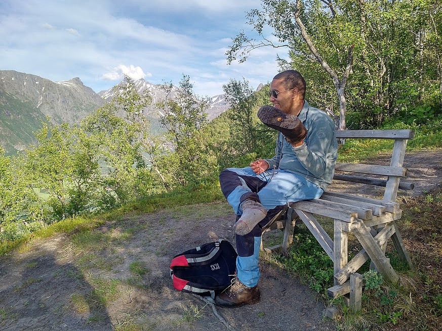
The hike back down was rather uneventful, but it takes more time to get back down than you would imagine, as the mountain is quite steep, in the upper part as well as in the lower part; hence you need to take care not to slip and fall. It was a hot and sunny day, and we had consumed all the beverages that we had brought with us long before we were back down. Shortly before we arrived at Nuken Viewpoint, therefore, we stopped at a little creek, and had some water to drink, and also filled up some of our bottles before we continued. That is one of the advantages of the Norwegian mountains, i.e., that the water in the mountain creeks and rivers is usually safe to drink; the exception being whenever there's a lot of dead lemming in the area, or if there's a lot of sheep or goats grassing in the area. We had a brief stop at Nuken viewpoint, to admire the view, as well as to shoot some images [Image #19], and then we continued back down to the parking lot where we had left our car.

User comments