GPS tracking and various photos from my round trip over the "city mountains" of Bergen, Norway.
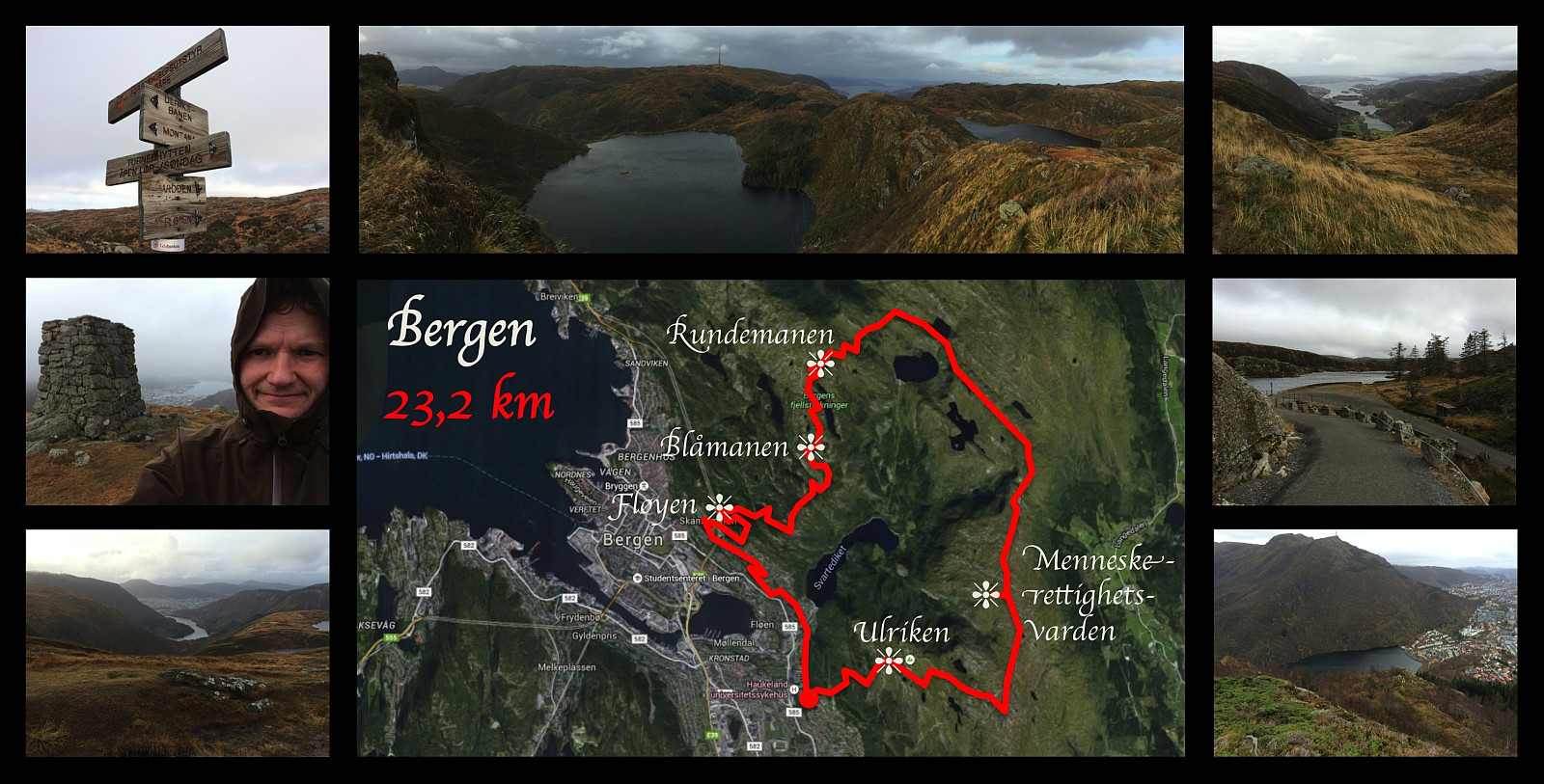
I've been working in the city of Bergen since September 2013, but I have not yet moved to Bergen. I usually go home (by plane) for the weekends unless I'm on call at the hospital where I'm working. During this particular week, however, my wife had come to Bergen to visit me instead, and we were therefore both in Bergen throughout the weekend. On Sunday I went for this 23 km long workout, where I climbed Mount Ulriken, and then followed a trail around the huge plateau that Ulriken is a part of, circumventing the valleys Isdalen, Hardbakkedalen and Våkendalen [The Norwegian word "dal" means valley]. The trail follows a mountain ridge that people in Bergen call Vidden. Finally, the trail takes you down into the pass that connects the valley of Våkendalen with the valley of Jordalen (see map / GPS track), and also separates Mount Ulriken from Mount Rundemanen. I continued the trail up Mount Rundemanen, then unto Mount Blåmanen, and finally down to Mount Søre Midtfjellet [i.e. the southern middle mountain]. From there, I followed a path down to Mount Fløyen, where I met my wife, who had gone for a shorter trek; and then we walked together along the roads back to my Bergen apartment.


User comments