Another Hike to Mount Gamlemsveten (04.01.2020)

| Startsted | Søvikdalen Parking Spot (81moh) |
|---|---|
| Sluttsted | Søvikdalen Parking Spot (81moh) |
| Turtype | Fottur |
| Turlengde | 2t 42min |
| Distanse | 9,4km |
| Høydemeter | 705m |
| GPS |
|
| Bestigninger | Gamlemsveten (791moh) | 04.01.2020 |
|---|---|---|
| Andre besøkte PBE'er | Søvikdalen p-plass (81moh) | 04.01.2020 |

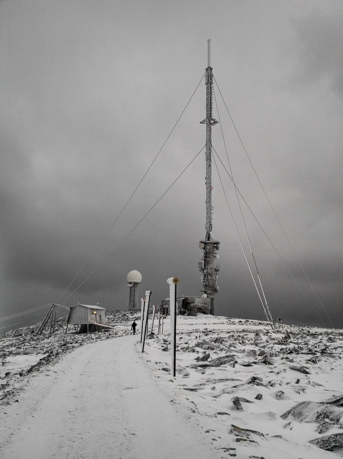
In winter time, whenever snow is to scarce for mountain skiing, and yet too abundant for an ordinary mountain hike on foot; then Mount Gamlemsveten is a very good option. There has been built a huge TV broadcasting antenna at the very summit, and there are even some other telecommunication installations up there as well. A construction road was once built up to the summit for the purpose of bringing material like plank, concrete and iron up there when the TV antenna was built; hence even when there's quite some snow, the ground beneath is pretty even, and not as stony as it usually is in mountains like this. On the other hand, the road up there is usually not plowed, and cars are not allowed apart from those that take part in maintenance work on the installations up there; hence you are very unlikely to be disturbed by any traffic if you decide to hike the mountain. Moreover, the road up to the summit is very well marked by snow plow guiding sticks, so even when snow's quite deep, you will be able to find your way up.
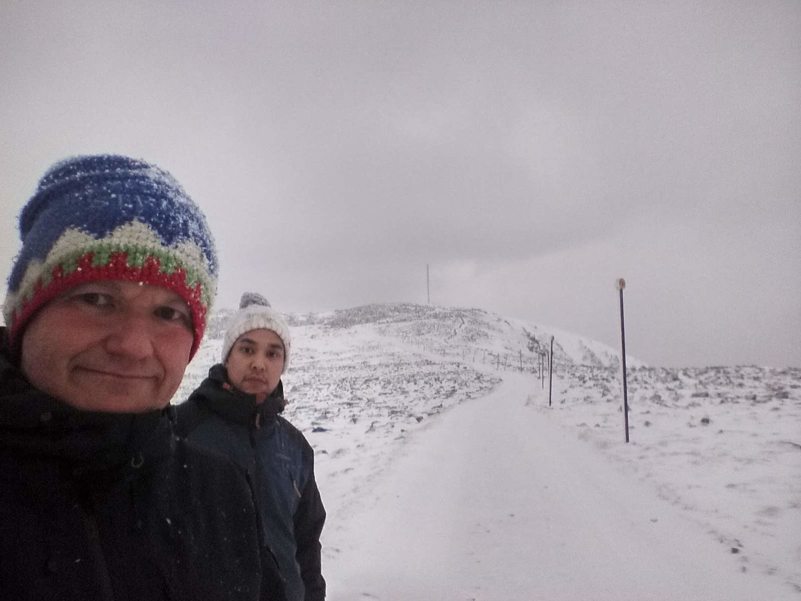
My son Dag and I decided to climb this mountain on this beautiful winter day. We had climbed this mountain many times before, but we rarely have anything against another hike up there, as we regard it a good workout. We drove to the village of Søvika, and then took a tinier road to the left, and followed this for a kilometer or so into the valley between called Søvikdalen, where there is a nice parking lot for mountain trekkers. Just by the parking lot, there's also a barrier to prevent people without a permit to drive up there. We followed the road as it winded its way upwards. The road is quite steep at places. I once climbed the mountain with a 29" mountain bike [a Gary Fisher Paragon], and when doing that, the traction [i.e. rear] wheel tended to spin out if I was leaning a little too much forward, whereas the front wheel tended to lift from the ground whenever I was leaning a little too much backward.
The mountain is slightly less than 800 m.a.m.s.l., and we reached the summit in slightly more than 1 1/2 hour (in summer it takes us less than 1 hour). On the wall of a building on the left hand as you approach the summit, there's a book in which you may write your name as proof that you've been up there. We wrote our names in the book, and then had an uneventful descent back down to the car.

Kommentarer