Encircling the Southern Part of Mt. Sulafjellet. (12.09.2015)

| Startpunkt | Mausavatnet (P-plass Mauseid) (50m) |
|---|---|
| Endpunkt | Mausavatnet (50m) |
| Tourcharakter | Wanderung |
| Tourlänge | 4h 15min |
| Entfernung | 13,1km |
| Höhenmeter | 1.008m |
| GPS |
|
| Besteigungen | Rundehornet (725m) | 12.09.2015 |
|---|---|---|
| Sulabakkhornet (661m) | 12.09.2015 | |
| Vardane (776m) | 12.09.2015 |
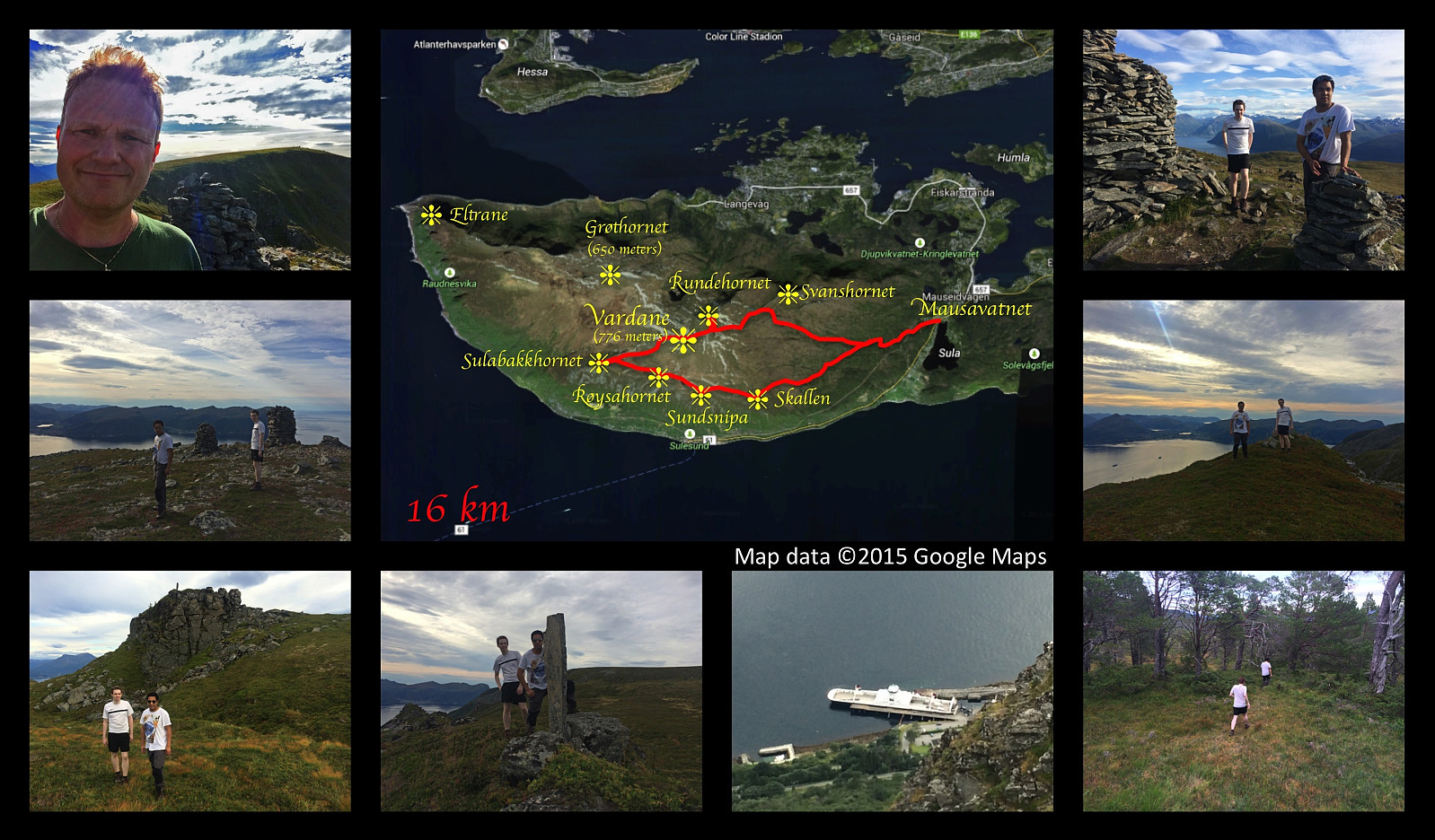
On this day I had another nice hiking trip on Mount Sulafjellet with my oldest son and one of his friends. This time we took a different route from what we've done on previous occasions; one that offers an awesome view in a southward direction. We set out from the parking lot at Mauseidvatnet as we've done before, and followed the gravel road through the forest past the cabin called Taustuhytta and up to the one called Rollonhytta. From there we continued along the mountain path that we had used before, up to the summit of the island, which is called Tverrfjellet or Vardane; making sure though, to take a few minutes even to mount the peak called Rundehornet, so that I could tell people that I had been there also.
From Vardane we descended in southwest direction towards Sulabakkhornet, and then we followed a track in eastward direction, passing the smaller peaks of Røysethornet, Sundsnipa and Skallen. From Sundsnipa there was an amazing view down to the ferry pier at Sulesund, where you may catch the ferry over to a large island called Hareidlandet. From Skallen [i.e. "The Scull"] it was difficult to find a track back down to our car. It was there on our map, but it had not been used for years, obviously. You could spot it every there and then, but as we approached the forest in the valley in front of us, the path completely disappeared; and we had quite a hard time fighting our way through the forest down to the gravel road on which we had started out in the morning.

Benutzerkommentare