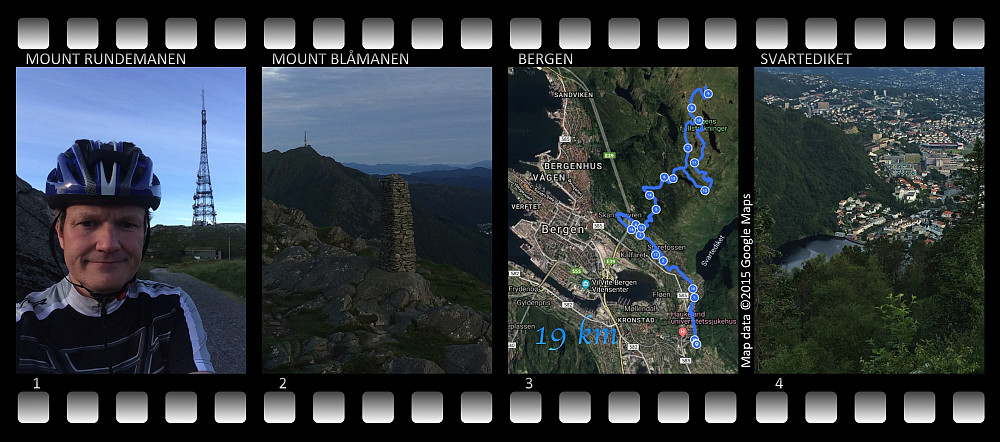
Bicycle ride to mountains Rundemanen and Blåmanen. (10.07.2015)


| Startpunkt | Haukelandsbakken (150m) |
|---|---|
| Endpunkt | Haukelandsbakken (150m) |
| Tourcharakter | Fahrradtour Gelände |
| Tourlänge | 2h 13min |
| Entfernung | 19,1km |
| Höhenmeter | 826m |
| GPS |
|
| Besteigungen | Blåmanen Vest (552m) | 10.07.2015 |
|---|---|---|
| Rundemanen (568m) | 10.07.2015 |

I had a nice little bicycle ride in the Bergen mountains on this evening; on the mountains Fløyen, Rundemanen and Blåmanen. I started out from the road Haukelandsbakken, where I've been renting an apartment in Bergen, and road down to Årstad in the valley between the mountains Ulriken and Fløyen, and then up the mountain side of Mount Fløyen, passing the high class restaurant called Bellevue due to its splendid view over Bergen. I continued upwards, zigzagging up to the football field of Skansemyren, right after which I took sharply up to the right, continuing up a mountain road that eventually leads to the summit of the mountain. The road is paved up to the a restaurant calle Fløyen Folkerestaurant [i.e. "Mount Fløyen People's Restaurant"] and to the end-stop of the Funicular that may take you from Bergen city center up to Mount Fløyen. I left the paved road shortly before reaching the restaurant, however, passing a little pond called Skomakerdiket [i.e. the shoemaker's dam], and continued climbing with my bicycle on the dirt road up to a kiosk named Brushytten [i.e. "the Soda-water cabin"]. I believe they sell soda-water at this spot, but I don't really know, as I've never seen it open at the hours that I've been on this mountain. From Brushytten the road is again paved, up a steep hillside with a sign warning that there's a danger of rockfall throughout all parts of the year. As you reach a lake called Store Tindevann [i.e. "Great Mountain Lake"], you're back on a dirt road, which takes you around a large part of the summit plateau of Mount Rundemanen, and eventually you'll find a short sidetrack on your left hand, which will take you to the large TV sender antenna and the summit point of the mountain.
From the summit of Rundemanen, I rode back to Store Tindevann, and then took a dirt road that takes you onto Mount Blåmanen. Blåmanen has about 4 summits, but non of them with primary factor above 100 meters, hence they are all really just part of the larger mountain Rundemanen. I passed close to the northern peak of Rundemanen, and then down into a valley with some small ponds, and next up again unto the western peak of Mount Rundemanen. You can ride your MTB or mountain bike unto the northern peak of Blåmanen more or less, but from the northern peak to the Western peak you have to carry your bike, and then down from the western peak there is a road built in stone, that once in time must have been possible to ride a bike on, but today you have to carry your bike on quite a bit of this road as well. Back down at Brushytten, I followed the same track back to my Bergen appartment as I had been riding up to the mountain.
![Image 5: The lake "Store Tindevann" [i.e. "Great Mountain Lake"] as seen from Blåmanen, not far from the "northern peak" of the mountain. Mount Rundemanen with its antenna is seen in the distance.](https://images1.peakbook.org/images/14939/Solan_20190626_5d13de365ff6f.jpg?p=large)

Benutzerkommentare