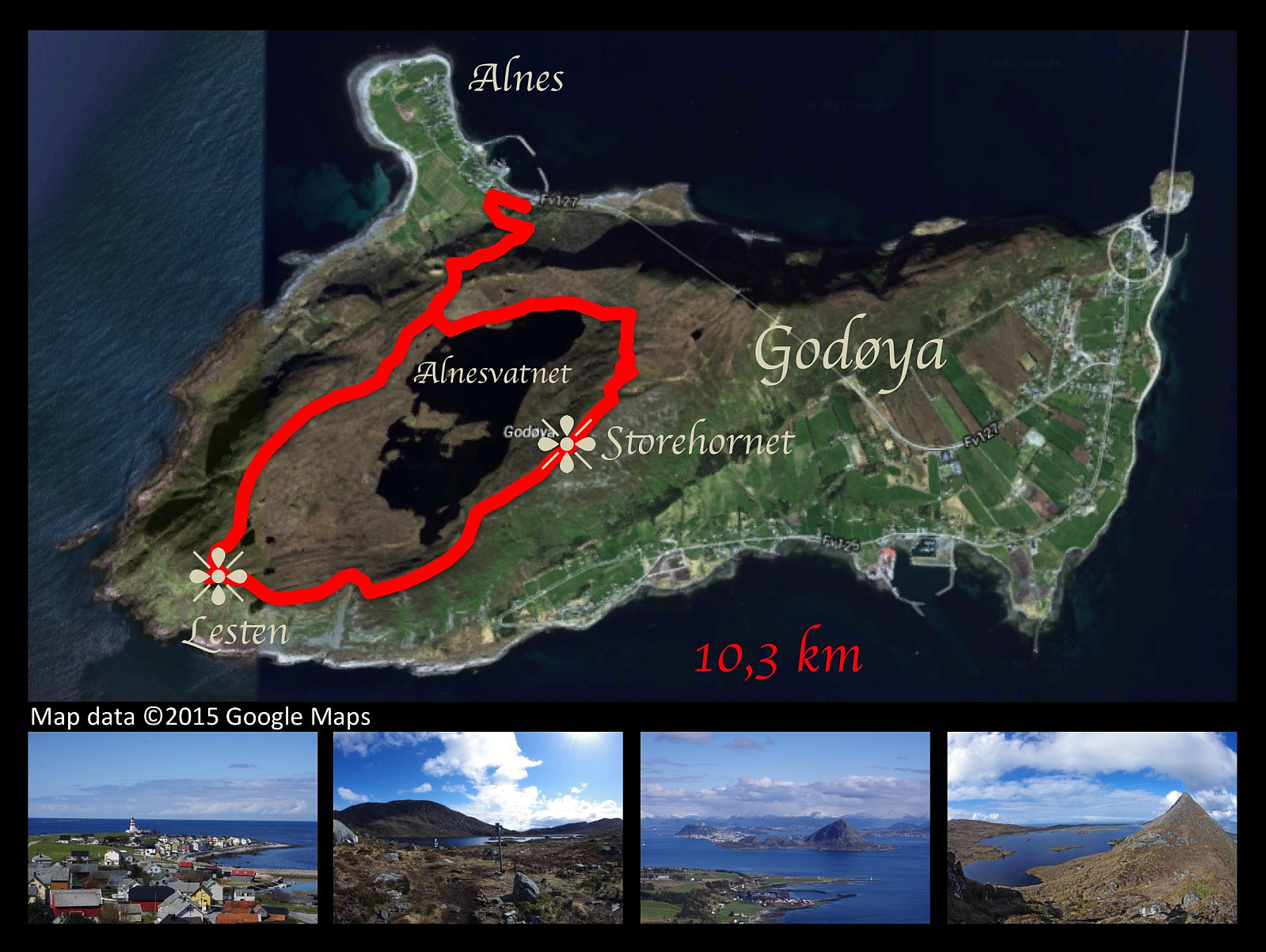
Trekking the mountains of Godøy Island in Giske municipality in Norway. The large image is my Endomondo tracking superimposed upon a Google Earth image of the island. On the left thumbnail image is seen the promontory of Alnes with its picturesque and well-known lighthouse. On the 2nd and 4th thumbnail is seen the lake Alnesvatnet, which is located on a plateau about 250 m.a.m.s.l., and serves as the main drinking water reservoir for the Giske municipality, which is constituted of the four islands Vigra, Valderøy, Giske and Godøy. The 3rd thumbnail shows the view towards the town of Ålesund.
On this day I had a nice trip walking the mountains of Godøy Island. Weather was nice, and the scenenery was picturesque. The climb from the promontory of Alnes is rather steep to begin with, but you then reach a plateau at about 250 meters above mean sea level, on which is located a lake called Alnesvatnet. This lake is ideally located as a drinking water reservoir for the entire municipality of Giske, which is constituted of four inhabited islands along with a number of uninhabited islets. The lake is located substantially higher than any of the inhabited areas of the municipality, hence there's sufficient water pressure to reach all the houses in need of water. Once on the plateau, you walk along Alnesvatnet to its eastern end, and then you follow the track up a rather stony mountain edge up to a number of mountain summits, of which Storhornet is the highest. The mountains of the Godøy Island offers a nice view in all directions. From Storhornet you may even see the islet Storholmen with another lighthouse far out in the northwest. The descent from Storhornet to the west is even steeper than the slope up on the northern aspect of the mountain, but anyone a bit used to mountain trekking will manage. Trekking over the smaller western peaks of the island [i.e. Lesten/Rantane] is not very challenging, but you need to whach your steps, as there's a steep mountainside down to the coast of the island many places.


Kommentarer