A short trek to Mount Myklebusthornet on Ellingsøy Island (25.04.2015)

| Start point | Nes Stadion, Ellingsøy (35m) |
|---|---|
| Endpoint | Nes Stadion, Ellingsøy (35m) |
| Characteristic | Hillwalk |
| Duration | 1h 40min |
| Distance | 5.2km |
| Vertical meters | 400m |
| GPS |
|
| Ascents | Myklebosthornet (329m) | 25.04.2015 11:19 |
|---|
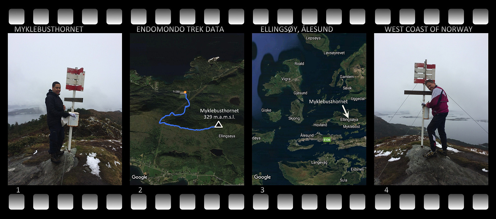
I went for a mountain trek with my oldest son this day to the island called Ellingsøya. The island has a mountain ridge in east-west direction, which stretches along most of the island. The ridge is usually just reffered to as Ellingsøyfjellet [i.e. "the Ellingsøy mountain"], but it has several peaks along its course, called Vikenakken, Sperrenakken and Myklebusthornet, among which Myklebusthornet is the highest. We parked at the parking spot of a local football field on the north side of the island (Nes Stadion). The climb to Myklebusthornet from this spot is about 2,6 km, making the trip 5,2 km including the decent back to the parking spot. The peak is 329 meters above mean sea level, about 300 meters above the altitude at which we parked the car.
The peak is located just above the village Myklebust, and has aquired its name from the village (the word horn means the same in Norwegian as in English). Myklebust comes from the Norse words mikill which means large and bustaðr which means farm; because there was a large farm at this spot [i.e. at Myklebust] during the Norse or Viking era. Myklebust hornet is thus the mountain horn above the large farm...

User comments