Archiv - Nach Datum
Archiv - Nach Aktivität
-
Andere Tour (123)
- Expedition (123)
-
Andere Wintertour (7)
- Schneeschuhtour (7)
- Fahrradtour (1)
- Fußtour (34)
Peakbookfreunde
Gesammelte Listen


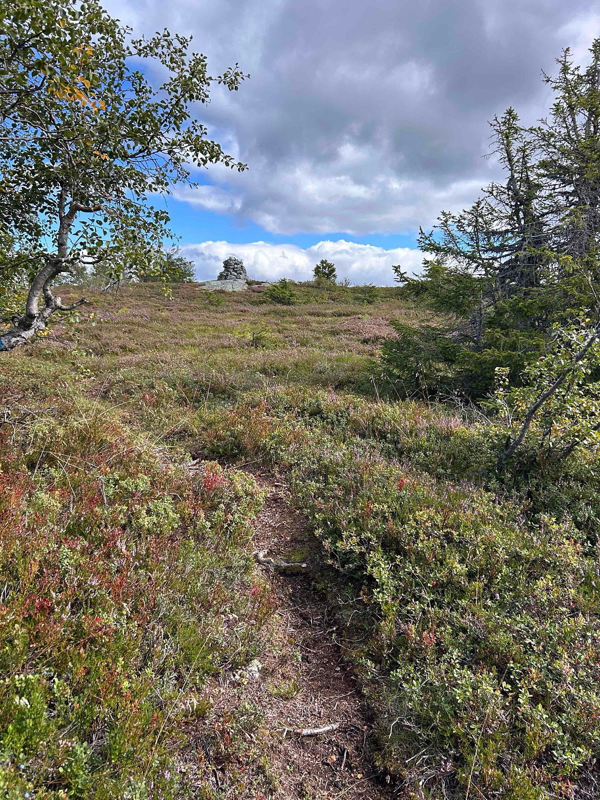
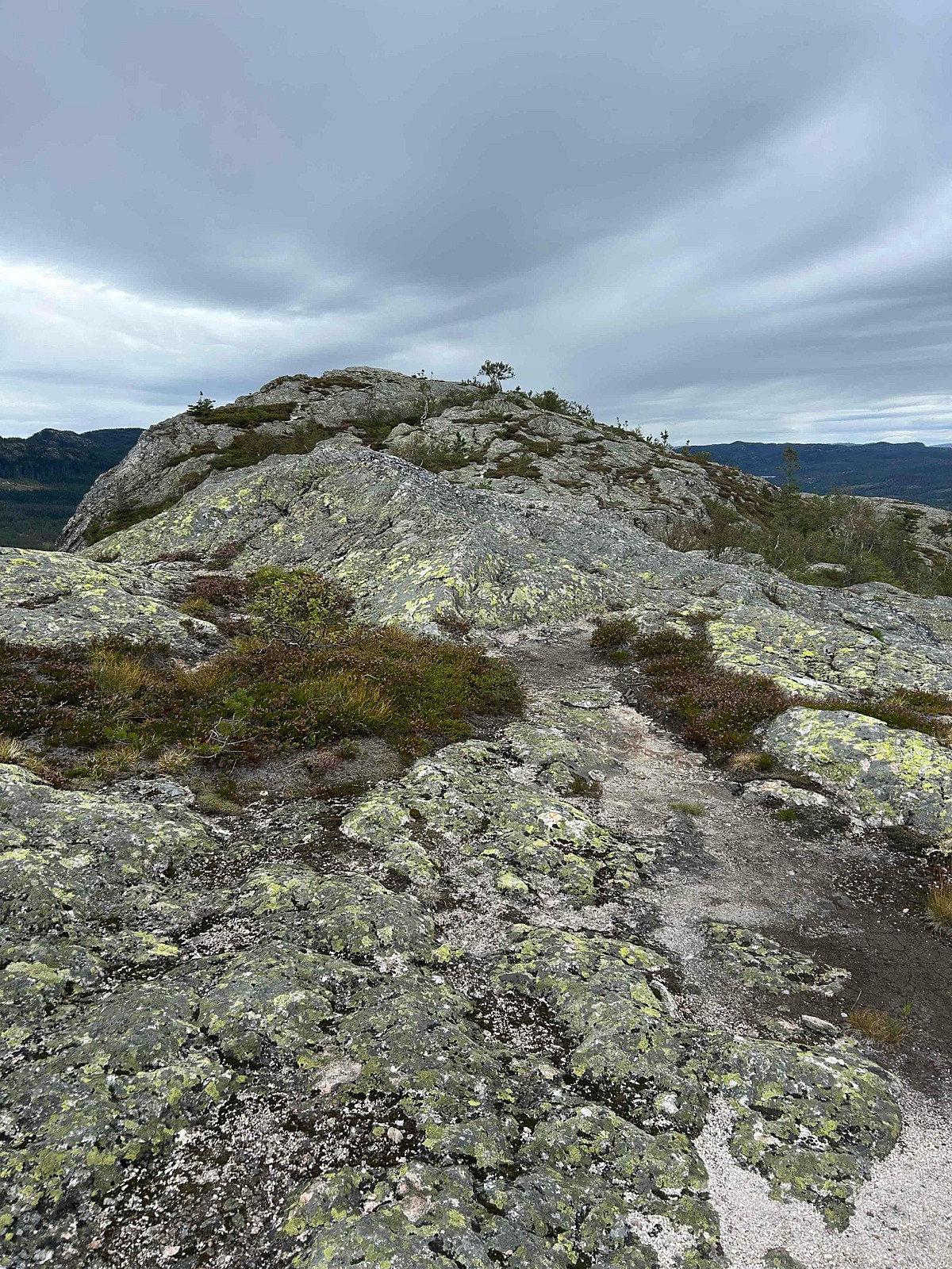
LA/HM-087 Rafjellet 576 moh
- Datum:
- 26.09.2025
- Tourcharakter:
- Expedition
- Entfernung:
- 1,8km
 Fantastikk fint sted å være, behagelig rute og anbefales.
Distance: abt 3.6 km t/r
Start: Svarttjern p-plass (parking).
Summer: Bike / Walk -> Hike up to summit.
Winter: Skiis / Snowshoes -> Yes snowshoes and boots with crampons when is a lot of ice.
Tollroad/Bom: 40 kr i 2024/2025
Equipment: KX3 15w & 1/4~wave Vertical (APRS LA9PJA-7/LA9PJA-9)
Apps / Resources: SOTA Goat, SOTLAS, PeakBook, APRS.FI, QTHnow / POTA, POTA-MAP.fr, AllTrails
- - - -
Photos & Track: Courtesy of LA9PJA :)
Fantastikk fint sted å være, behagelig rute og anbefales.
Distance: abt 3.6 km t/r
Start: Svarttjern p-plass (parking).
Summer: Bike / Walk -> Hike up to summit.
Winter: Skiis / Snowshoes -> Yes snowshoes and boots with crampons when is a lot of ice.
Tollroad/Bom: 40 kr i 2024/2025
Equipment: KX3 15w & 1/4~wave Vertical (APRS LA9PJA-7/LA9PJA-9)
Apps / Resources: SOTA Goat, SOTLAS, PeakBook, APRS.FI, QTHnow / POTA, POTA-MAP.fr, AllTrails
- - - -
Photos & Track: Courtesy of LA9PJA :)
LA/HM-094 Engerfjellet 567moh
- Datum:
- 26.08.2025
- Tourcharakter:
- Expedition
- Entfernung:
- 1,6km
 Summer route, easy and nice view from the summit.
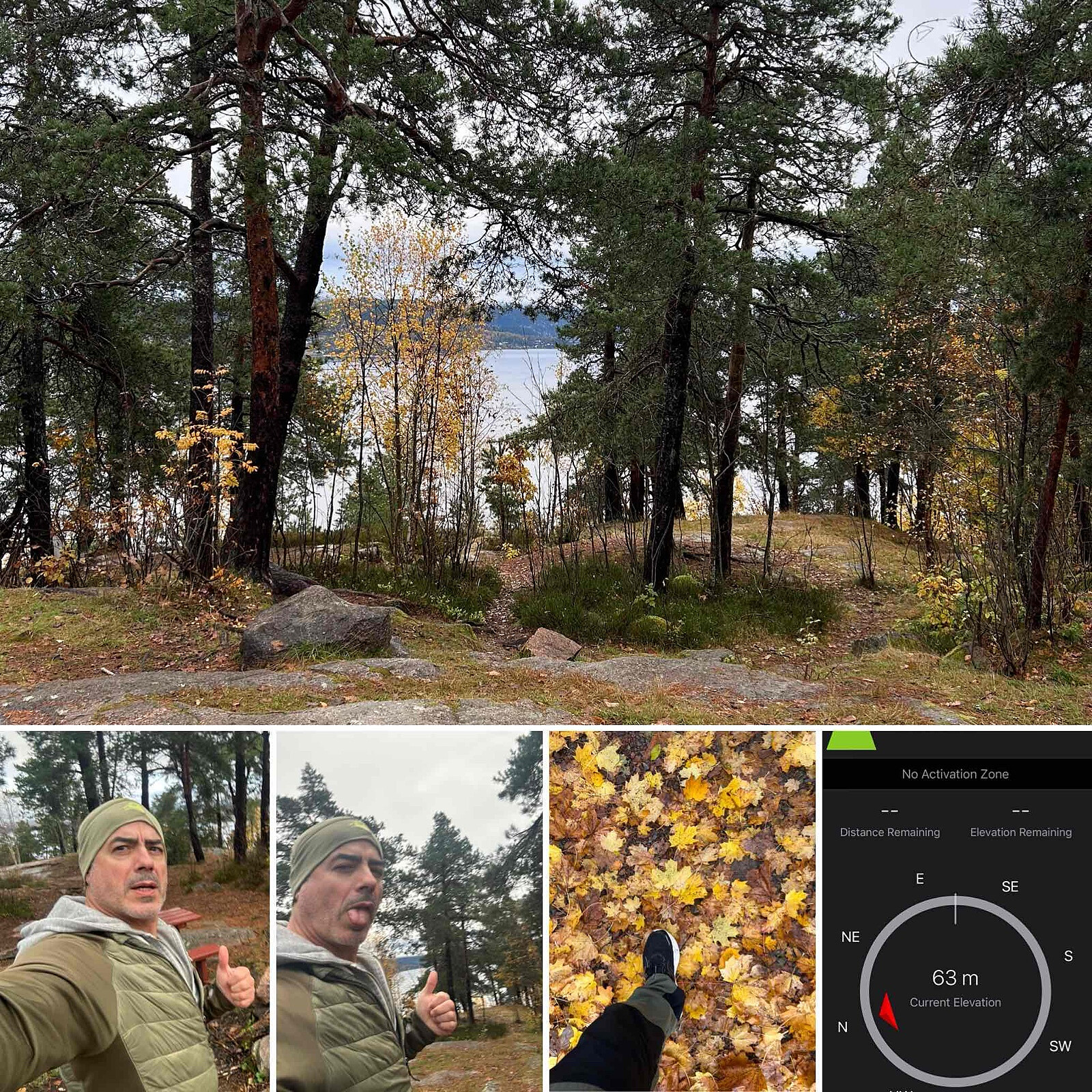
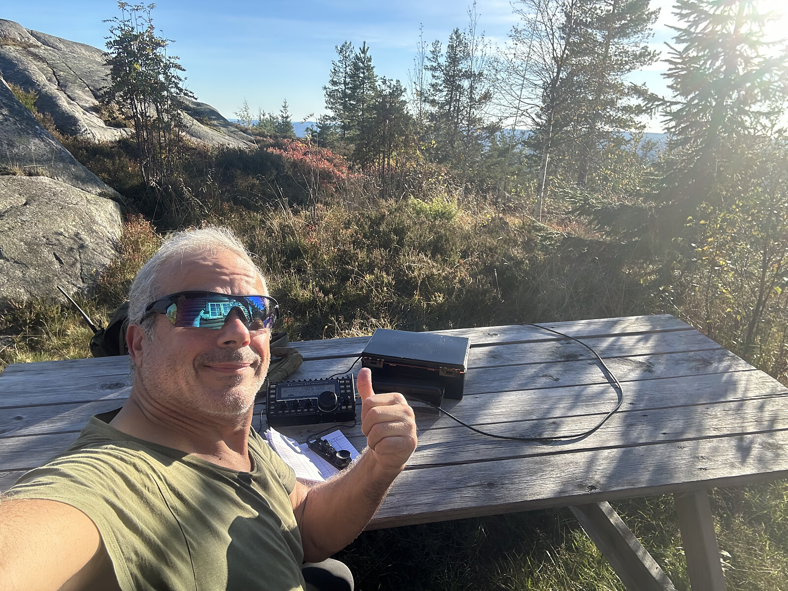
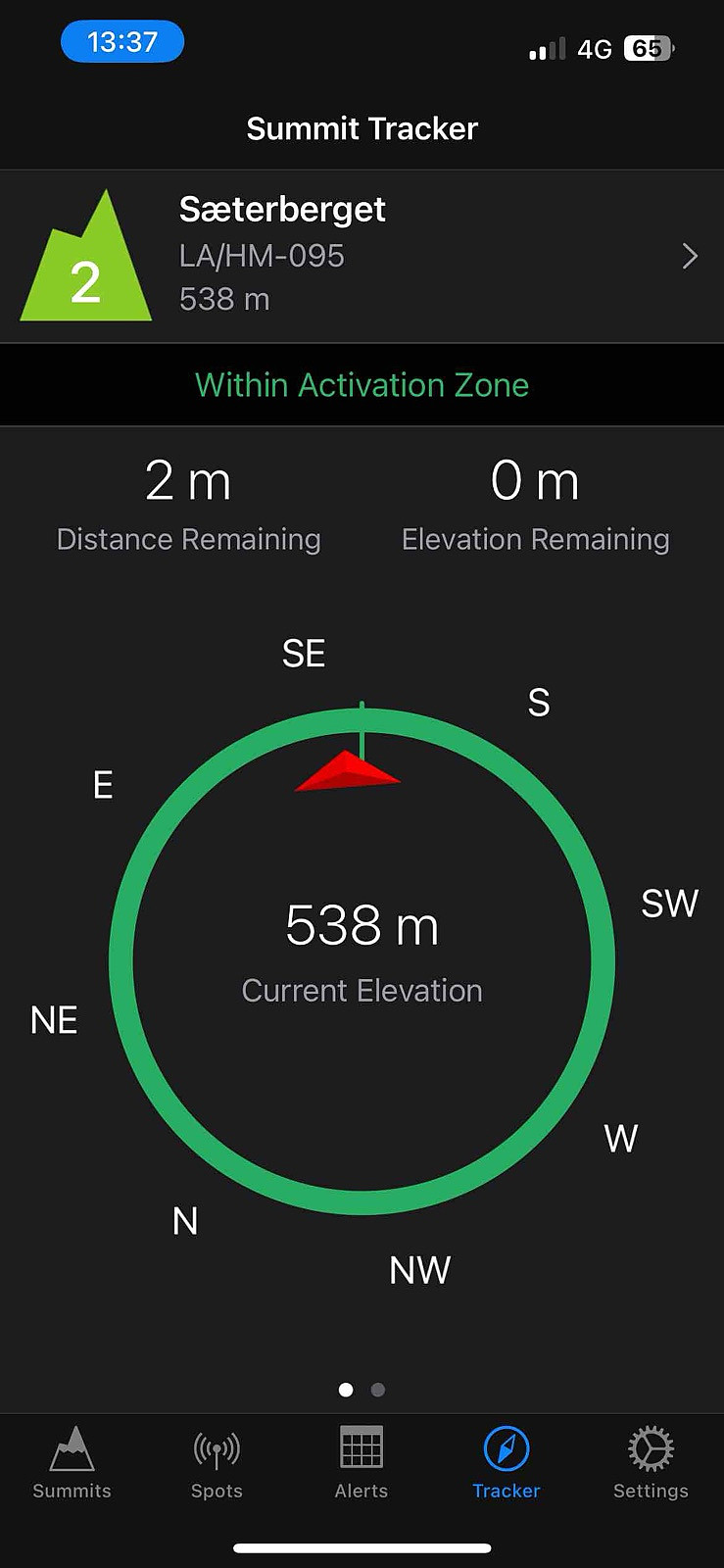
LA/HM-095 Sæterberget 538 moh
- Datum:
- 26.08.2025
- Tourcharakter:
- Expedition
- Entfernung:
- 1,7km
 Nice and easy hike up to summit, possible to bike as well. The spot has no great view but there is always possible to operate from another place inside activation zone.
Distance: abt 4 km t/r
Start: Stormyrvegen P-lomme (parking) before bom.
Summer: Bike / Walk -> Bike or Hike up to summit.
Winter: Skiis / Snowshoes -> Yes skiis or snowshoes and/or boots with crampons when is a lot of ice.
Tollroad/Bom: NO - 0 kr
Equipment: KX3 15w & 1/4~wave Vertical (APRS LA9PJA-7/LA9PJA-9)
Apps / Resources: SOTA Goat, SOTLAS, PeakBook, APRS.FI, QTHnow / POTA, POTA-MAP.fr, AllTrails
- - - -
Photos & Track: Courtesy of LA9PJA :)
Nice and easy hike up to summit, possible to bike as well. The spot has no great view but there is always possible to operate from another place inside activation zone.
Distance: abt 4 km t/r
Start: Stormyrvegen P-lomme (parking) before bom.
Summer: Bike / Walk -> Bike or Hike up to summit.
Winter: Skiis / Snowshoes -> Yes skiis or snowshoes and/or boots with crampons when is a lot of ice.
Tollroad/Bom: NO - 0 kr
Equipment: KX3 15w & 1/4~wave Vertical (APRS LA9PJA-7/LA9PJA-9)
Apps / Resources: SOTA Goat, SOTLAS, PeakBook, APRS.FI, QTHnow / POTA, POTA-MAP.fr, AllTrails
- - - -
Photos & Track: Courtesy of LA9PJA :)
LA/BU-093 Raudsteinvarden 897 moh
- Datum:
- 22.08.2025
- Tourcharakter:
- Expedition
- Entfernung:
- 1,8km
 Fantastikk fin tur på en solfylt dag.
Distance: abt 3 km t/r
Start: Milebotten p-plass (parking).
Summer: Bike / Walk -> Hike up to summit.
Winter: Skiis / Snowshoes -> Yes snowshoes and boots with crampons when is a lot of ice.
Tollroad/Bom: 50 kr cash & VIPS i 2025
Equipment: KX3 15w & 1/4~wave Vertical (APRS LA9PJA-7/LA9PJA-9)
Apps / Resources: SOTA Goat, SOTLAS, PeakBook, APRS.FI, QTHnow / POTA, POTA-MAP.fr, AllTrails
- - - -
Photos & Track: Courtesy of LA9PJA :)
Fantastikk fin tur på en solfylt dag.
Distance: abt 3 km t/r
Start: Milebotten p-plass (parking).
Summer: Bike / Walk -> Hike up to summit.
Winter: Skiis / Snowshoes -> Yes snowshoes and boots with crampons when is a lot of ice.
Tollroad/Bom: 50 kr cash & VIPS i 2025
Equipment: KX3 15w & 1/4~wave Vertical (APRS LA9PJA-7/LA9PJA-9)
Apps / Resources: SOTA Goat, SOTLAS, PeakBook, APRS.FI, QTHnow / POTA, POTA-MAP.fr, AllTrails
- - - -
Photos & Track: Courtesy of LA9PJA :)
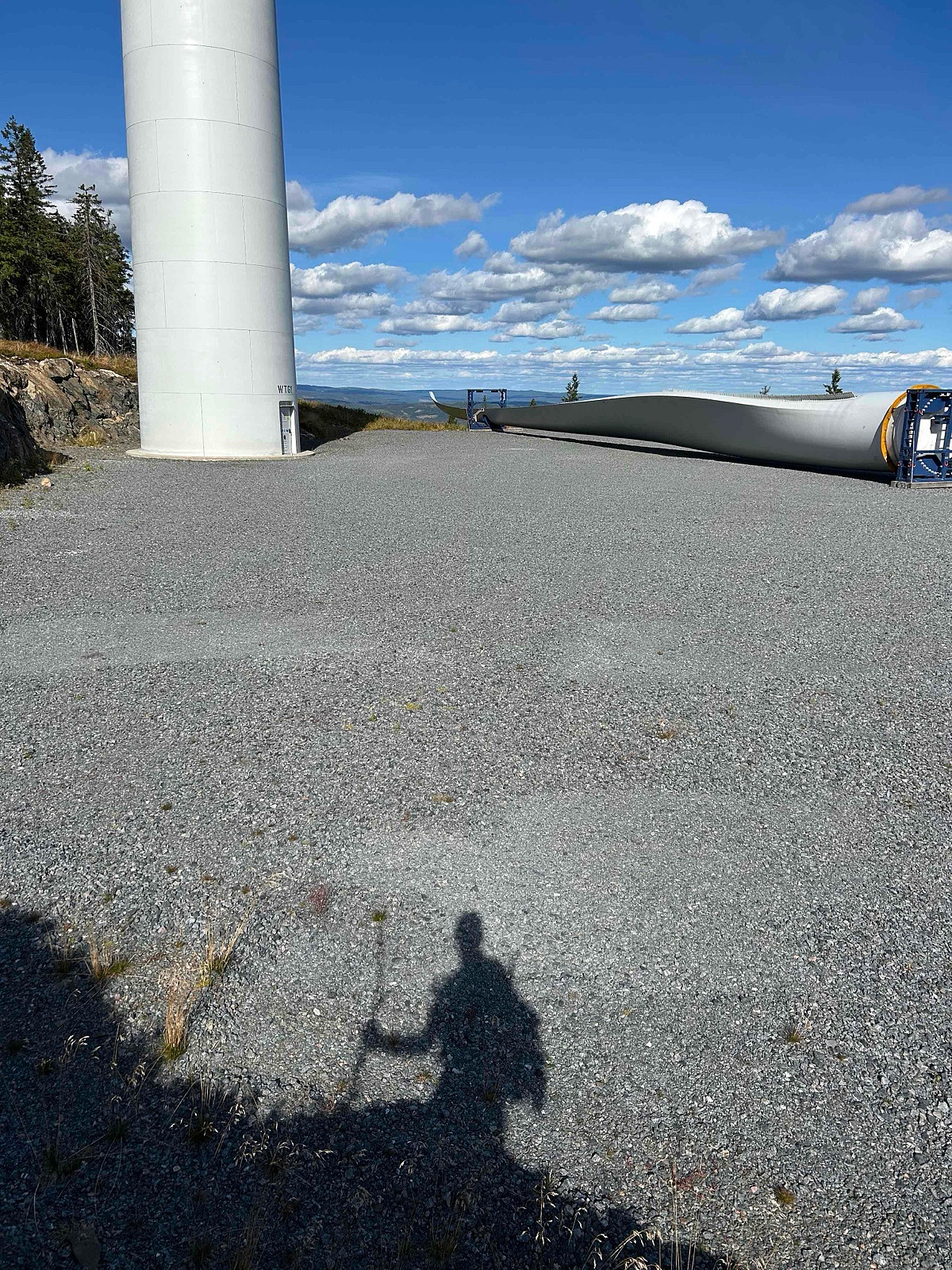
LA/BU-101 Tekslehogget 721 moh
- Datum:
- 20.08.2025
- Tourcharakter:
- Expedition
- Entfernung:
- 1,6km
 It looks like there are several ways to get to the summit, probably driving further the road up and parking at the end and go over the other top to the summit. I decided to go for the safer one and most used by other trakers (Not SOTA related) that I found online, most used this track.
For some reason my Garmin clock Track GPS file up, got corrupted, seems never got saved, luckly I have found GPS file from another app I had activated.
Distance: abt 3 km t/r
Start: Tekslehogget parking.
Summer: Bike / Walk -> Hike up to summit.
Winter: Skiis / Snowshoes -> Yes snowshoes and boots with crampons when is a lot of ice.
Tollroad/Bom: 50 kr (2025)
Equipment: KX3 15w & 1/4~wave Vertical (APRS LA9PJA-7/LA9PJA-9)
Apps / Resources: SOTA Goat, SOTLAS, PeakBook, APRS.FI, QTHnow / POTA, POTA-MAP.fr, AllTrails
- >>>
It looks like there are several ways to get to the summit, probably driving further the road up and parking at the end and go over the other top to the summit. I decided to go for the safer one and most used by other trakers (Not SOTA related) that I found online, most used this track.
For some reason my Garmin clock Track GPS file up, got corrupted, seems never got saved, luckly I have found GPS file from another app I had activated.
Distance: abt 3 km t/r
Start: Tekslehogget parking.
Summer: Bike / Walk -> Hike up to summit.
Winter: Skiis / Snowshoes -> Yes snowshoes and boots with crampons when is a lot of ice.
Tollroad/Bom: 50 kr (2025)
Equipment: KX3 15w & 1/4~wave Vertical (APRS LA9PJA-7/LA9PJA-9)
Apps / Resources: SOTA Goat, SOTLAS, PeakBook, APRS.FI, QTHnow / POTA, POTA-MAP.fr, AllTrails
- >>>
