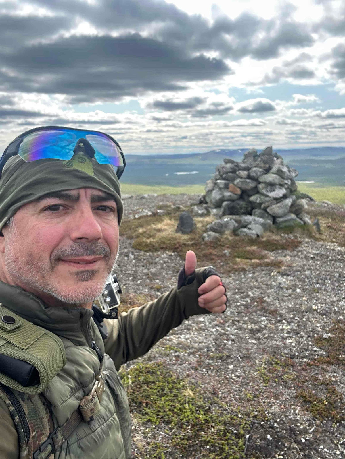
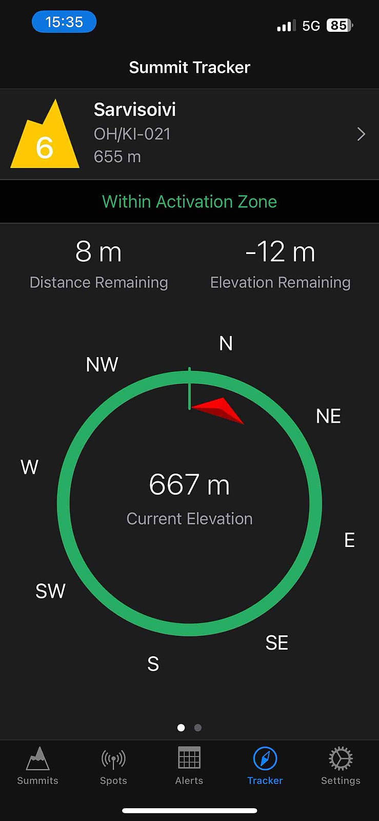
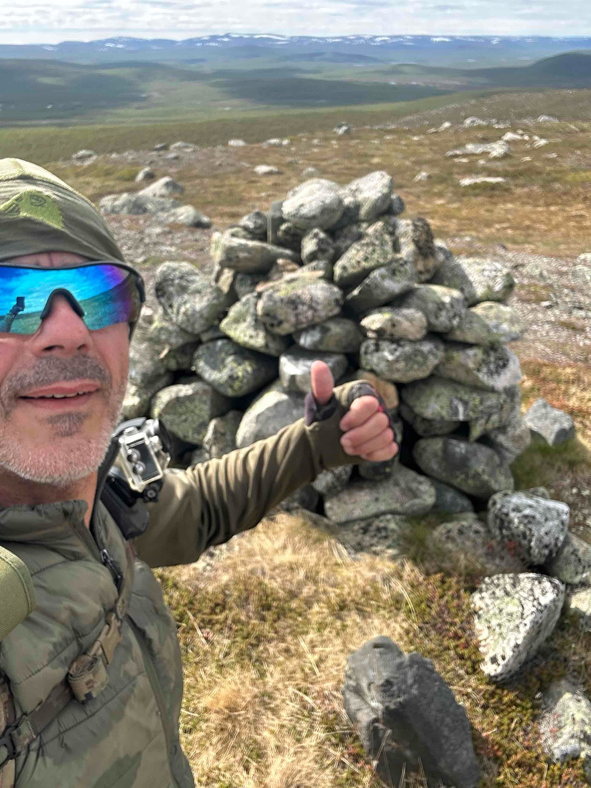
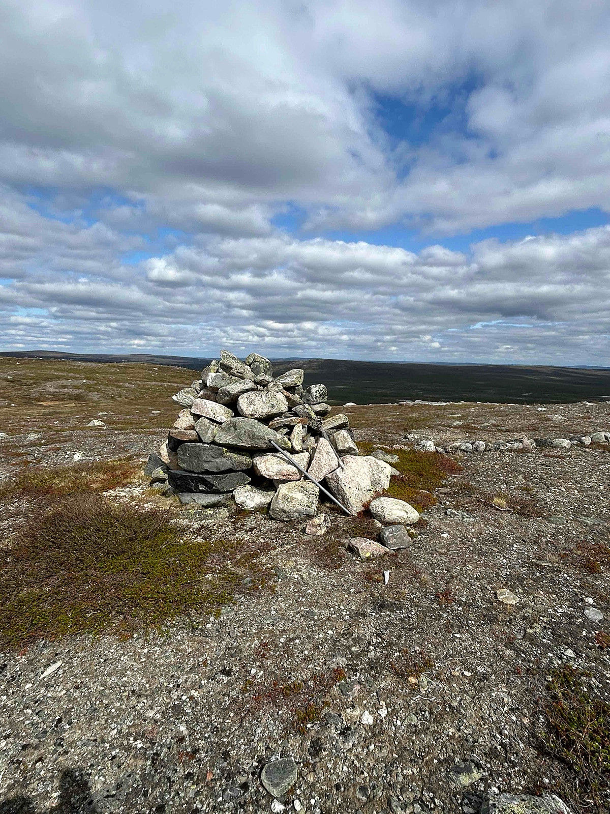
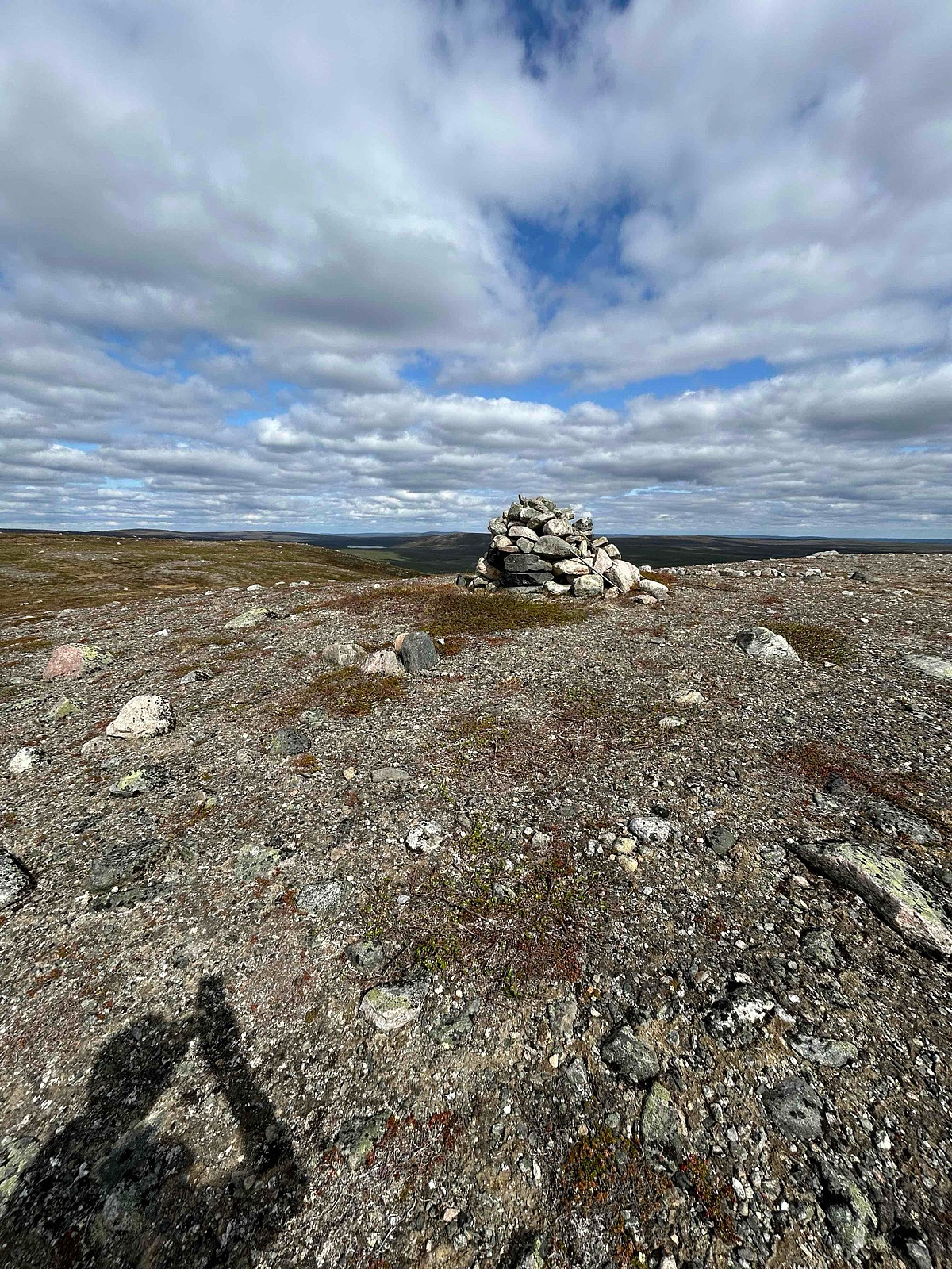
OH/KI-021 Sarvisoivi 655 m (20.06.2025)


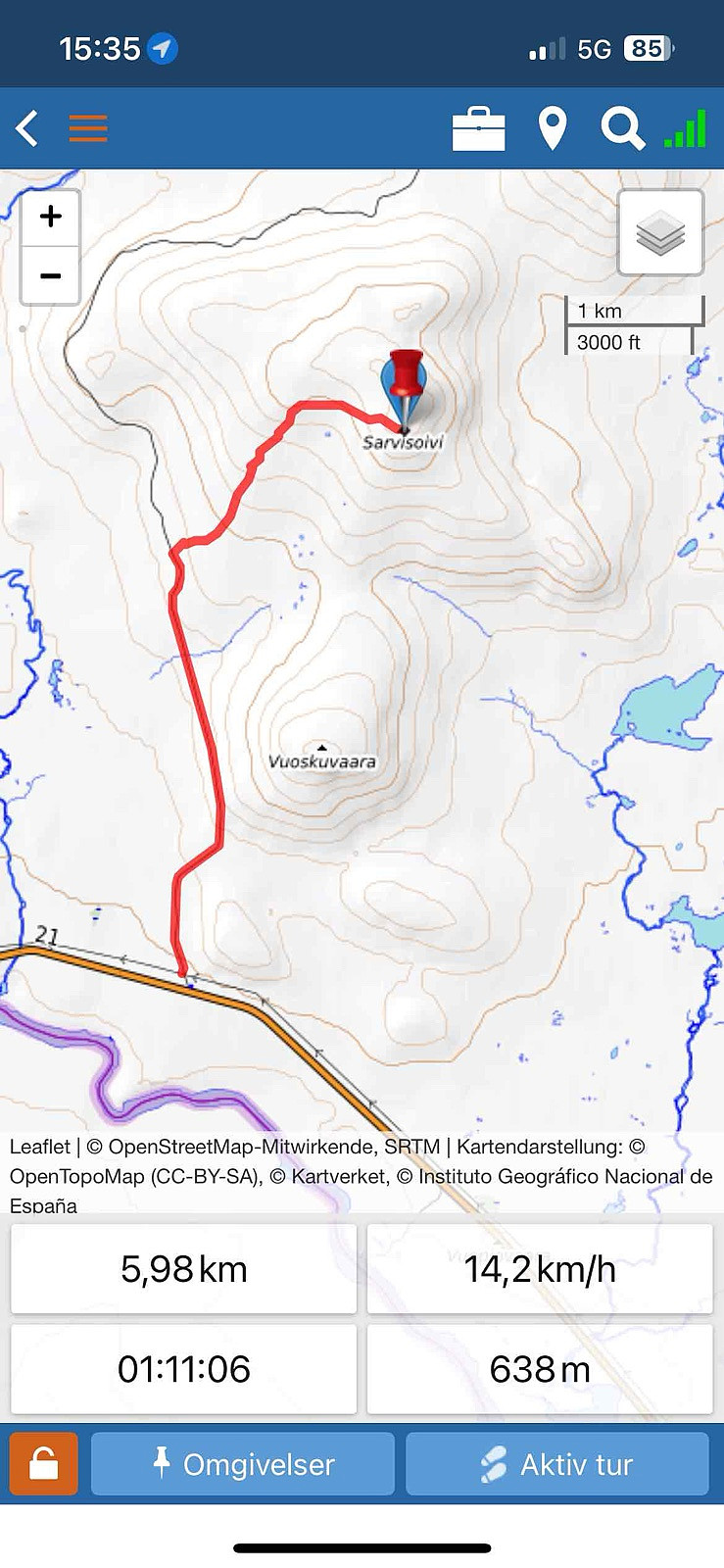
| Startpunkt | Parkering (374m) |
|---|---|
| Endpunkt | Topoen (638m) |
| Tourcharakter | Expedition |
| Entfernung | 6,0km |
| Höhenmeter | 282m |
| GPS |
|
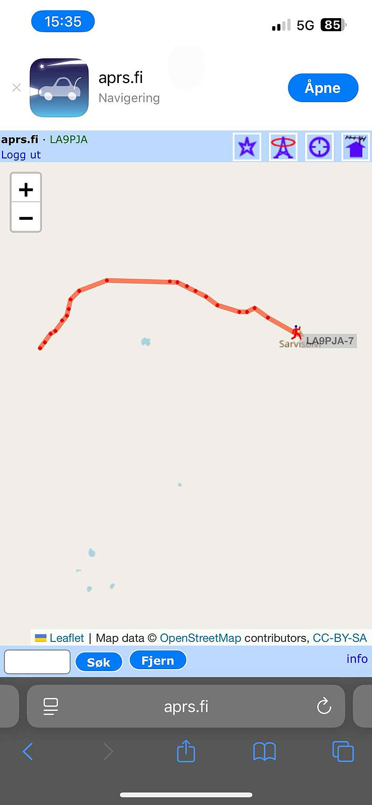
I made the first part 3km by Terrain bike. Then the rest by Hike about 2.8 km. In total 6km by terrain bike, and about 5,5 km hike.
It can be done by less time and distance, but I wanted to check the terrain bike condx, first time I did only by hiking and was about 8km in total, but went earlier into the terrain.
- - - - -
Distance: abt 12 km t/r
Start: Kalkkoaivintie P-plass.
Summer: Bike / Walk -> Bike or Hike up to summit.
Winter: Skis / Snowshoes -> Yes skiis / snowshoes and boots with crampons when is a lot of ice.
Tollroad/Bom: NO - 0 kr (2024/2025)
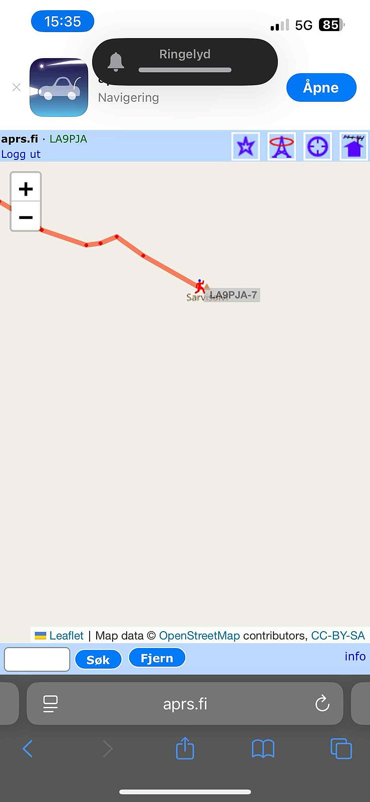
Equipment: KX3 15w & 1/4~wave Vertical (APRS LA9PJA-7/LA9PJA-9)
Apps / Resources: SOTA Goat, SOTLAS, PeakBook, APRS.FI, QTHnow / POTA, POTA-MAP.fr, AllTrails
- - - -
Photos & Track: Courtesy of LA9PJA :)

Benutzerkommentare