Archive - Date
Archive - Activity
-
Bike trip (137)
- Bike trip - mixed (51)
- Bike trip - road (9)
-
Other trip (1)
- Kayaking (1)
-
Other winter trip (4)
- Snowshoe trip (4)
- Ski trip (4)
- Trip by foot (740)
Archive - Geography
Peakbook-Friends


Collected lists
-
Bergen ≥ 50m pf. og ≥ 100 m.o.h.
(87/89)
 97%
97% -
Most dominating tops of the Bergen peninsula
(68/75)
90%
-
Utvalgte topper og turmål i Bergen
(316/350)
90%
-
Alle topper i Bergen
(357/398)
89%
-
Opptur Bergen
(100/113)
88%
-
De syv fjell rundt Bergen
(6/7)
85%
-
Sund ≥ 50m pf.
(14/18)
77%
-
Os ≥ 50m pf.
(25/34)
73%
-
Søyler (fastmerker) i Bergen
(68/100)
68%
-
Fjell ≥ 50m pf.
(21/32)
65%

Morning walk in Odense
- Date:
- 30.05.2024
- Characteristic:
- Walk
- Duration:
- 1:30h
- Distance:
- 9.1km
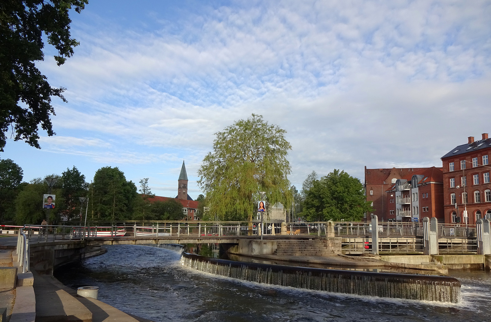 I was up early and had time to walk from downtown Odense to the University ( SDU , i.e., Syddansk Universitet). Starting from the main railway station, I first headed to Kongens Have, where I passed by Odense Slot. I then turned left to pass by H.C. Andersens Hus, before thereafter heading down to Odense Å at Brogade. From there, I basically followed the course of Odense Å upstream, passing through Eventyrhaven and then Munke Mose. Following Odense Å further upstream, I headed towards the Zoo of Odense. When I came to Erik Bøghs Sti, I followed it up to Langelinie. This street then brought me to Læssøgade, which I crossed to continue along Kaalundsvej. Via Skovgyden, I got to Hjallesevej, which I walked southwards only a short stretch to get into Bjørnemosevej. Walking then more or >>>
Cycling around Copenhagen
- Date:
- 06.05.2016
- Characteristic:
- Bike trip
- Duration:
- 6:00h
- Distance:
- 63.6km
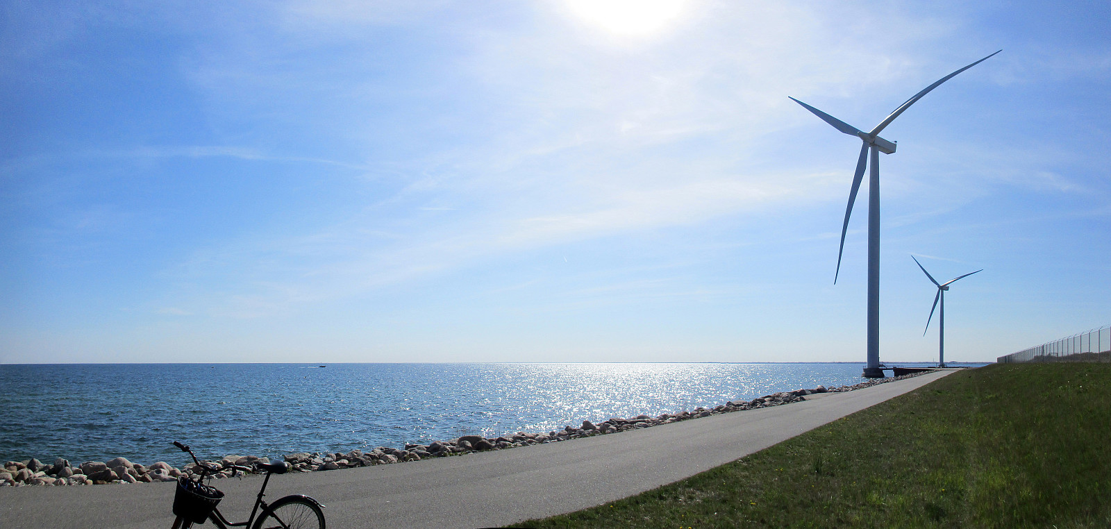 We started directly from WakeUpCopenhagen with the bikes that we had rented from there the day before. Our first goal, Utterslev Mose, is towards the northwest from Copenhagen center, so we cycled towards Nørreport, first. At Søerne (The Lakes!), we cycled them up and down once---more, because we were unsure, first, of where to continue, but then also to enjoy this nice area! :-) After that, we followed Tagensvej towards Bispebjerg. At the graveyard of Bispebjerg, we got to see the impressive church Grundtvigskirken, reminding us strongly of the also impressive church in Reykjavík, Iceland. From there, we continued towards Utterslev Mose, a nice recreational area, previously part of the defense system of Copenhagen. There, we met the cycling path #9, which continues along Vestvolden---an >>>
Copenhagen-Humlebæk-Copenhagen
- Date:
- 05.05.2016
- Characteristic:
- Bike trip
- Duration:
- 6:00h
- Distance:
- 71.8km
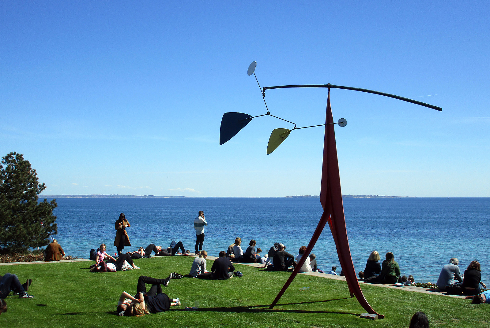 We had a room in WakeUpCopenhagen (Borgergade) and rented bikes---typical Danish bikes with three gears---from there. We headed first towards Kastellet and aimed then at Strandvejen, which leads all the way towards the north. Cycling in Copenhagen, Denmark, is really great: lots of space for cyclists, not much up and down---nice and easy! :-) Near the Tuborg factory, we met the cycling path #9, which connects to the north along Strandvejen. Cycling along Strandvejen is nice with lots of great views over the sea to the east. At Skodsborg, we should have understood that cycling path #9 is continuing in parallel to Strandvejen---a little further away from the sea. Instead, we continued along Strandvejen, which was OK, but a little less fun, since no cycling path is available at this stretch. >>>
Slættaratindur
- Date:
- 02.05.2015
- Characteristic:
- Hillwalk
- Duration:
- 3:30h
- Distance:
- 3.3km
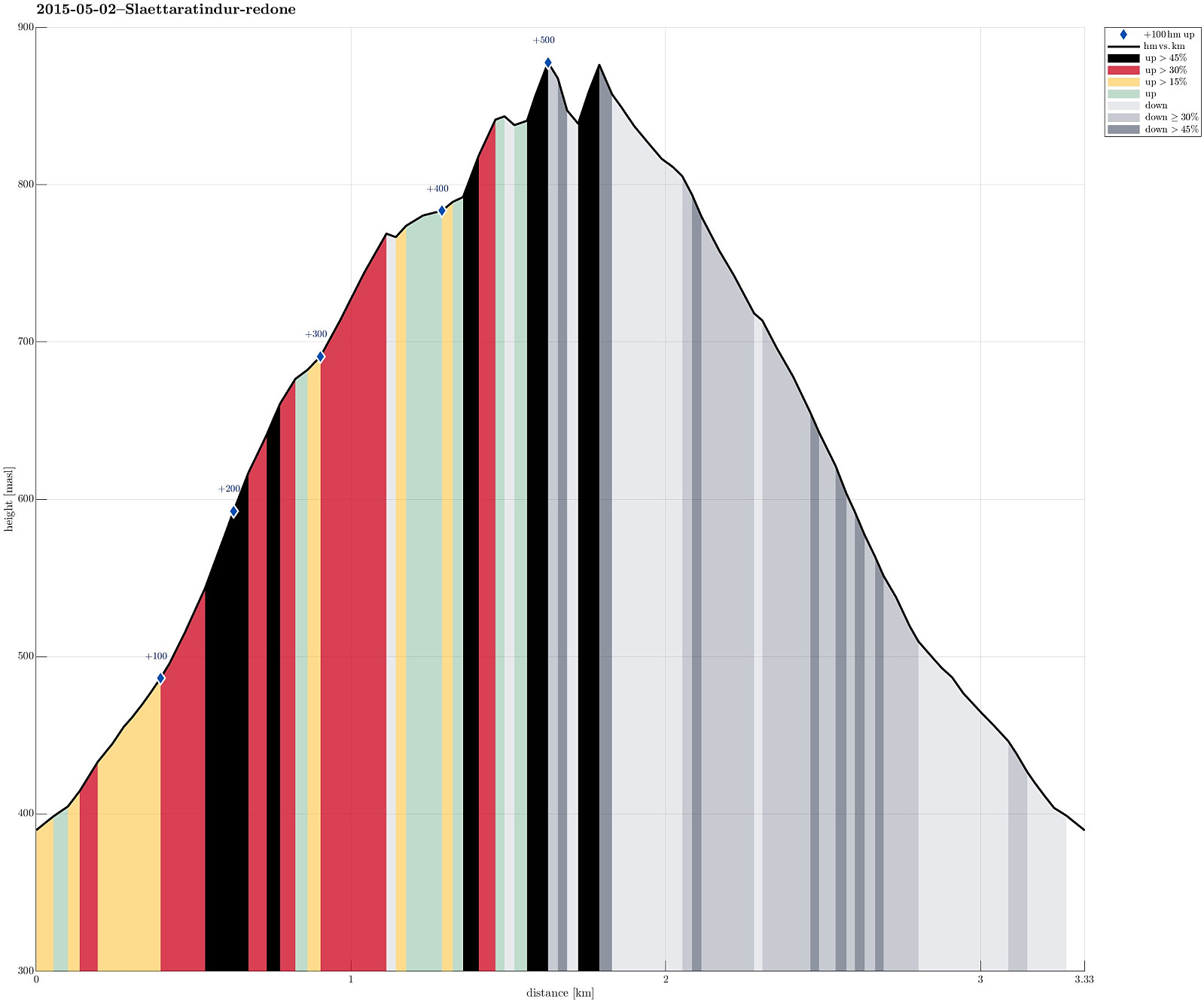 We drove up to Eiðisskarð (pass between Slættaratindur in the north and Vaðhorn in the south) and parked near the highest point on that pass (at about 380m above sealevel). From there, we basically headed straight northwards, (more or less) straight up the quite steep south-slope of Slættaratindur. Doing so, we quickly reached a high ridge, which extends eastwards from Slættaratindur. The ascend was OK (with regular hiking boots) even though it quickly became unavoidable to pass over patches of (steep) snow -- there it was necessary to walk carefully and set each foot consciously. We then followed the ridge towards Slættaratindur. We tried two or three ascends from the eastside, but the proved to be very difficult (climbing, very steep, icy and snowy, etc.) and we decided to descend >>>
Tindur
- Date:
- 02.05.2015
- Characteristic:
- Hillwalk
- Duration:
- 3:30h
- Distance:
- 7.8km
 We drove to Elduvík and parked near the cemetery. From there we followed a narrow path (along the northern slope of Skoratindur), along Funningsfjørdur. Between Skoratindur and Tindur, this path leads upwards and over a (not very high!) pass, towards Fuglafjørður. From this pass (below 160m above sealevel) we ascended Tindur, first via its (very!) steep western slope. Before we could reach the top, the slope became so steep that we avoided the last bit by detouring a bit towards the southwestern ascend (which proved to be much easier). From the top one has fantastic views in all directions, wow! :-) Once on the top, we decided to continue towards the eastern-most tip of Tindur, connected by an easy to walk ridge. More wonderful views can be enjoyed from both the ridge and its end >>>
Villingadalsfjall
- Date:
- 01.05.2015
- Characteristic:
- Hillwalk
- Duration:
- 5:00h
- Distance:
- 4.9km
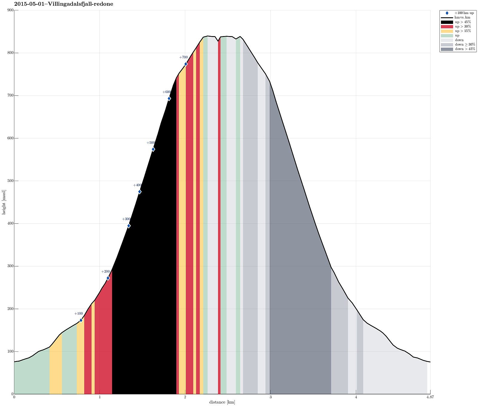 We parked in the northern end of Viðareiði (almost at the end of the upper road, near the place, where the street is a bit wider). From there we went to the end of the road, then along a small stone wall, already ascending towards Villingadalsfjall. Then, we basically followed a series of blue sticks, which someone placed in short distances from each other to indicate the best path up. Ascending to the top proved to be (very) steep in selected places and we had to concentrate -- not at the least due the snow (quite a bit of snow, still). The top itself flattens out and there are magnificent views in all directions! What a great tour! After a short break on the top (even though the weather was very good, the conditions still did not invite to stay on the top for very long), we descended >>>
