Arkiv - dato
Arkiv - aktivitet
-
Annen tur (1)
- Kajakkpadling (1)
-
Annen vintertur (4)
- Trugetur (4)
- Fottur (740)
-
Skitur (4)
- Fjellskitur (4)
-
Sykkeltur (137)
- Blandet sykling (51)
- Gatesykling (9)
Arkiv - Etter geografi
"Peakbookvenner"


Lister jeg samler etter
-
Bergen ≥ 50m pf. og ≥ 100 m.o.h.
(87/89)
 97%
97% -
Most dominating tops of the Bergen peninsula
(68/75)
90%
-
Utvalgte topper og turmål i Bergen
(316/352)
89%
-
Alle topper i Bergen
(357/400)
89%
-
Opptur Bergen
(100/113)
88%
-
De syv fjell rundt Bergen
(6/7)
85%
-
Sund ≥ 50m pf.
(14/18)
77%
-
Os ≥ 50m pf.
(25/34)
73%
-
Søyler (fastmerker) i Bergen
(68/100)
68%
-
Fjell ≥ 50m pf.
(21/32)
65%

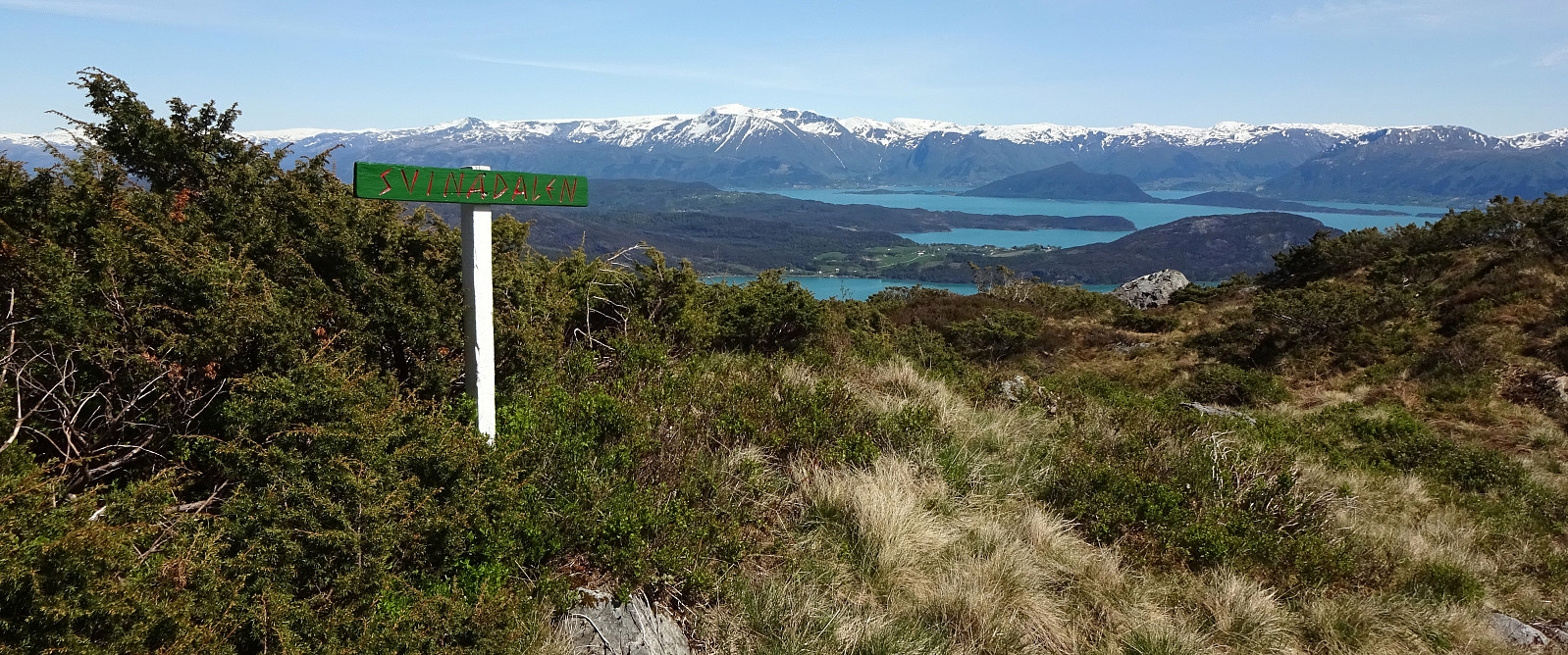
Tysnessåta from Myrdal
- Dato:
- 11.04.2026
- Turtype:
- Fottur
- Turlengde:
- 3:45t
- Distanse:
- 6,9km
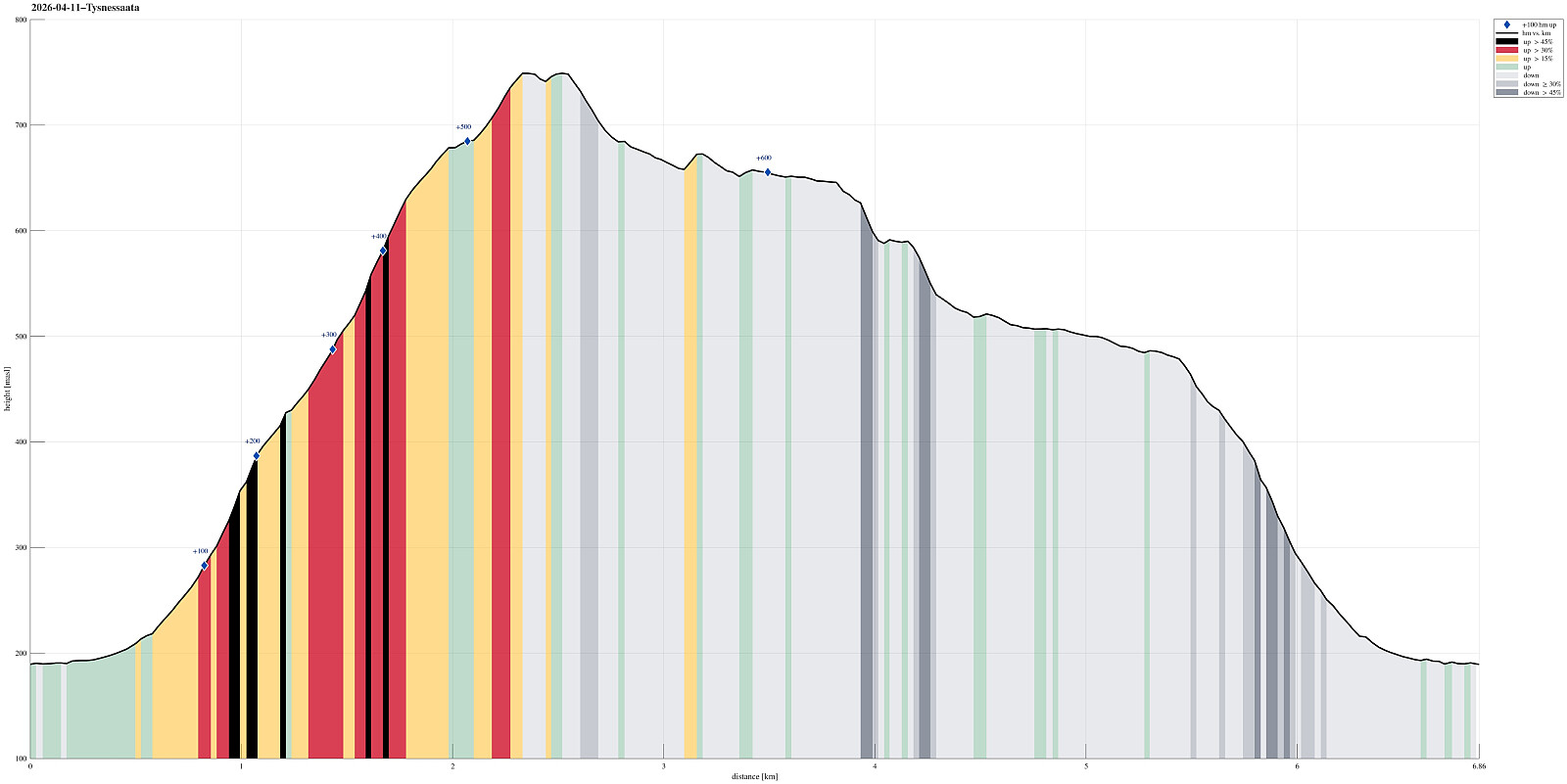 The idea was to make a nice hike on a nice day, which would (1) bring us up to enjoy some nice views and (2) avoid significant amounts of snow, if possible (well, well). We took the ferry from Halhjem to Våge and then drove around and up to Myrdal (already at about 195masl). After parking near Storåkerhølen, a bit north of Myrdal, we started our hike first on a tractor road across Myrdal, before getting into the real hike from the "second" parking place south of Myrdal. From there, one can now (since 2024) find a "Sherpasti" with numerous impressive rock steps that are laid down for large stretches of the ascent along Steinelva. This way, one can "simply" step up these stone steps and reach the heights of Tysnessåta quickly (one still needs to make about >>>
Hovlandsnuten and Etlådnefjellet
- Dato:
- 31.05.2020
- Turtype:
- Fottur
- Turlengde:
- 5:15t
- Distanse:
- 11,8km
 For years, we had talked about "one day" visiting Tysnes and doing some nice hike there. This weekend, with warm and sunny weather, seemed to be perfect to actually do it! :-) We drove from Bergen to Halhjem (southwest of Osøyro) and took the ferry to Vågen from there. Already this crossing of Bjørnafjorden was nice, with nice views towards south and east! Once on Tysnes, we drove first east (towards Lundegrend). There, we turned right (and south) and crossed over to the southeastern side of Tysnes (Hovland & Tveit). Our plan was to go a nice round over Hovlandsnuten, maybe the most spectacular mountain on Tysnes (not the hightest though). We parked near Tveitneset and started to hike along a forest road that extends southwards (parallel to the steep mountain side there, >>>
