Arkiv - dato
Arkiv - aktivitet
-
Annen tur (1)
- Kajakkpadling (1)
-
Annen vintertur (4)
- Trugetur (4)
- Fottur (740)
-
Skitur (4)
- Fjellskitur (4)
-
Sykkeltur (137)
- Blandet sykling (51)
- Gatesykling (9)
Arkiv - Etter geografi
"Peakbookvenner"


Lister jeg samler etter
-
Bergen ≥ 50m pf. og ≥ 100 m.o.h.
(87/89)
 97%
97% -
Most dominating tops of the Bergen peninsula
(68/75)
90%
-
Utvalgte topper og turmål i Bergen
(316/350)
90%
-
Alle topper i Bergen
(357/398)
89%
-
Opptur Bergen
(100/113)
88%
-
De syv fjell rundt Bergen
(6/7)
85%
-
Sund ≥ 50m pf.
(14/18)
77%
-
Os ≥ 50m pf.
(25/34)
73%
-
Søyler (fastmerker) i Bergen
(68/100)
68%
-
Fjell ≥ 50m pf.
(21/32)
65%

Sangoltshornet
- Dato:
- 15.02.2015
- Turtype:
- Fjelltur
- Turlengde:
- 1:30t
- Distanse:
- 4,0km
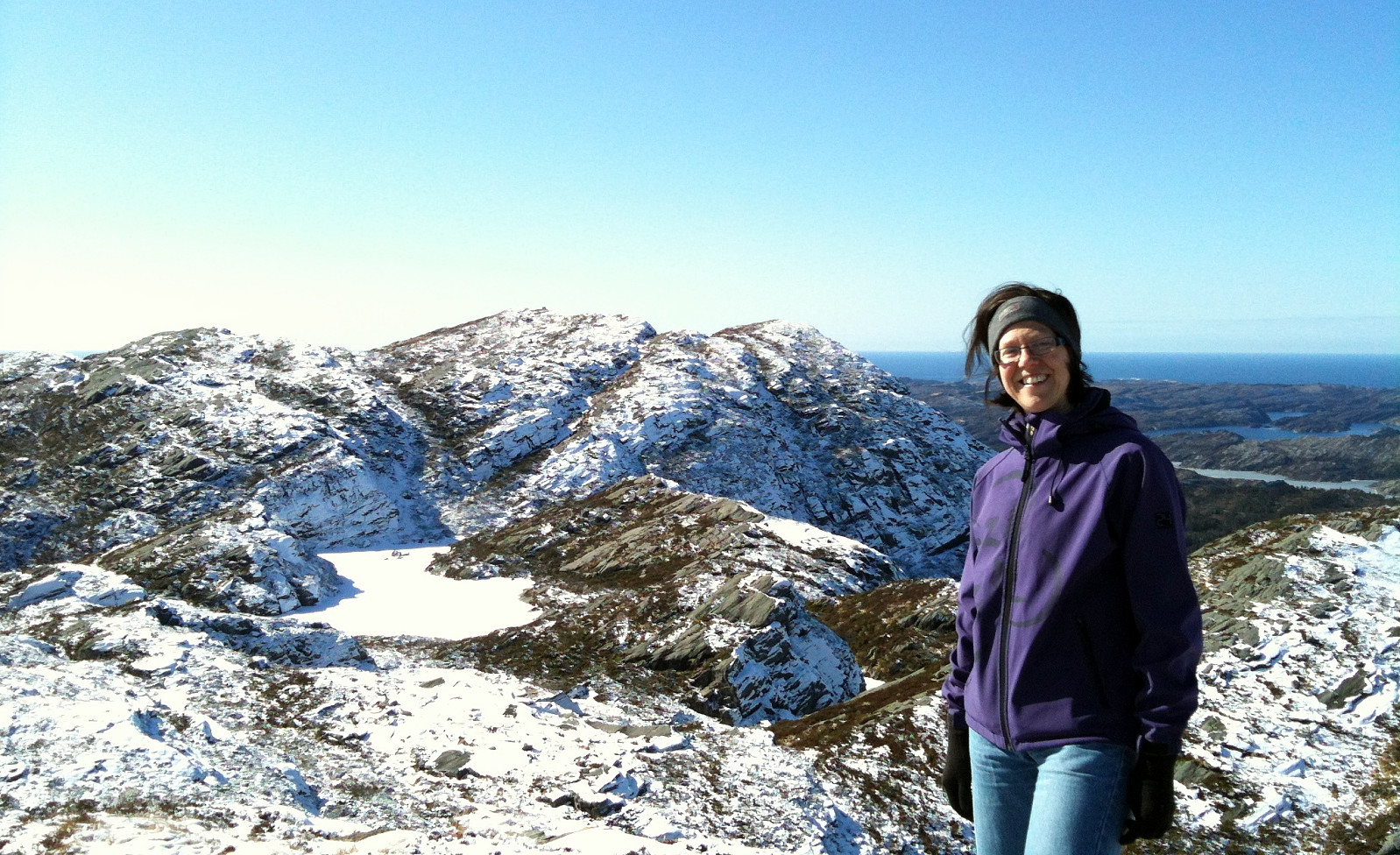
 We started right next to Sangoltvatnet and quickly found a path that led us up to Sangoltshornet. This really is no difficult, nor demanding hike. Still, one can enjoy nice views, for example, over Raunefjorden. From Sangoltshornet, we then continued -- without path, mostly -- in a south-easterly direction, passing over three, four additional, minor heights. Eventually, we decended -- also without any path (not 100% recommended) in direction NE (basically towards Sangoltvatnet). Once back down, however, we completed a slightly larger round, including a place near the coast with name Sangolthella / Helleskaget. All in all, the hike was refreshing in nice winter weather! :-)
Petter Bjørstad has a useful page about Sangoltshornet .
Web page UT.no from the Norwegian Trekking Association recommends another hike up and down Sangoltshornet (also via Mannen).
We started right next to Sangoltvatnet and quickly found a path that led us up to Sangoltshornet. This really is no difficult, nor demanding hike. Still, one can enjoy nice views, for example, over Raunefjorden. From Sangoltshornet, we then continued -- without path, mostly -- in a south-easterly direction, passing over three, four additional, minor heights. Eventually, we decended -- also without any path (not 100% recommended) in direction NE (basically towards Sangoltvatnet). Once back down, however, we completed a slightly larger round, including a place near the coast with name Sangolthella / Helleskaget. All in all, the hike was refreshing in nice winter weather! :-)
Petter Bjørstad has a useful page about Sangoltshornet .
Web page UT.no from the Norwegian Trekking Association recommends another hike up and down Sangoltshornet (also via Mannen).
Spjeldsfjellet
- Dato:
- 26.10.2014
- Turtype:
- Fjelltur
- Turlengde:
- 2:00t
- Distanse:
- 6,6km
 From road 210, some ~500m from Landrovegen, we first headed eastover (following an easy to find and well-used path), before we then started to ascend to Spjeldsfjellet. From the top, where we enjoyed extra-strong winds (so strong that it -- at times -- was difficult to prevent falling over!), we first descended towards Spjeldsunnet, before we then turned back (without path, approx. from km 3.6 to km 4.5), getting back to the same path which we had used first (slightly beneath Spjeldsfjellet). All in all a nice hike in stormy weather! :-)
Petter Bjørstad has a useful page about Spjeldsfjellet .
Web page UT.no from the Norwegian Trekking Association recommends another hike up and down Spjeldsfjellet .
From road 210, some ~500m from Landrovegen, we first headed eastover (following an easy to find and well-used path), before we then started to ascend to Spjeldsfjellet. From the top, where we enjoyed extra-strong winds (so strong that it -- at times -- was difficult to prevent falling over!), we first descended towards Spjeldsunnet, before we then turned back (without path, approx. from km 3.6 to km 4.5), getting back to the same path which we had used first (slightly beneath Spjeldsfjellet). All in all a nice hike in stormy weather! :-)
Petter Bjørstad has a useful page about Spjeldsfjellet .
Web page UT.no from the Norwegian Trekking Association recommends another hike up and down Spjeldsfjellet .
Liatårnet
- Dato:
- 18.10.2014
- Turtype:
- Fjelltur
- Turlengde:
- 1:30t
- Distanse:
- 5,8km
 Evening walk, almost in the dark, and in the middle of windy clouds (but with less rain than expected!) -- it's always nice to walk up and down Pyttane, especially, if there's limited time! :-)
Web page WestCoastPeaks.com provides useful information about Liatårnet
and also Petter Bjørstad has a useful page about Liatårnet .
Evening walk, almost in the dark, and in the middle of windy clouds (but with less rain than expected!) -- it's always nice to walk up and down Pyttane, especially, if there's limited time! :-)
Web page WestCoastPeaks.com provides useful information about Liatårnet
and also Petter Bjørstad has a useful page about Liatårnet .
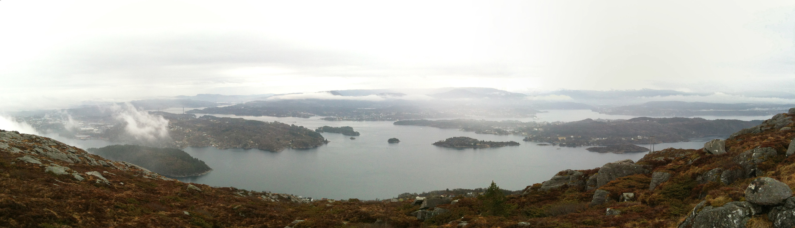
Skogsøy in stormy weather
- Dato:
- 04.10.2014
- Turtype:
- Fjelltur
- Turlengde:
- 3:00t
- Distanse:
- 5,5km
 With the weather being quite stormy, this was an exciting tour to Skogsøy! :-) It's one of the view places, which I know and appreciate, where you get close to the open north sea, here in the vicinity of Bergen -- a place to return to again and again!
Selected photos are available as Google photo album .
With the weather being quite stormy, this was an exciting tour to Skogsøy! :-) It's one of the view places, which I know and appreciate, where you get close to the open north sea, here in the vicinity of Bergen -- a place to return to again and again!
Selected photos are available as Google photo album .
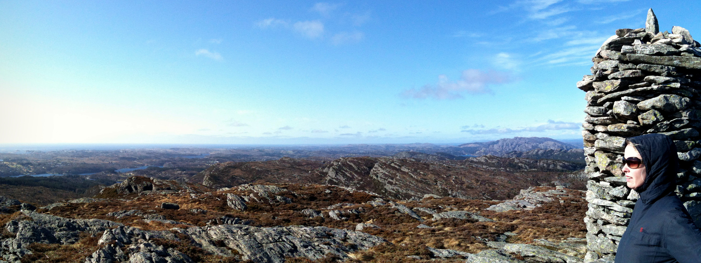
Hillefjellet
- Dato:
- 13.07.2014
- Turtype:
- Fottur
- Turlengde:
- 4:00t
- Distanse:
- 10,1km
 Someone (Leif Algerøy?) has put really a lot of effort into preparing nice hiking choices on Algrøyna -- wow! :-) The tour to Sandeie is really worth the lengthy approach (driving to Algrøyna)!
Selected photos are available as Google photo album .
Someone (Leif Algerøy?) has put really a lot of effort into preparing nice hiking choices on Algrøyna -- wow! :-) The tour to Sandeie is really worth the lengthy approach (driving to Algrøyna)!
Selected photos are available as Google photo album .
Skogsøytua
- Dato:
- 21.06.2014
- Turtype:
- Fottur
- Turlengde:
- 2:00t
- Distanse:
- 4,8km
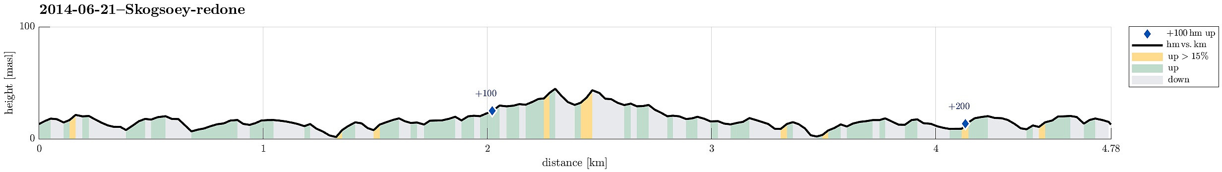 Again and again a nice little hike to the outermost rocks of Øygarden!
Bildøybakken
- Dato:
- 18.04.2014
- Turtype:
- Fottur
- Turlengde:
- 3:00t
- Distanse:
- 7,6km
 Nice and easy tour -- not much up, actually, but great views over the North Sea! One could also connect further to Pyttane and/or Liatårnet -- really a great hiking area! Note that parts of this tour (between km 3.6 and km 4.5) were without path, while still easy to go.
Web page WestCoastPeaks.com provides useful information about Liatårnet
and also Petter Bjørstad has a useful page about Liatårnet .
Nice and easy tour -- not much up, actually, but great views over the North Sea! One could also connect further to Pyttane and/or Liatårnet -- really a great hiking area! Note that parts of this tour (between km 3.6 and km 4.5) were without path, while still easy to go.
Web page WestCoastPeaks.com provides useful information about Liatårnet
and also Petter Bjørstad has a useful page about Liatårnet .
Liatårnet
- Dato:
- 09.05.2013
- Turtype:
- Fjelltur
 Starting from Nordre Ekrhovda, it's easy and straight-forward -- for almost everyone! -- to get up Pyttane, following the access road to the radar stations.
Web page WestCoastPeaks.com provides useful information about Liatårnet
and also Petter Bjørstad has a useful page about Liatårnet .
Starting from Nordre Ekrhovda, it's easy and straight-forward -- for almost everyone! -- to get up Pyttane, following the access road to the radar stations.
Web page WestCoastPeaks.com provides useful information about Liatårnet
and also Petter Bjørstad has a useful page about Liatårnet .
Liatårnet
- Dato:
- 01.04.2013
- Turtype:
- Fjelltur
 Quick and nice hike up Pyttane -- Liatårnet is always good for a nice hike! :-)
Web page WestCoastPeaks.com provides useful information about Liatårnet
and also Petter Bjørstad has a useful page about Liatårnet .
Quick and nice hike up Pyttane -- Liatårnet is always good for a nice hike! :-)
Web page WestCoastPeaks.com provides useful information about Liatårnet
and also Petter Bjørstad has a useful page about Liatårnet .
